A UK Coastal Trip – Robin Hood’s Bay

Runswick Bay

The village has changed little over the years. Red-roofed, fishermen’s cottages nestle up against the cliffs. The beach is popular for rock pooling and fossil hunting.

Sansend

It is a magnificent walk along the beach, with miles of soft sand to enjoy, between the old fishing village of Sandsend and the hustle and the bustle of the fishing and tourist town of Whitby.
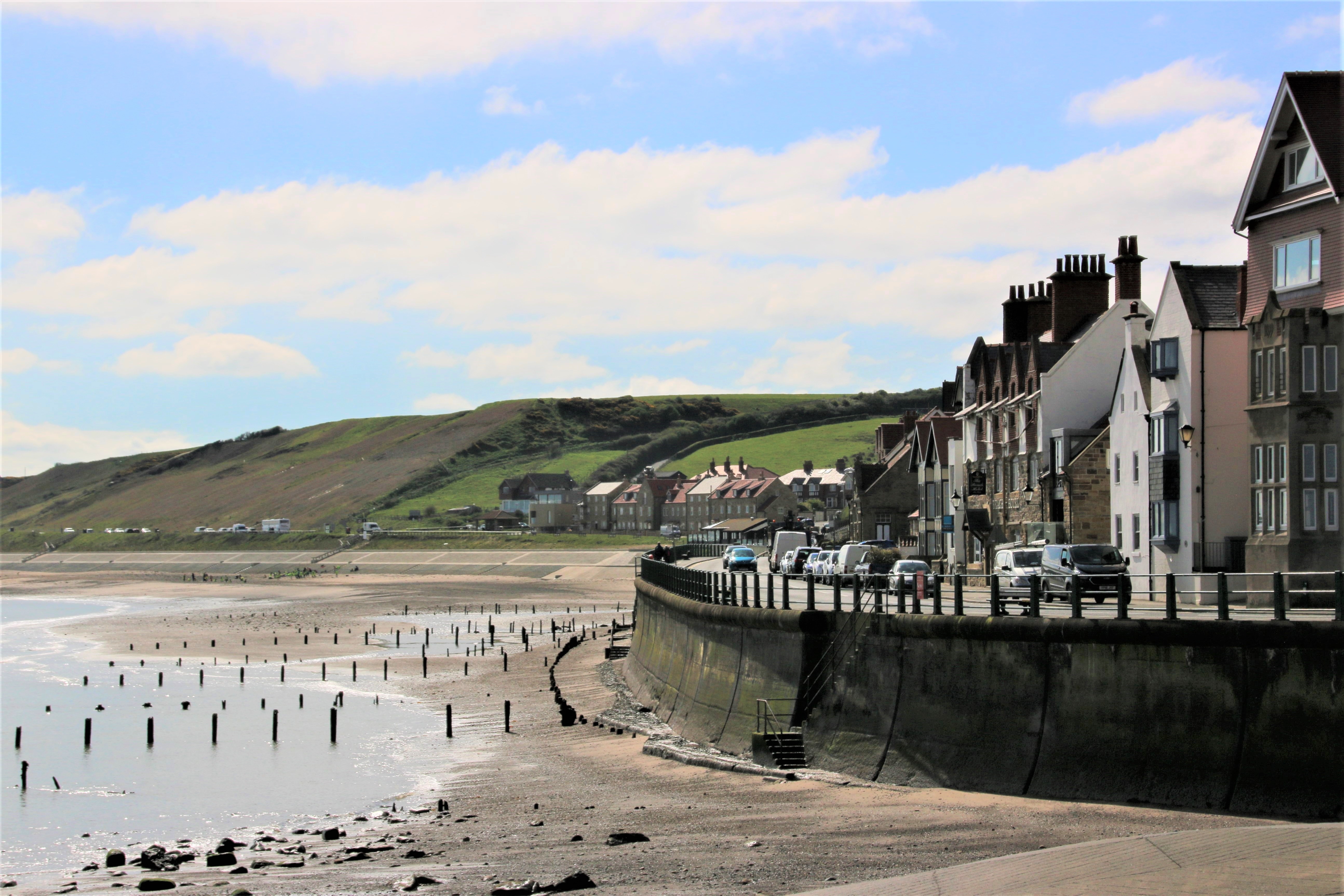
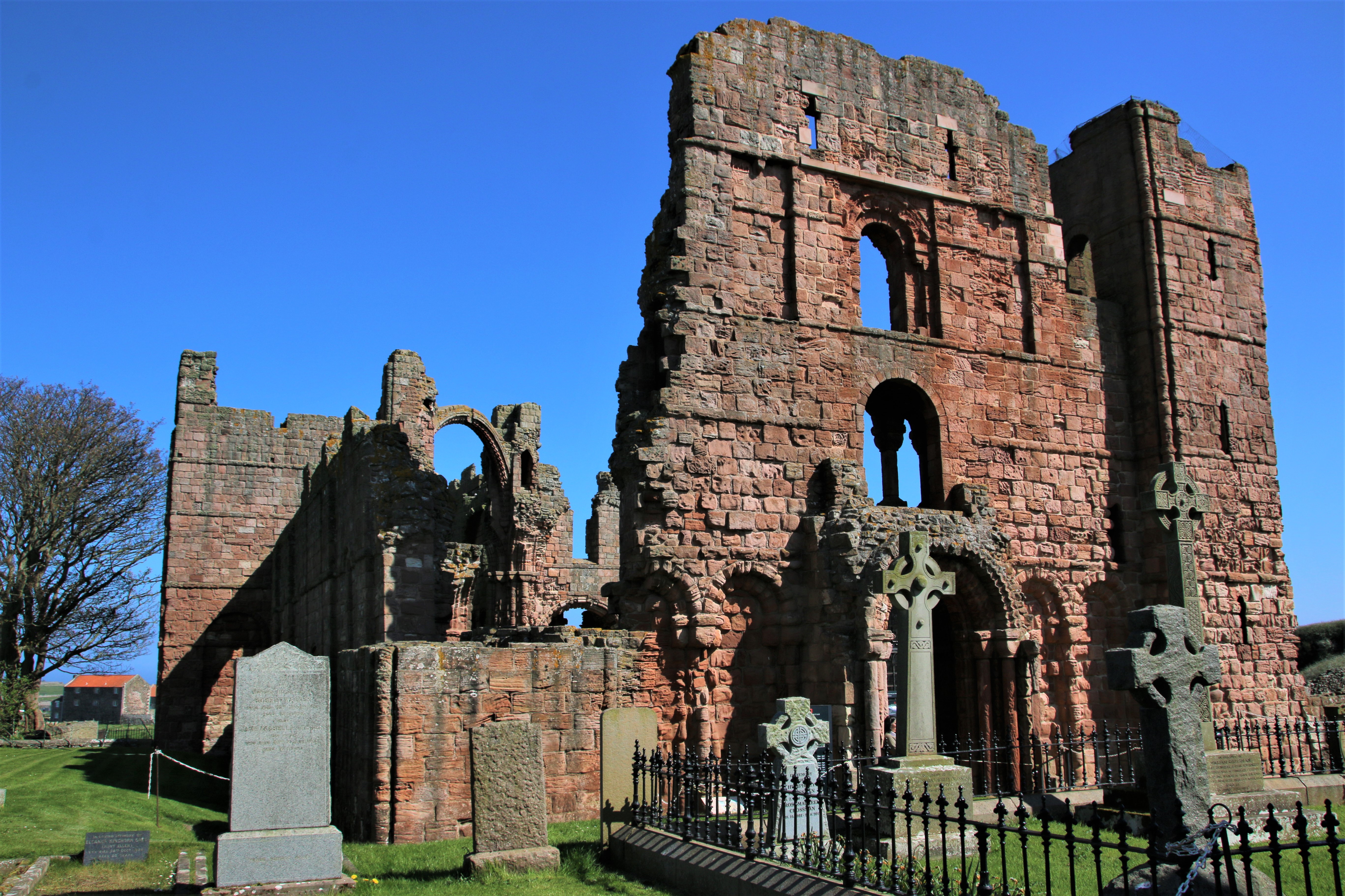
Whitby

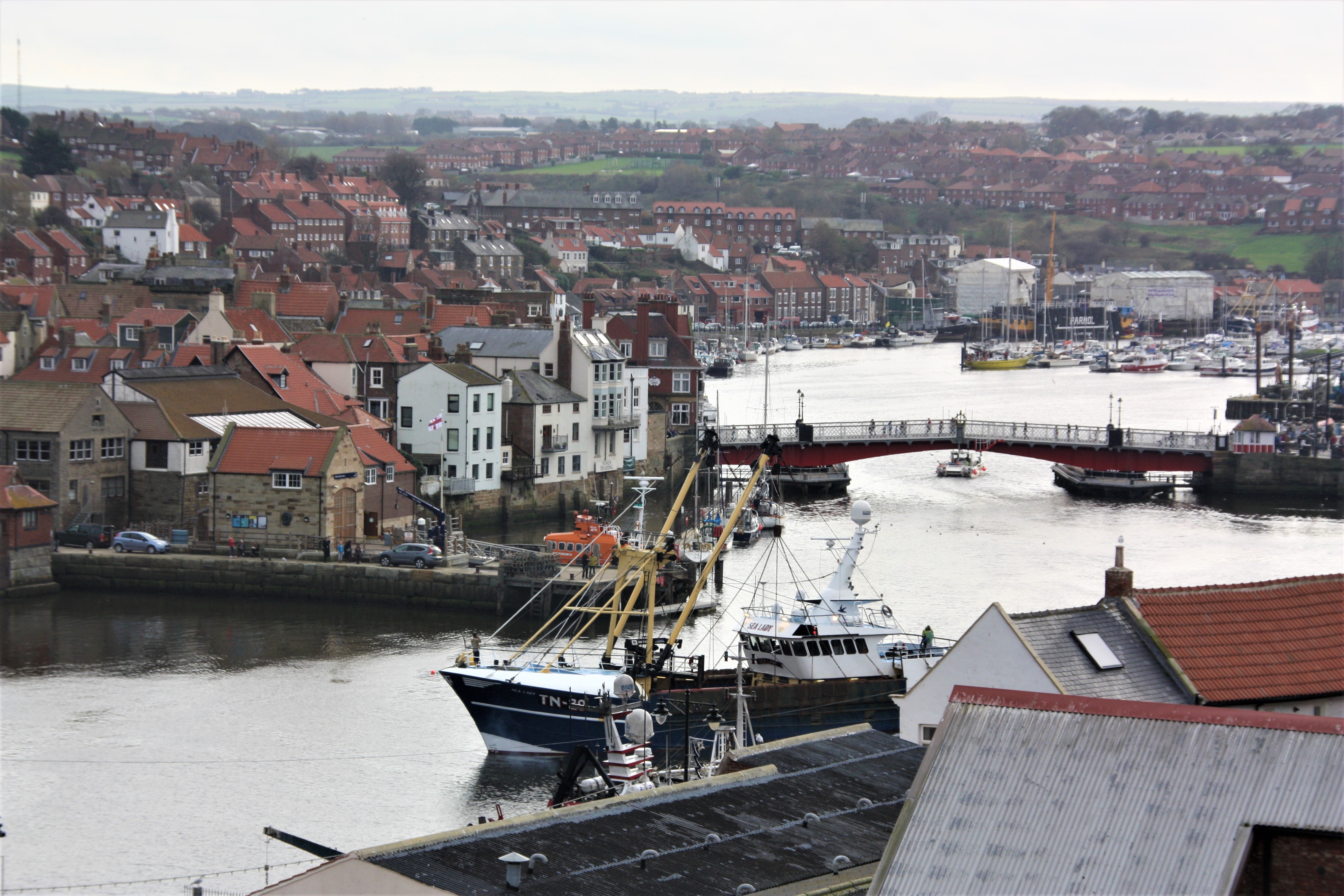
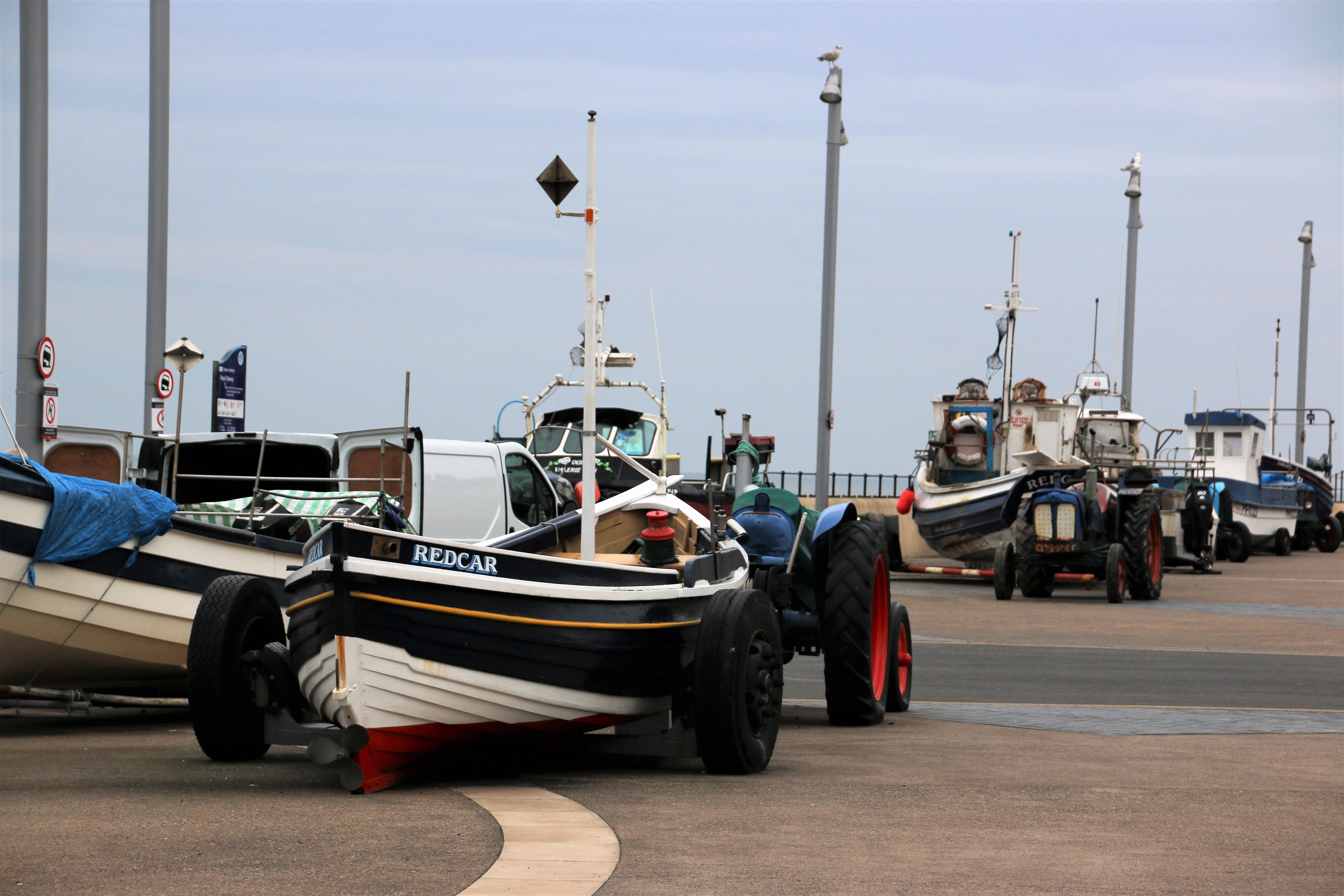
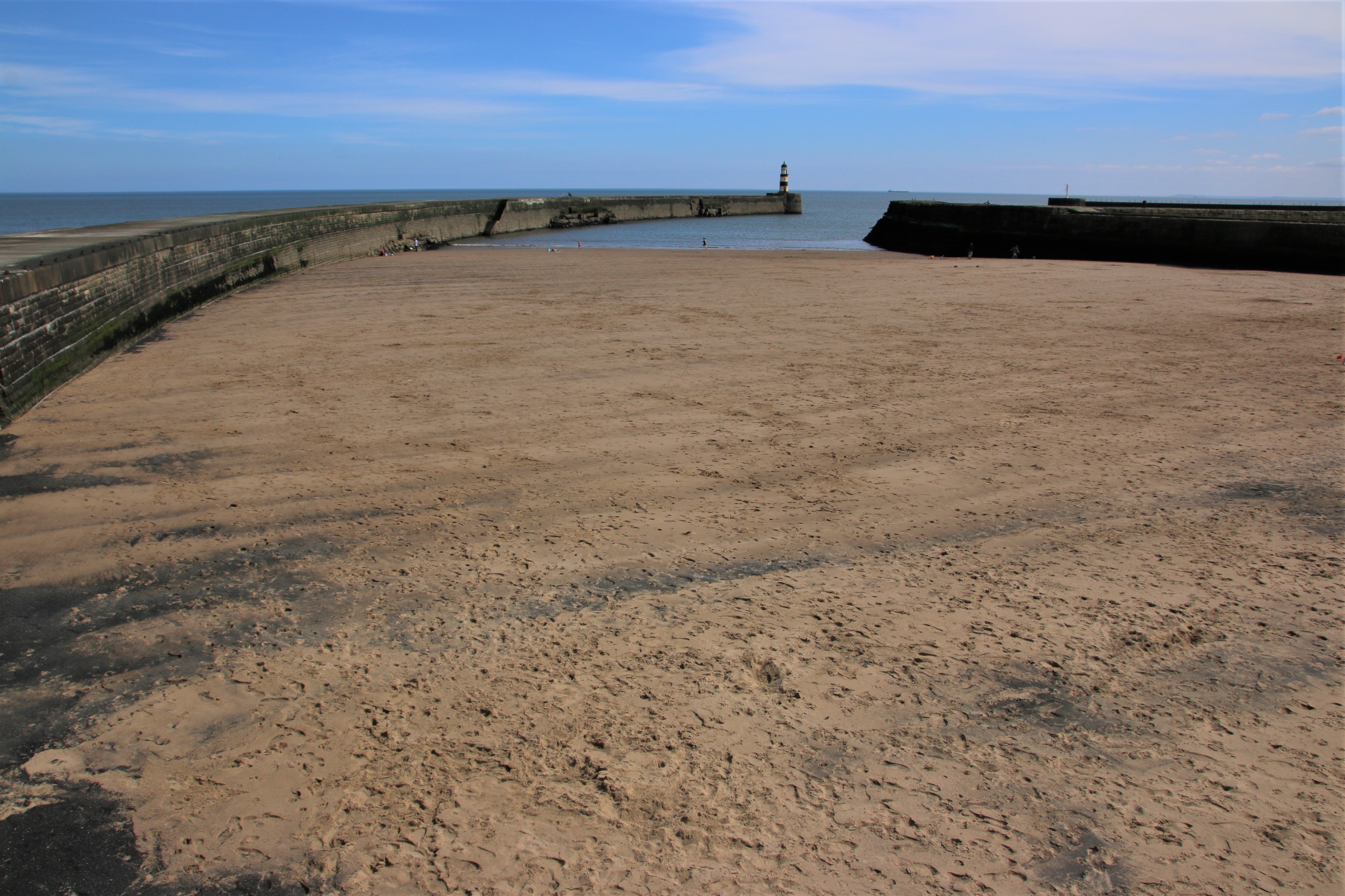
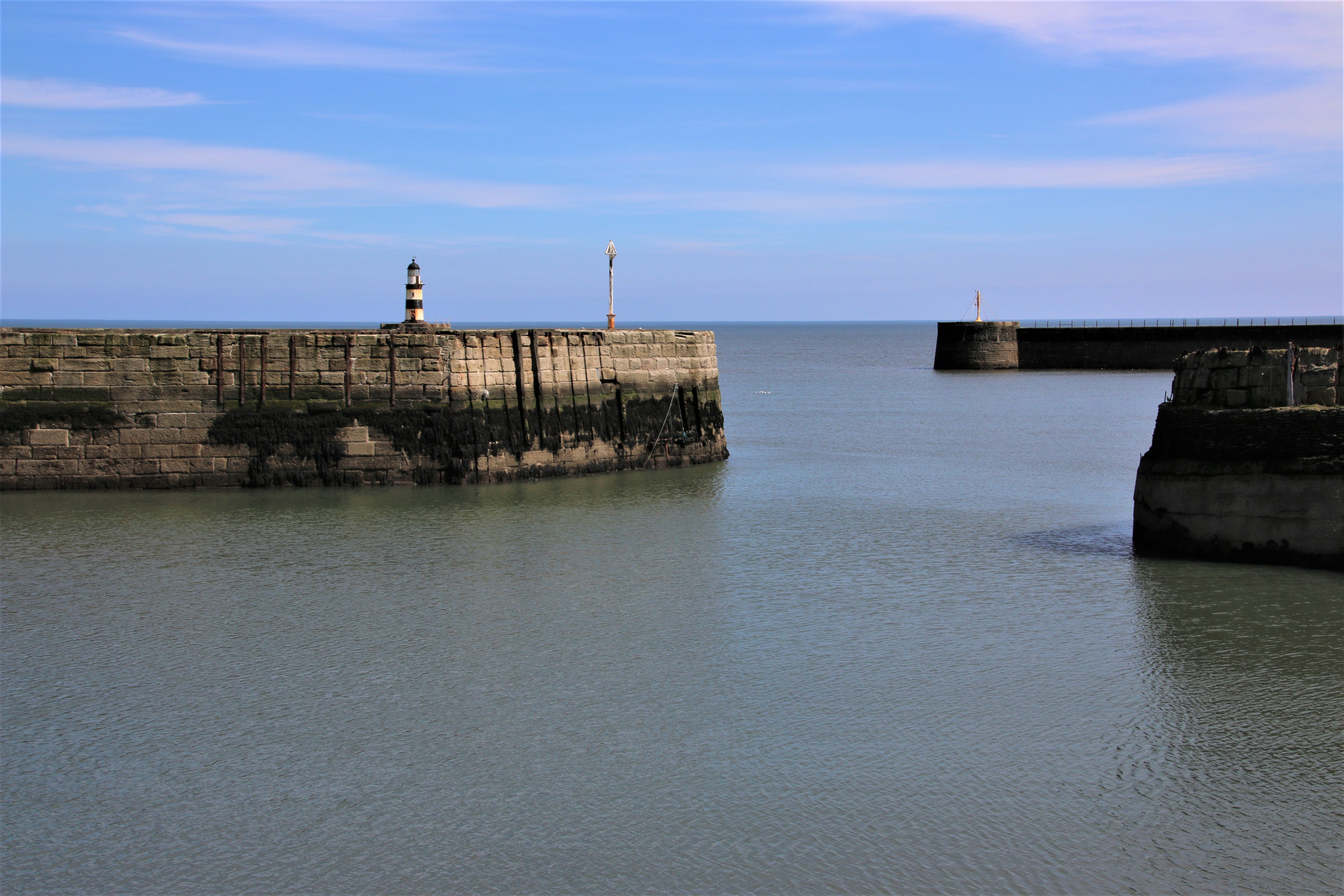
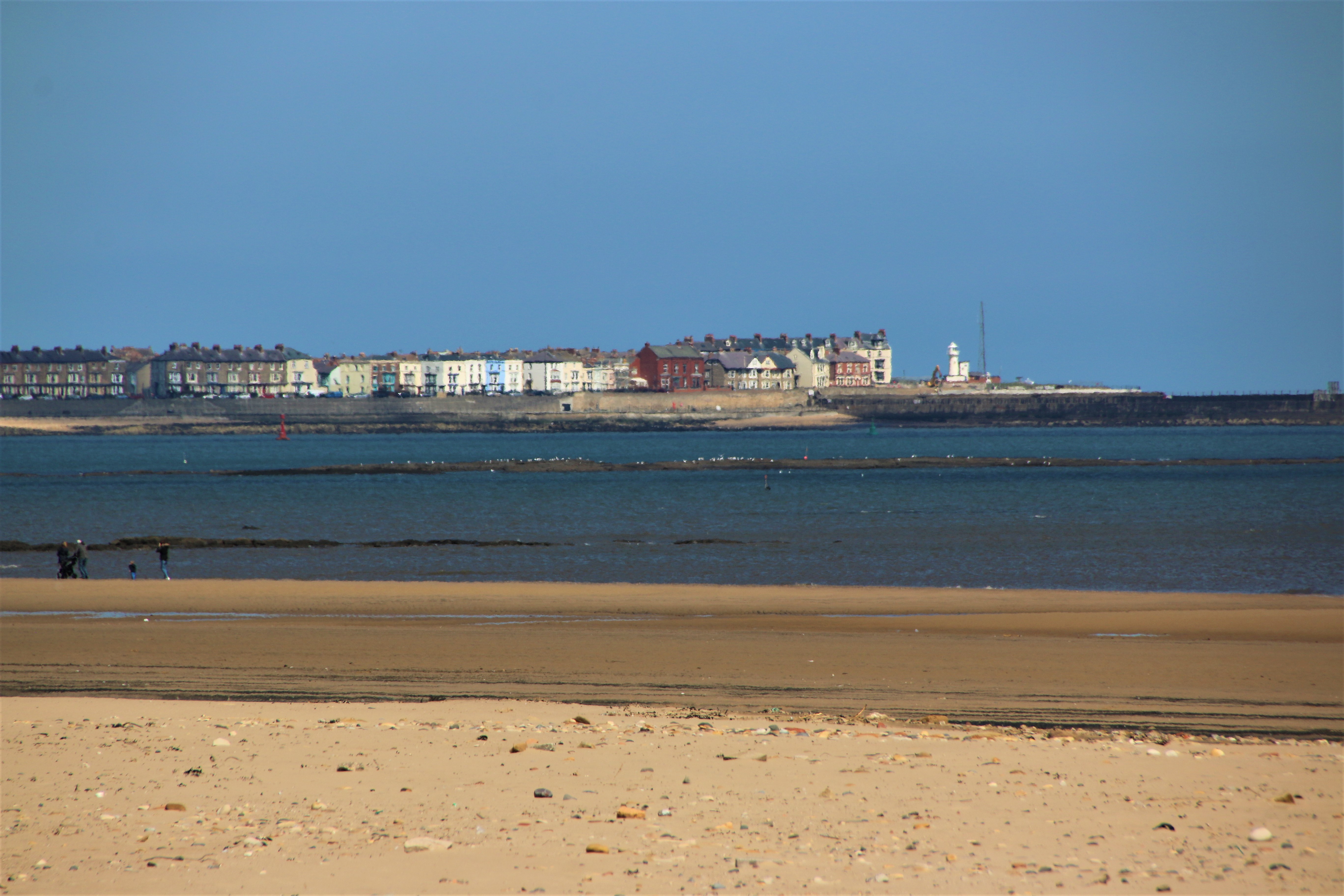
The ruins of Whitby Abbey stand high on the headland overlooking this great holiday destination with its Blue Flag beaches, its historic connections to the sea, the energy of a major fishing port and some of the best, or so the locals say, fish & chips around. It attracts visitors from all over as the crowds swarm around the quaysides and the cliff paths quaffing tea & scones in grand and not so grand tea rooms, consuming fast and slow food, visiting gem shops, searching for that special piece of local jet, and fossil shops and signing up for trips on land and sea.  Lines of yachts and sailing boats moor up in the estuary of the River Eske mixing it up with large North Sea trawlers and smaller inshore cobles . Every type of housing, from many centuries, line the estuary, spreading up the surrounding headlands and hills – guest houses, holiday lets, hotels, grand Victorian edifices alongside stately terraces of Georgian grandeur, pubs and restaurants and snack bars. The two stone-built light houses guarding the entrance to the harbour are a very obvious reminder of the working heritage of this town.
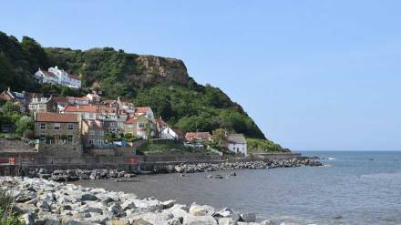
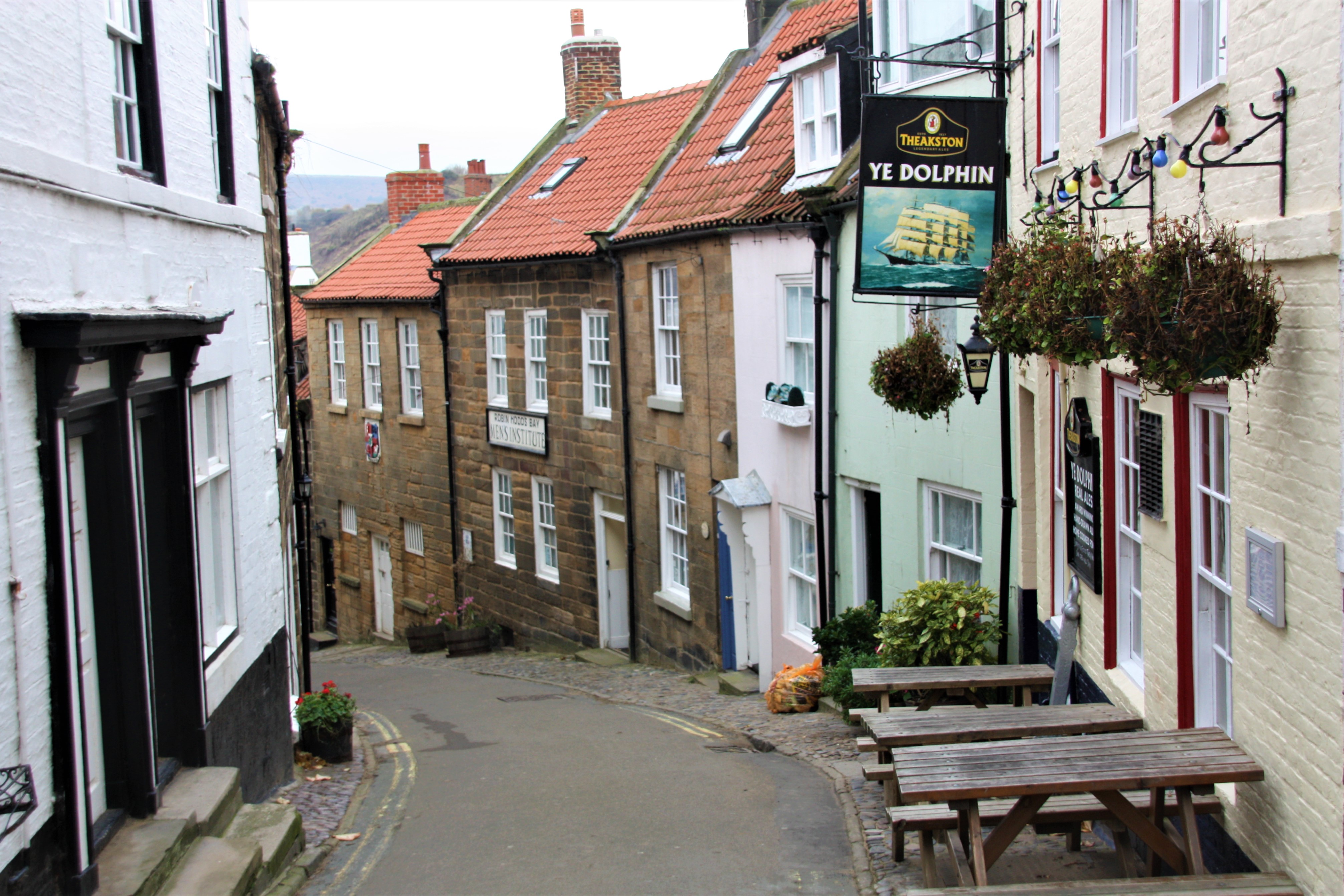
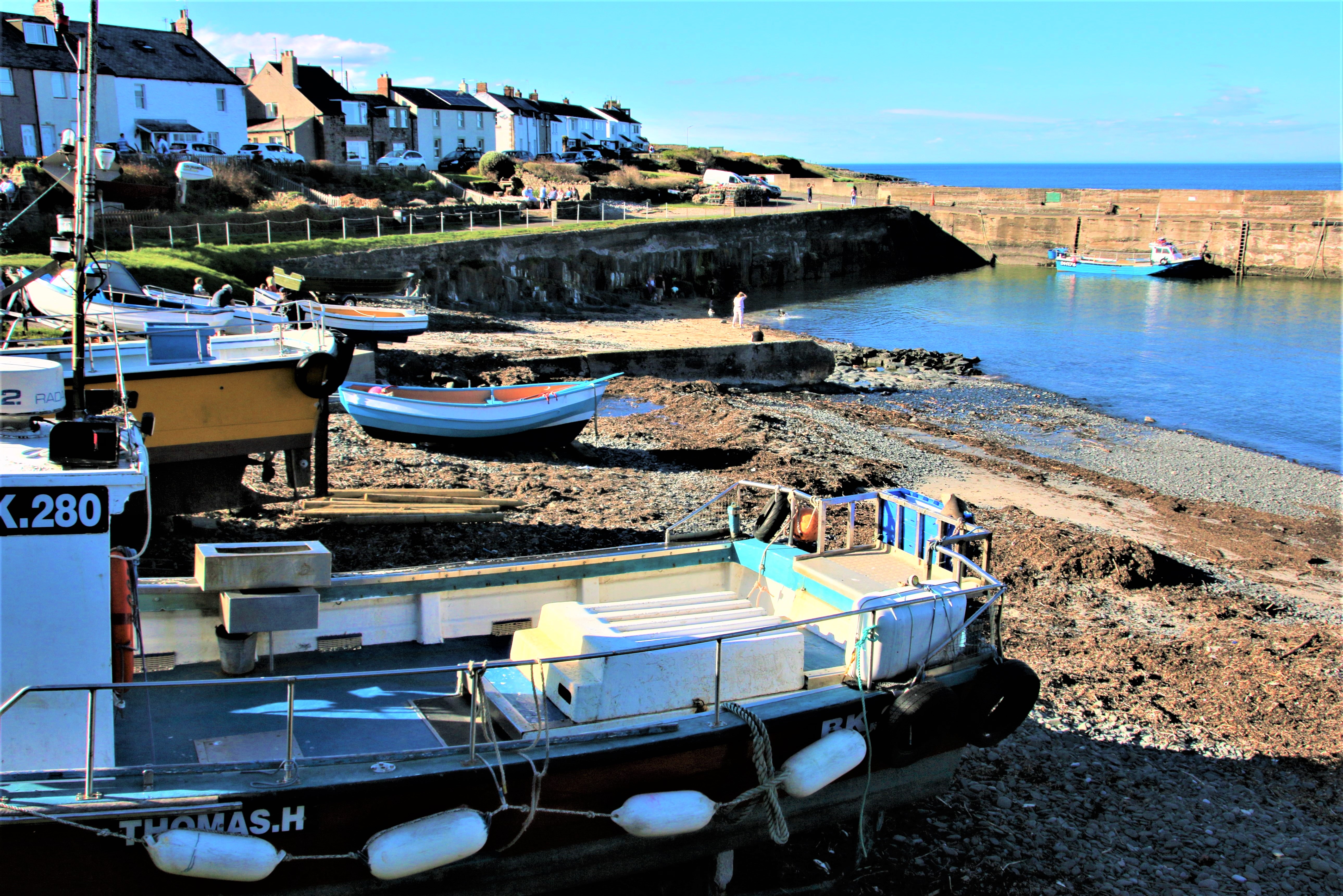
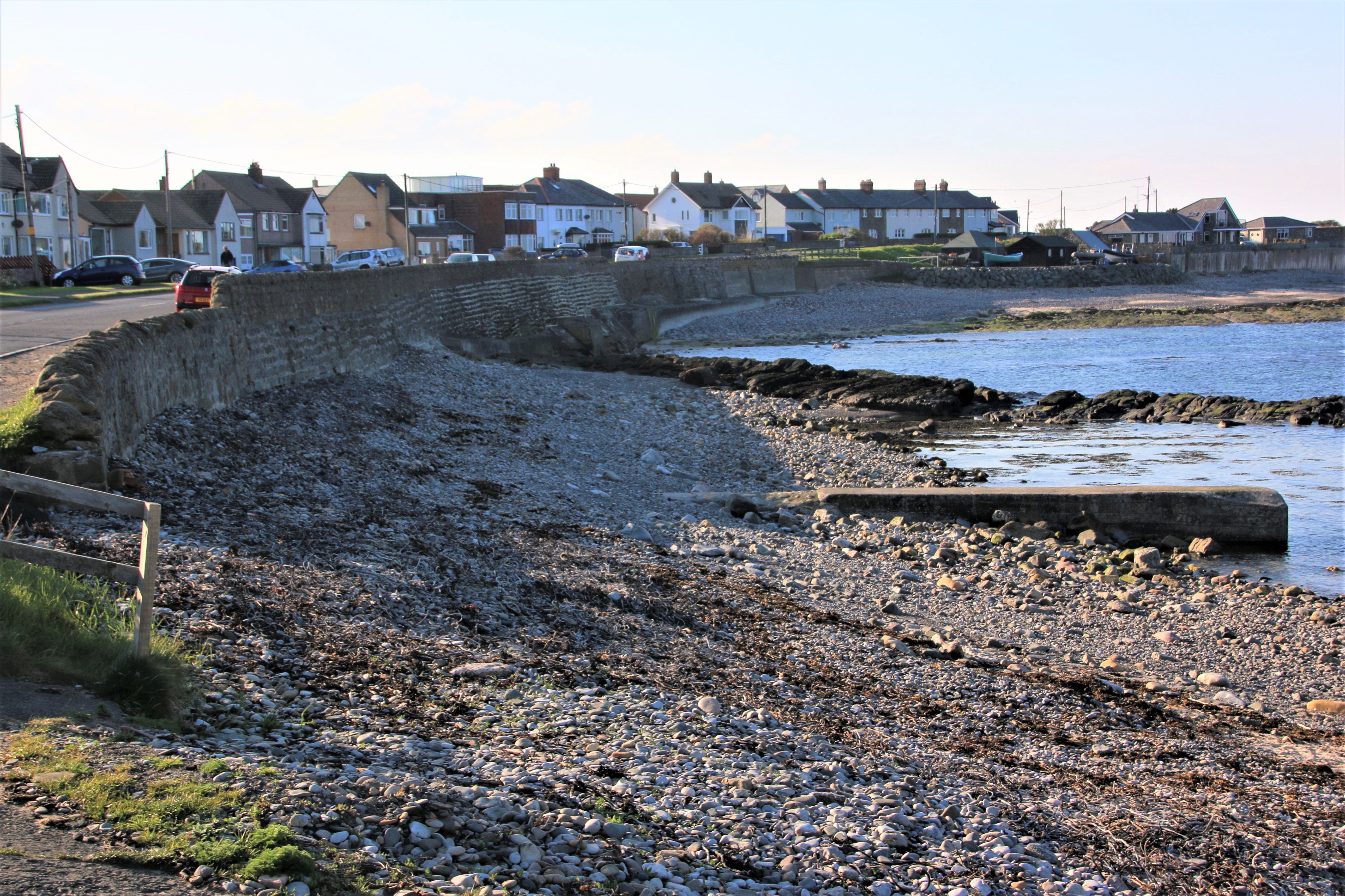
Robin Hood’s Bay

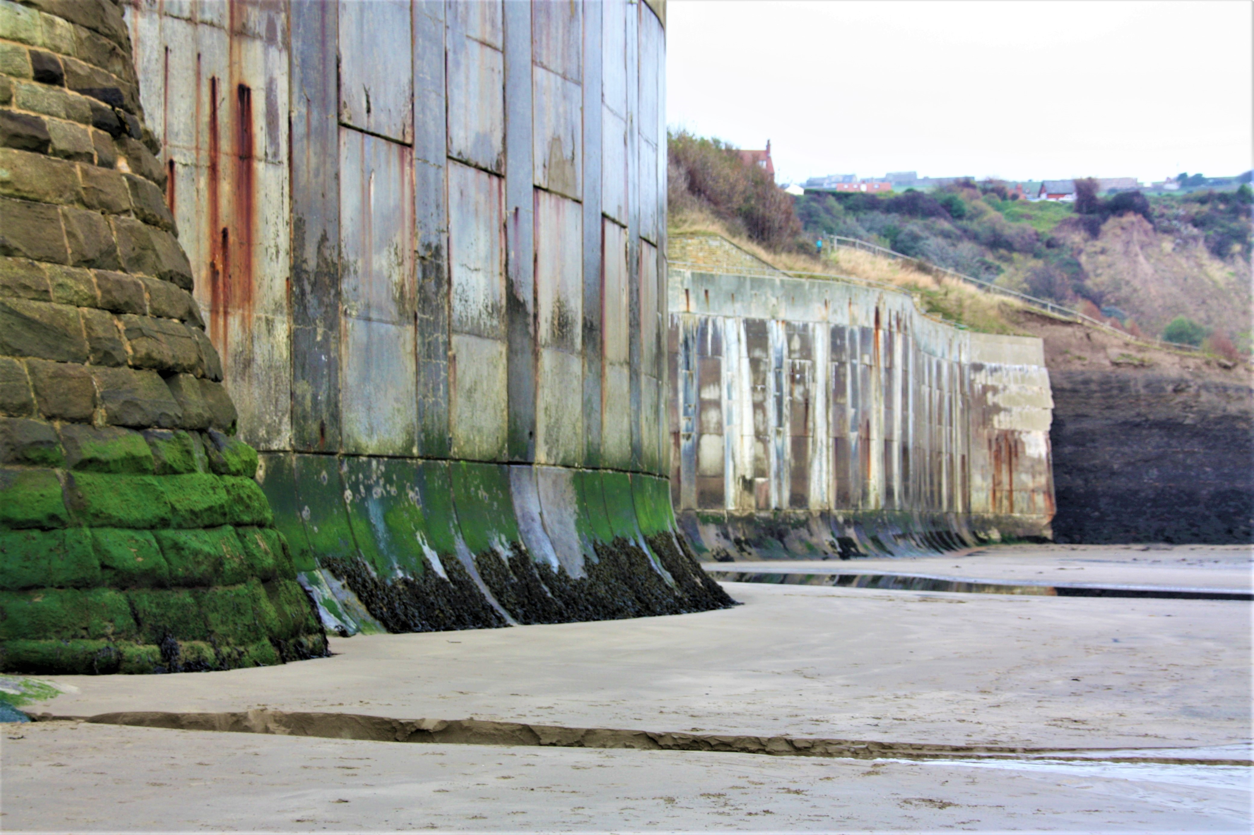
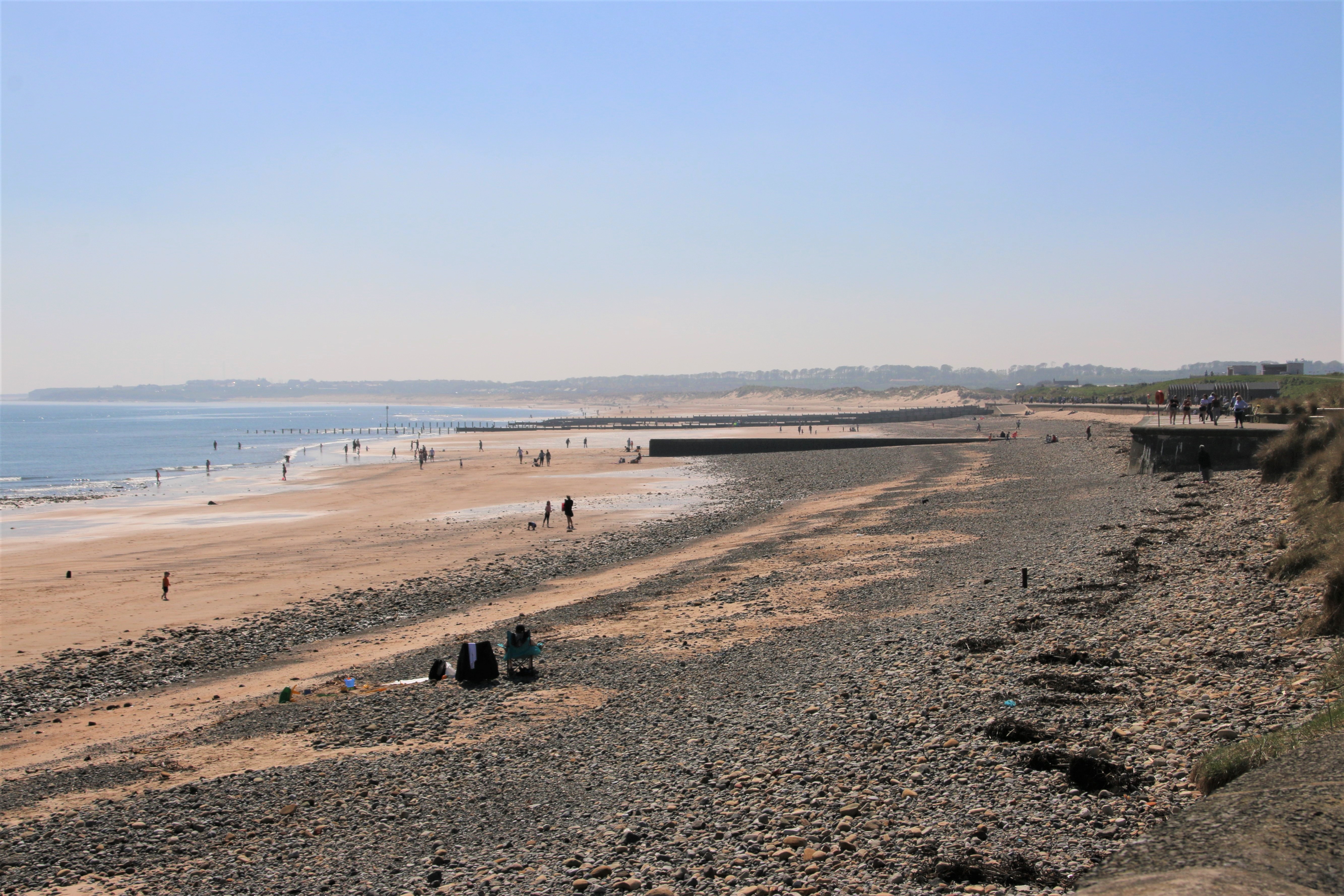
Now I do like Robin Hood’s Bay, a picturesque old fishing village with a family-friendly sandy beach. The car has to be parked at the top of the valley and further progress has to be made on foot. Wandering through its narrow, twisting cobbled streets and alleyways, are the ghosts of sailors and fishermen, smugglers and press gangs that walked here hundreds of years ago. Today it is a vibrant village, with a wide range of cafes, pubs, restaurants, small shops and places to explore. Deliveries to the pub have to be made on sack trolleys. Stone cottages with red roofs hug the steep slopes overlooking the bay. It feels like the village is built for hobbits with small gates, small gardens, small doors & small windows. Progress down the stone steps alongside the main route down fills the visitor with slight apprehension in the knowledge that this same journey has to be made in reverse. The cobbled slipway leads out onto the beach where, at low tide, families in wellies prod about in the pools that form in the rocks. The sea defences stand hugely powerful above the sandy beach, protecting the village from all the elements can throw at it.

A UK Coastal Trip – Staithes

As we head south, the estuary of the River Tees lies ahead of us. The first crossing point over the water is the magnificent Tees Transporter Bridge at Middlesbrough.

Tees Transporter Bridge, Middlesbrough

This iconic symbol of the industrial heritage of Teesside was built in 1911 to transport workers to and from the steel works, industry and shipyards in the town. It is a transporter bridge, carrying a travelling ‘car’, or ‘gondola’, suspended underneath, across the river in 90 seconds. The gondola can carry 200 people, 9 cars, or 6 cars and one minibus. This motorised, hanging bridge is still in operation with vehicles paying for the number of bays they occupy. A journey across takes just a few minutes.

Redcar

Redcar originated as a fishing town in the 14th century. It became a resort in the mid-17th century with the coming of the railways. Two piers were built at Coatham and Redcar but both suffered damage following collisions with shipping and neither remain today. Local iron-ore was processed here but the furnaces were eventually closed down in 2015. There is a small inshore fishing fleet and in bad weather, the locals have permission to draw up their boats onto the esplanade fronting the arcades and cafes.

Marske-by-the-Sea

The town is first mentioned in the Domesday Book. Most people work outside the village in the larger towns. A small number of cobles still operate from a sheltered part of the beach, fishing lobster and crab in the inshore waters. Beach House on the clifftops was built in the 19th century by the Pease family, major shareholders in the Stockton & Darlington Railway. This was extended to Redcar in the 1840s and to Marske and Saltburn in the 1860s, bringing day-trippers and visitors to the seaside resorts.

Saltburn-by-the-Sea

Originally a small fishing hamlet, Saltburn became a Victorian holiday resort with the advent of the railways. The town was laid out to take advantage of its clifftop location, the tranquillity of the ‘glens’ and valleys and the views over the sea. The pier was built in 1869. The steep gradient of the cliff deterred people walking from the town down to the pier and so the water-powered Saltburn Cliff Lift began operation in 1884.

Skinnigrove

Down at the bottom of Steel Valley, beyond the Cleveland Ironstone Mining Museum and behind the steel works, lies the village of Skinnigrove. Originally the local economy was based in agriculture and fishing. Industry arrived in 1848 when ironworks were opened locally, followed by the railway. Iron smelting began in 1874 and a jetty was built, allowing seagoing vessels to carry heavy cargoes from the area.

Staithes

Now I like Staithes, even if it does feel a bit like it comes from the top of a biscuit tin. The descent down the winding, cobbled streets opens up around the beach. A random arrangement of tastefully decorated guest houses, holiday lets, cafes, pubs and craft shops line the narrow lanes, giving the village a nostalgic, quaint feeling. A path leads off between the old fisherman’s houses, and crosses the Staithe Beck, the brook that runs down to the sea. When the tide is in, fishing boats bob at anchor. When it is out, they lie drunkenly at an angle in the silt. The sheltered harbour, bounded by high cliffs and two long breakwaters, allowed the village to become one of the largest fishing ports on the North East coast. In the mid-1740s, 50 full-time fishing boats put out from here. Only a few part-time fisher men remain and the population has dwindled – nearly half the houses have been purchased as second homes or holiday lets. Staines is a popular base for walking the cliff top paths and discovering the delights of rock pooling and fossil hunting on the beach.

A UK Coastal Trip – Hartlepool

Hendon

The Durham Heritage Coast runs south from Sunderland. Hendon is a mixture of heavy industry, Victorian streets and modern housing. The small, rocky beach can be accessed from the narrow lane under the railway line.

Ryhope

Ryhope was once part of the Durham Coalfield and followed the path of many other villages in the area, by abandoning agriculture as the main employee in favour of coal. In 1859 a colliery was opened and railway lines were introduced to the area, linking Ryhope to Sunderland, Seaham and other Durham Coalfield mining villages. Now only a single railway line runs through the village, although there is no longer a station. The colliery was closed in 1966.

Seaham

High up on the clifftop, overlooking a wide sandy beach, lies Seaham, an attractive town built around the harbour down below. The town grew from the late 19th century onwards as a result of investments in the harbour and in the local coal mines. A promenade runs along the open ground at the top where mixed terraces of smart houses, craft shops, boutiques and independent coffee providers rub shoulders with each other. Fine beaches and excellent transport links attract visitors to the town.

The harbour consists of a series of interconnected locks rather than the more typical two wall construction. The first harbour was built in 1828 to transport local goods, and when the first mine was opened in 1845, coal in particular. When it could no longer deal with the millions of tonnes of coal, a new dock was constructed from reclaimed land, with a pier-head light at the end, which was opened in 1905. The harbour is still a busy place with working fishing vessels tied up alongside dockside chandlers and warehouses.


Hartlepool

A village was founded here in the 7th century around Hartlepool Abbey. It grew in size from medieval times and expanded even further in the 19th century as a centre for shipbuilding. With the laying of a railway link to the local coal mines, the town became a shipper of coal, requiring a new port to be built. Hartlepool’s old docks are now a marina with new apartment blocks built around the edge and include a collection of historic ships.


Seaton Carew

A splendid promenade and miles of glorious, soft sandy beaches connect the marina with the popular resort of Seaton Carew. The resort, originally a fishing village, grew as a seaside holiday resort for wealthy Quaker families from Darlington. Many stayed in the rows of stucco houses and hotels built along the seafront and elsewhere in the town. Since the 16th century visitors have arrived here by horse and carriage, stagecoach and then by railway.

Graythorp

Graythorp heralds the approach of the mouth of the River Tees and the industry of Middlesbrough. The graveyard of numerous, now defunct, North Sea oil rigs, lies on the north bank of the estuary, their partly dismantled skeletons rusting on scrubland amongst the refineries, the power stations and the steel works.

A UK Coastal Trip – Sunderland

A path runs along the open clifftop from South Shields, south to the mouth of the River Wear at Roker. Old mining communities, now presenting more of a 20th century face, stand back from the edge where the occasional cliff stack grows, like a giant crystal, out of the soft, sandy beaches below, attracting nesting birds in huge colonies.

The Leas

The Leas is a stretch of open cliffs, covered in grass and wild flowers, which runs south along the top of the cliff. Limestone cliff formations dominate the coast here and isolated stacks provide refuge for seabirds. Marsden Grotto Public House, seen here, is just that, an eating place, set within a cave in the cliff face. It can be reached by a lift from the cliff top or by the zigzagging stairs down the side. In 1782 a lead miner called Jack ’Blaster’ Bates came to work in the limestone quarries at Marsden blasted a rent-free home from one of the caves in the cliff for his family. Over the years he developed it into an inn which still operates today.

Whitburn

The main road runs parallel to, but is set well back, from the coast along here, connecting the old mining communities that existed here. Westoe Colliery, now part of South Shields, was one of the last deep-under-sea pits of the region. It closed in 1993.

Marsden Colliery operated close to the lighthouse, built by Souter in 1871 and the first to be powered by electricity. When the colliery closed in 1968 the whole village was demolished and its residents moved to Whitburn. The open cliff top around the lighthouse is designated as a recreational area for mine workers and their families. The lighthouse was decommissioned in 1988 and is now run as a visitors’ centre by the National Trust.

Seaburn

The cliffs here overlook the wide crescent of Seaburn’s wide, flat, sandy beaches. A promenade runs alongside the beach and there are hotels, shops and plenty of places to eat on the other side of the road that runs alongside it. In the 1960/70’s the artist LS Lowry was a frequent visitor to the town to the extent that a road was named after him.

The White Lighthouse was originally built in 1856 on Sunderland’s South Pier. In 1983 it was dismantled to allow for harbour improvements, and then re-erected in Roker Cliff Park, between Seaburn and Roker.

Sunderland

Sunderland grew as a port, trading coal and salt. Ships began to be built on the river in the 14th century. By the 19th century, the port of Sunderland had absorbed local settlements, owing to the growing economic importance of the shipbuilding docks. Following the decline of the city’s traditional industries in the late 20th century, the area grew into a commercial centre for the automotive industry, science and technology and the service sector. Roker is a tourist area at the southern end of Seaburn’s golden sands and an affluent part of Sunderland.

The New North Pier, Roker Pier, built between 1885 & 1903, is 600m of exposed stonework leading out to the lighthouse at the end. A huge crane, its gas engines supplied by pipes running in a specially designed tunnel, was used to manoeuvre the stones into place. This tunnel was used by the keeper to reach the lighthouse in rough weather and can still be used today in the event of anyone becoming trapped on the pier for any reason.

A UK Coastal Trip – North and South Shields

The coastal settlements of Tynemouth, North Shields and South Shields lie on the north and south bank of the estuary of the River Tyne. North Shields is slightly further down from Tynemouth and connected to its namesake on the other side by a passenger ferry. The towns’ name derives from the Middle English word ‘schele’ meaning ‘temporary sheds or huts used by fishermen’.

North Shields

A settlement was first recorded here in 1225 when the Prior of Tynemouth decided to build wooden quays here to land fish to send up to feed the priory. The priory, seen here from the south side of the estuary, also owned local collieries and used the port to send out coal.

As the population increased business men and merchants built houses on the plateau above the old, overcrowded, insanitary dwellings along the river. The businesses on which the town depended like fishing, ship building and marine engineering continued to be based down here. Sadly, none remain. In 1870 the Fish Quay was built near the fish market to provide shelter for the moored boats. This whole area has been transformed with the building of luxury apartments and streets alive with the buzz of classy fish restaurants and bars. Fishermen still unload their catch at the Quay.

South Shields

South Shields is on the south side of the mouth of the Tyne and faces the North Sea. Its coastal and riverside walks provide excellent views over the waters to Tynemouth and to North Shields. The town was founded in 1245 and grew as a fishing port. Over the centuries other industries in the town included ship building, fishing, coal mining and glass manufacturing. These provided employment, attracting workers from the countryside, and created wealth in the town. Sadly, none of these industries remain in present times. Today the local economy revolves around port-related activities, ship repair work, manufacturing and, increasingly, tourism.

New multi-million projects along the beach have created a wide promenade and a network of walkways, Ocean Beach Pleasure Park with fairground rides and arcades and a wide, family-friendly beach with golden sands and easy, safe bathing, all of which look across the estuary to the ruins of Tynemouth Priory & Castle on the far side.

North and South Tyne Piers

North and South Tyne Piers were between 1854 and 1895. The original plan was for each pier to curve out from below the priory to the north and from the end of the beach to the south, creating a set of callipers to protect shipping as vessels entered and left the River Tyne.
The North Pier, hidden at the back, was supposed to match its southern partner in shape. But the central part was breached on several occasions after a series of heavy storms. A new pier with a straighter line replaced it and in 1909 a lighthouse was built at the sea end.

The South Pier had no such issues. It was never breached and maintained its original shape and structure. It is 1.5km in length and curves out to sea. It also has a lighthouse at the far end. It is accessible from South Shields’ seafront and is open to the public if the weather is set fair.
A third lighthouse stands slightly further upstream on a site between North Shields and South Shields to warn shipping about sand banks in the river. The Herd Groyne lighthouse, painted red, has an upper part of corrugated iron and wood which sits on 12 cylindrical steel legs.


A UK Coastal Trip – Tynemouth

Blyth

The busy, port town of Blyth anchors the northern end of a long stretch of golden sandy beach. There has been a settlement here since the 12th century but it was in the early part of the 18th century that real developments took place with the rise of coal mining, ship building, the railway and modern fishing methods. The port handles more than 1.5m tonnes of cargo each year. On the edge of the town the coast road passes a marine engineering business where huge wheels of cable can be seen through the railings, along with the rising skeletons of deep-sea drilling rigs.

Seaton Sluice


The southern end of this magnificent beach is anchored by the village of Seaton Sluice. All the way along grassy dunes run behind the golden sands. The village with pubs, shops and cafes, is at the mouth of the Seaton Burn and has a small harbour, created in1660, to export coal & salt.


The coastline from Blyth down to Tynemouth consists of wide beaches of glorious soft sand, backed by imposing dunes in places, but more often by low cliffs which provide more sturdy foundations for resort towns to grow up catering for Newcastle’s working population and an increasing number of visitors.

St Mary’s Lighthouse

St Mary’s Lighthouse was built on a small rocky island on the site of an 11th century monastic chapel. It is reached by a causeway at low tide. The monks maintained a lantern on the tower to warn passing ships of the danger of the rocks. It was completed in 1898 but went out of operation in 1984. The lighthouse, and the former keepers’ cottages, are now open to the public with great views for those prepared to climb the 137 spiral steps to the top. The island contains rockpools, clifftop grassland and a beach.

Whitley Bay

All along here the shore reveals evidence of a long history of coal mining, many seams dug far out under the sea. The decline of coal mining coincided with the emergence of several seaside holiday resorts. Whitley Bay was one of these. The North Tyne Loop railway was opened in 1882 and connected a number of coastal villages to Newcastle. Today’s metro system follows the same line and it is not uncommon to see folk travelling out from the centre of the city in their beachwear and flipflops. The areas around Spanish City and the promenade have been redeveloped and the town has a lively night scene, particularly at weekends.

Cullercoats

Cullercoats was founded in 1539 as a fishing harbour. As a port, salt and coal were exported from here. However, the salt industry declined and the growth of the railways led to coal going elsewhere. The last salt pans moved to Blyth in 1726. In the 19th century, piers were built on either side of the harbour to provide shelter for the many open top fishing vessels, called cobles. At the same time, they created a safe beach making it popular for families and young people alike. Dove Marine Laboratory is a research centre for Newcastle University.

Tynemouth

The ruins of Tynemouth priory and castle stand on a rocky headland at the mouth of the River Tyne. In the 7th century a monastery was built here and later fortified. During troubles with Scotland, English kings and queens stayed in the castle and priory. Villagers settled in the shelter of this fortified priory. Around 1325 the priory built a port for fishing and trading.

From the foot of the priory cliff a huge, long breakwater stretches out to sea, forming the northern half of the sea defences to the mouth of the River Tyne. The centre part of its original curved design, completed in 1895, was destroyed by a storm. A new pier with a straighter line replaced it and in 1909 a lighthouse was built at the sea end. A broad walkway on the top allows locals and visitors to stroll along its length when the weather is clement.

The main part of the town stands back from the cliffs, its many popular bars and restaurants and coffee-shops make it an attractive destination for holiday makers from all over. Historic buildings and grand houses share the sky-line above the award-winning beaches which attract many visitors. Georgian terraces are around the corner from Victorian ship-owners’ houses and executive homes from more modern times.

A UK Coastal Trip – Newbiggin-by-the-Sea

Alnmouth

Alnmouth is a lovely village of colourful cottages and old houses, best known for its wide expanse of golden, sandy beaches. There is a good variety of restaurants, pubs, tea shops, gift shops and a golf course. It used to be an important grain port until, in 1806, a huge storm altered the course of the river and its estuary where it entered the sea, silting up the harbour. It is easy to get to by local bus and train, being on the East Coast Mainline.

Amble

Amble is a town at the mouth of the River Coquet. There are numerous cafes, bars, restaurants and fish & chip shops to satisfy the appetite of its many visitors. Its history stems from the sea and it still has a fishing industry, with marine repairs also carried out focussing on yachts and pleasure craft.


A mile up the River Coquet is Warkworth Castle, where the powerful Percy family lived from the 14th century.

Here you can act as king or queen for the day or be rowed across the river by the boatmen of Warkworth Hermitage. Only accessible by boat, this 14th century chapel is hewn from the rock face. It was here that monks prayed for the souls of the Dukes of Northumberland. Today you might catch sight of seals and otters swimming up to this curious cave-like chapel.

Cresswell

Two holiday caravan parks line the main road through the village, facing the open sea. The gentle slope of the beach is backed by extensive sand dunes. There is an ice-cream shop and a café down on the shore.

Newbiggin-by-the-Sea

Lining a vast sandy beach, with black streaks of coal that have risen to the surface in tendrils of darkness reaching out to sea, is a wide promenade atop a massive sea wall. The town bunkers down behind it. Half a million tonnes of sand from Skegness was used to rebuild the beach in 2007, along with the construction of a breakwater, decorated with a 12.5m high sculpture by Sean Henry called The Couple.

Newbiggin was an important port in the Middle Ages, only Hull and London shipped more grain. As a result of its wealth, the town was granted a weekly market and a yearly fair by Henry III. It was a coal mining town and had a small fishing industry. By the 19th century visitors started arriving, attracted to its sandy beaches, and hotels, guesthouses and bathing facilities grew up to serve these holidaymakers. The Maritime Centre stands at the end of the promenade and features exhibits on local history and the town’s maritime heritage. It also tells the story of the development of the telegraph. In 1868 a telegraph cable was laid from Cable House in Newbiggin to Jutland in Denmark. In the nearby village of Woodhorn is the Colliery Museum which uses the original pit buildings to depict the lives of mine workers.

A UK Coastal Trip – Dunstanburgh Castle

Low Newton-by-the-Sea

From the top of the hill on the approach to the village of Low Newton, there is a good view of the entire settlement nestling on the beach and dunes. In the past the locals made a living from fishing. The village pub at the bottom provides a clue.  An open-ended square of cream-washed cottages, in the centre of which The Ship Inn, originally known as the Smack Inn, looks directly out onto the glorious sandy beach. In the far distance the ruins of Dunstanburgh Castle can be seen on the other side of Embleton Bay.

Craster

A smoking shed and a ring of houses overlook Craster’s small harbour. The village and estate have been owned by the Craster family since 1272. The harbour, built in 1904, was used to load local stone into boats which was then shipped to London and used as kerb stones. Today it is used by leisure boats and a few cobles that fish for lobster and crab. Craster is famous for producing kippers (cured herring) which are served in several establishments in the village which is a good base for coastal walking and fishing

Dunstanburgh Castle

From Craster it is a magnificent walk northwards along the cliffs for a mile or so to the stark ruins of Dunstanburgh Castle.

These stand on a rocky promontory sticking out into the North Sea. Work began on the castle in 1313. Thomas, Earl of Lancaster, who had inherited the Barony of Embleton, was a man of immense power and great wealth. He chose this spot as the place to build the ultimate status symbol of the day. Thomas commissioned the renowned mason, Master Elias, to build his castle. To impress folk, he gave instructions to build a ‘gatehouse 80ft high with a tower on either side’. In 1362, the castle came into the possession of John of Gaunt, the younger son of Edward III who turned it into a proper fort by strengthening its defences. These were needed for the first time in 1461 during the Wars of the Roses, when it was held by Sir Ralph Percy for the Lancastrians against Yorkist forces. Dunstanburgh then became a real backwater, so much so that by 1470 its garrison had turned to piracy to supplement their income. By the early 1500s it had fallen into ruin.

 Boulmer

The hamlet of Boulmer is a fishing community with a long stretch of low houses and bungalows along a flat, empty beach. Above the high tide mark the dry sand is littered with tatty, fishing paraphernalia and the occasional fishing coble is drawn up here when it is not moored off the beach. In the 18th/19th centuries Boulmer was notorious for its involvement in smuggling and piracy.  Crews came from up & down the coast, and from as far away as Scotland, to deal their ill-gotten gains. This included spirits from the Netherlands, salt and tobacco. The Village pub, The Fishing Boat Inn, was at the centre of this smuggling activity.

A UK Coastal Trip – Bamburgh Castle

Waren Mill

Further down the coast road from Beal, with Lindisfarne clearly in sight across the water, we come to the hamlet of Waren Mill on the edge of Budle Bay. At low tide the bay consists of weed-covered mud flats in front of soft sand dunes. It the far distance a ridge of sand almost cuts it off from the sea. It can be dangerous to venture out too far because of fast incoming tides. It is part of Lindisfarne Nature Reserve, popular with birdwatchers. As its name suggests a corn mill is first mentioned here in 1187. The present building dates from 1780 and was still working as a maltings in the early 1920s. Unused from 1978, it was eventually converted into holiday flats despite the objections of Lindisfarne Nature Reserve. The place has an industrial past. In the 13th Century it was a busy port although the harbour has now disappeared beneath rising silt.

Bamburgh

The village of Bamburgh lies on the main road with its pubs and guest houses and the small RNLI Grace Darling Museum.


Bamburgh Castle itself occupies a strong defensive position on a volcanic crag outside the village directly overlooking the beach.

There has been a fortified settlement here since Anglo-Saxon times when it was capital of Northumbria. Vikings destroyed it in 993. The Normans built the first proper castle on the site and its keep, 3 metres thick in places, still stands proud within its walls. The union of the Scottish and English crowns in 1603 ended its role as a border fortress. It changed ownership a few times and, in 1704, Nathaniel Crewe, Bishop of Durham, bought it. Under his Trustees it housed a school and a hospital. It was the centre of its own mini ‘welfare state’. In 1874 it was purchased by a wealthy industrialist, Sir William Armstrong, who completed the renovations, turning it into the Victorian ideal of what a medieval castle should be like. His family still own it today and it is open to the public.

Seahouses

Terraces of grey-stoned houses overlook this little port. The working quay is covered in ropes, nets, crab pots, fish boxes and clusters of marker buoys.

Shuttered shacks advertise sea fishing trips and boats out to the Farne Islands.

Beadnell

The sea has nibbled its way into the land to create a hard, stony beach with fingers of concrete and rock strata crossing it in a diagonal direction. A minor road sweeps around the bay protecting the crescent of homes from the elements.

A UK Coastal Trip – The Holy Island of Lindisfarne

A narrow lane descends down through the hamlet of Beal to the shore. At low tide a causeway is revealed which allows vehicles to cross the muddy-mixed sands to the Holy Island of Lindisfarne, a place that oozes history, religion and past spirits.

But beware – twice a day the tide comes in and covers this whole stretch, between the island and the mainland. Wooden poles mark out the pedestrian routes and high refuge boxes have been constructed along the way, just in case any of the many visitors are caught out by the tide.

The car park is large, the tea rooms plentiful and the atmosphere wild and intriguing.


St Aiden came from Scotland to convert Northumberland to Christianity. He founded the Lindisfarne Priory in around 634 AD. It eventually fell into disuse, leaving the extensive ruins that can be seen today. The island is still a place of pilgrimage and it is the final destination on the long-distance walking route of Saint Cuthbert’s Way.


Rising from the sheer rock face at the tip of the island is Lindisfarne Castle. Built in 1550 using stone from the abandoned priory buildings, it defended the harbour against attack from Scots and Norsemen. In 1901 Edward Hudson bought Lindisfarne Castle and gave it a luxurious makeover, turning it into a comfortable but quirky holiday home. In 2017 the castle underwent extensive renovation and is managed by the National Trust. My photograph shows this work taking place under its protective tent.

from http://www.visitnorthumberland.com

The castle is open to the public, as are the nearby lime kilns at Castle Point. Lime was used in constructing the homes and to enrich the soil. Numerous pubs, hotels, tea rooms and guest houses service the thousands of visitors who come to the island to immerse themselves in its history, to appreciate its wildlife or to enjoy its fine beaches.

A UK Coastal Trip – Berwick-upon-Tweed

Hi Everyone,

Well, here we all are stuck in our little bubbles hoping the world will stay away and not burst through to harm us, our loved ones or those out there least able to deal with such adversity. We are all out of sorts and unsettled, unsure for how long the present crisis will last. At some time in the future we will get our lives back. Let’s hope our world will not have changed too much by then and we can return to whatever it is that gives us our happiness, our harmony and our value.

So, what to do in the meantime? As you know over the years I have been sharing a blog of images and words, reflecting my travels and my passion for new places and cultures. So, I thought: use my catalogue of experiences and images to show what a wondrous world still exists out there and provide inspiration for planning visits and travel once life returns to some normality.

Firstly, I am going to share with you my journey around the coast of the United Kingdom. It is incomplete at this juncture. I had planned to cover the last regions (the West Country, the North West and, maybe, Scotland) in the coming months but the present situation has put a kibosh on that. However, the internet is a powerful tool, so where I lack my own material, I will draw on information put up by local tourist boards.

This project started 6 or so years ago as an attempt to visit the many places of the UK that I had never visited before. I decided to visit every settlement, every hamlet, village, town and city, that is sited on our coastline and take an image of the shore or from the shore. I started in the North East, purely because most of the east coast was largely a mystery to me, and moved clockwise around the UK.

Our journey starts –

Berwick-upon-Tweed

Berwick is a town full of history and memorials from a turbulent past and just 3 miles from the Scottish border. In medieval times it passed backwards and forwards between the Scots and the English. It was captured and sacked13 times before finally falling into English hands in 1482. It still retains close connections with Scotland as demonstrated by the fact that the town’s football team plays in the Scottish League. The town is on the north bank of the River Tweed. Three bridges cross the estuary at this point.

The first, seen here, is the Jacobean Berwick Bridge, built of stone between 1611 & 1635 which now takes one-way traffic from east to west. Behind that is the four-arched Royal Tweed Bridge, built in concrete, which takes the A1 main road around the town. The third, the Royal Border Bridge was built by RL Stephenson in 1847 to take the main line railway over the estuary.

Berwick’s walls and ramparts were built in Elizabethan times to protect the town from the invading Scots. These defences, wide and extensive, can still be clearly seen. The road to the golf club, the cliffs and the town’s small beach cuts through the thick stonework in a narrow tunnel.

Tweedmouth

On the southern bank of the River Tweed, Tweedmouth is part of the suburban overflow of Berwick-upon-Tweed.

King John attempted to fortify Tweedmouth against the Scots in 1203, but building the defences were interrupted twice, and his half-finished castle was finally destroyed when William the Lion of Scotland occupied Berwick. In an annual ceremony dating back to 1292, Tweedmouth schools elect a Salmon Queen to mark the start of Salmon Week, a traditional celebration which dates to medieval times.

Spittal


The small resort town of Spittal lies further along the south bank. Its lovely, soft sandy beach can be seen beyond the RNLI Station. It is backed by a Victorian promenade and ‘Venetian’ pavilion, built in 1928. Berwick’s Lighthouse can be seen far away on the far side of the estuary.

Goswick

A single-track road runs through the fairways of Goswick Golf Club, parallel to the dunes and between the railway line and the sea. It acts as an artery for the homes and the smallholdings that form this hamlet.