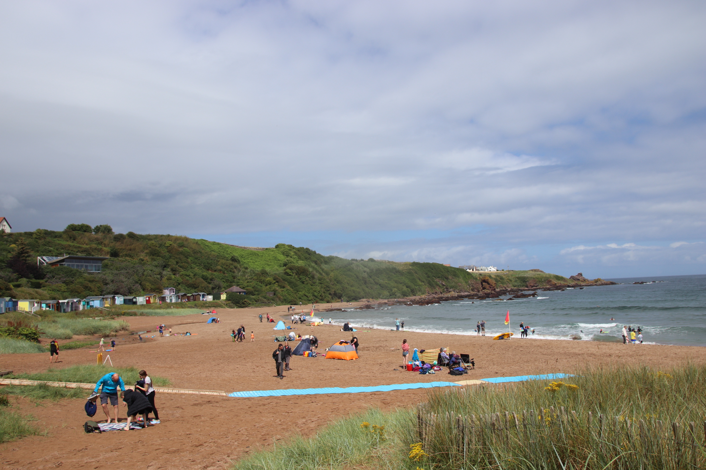
It’s a bit like olden times – a raiding party snaking past ancient hilltop castles & towers to take control of that narrow coastal strip of Liguria, nowadays called the Italian Riviera.
It’s wonderful to see the Mediterranean from the ribbon of road that hugs the coastline. The days of lounging on the beach, picking random pieces of clinker from feet and rear whilst roasting in the sun like leathered lizards on a Sunday spit, are long over.
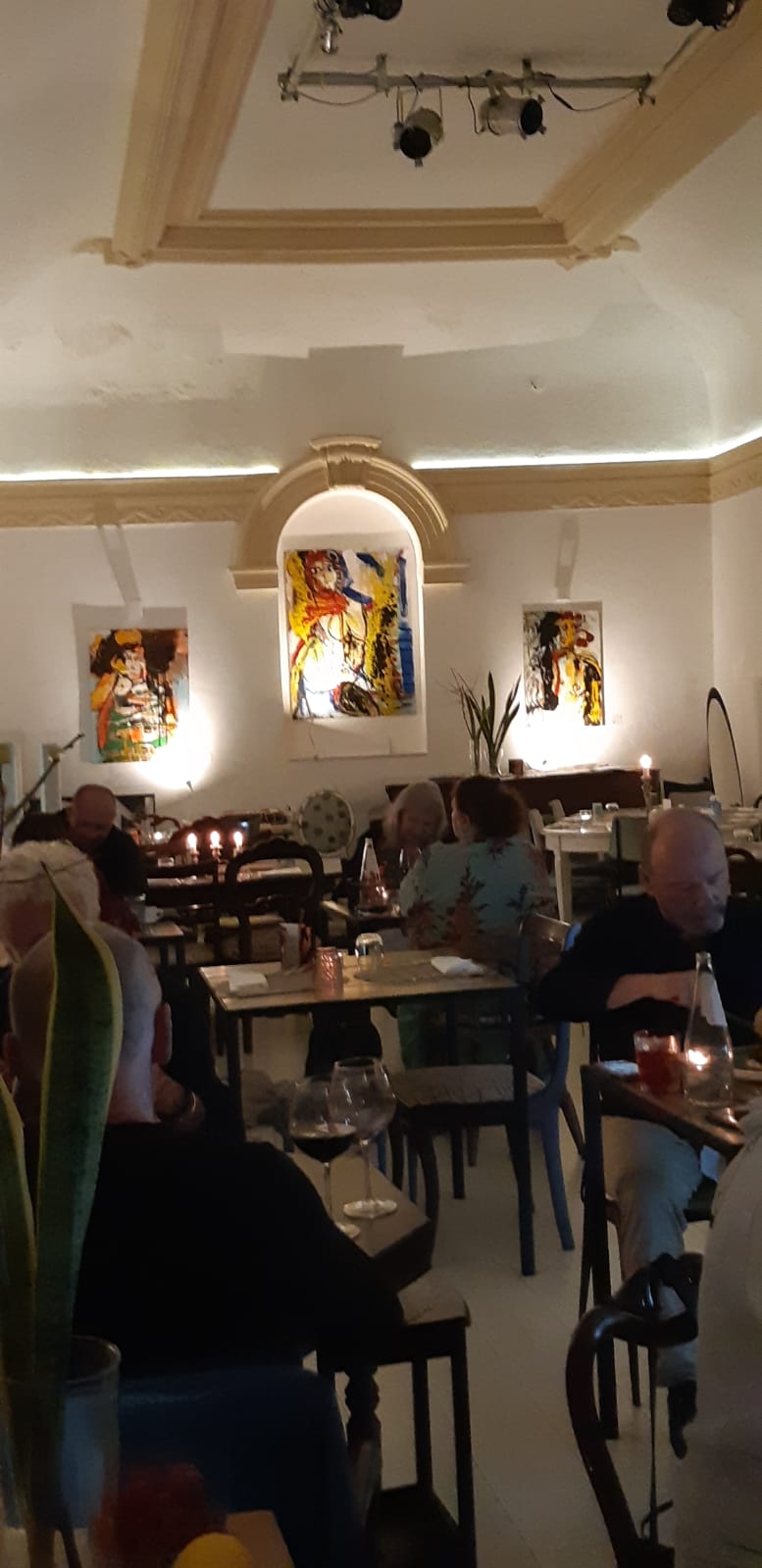
I prefer the tourist wander, appreciating history, art & architecture and partaking in wine & food, however much they might take me for an expensive ride.
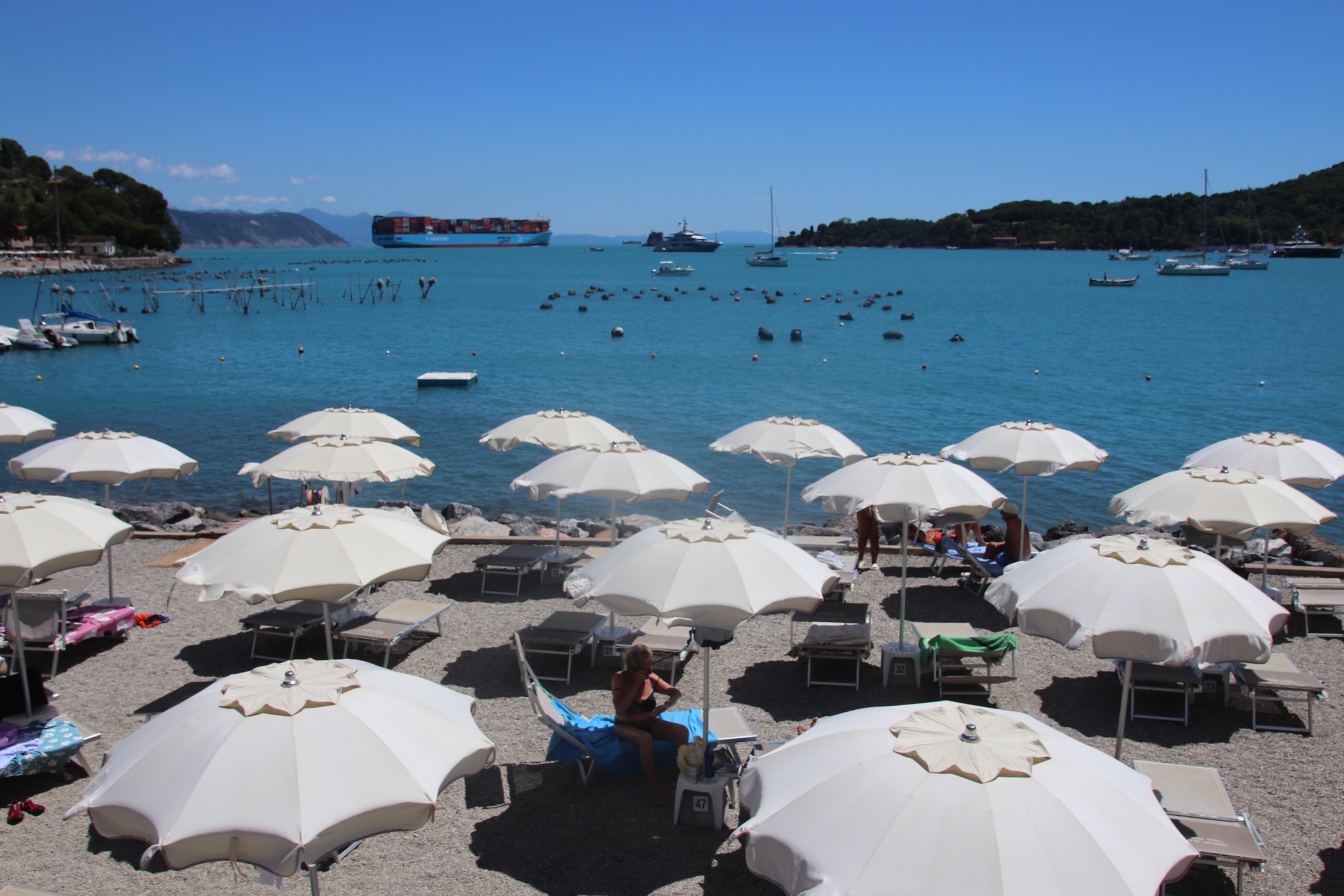
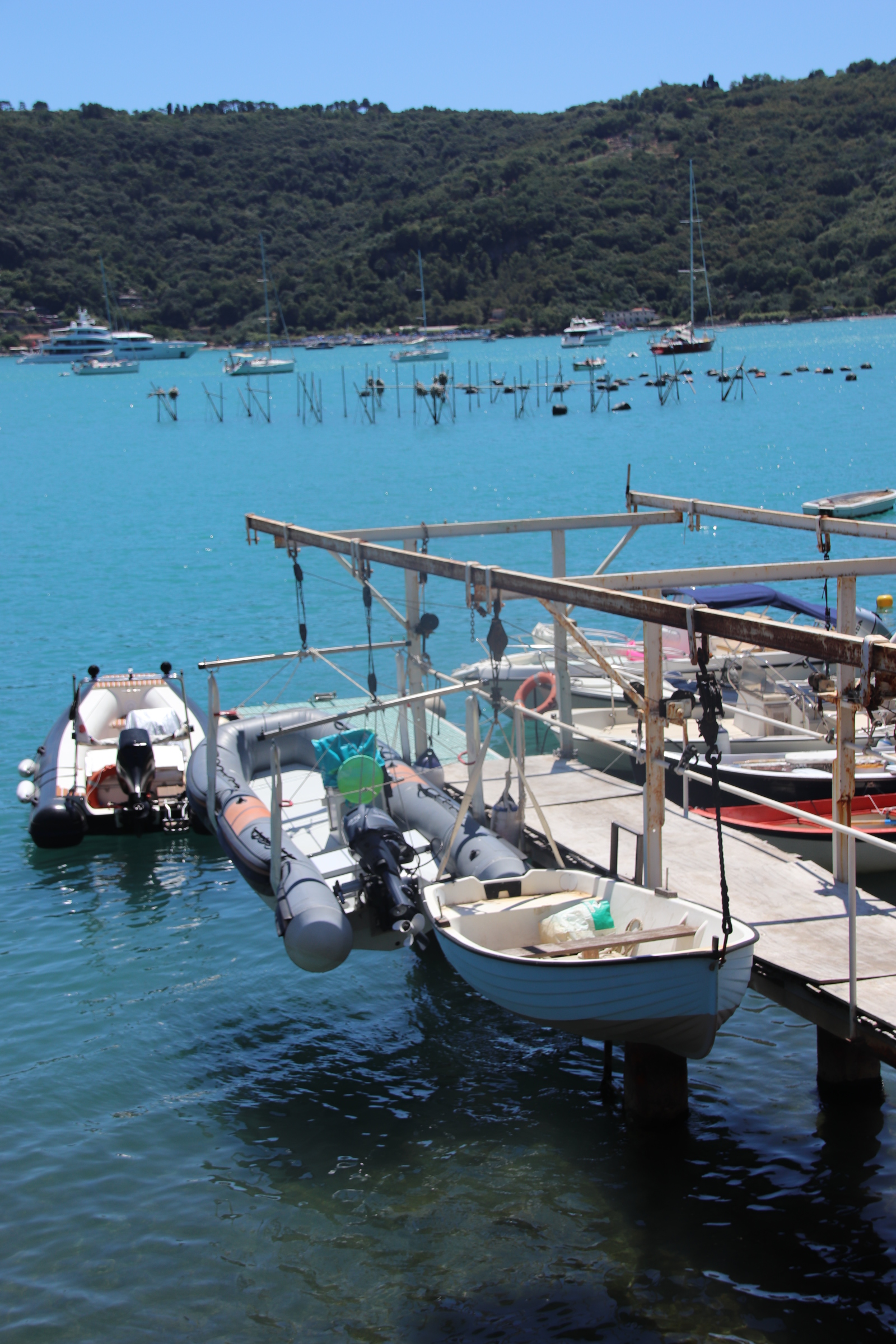
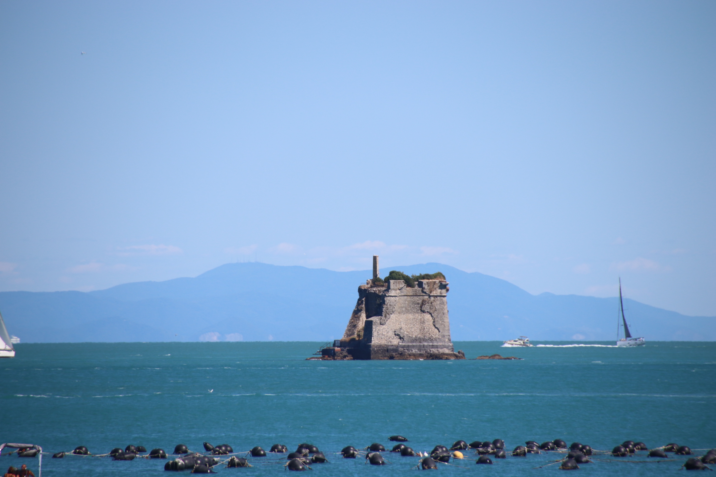
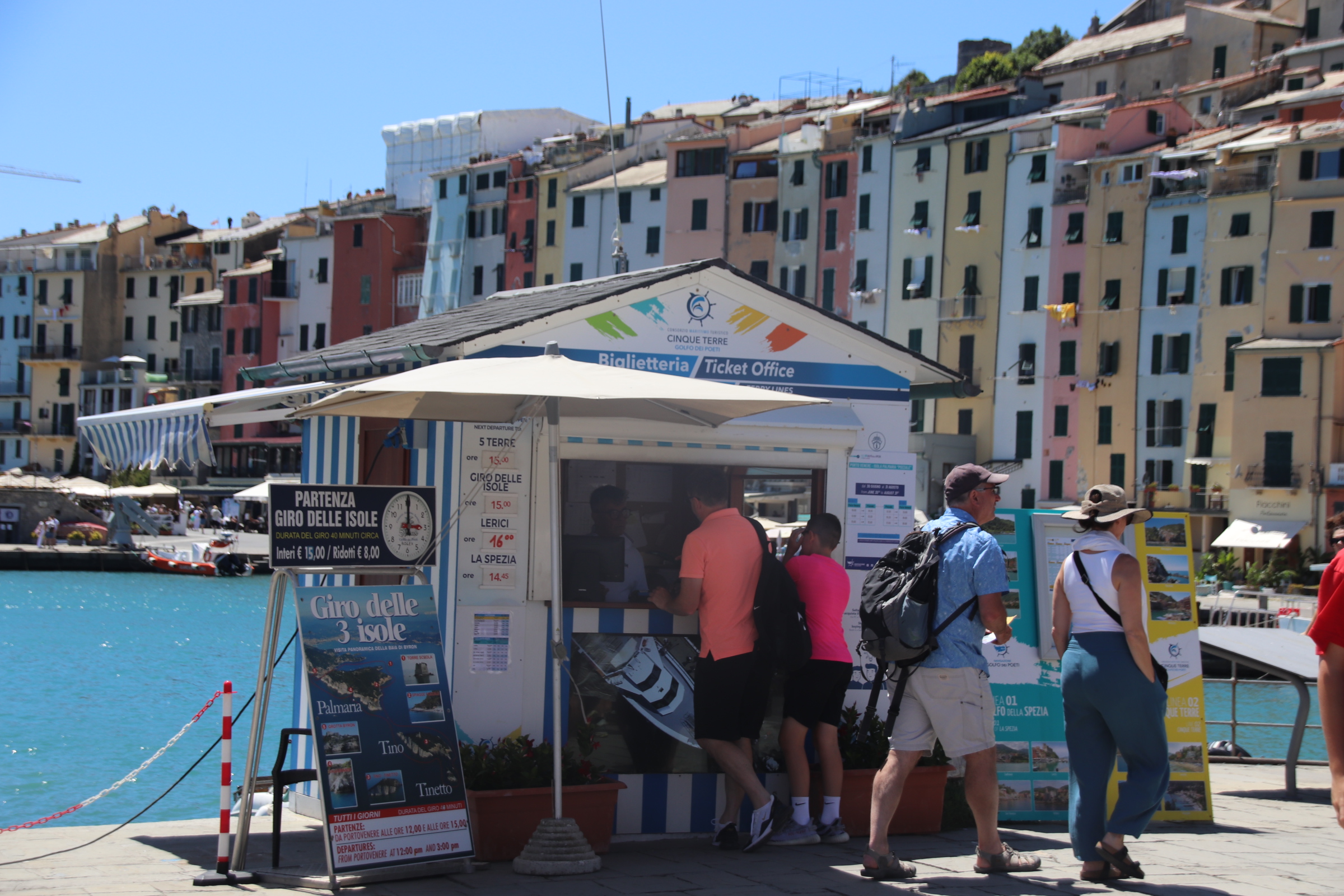
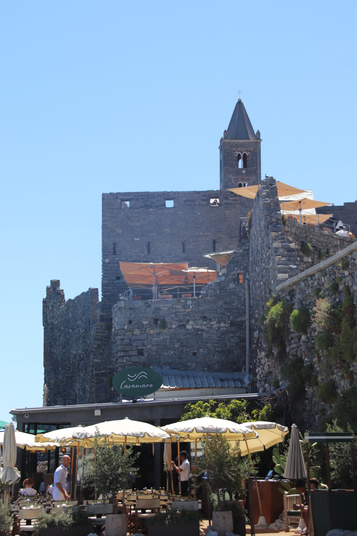
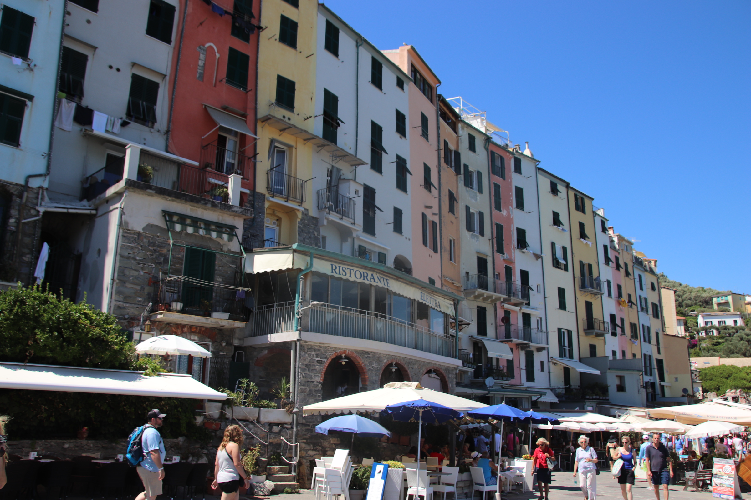
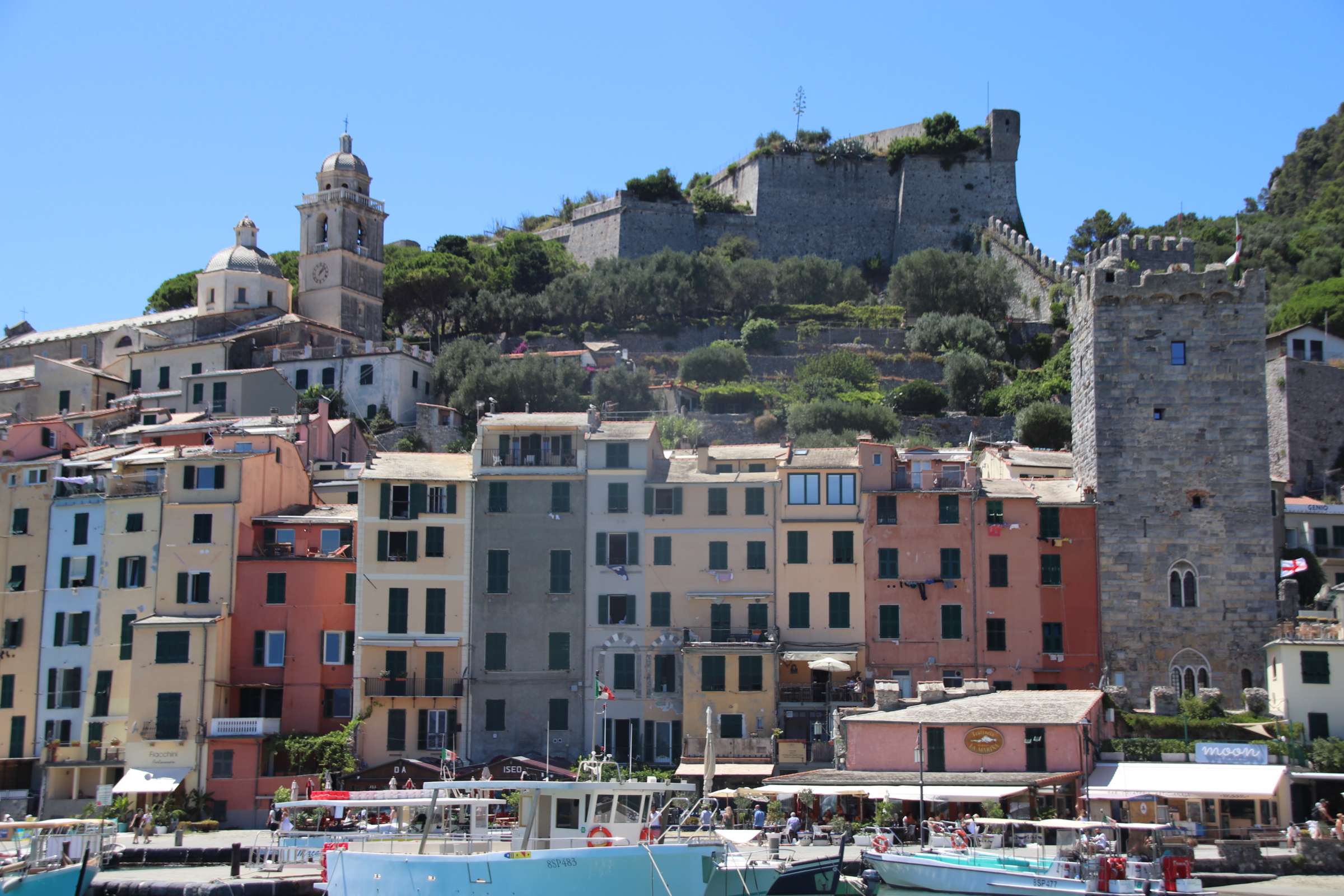
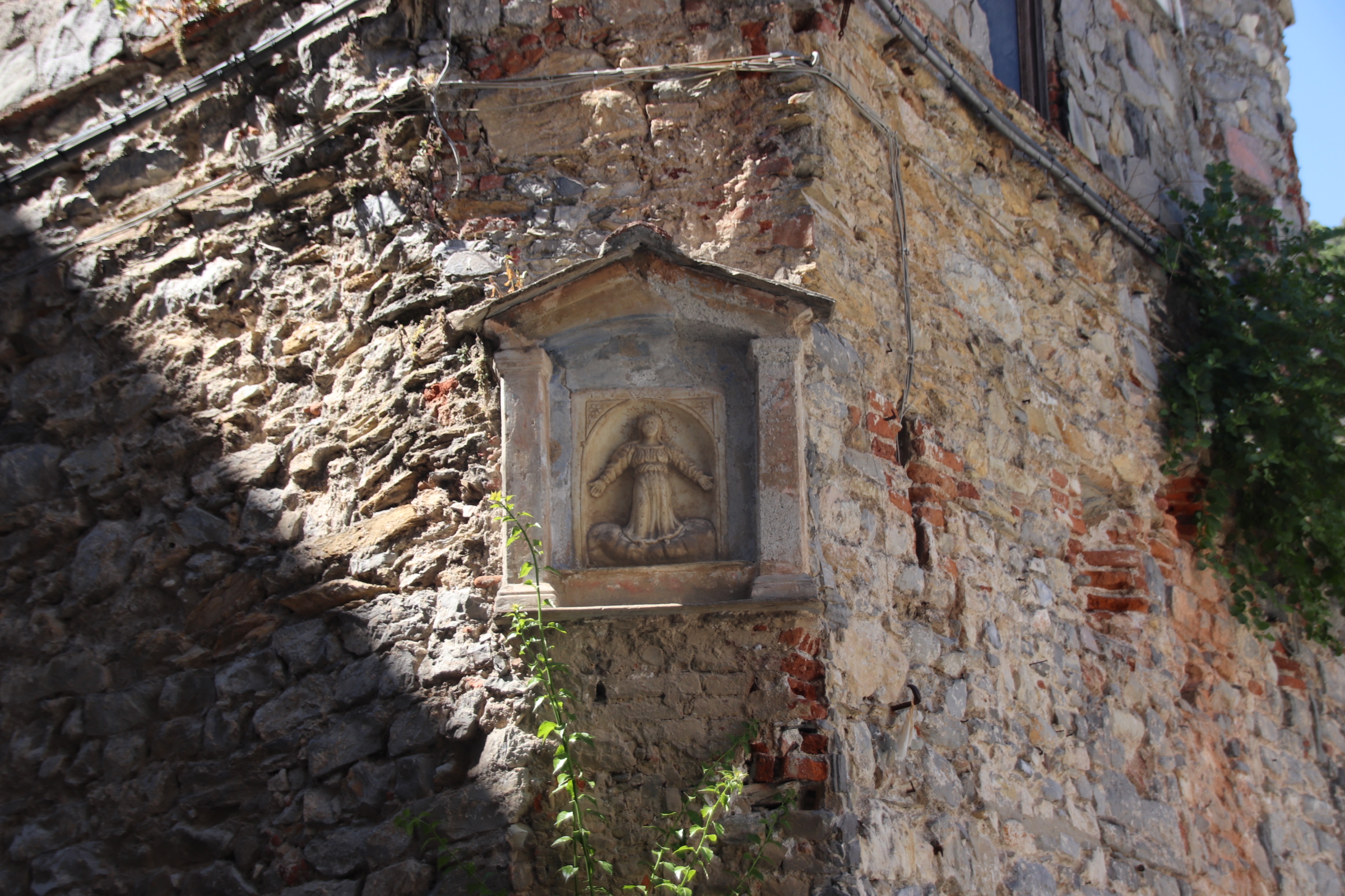
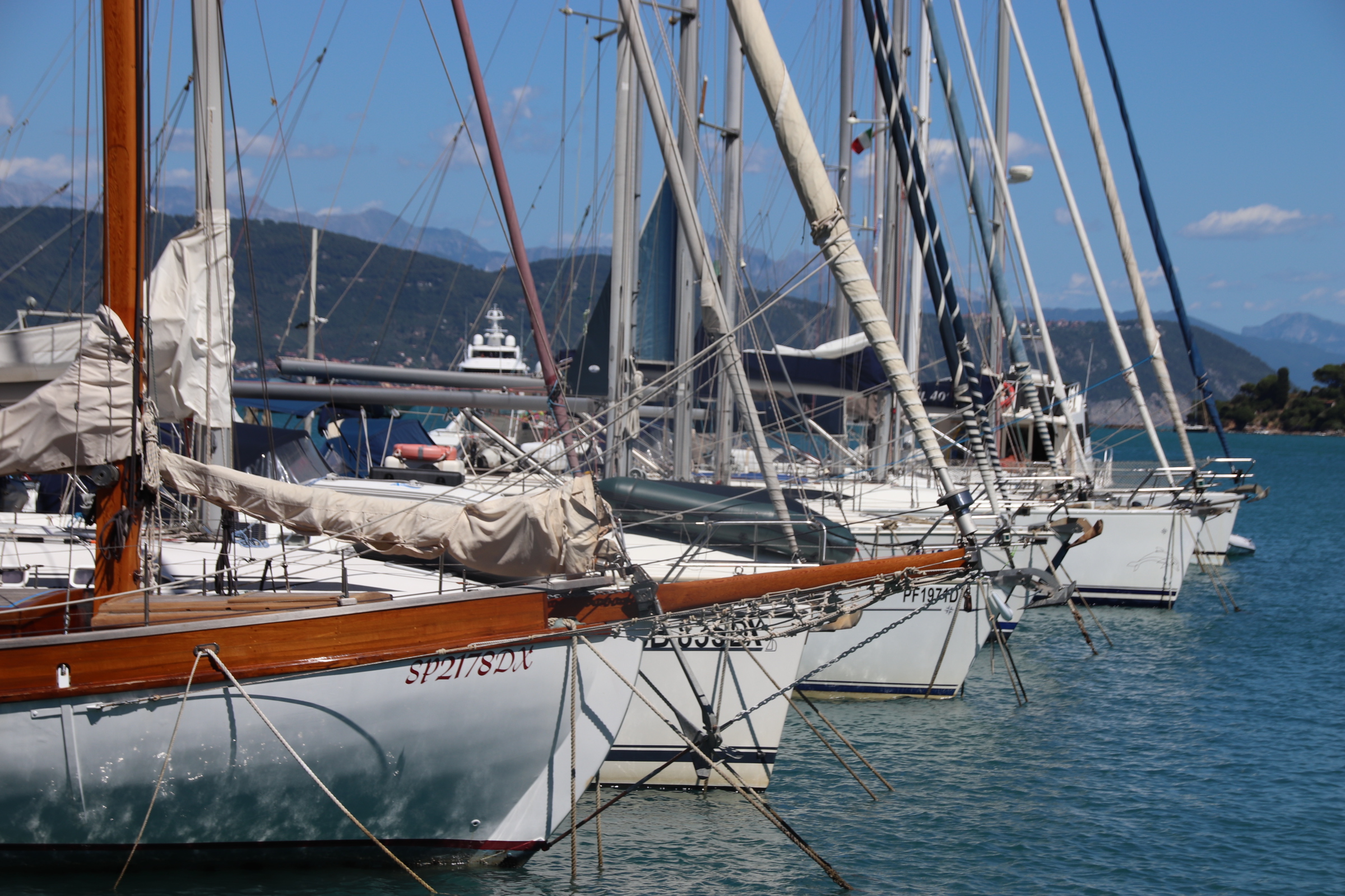
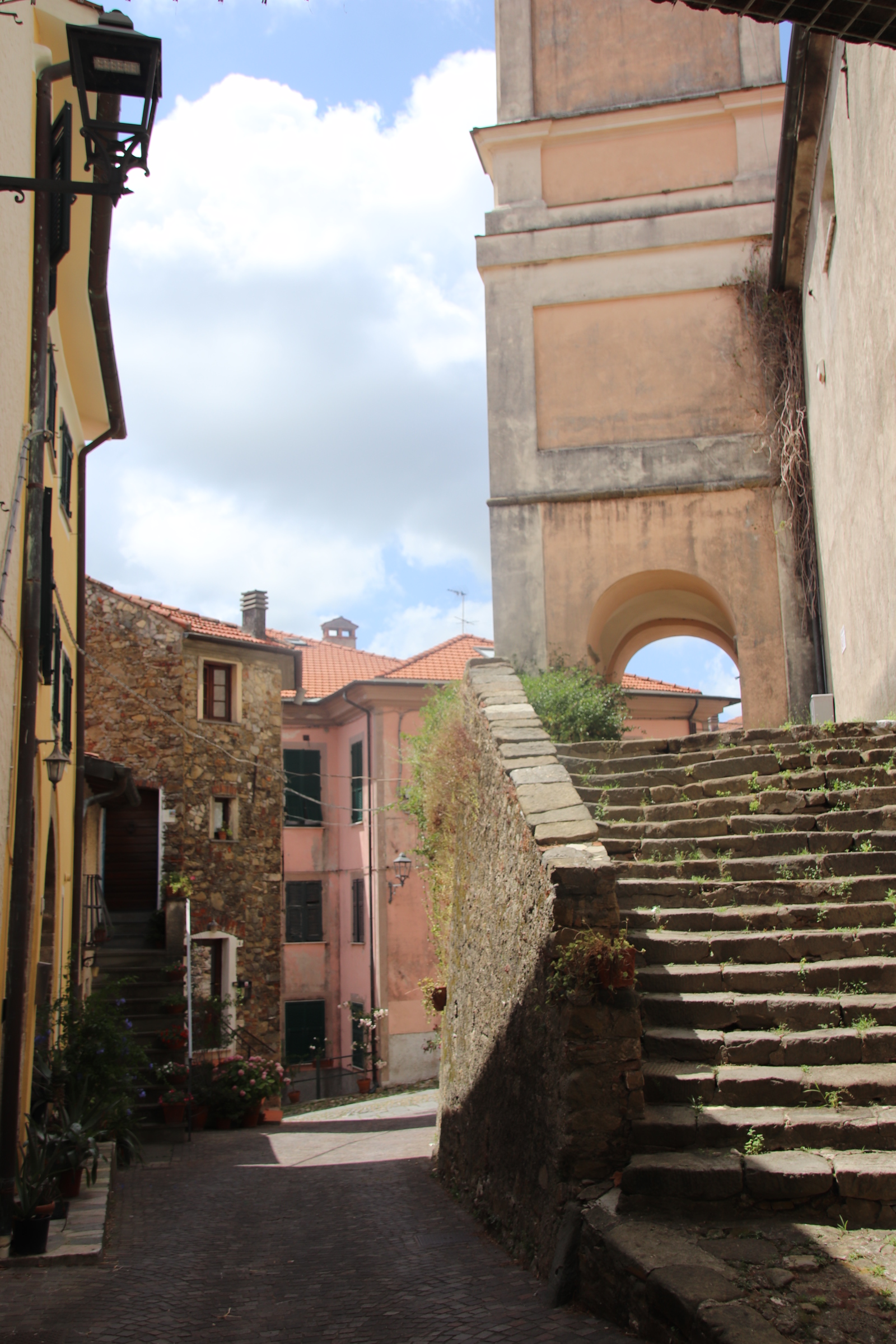
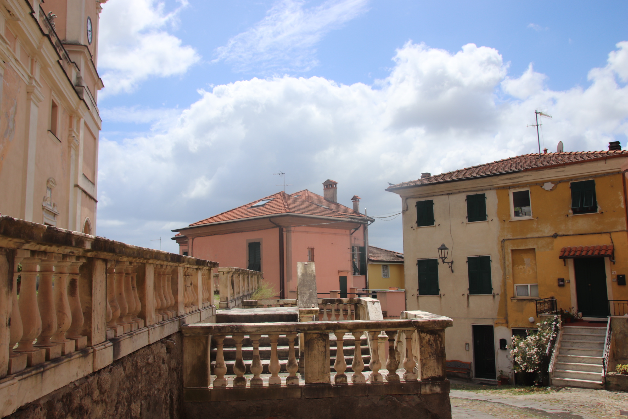
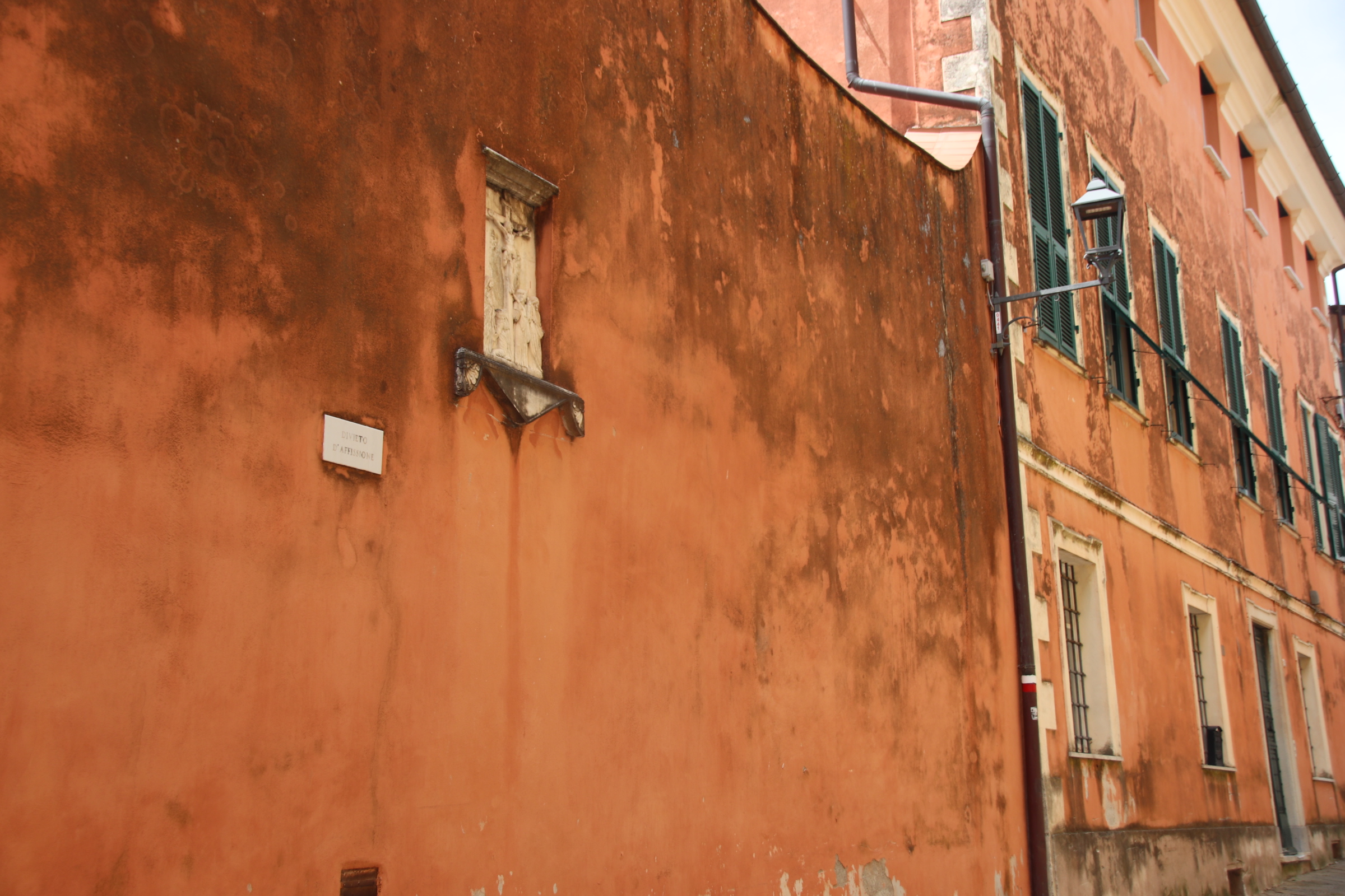
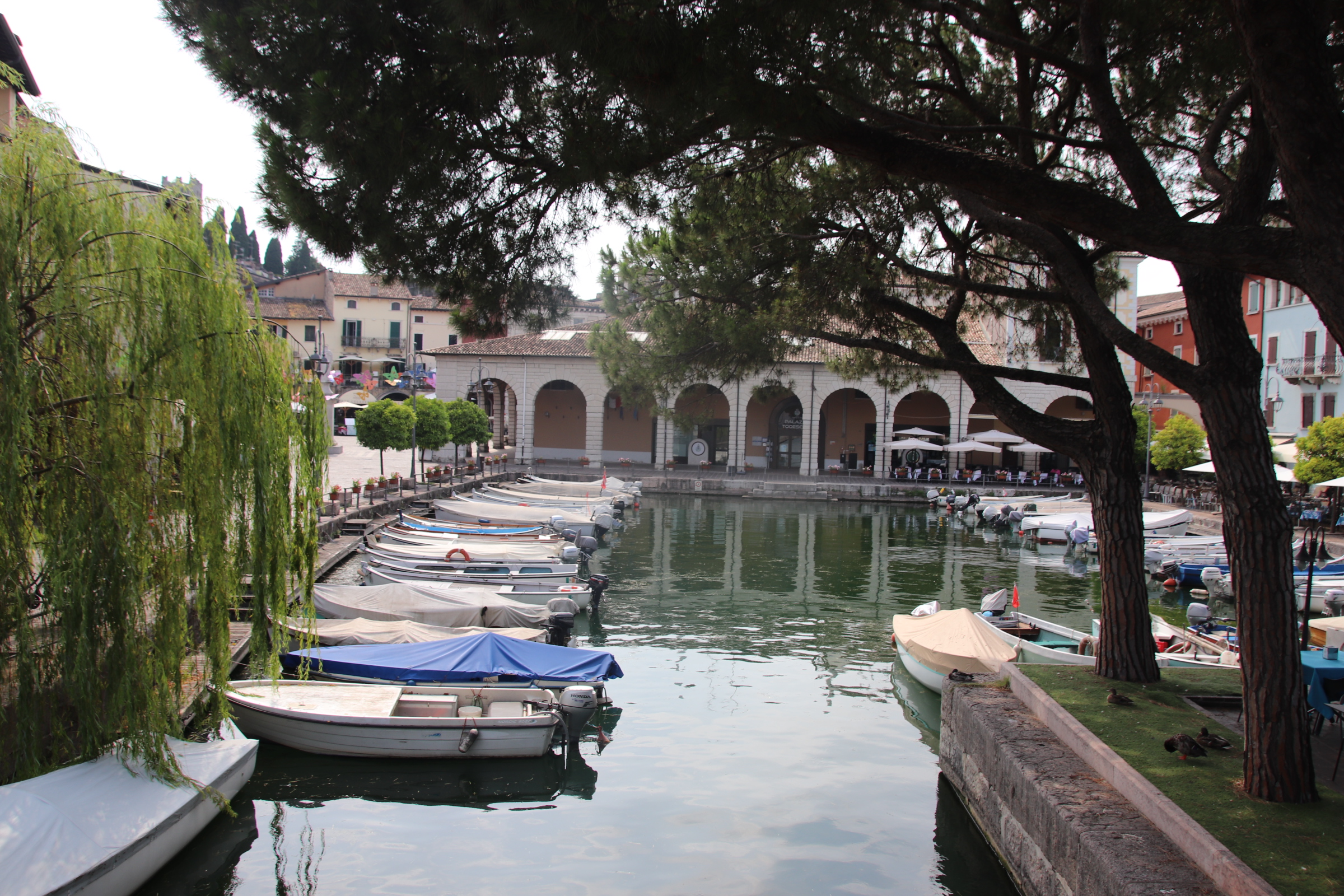
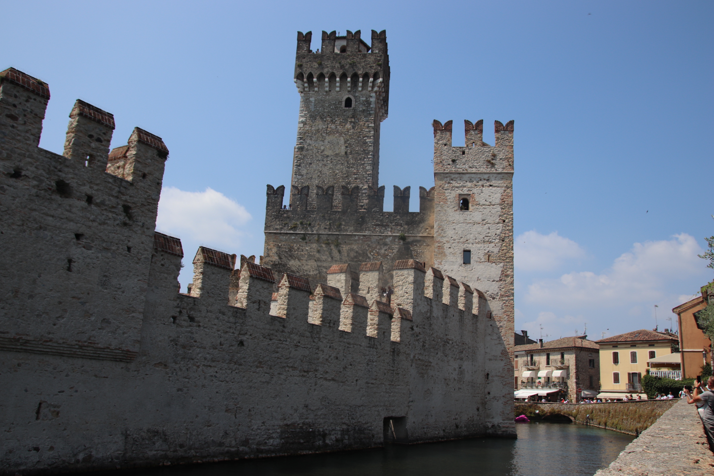
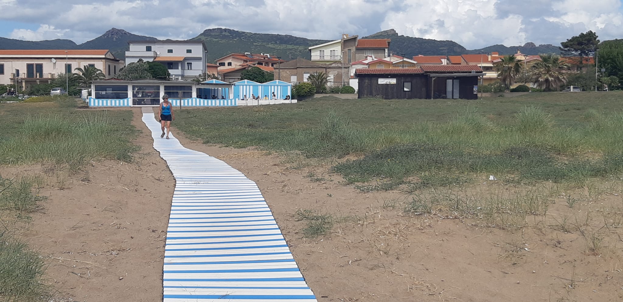
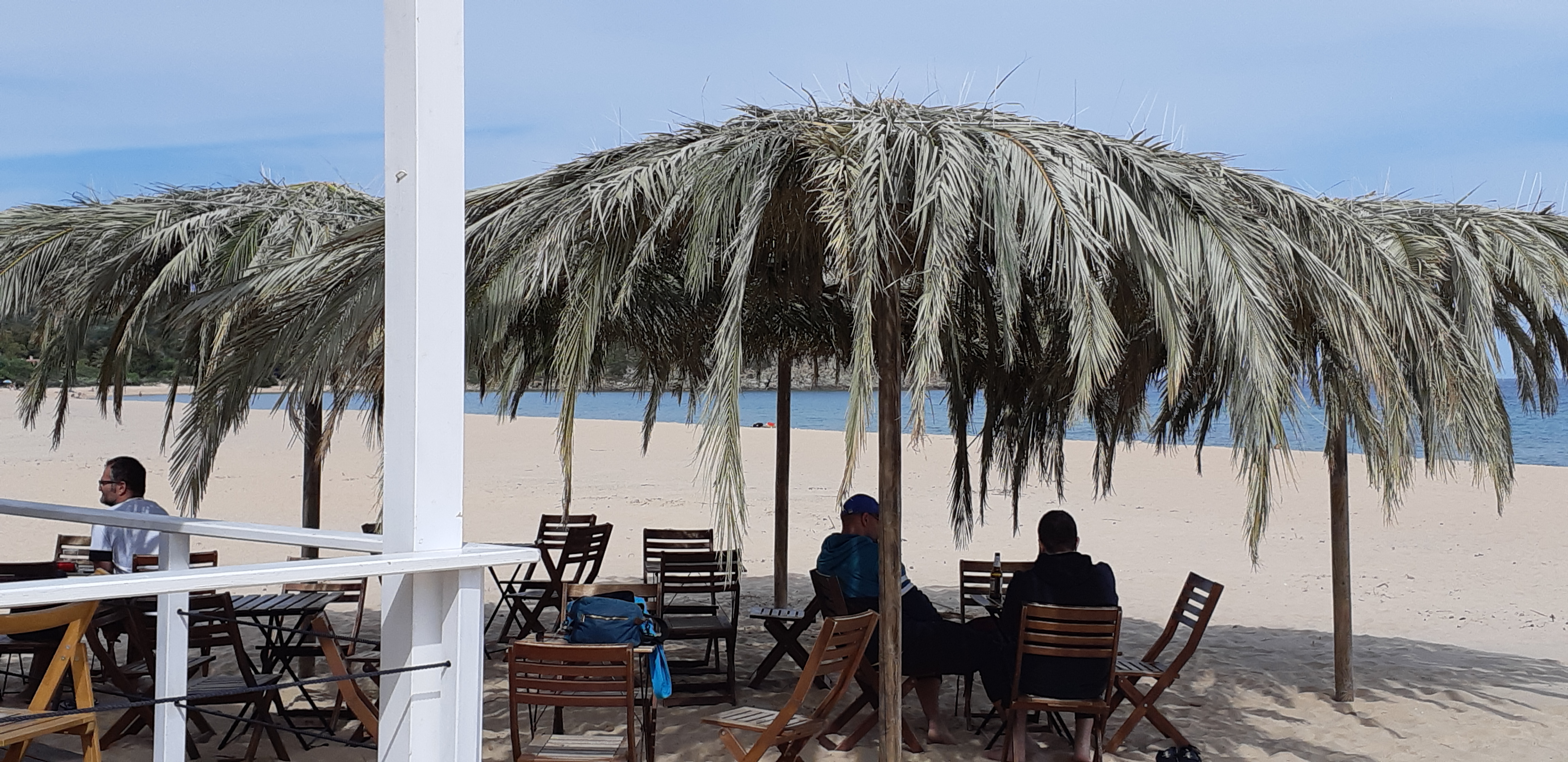
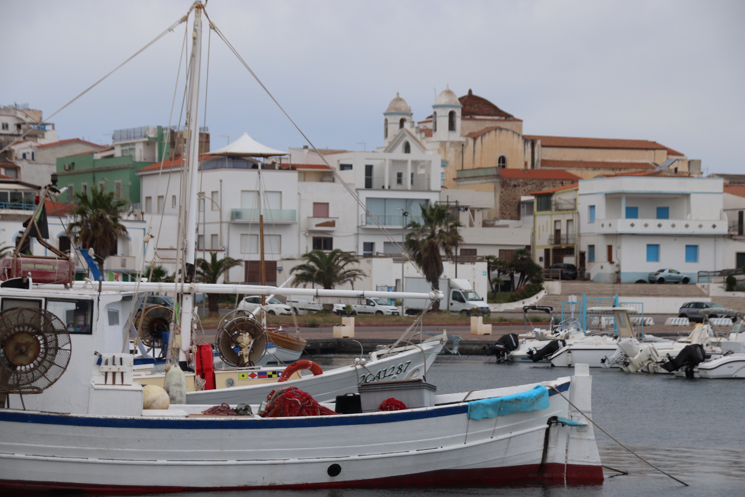
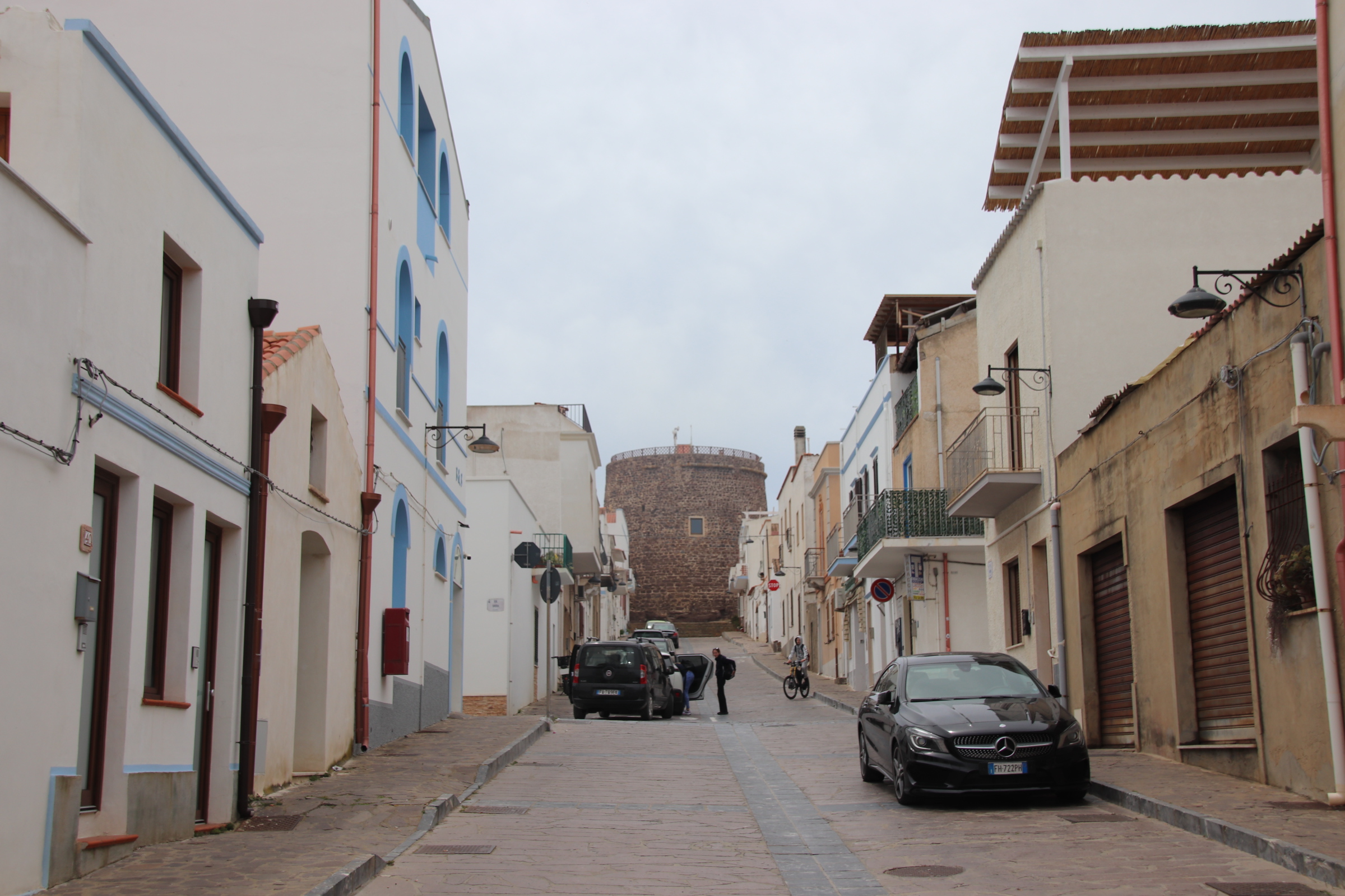
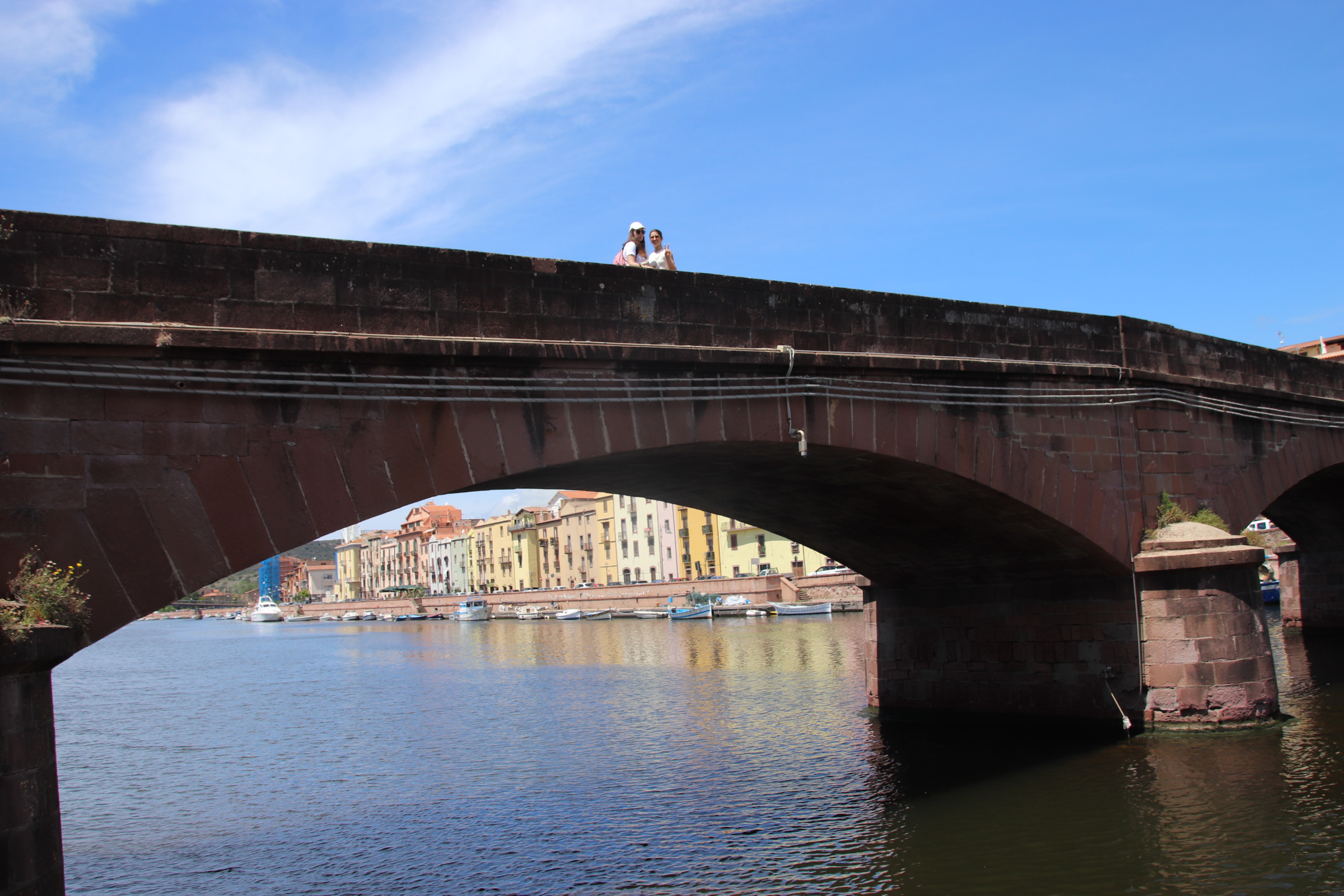
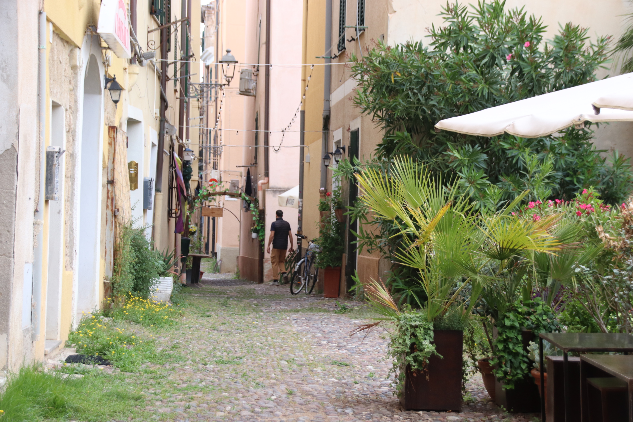
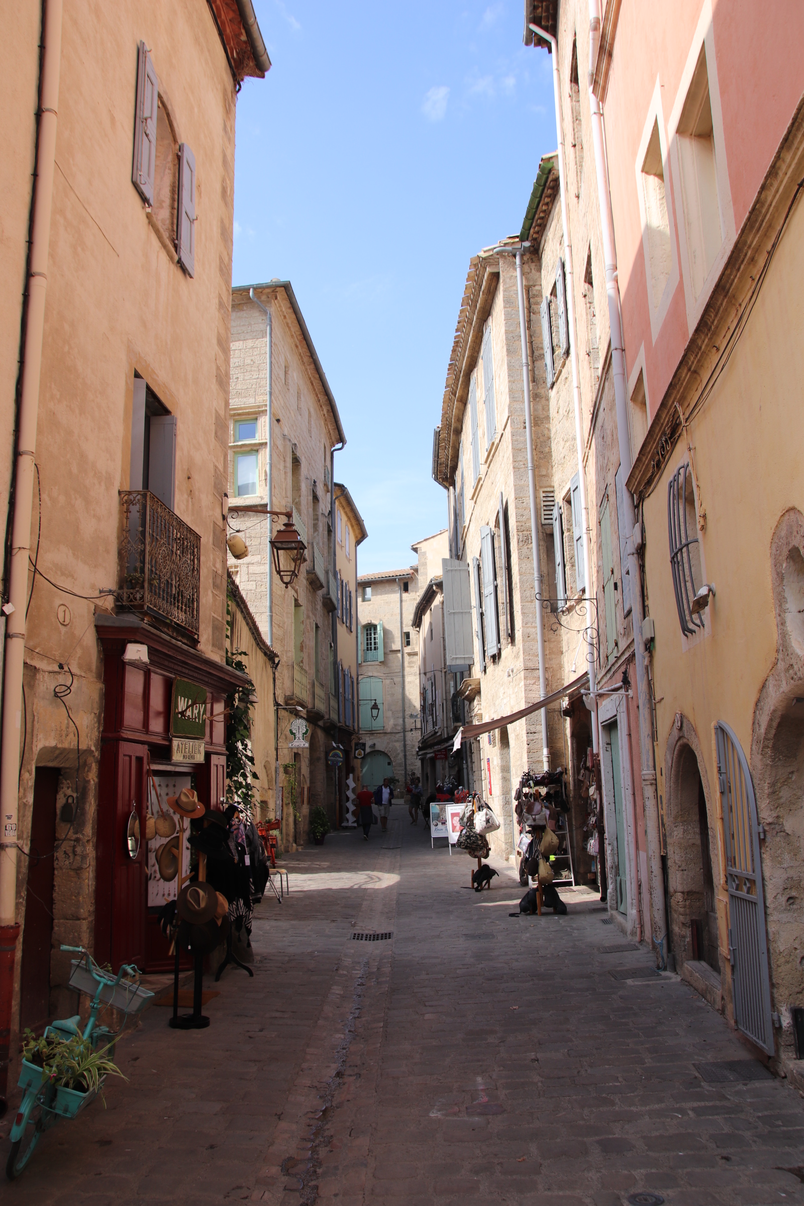
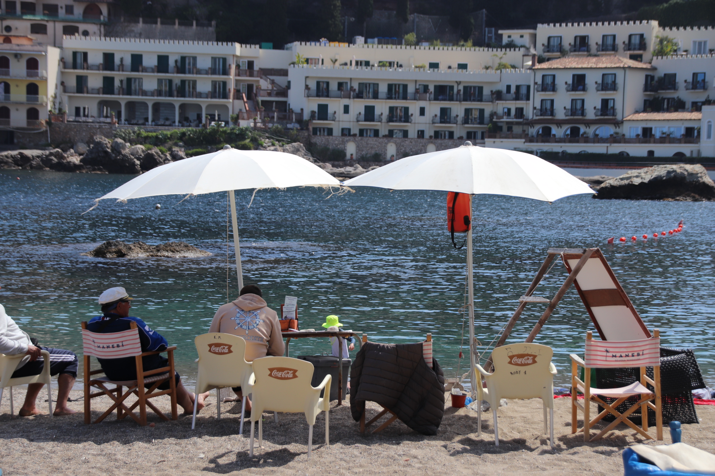
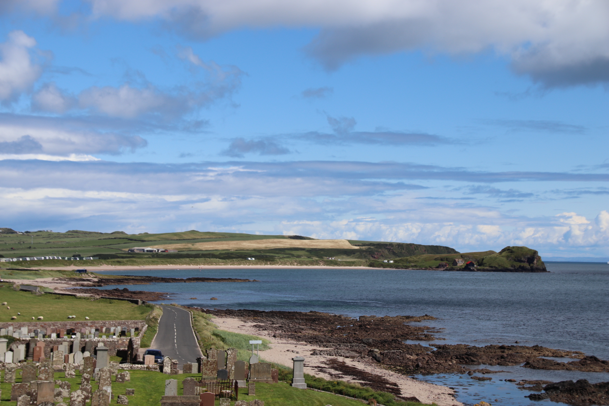
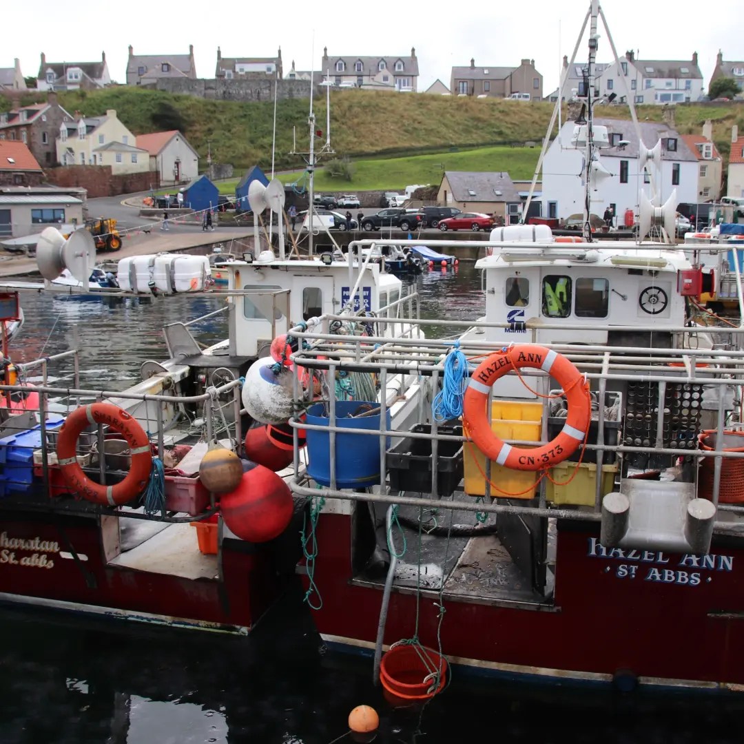
Portovenere is just south of the Cinque Terre. It has the essential elements of Lunigiana – a coastal fort & town walls, churches powering it over local troops & citizens, narrow streets & tall, pastel-coloured, tenement type buildings, once home to fishermen & merchants & now to restaurants & bars & tourist shops.
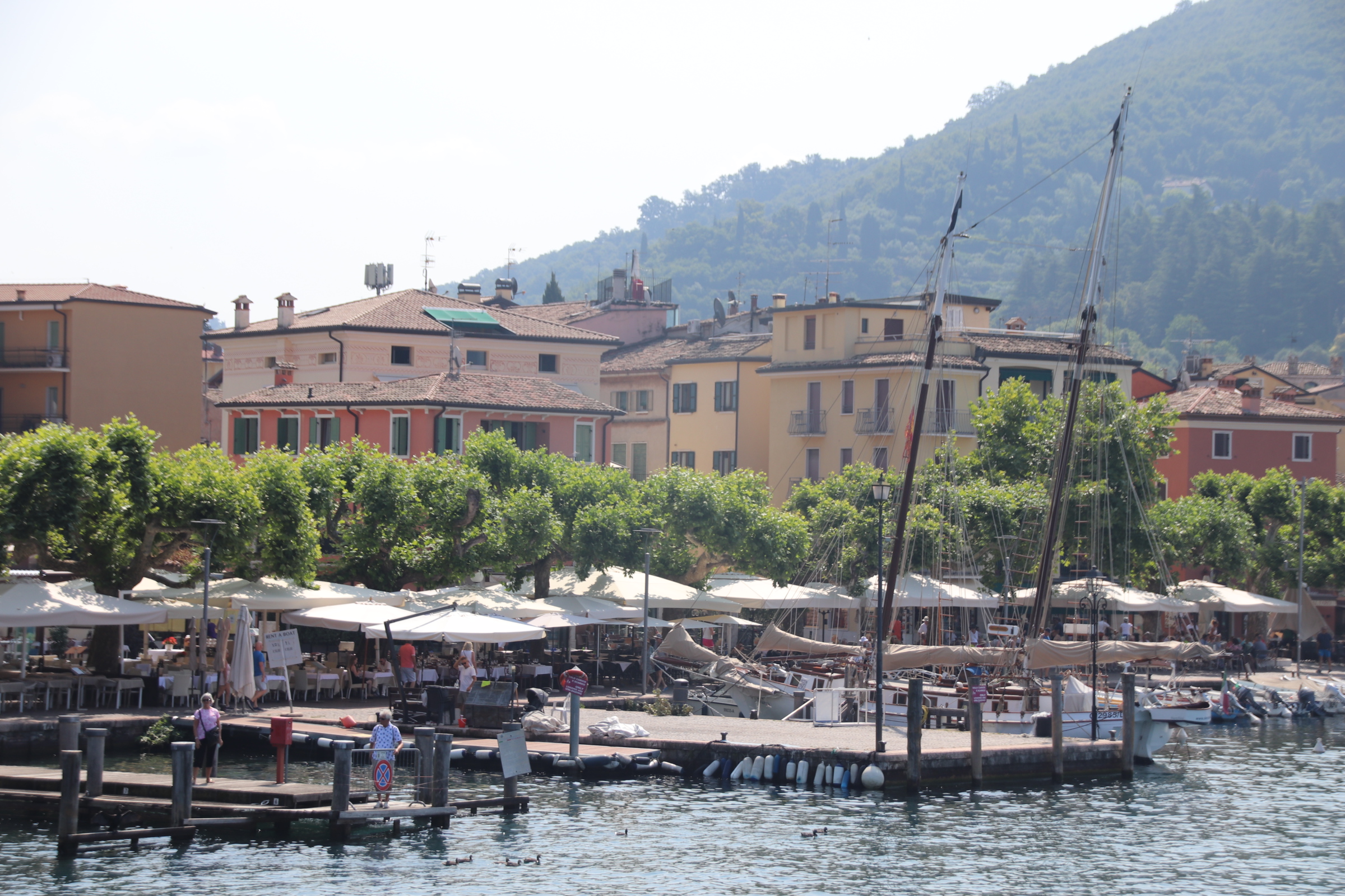
Rather than a shipping industry built to trade up & down the coast & further afield, the modern way is to shuttle tourists about on day trips, snapping photos of caves & blow-holes & picturesque fishing villages.
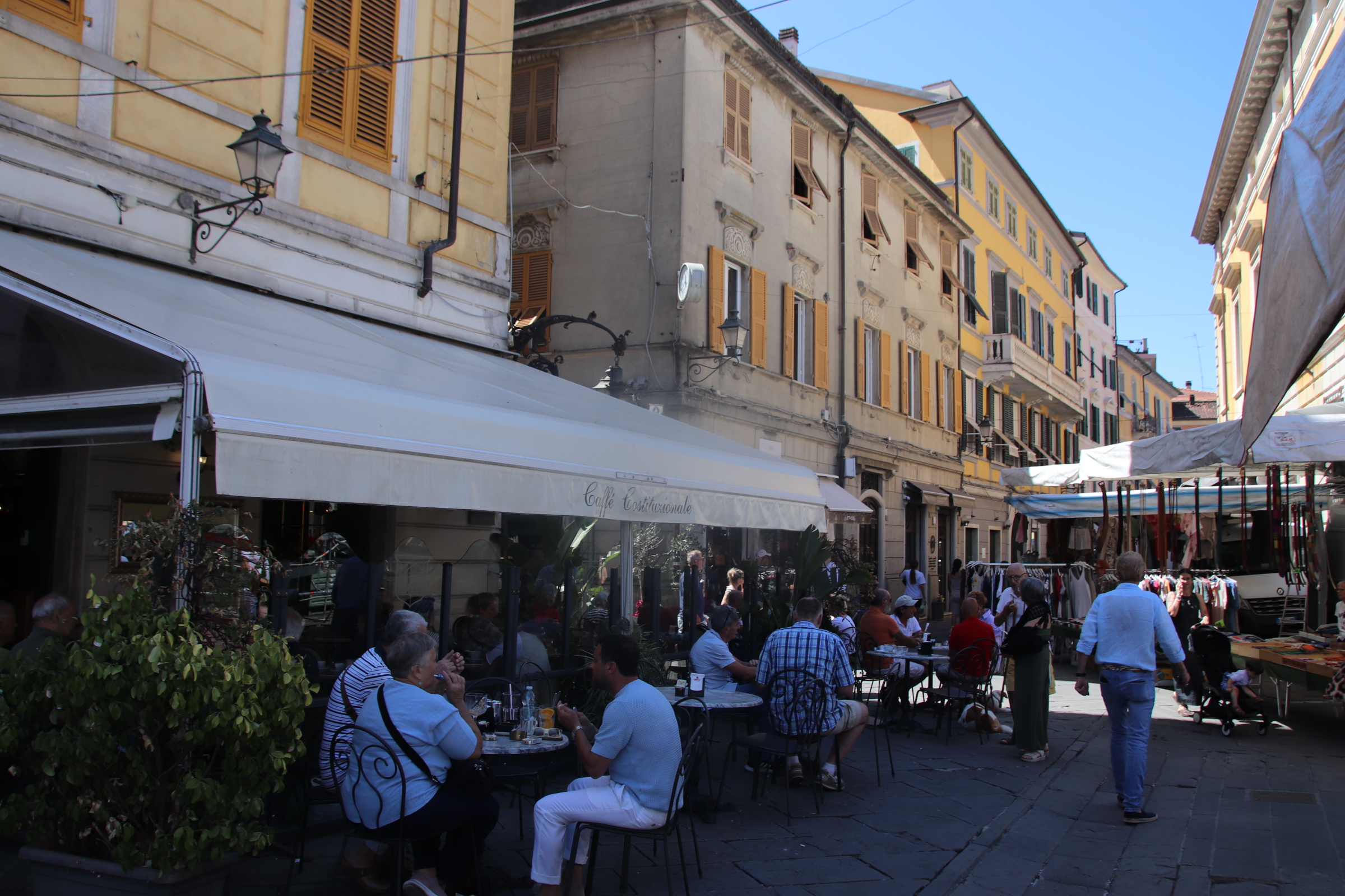
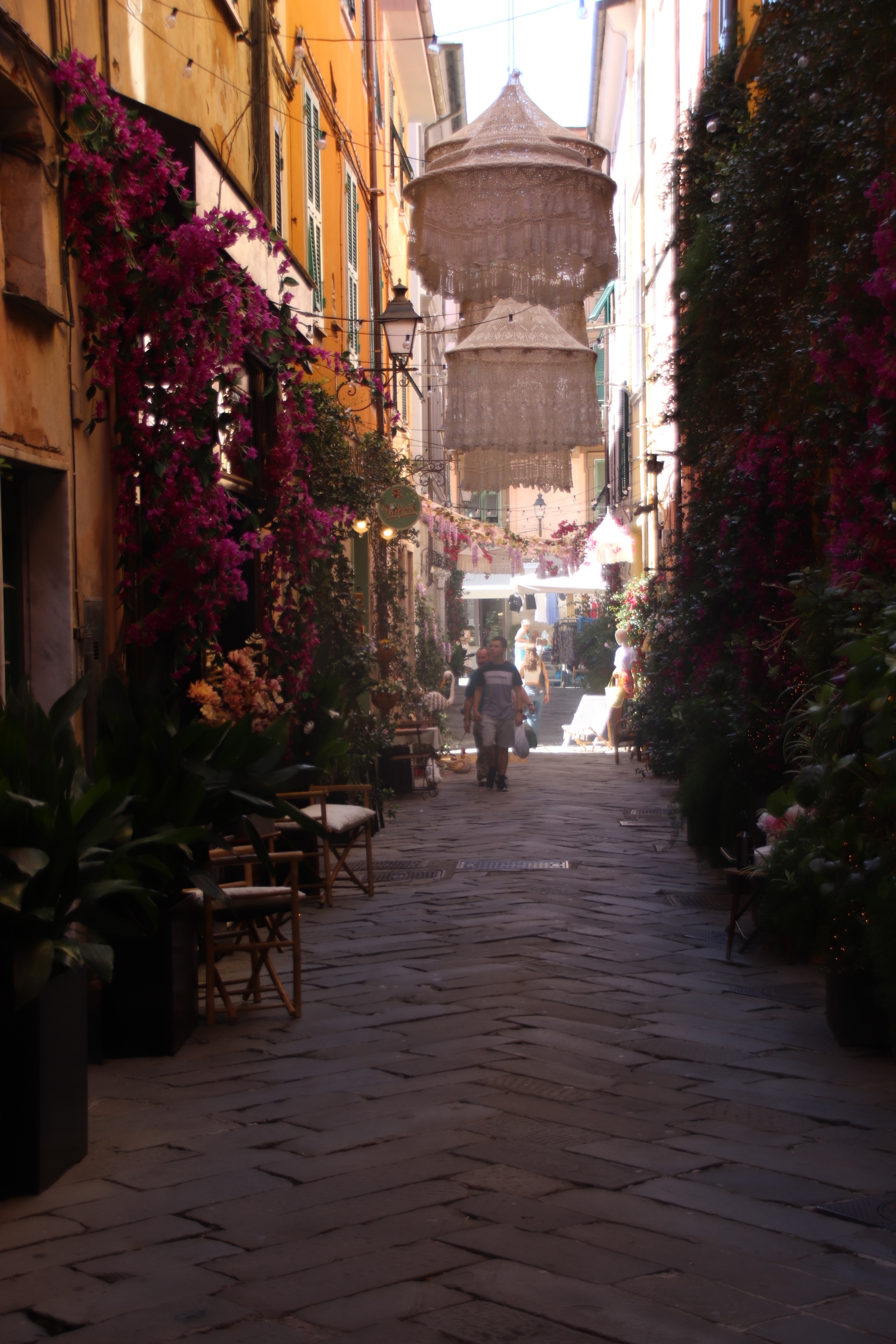
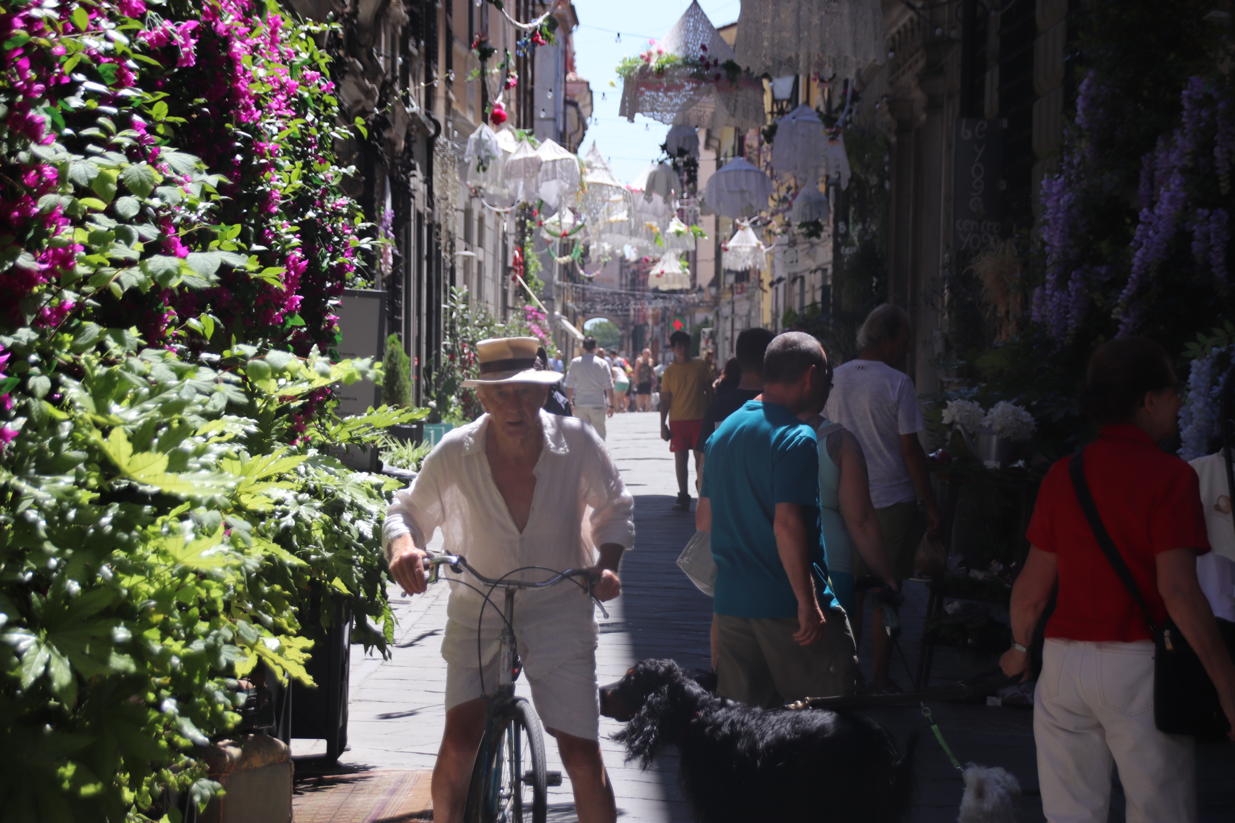
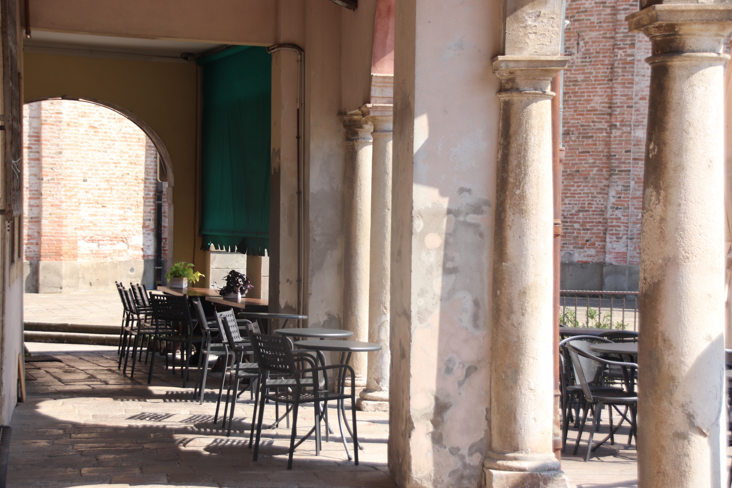
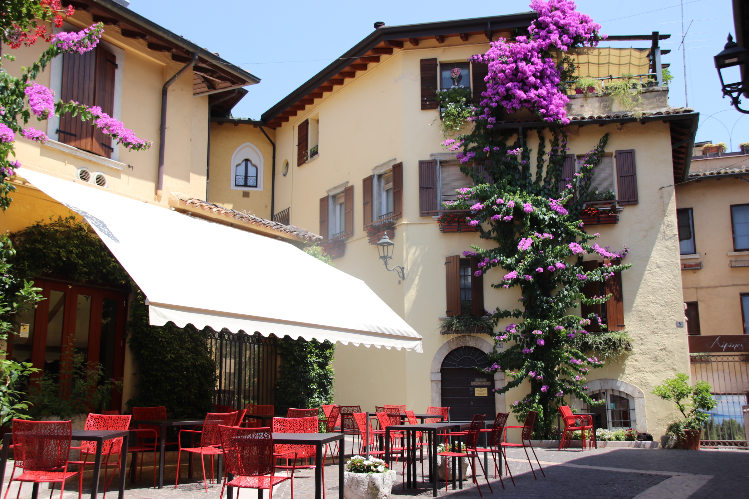
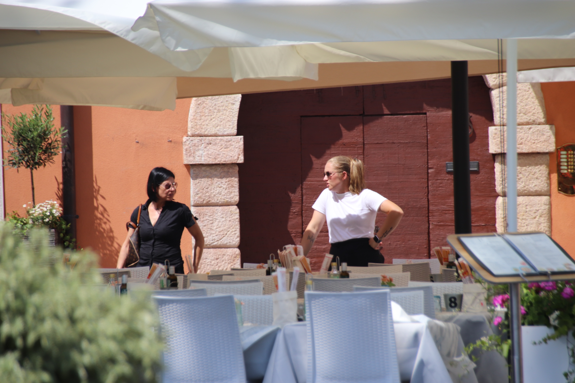
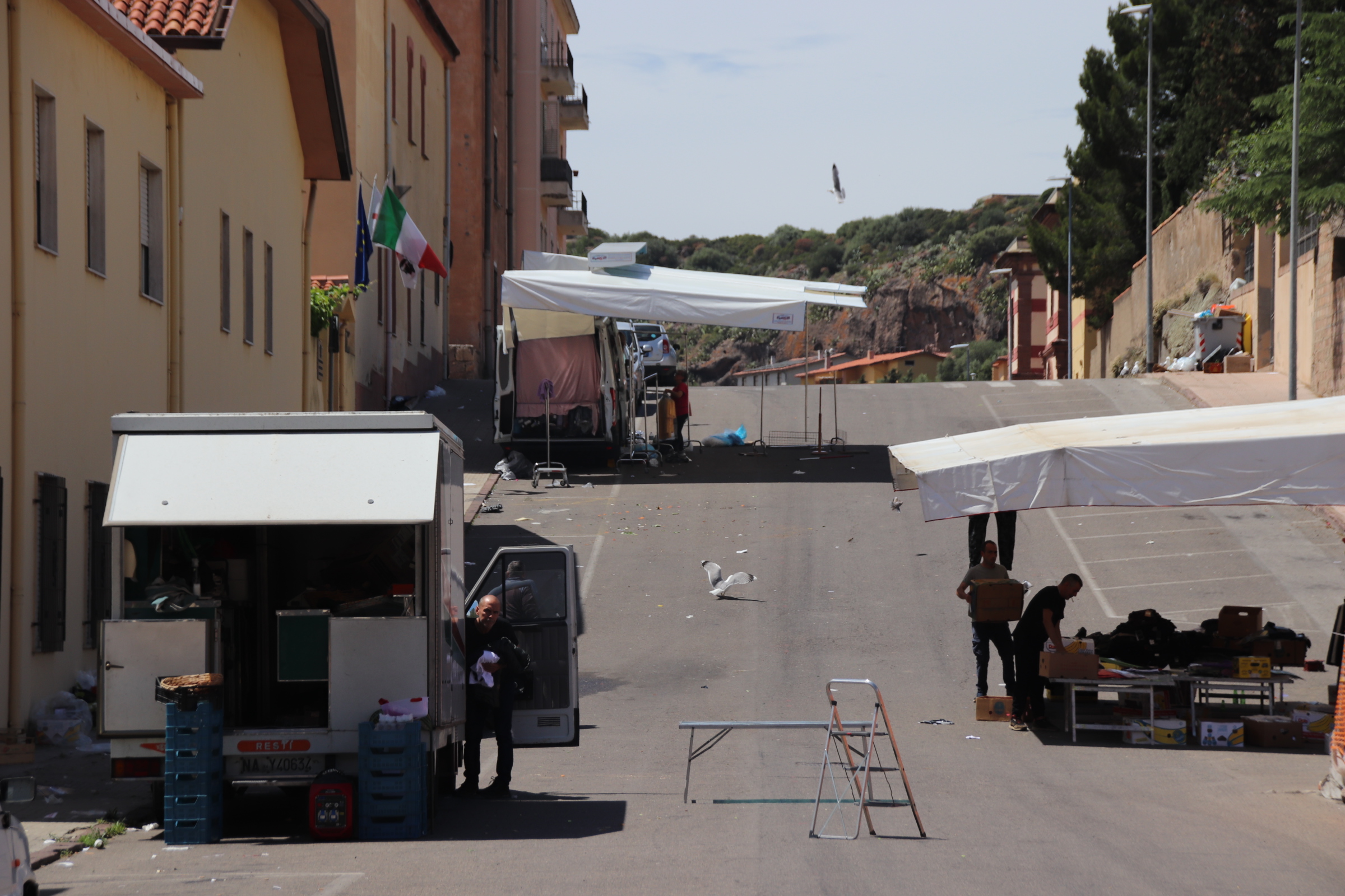
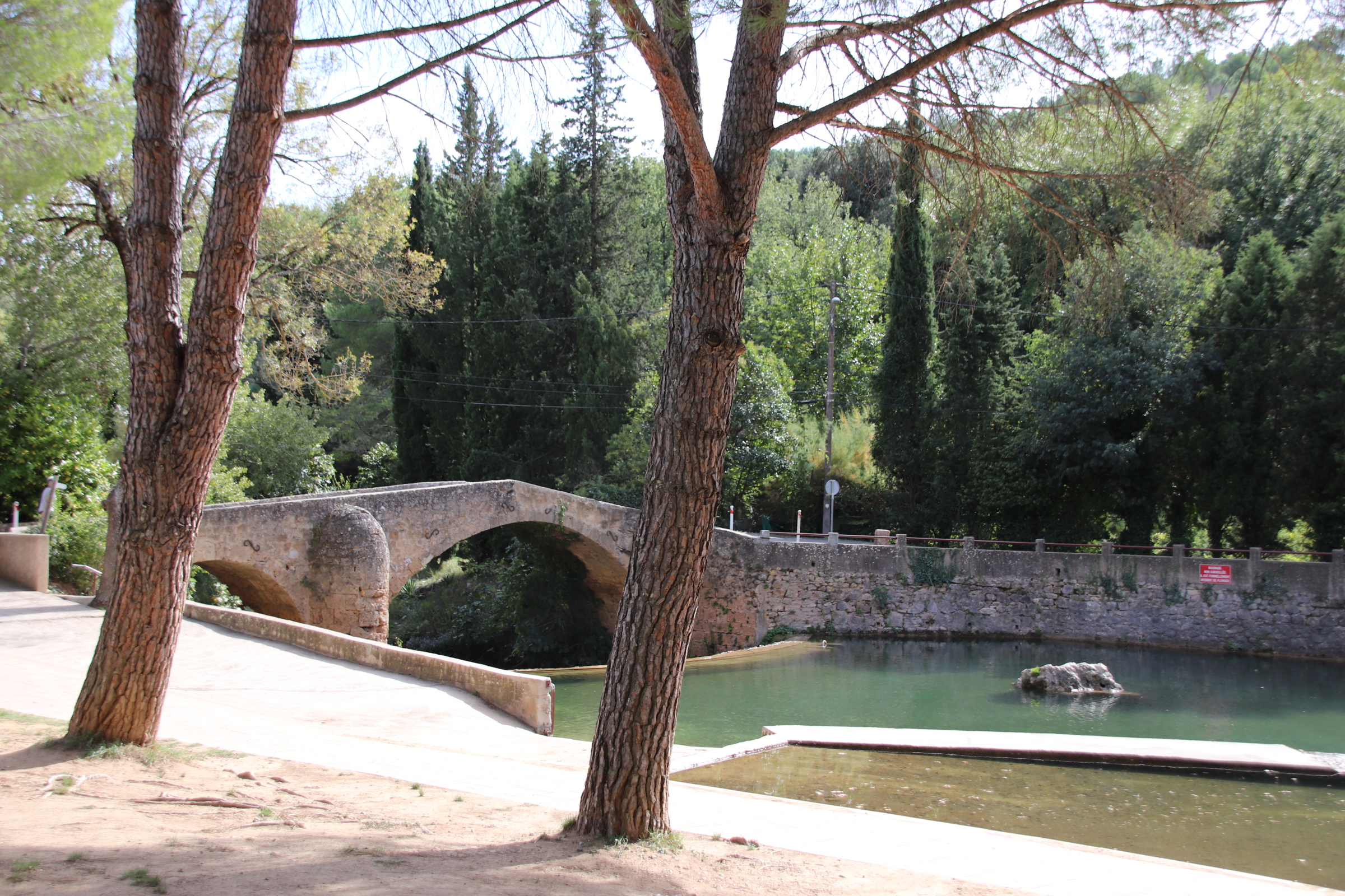
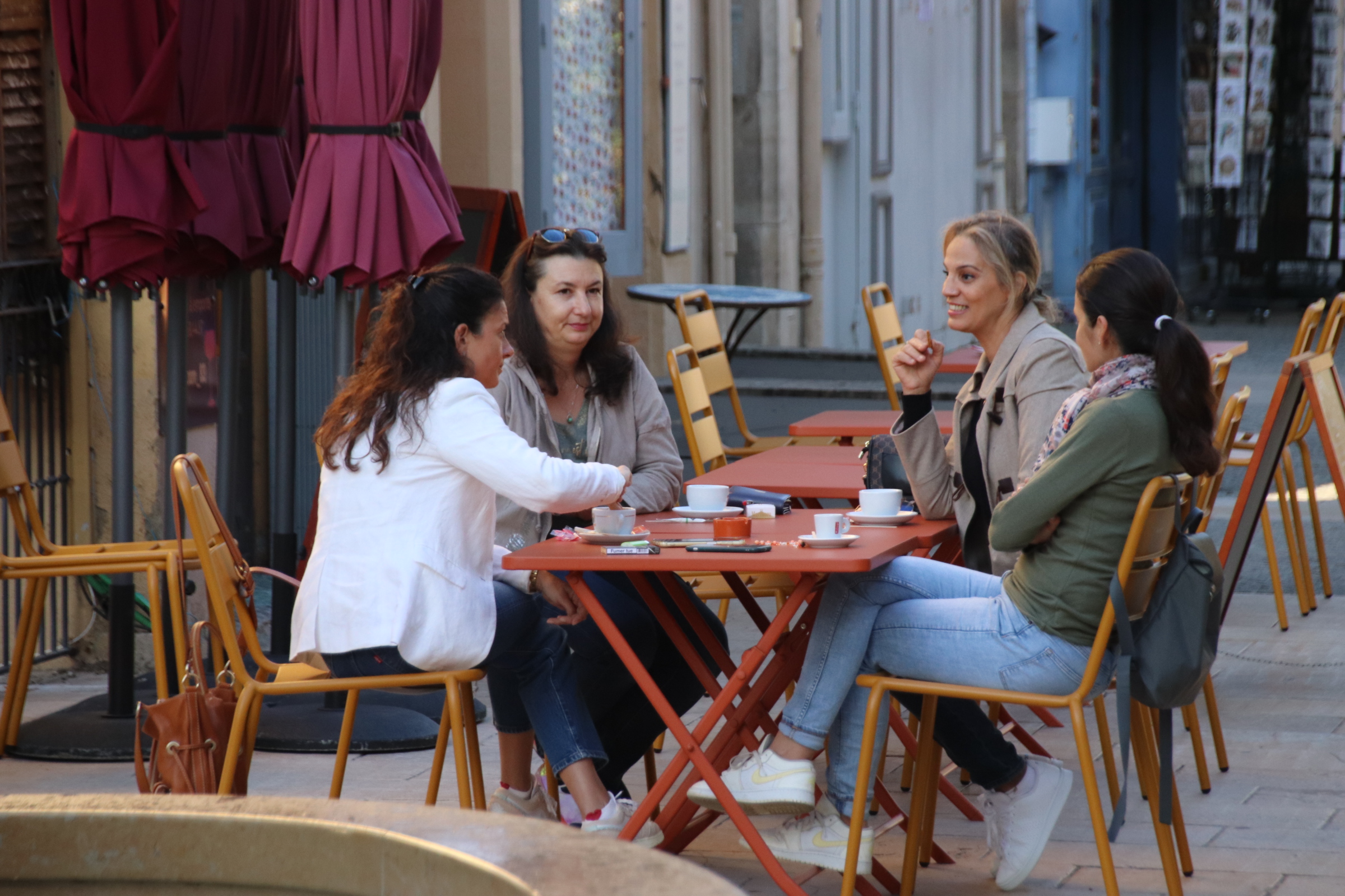
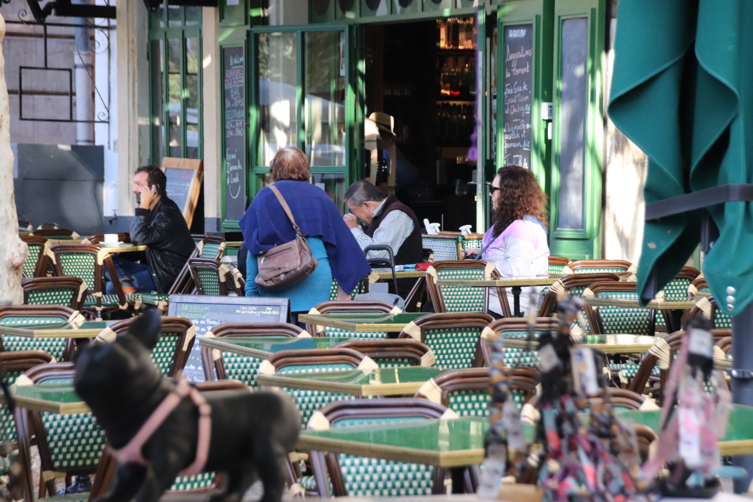
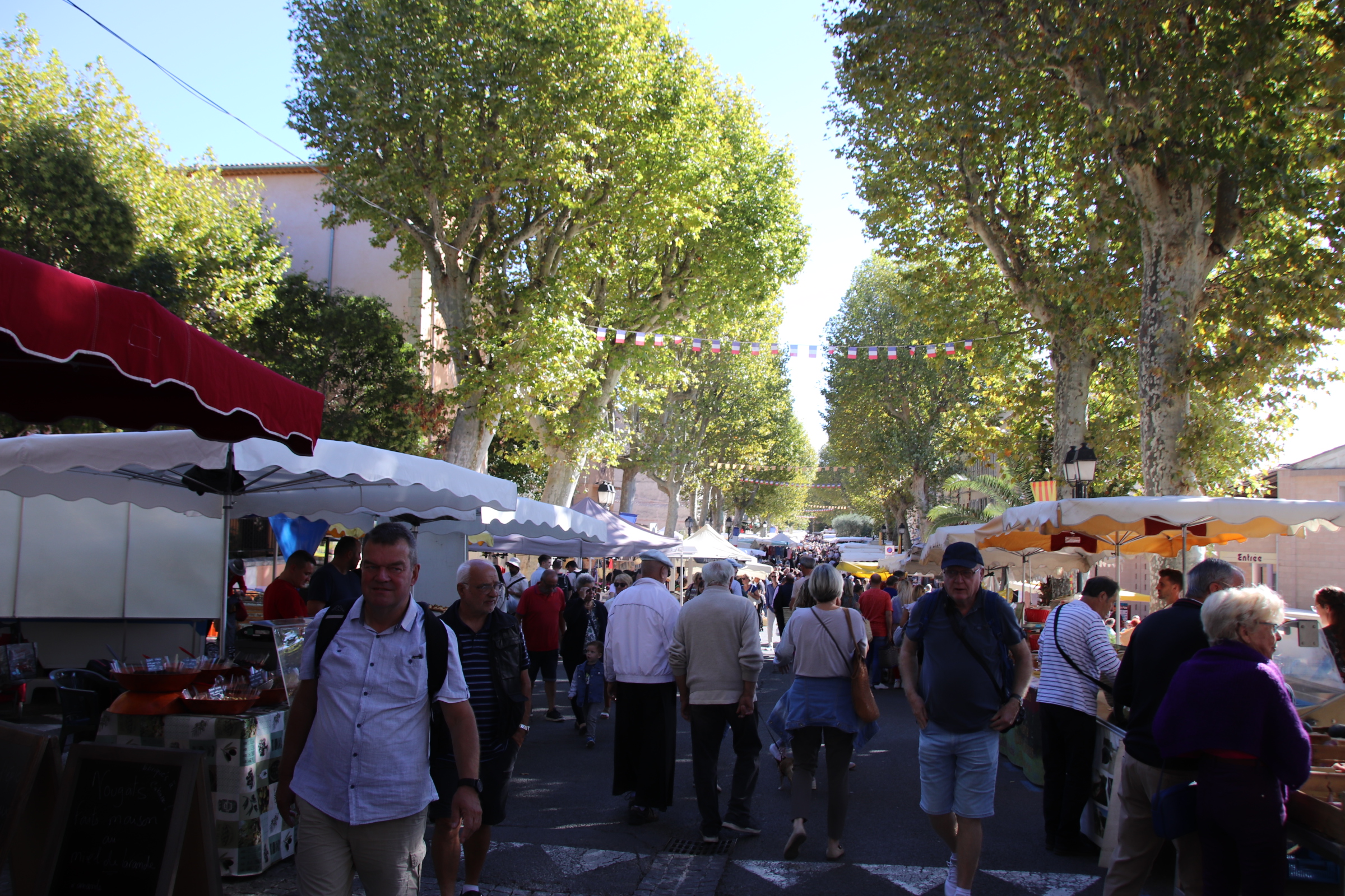
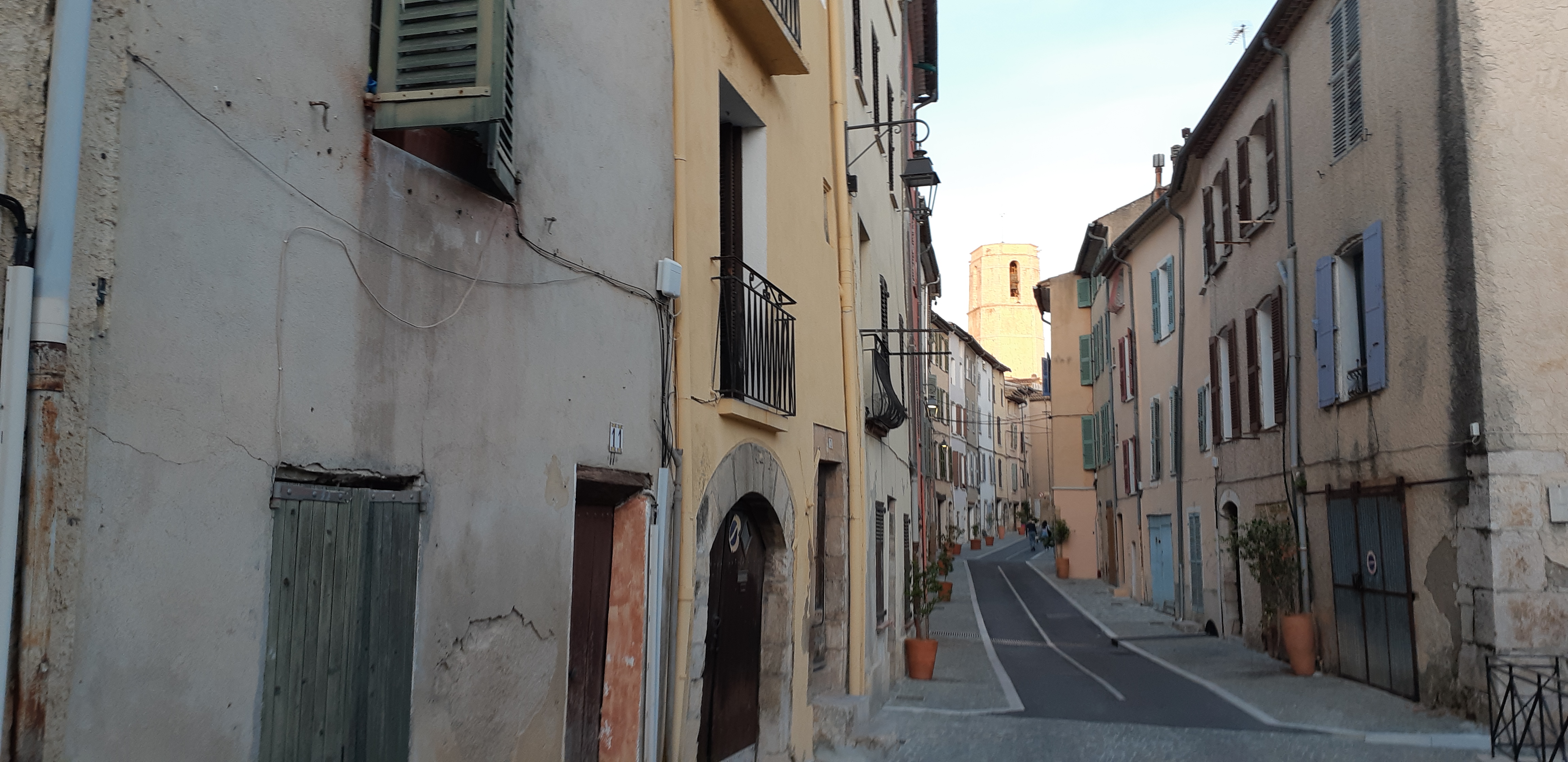
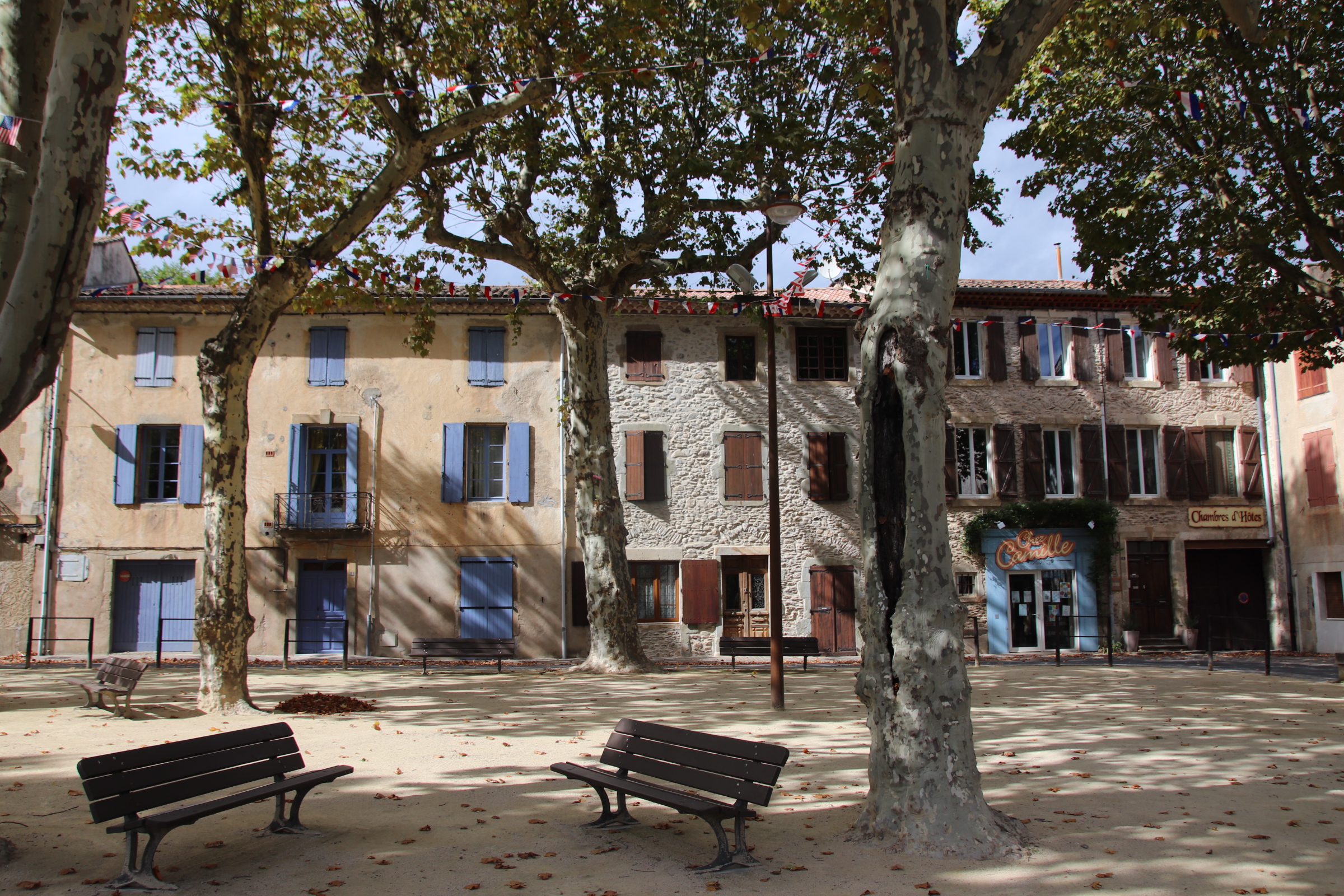
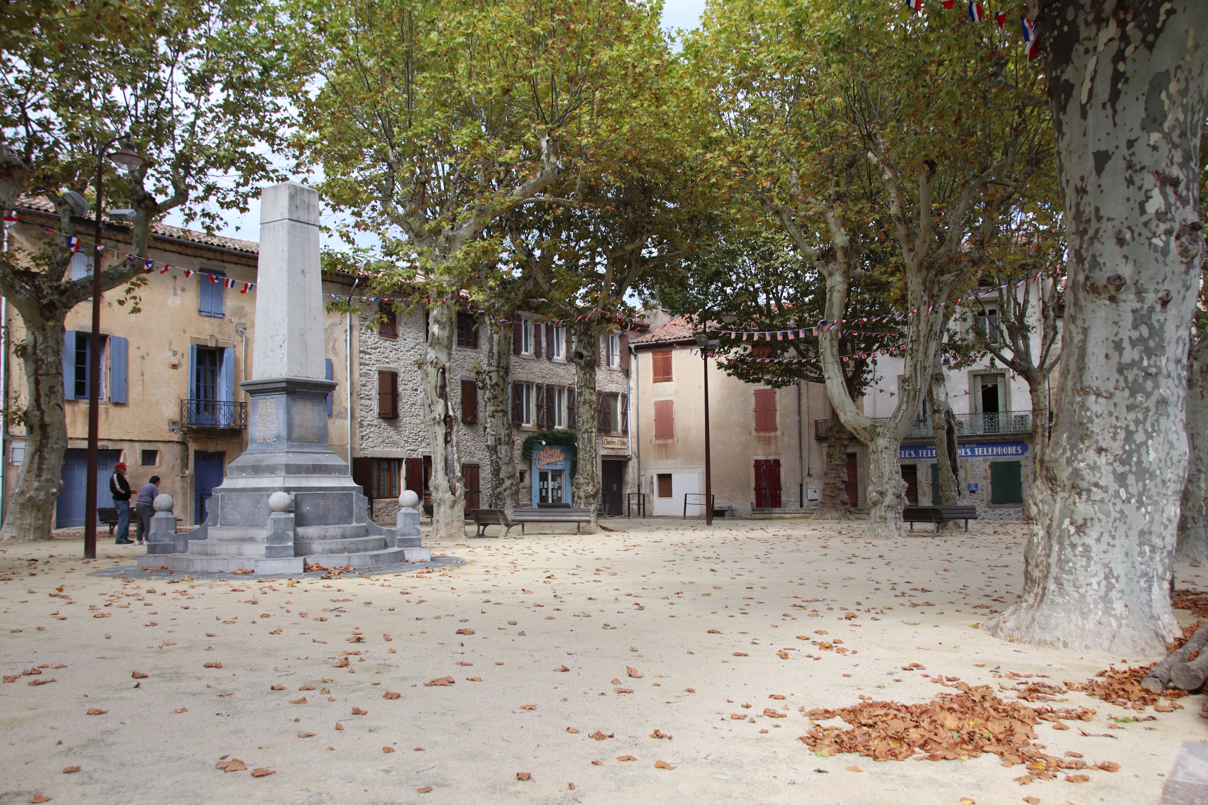
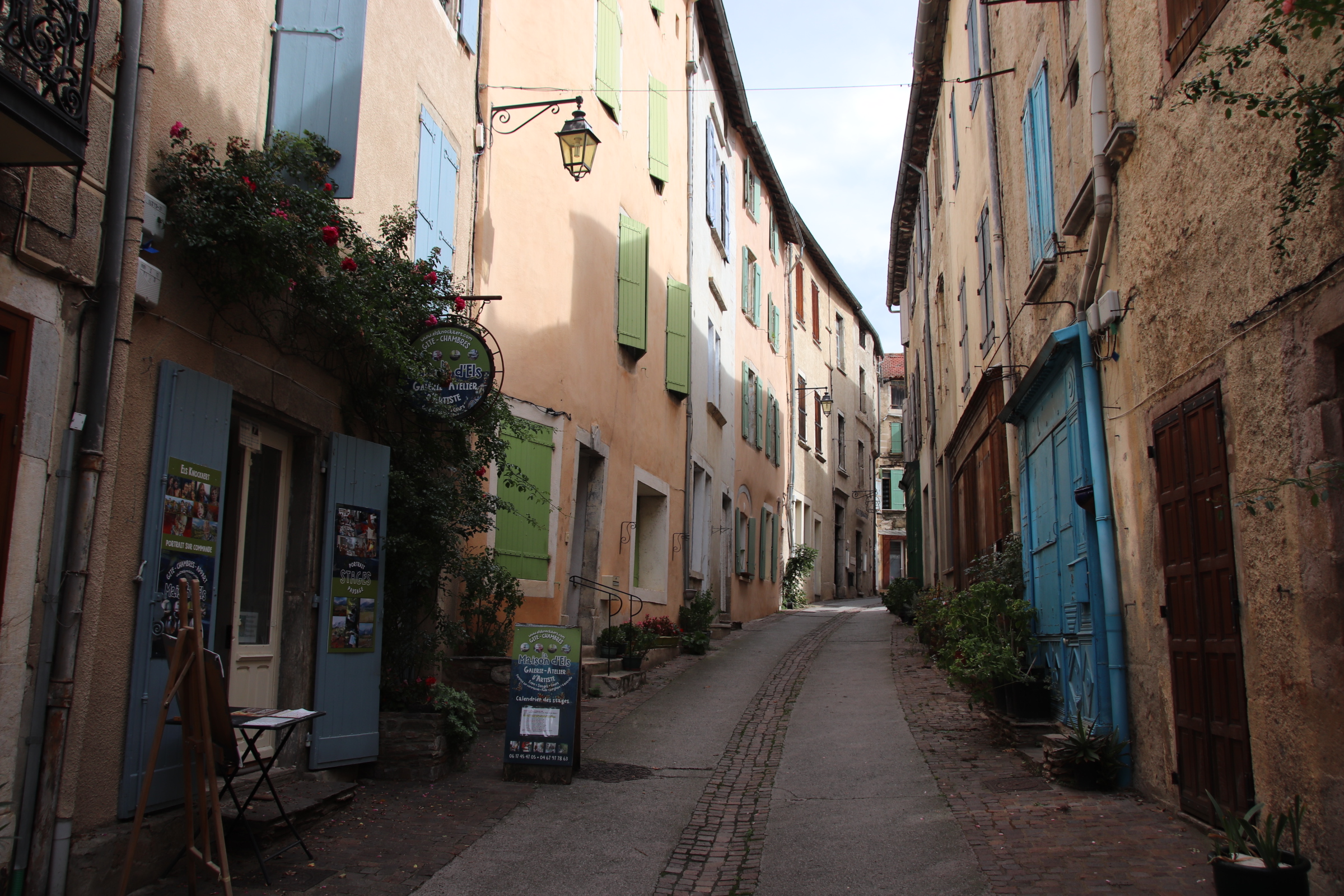
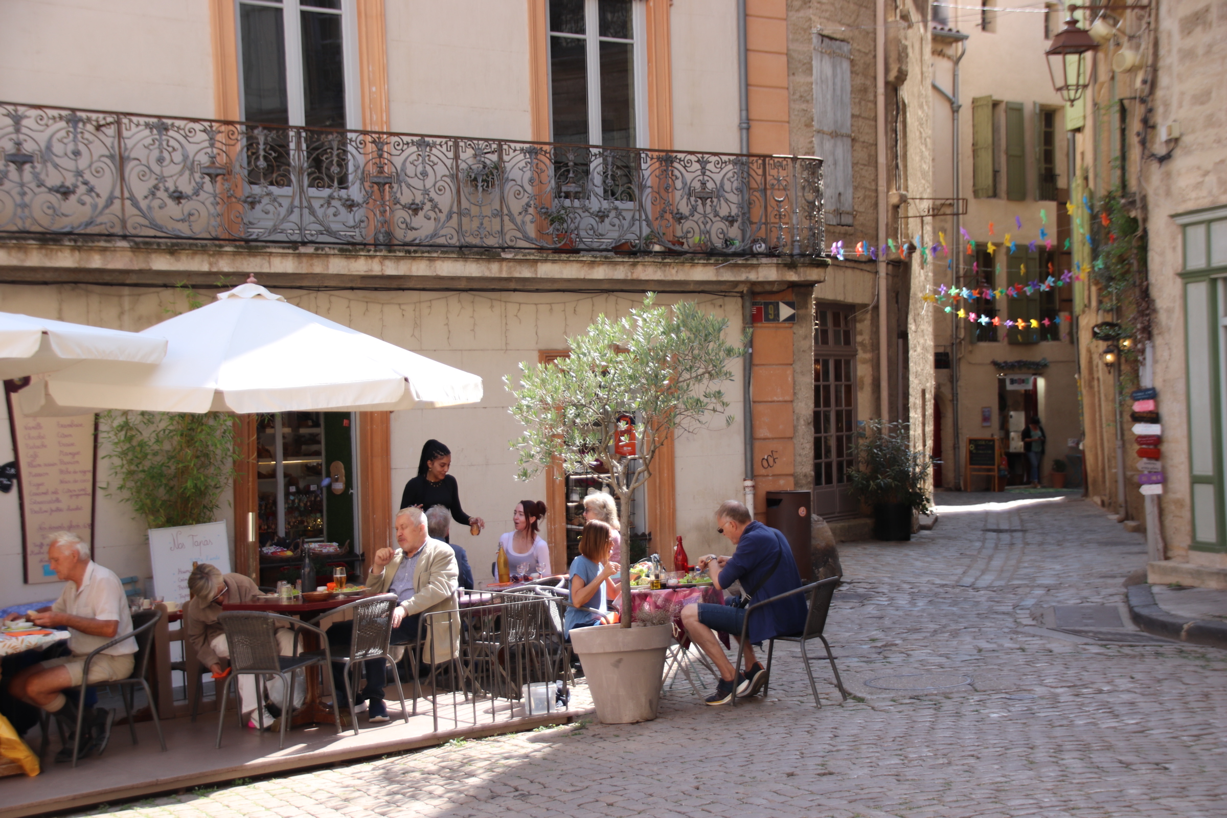
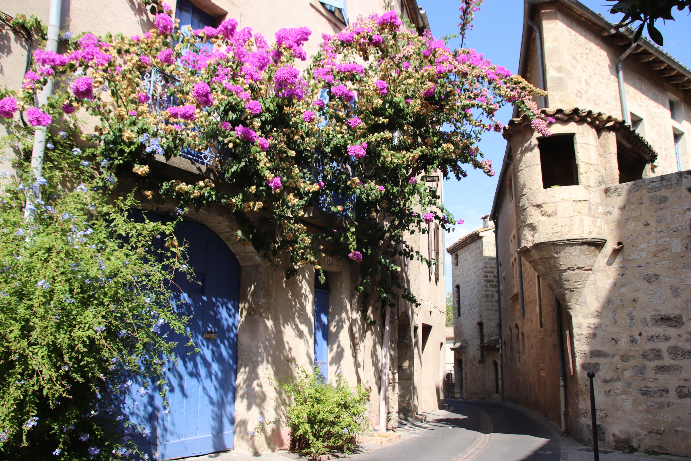
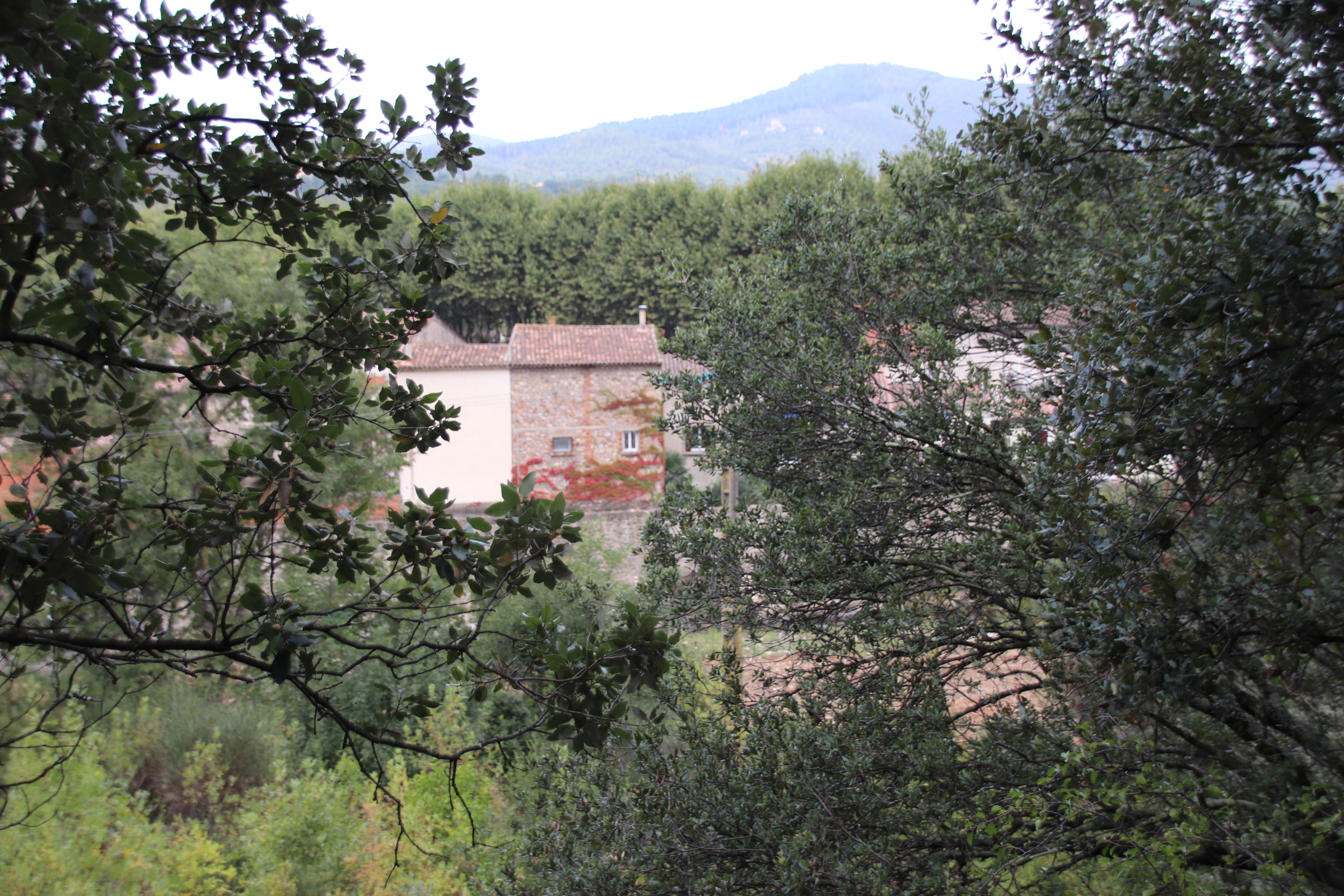
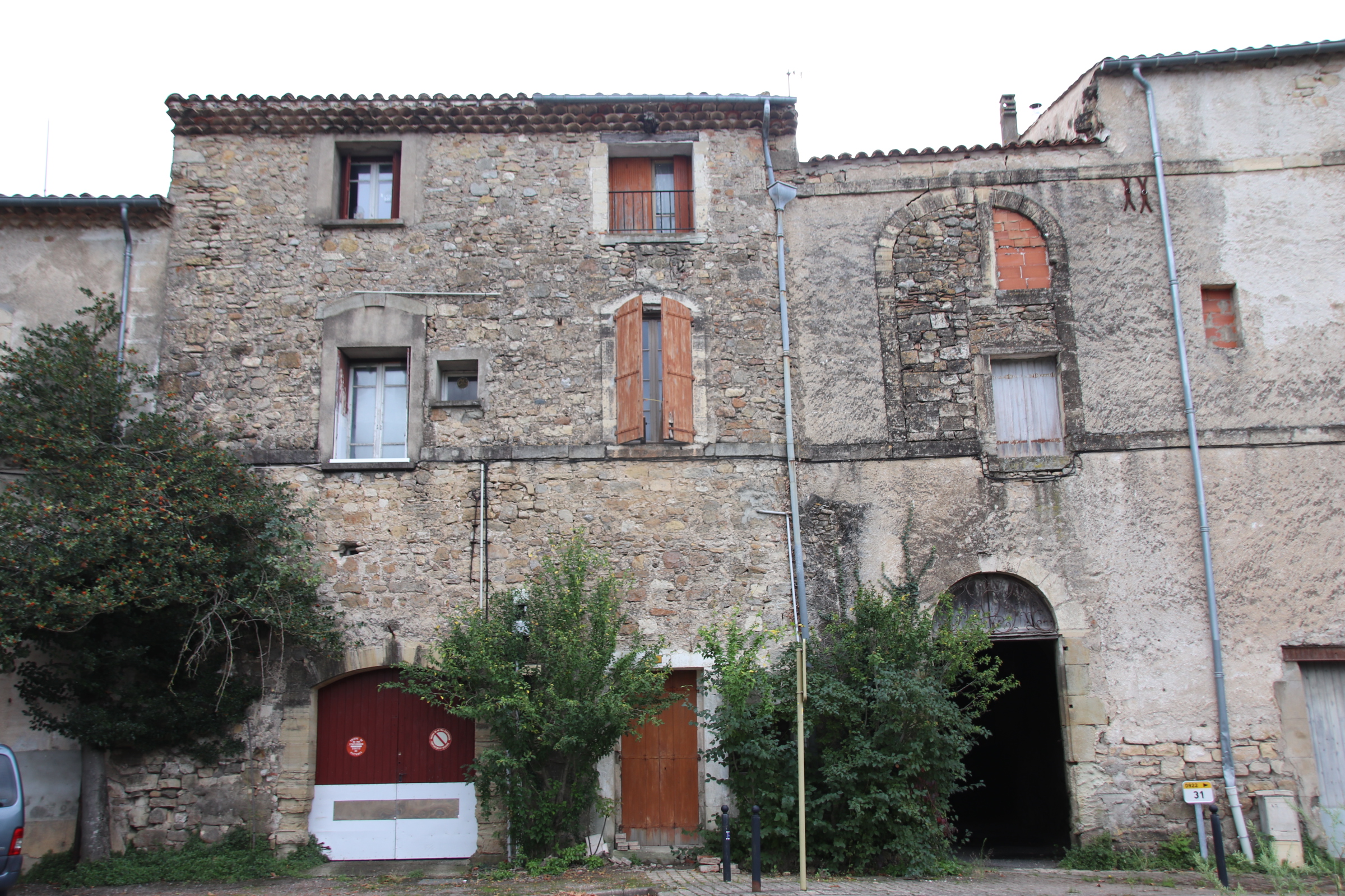
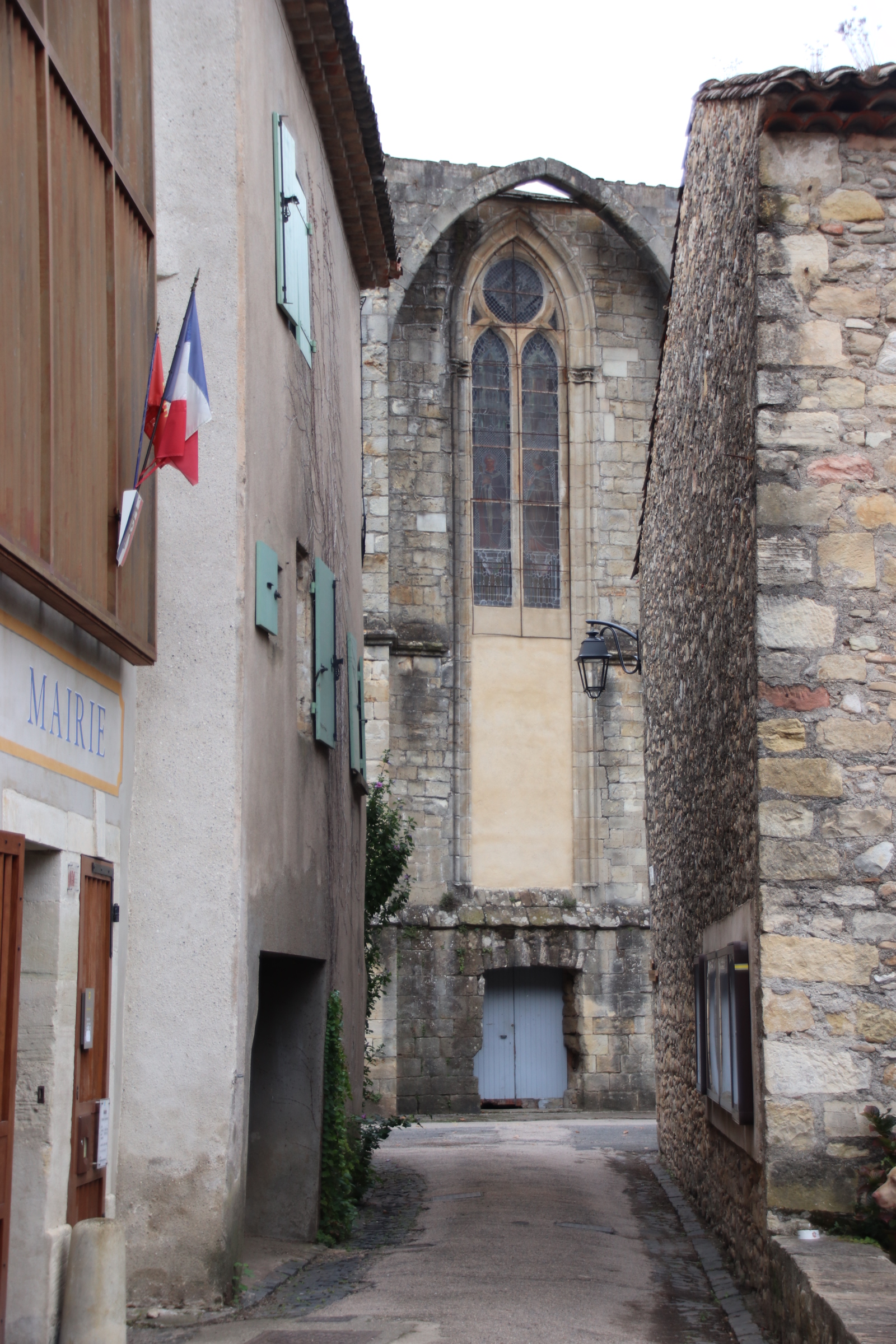
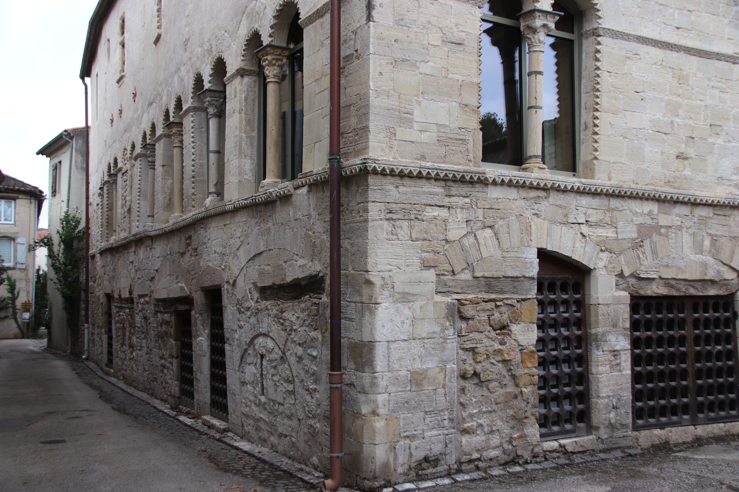
Sarzana is a few miles inland. It’s Thursday. Market vans conceal the axes of cobbled streets with their huge hanging umbrellas & their haphazard positioning.
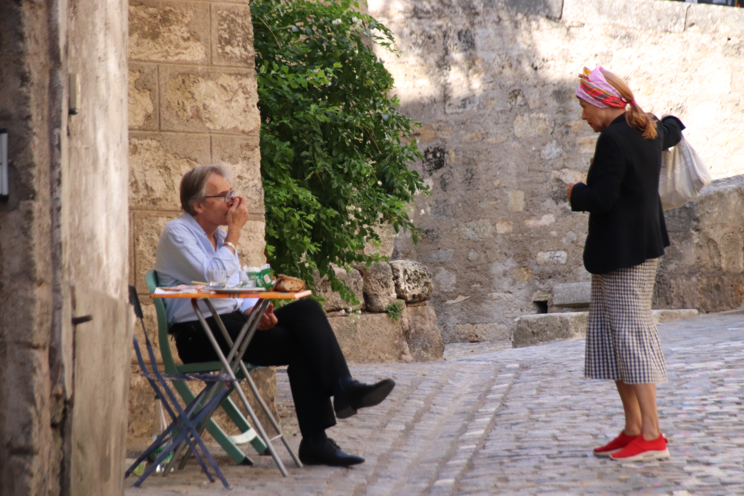
Once the chattering locals have been pierced, coffee consumed, cobbles negotiated, spokes of pretty streets are revealed, decorated with whispy hanging silks & purple bougainvillea.
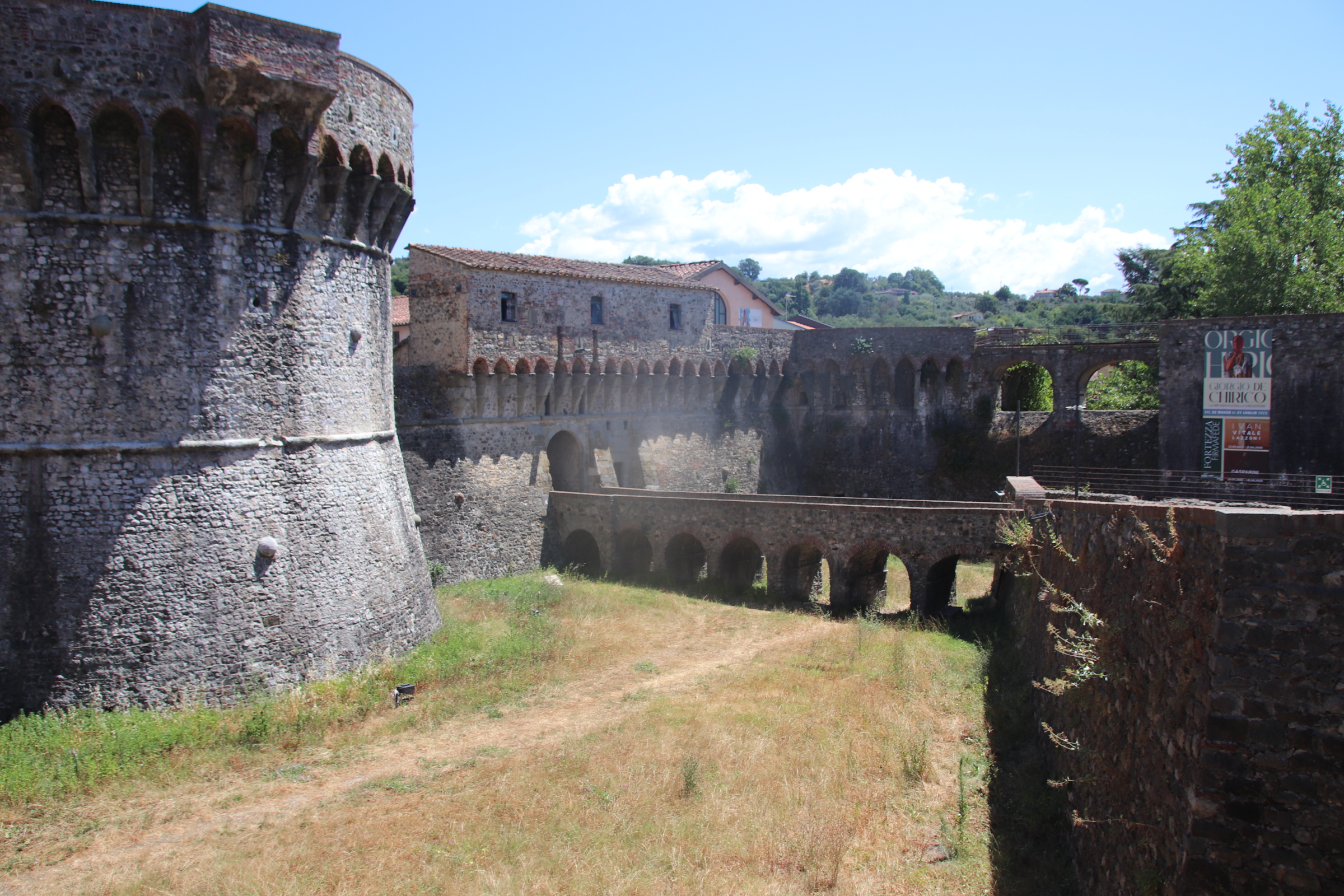
The town’s walls & gates added an extra defensive loop to the castle & fortifications.
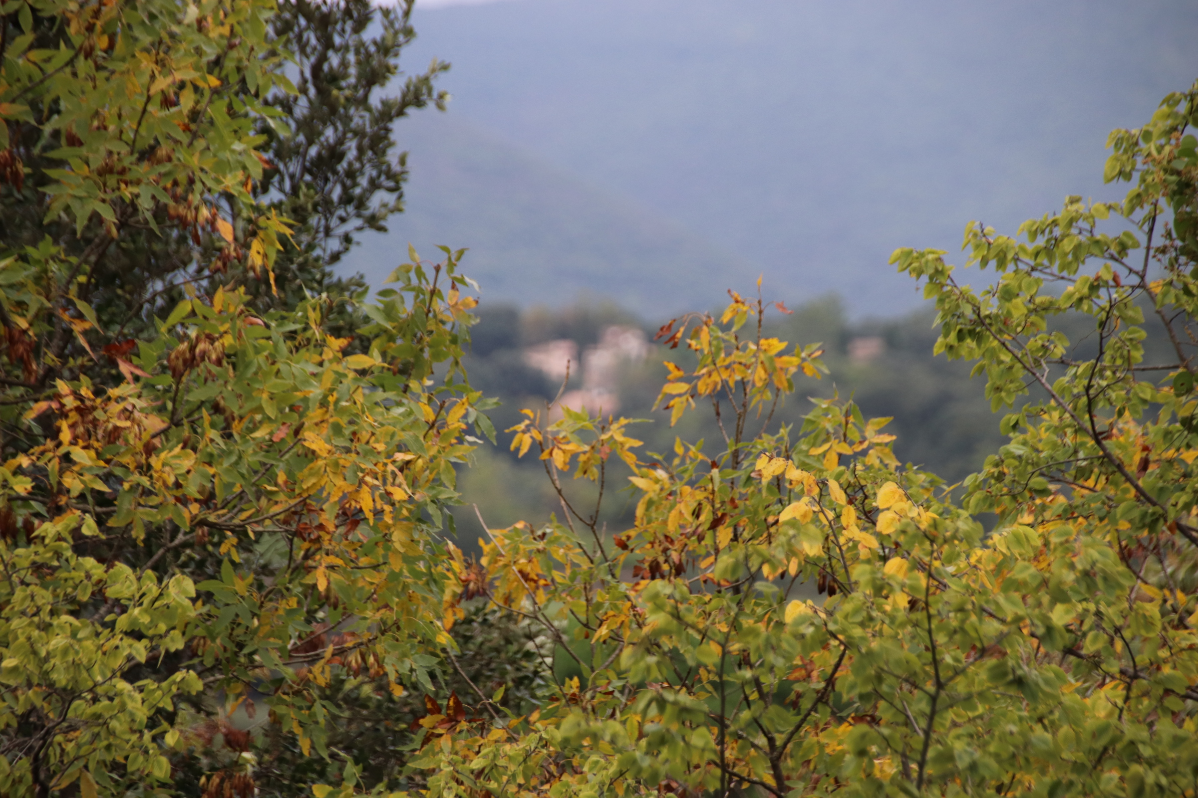
So now its a drive into northern Tuscany. Once off the autoroute and away from the flatlands south of Milan, the land starts to rise and wooded ridges appear in the distance, backed by dim, grey shark-teethed peaks. This is Lunigiana, a mountainous region that runs from the Apennine Mountains to the Mediterranean Sea, most of which falls in Tuscany but some in coastal Liguria and we are smack in the middle.
This area has long been strategically important. The Romans constructed the Via Aurelia through Lunigiana to get their armies up to Gaul & Spain. In medieval times there were 160 castles here, but only 30 have survived in a good state. They stem from the time when the Lombards of Milan, dominated here and sought an outlet to the Mediterranean through various mountain passes. All the local city/states have at some time or other battled for control – Luccans v Pisans v Genoese, Milanese v Modense v Florentines. Tuscany eventually took full control of the region in the 15th century.
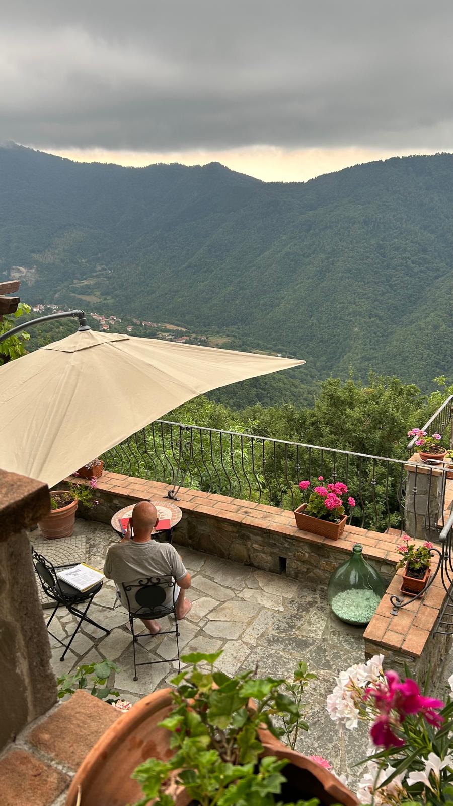
As we arrive the weather gods offer a relief from the heat of the past two weeks. We offer up our thanks as the Storm Goths thunder their welcome and lighten up our senses with flashes of awesome power. Yes, refreshingly, it can rain on Italy’s parade.
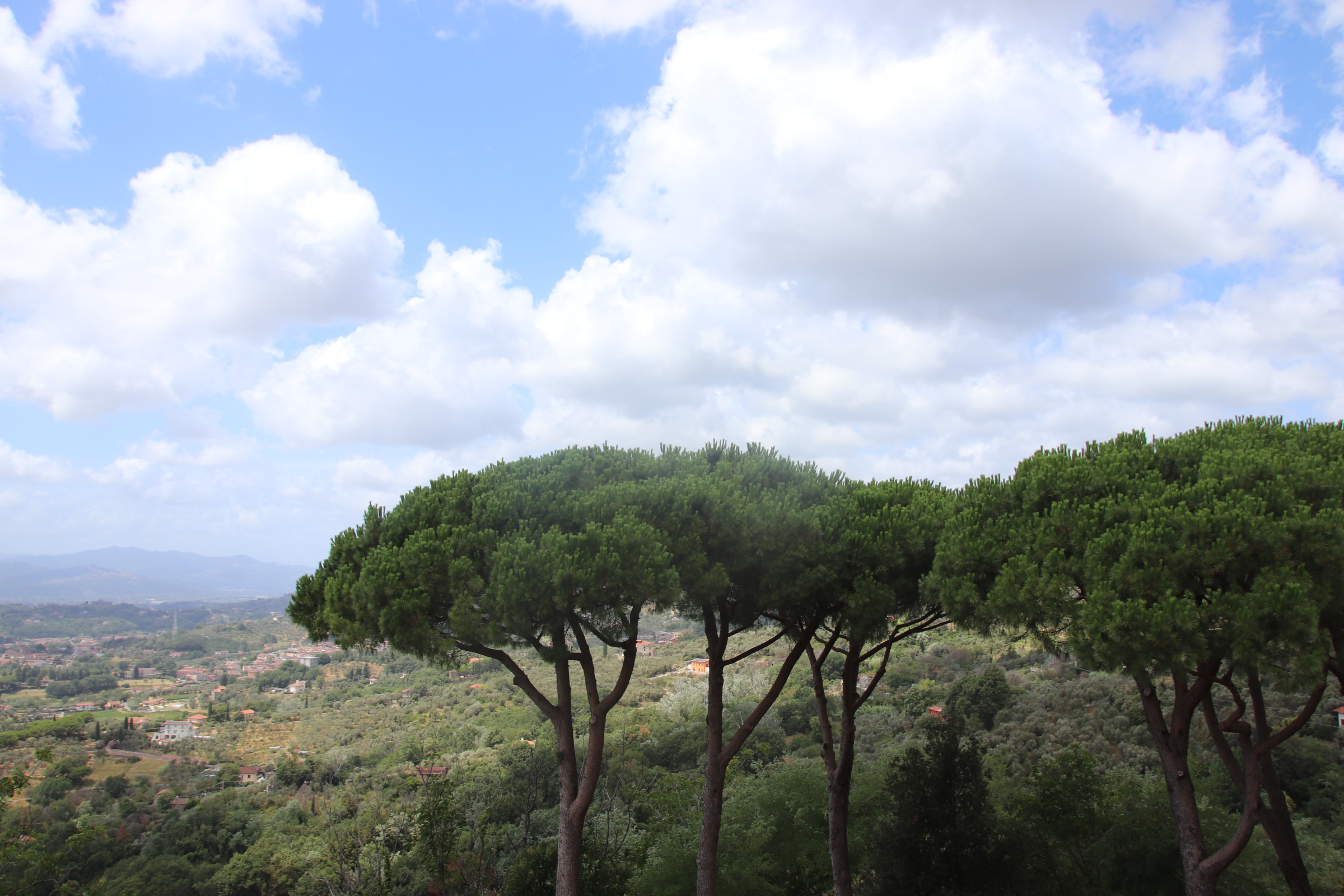
From our outpost high on a ridge, we can spot the approaching storms, take their anger and watch them retreat into the distance. The church bells in village way down below ring more in celebration of the storms’ passing than in summoning the faithful to mass. Once the storms pass the true glory of our position is revealed.
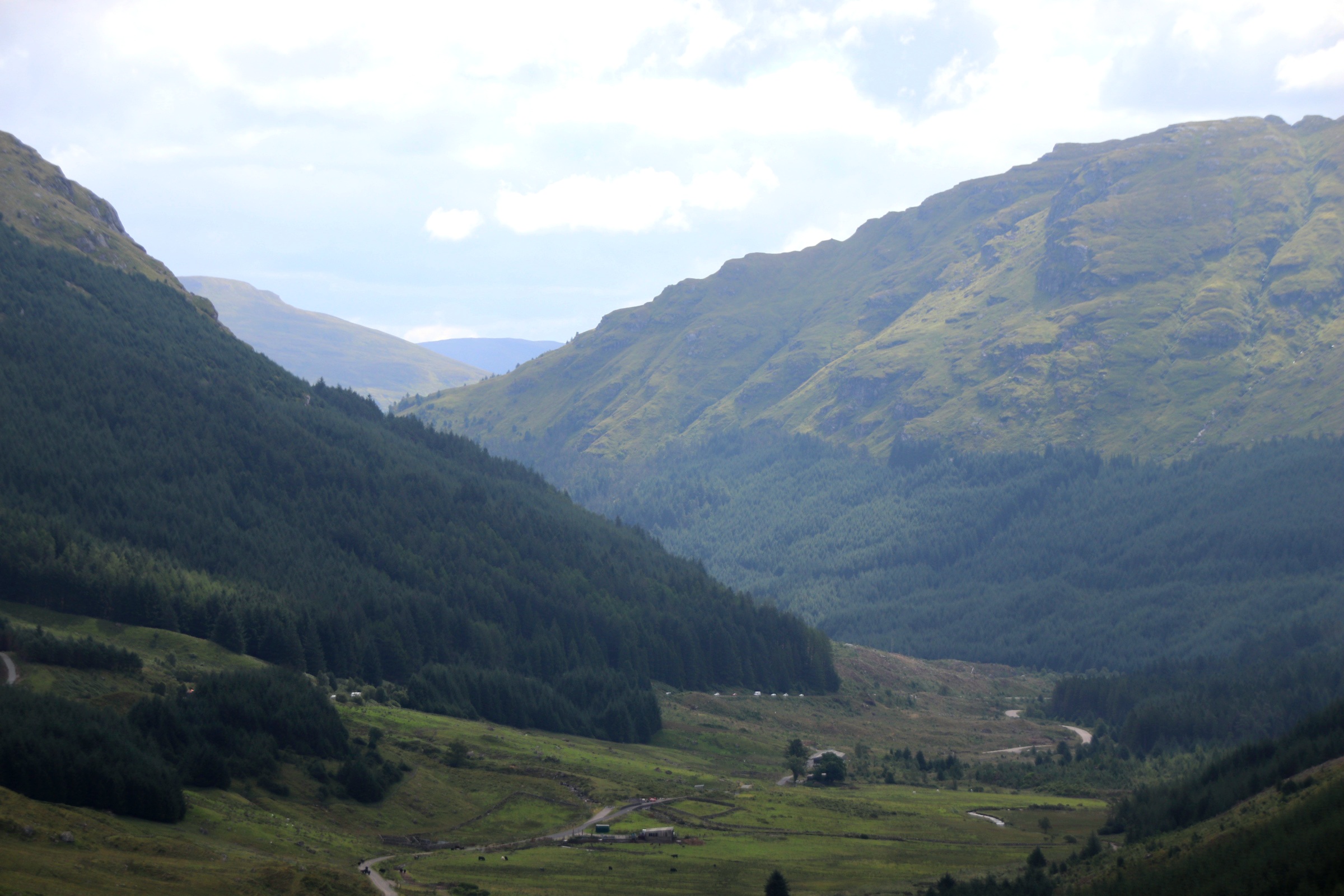
Exploring this region takes a fair bit of stamina. Roads are demanding to say the least. It’s a bit like following the region’s intestines – in & around, up & hairpin, squeeze to the side to allow oncoming & hold one’s breath. Surely, it’s not up there…. oh yes. TOM TOM say “fastest route!” Up the twists & turns of scabbed, crustacean tarmac between lush walnut & sweet chestnut woods and overgrown edges of brambles & bracken.
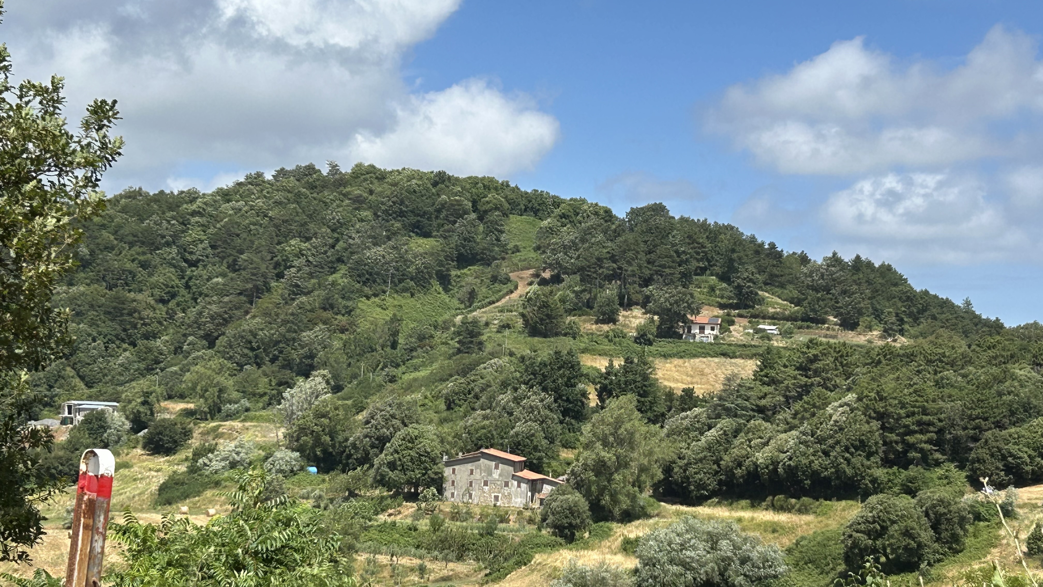
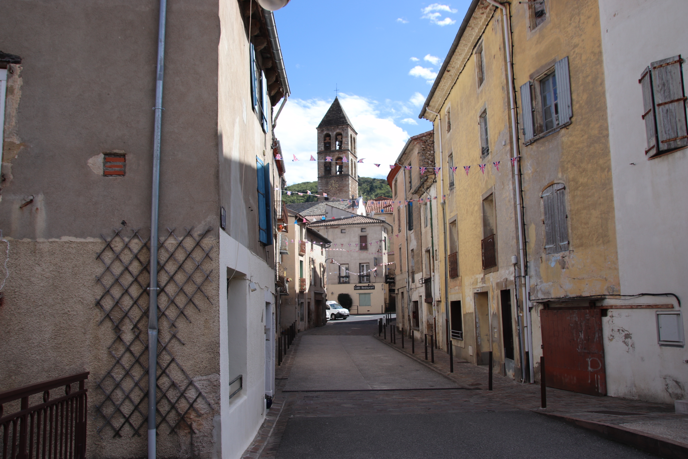
Scattered along streamed valley bottoms, in clearings on the shaded slopes of wooded ridges or atop strategic hilltops are a confetti of dusty, ancient villages & homesteads. Time seems to have stopped in many. A centuries-old church or the remains of a medieval tower or castle centre these ancient settlements, linked through the hills by ancient mule tracks. In many there is little life on display. Only the clink of plates & muffled voices from open windows indicate the presence of anything human.
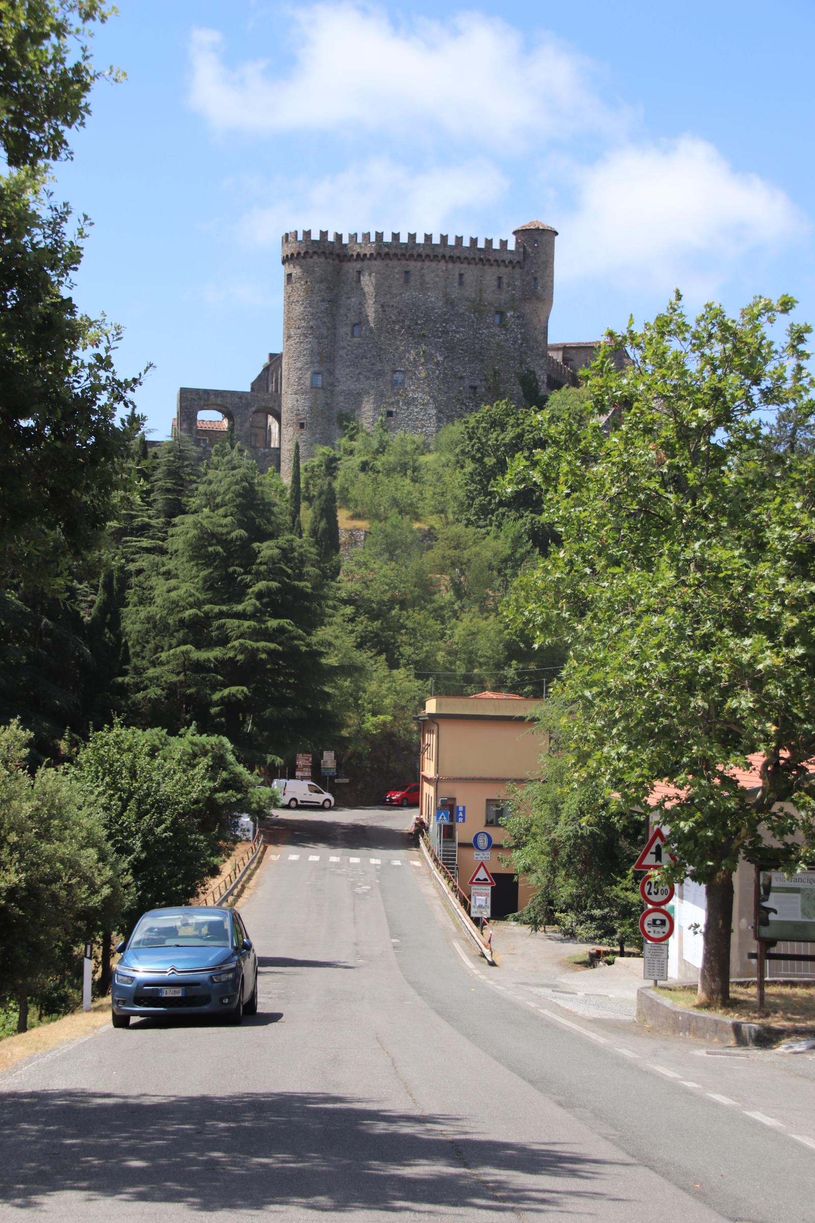
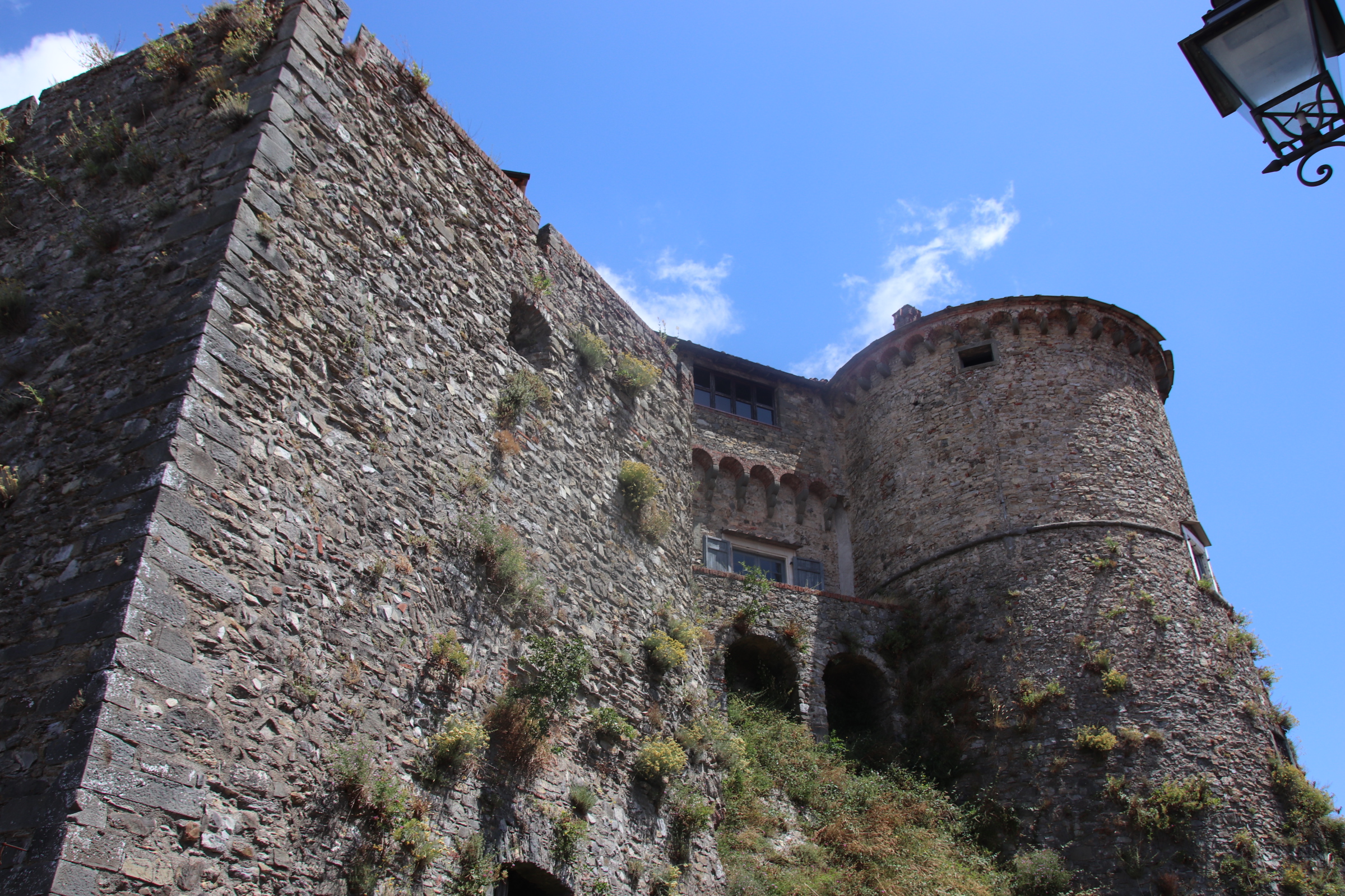
Fosdinovo is protected by a medieval castle part of which is open for the public to explore & part of which is inhabited by private owners.
Castelnuovo Magro’s narrow streets lead down to the church from the open-air cinema in the castle ruins. The lines of cottages provide shaded pathways for the handful of locals on display.
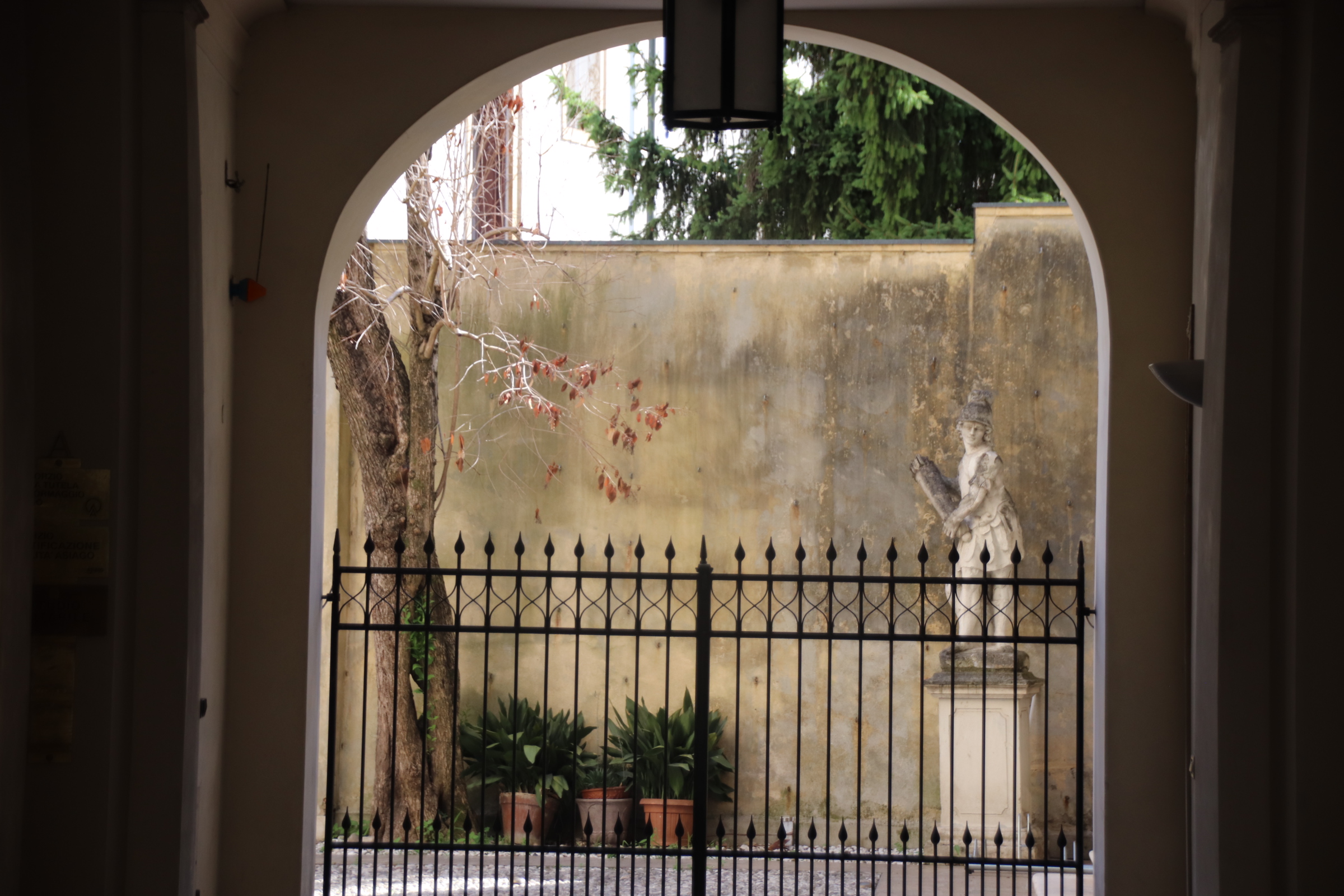
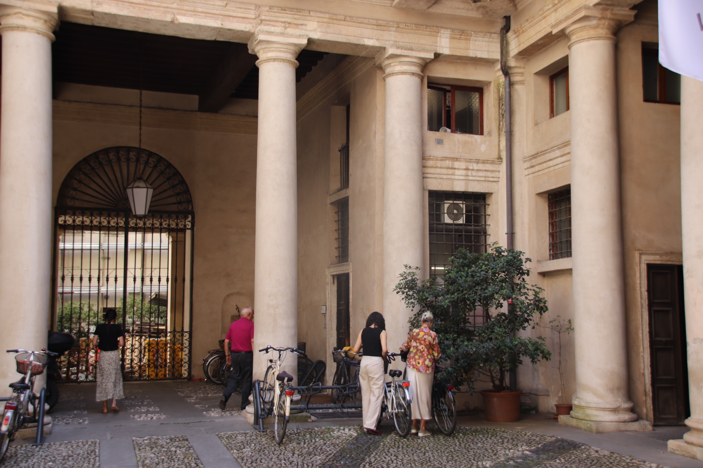
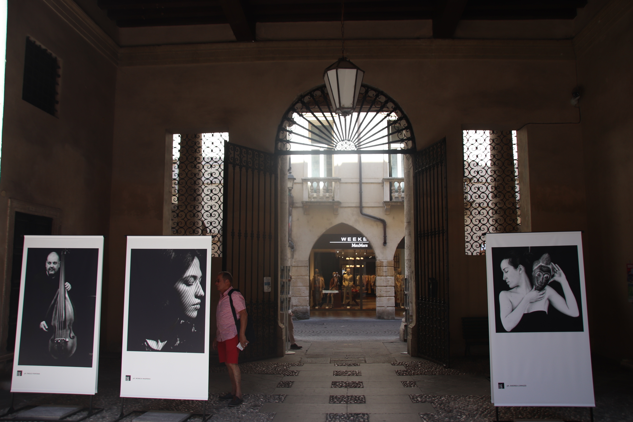
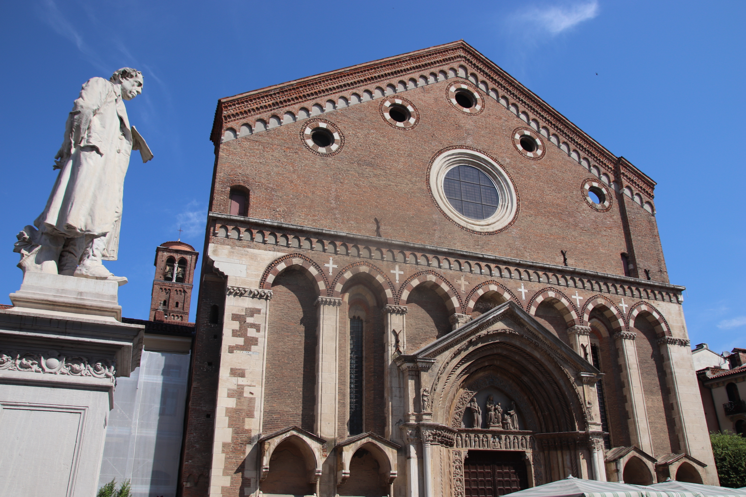
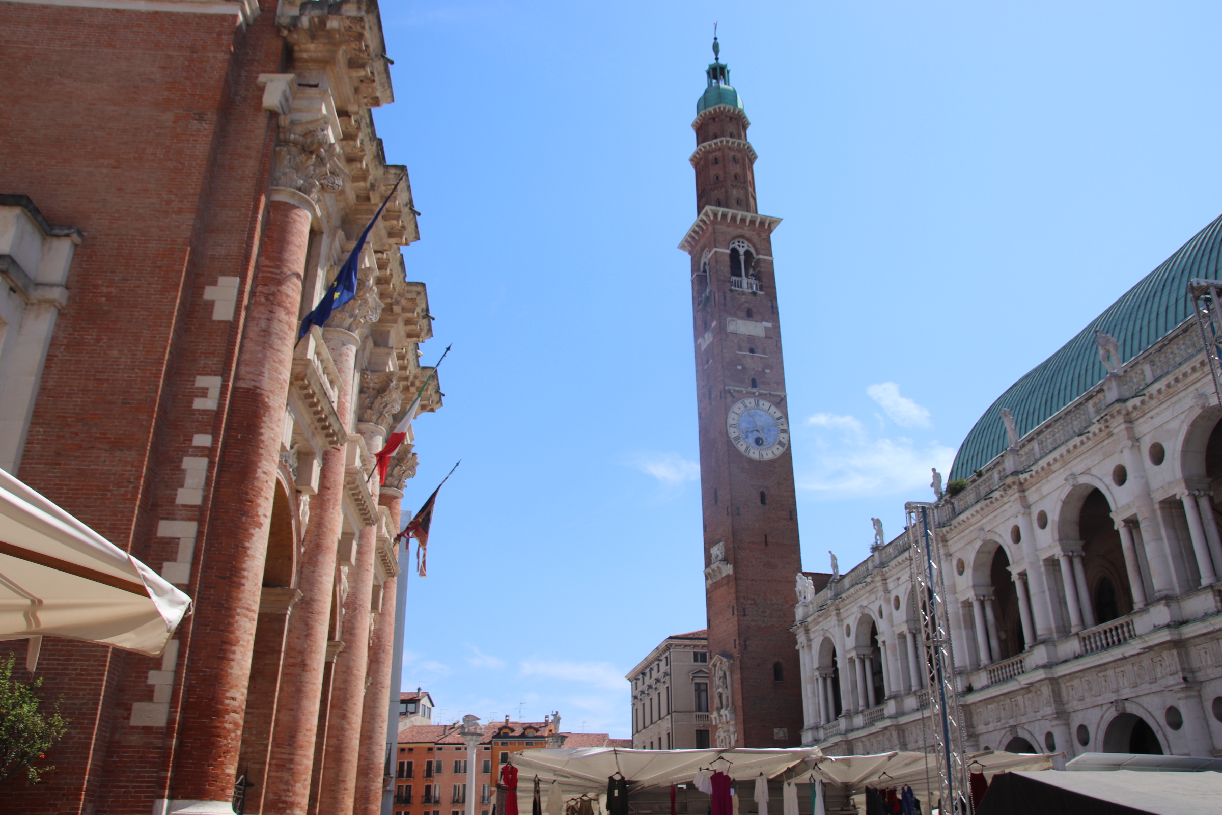
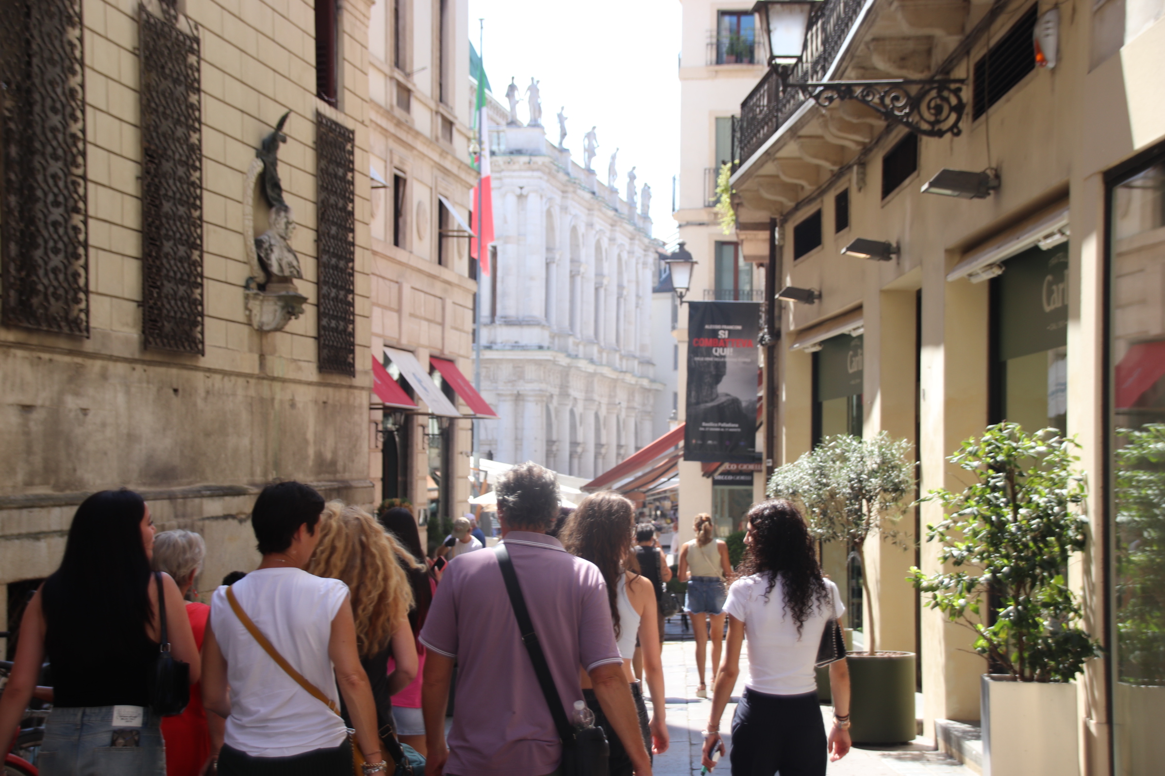
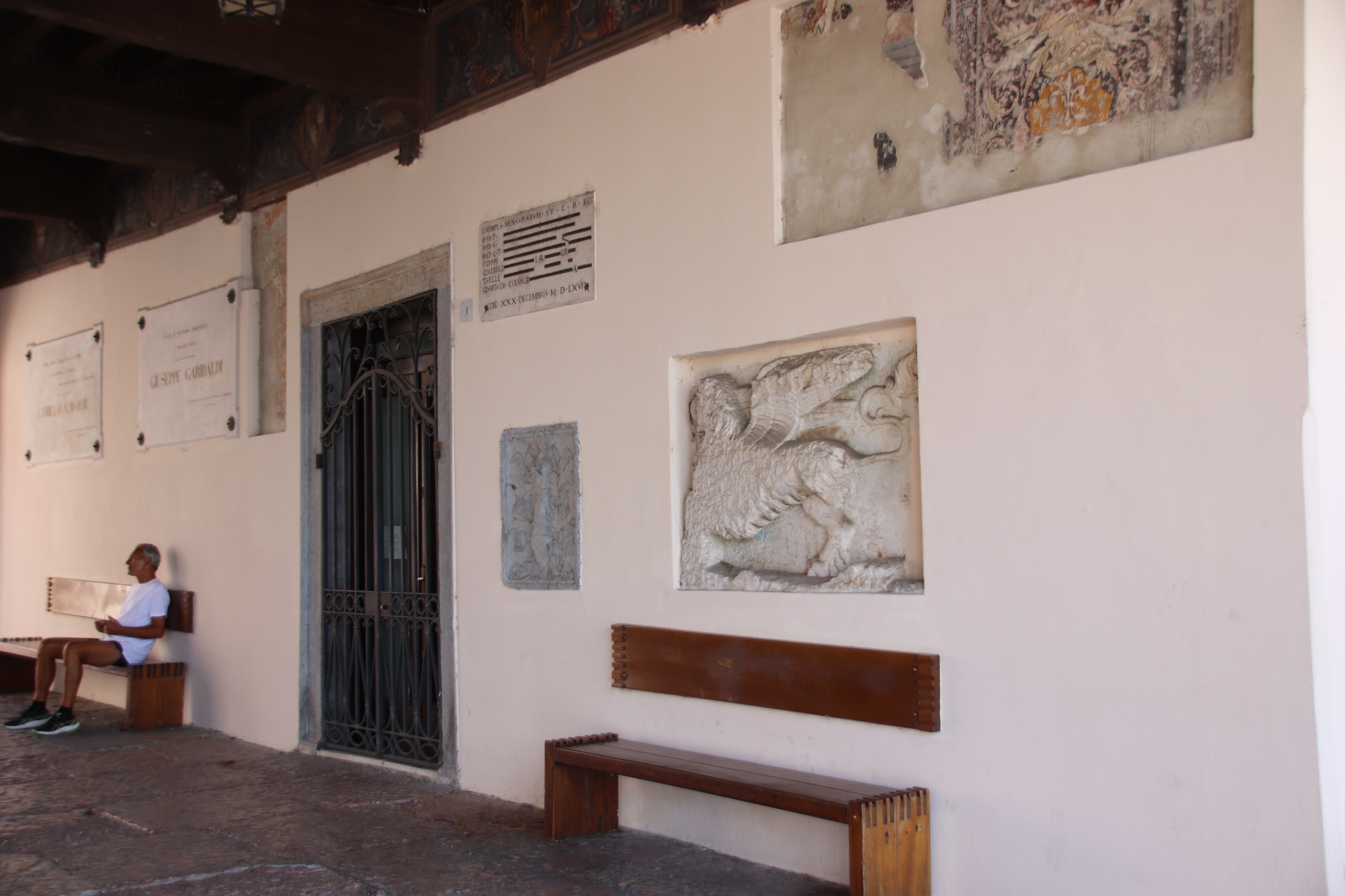
Some places are worth a mention on their own, and Vicenza is one. It is difficult to use words to describe its glory, so I’ll let my images do the talking.
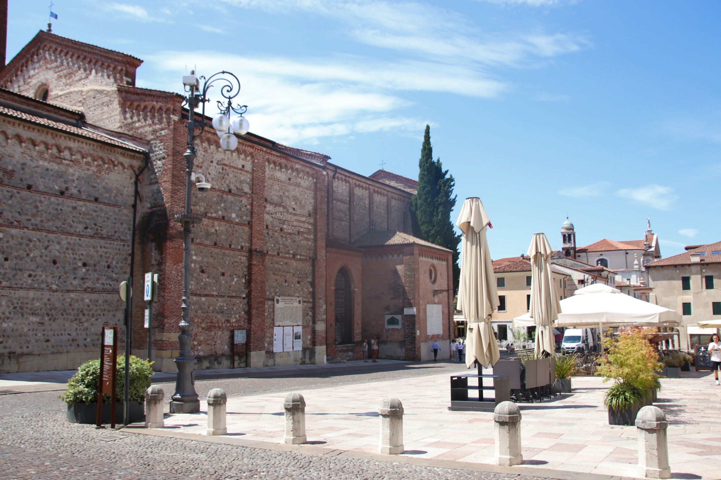
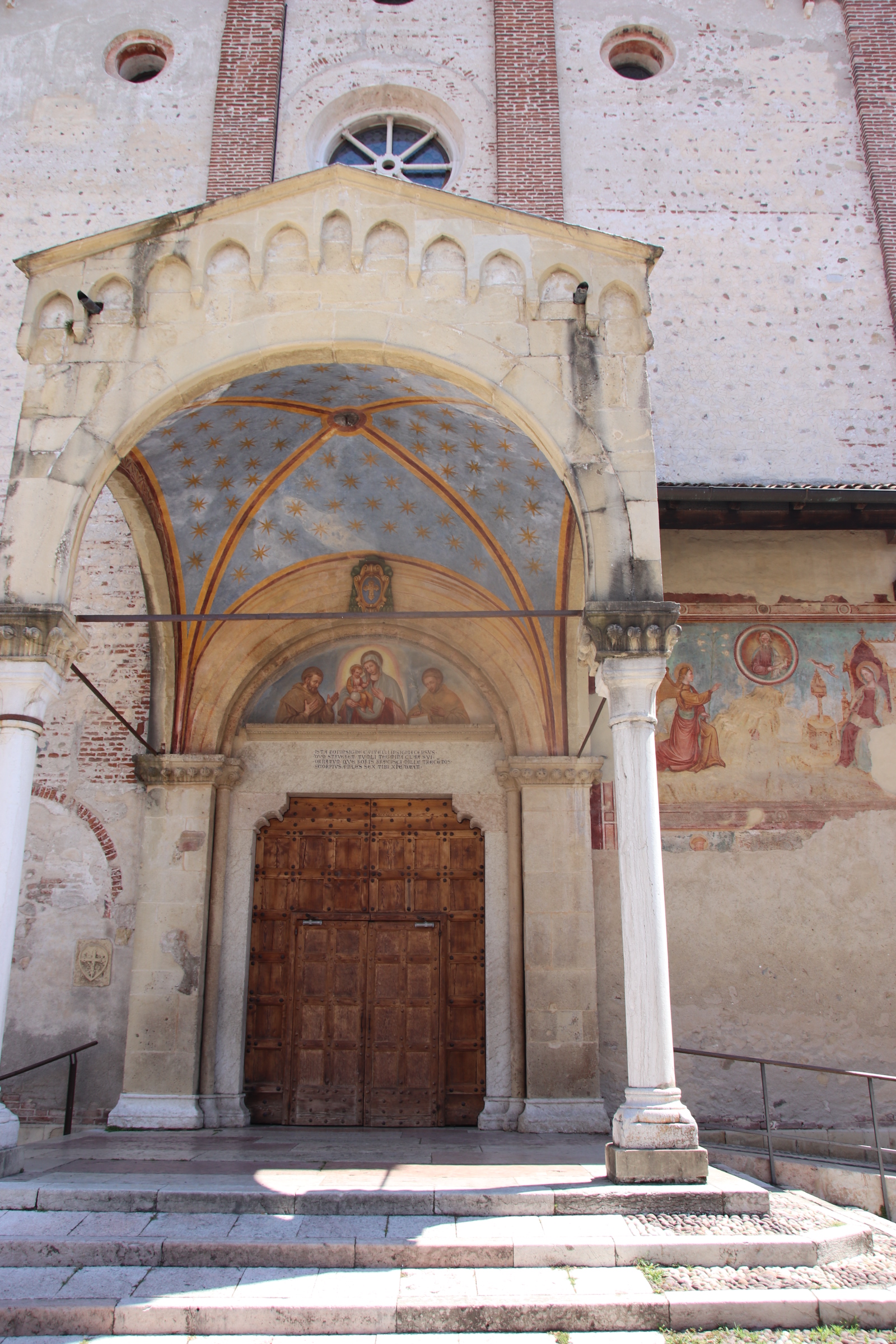
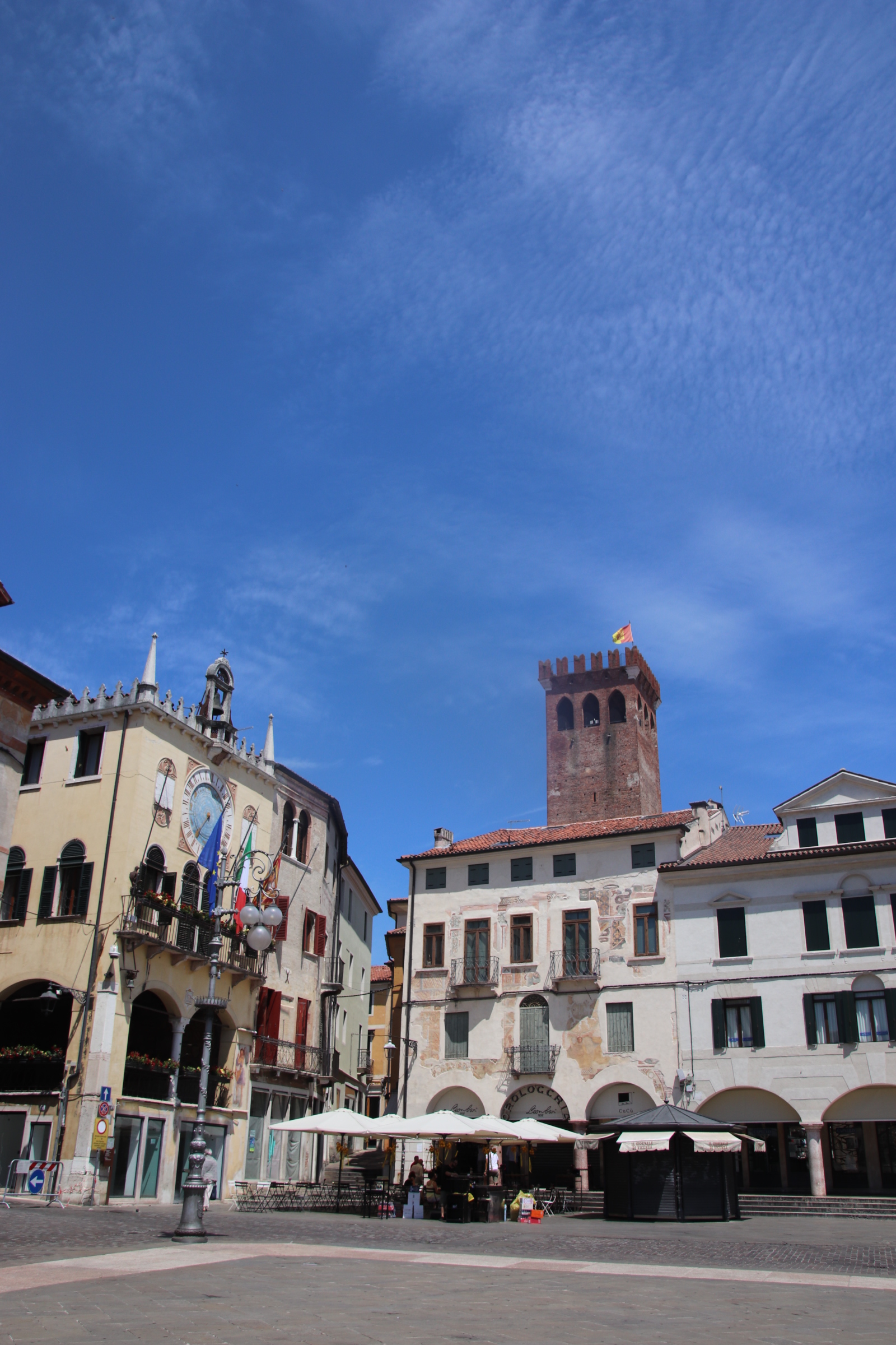
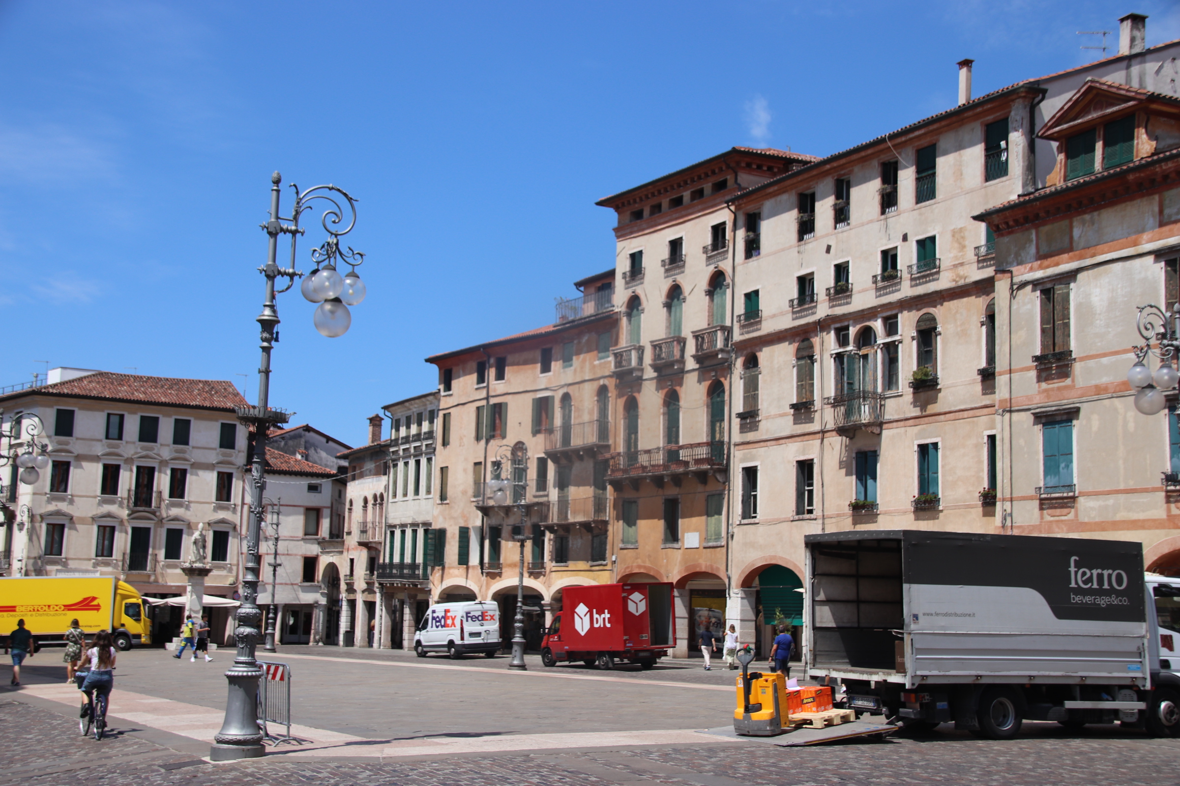
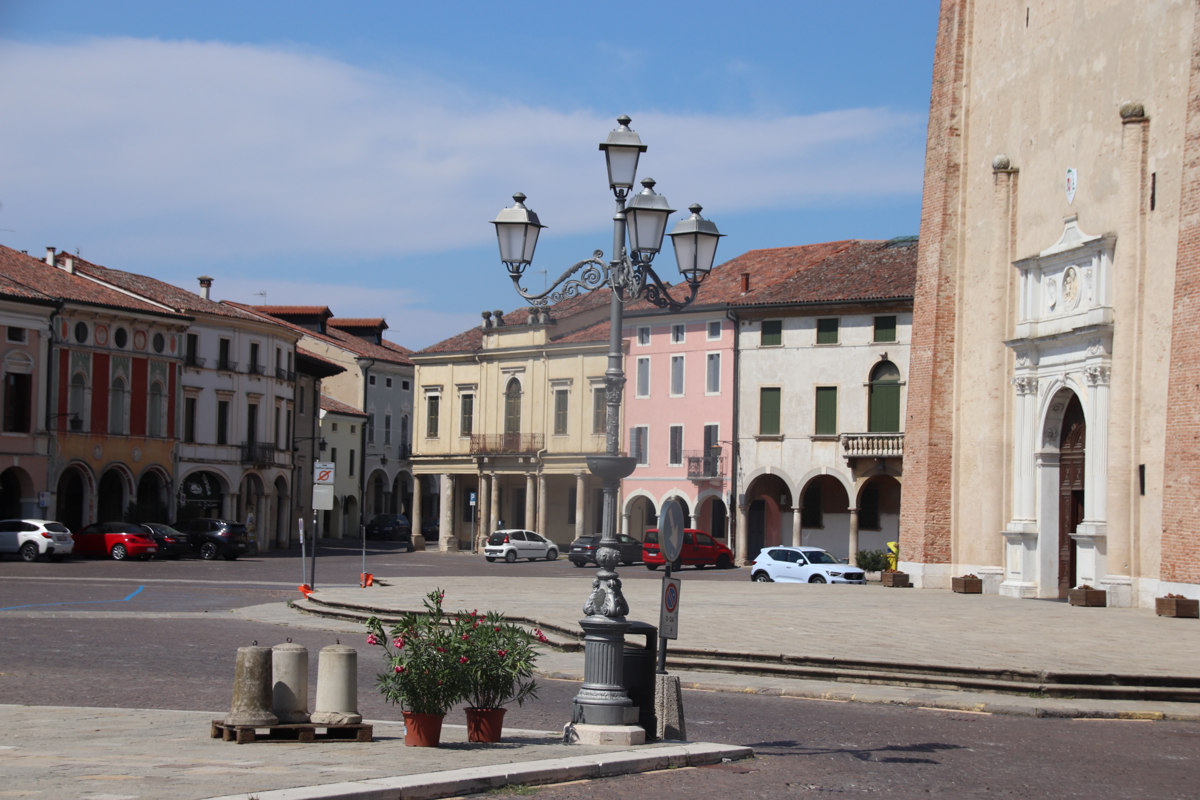
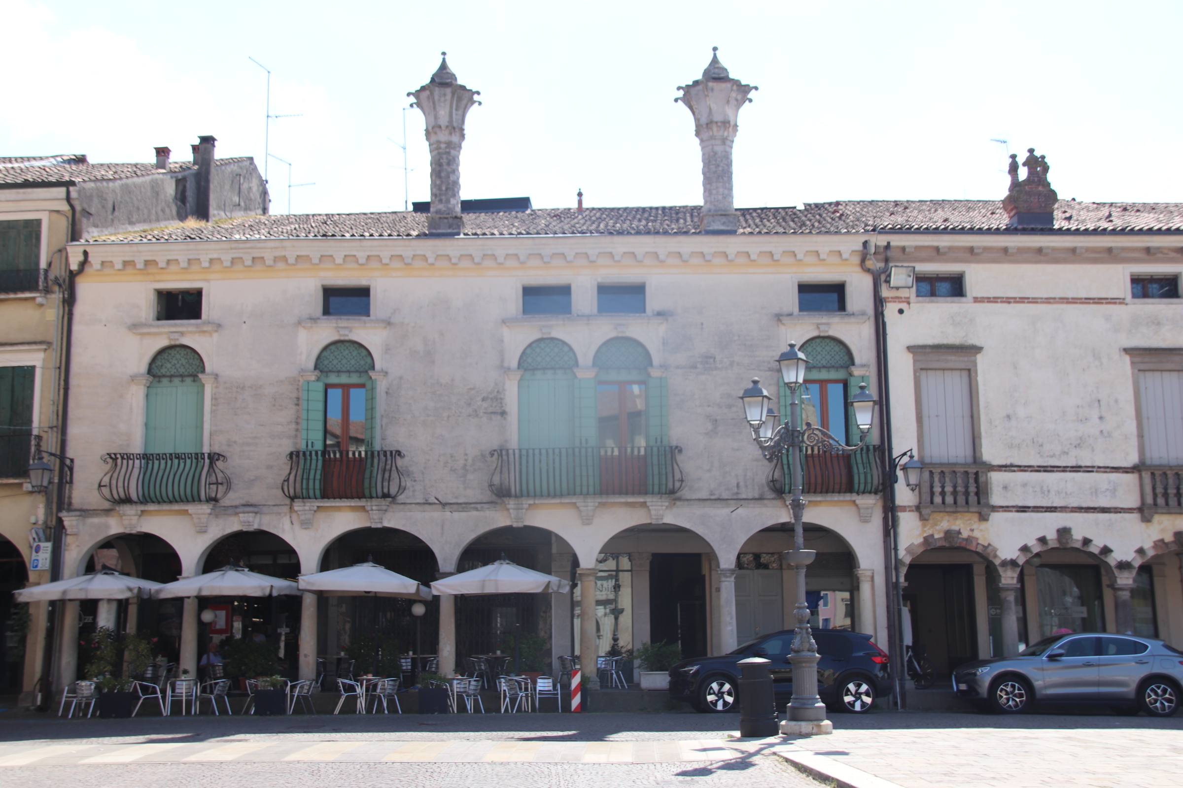
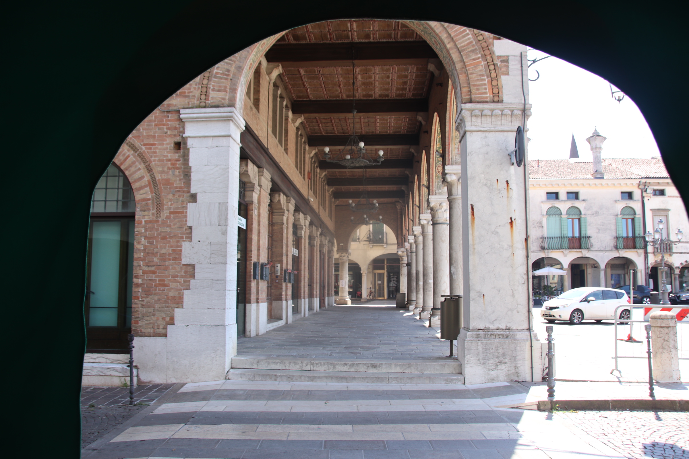
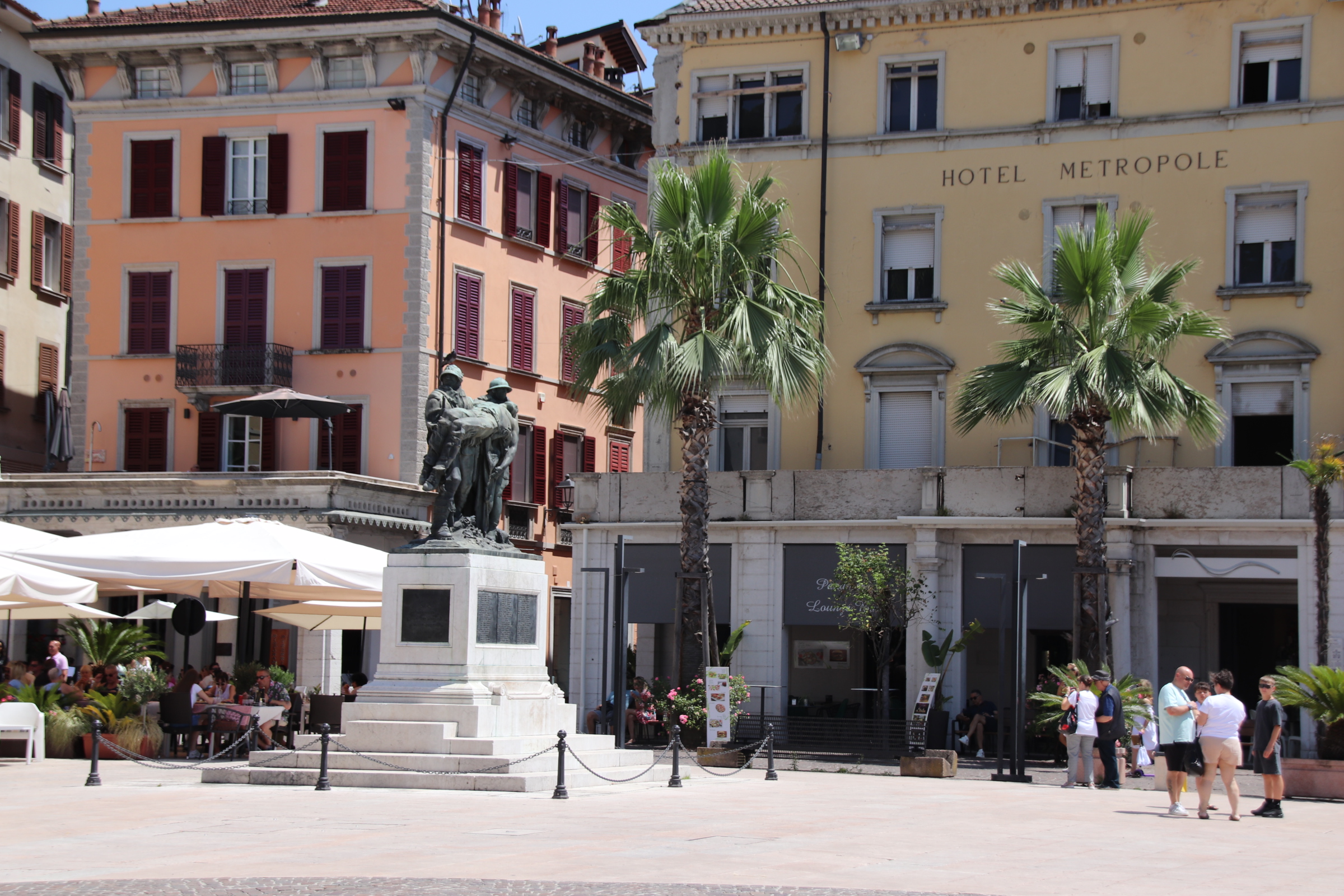
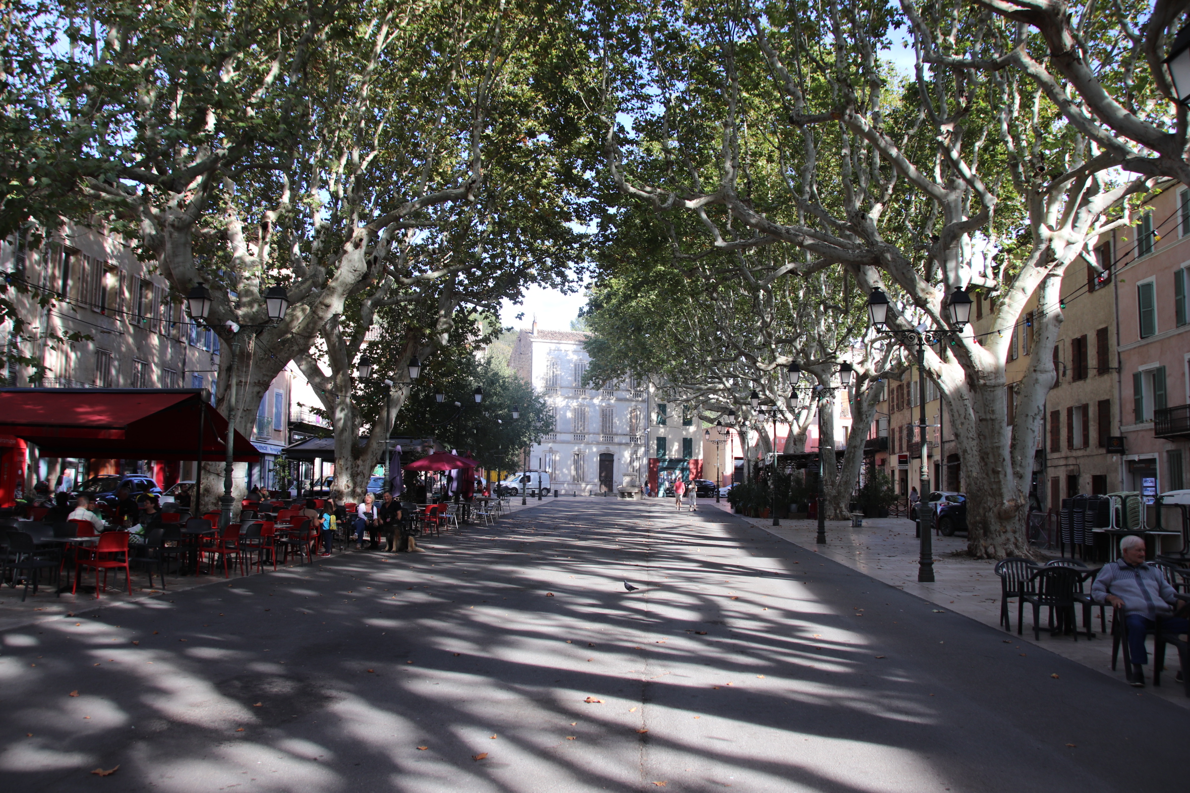
At first sight it is the super-elegant, grand buildings & wide piazzas that grab the eye.
The city is known as the showpiece of the 16th century architect Andea Palladio & his successor Vincenzo Scamozzi – elegant, cultured , artistic.
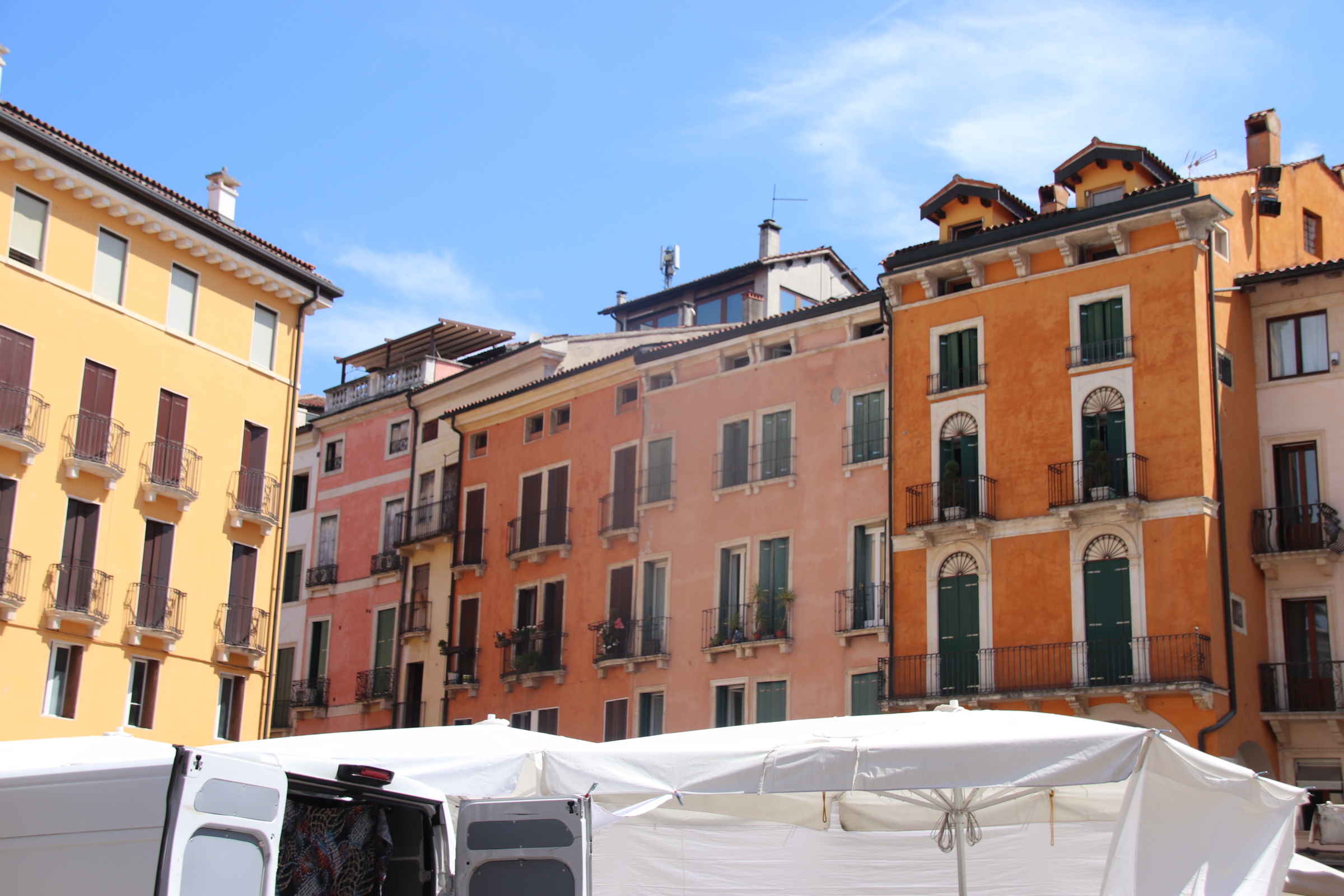
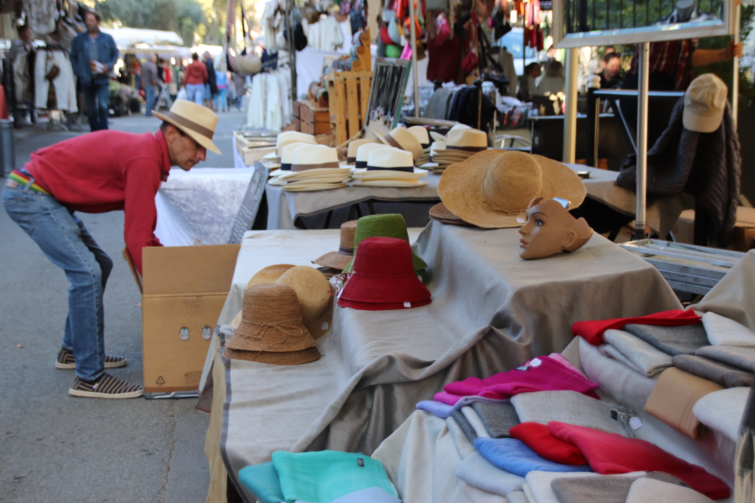
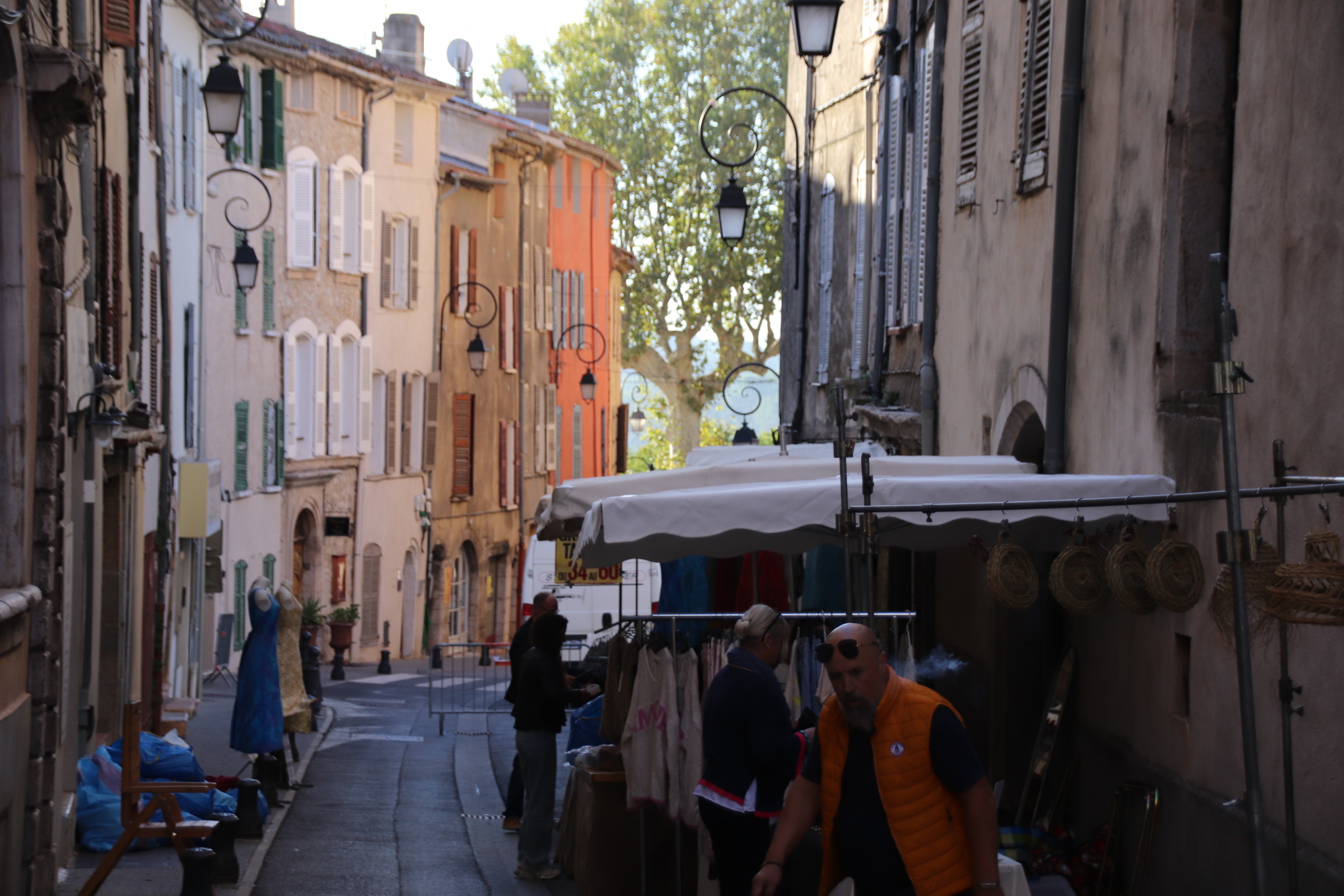
Today, their legacy is offset by the weekly market, bringing bustle & colour, diversity & humanity to its classic lines.
A smogasburg of age, ethnicity, class, appearance, dress, background mix in the streets & piazzas. They live & walk & work together.
This part of Veneto between Vicenza & Venice and bordered to the north by the craggy peaks & ridges of the Dolomites Mountains and to the south by the Adriatic Sea, is not considered to be a tourist area. Maybe because of this it has a very genuine character. Italian families go about their normal daily business, the shops close in the afternoon & everyone seems to dessert the streets to siesta. Life has a calm pace. The roads are quiet, farmers harvest hay & wheat and vines cover hillsides. Shaded hills bubble deciduous woodlands that remind of the Dordogne countryside in France.
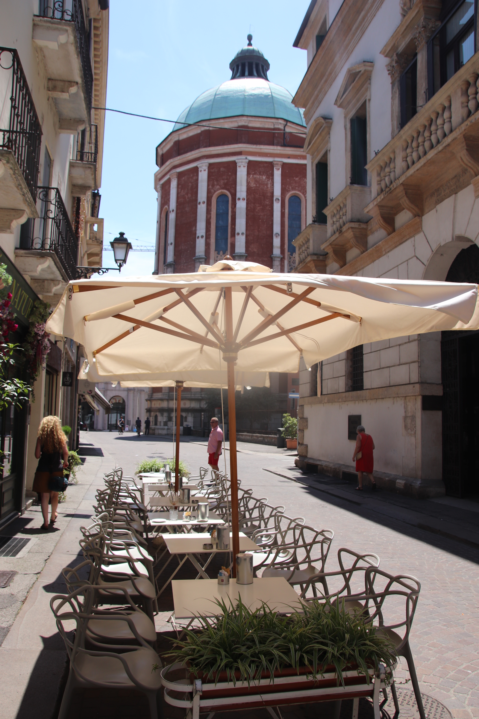
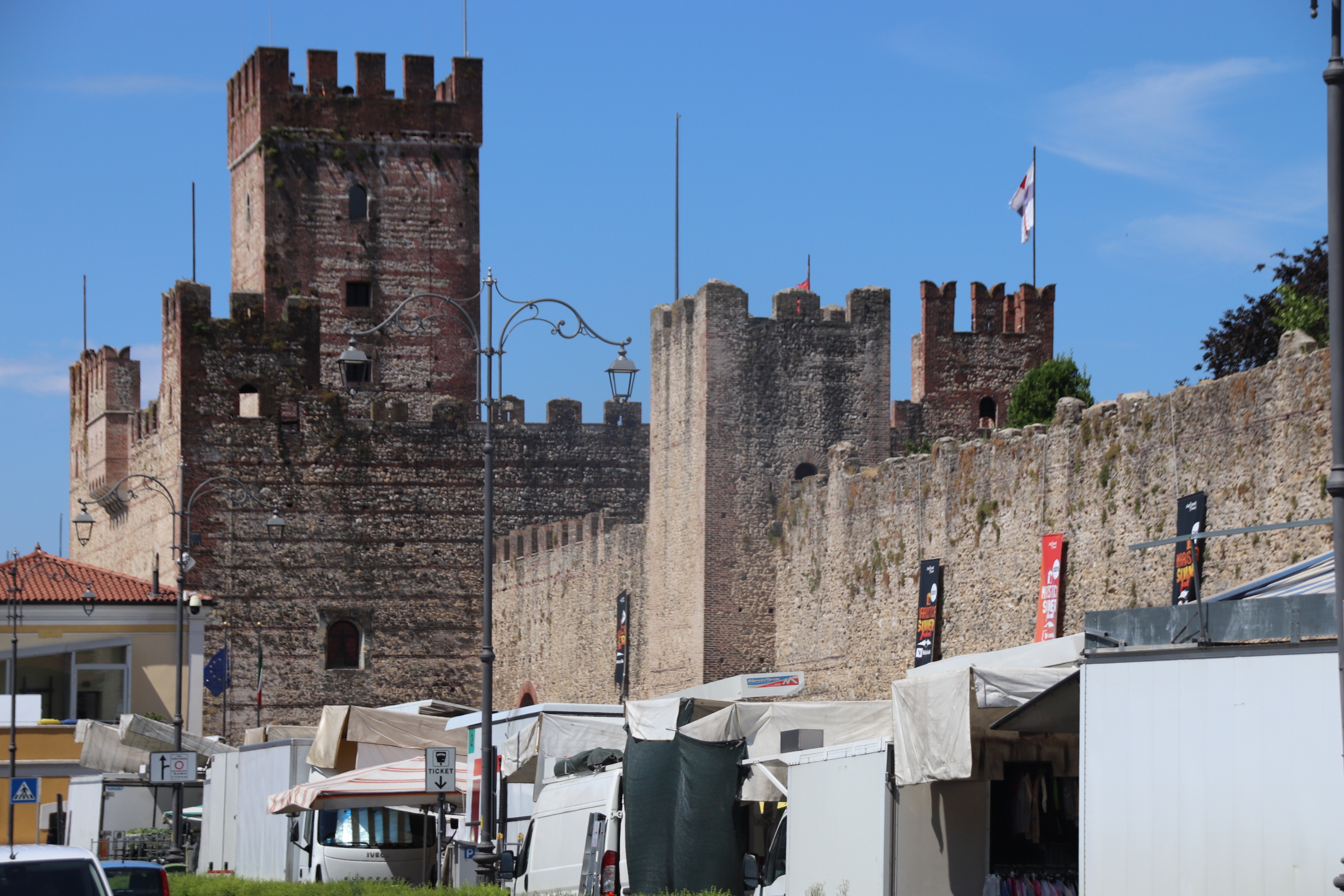
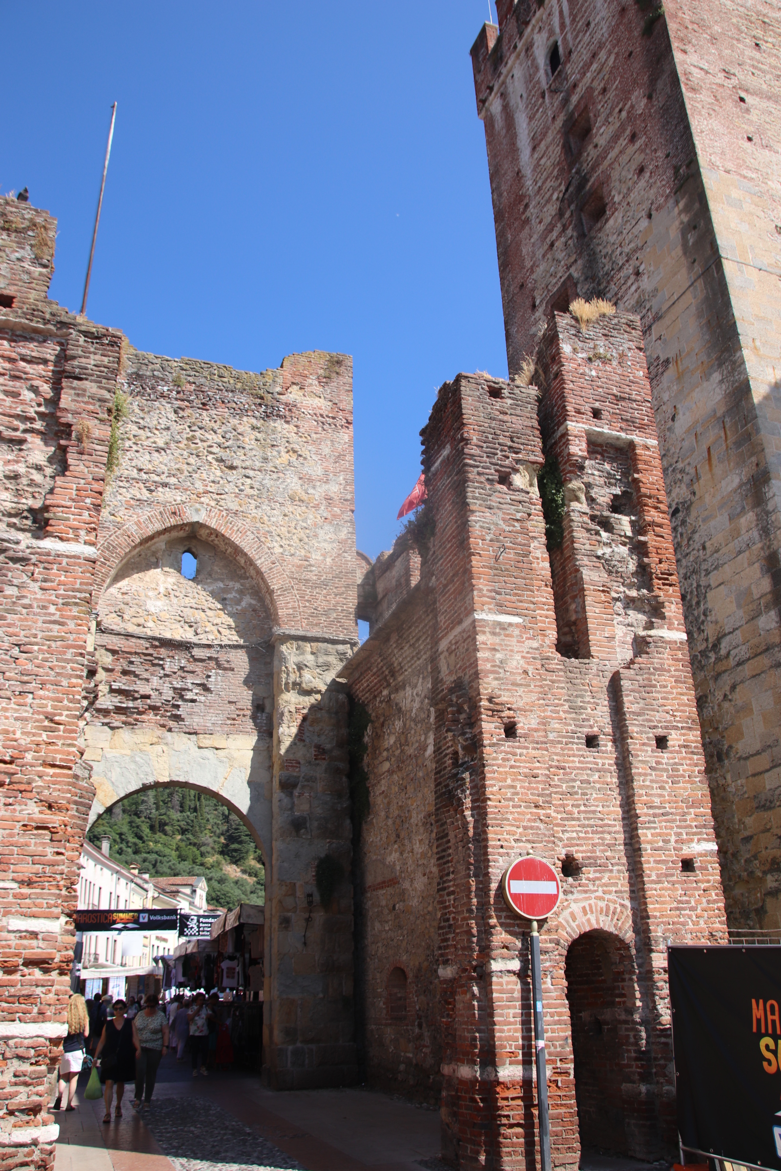
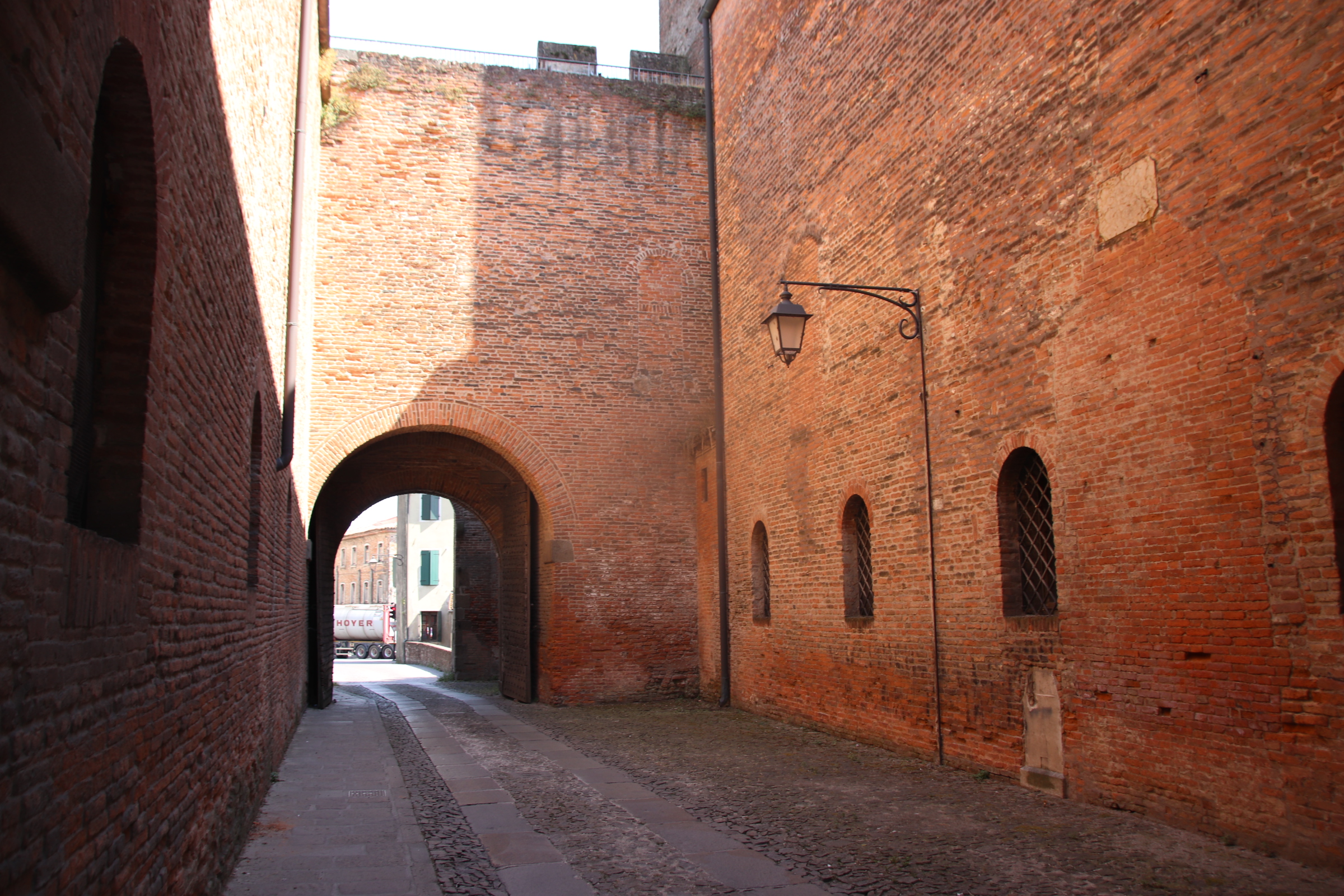
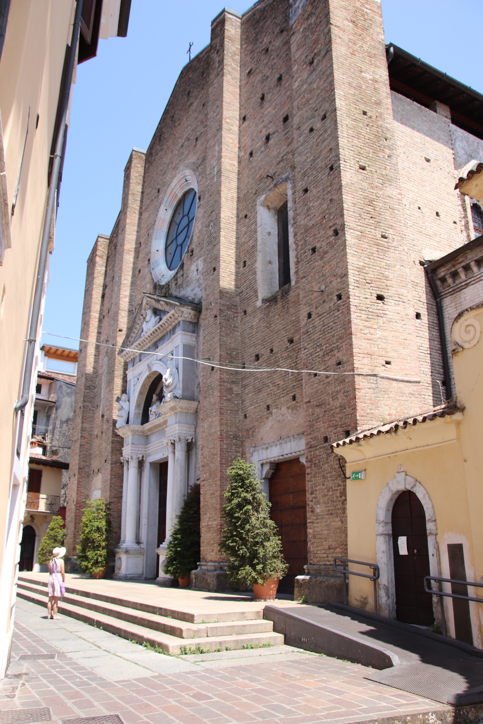
The towns are intriguing places and have many features in common – castellated walls and tall defensive towers enclose a large open piazza, cloistered edges provide shade from the blasting midday heat and powerful Gothic churches impose their presence on those below.
Marostica had a flourishing history in medieval times. During the 19th century it became relatively poor until it’s wealth grew again from the 1950s. The impressive walls & ramparts enclose the town completelÿ with a couple of imposing gateways limiting the progress of vehicles in & out of the piazza.
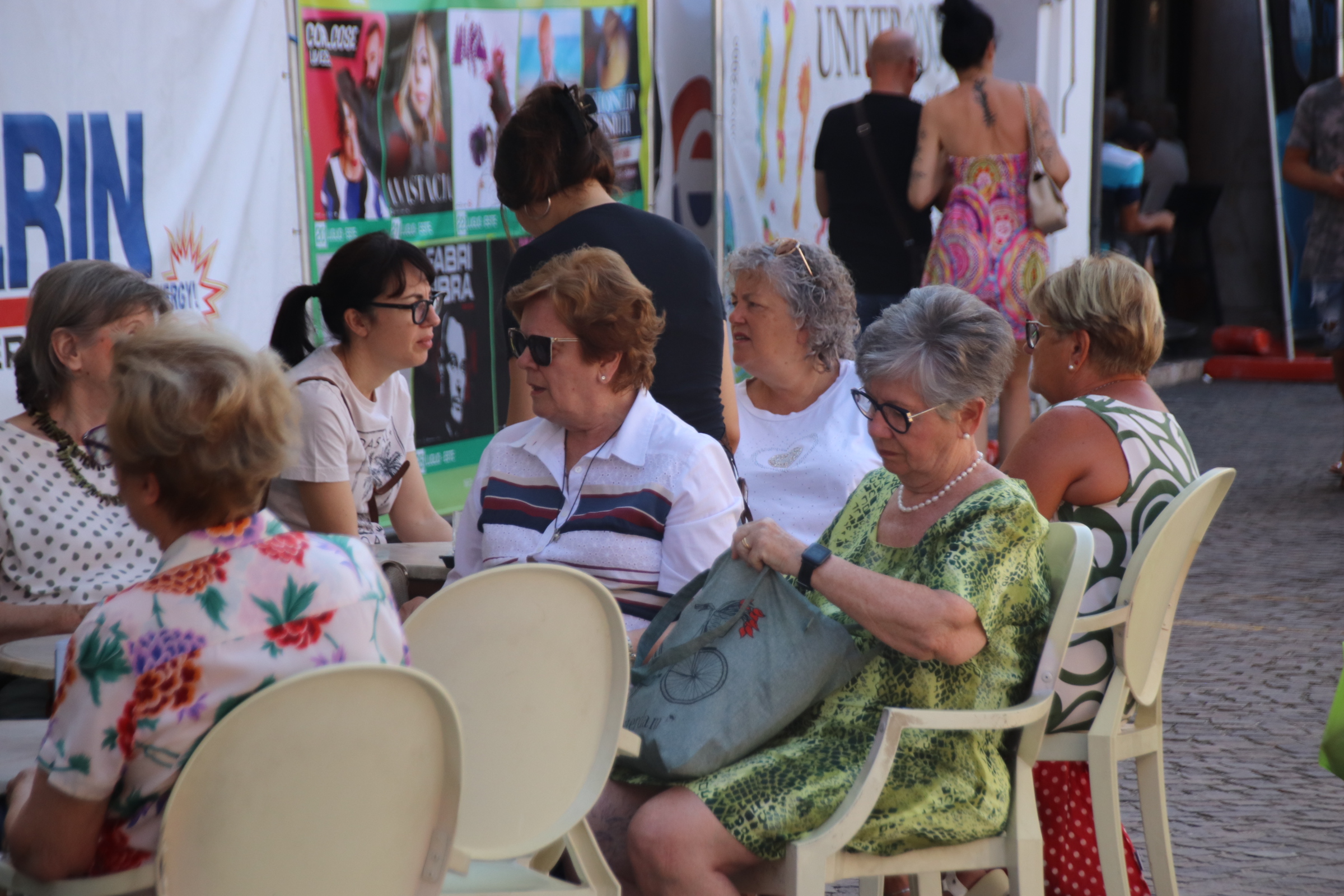
The weekly market gave the whole place a medieval aura with the cloistered edges providing shade for chattering families & friends chatting over their cappuccino & cake.
Umbrellered, ‘white-market-van-man’ acted as a second square of defence around the four sides selling all the wares of a large town market.
Overlooking the whole scene, high up on the hill, a line of medieval, stone fortifications steps to the top to see off any invading army that might have dropped through the time warp.
The town is best known for a chess event which takes place with costumed people playing the part of chess pieces and playing out a game. A large, 64 square chess board is a permanent feature of the market square. Legend has it that this live event has taken place every two year since 1454. Although the original moves have been lost, the festival was recreated after WWII and a modern game played out with costumed locals re-enacting a classic modern game. To give it a bit more class, the whole thing is accompanied with an opera as shown on the poster.
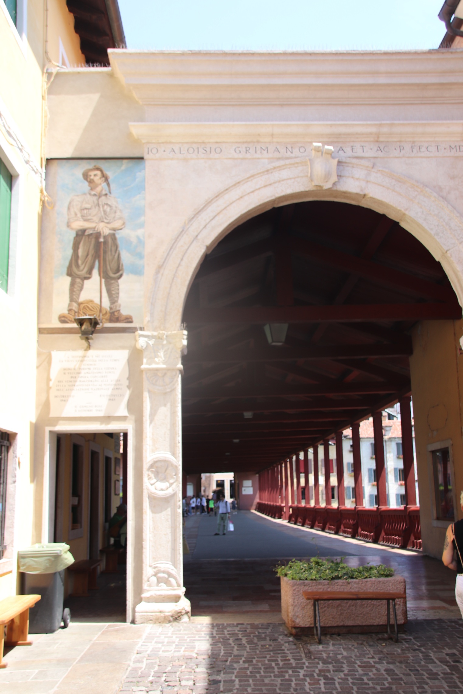
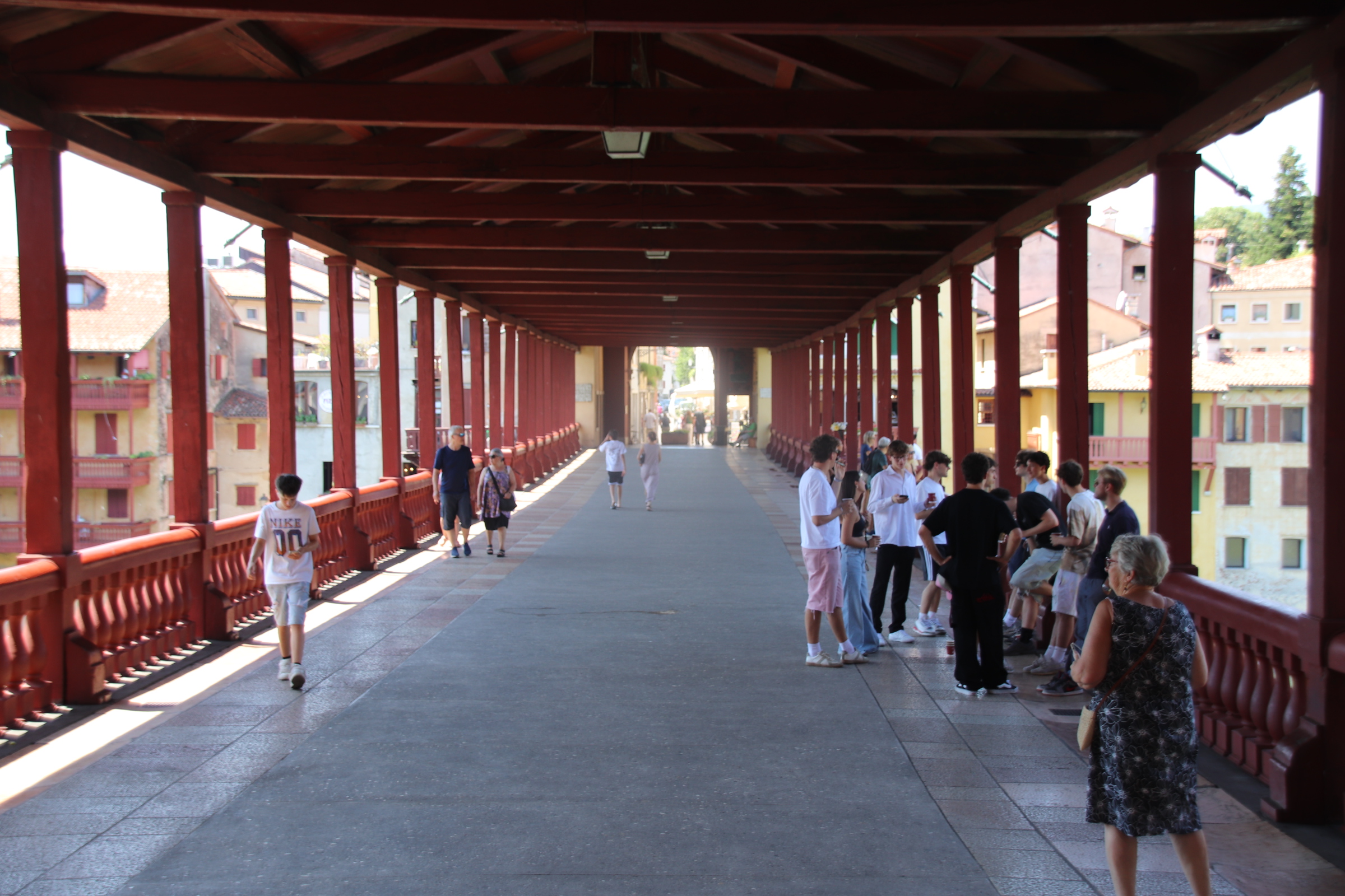
Bassano del Grappa held an important strategic position as a crossing point over the River Brenta. Once through the town walls, a series of piazzas link up to lead down to the bridge.
The wooden bridge has undergone numerous reconstruction’s since it was first documented in 1209.
It was here 1779 that the Nardini Family opened Italy’s, now oldest, distillery thus giving the town its name.
Montagnone
Montagnona has the best preserved, medieval walls in Europe. They form the defensive structure of the Castle of San Zeno. The square tower is deemed to have been built in 1242 on the site of a castle built in 996.
On the north & south walls, traffic lights control vehicular access to the enormous piazza that heatedly bakes in the mid-afternoon sun.
Holding prime spot in the piazza is Santa Maria Assunta. This Gothic Cathedral was built between 1431 & 1502.
Our next port of call is in the Veneto countryside just south of Vicenza. Although only an hour & a half away by the shortest route, this would require joining the main east/west artery of Northern Italy, the A4 autostrade, and I did not fancy the hassle of that. I’m on holiday!! So I decided to head in the opposite direction.
I thought to cross the lake on the car ferry from Maderno to Torri del Benaco, head up the east bank to Rovereto. From there, to snake south through the mountains to Schio and on to Vicenza -a trip of around 4 hours. Boy, it was worth it….always take the long road and remember – it’s the journey that counts!
19€ is the cost of the roll-on/off ferry across the lake.
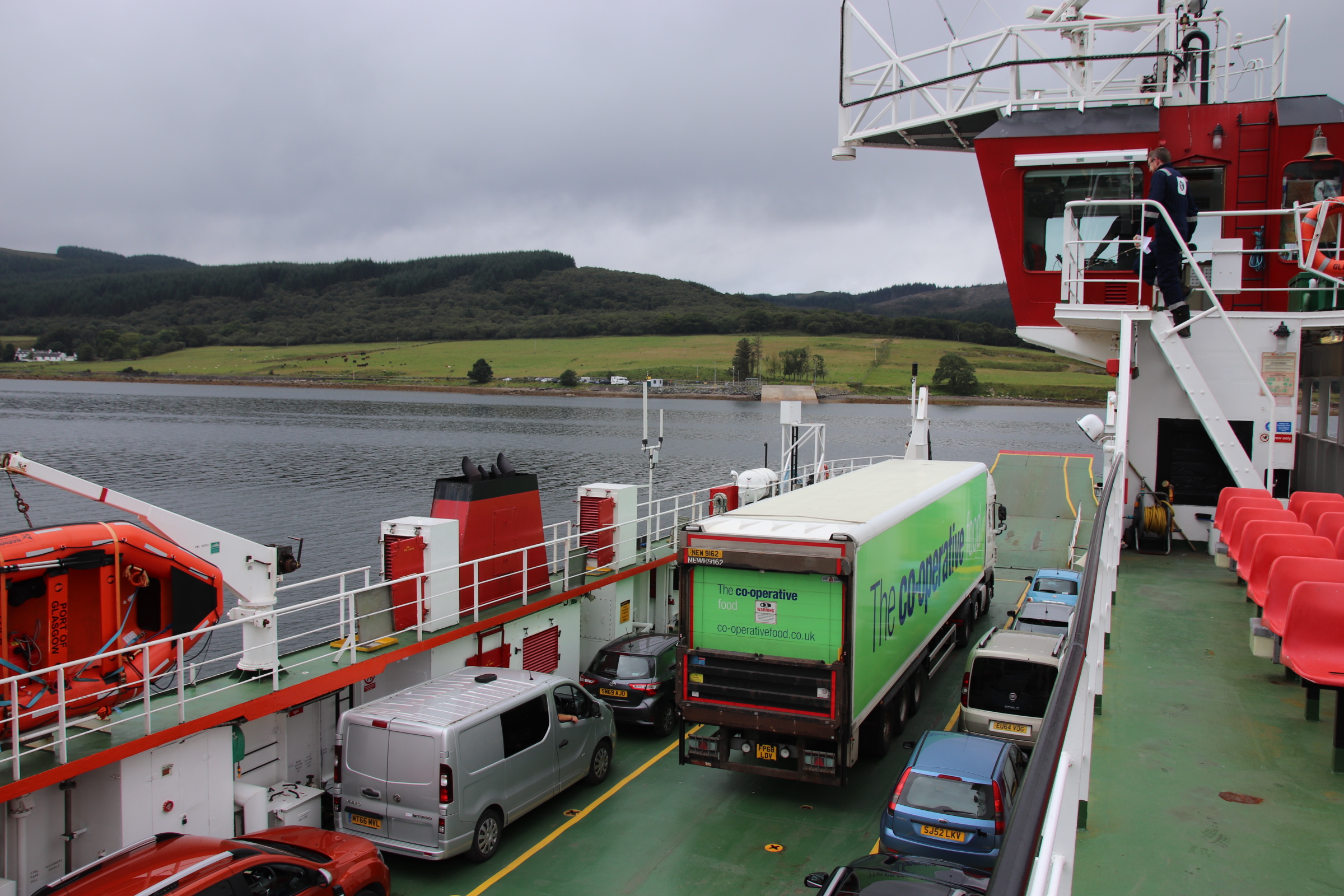
The journey takes 30 minutes on a vessel that would not be out of place in the Calmac fleet operating between the Scottish islands. It clanked & shuddered us across with the ramped front creating a hissing surf & the open car deck allowing the bursting sun to shine down on the righteous.
Once across, the route runs up right beside the lake with only a narrow strip of sharp stones & rough rocks separating it and the road. No grand mansions, extensive gardens or private estates hiding the lake from the hoi polloi, here. On this stretch, hotels & villas squeeze into any spare space on the land side and vehicles fit snugly into any verges against the lakeside cliffs.
From both, folk struggle over with their beach equipment like a games of Beach Crackerjack. The only way to survive the challenge of the lake ‘beach’ is to sit/lie on your own sun lounger to raise you above the surface of the shrapnel below.
The dedicated beach creature unloads said sun loungers, deck chairs, lilos, hampers, flippers, snorkels, towels, umbrellas which, somehow, they are able to erect in the rocky terrain. Wind-surfers soar above in the mountain air.
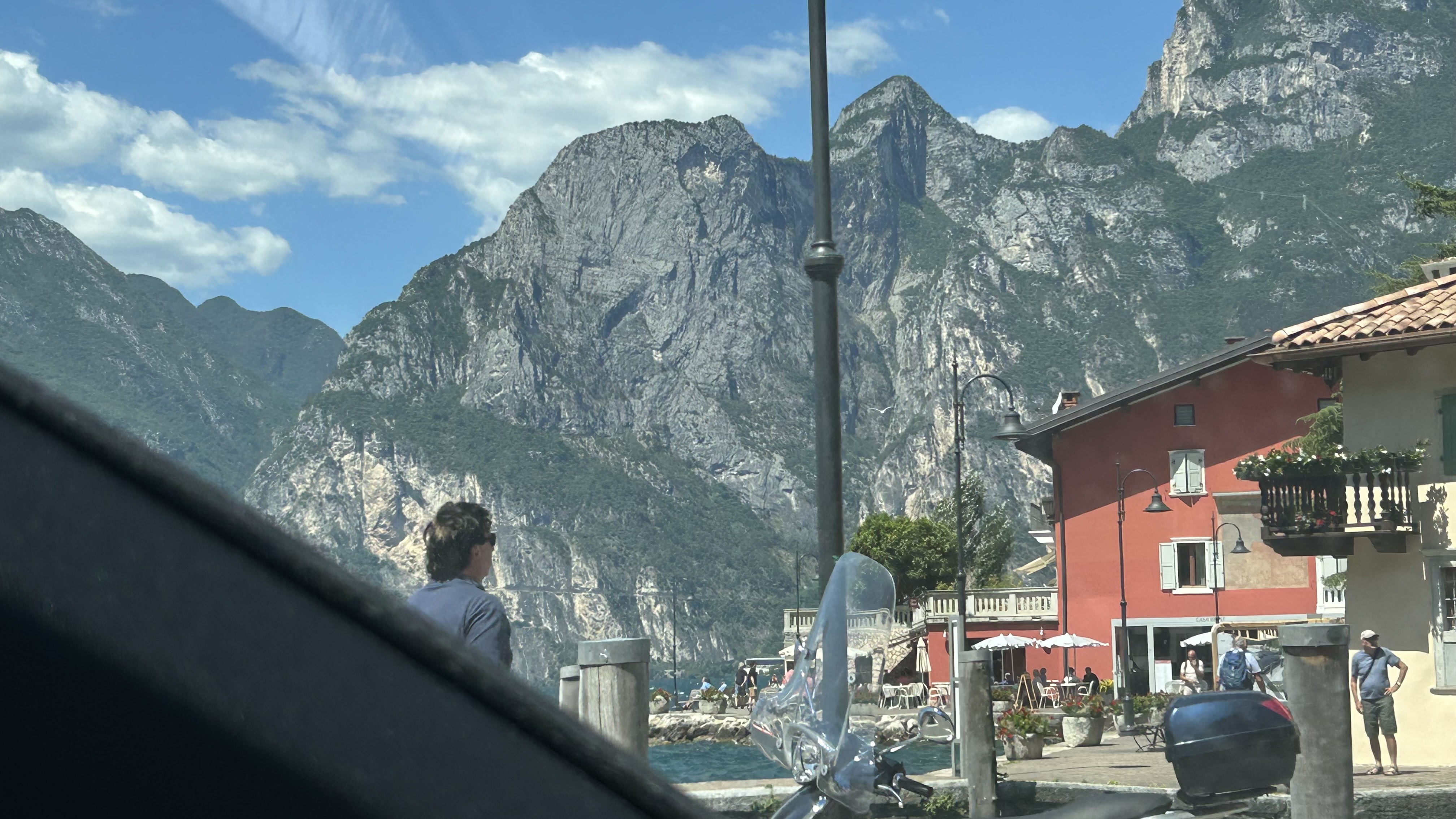
As the top of Lake Garda narrows, the peaks & crags tighten their grip on the landscape and squeezes it until it oozes out into wide meadowed valleys. The route then enters the ridged spine of the mountains, snaking up cavernous passes and down crag-strides in sharp-sided canyons & around pointed, ghoul-friendly peaks finding isolated , ancient, settlements or the occasional field of harvested grass.
After several hours of invigorating driving, hard but rewarding, we emerge in the soft hills of Veneto.
Desenzano del Garda was the last place to visit on the southern shore of Lake Garda and, like all the rest except Sirmione, it was quiet, peaceful, almost empty of life. The scorching heat had cremated any living body and scattered their ashes over sun-blasted streets & furniture.
A memorable part of the stay were the many places we found to eat. There were two along the modern front in Salo.
The first menu balanced lake fish & meat – in the end I declined the donkey casserole (bit heavy for a hot, sultry evening).
The second was a handsome pizzeria.
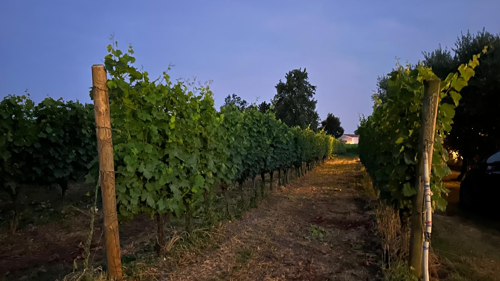
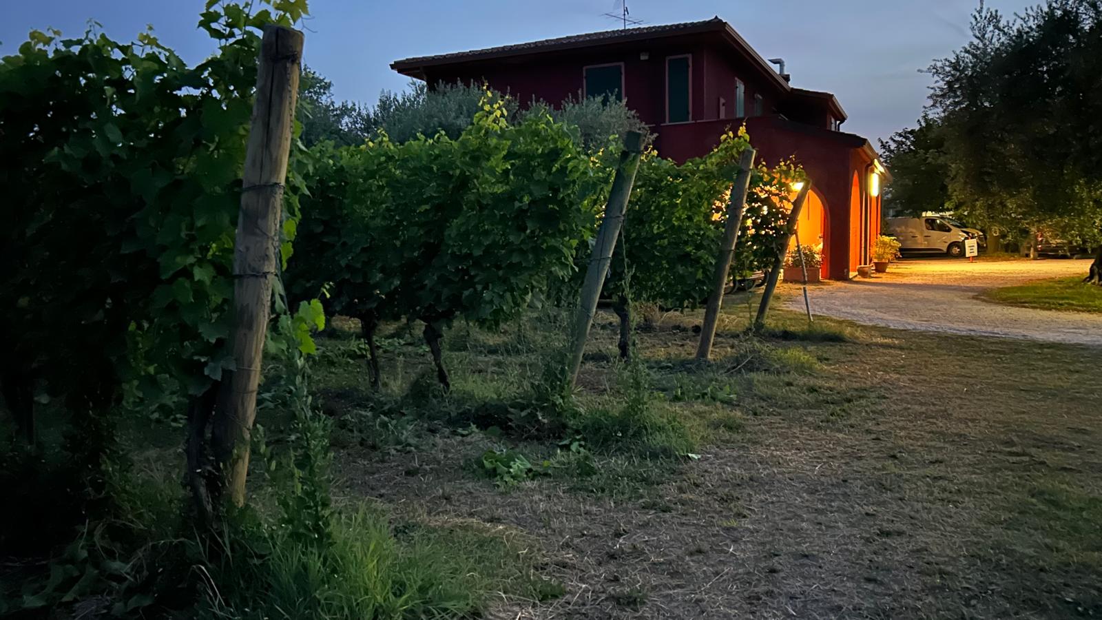
One evening we ate in amongst the vines.
A ‘carne’ restaurant that served no fish was a godsend to those with a seafood allergy.
We shared our last meal with a coach load of German tourists next to asmall funfair; the saving grace was a bottle of excellent red and an exceptionally tasty apple turnover.
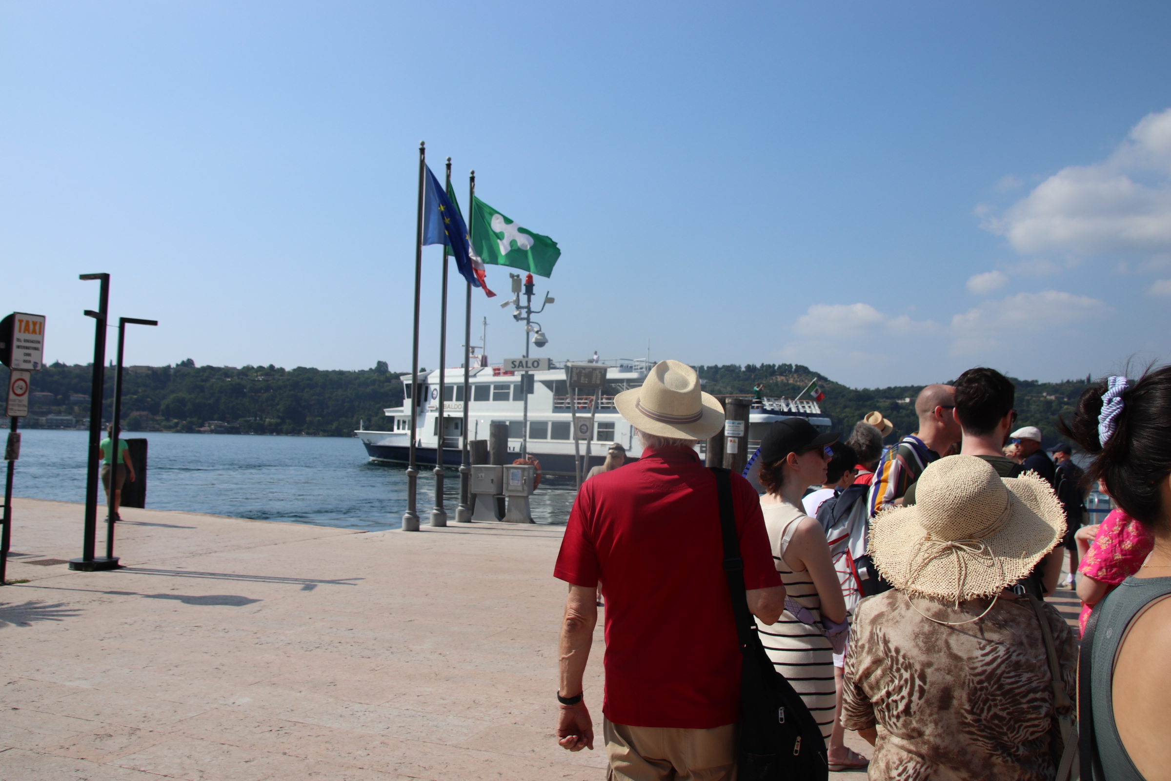
It is the day to come to terms with the Lake Garda ferry timetable.
Easy you may say. Yes, but only after careful study. It details all routes from all towns in no particular order other than north to south on one side and visa/versa on tother. An occasional ‘fast’ ferry confuses it more by missing out certain stops and reducing journey times. The danger is that by timing your arrival at one place you then have limited options to get back and if that boat is full, you are stuck for several hours. Luckily this never happened and our journeying was great fun & really cool (in more ways than one – lake breeze ruffling my hair and wonderful views of private islands, elegant gardens, castles & turrets & spires).
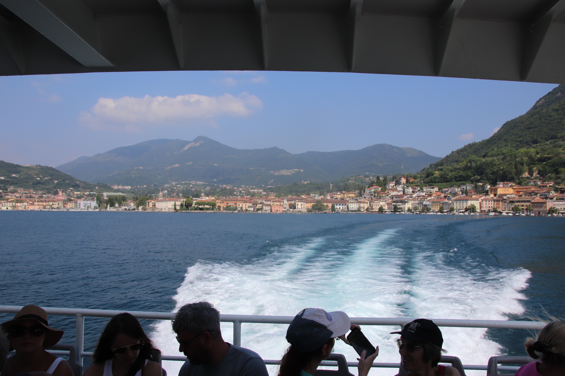
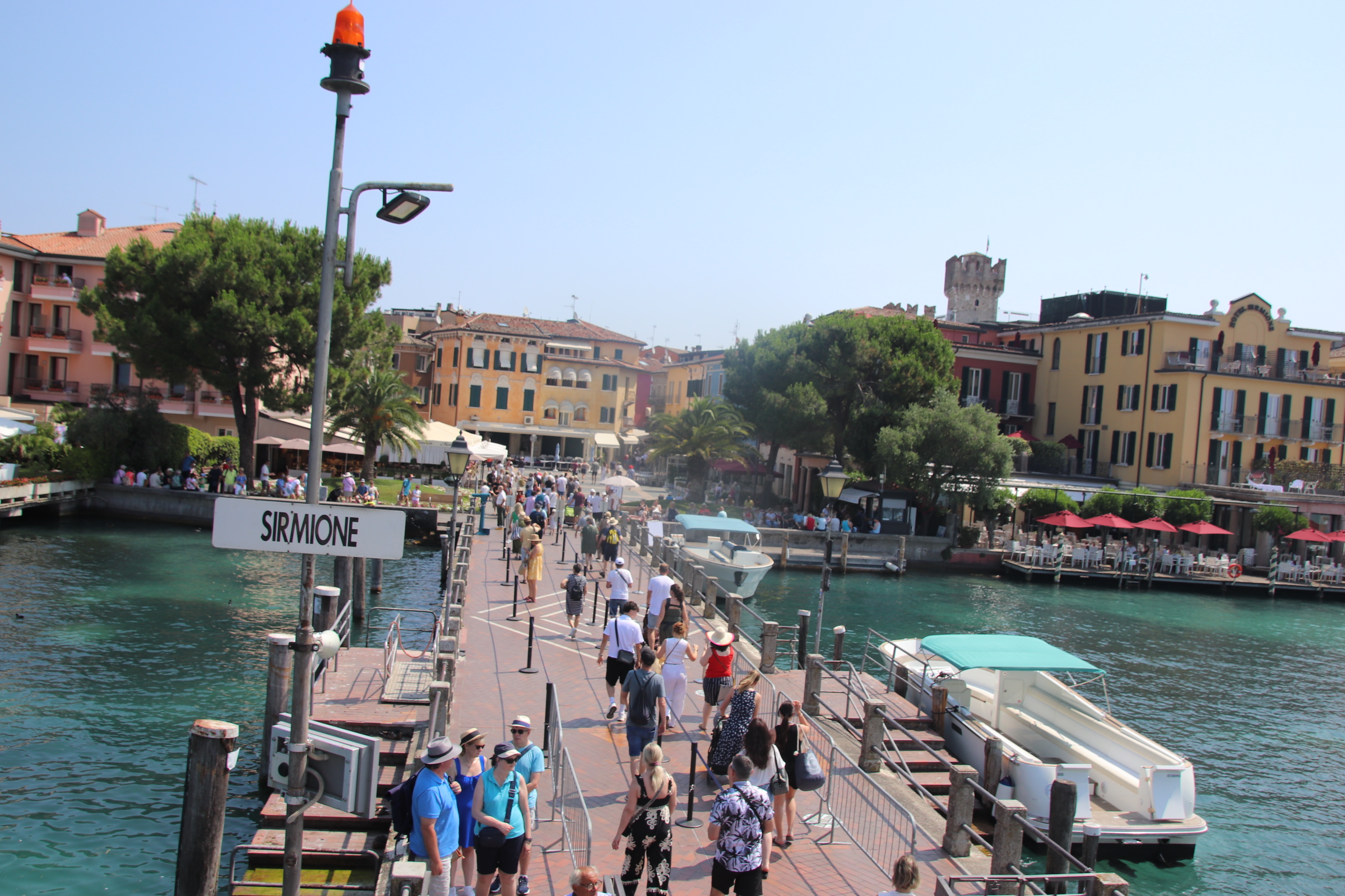
The first journey was down to Sirmione, an hour away on the first, fast boat; a bit of a shudder but glorious sights of lake craft – chugging ferries, elegant yachts, sleek playboy motorboats leaving crisscrossing wakes of leaping horses to mark their routes.
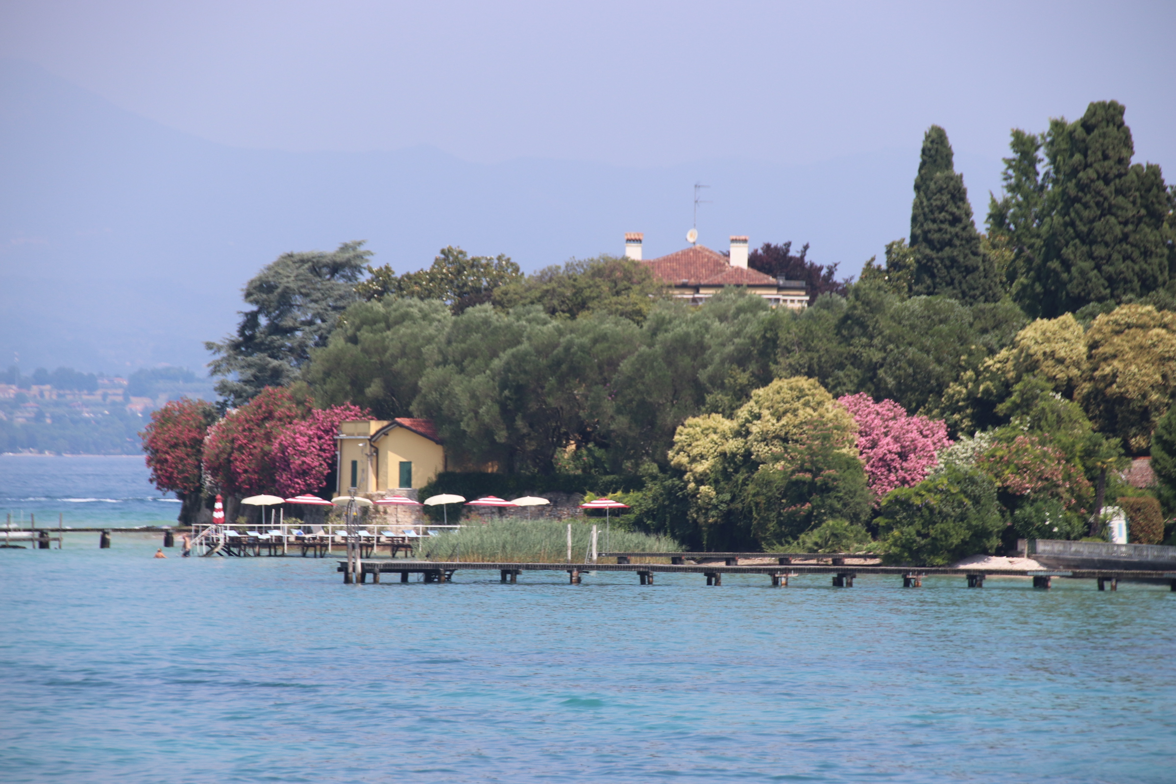
From our crow’s nest on land we can see Sirmione down on the lake in the haze. It lies on the head of a long, thin peninsula that stretches out from the south shore. In Roman times a villa stood here amongst Cyprus trees, olive groves & shaded gardens with thermal baths as company.
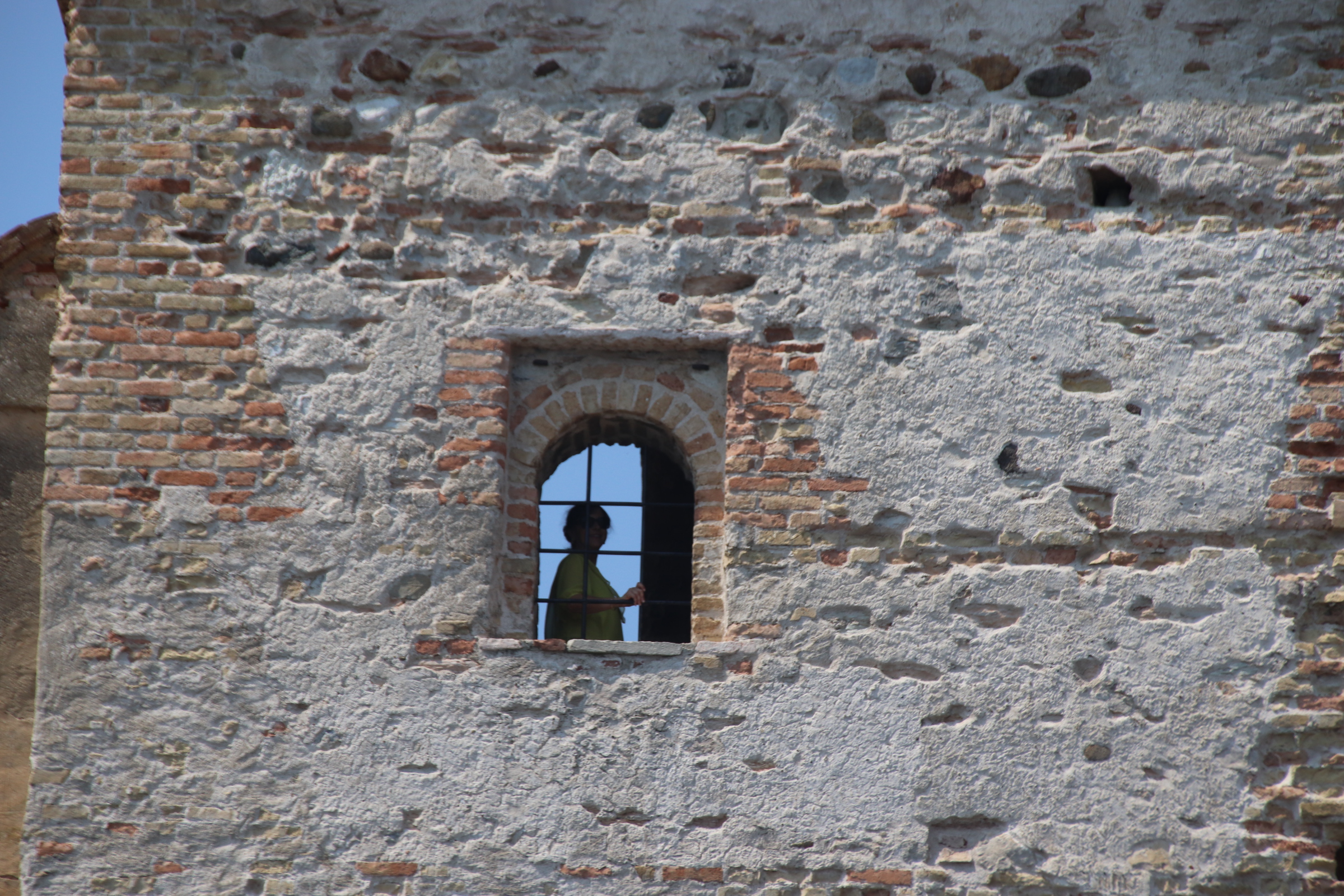
Its unique position was not lost in medieval times when the impressive Rocca Scaligera castle was built with typical castle features – drawbridge, castellated walls, a Rapunzel tower, moat …. oh and a large, bright pink, plastic crocodile.
However, Sirmione is on the radar of every tour operator from Frankfurt to LA and suffers with tourist groups crammed into dusty, hot, cobbled streets. The outside car/coach parks are full & ferries offload their full capacity to contribute to this bad tempered melee.
“Quick, consult the timetable. There’s a boat in 30 minutes to Gardone. We can get off there, and wait for the 3.05pm to Salo….maybe grab a light lunch & a glass of wine…….much more civilised”.
From our perch up here amongst the ripples of breeze that rustle the olives, vines & cypress dotting the hills above the southern part of Lake Garda, one can plan sorties out to take advantage of any cooling effect from lake or wind.
The first bit of exploring took us a few miles up the west side of the lake Late June seems a good time to holiday here. Flowering shrubs are abundant and in full display. Roads are not that busy, parking is easy and the places we came to are very slow & sleepy.
Gardone is a chalk & cheese kind of place. I presume the cheese is the tasty place & the chalk is nothing to write home about. Well, the ‘chalk’ follows the lakeside with very grand, impressive century+-old mansions beside the water on a stretch called the Gardone Riviera. Hmmm; it does not really smack of Nice or le Tropez; all a bit grey & concrete & baked promenade. A solitary tree provides some natural shade half way along the front where refreshments can be found.
Gardone’s ‘cheese’ can be found above on the high lakeside above the line of multi-floored hotels & mansions. Up a picturesque, winding road, past formal gardens and through extensive lawns & strong, overbranching conifers to arrive at a small settlement at the top. The mayor’s office overlooks the lake.
Pass up further through the tidy, narrow streets to the far side of the village where a tiny piazza is enclosed by several small restaurants and the church.
Beyond this is an elaborately sculptured entrance to an open-air venue which hosts a range of modern-day artists and an idiosyncratic motor museum with some interesting figures standing guard!
Mardone is the next village up the lake. Fast asleep in the midday sun, it is far too lazy to lift itself out of any heat-imposed slumber. I had to visit to find details of the vehicle ferry across to the east side of the lake and thus avoid the motorway to the south when moving on.
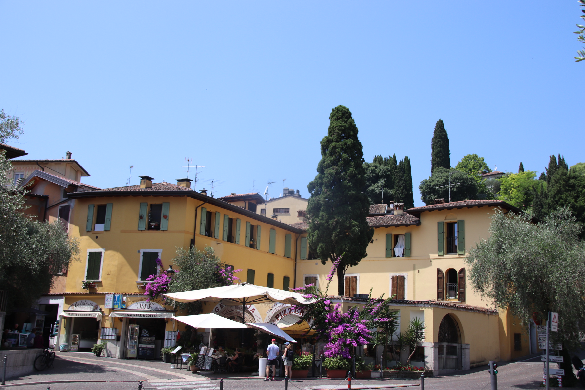
So it’s a return to my beloved Italy and, for the first week, chilling it in the hills overlooking Lake Garda itself. Up here, a gentle breeze whispers across the skin, reminding you where you are and to let the eyes & ears do all the work.
Salo is a small lakeside town that epitomises the classic Italian Lakes tour. June is the time of year to indulge yourself & come away to the lakeshore where coniferred hill ranges contour down to a sharp edged line around the clear waters. There are few crowds, eating & drinking is easy with no need to book & Garda’s ferries provide easy access around the ancient towns & villages that dip their quayside toes into the clear, fish-strewn waters.
Main problem has been to find dinner this evening. Having looked at menus up and down the front, this is it:
Now to decide between braised donkey (!!!) or lake sardines. I’ll let you know.
I’ll let Salo show off its character, accompanied by the few visitors that have slipped the cordon and arrived on foot, bicycle, car or boat.
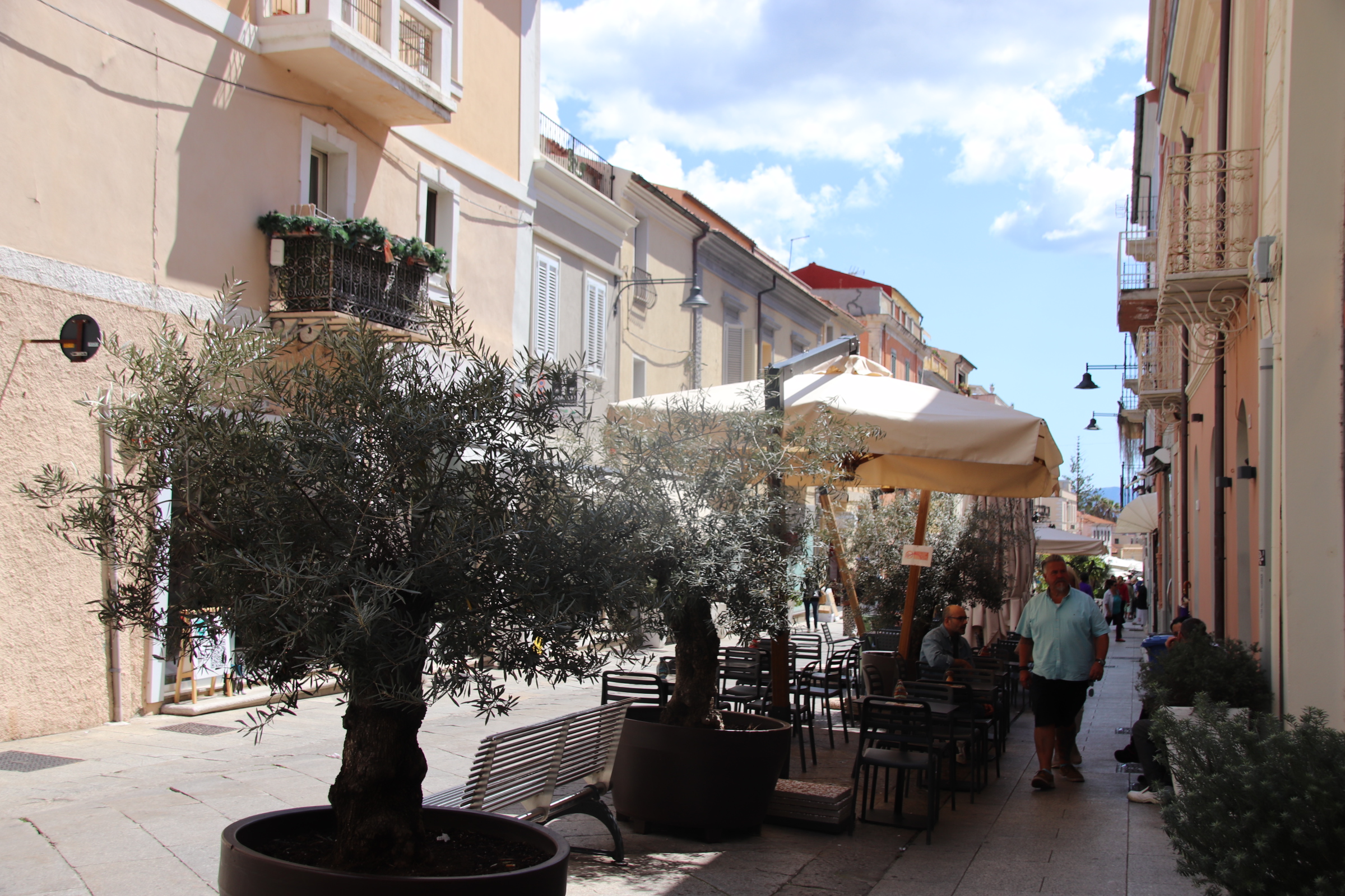
Flying home from Sardinia provides a further day to explore the historic city of Olbia. Originating in Greek times as a coastal port, it was developed further by the Romans and later in medieval times. The layout of the old city is quite simple. Corso Umberto is the main drag, up over the low hill and down to the marina, full of luxury yachts & quayside parking.
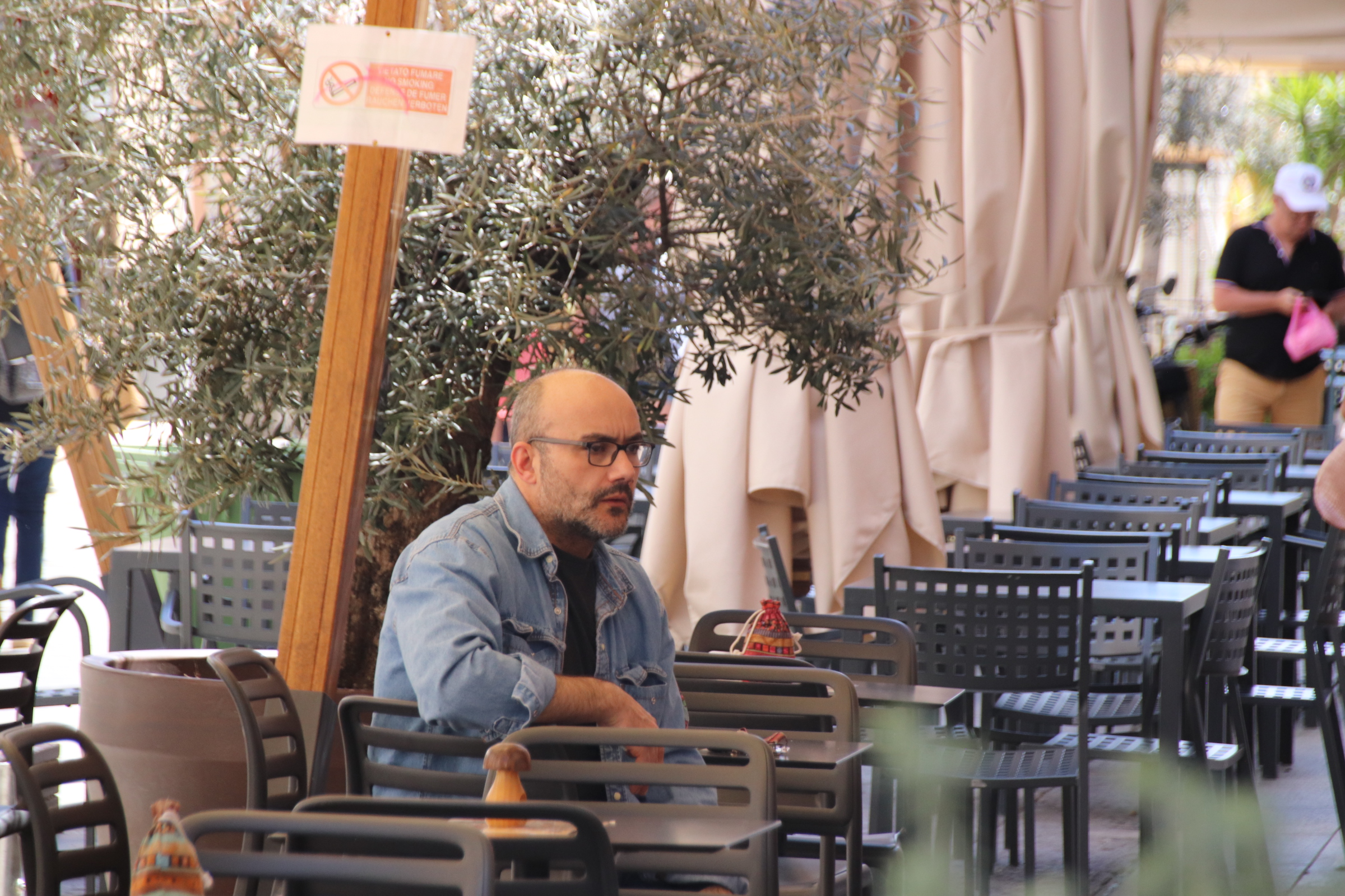
On either side elegant buildings line the 750 metre route. Cafes, bars & eateries have spread out onto the stones in an attempt to catch passers-by in their net of QCR codes, menus & images of dishes, meals & drinks.
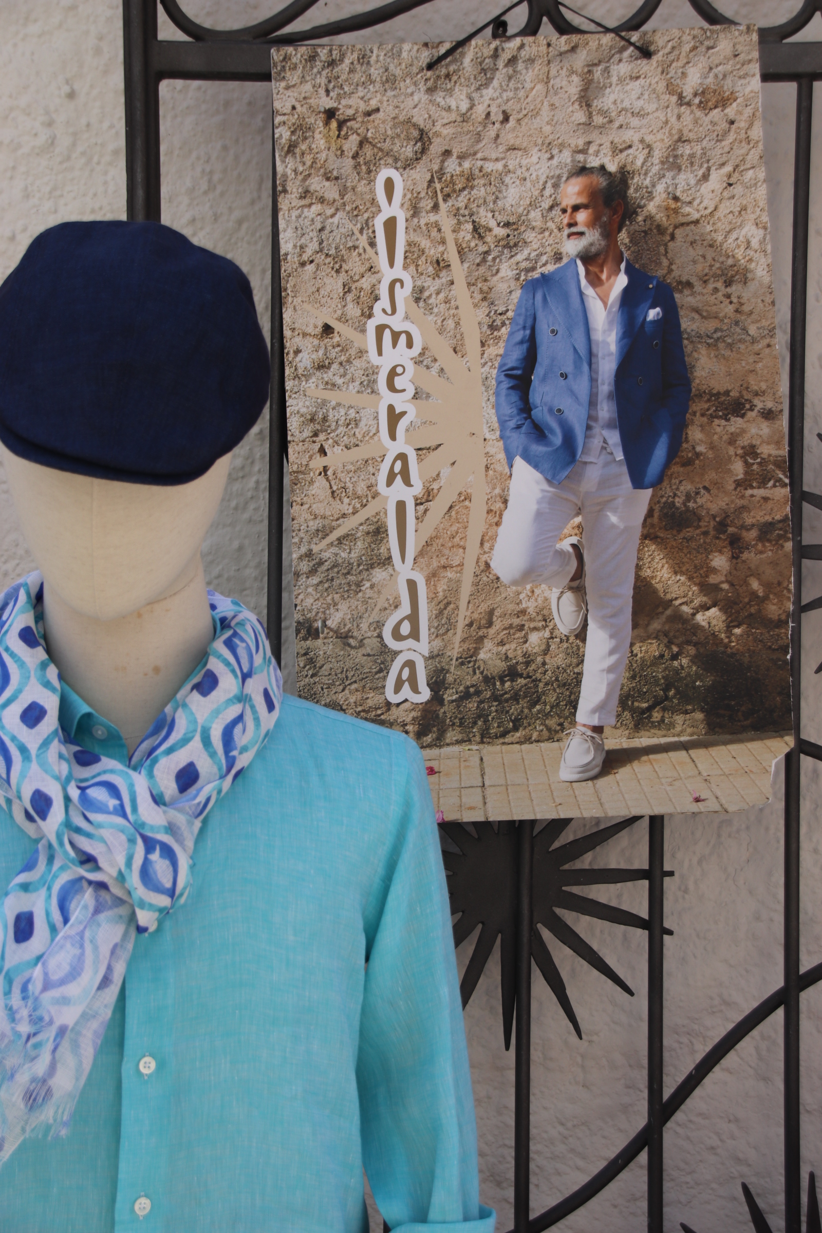
Expensive summer clothing for men & women gases out of small, intimate shops, sucking in customers with displays of what you might look like if you paid their exorbitant prices for pastel linen & flowing, light cotton.
The Basilica of San Simplicito dates back to the 12th Century.
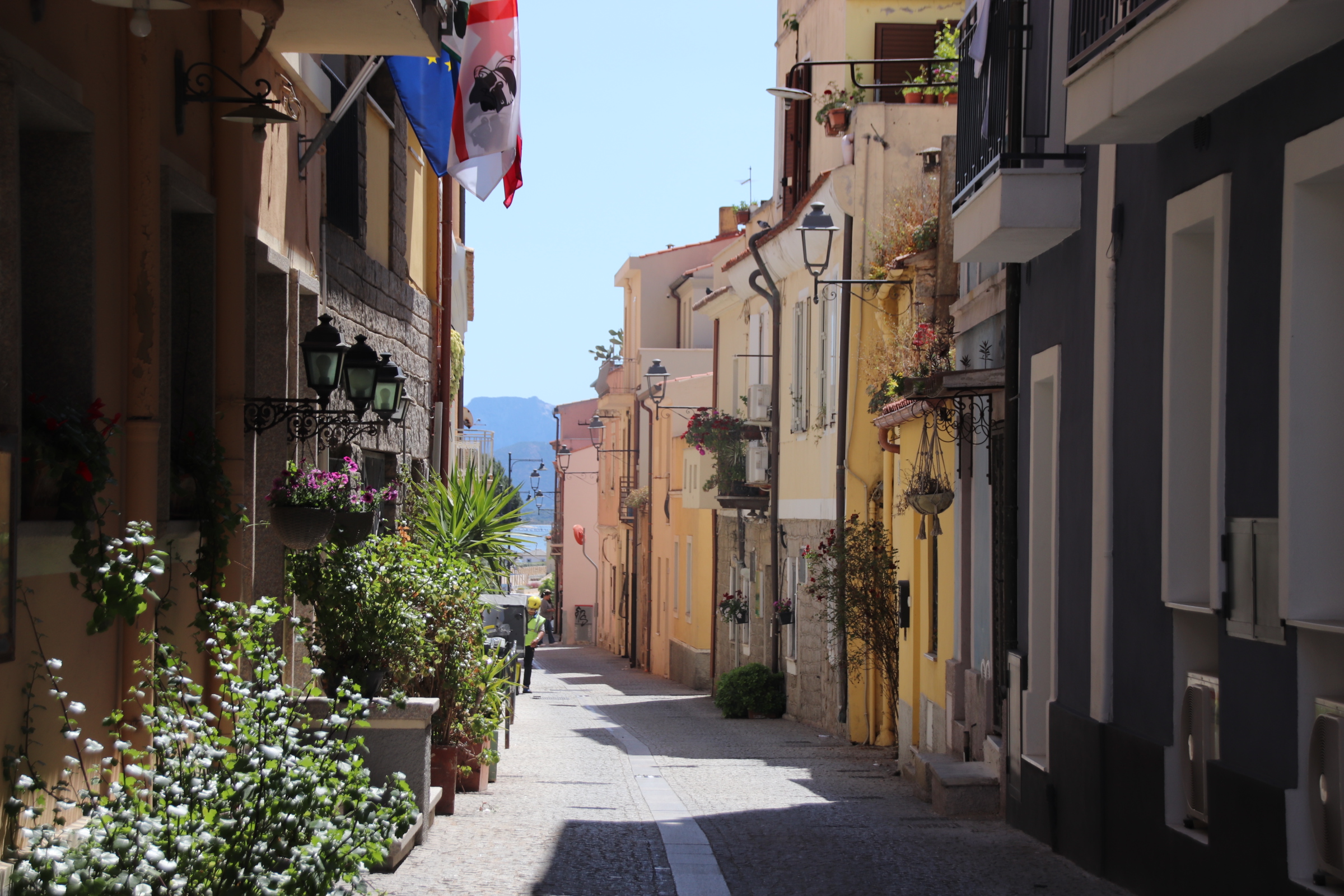
On each side of the of the main promenade, narrow stoned alleys & lanes lead into a maze of old buildings where unique bistros & restaurants squeeze a presence out onto the small narrow streets and expensive clothiers sell their luxury wares.
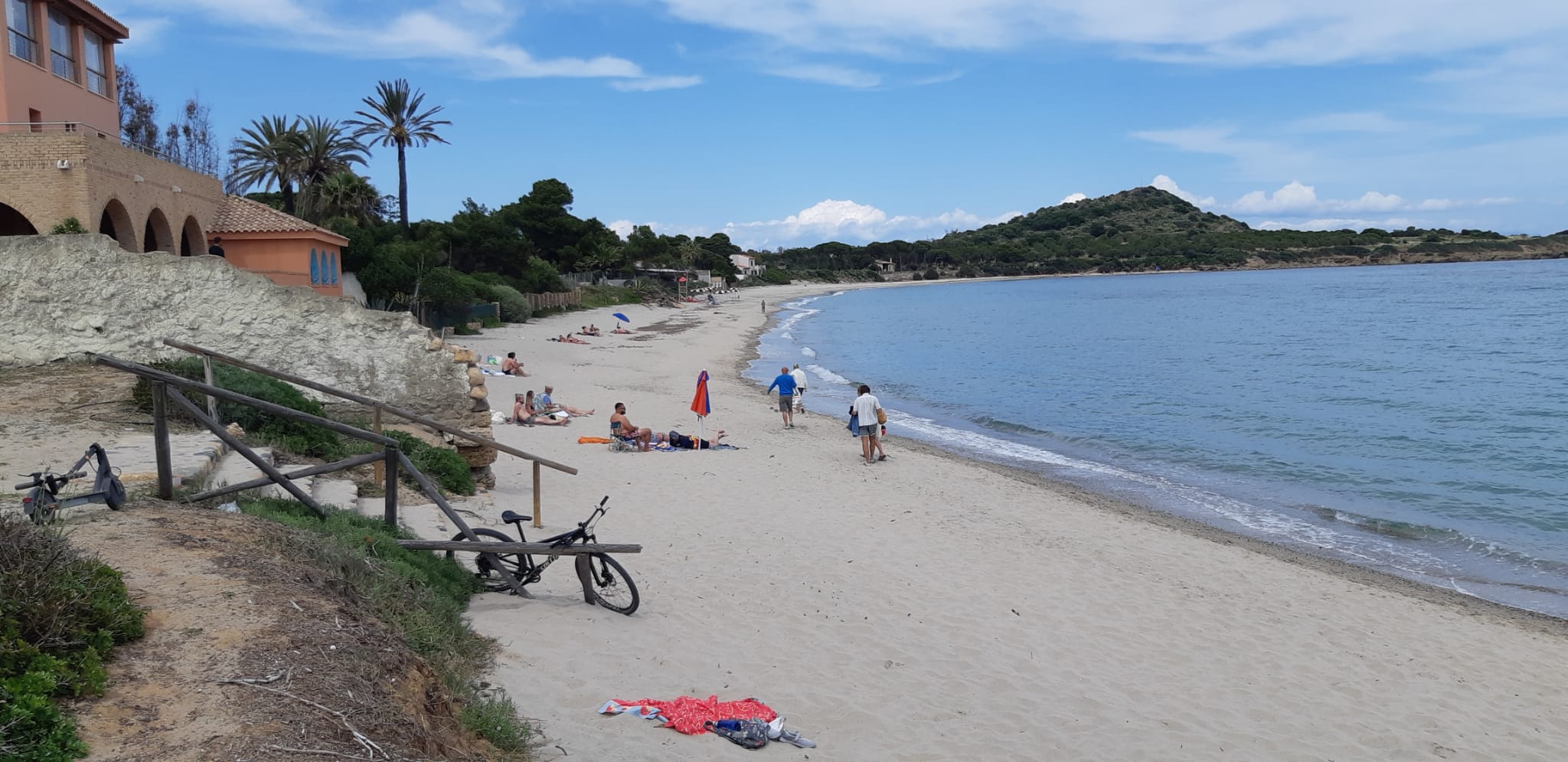
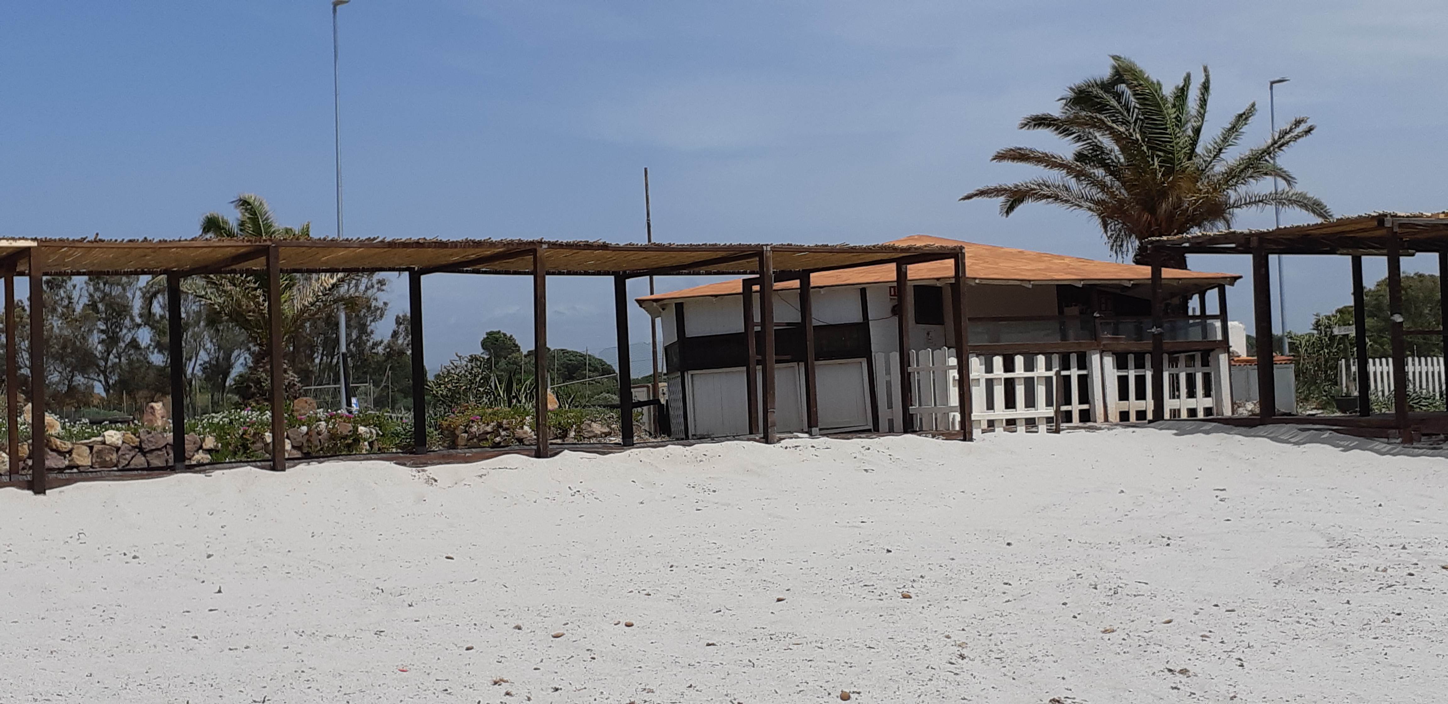
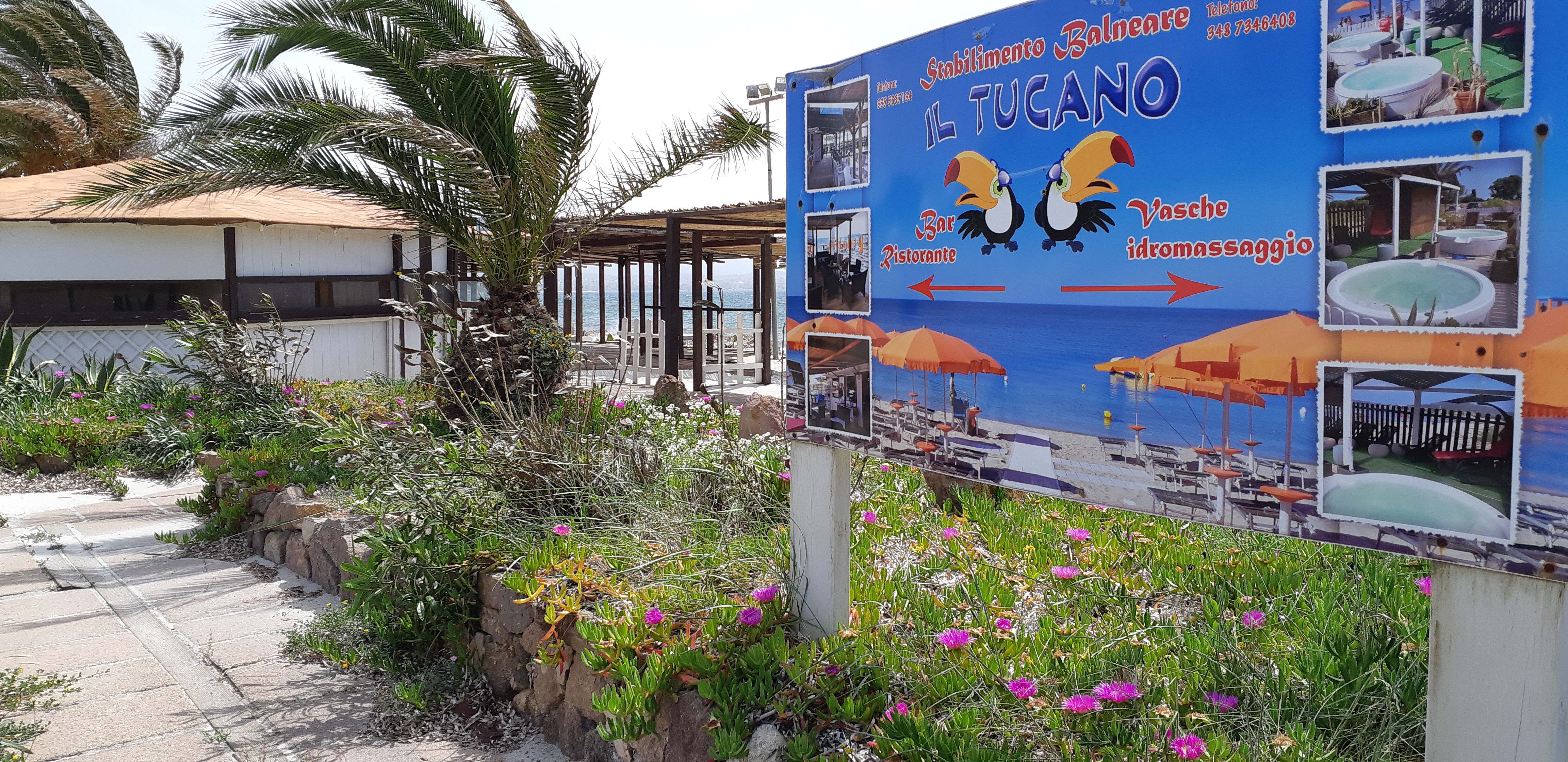
The last few days have been spent sampling Sardinia’s coastline and the beaches in particular and exploring the south of the island.The beach at Bosa typifies most: wide silver-soft curves around turquoise/blue waters; usually a single shack/beach bar controls the beach; it may have a handful of sunbeds to share (although you can drop your towel almost anywhere on all of them).
Pula is our base further down the south west side of the island. An ordinary town with a mixture of businesses and holiday homes. What it has going for it is a number of reasonable restaurants 8n the square and around the church. The latter is home to Fedrica’s where we ate most often.
Visiting in May makes everything so easy. It is pre-season – no need to book tables in restaurants, easy to park, beaches are empty, as are the roads. Everything is very peaceful, calm & relaxed.
Pula’s town beach is on the way to the tower at Nora situated on a promontory at the far end.
The beach at Chia was the best. Gob-smackingly beautiful it could have been the Caribbean or a south sea island.
Spiaggia Di Tuerredda was similar.
The island of Sant’Antioco is linked to the main island by a spit of land and a low bridge. At its far end, Calasetta has the feel of a north African fishing village with palms & weather beaten facades and dominated by the large cathedral.
Traditional fishing boats are moored alongside modern sailing boats & luxury yachts.
My biggest surprise in driving the coast road south to Bosa is just how green & flowered the island is.
A patchwork of hay grass, some lying flat awaiting raking, mixes it up with meadow flowers of white & sunshine yellow. Lines of mixed deciduous woodland trees mushroom up alongside stretching olives & the occasional patch of pine. Lightbulbs of flowering gorse blaze in clumps, illuminating the course of a track, the side of the road or highlighting a crag of rocks or a tamed wild rockery. The colour palette is so varied, blues, lavenders, pastel purples, even lilacs thrown in there along with a brief flash of rather garish crimson poppy and all against a background of greens on one side & the turquoises of ocean & sky on the other.
The route attracts bikers & enthusiastic cyclists. For the most part the road is wide, the surface smooth – a joy to drive/ride. There is no room for cafes or bars or tourist tat here; Just the occasional view point where riders can share anecdotes & appreciate the serenity & beauty of the open road & the clear blue sky.
Don’t be fooled by the functional feel of the modern buildings you first meet as you enter Bosa; nor by the very ordinary street market, which by 1pm consists of a few lonely stalls, unloved & seemingly unwanted by their traders.This is one of the most beautiful villages in Italy.
The old town lies at the bridgehead over the Temo River. This meant that it prospered – agriculture was king on the plateaus inland with the water transporting grain & products to & from the coast, whilst the river also provided access to the sea, and fishing and trade created wealth from the surrounding ocean.
Ignoring the gate keepers at the small restaurant gurding the entrance, head into the maze of narrow cobbled streets/alleys of the old town.
Here, the multi-storeyed terraces stretch so high above that the shadows reign supreme and the sun has no hope of surviving down at street level.
The river is lined on both sides with buildings dating from past times – on the far side mostly warehouses stretch in an unbroken line from the bridge towards the sea. Opposite, warehouses share the riverside with merchant’s houses.
Domes, steeples flaking facades peer over each other and jostle for position alongside the bank providing a textured backdrop of colour, texture & position.Above the village, the 14th century Malaspina Castle stands guard, protecting the village from ancient enemies & invaders.
Having landed in Olbia on the north-east of the Italian island of Sardinia late on Saturday night, we negotiated the intricacies of a hybrid hire car with only 1,500km on the clock, the small digital display of Google maps on a phone & light RAIN through dark streets to reach our first night’s accommodation. Our mood was not lightened when we were unable to remove the key from the door once I had pushed it open & the lovely night porter could find no other rooms to offer us. Chairs were used to prop the door closed overnight.
The following day required a couple of hours drive the town of Alghero on the west coast. I expected inland Sardinia to be like Corsica so it was a pleasant surprise to drive long straight dual carriageways through wooded flatlands of flower carpets & fresh leaved trees. In the distance ridges & peaks of the inland mountains kept us company.
Approaching Alghero from the north gave us our first taste of Sardinia’s glorious beaches. Well, it has to be said that it was a bit of a before & after. The road runs right beside the water. At beach number 1 the winter winds had dumped copious amounts of seaweed on the sands to dry in huge clumps.
We were assured about the coming summer by this poster behind the beach:
Beach number 2 had no such obstacle preventing access to the water and we spent a couple of hours taking in the sun & watching the antics of the high-flying kite surfers.
Old Alghero is surrounded by typically functional, modernish buildings for commerce & housing. The city was founded in the early twelfth century. The Aragon crown first expanded the port. The Hapsburgs then colonised the Island, and Alghero in particular. The ancient curtain wall with its strong battlements connects impervious towers and piers to circle around to face the sea.
Within it, a maze of cobbled streets are lined by dusty, medieval buildings with low doors & tight windows. History & tourist tat ( the most apparent being copious amounts of red coral artefacts) combine to to pull in large numbers of visitors. The sun finds it really hard to penetrate these historic streets, only succeeding where attractive squares open up to umbrellas, cafe/restaurant tables, gelatine stalls, imposing churches & chapels.
This all started at home when the storms & overcast skies & rain & gloom threatened to pinch any buds of brightness out of a feeble spring. A trip to wonderful friends in Provence would surely lift the spirit. Sadly the weather is letting us down but the friendship, the change of scene and the French style have all helped to refresh & revitalise. This blog will be like a series of picture postcards from our short stay.
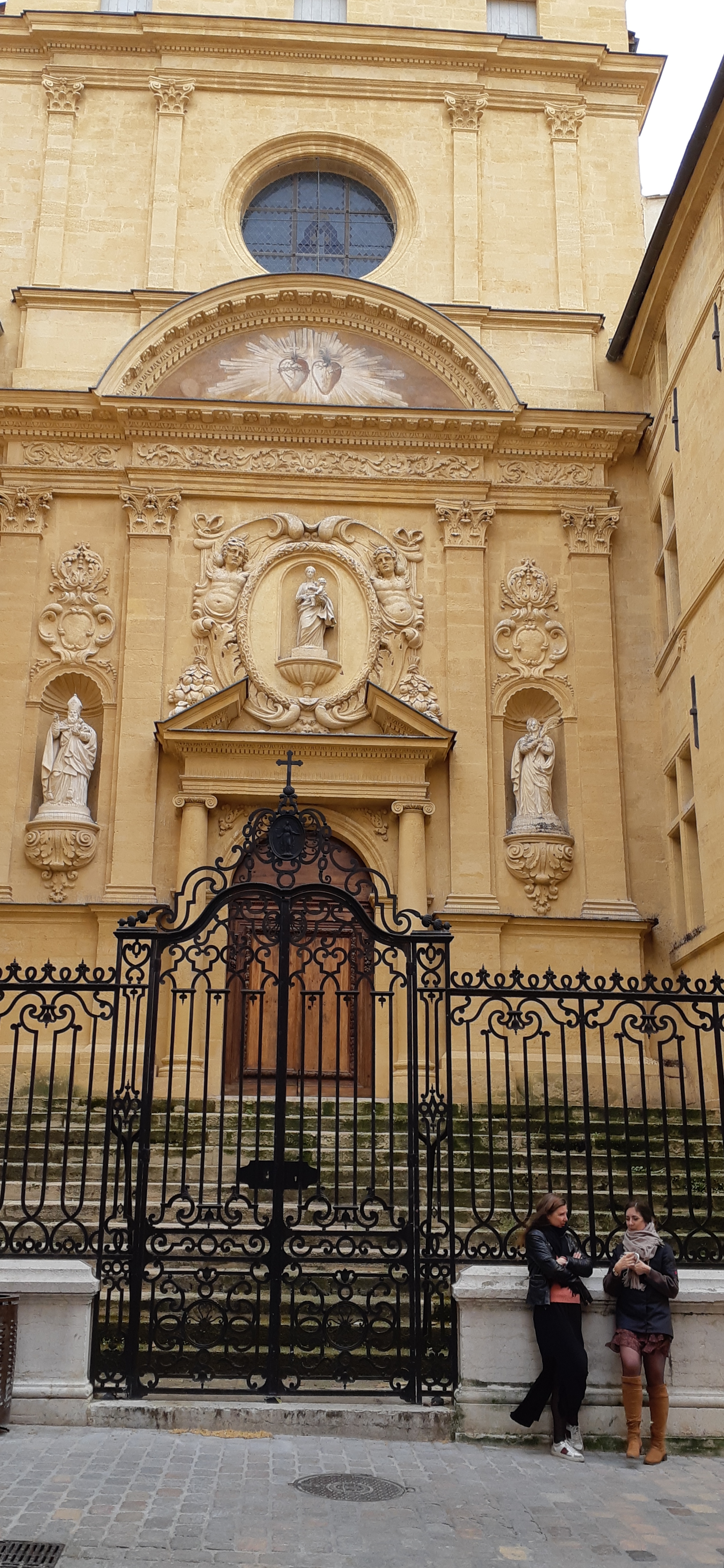
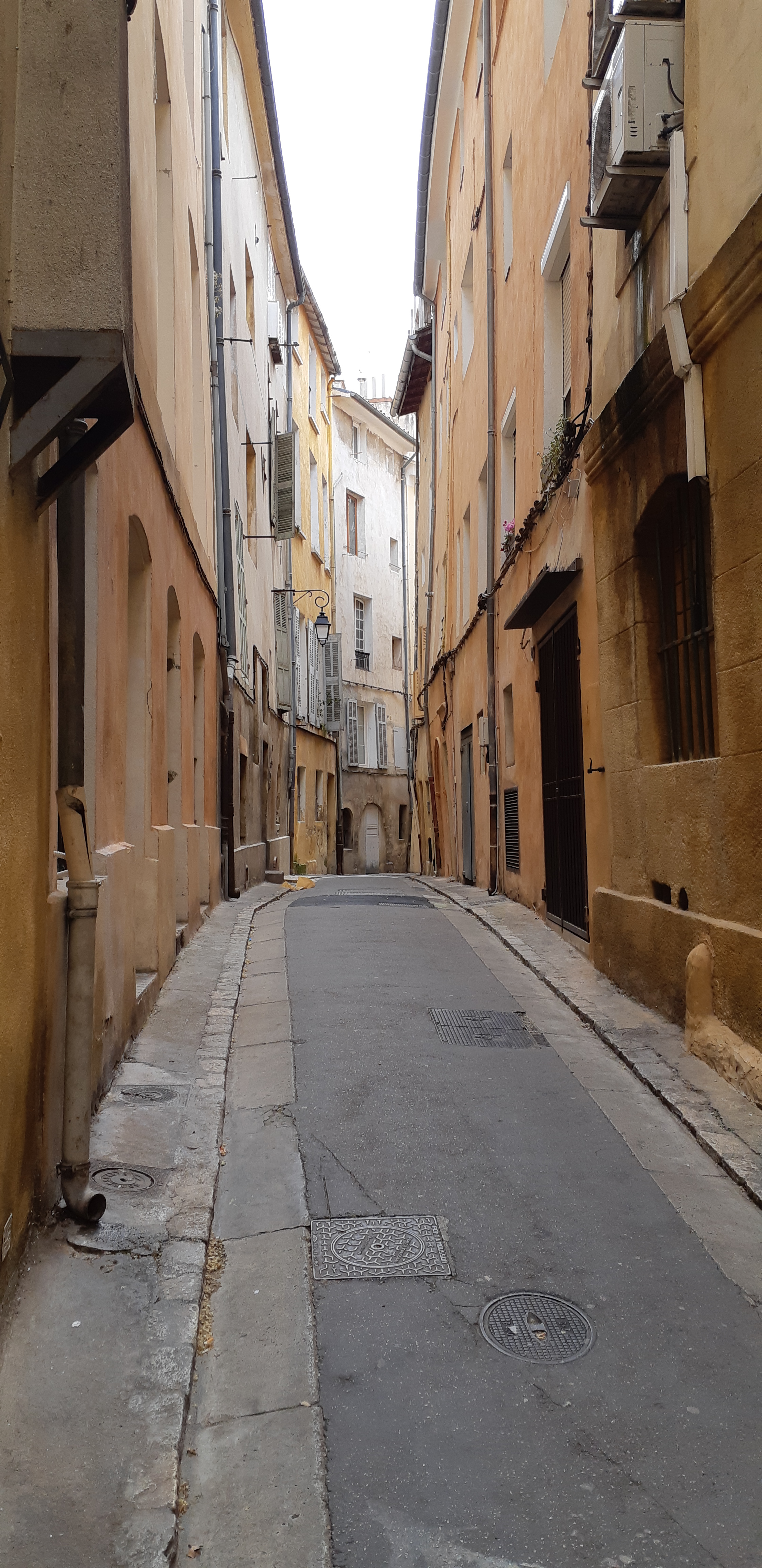
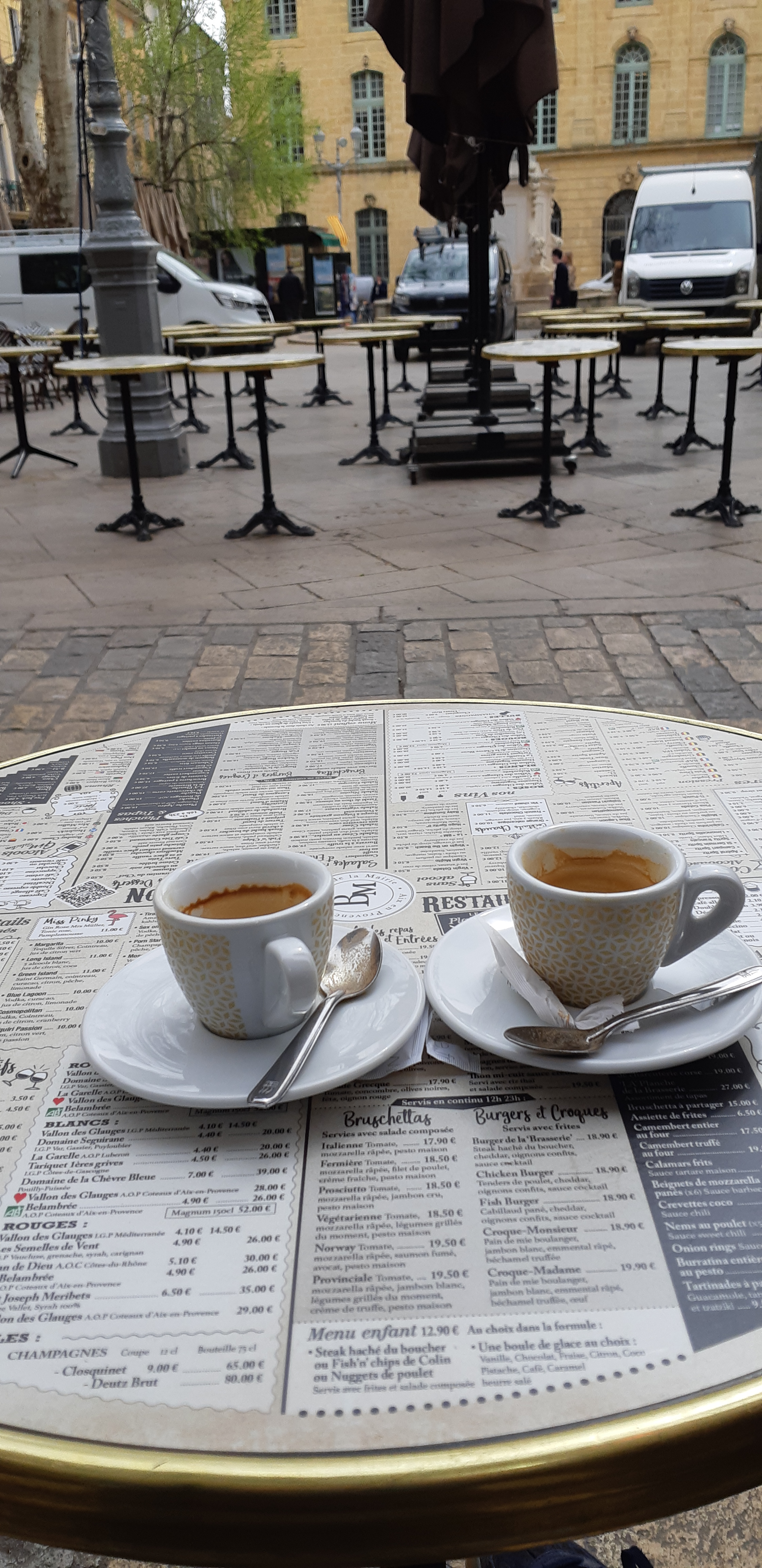
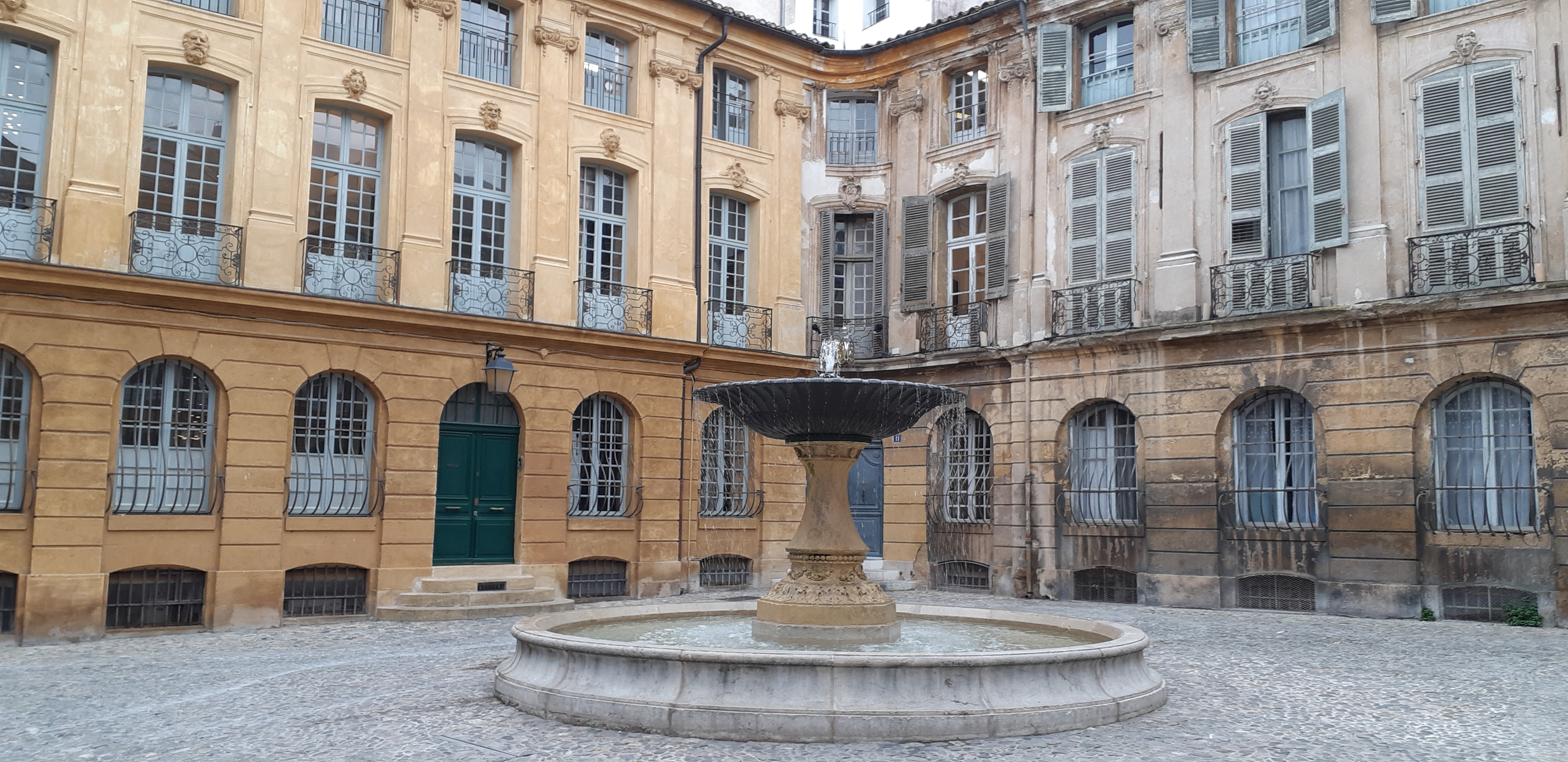
Aix en Provence is a classy place about the size of Oxford. Previously, the main routes through the centre, now wide, elegant pedestrianised boulevards now lead into the centre of town. Lined with grand buildings & bare saplings these present the best of Aix in impressive style. Moss-scragging sculptures check their hair in small fountains dotted up the middle of the old road.
Cutting through the blocks, cobbled streets lead into the heart of the town. A lively maze of cafes & fashions & crafts mixed up with attractive squares, churches & galleries. A great place to browse for hours at a time. It’s great to see the French at home and being French with few tourists to spoil the mix
The wind sends squalling gusts of tables & chairs in waves to attack the few resolute customers who have been successful in anchoring their cafe furniture to the ground.
Moving across Provence, over the Little Rhone and the (big) Rhone, we come to the Var departement above the Cote d’Axur. Here our base is the small market down of Lorgues. The land has changed as the kilometres rise. The dense mixed woodland covering the ridges & ravines now gives way to dry, craggy outcrops of rock and valley. The dominant flora is different species of pine, less dominant in height but equally impressive in terms of structure and shape. Mixed in are evergreen beech & oak with maples, chestnuts, ashes and olives. The land is flatter, more cultivated, with large château vineyards dropping off the sides of minor roads surrounding impressive signage of their bottled crop.
The layered ridges of the Cevennes away to the west still frame the vineyards of the Rhone. At Tourtour, almost a heartless facade for Hollywood rom-coms rather that a pastel painted, 13th-century settlement in a prime hilltop location, you can see over to the far horizon and count at least seven layers of receding interlacing ridges
Settlements are closer to each other and have a purpose. Yes, there’s a medieval core of narrow streets, recreational squares & plane trees & tall pastel-coloured buildings, but outside this there are manufacturing businesses, fabricators, proper activities. Traditional Provencal hexagonal tiles are made in factories throughout Salernes.
Longues is a lovely small town, surrounded by south facing hills, covered in vineyards and olive trees which are the source of much of wealth. Rather than trying to capture the essence of Lorgues in words, I’ve caught its Tuesday market day in image from setting up in early morning to the setting sun at night. It is a delightful, typically French, Provencal town.
The Cevenne is a wonderful place to visit but it can darken the soul when the land is covered in dense spreading conifers and heavy chestnut trees. The shade & the shadows hide & create monsters & ghouls to pick at your imagination. The sun fails to penetrate the foliage and gnomesteads remain undiscovered and ancient villages suck in visitors to gape at empty windows & dusty doorways. Any sign of human life own here tends to be on the topside of 60, leaving younger years to a few straggling tourists who forget that the visiting season ends with the start of September.
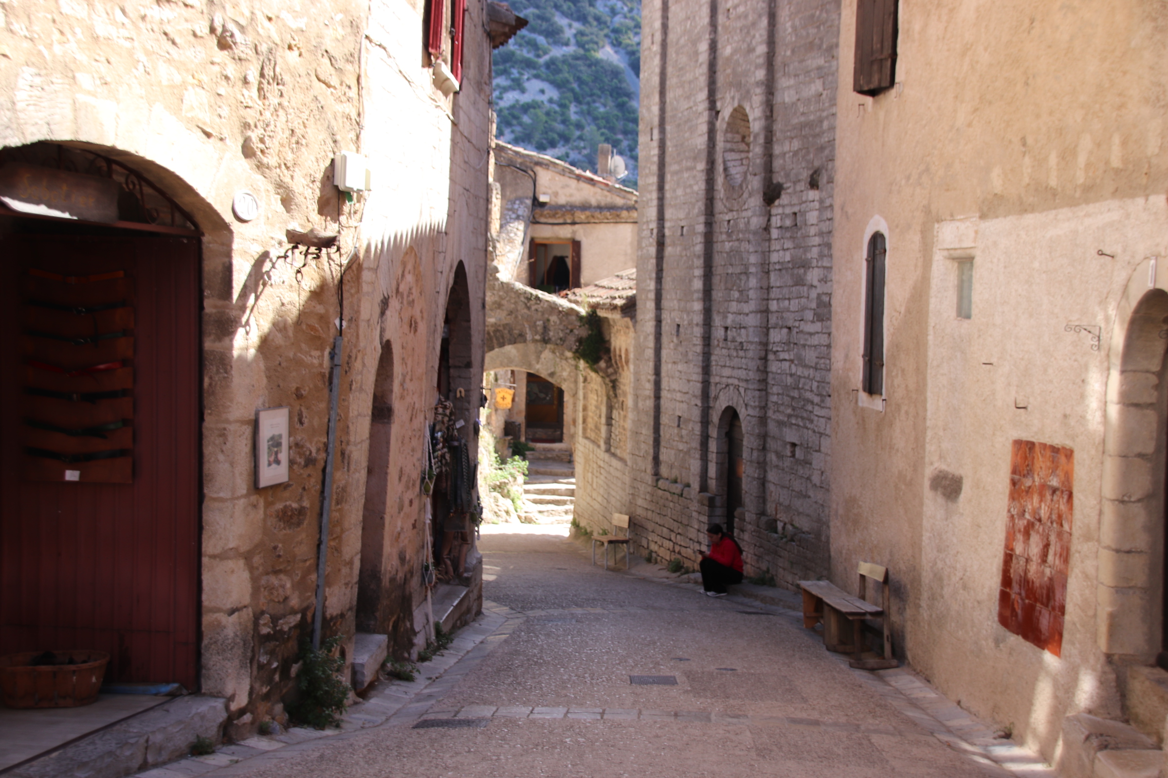
Saint-Guileme-le-Desert is a popular tourist watering hole on the edge of the Herault region with all the required elements for a gnomevillage – narrow, cobbled streets,
an ancient Abbey on the Pilgrim Route (you know all about that from previous blogs!)
evidence of high hill forts from early times with testing trails that provide a challenge to modern traiblazing athletes.
At the end of a hairpin lane, it tempts families up for a few hours. Never crammed, the limited sized carpark sees to that, the visitors spread them selves through the narrow lanes & burrows and then leave the ancients to their own haven. It would be interesting to know how many folk actually live here today. The answer may well be in double figures – a proper ghost town!
A circular route takes us into the high country. Narrow roads, so well maintained & surfaced clawed across the landscape to the far, faint horizon. Mixed woodland, girding its loins to begin the change from green to brown to bare, covers straight ridge lines and sharp-sided valleys across the spreading landscape in subtle shades and interlace their fingers like a congregation of parishioners about to settle into prayer.
The weather drops a very wet load on this land, particularly in winter when the snow & ice melt. Streams & rivers have cut & hacked away at the land over the years leaving evidence of the power at work in the form of gushing torrents, sharp ridge lines or bottomless ravines. Man does the best to cope with such obstacles, building bridges & settlements at suitable places in an attempt to tame it.
Villages are small and ancient; old lanes & trails, designed for another age when feet and the cart were the main form of transport, hug the valley sides or crawl to the top to peer over to follow the chicanes down to the distant settlement far down at the next crossing over a tumbling water course. In places, the old tracks can be seen cutting a bend or smooth modern tarmac has been layed over the ancient route, providing a wonderful course for speeding motorbikes. Settlements can be too small to even mention – a handful of houses clustered around a small church & maybe a graveyard, but some grew to be essential to folk of the time – around here it was to provide sanctuary and respite to those passing on the Pilgrim’s Trail.
St-Gervais-sur-Mare is a stunning little village that grew up in the 13th-century as a staging post on the route to Spain.
A largish village, it is dominated by the nave of the church of Saint-Gervai-Saint-Protais. Wide, ancient steps lead up past the arched doorway and historic dwellings to the ramparts & the château.
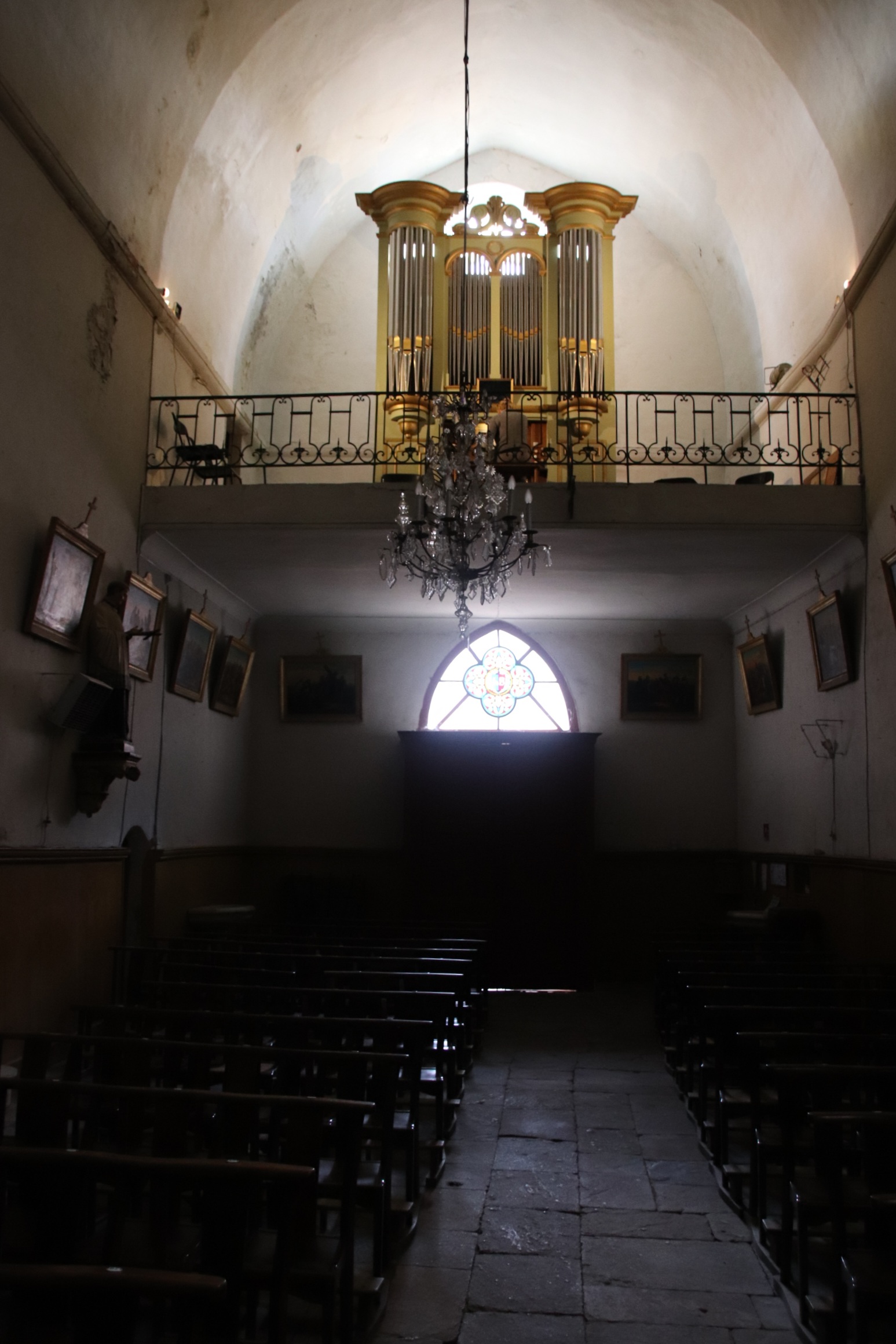
Peeking inside the historic church, an old lady follows us in and points out in local, incomprehensible French a side chapel containing a font made from the same marble as used in Versailles by French kings (I think!). She turns out to be the organist – having left through the front door, she appears up on the organ loft & proceeds to give a private rendition of some wonderfully poignant piece that echoes around this empty space, leaving emotions exposed and senses shredded.
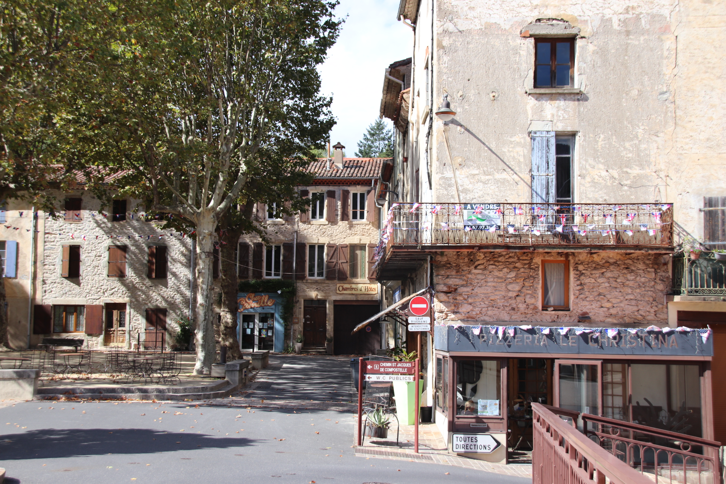
The high spot of this place is the village square. stands on above a small river that runs through the middle of the settlement.
If any place is quintessentially French, it is here.
Elegant buildings form 3 sides, with the Post Office, two bars & a hotel tucked into one corner & at the other corner of the same side a second bar;
empty tables with rather ornate chairs, cushions piled up under cover, await ’the rush’ (although, I’m not sure there’s going to be one any time soon)
a war memorial reminds everyone of the nation’s past; shade is provided by staggered plane trees – high & impervious to sunshine & showers.
To complete the scene an old couple come out for a game of petanque, chatting away and traversing across the crunching stones between camouflaged trunks, clunking their boules as they go…. all so French!
Herepian Is the neighbouring village to Villemagne l’Argentier and it’s the main centre for food, bars, petrol etc. The drive south west from Herepian takes you on smooth, gently winding roads straight into this wonderful calming landscape of layers of sharpened ridges & scraggy outcrops covered in bubbling mixed woodlands & forests of cherry & hornbeam & chestnut alongside pine & cypress. Streams & rivers have cut their course deep into the landscape creating rocked ravines & razored gorges. Evidence of human habitation is left to the occasional ruin amongst the trees or the occasional small settlement that clusters around a crossing point over a steep valley bottomed by water of some sort – a stream or something a bit more substantial. Usually this takes the form of an old, arched, stone bridge which contributes to the general air of medieval living in these closed, tight, squeezed collections of cobbled lanes & stoned buildings.
I must not forget to add into the mix the fields of vines that squeeze onto any flattish land beside the road and the rows of ancient olive trees. Especially at this time of year as leaves are lightening & beginning to start their autumn tan. It is the time to get the harvest in and the roads are full of small trailered tractors, tonka type mini trucks, that fit neatly down the rows of straight-edged grapes, clogging the route to the local cooperative’s vats & casks.
Many state that Olargues is one of the prettiest villages in France. I’m not sure about that. From a distance it certainly looks pretty. Yet, inside the walls, it’s narrow passages & lanes inhibit vehicular traffic and it’s ancient buildings ooze history and passing time and seem to have sucked the life out of the place.
It feels a bit like a ghost town – there is little evidence of human habitation or even touristy visitors (at this time of year, anyway). Maybe it has more life when the sun shines!
St-Pons-de-Thomieres is further down the road and another village on the route to Spain. The church, which gives the place its name, is huge and must have provided relief & strength to those on the journey.
Pezanas deserves a mention on its own.
This picturesque town has a rich history & culture dating from Renaissance times. A fair has been held here since the Middle Ages. Wander its cobbled streets to discover private mansions and museums & galleries, all sprinkled with generous doses of artists & craftsmens’ street stalls and small independent shops selling good quality art, clothes & crafts.
It seems like ages since I last blogged on my travels and even longer since I visited ‘La belle’ France. This autumn trip takes me from the Cevennes on the south east area of the Central Massif, across the Rhone to just north of Toulon to a market town called Lourges and then north to friends near Manosque – all excellent wine growing areas you will notice!
My love affair with France goes back decades but I was introduced to The Cevennes by my dear friends, the family Friends, who completely by accident, had discovered Barjac when they broke down on the autoroute and they had to have it towed to a campsite outside the town where it still remains, drawing families & friends for memorable holidays ever since. I have countless memories of my girls & pals splashing & swishing about in The Gold River & the streams & lakes in the dry Provencal landscape, canoeing down the Ardeche or the Ceze and meandering drives through the Provencal landscape for a night visit to Avignon or a day treat to Saint-Remy-du-Provence, all indelibly ingrained into my very being.
Back at the hacienda, after food had been consumed the Cote du Rhone continued to flow and we would lie back and stargaze & count the numbers of shooting stars on show each night, absorbing the aroma of wild oregano & rosemary and the wafting lavender fields that were grazed by the breeze and sifted over our receptive senses in a constant perfume. In the darkness the clear outline of the distant Cevennes could be always picked out against the glories of the spinning stars. During the day these layered, straining landscapes provided a constant backdrop to everything that we did, offering the possibility of adventure and excitement, but always too far away – until today, that is!
This trip starts on the edge of the Cevennes National Park just outside the small village of Villemagne l’Argentier in the Languedoc region of France about 30 km north of Bezier.
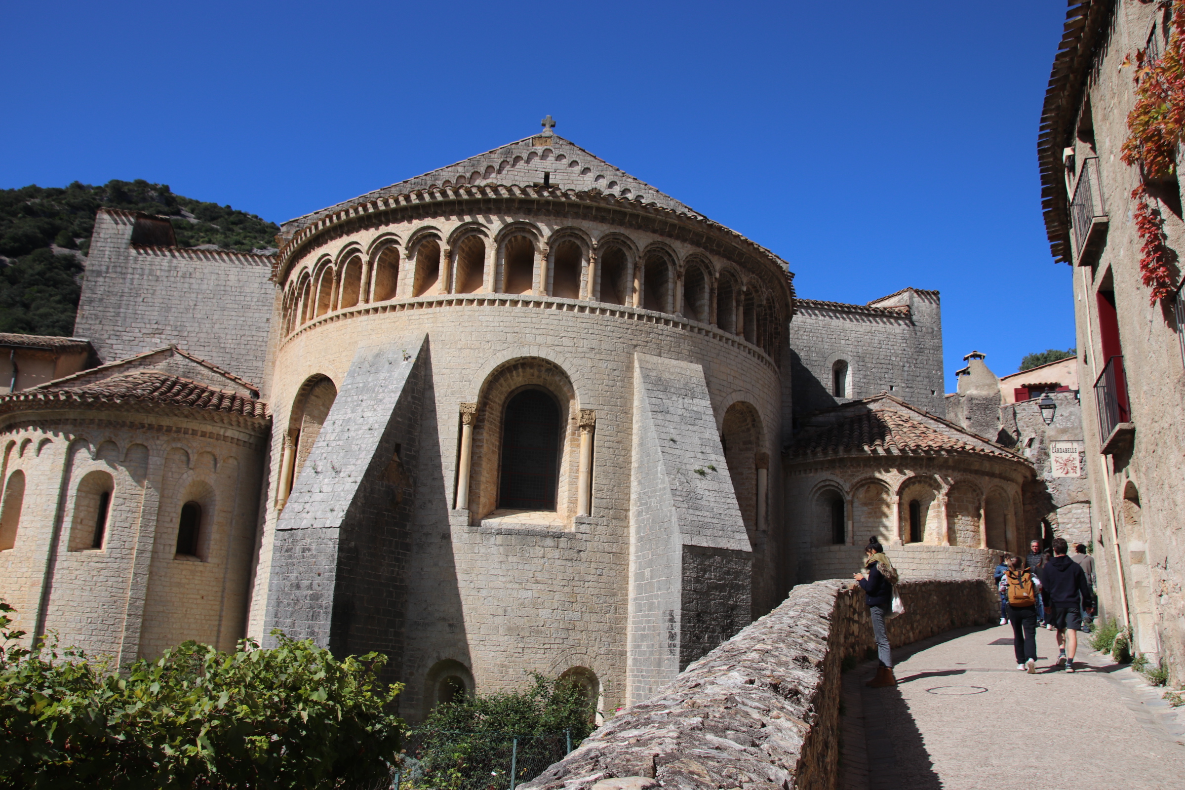
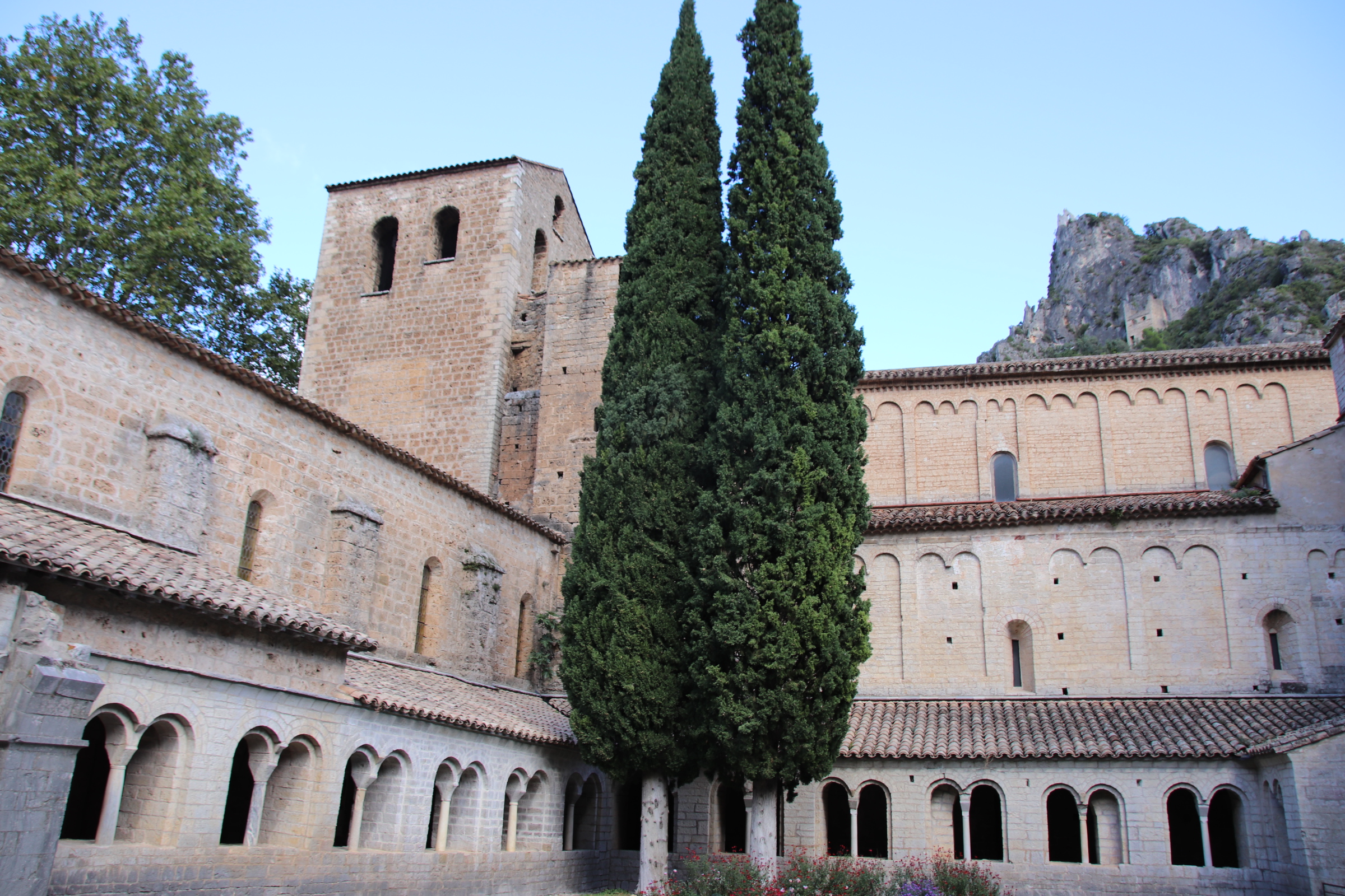
Established on the banks of the Mare River in medieval times, this ‘Abbey city’ lay on the pilgrim route to Santiago de Compostela & provided rest & refreshment to pilgrims on their way to Spain. Three buildings are listed and still standing & in use – the 11th century Church of St Gregoire,
the 14th century Saint Majan Abbey
and the 13th-century Hotel des Monnaies, now used as the Town Hall.
Over the centuries the Abbey has been the main force in the village and across the surrounding landscape. Wandering around the narrow lanes of 13th-century buildings little has changed since those early days – the only thing to suggest that times have moved on is the shiny gleam of modern vehicles parked outside cold, ancient facades.
A five minute walk across the river on the old, red-rusting bridge and up the lane into the hills, amongst the steep hillside of trees & shrubs lies our home for the week – a great base from which to explore the Haut Aquitaine region in general and the Cevennes in particular.
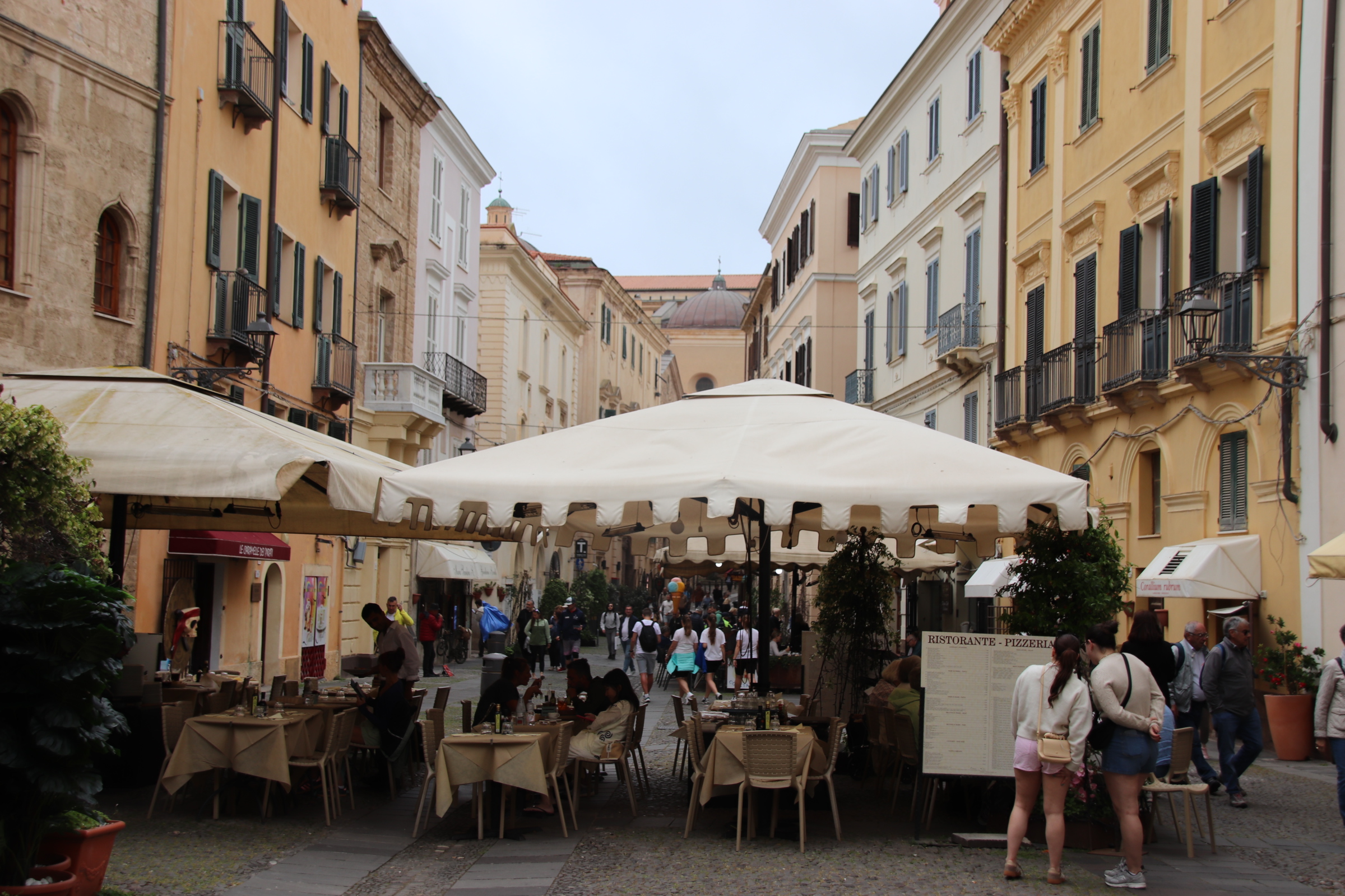
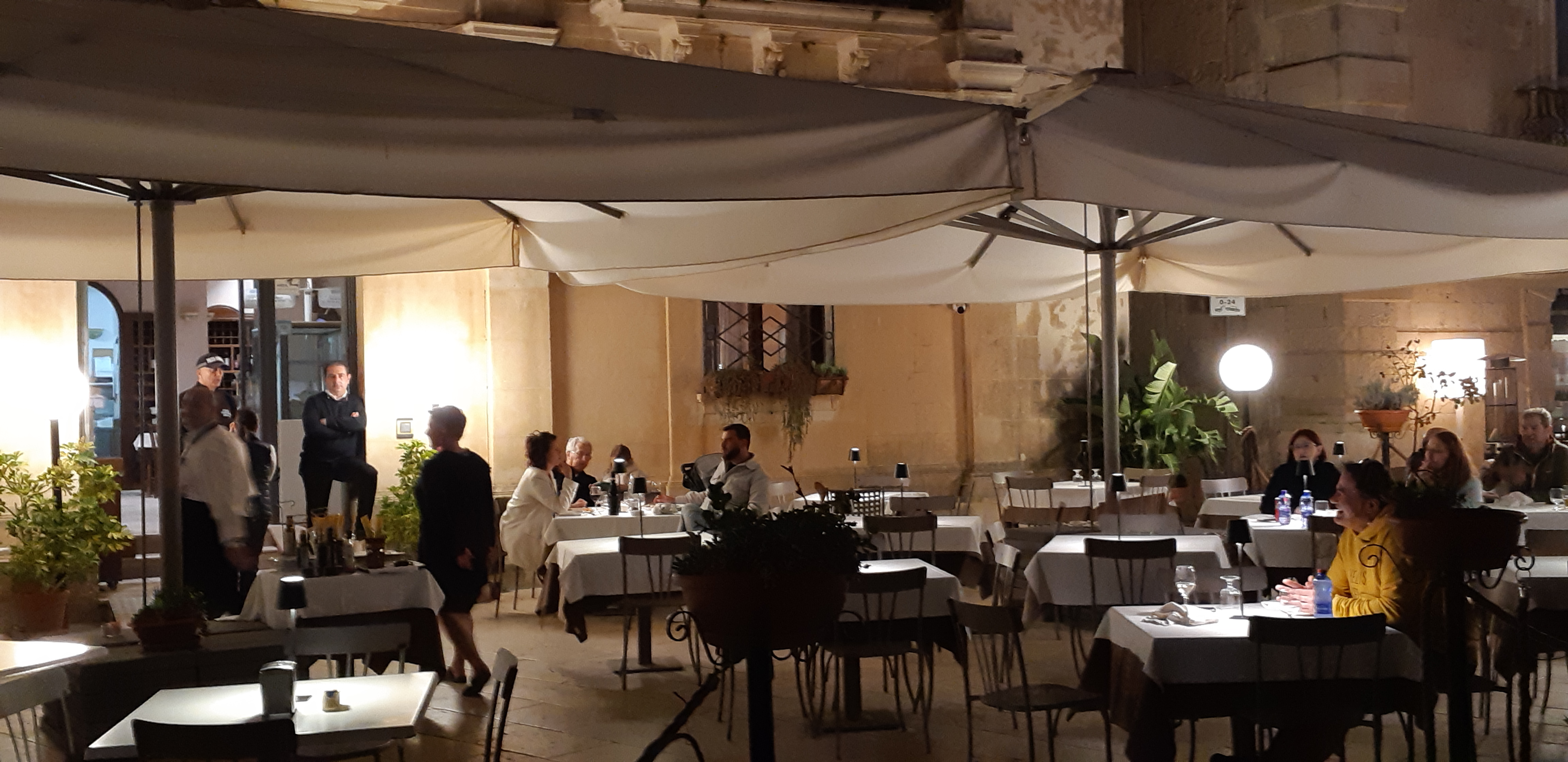
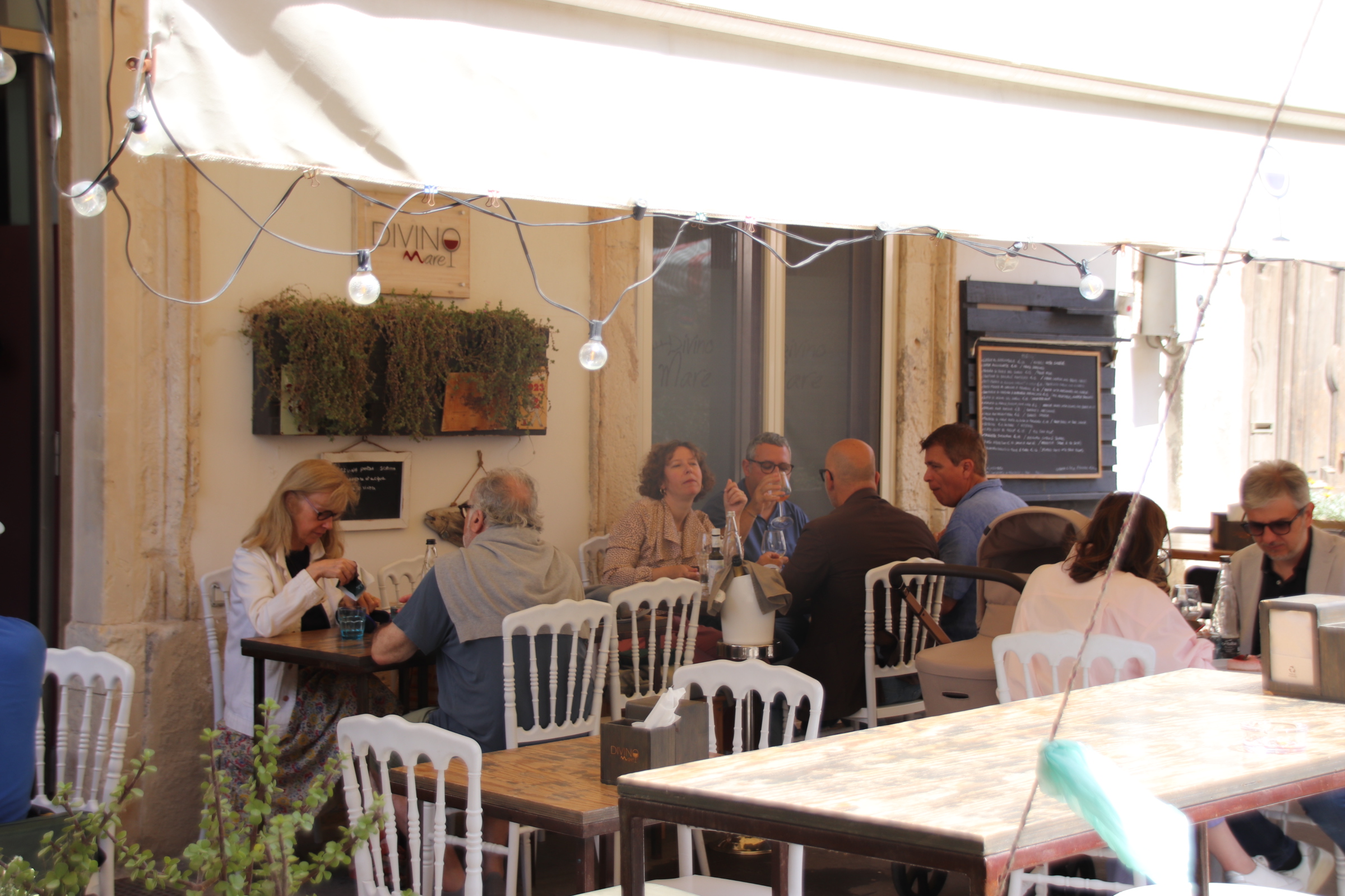
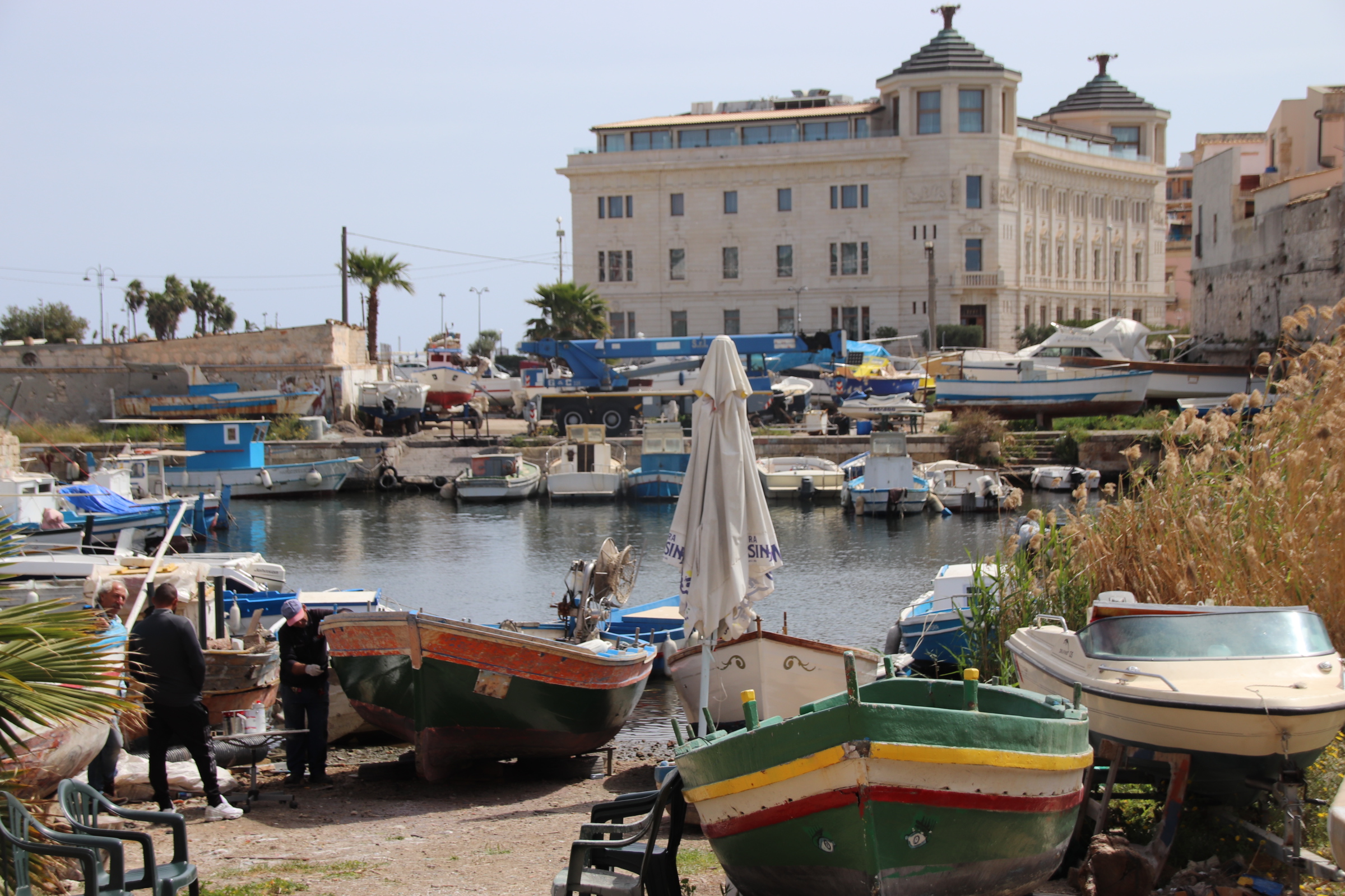
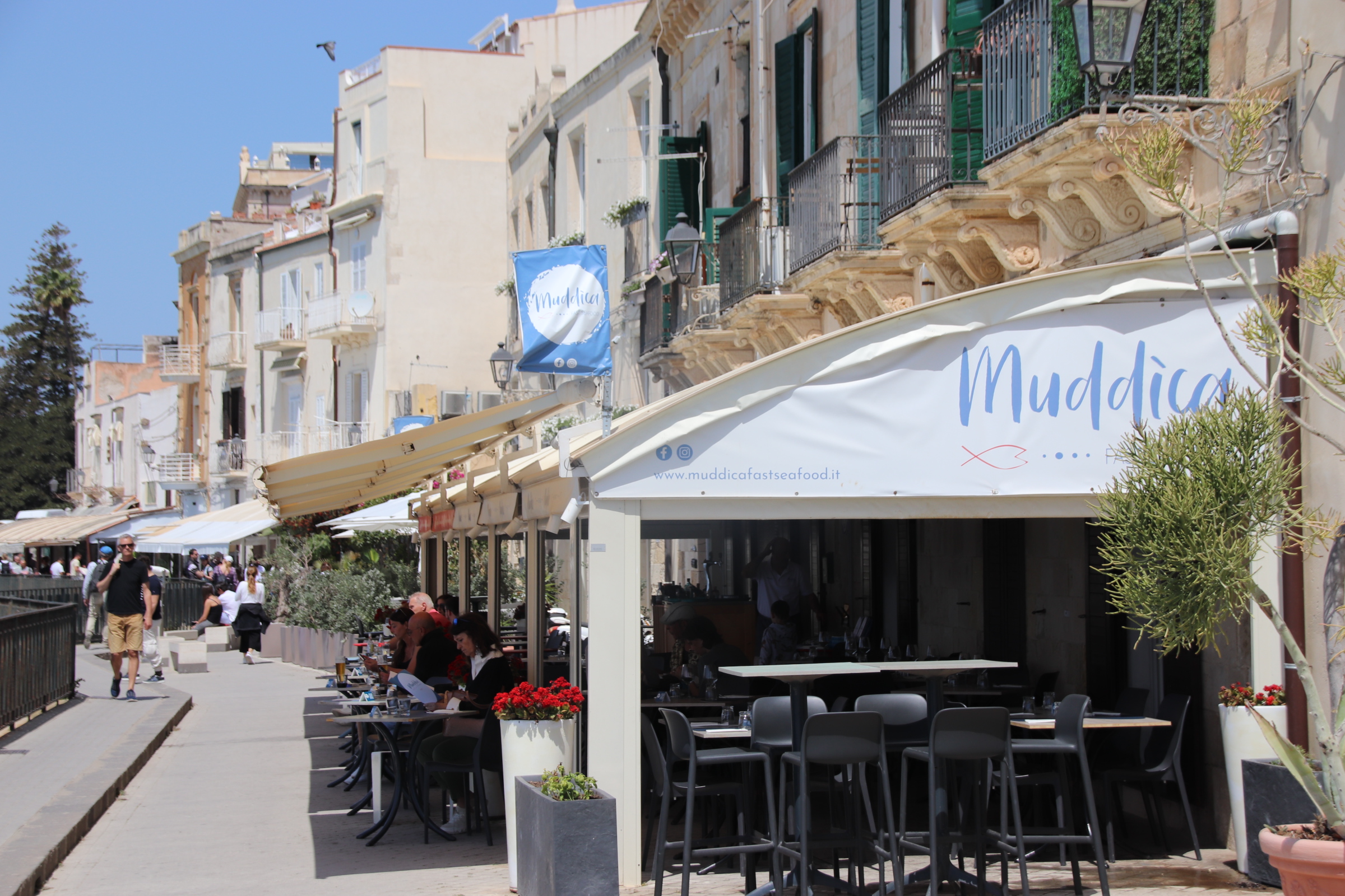
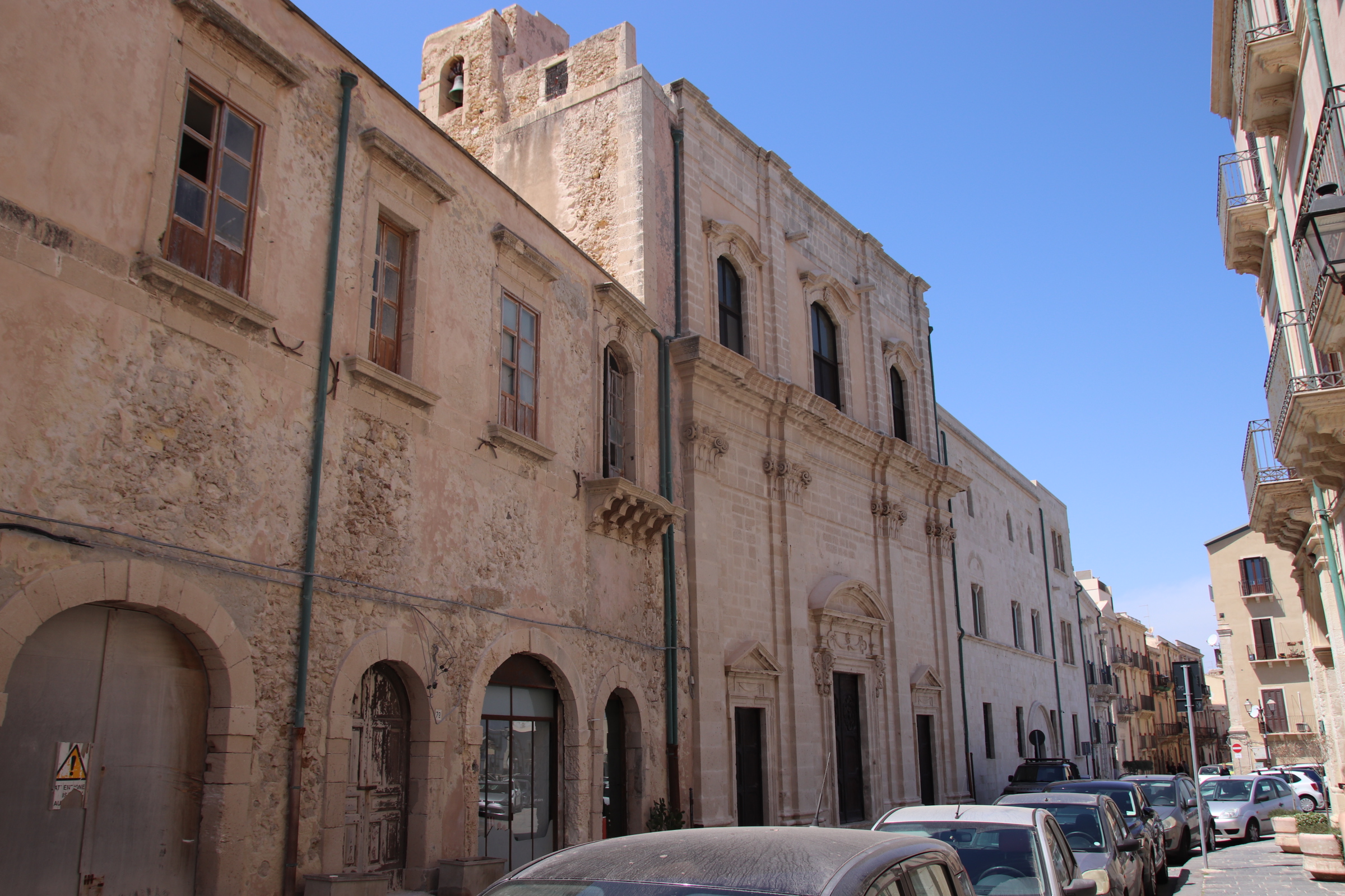
So now I can wax lyrical about Syracuse & the Island of Ortigia. The streets are scruffily magical (or magically scruffy!), full of history & atmosphere. Within its deep ravines of shadowed narrow streets a huge variety of high-end restaurants, local family venues, quirky eateries, bars, cafes, bistros, street vendors cater to all visitors & all pockets.
There are so many different styles of food and all reflect the city’s island location with most offering only a single non-fish option be it pizza or the typical multi-course Italian menu. We explored the many crannies and found a different one every evening and dined in style at each one. The cost and quality were excellent with the obligatory bottle of Nero d’Avola being the most expensive item at around 25 euros
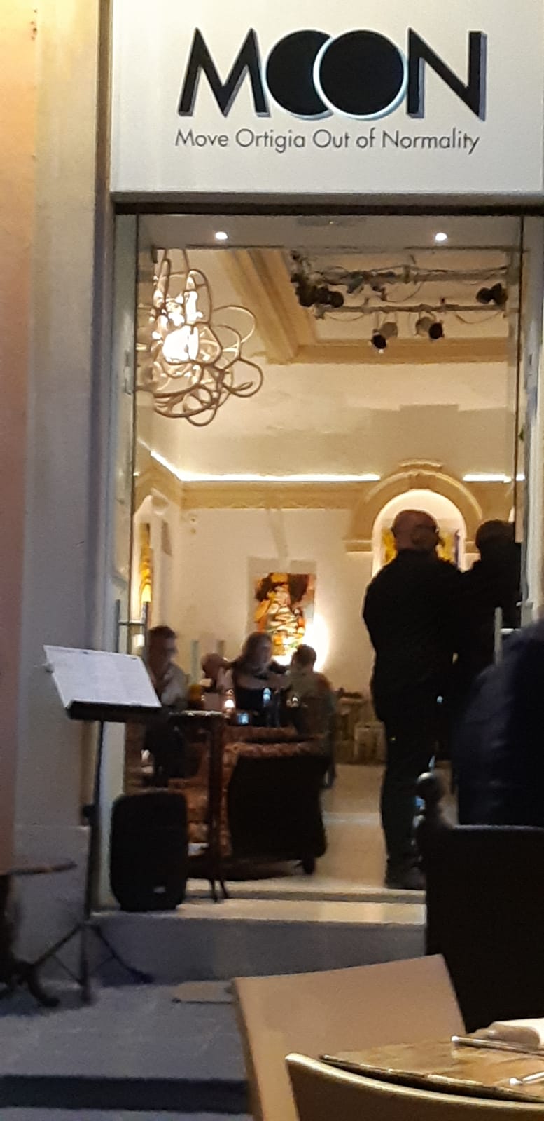
A vegan meal at Moon in startling environs & intriguing flavours:
In Taormina it was spaghetti & clams and Margarita pizza. Then pine-crusted leg of rabbit.
Syracusa started well and carried on at a high level – Sicilian meat balls in tomato sauce and battered red mullet, charcuterie board with meats & cheeses, strips of beef with rocket & parmesan, swordfish pasta.
Every experience was so good and of the highest quality served by friendly, knowledgeable staff and priced very reasonably.
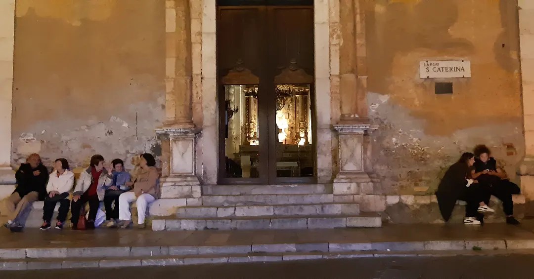
Afterwards, feeling very content, it is a slow walk through magical streets to the room, pausing in Duomo Square to take in the last few frames of some black & white classic of Italian cinema beinb shown on a outdoor silver screen.
To view full-sized images tap above: ‘Read on blog’
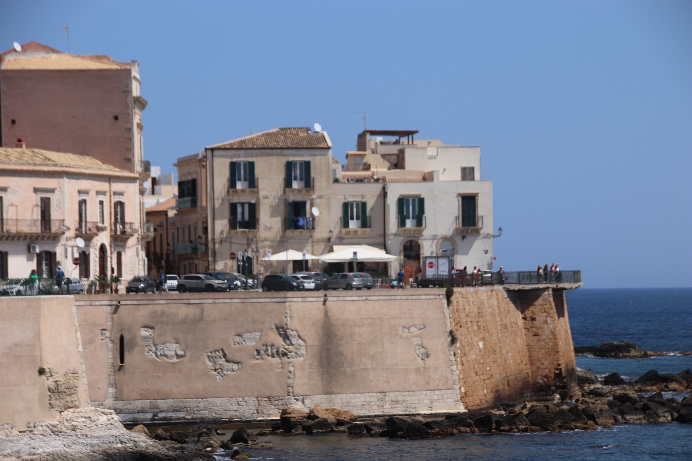
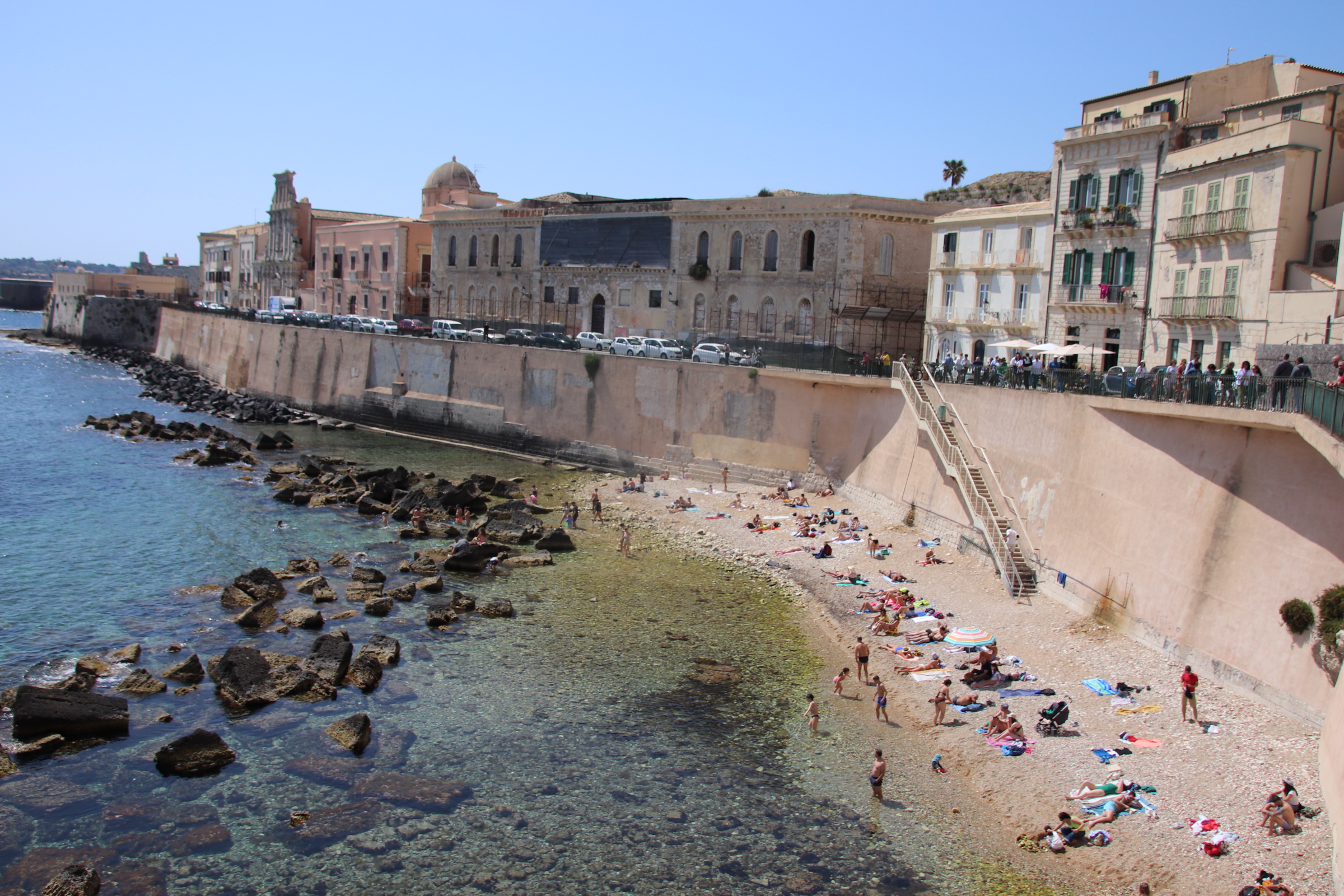
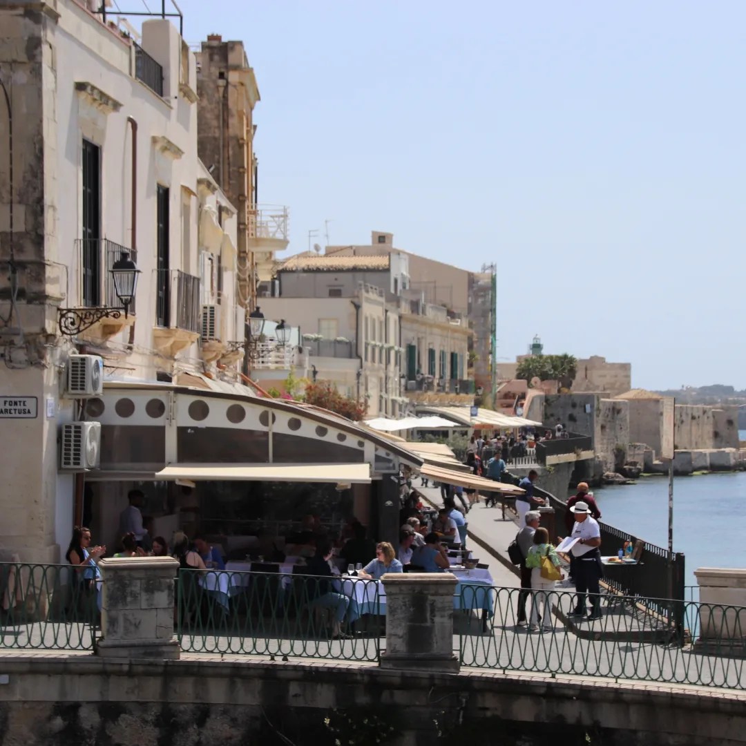
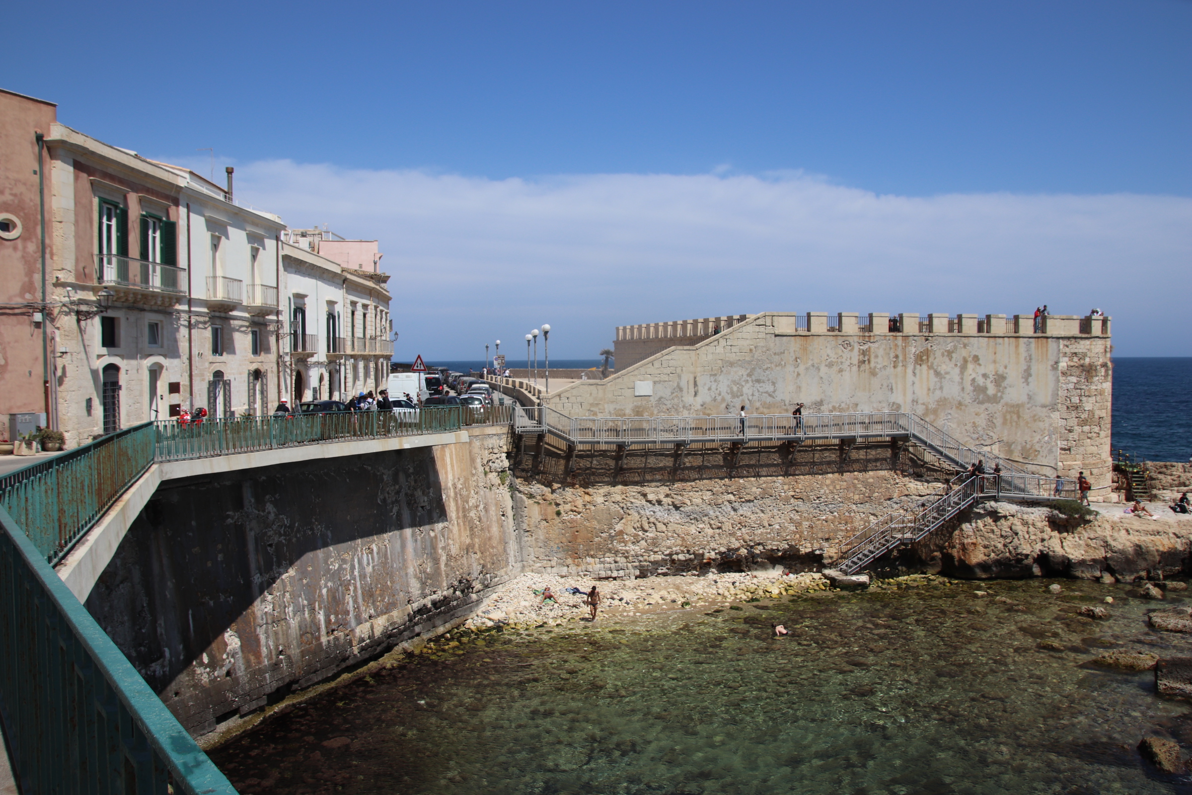
Having explored the main tourist route with its incredible line of imposing buildings, fountains & springs, squares, palaces, galleries, museums, and adventured into the mazed grid that makes up the Arab/Spanish & Jewish Quarters, it is time to explore around the edge of this historic island – a route of about 3km.
Progressing clockwise, the turquoise waters of the ocean are always to the left, the high-rising temperatures deceptively cooled by off-water breezes. On the right, weathered facades blankly face the centuries of storms & battling ships, reflecting the character of the neighbourhoods that shelter behind these protective shells.
Castello Mariace is at the southern-most tip of the island. Here the route turns for home along the bars & cafes on the raised promenade.
At the Spring of Aretusa, the Grand Hotel stands imperial above the new construction work taking place down on the water. This leads in a wide walkway along moorings designed for yachts, small liners & supercritical until more normal folk sort out their nets, bookings for their island cruises and boat hires.
To view full-sized images ‘read on blog’ (tap top right)
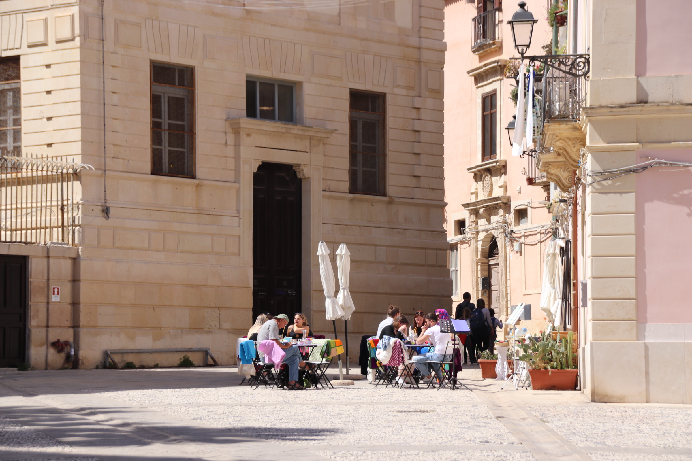
The island of Ortigia runs in an inverted teardrop shape from north to south. Whilst the main tourist drag of palaces, piazzas, grand buildings & the duomo takes the visitor slightly to the left of the central axis, the maze of narrow streets in the bulging land to the right is there to be explored. These dense areas of alleys, tenements & courtyards are shared by the Arab & Spanish Quarter to the north and the Jewish Quarter to the south.
The contrast between east & west is very apparent. Streets are even tighter. Housing tends to be in terraces of smaller properties, punctuated by small-fronted shops & cafes.
A few squares & piazzas are present but they tend to be much reduced in number & size and lack the grand accompaniment of statues & crests that boast power & influence over to the east.
These streets were inhabited by a lower strata of Sicilian society -shopkeepers, craftsmen, sailors, fishermen, money lenders. Certainly, they are not such a draw for the tourist as the cobbles are empty of raised iphones & gaggles of clucking visitors. It is all rather calm & peaceful in here. It’s on a much smaller scale than elsewhere; an area where one can appreciate a different feeling to the city.
There is little to differentiate the two quarters. Maybe there is more of a Spanish/Moorish feel in one, with balconies of intricate metal & colourful mosaics more in evidence. Occasionally, street gates are left open to display cactus strewn courtyards and open quadrants.
The main way to know you have entered the Jewish Quarter is the sign on the alley, along with obvious features of life like the Jewish baths.
Working a way through this labyrinth where palaces sidle up to small tenements and plain-fronted churches, makes no difference to where you emerge – somewhere on the coastal defences to the west of the island.
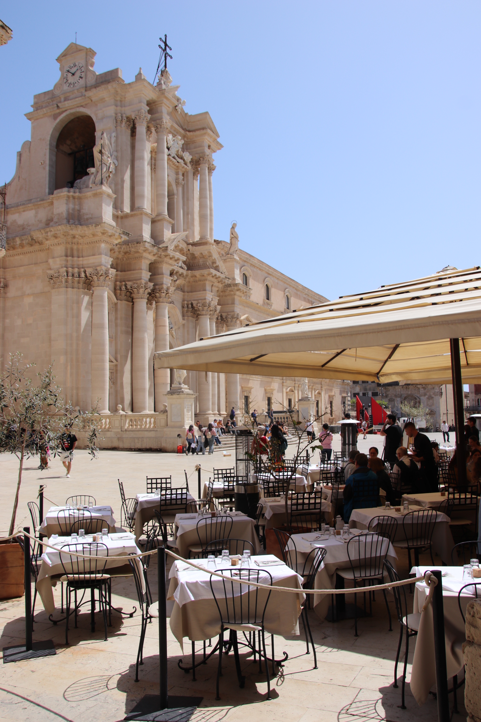
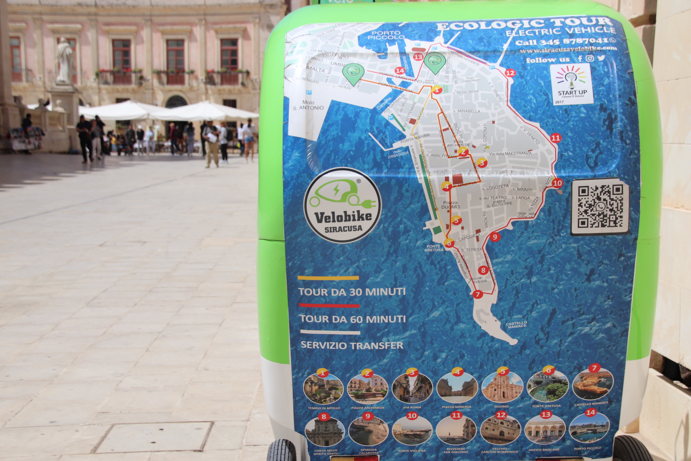
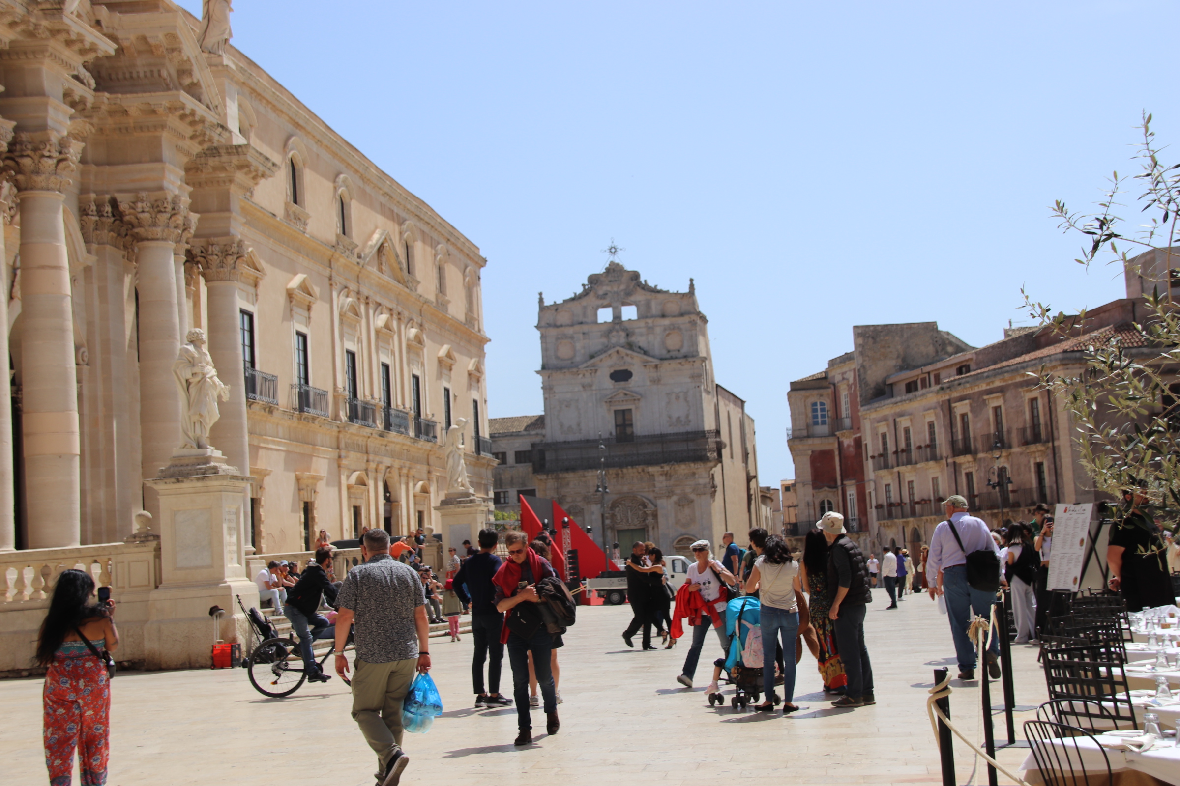
The centre of the ancient city of Syracuse is firmly rooted on the Island of Ortigia, connected to the mainland by a couple of short bridges. It is famous for its Greek & Roman civilisations and has been of strategic importance for world powers since medieval times – Arabs, Crusading Christians, Holy Roman Emporers, Spanish & French & Italian dictators and Mafia gangs. All have come and left their mark.
Ponte Umbertino is the main artery into this ancient place. A Roman grid suck the visitor away from the bright sun into a maze of deep, darkly shadowed streets that have cut deep through the storeys of centuries of imposing, fading buildings.
Palaces, churches, villas now home to countless museums & galleries, create the shadows -a grid of age-weathered necklaces. Other grand dwellings of merchants & soldiers & city grandees gaze down on those below from high lofted crests & statues.
The adventure starts by crossing the narrow stretch of water and girding the loins with coffee at the small huddle of cafes that nestle at the root of the entrance to this history before entering the cave of ancient delights.
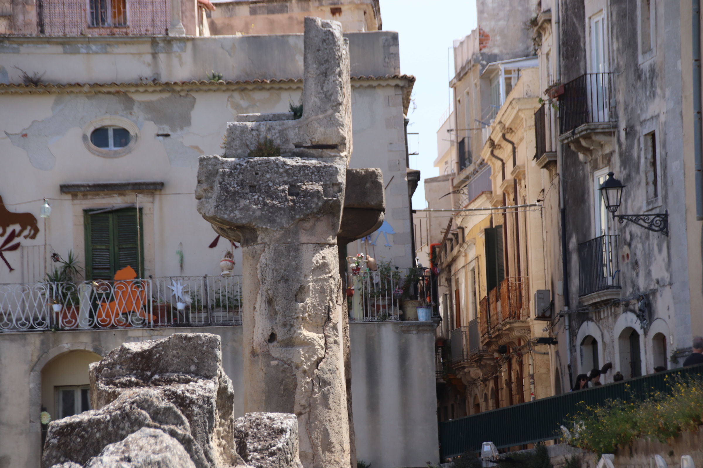
The Temple of Apollo, considered to be the oldest Doric temple in the world, is the gate keeper to this ancient world.
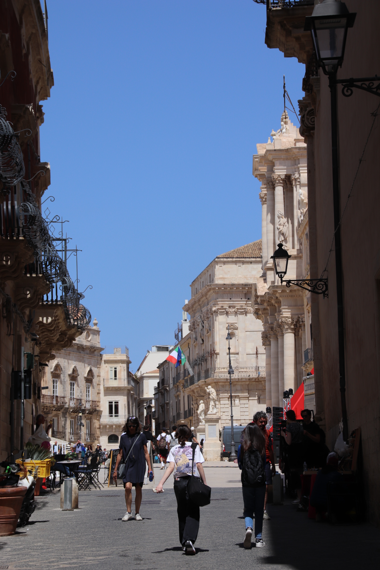
The Via Dione draws us along the shadowed canyons & ravines that link the best- prized elements of this aged city. This is the main tourist drag and leads to the ocean on the south side of the island.
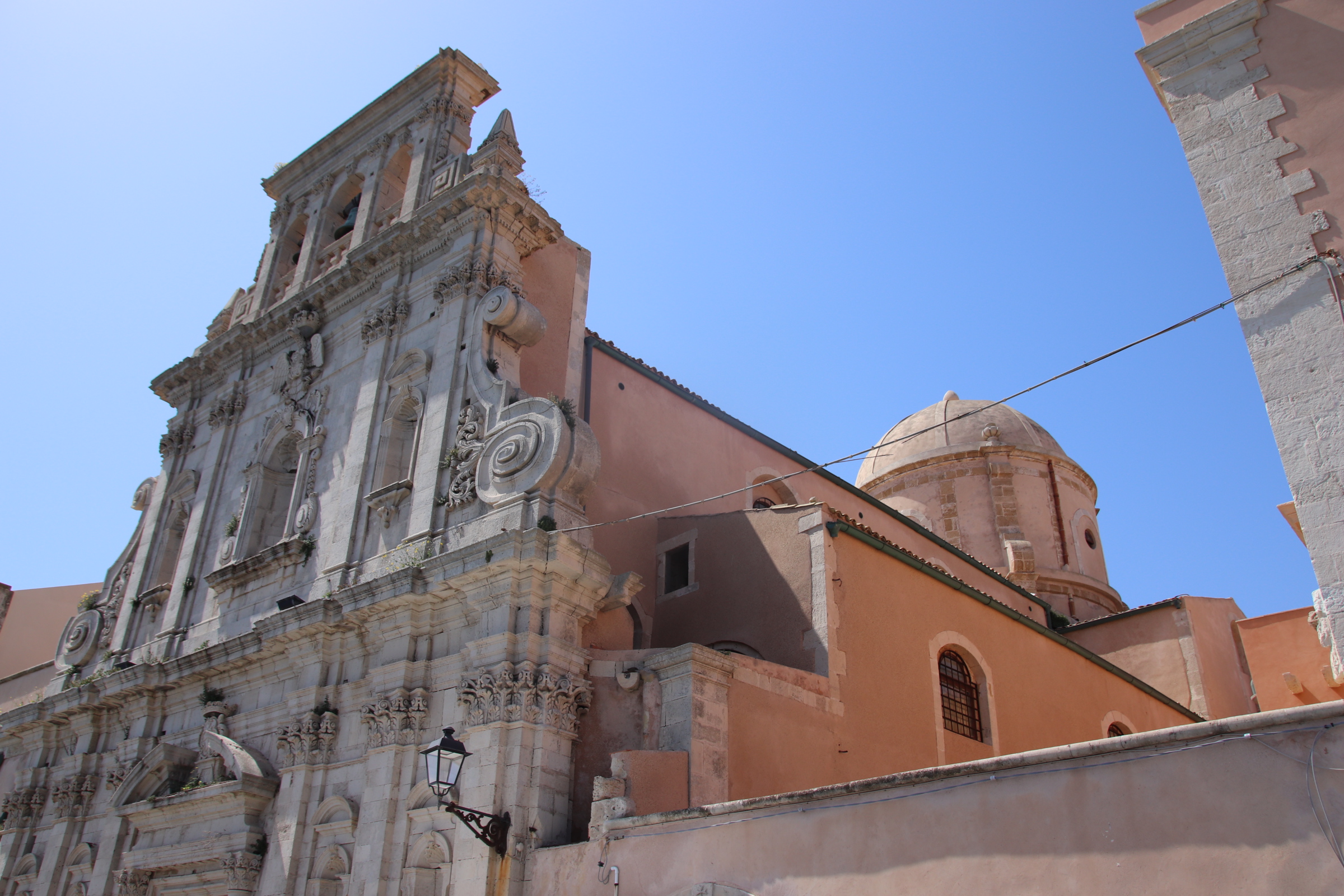
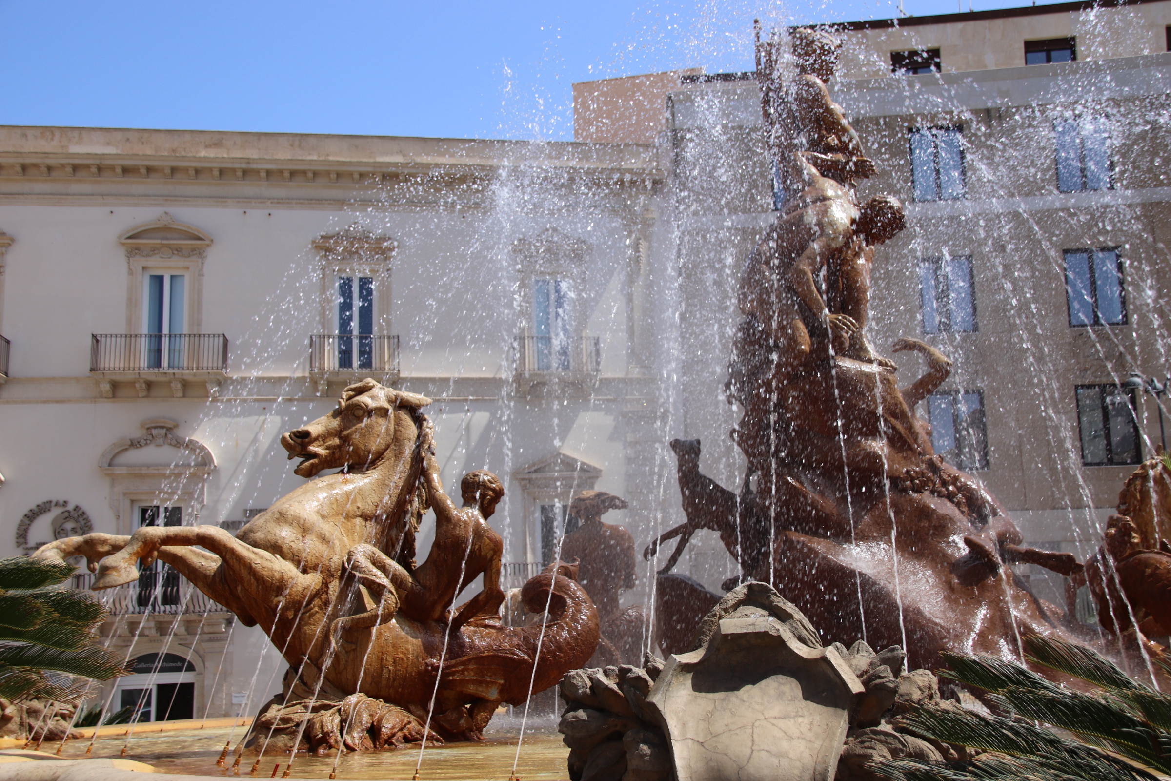
Archimede Square (yes, the famous man was born in the city) is the location for the Fountain of Diana. Four palaces, dating from 14th to the 19th centuries form the four sides of the Square. Each has now been converted for use by numerous institutions. In the centre the Fountain, created in 1906 symbolises the history of Syracuse from medieval times to the present day.
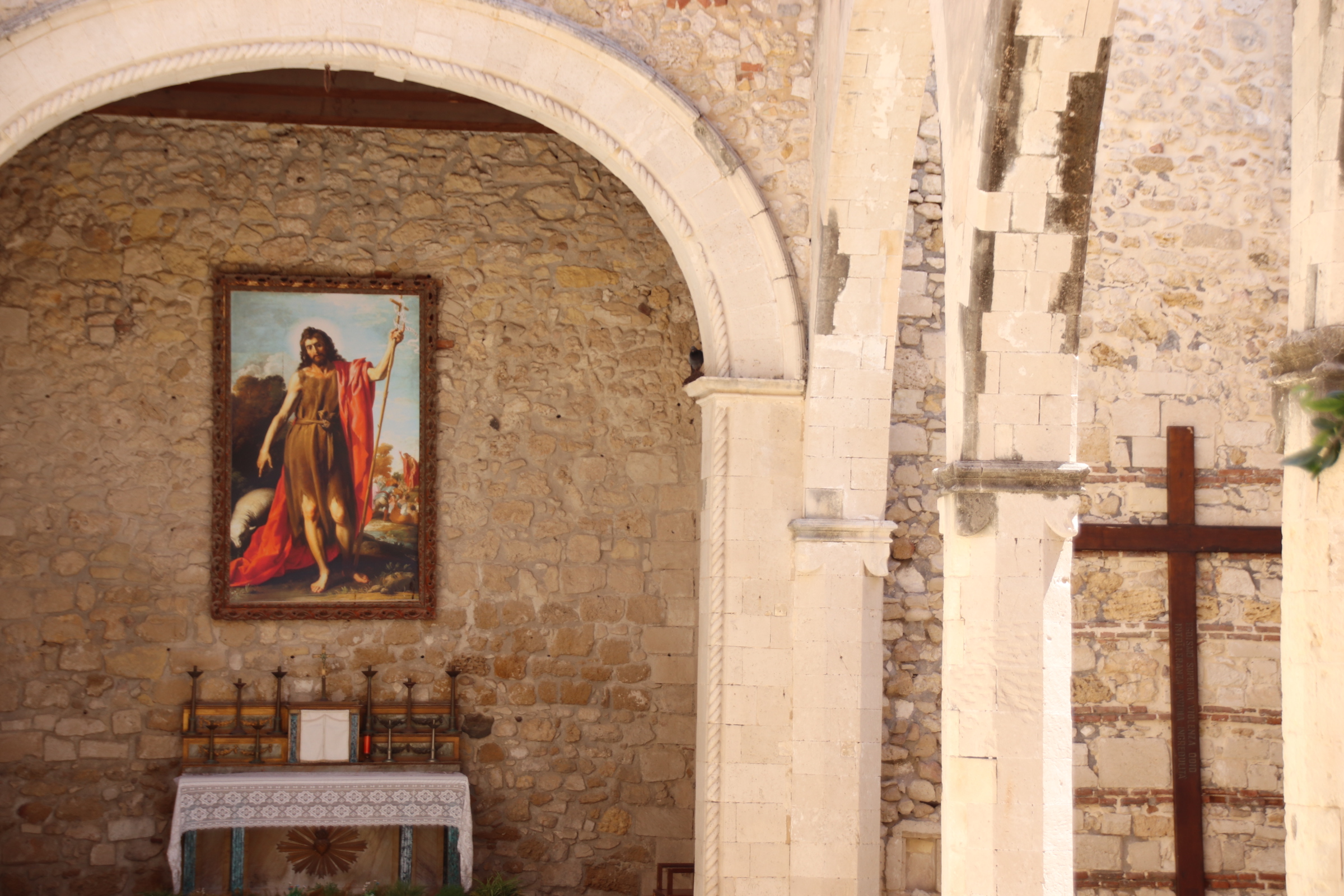
The Duomo & Duomo Square – so impressive; the spiritual heart of every Italian city!
The Spring of Aretusa is considered to be the historical centre of Syracuse. From here there’s a great view along to the Castle of Maniace at the tip of the island.
I am back in my beloved Sicily. This time exploring the south of this wonderful island – full of history, culinary delights, fantulous wines, cliff-clustered, white-faded villages, turquoise waters, dusty, characterful facades mixed in with grand fresco-blinding hotels & villas; and always against the backdrop of smoking Mt Etna, and the rippling waters of the Mediterranean ocean.
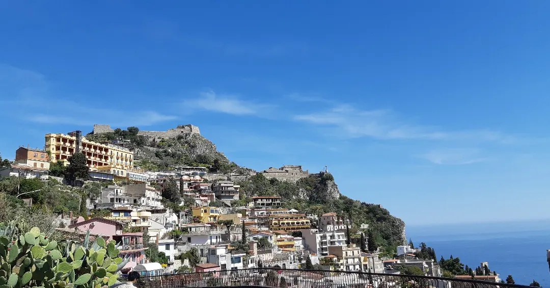
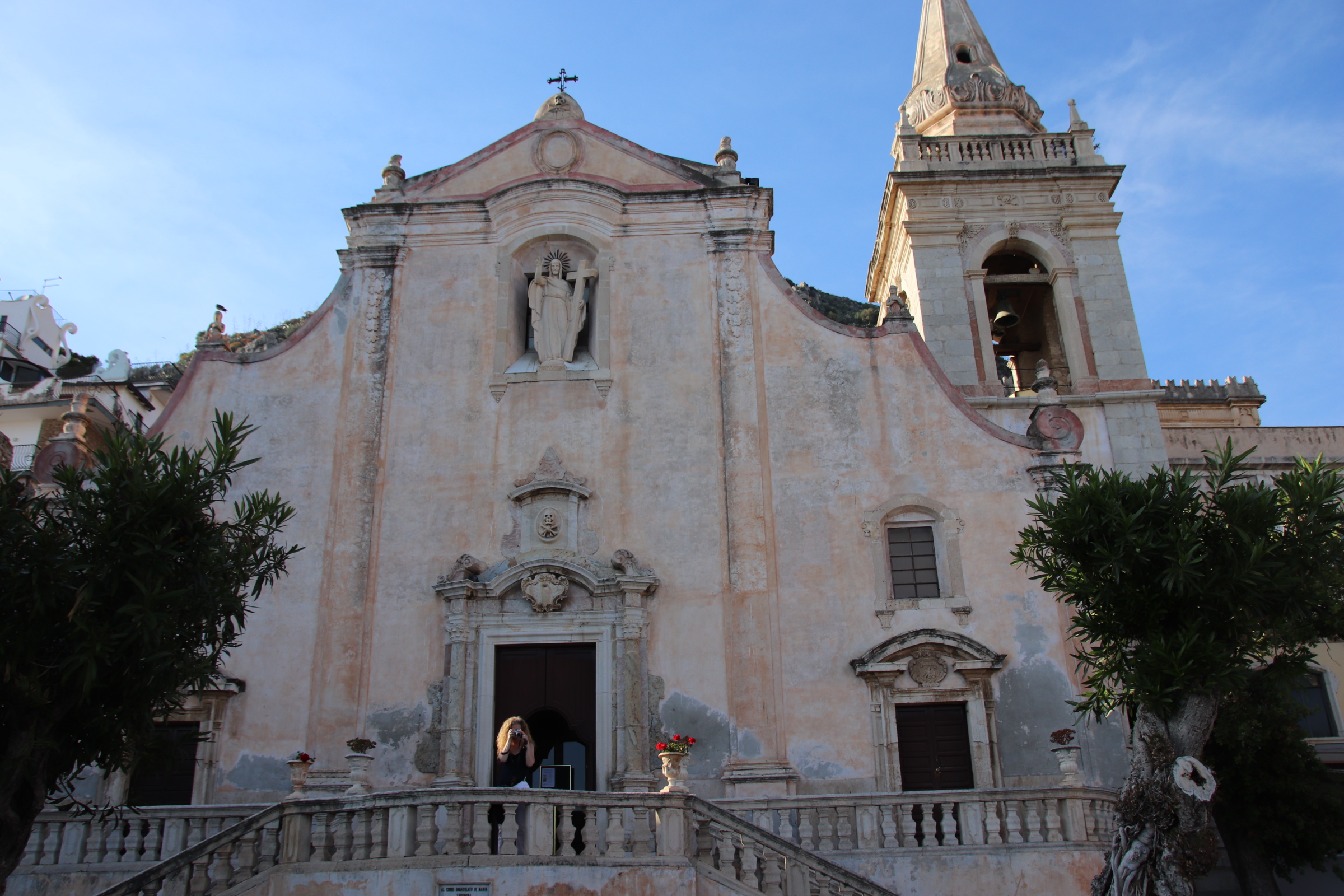
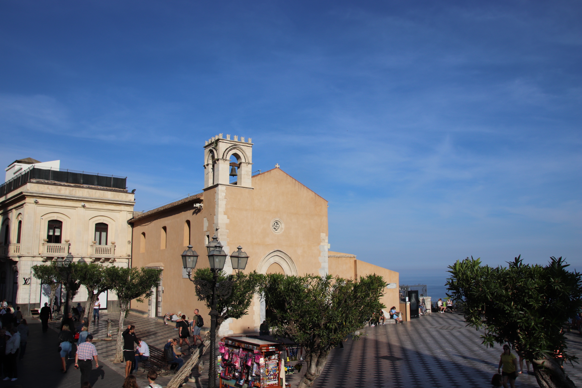
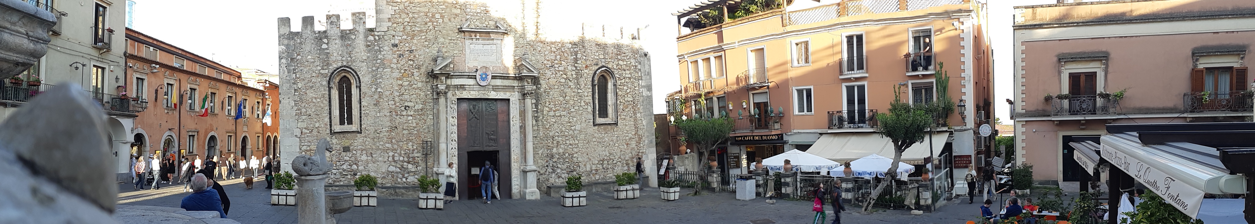
Taormona is a jewel in the Sicilian, née Italian, crown. Developed over centuries, it has a feel of wealth & opulence. The town on three levels, dates back to ancient Greece. It can be summed up in three words – steps, ancient steps, and more ancient steps! The one sop to modern living is a cable car that transports visitors to and from the beach resort to the old town at the top of the first cliff.
Tucked up high on a large pillar outcrop is the protective castle and the village of Castelmola.
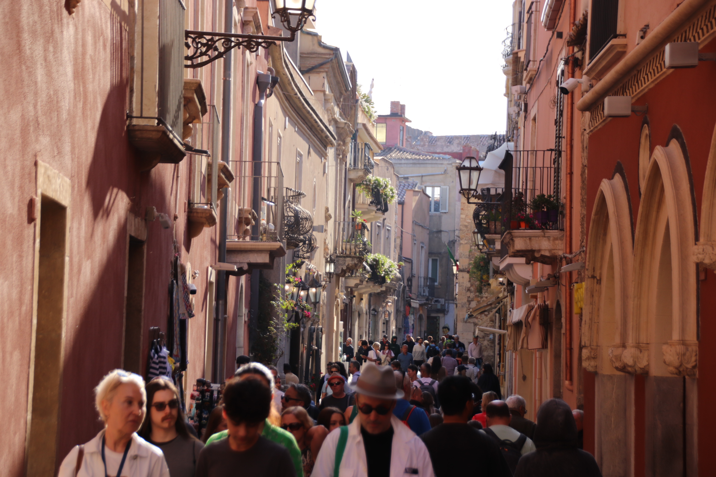
Taormona itself is basically a single cobbled street running between 3 ancient gates with narrow stepped alleyways diving up & down to either side. Ancient churches, piazzas & palaces dating back to medieval times rub shoulders with high end fashion shops, eateries & posh souvenir establishments.
During the day dragon’s of young visitors clog the main street.
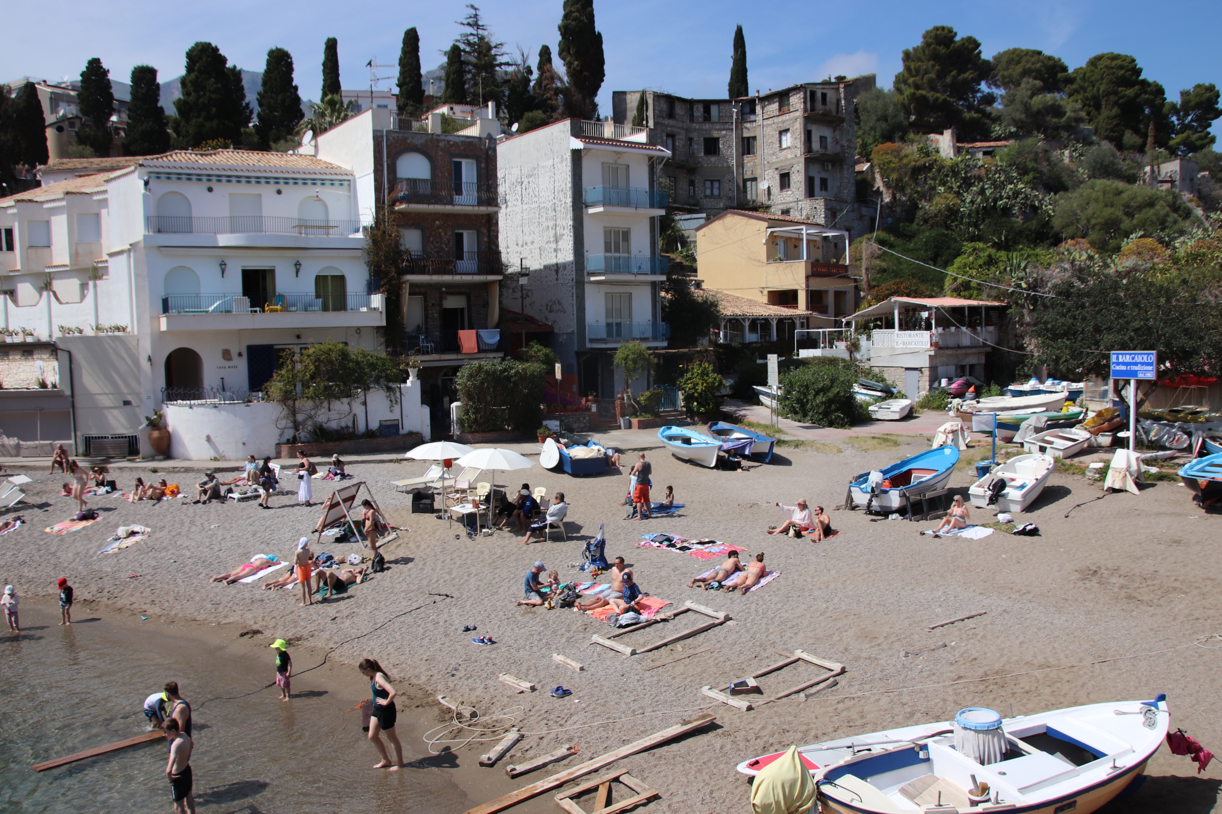
At the bottom of the cable car, or a stepped descent of what feels like 3km from the old town, lies the beach area where White Lotus hotels rub up against public beaches. The latter look much more fun!
I should remind everyone that however easy it is to go down, there is always the going back up to take into account and, boy, those steps are steep.
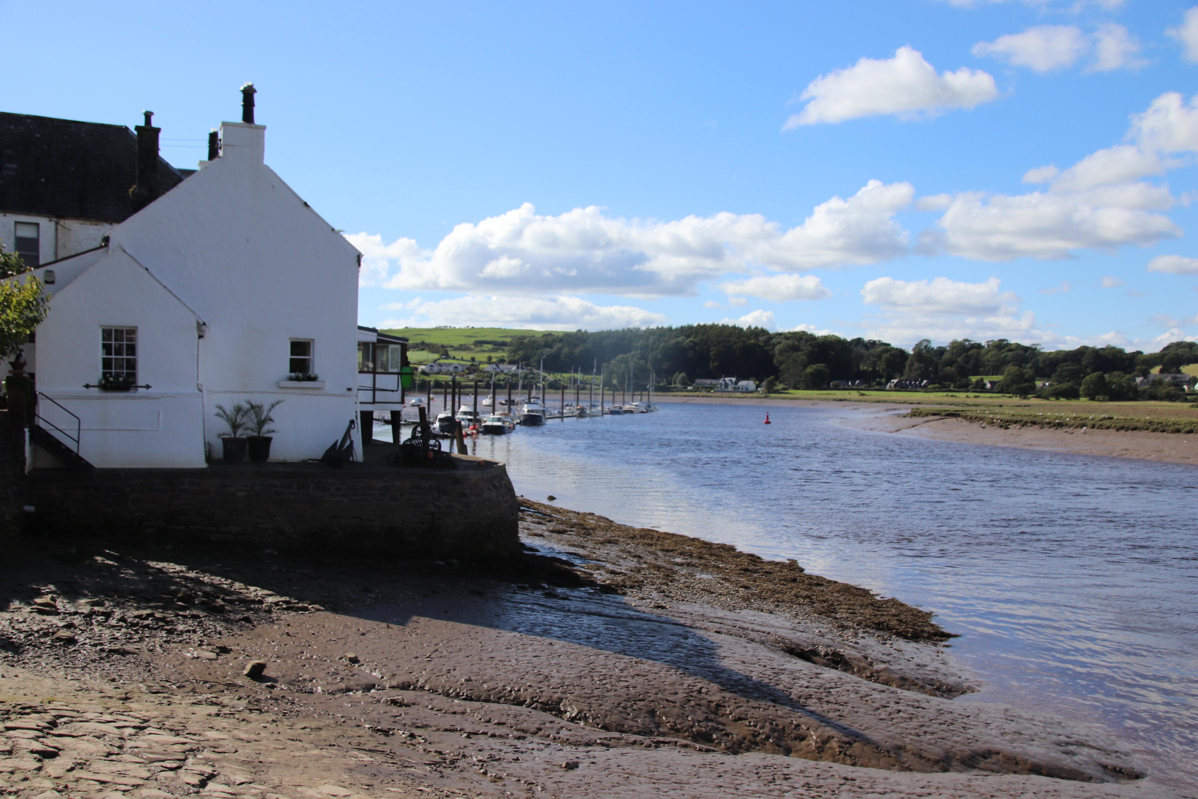
From St Fillans, at the head of Loch Earn, it is south now, past Stirling and Glasgow, to Dunfries & Galloway and the Irish Sea coast. The least said about Castle Douglas the better. Further on is the town of Kirkcudbright, on the banks of the River Dee, about 4 miles from the sea.
From a spot on the estuary, there is a wonderful view down to the open sea, with the dim silhouette of the Isle of Man in the far distance. The Dee is instrumental in creating wealth for the town as it is the only settlement on the Solway Coast with a working harbour.
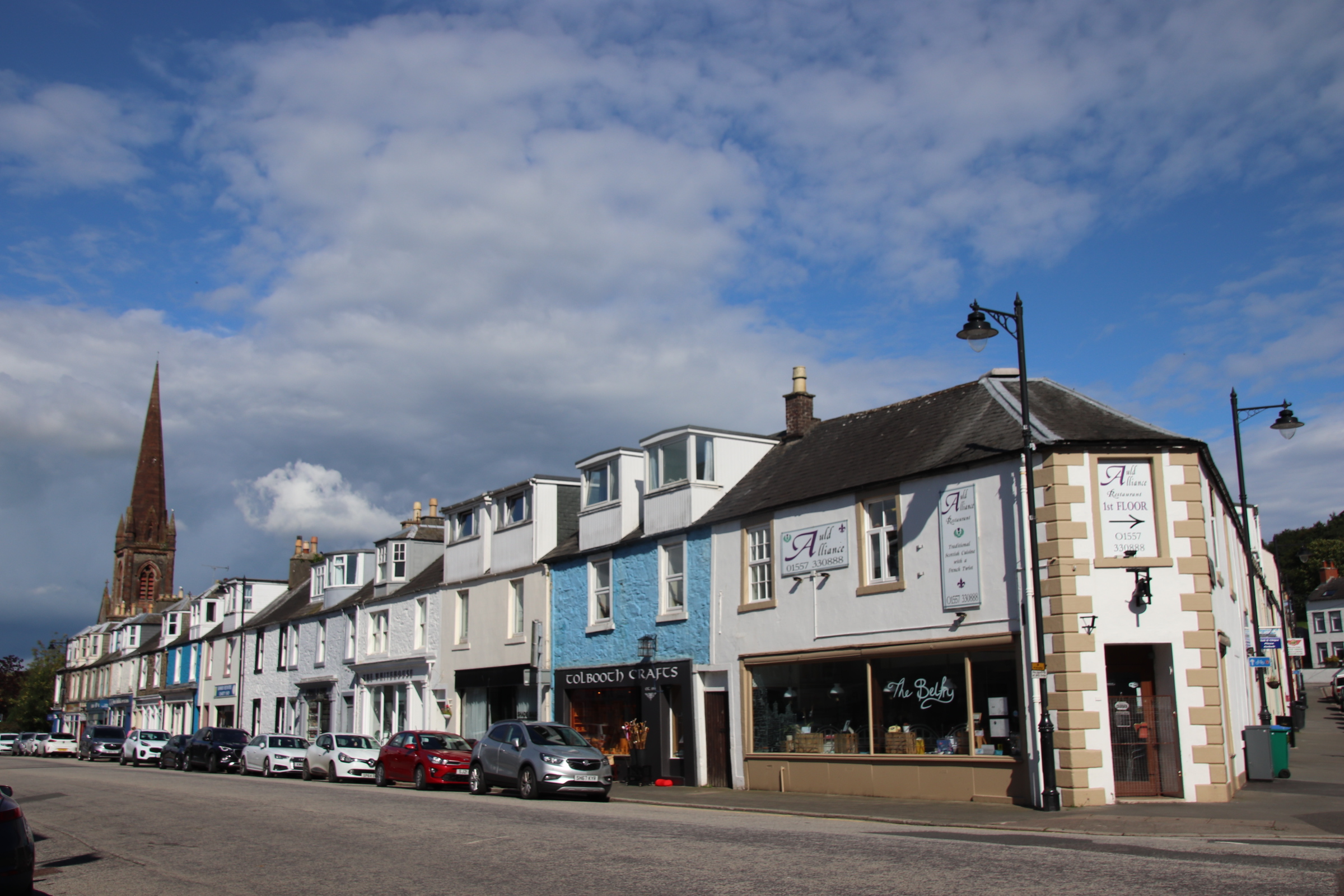
Kirkcudbright (pronounced by the Scotts: kir-KOO-bree!!!) is renowned for the number of galleries and arty/craftyshops. It is an attractive place with a blend of medieval, Georgian & Victorian buildings. It became a magnet for Scottish artists in the late 19th century and is now known as The Artist’s Town attracting both practitioners and promoters.
Aberfoyle is the gateway to the Trossacks. The drive from here to St Fillans, (tonight’s accommodation) through mountains & hills, along streams & lochs, past farms & hamlets is gobsmackingly beautiful, with best left till last! Three Lochs Drive starts just outside Aberfoyle and follows an unmade track down, around….you guessed it – 3 lochs! First is Lochan (a baby Loch!) Reoidhte.
Then Loch Drunkie!!!!
Then Loch Achray
Add in the Victorian hotspot of Loch Katrine
Along to Brig O’Turk along the shores of Lock Venachar to Callander.
Loch Lubnaig
And finally the magnificently, splendidly peaceful Lock Earn from St Fillan.
Farewell Bute with your wild water swimming, your kite flying and your cliff hiking.
There is a clear difference between your glorious deserted beaches and the seaside attractions of Largs on the mainland. Separated by a few miles of sea and a short drive down the coast road they are like chalk & cheese. The only thing they seem to share appears to be the weather – grey, wet & windy.
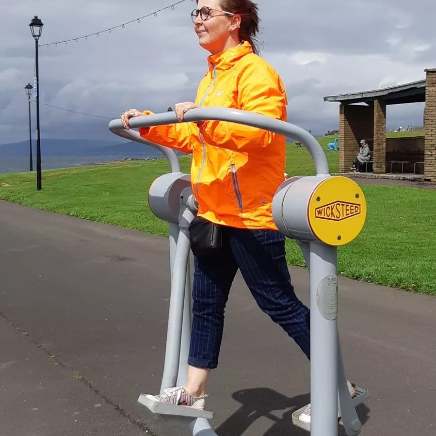
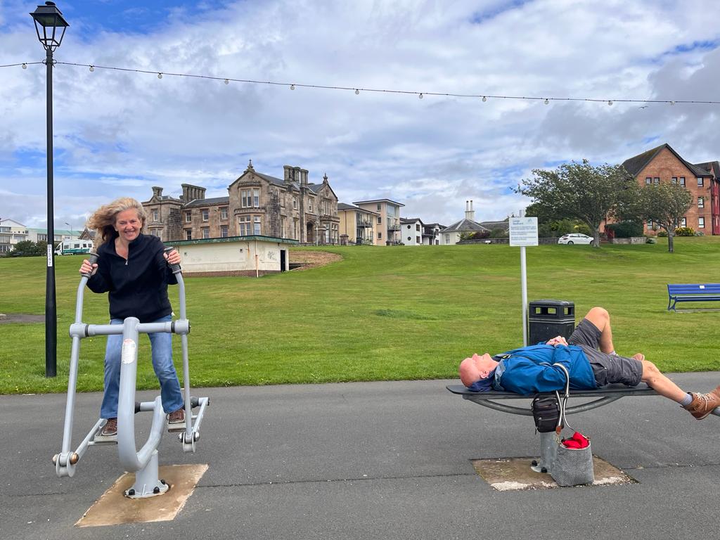
Largs has a few things going for it – a range of accommodation, numerous ice-cream parlours including Nardini’s, established by Italian emigres in 1935 , a regular ferry service to outlying islands, a long promenade with crazy golf, a pebbly beach (with a line of light brown kelp & dead jellyfish!) and several play/fitness areas for children or adults.
Arriving in Largs, the carpark is shaking off the latest heavy downpour, so it is into the iconic art deco Nardini’s Ice-cream Parlour for the go-to start to any wet day at the seaside – bacon & egg roll & a cuppa tea.
The interior of this magnificent building holds 200 odd punters and is gradually filling up with those partaking in morning refreshments. It will receive two further visits from us as the day progresses.
Outside, the clouds open up and family groups of all shapes & sizes start to appear, wandering rather aimlessly along the promenade seeking some kind of activity to occupy their time. No swimming here – the windy conditions put most people off putting even one foot on the rocky shore.
Along the promenade, past the putting green and the children’s playground, the adult gymn tempts passers-by to have a rather inept go. We are no exception and we all put our best feet forward.
So much activity requires a sugar rush, so it’s back to Hardini’s for an ice-cream, one of the 36 flavours made there – strawberry, pistachio, double cream vanilla. We take them outside to sit on a bench in whatever the weather throws at us, in this case wind and showers of chilly rain.
It must be time for a warming coffee and a sample of some very classy mini-pastries.
By this time, like any typical British day at the seaside, the weather takes a turn for the better, the skies part for a bow from the sun, the carpark is full and the funfair is in full swing with all 3 elements in operation.Still no-one is tempted to enter the water.
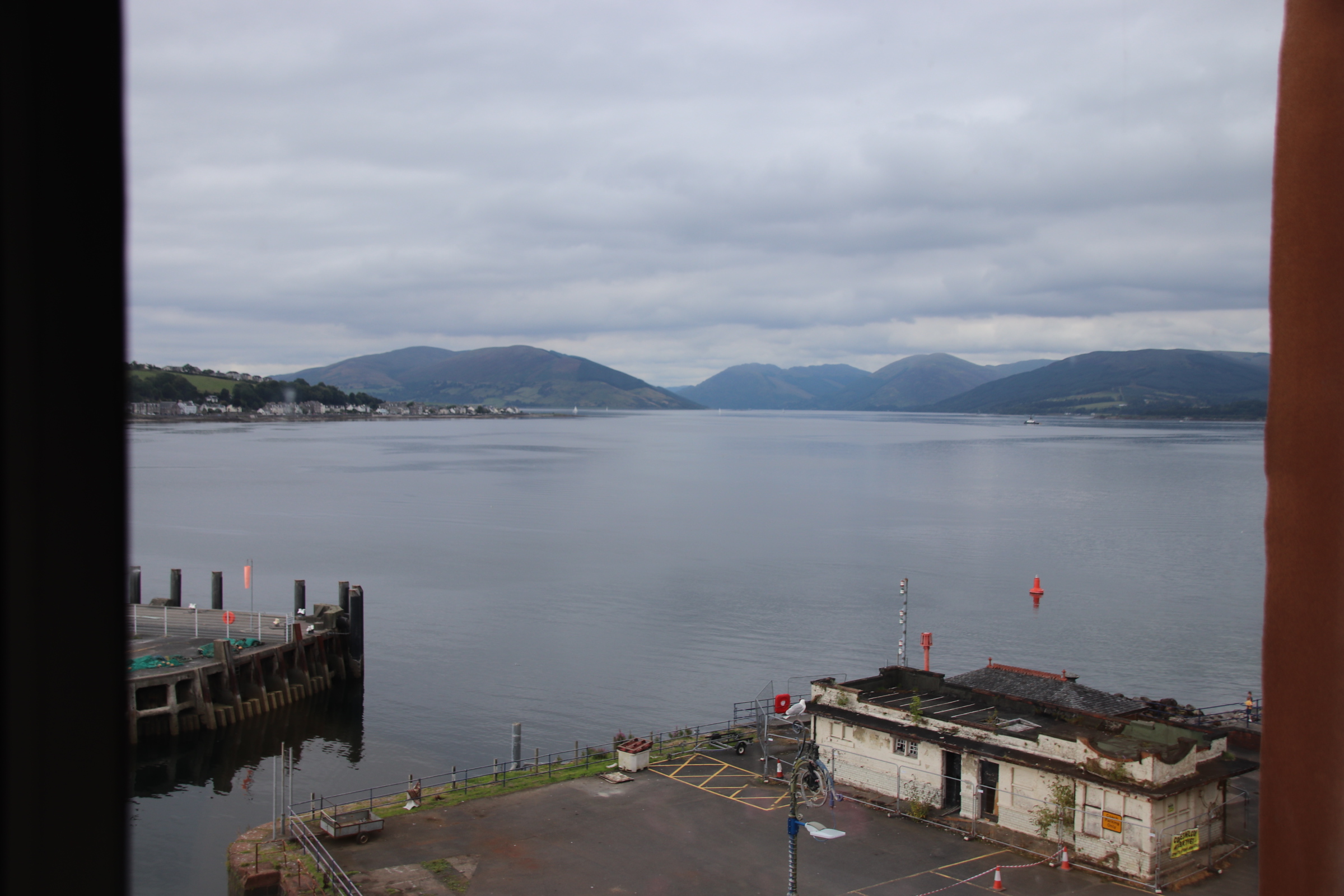
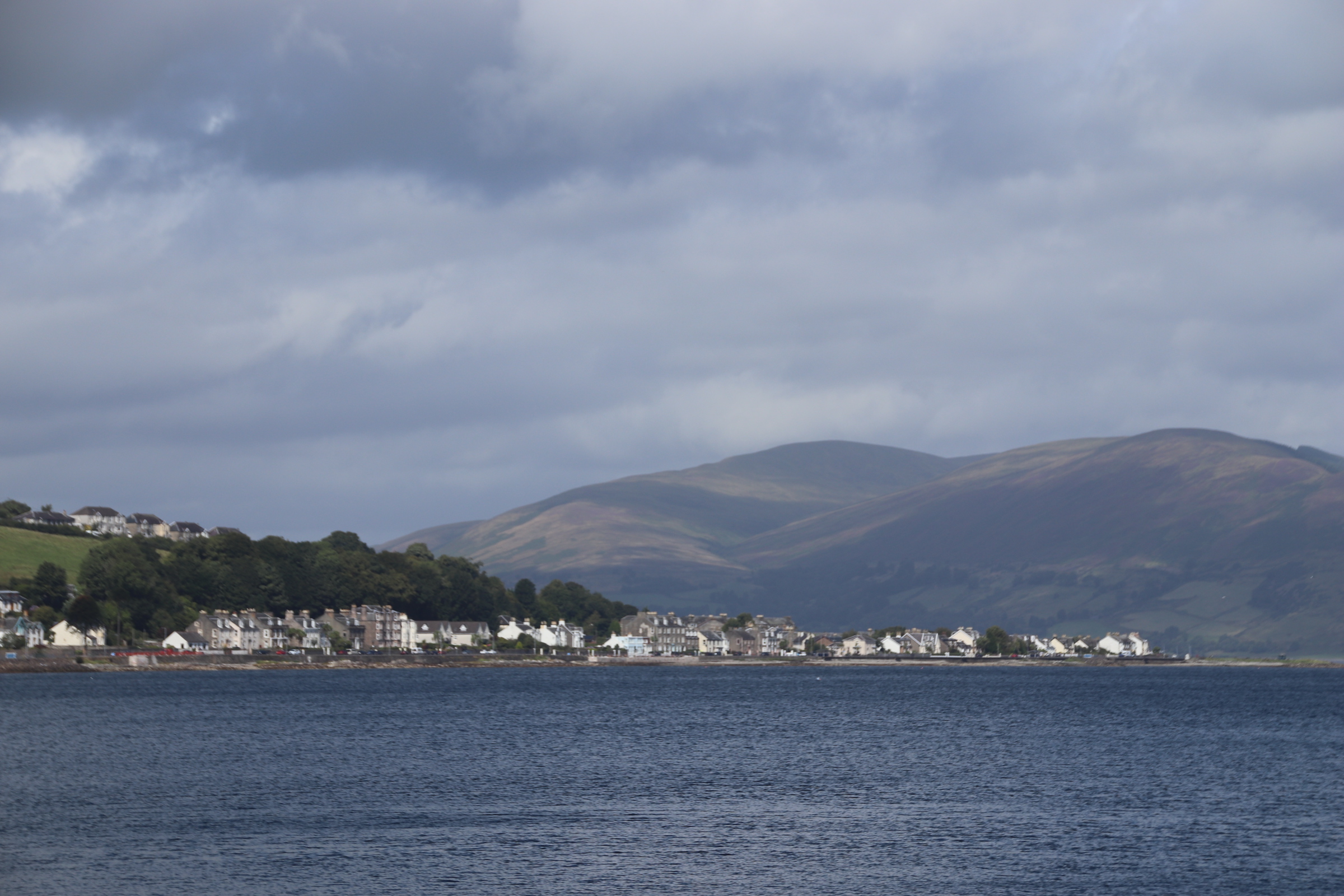
Crossing from the mainland to Rhubodach sets us down on the 23 mile loop around the isle of bute, some distance from the main settlement of Rothesay.
The island is hilly rather than mountainous, with a landscape of woods mixed with harvested cereals and fields of sheep & cattle. It is a few miles around the loch to the main town.
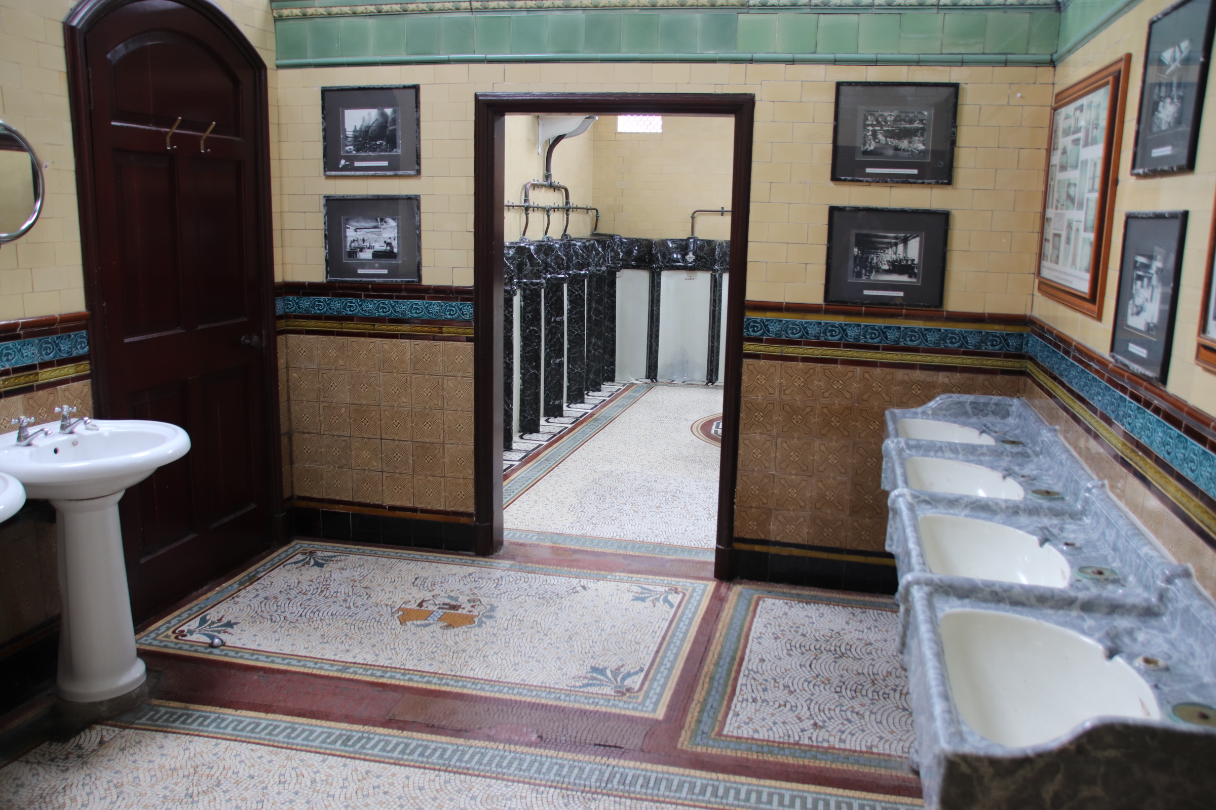
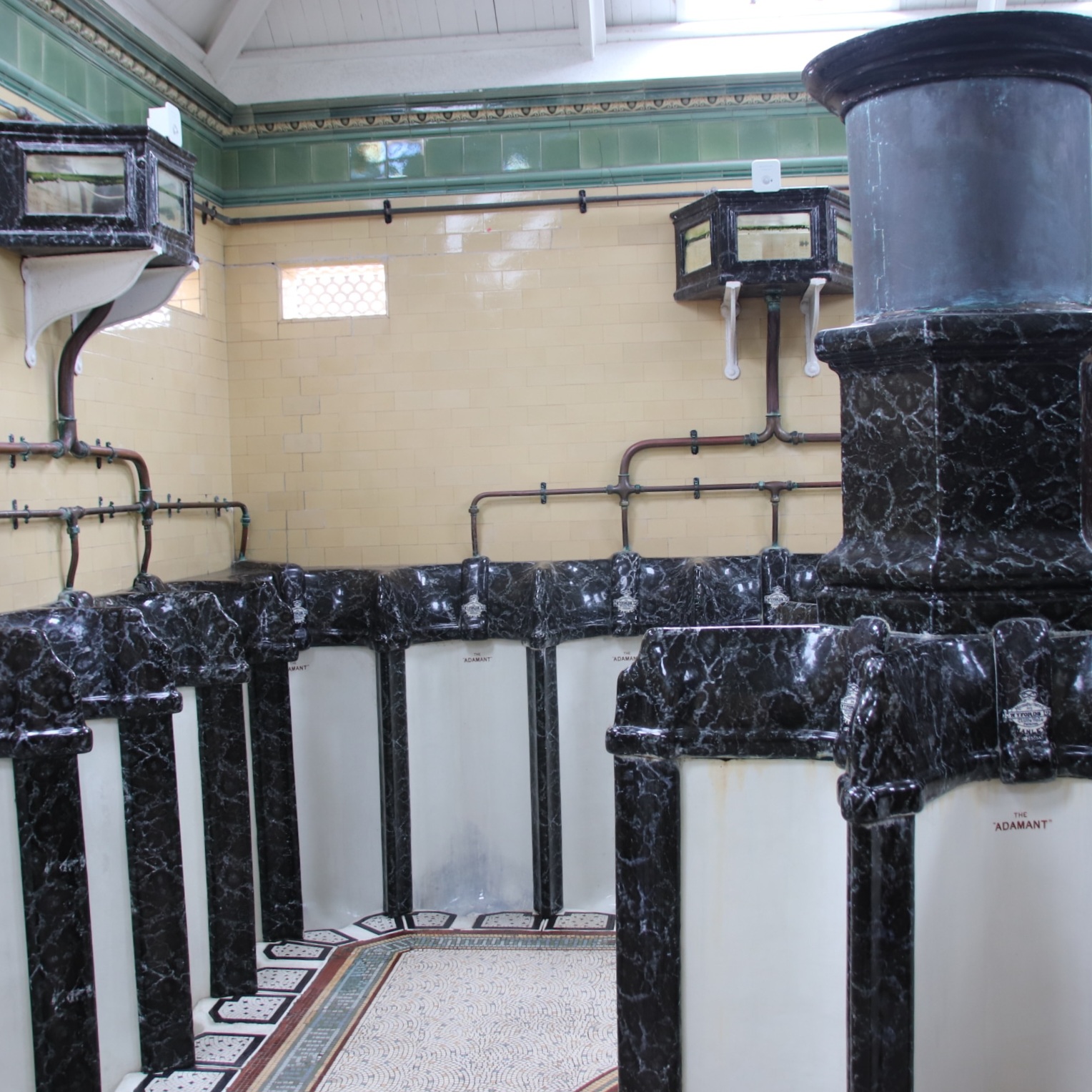
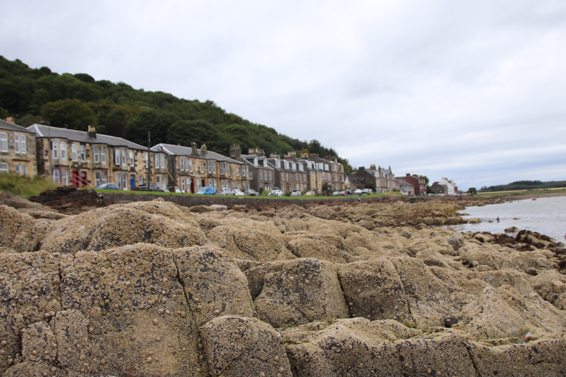
It takes a while to get beyond first impressions of Rothesay. Shop fronts are tired and tatty, with scaffolding and peeling paintwork out front. But look up to the rooftops and a grander side peers across the harbour and the busy ferry terminal.
Indeed, looking out from our top floor window one can appreciate the once-grand days of the Victorian wealthy, arriving on steamers to walk the promenade and enjoy the sea air. The renovated Victorian Toilets take bragging rights as the top sight in the town for visitors. Indeed, they are a splendid place in which to spend a penny or, even, take a shower!
Away from the harbour and the centre, the buildings become grander, built by the wealthy as summer residences overlooking the water.
Going out on a tour of the island, the road follows the coastline with small lanes disappearing down to beautiful, sandy bays. Past the big estate (Stuart House, open to the public) Kilchatten Bay is the only other place of any size, a single strip settlement of Victorian houses on the end of the local bus route with a small harbour at the end, once used for bringing in lime for the farms, then for exporting clay tiles for field-drainage and then for bringing in on steamers the wealthy who built holiday homes here.
Scalpsie Bay is a popular beach, a short walk from the road, best seen from the clifftop.
The coastline is dramatic, with farms merging down to wide beaches and, in the far distance across the Kyle of Bute, the sharp, molars of the peaks of Arran dominate the horizon.
Attrick Bay has two personalities. Firstly empty sands attract wild campers, excited dogs and their owners and folk chewing on their cud at one with the elements.
At the other end of the beach, sand-castle-building families, kite flyers, swimmers, leaded pooche owners, lycra-tight cyclists are attracted to the cafe where tea & bacon sandwiches bulk up intrepid wild swimmers as they take on the water…..but hey, it is suprisingly warm, just like old days at the seaside!
So moving on and, very sadly, leaving Gigha takes three ferries if you want the most effective way to reach the island of Bute. Yes, the first is the island ferry from Gigha to the mainland. Then a 30 minute drive to Tarbert – a working fishing village for generations.
First thing in the morning, it’s the ferry across Loch Fynne.
And a drive around the top of the mainland to a 10 minute ferry crossing to Bute.
In 1944, Sir James Horlicks of the nighttime malt drink fame, bought the island and Achamore House and went about planting a rhododendron garden that still exists today. Around it, he gathered a forest of trees and plants from around the world. What better way to spend the last day on this wonderful island than by exploring the colourful gardens and exotic woodlands?
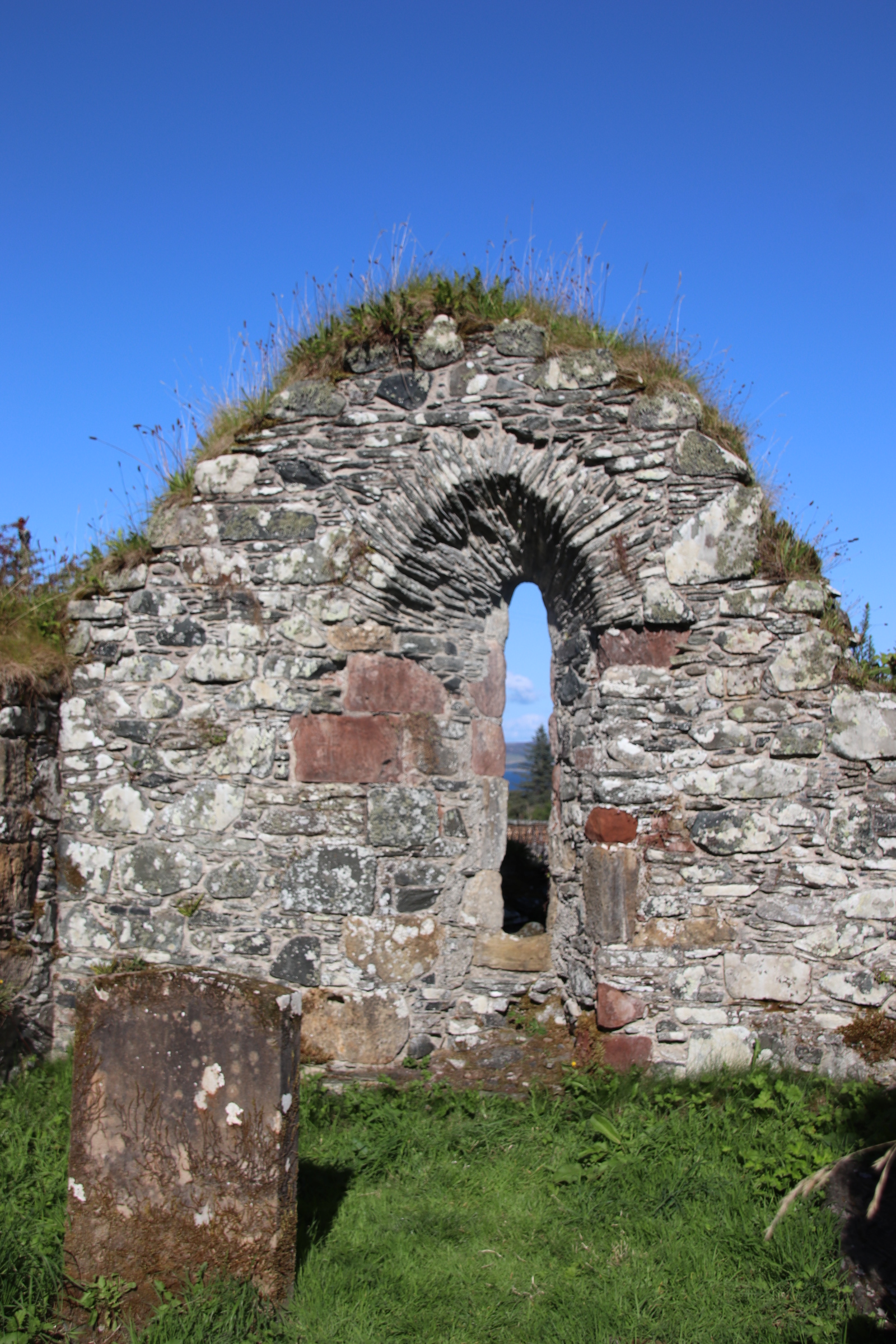
At the far end of Achamore Gardens are the ruins of the island’s first church at Kilchatten.
This the view from the bedroom window, every morning must be one of the best. Well, it does change, as the weather changes, but it is still very special and it is what greets you when you emerge from the land of nod. This is the story behind it.
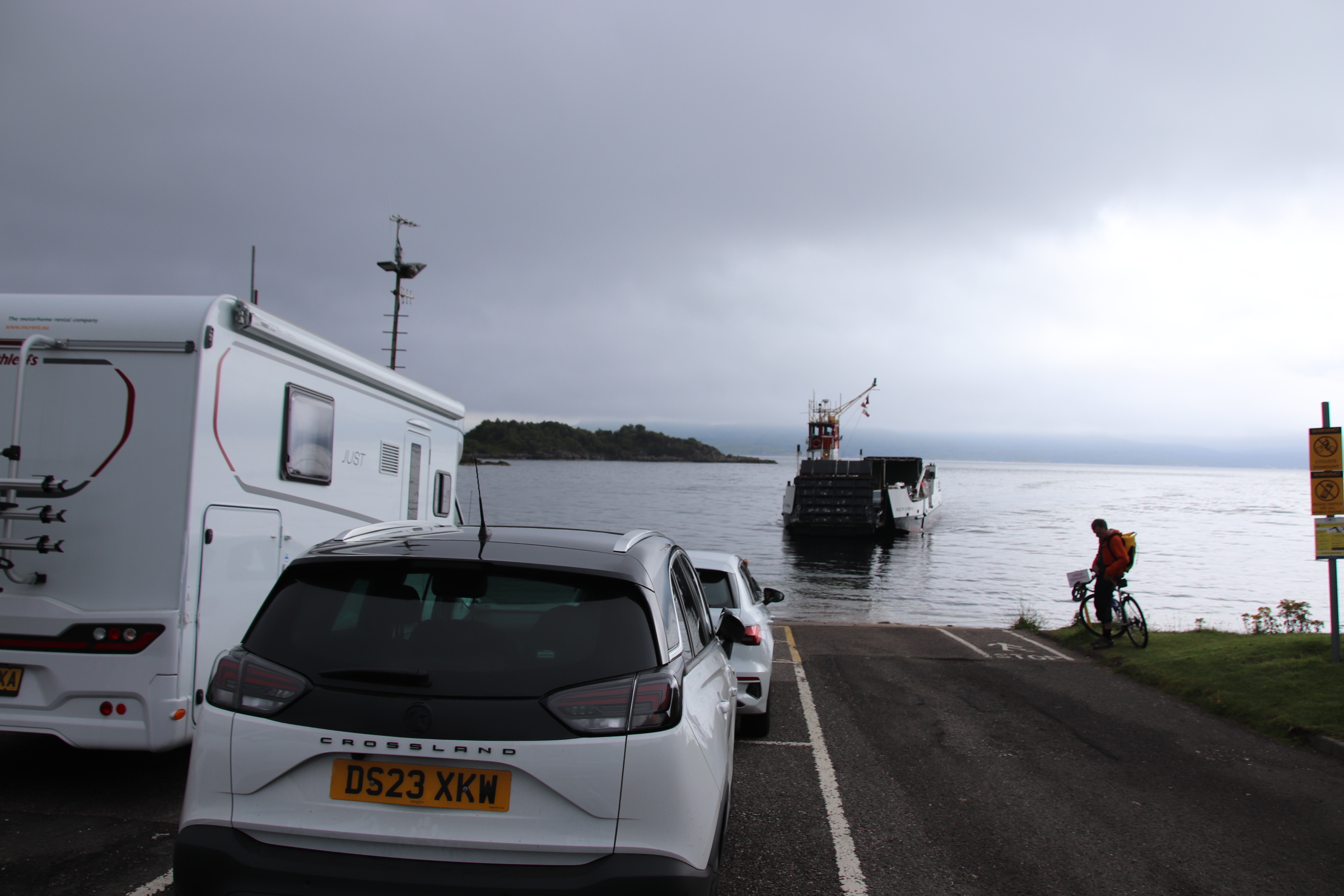
You know you are going somewhere special as you approach the ferry terminal at Tayinloan on the Kintyre peninsula. Across the fields the clutter of bungalows & parked-up vehicles glitter in the afternoon sun, the foreground to the low shadow that is the Isle of Gigha, with the Paps of Jura behind, like a favourite old roller-coaster.
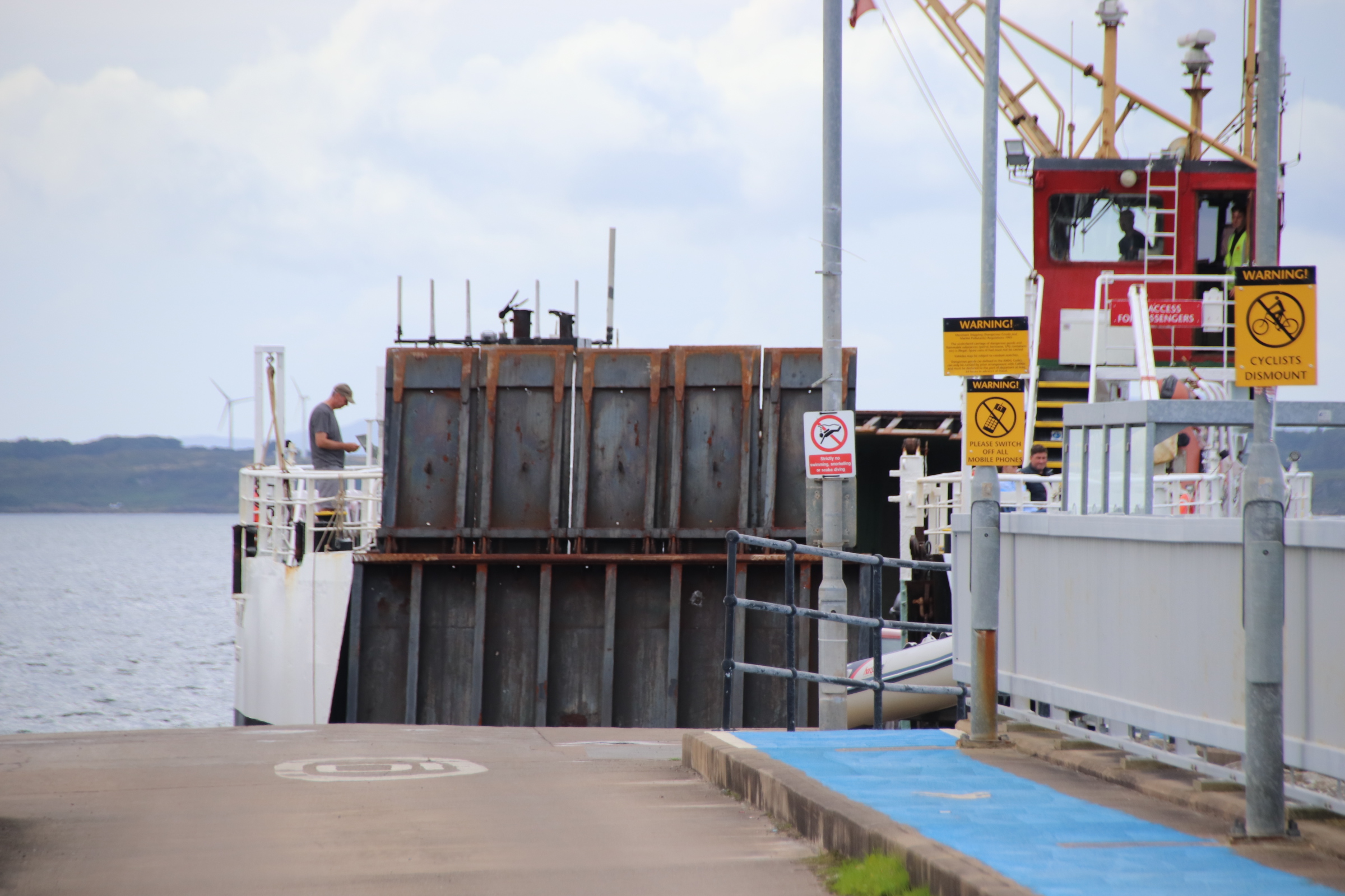
The journey takes just 20 minutes with the vessel zigzagging its way across – with ramps at each end to enable vehicles to drive on & off at each end, propellors are positioned in the middle and prevent it from moving in a straight line. On the Gigha side, vehicles wait patiently in a queue awaiting their turn for the return leg.
Once off, the centre of the island is a short distance. Here are collected most of the homes and most of the services & amenities – the village school, the church, the village store which trebles up as the post office & a takeaway fish bar, a restaurant, a hotel (closed at present), a new cafe, a gift shop with smellies & local crafts and the Trust offices. The weather changes by the hour – the following images were taken within 30 minutes of each other!
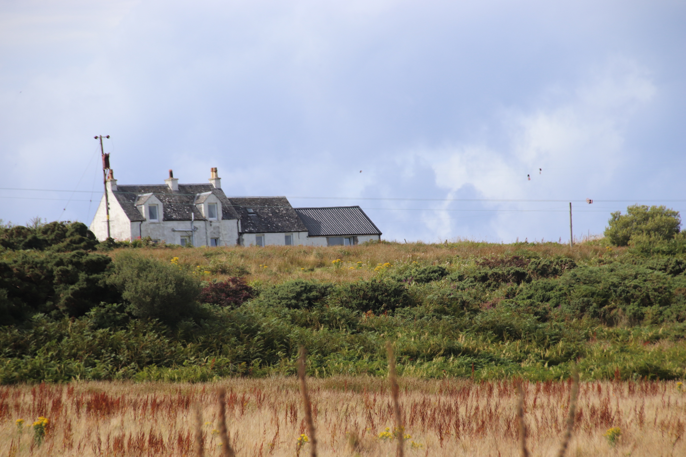
Our destination is this cottage, home for five days and a 15 minute walk from the ferry, up on a small hill.
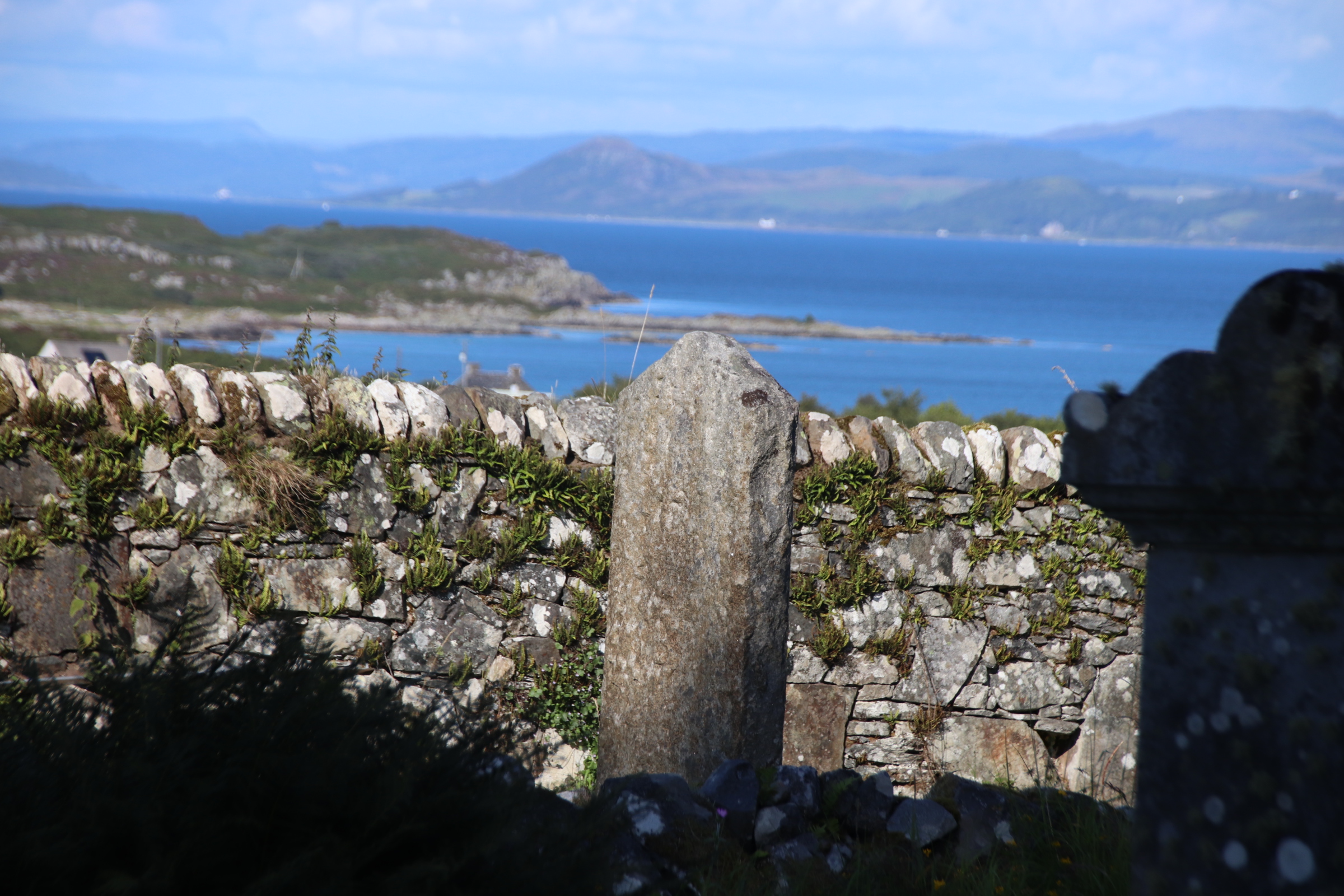
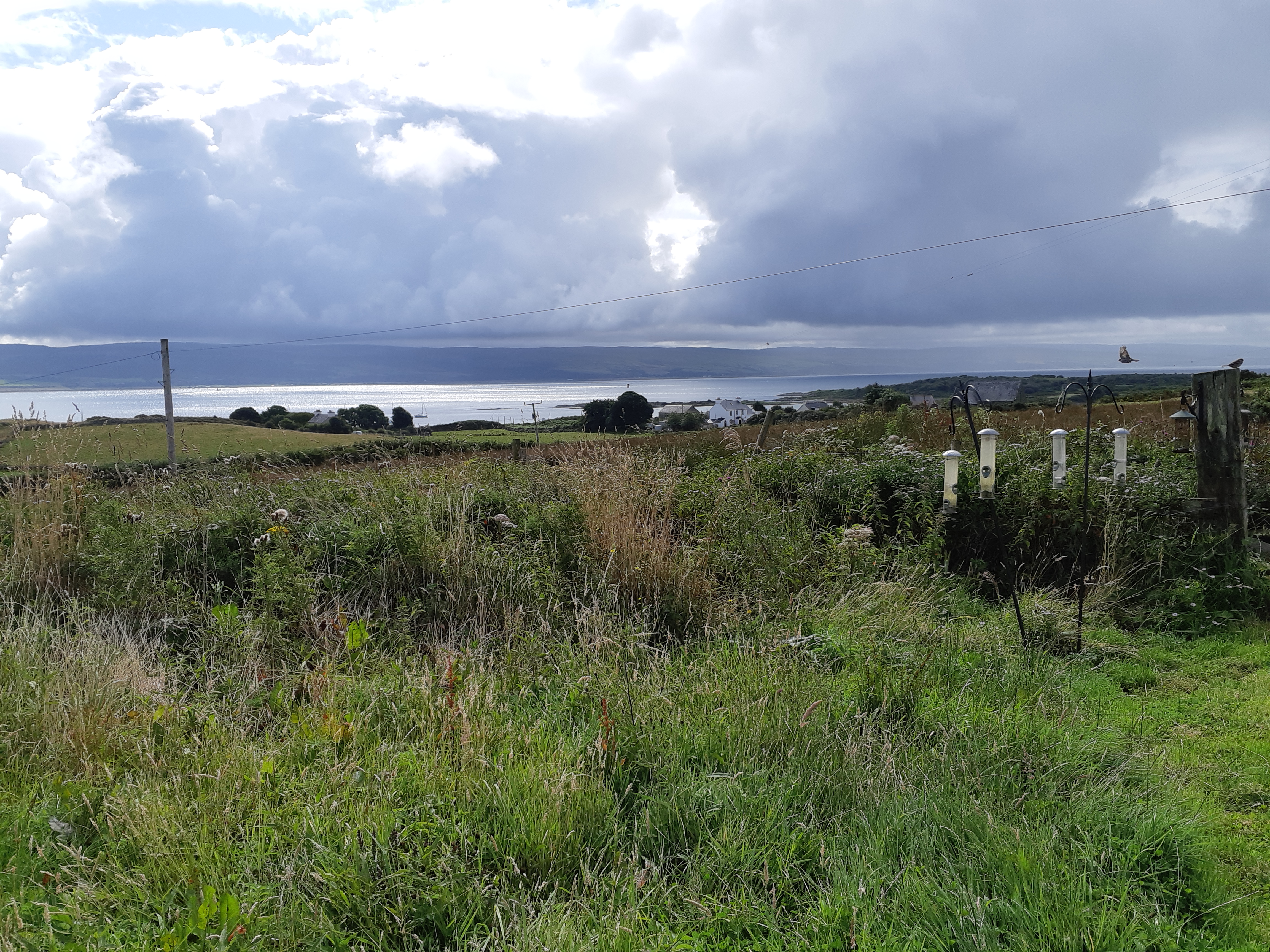
From this location one can really appreciate both its position and the elements. One can smugly watch the clouded sky grow & darken and plough by on either side or pass along the Kintyre peninsula over the water, dumping its wet stairrods on the hills opposite while overhead a warm sun warms the island through light cloud, its rays picking out houses and vessels down by the ‘marina’.
Around the house a host of wild plants & grasses spread down the slope. Bird feeders enhance this seed-based paradise for numerous species of birds. In the space between the outhouses raised beds with an abundance of of veg & edibles show themselves off in full glory before trapsing off indoors to feed family & friends.
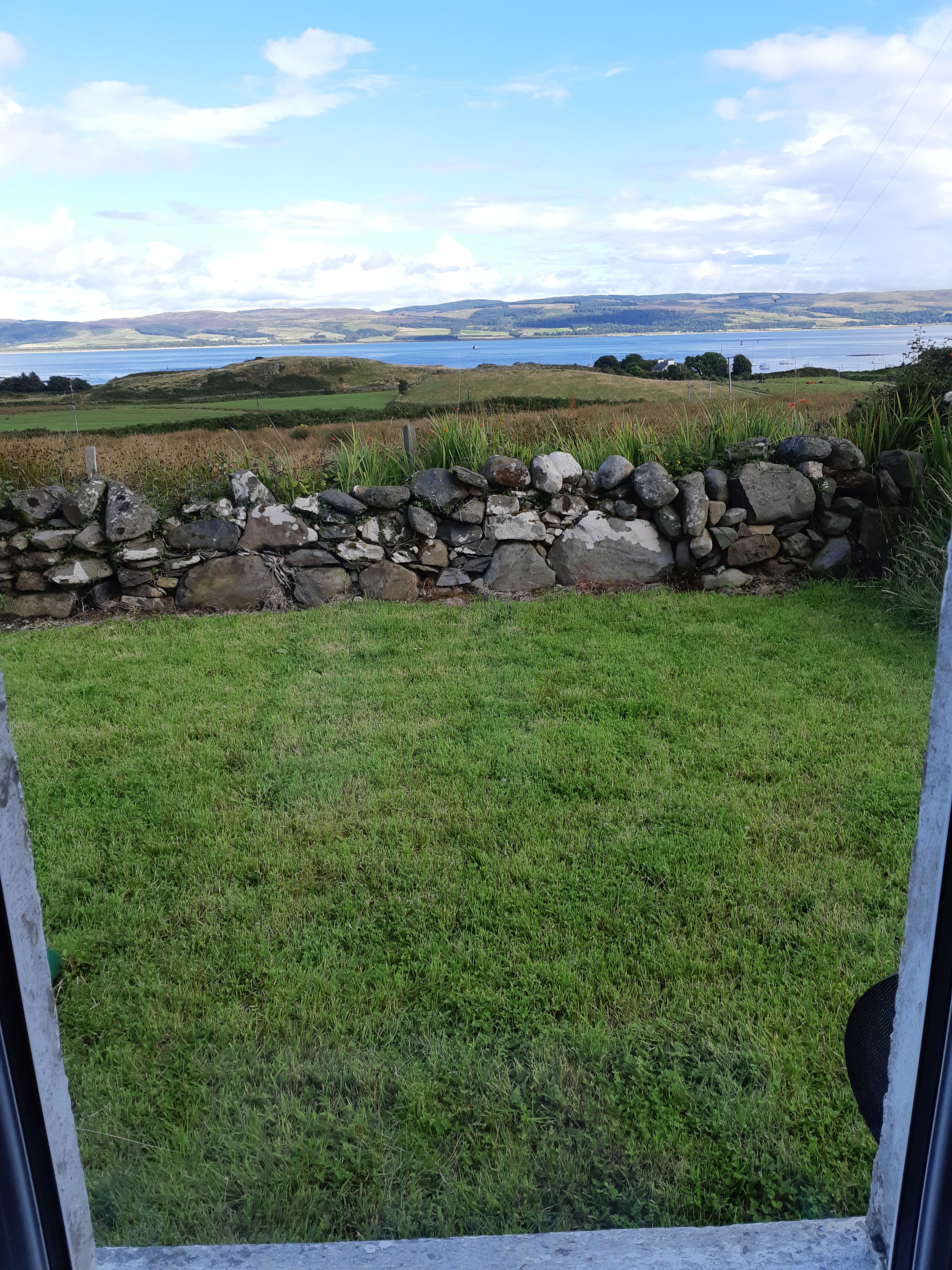
I leave you with the view from the kitchen window which is just as amazing.
To get anywhere from Gigha, it has to start with the ferry. It is, however, a more pleasurable journey when the sun is shining rather than catching that occasional squall:
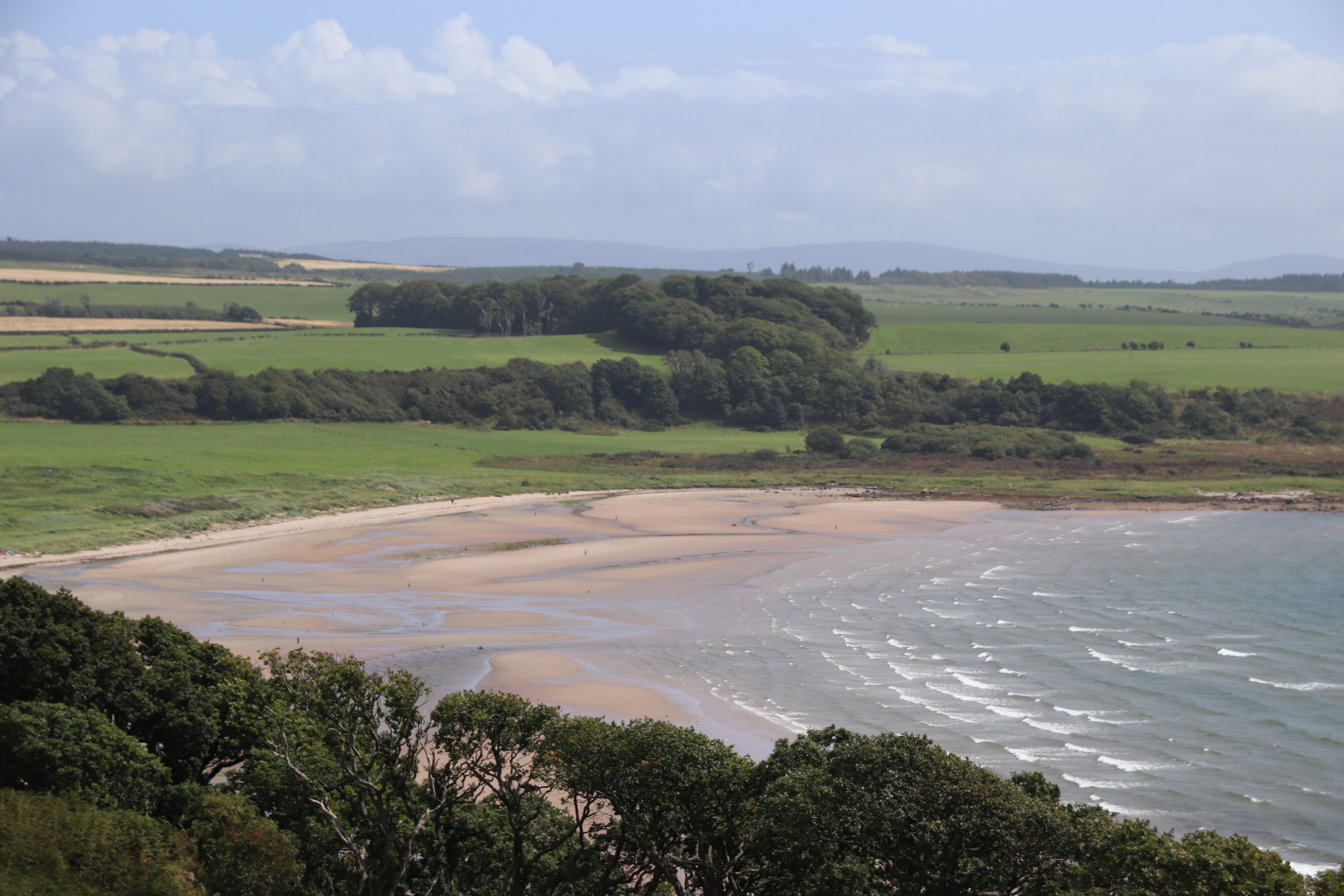
On the mainland, turn left and the road flows down the coast with breathtaking views of manicured farmland & neat fields to the left and ribs of land, nibbled by Atlantic surf to create sandy bays separated by racks of rock & stone on the right. The occasional bungalow or cluster of mobile homes nab good positions overlooking a patch of sand or easy access to the ocean.
26 miles, on the other side of Cambletown, is the Mull of Kintyre. This is the southwesternmost tip of the Kintyre peninsula, marked by the village of Southend. The local store is a quirky place selling a traditional menu of popular dishes like sausage, beans & chips, alongside a selection of fairground toys and a range of household basics- toilet rolls, butter, cans of soup, surrounded by shelves of 1940s household artefacts. It is also a bakery on a Weds & Fridays selling huge great slabs of delicious cakes & meringues. Just past the line of houses a cluster of mobile homes marks the curve of Dunerverty Bay.
St Columba’s Footsteps mark the spot where said saint first landed on mainland Britain to begin the conversion process. Kiel Cemetary is alongside.
And then on to the beach itself – flat, golden sand stretched out like dough around the bay. A few visitors scatter themselves around the empty surface, marked only with their footprints and a line of tangled flotsam.
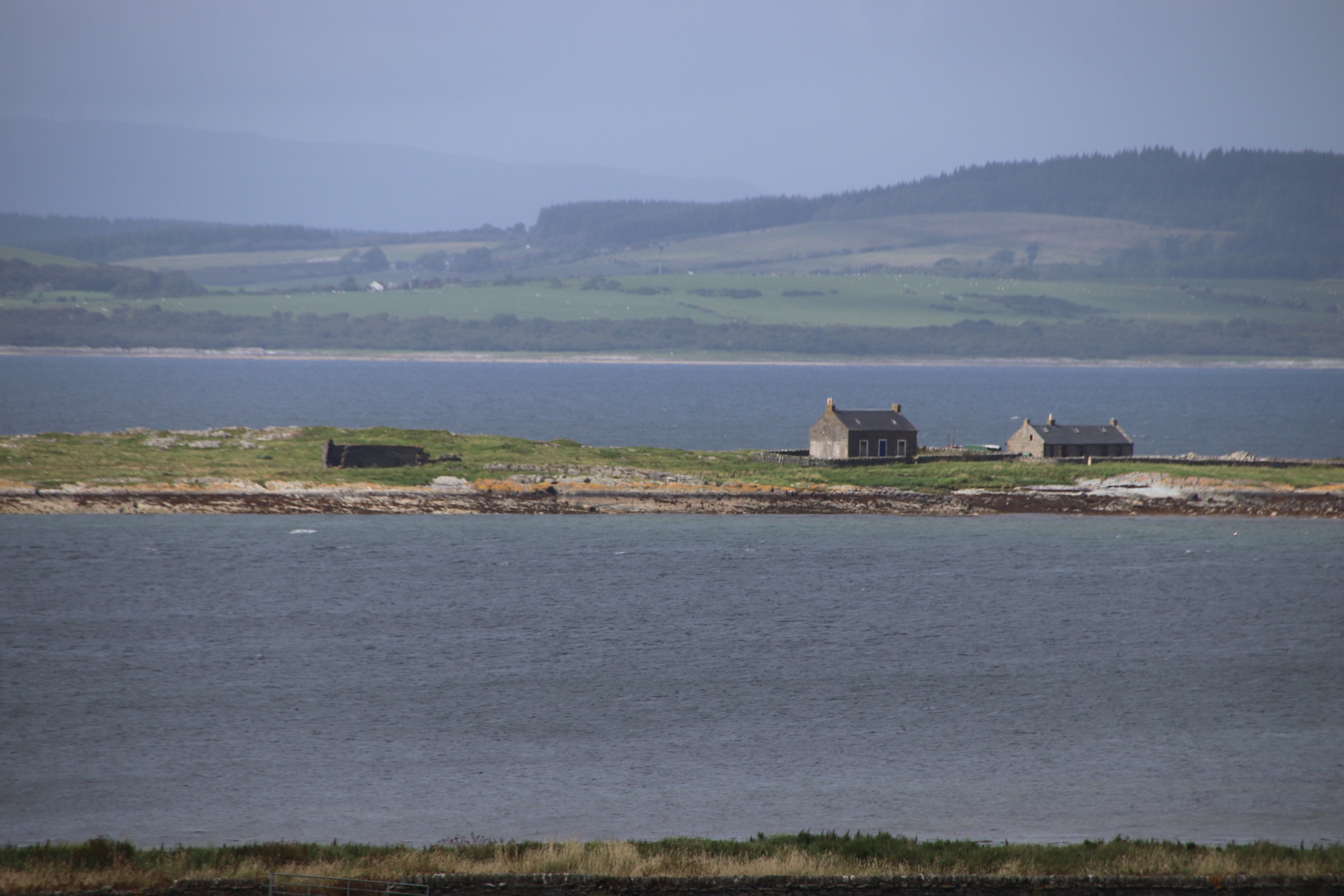
Two houses mark the merging of rocks into beach-perfect sand at the top end.
At the far end nearest the faded silhouette of the nearby island of Ireland, a collection of whitewashed houses hides behind the arriving stream and the grass-sprung dunes and a small, renovated ex-terrace, now a single home, stands proud, only disturbed by a chaotic flourish of a flock of party gulls, disturbed by our approach.
Clumps of whispy-cotton cloud, layer upon layer, line up to approach and pass overhead sucked along by a refreshing, wild breeze. The sun shines raising spirits, lifting the mood, bringing joy and light to soul & heart.
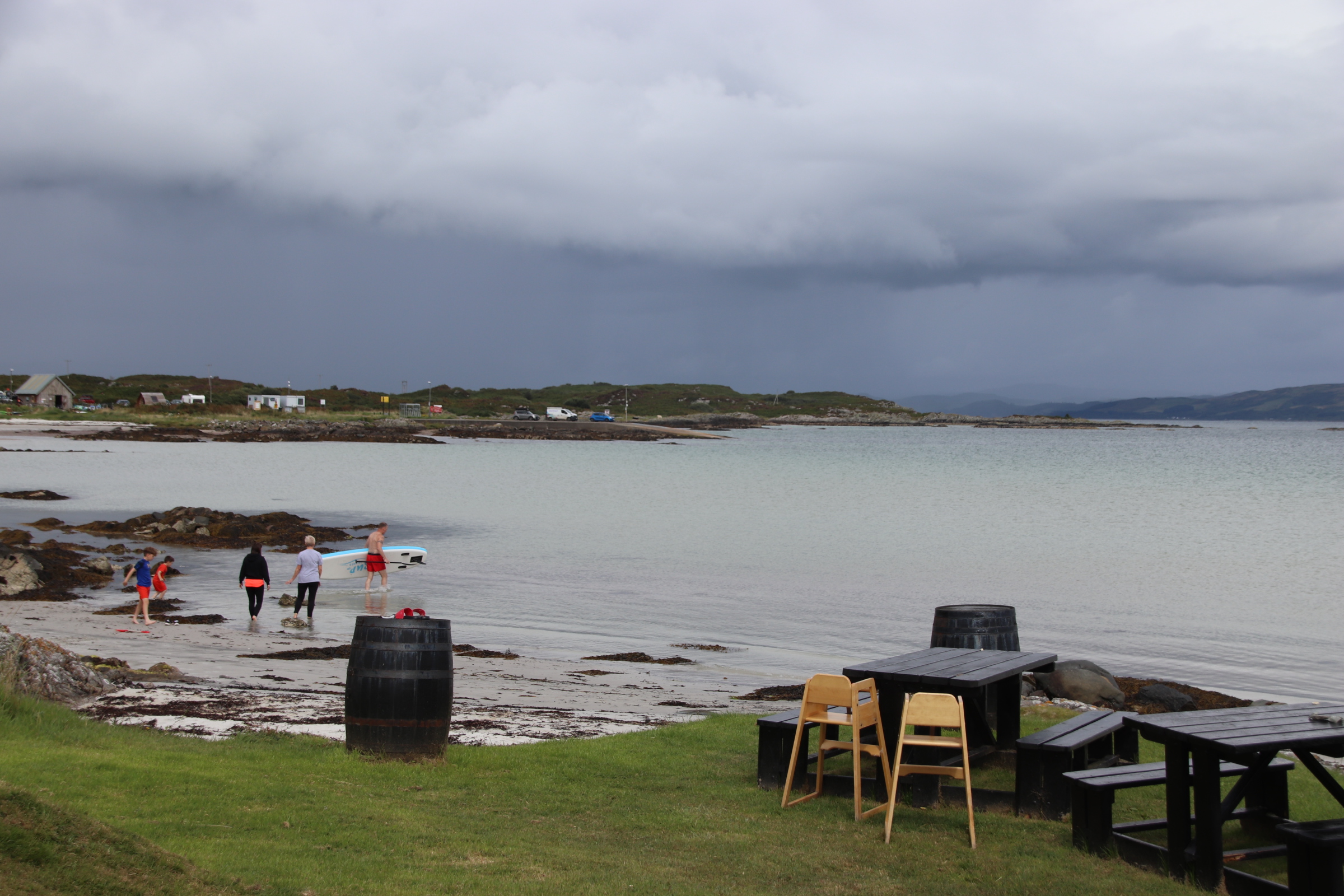
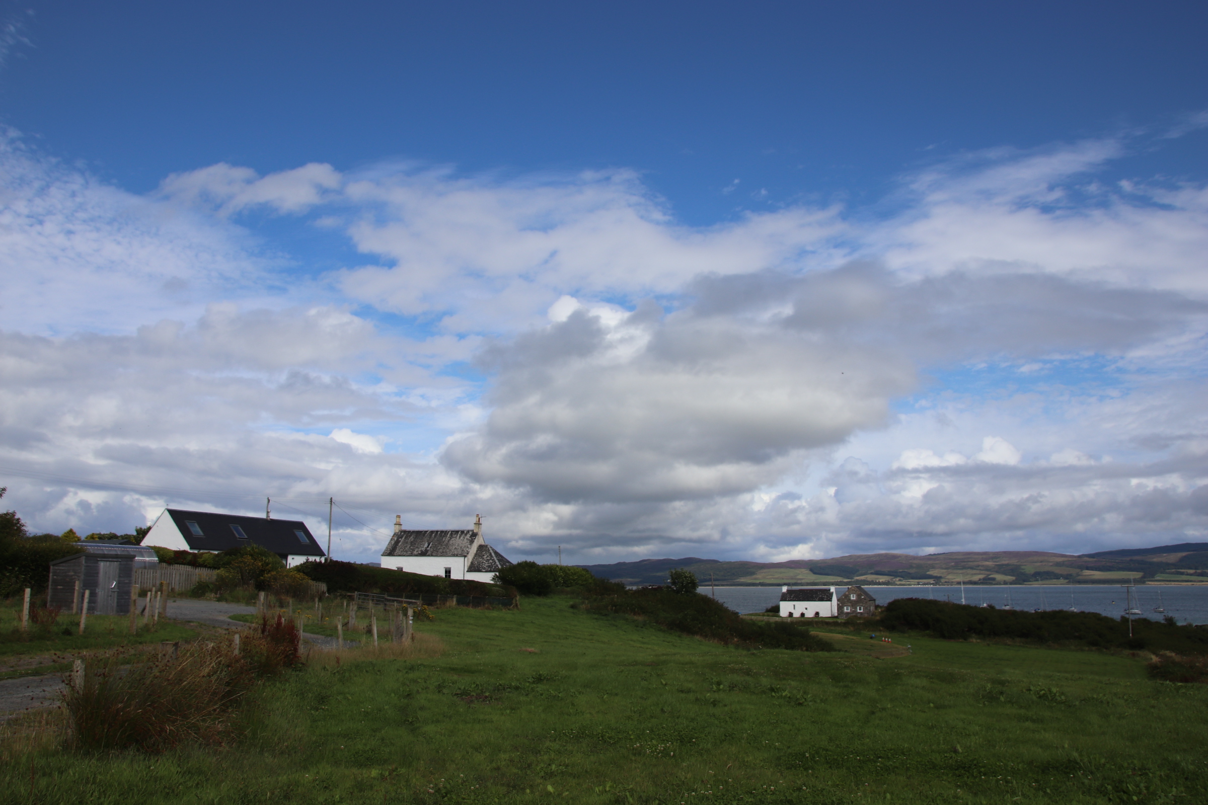
The community-owned Isle of Gigha is a short ferry ride across the sea from Taryloan on the west coast of Scotland. The ferry lands up to 12 or so vehicles and up to 30 odd walk-ons at the terminal which is about half way along the coast, next to the ‘marina’.
There is a small cluster of homes and businesses around this landfall. A store selling the basics, a hotel, (closed at present), a new cafe, canoe and bike hire shop, a fish restaurant. All that is needed if the weather gets so bad the ferry can’t run.
A single, single-track road runs the entire length of seven miles from North End, where the old wooden pier was used to unload passengers.
And South End, where the ferries dock overnight.
At its widest part it is under two miles wide with tracks & paths leading off on both sides to farms & sandy coves.
There is an excellent ice cream business on the island and milk is sent to the mainland. Salmon is farmed in convoys of pens and oysters cultivated in metal cubes.
The island has its own micro-climate, mild with higher than average sunshine hours. On the island we can feel smug as over the mainland to the east, dark menacing storms gather, build and dump their contents in grey curtains of wet stairrods. To the west a brilliant lampstand of sunlight drops glorious rays over gorse and heather, blanketing the landscape in a glaze of shining gold.
163 people now live on Gigha, following the community buy out of the island in 2002. This wonderful place is home for 4 days. More to follow.
It’s time to change coasts. Having spent 4 days in the rolling, harvested landscape to the east of Edinburgh visiting the many fishing villages & towns by the North Sea, the first part of the journey follows the A1 around the capital. There, the landscape changes and the road climbs, peaks & lochs and high lands closing up around the car.
Gone are the tidy, wide-spreading, fields of golden, swaying wheat & barley & rape seed, edged with Old Man’s Beard and mixed bracken & brambles & grasses. Mountain landscapes appear with disappearing peaks lined up behind each other. Tall mixed woodland of pine & ash, oak & cedars stand imperious, dwarfing the passing traffic. Like a monks’ tonsure, they ring the heights. Breaking through to the light reveals a balding, grazed, rock-pitted landscape, contrasting light-grey, bouldered outcrops with flimsy greens of rough, pasture, yellow-studded gorse and a few stunted trees.
The road passes the sky-reflected mirrors of lochs & streams stretching for miles around the route. Loch Lomond, Loch Long, Loch Fyne break up the scenery, gleaming jewelry draped around the necks of preening peaks.
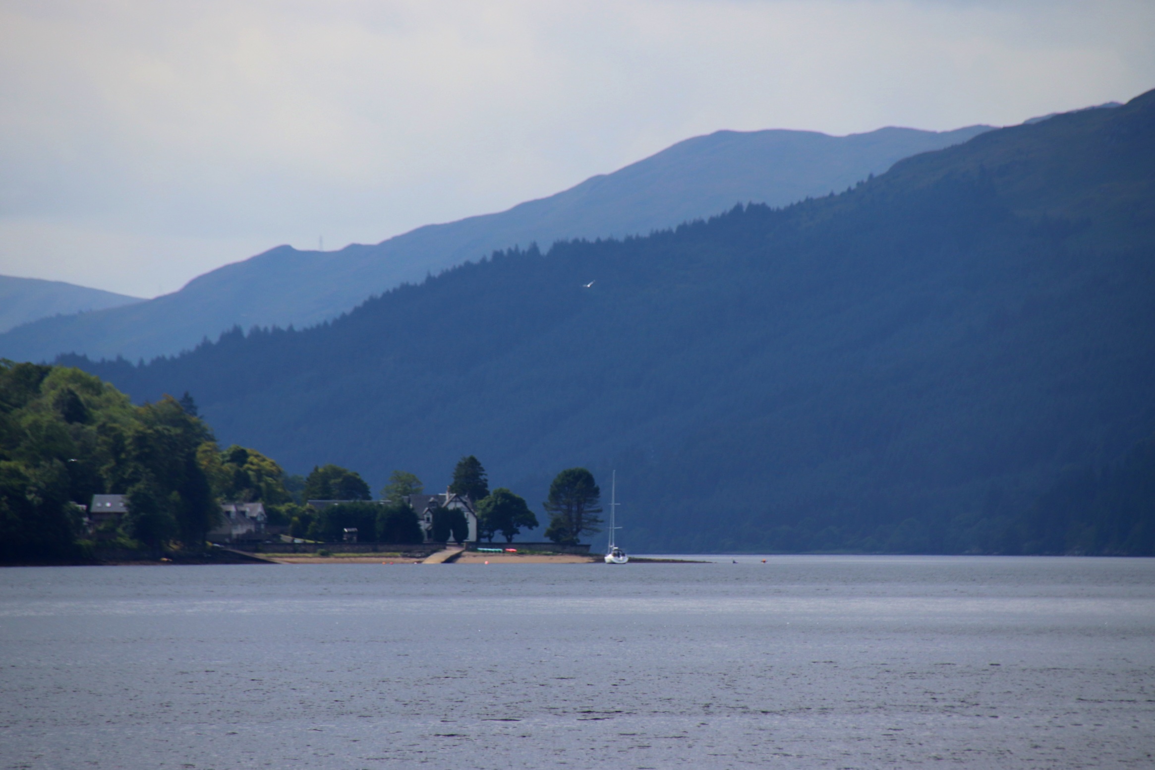
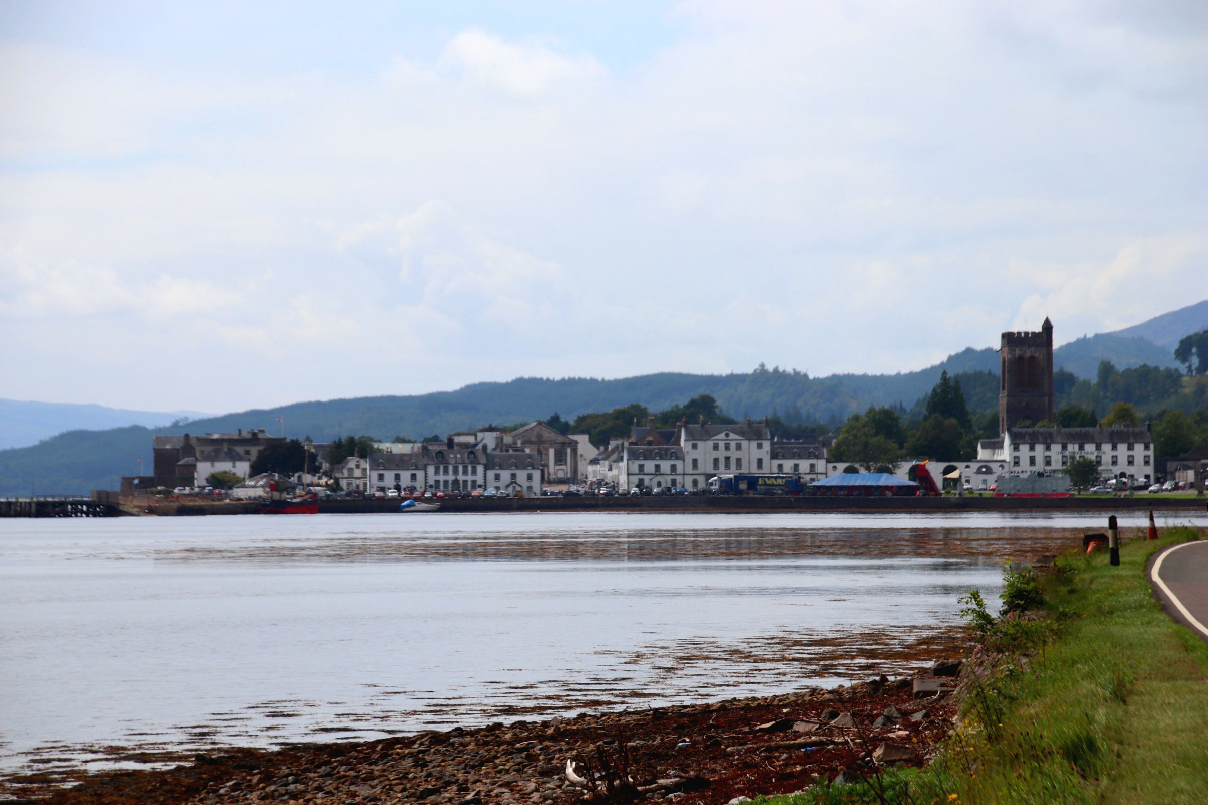
The lochs provided essential means of passage through the mountains for trade & communication and several small towns & villages are dotted around the edges. One of the most picturesque is Inverary on Loch Fyne.
Fishing may well be the source of wealth in small towns like this, as can be appreciated by the size and layout of the buildings.
After a beautiful drive of 5 hours or so, we reach the west coast and the island ferry that runs from Tayinloan to the Isle of Gigha, our final destination.
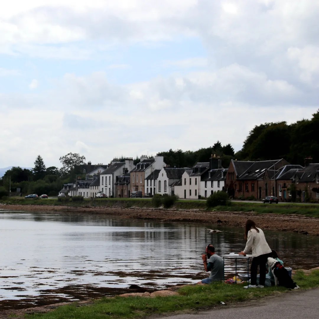
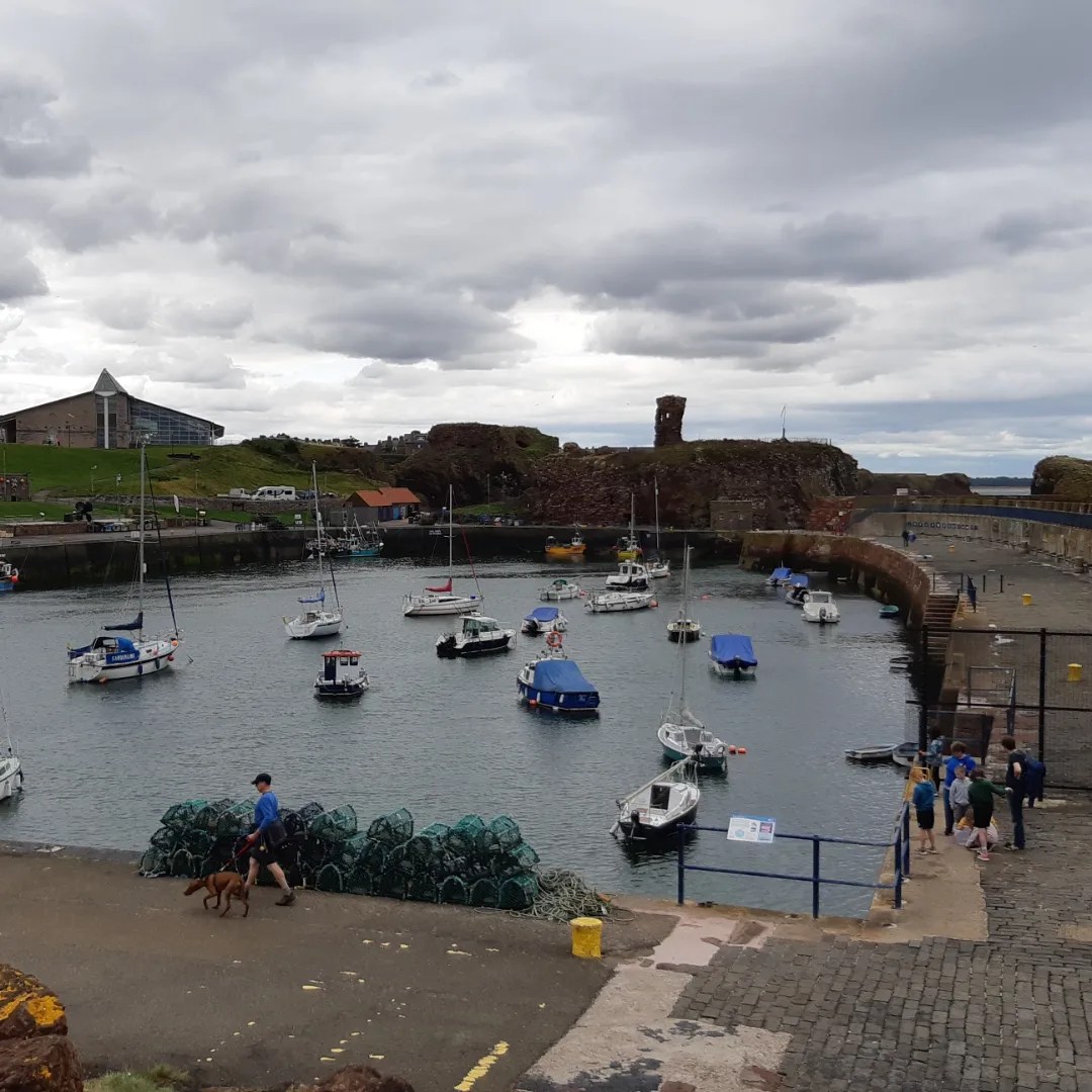
Dunbar prospered as a market town positioned on the east coast of Scotland, with a strong fishing & farming community, then as a military base before, in the late 19th century with the arrival of the railway in 1844, it became a seaside resort. The historic town centre became one of the oldest Royal burghs in Scotland in 1370. This gave it the right to trade in goods along the long & broad High Street.
In those days town centres featured a standard design with a castle at one end and a church at the other with a very wide street between with enough room to position market stalls on both sides. Over time these ‘shops’ moved into the buildings and the shopkeepers lived with their families upstairs.
The High Street buildings vary in style and grand essentials. Outside the Town House is a statue of John Muir, the founder of the modern conservation movement who was born in Dunbar. He moved to the US and was instrumental in founding their national parks.
To the east of the town, high cliffs peer out across the North Sea and the far-off islands colonised by cormorants.
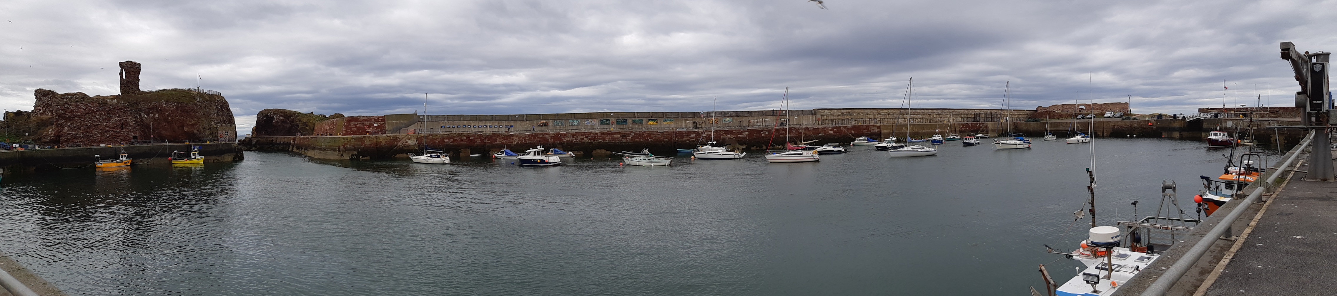
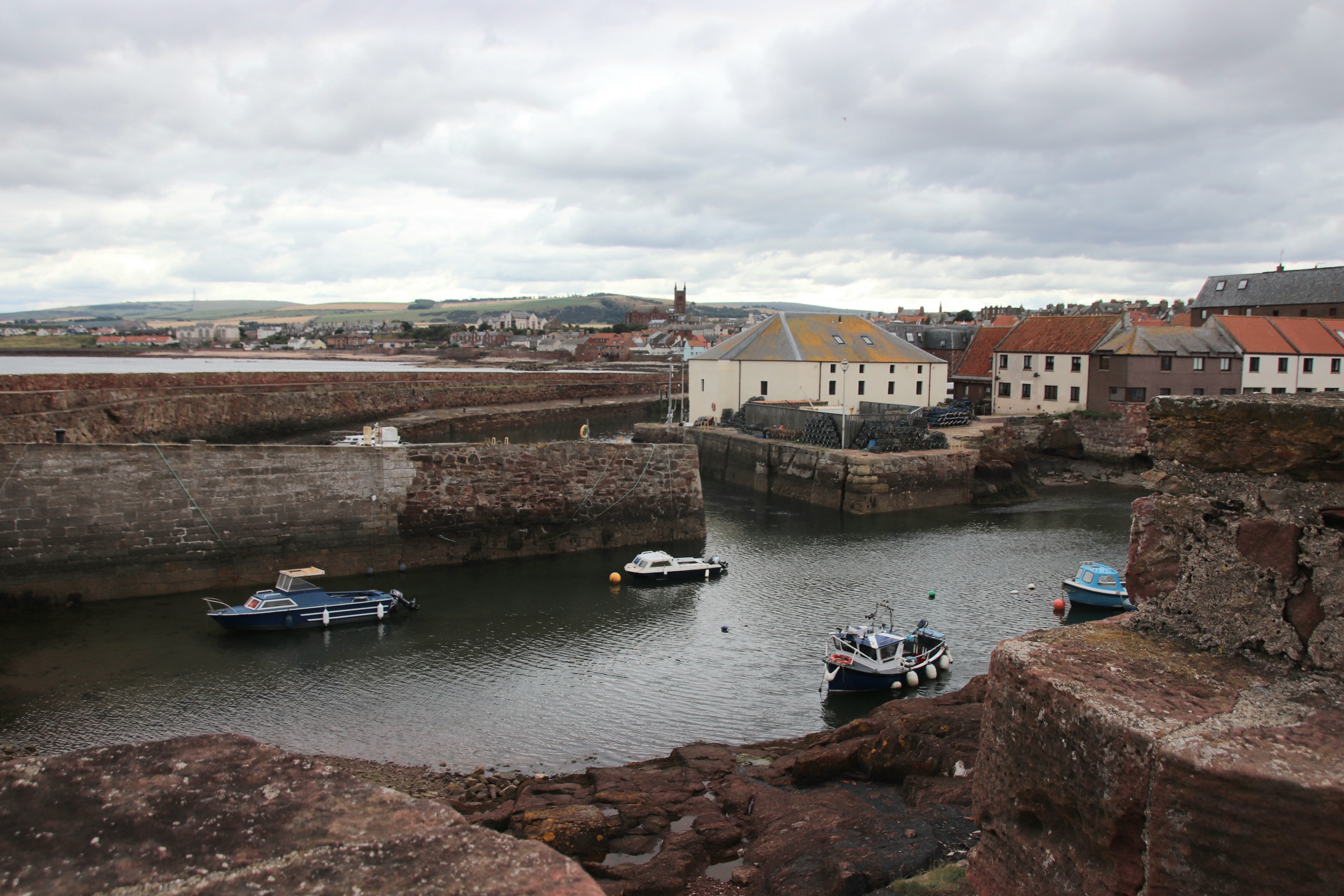
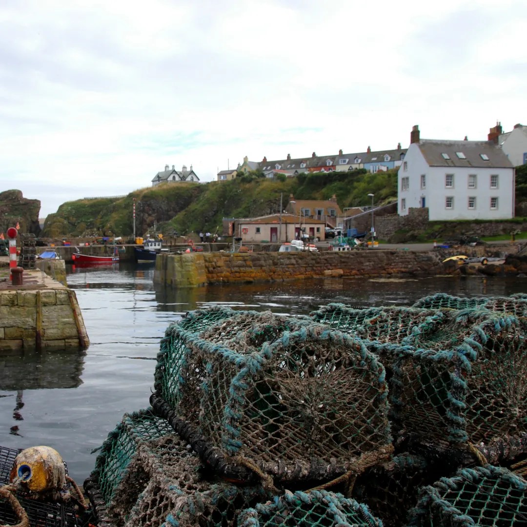
The harbour area below the high cliffs consists of three harbours, a ruined castle and a battery. The town has a long history going back to the 7th century with its strategic importance at the entrance to the Firth of Forth. Above the harbour are the ruins of Dunbar Castle, stone from which was used to create Victoria Harbour in 1842. Dunbar was also home to a major herring & whaling fleet and to this day, retains a commercial fleet mainly landing shellfish.
A bascule bridge (opening upwards) separates the battery from the wharfs & sea walls.
Around the corner, Cromwell Harbour dates from 1574 and provides better shelter during winter storms.
Possession of Berwick-upon-Tweed has passed between England and Scotland on at least a dozen occasions over the centuries, the last being in 1482. Its medieval walls, Elizabethan ramparts and 18th century barracks reflect its strategic importance during frequent border wars between the two countries. However, do not seek refuge in the town on a wet, cold autumn-feeling day, for there is little to raise your spirits beyond these ancient, military walls & defences. Indeed the high Street seems to have given up the fight to bring a bit of colour to families of damp, weary holidaymakers trying to find some shelter from the elements.
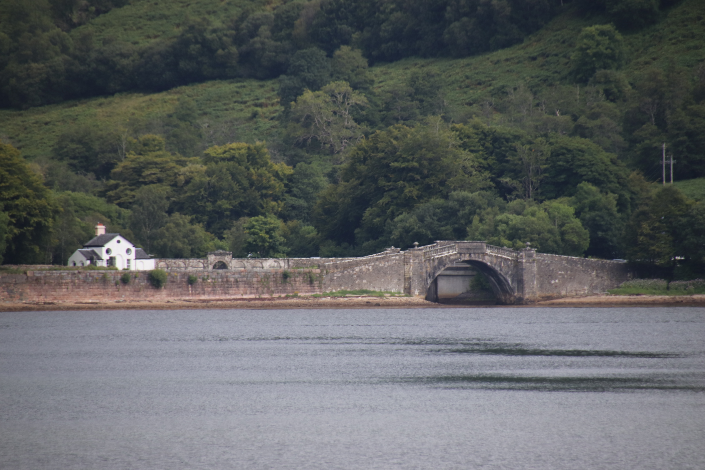
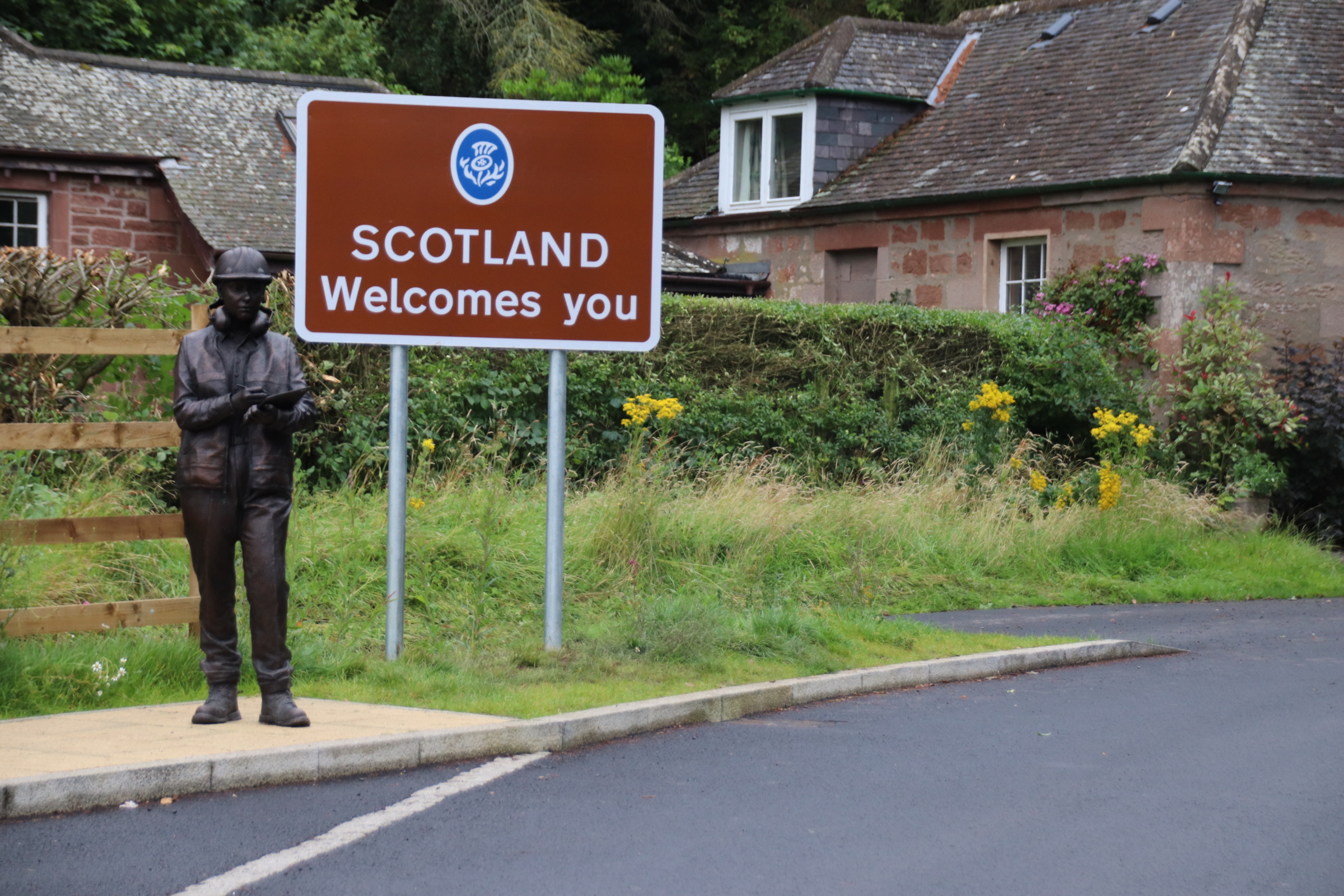
The border between the two countries runs from the North Sea coast just above Berwick-upon-Tweed, south west across the River Tweed near Paxton House, a grand Georgian mansion that is open to the public. This is the first chain link suspension bridge in Europe, built in 1820, for horse & carts and later modified for motorised vehicles.
Once in Scotland, the coast road meanders along the clifftop through open, golden, shave-harvested fields and lush, purple-speckled hedgerows, with ocean blue to the distant right flushing up to join the assorted greys above. In places, the road drops down from caravanned headands to busy harbours or sandy beaches. The first is Eyemouth where the harbour has been redeveloped along the estuary to include a wharf for working boats but also bars, cafes & eateries catering for visitors and holidaymakers.
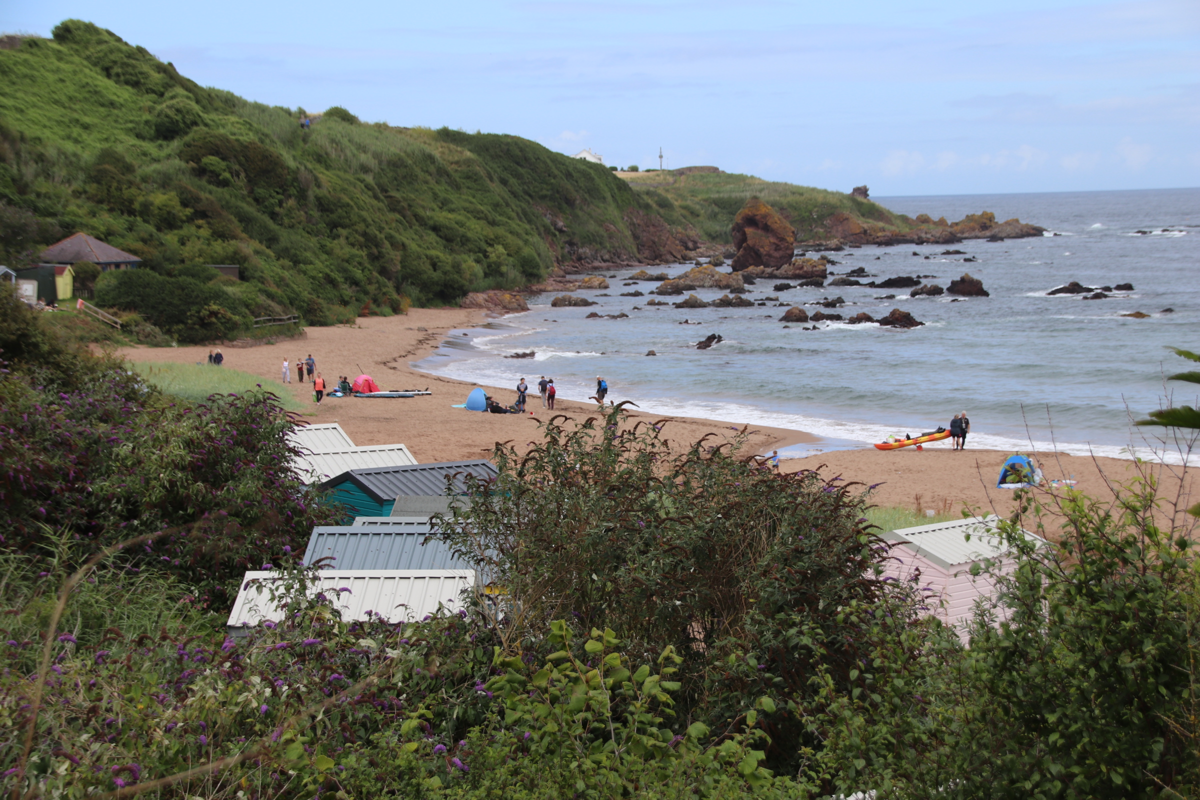
Coldingham village is a mile or so away from its cove where multi-generational families enjoy the sands and the Beach Cafe (called, unsurpringly, the ‘Beach Cafe’!). Children splash the waves, dads score centuries in games of beach cricket, grandads show off keepy-uppies and their dribbling skills against giggling children. A few trepid surfers ride the waves and clusters of children scrape the beach with their body boards.
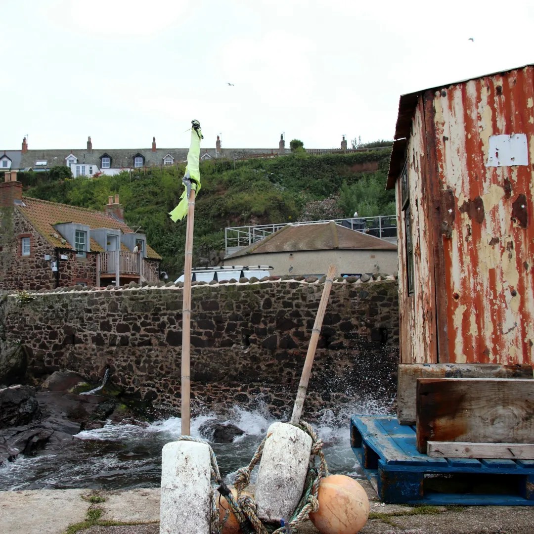
The road struggles up the hill to peak at the brow. Below, picturesque St Abbs collects around a number of quays & wharves, divided by stone walls & jetties. Klinkered rocks jaw around the numerous harbours, ready to snap up fishing vessels and paraphernalia.
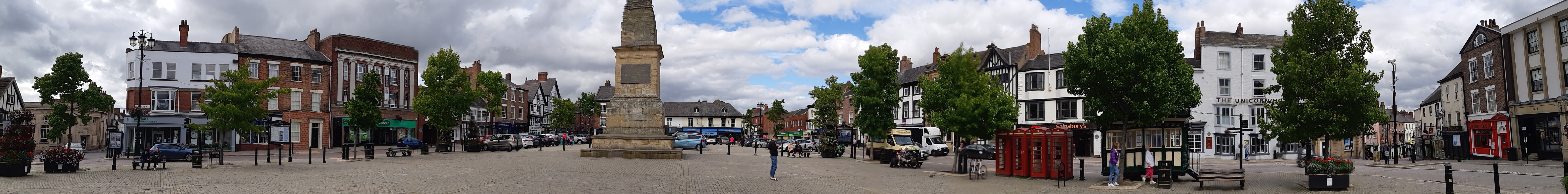
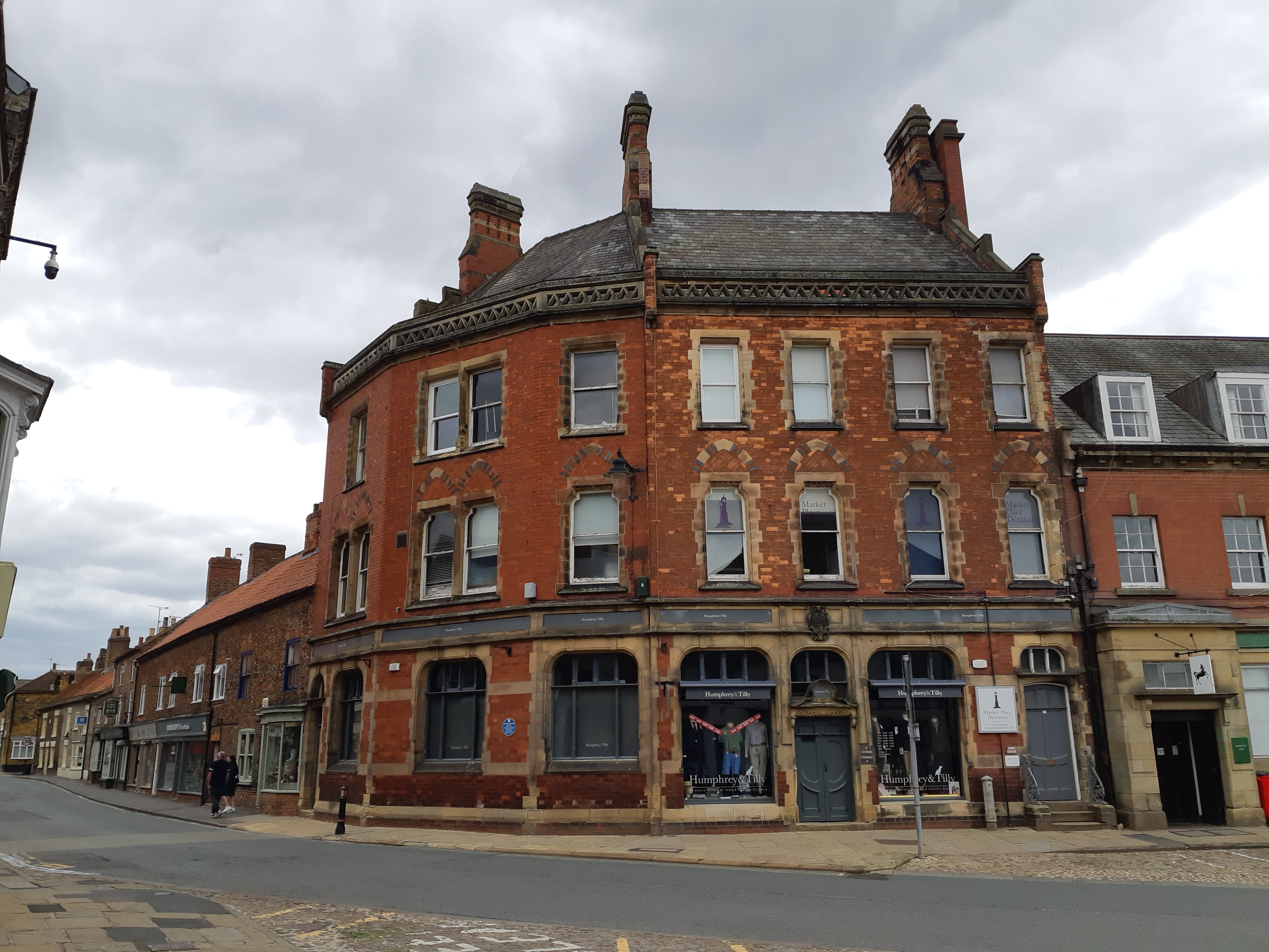
On my travels again – this time swaping the hassle of airports & the heat of southern Europe for a road trip enjoying the cool & peace of Scotland. Within 200 or so miles from home I am in North Yorkshire and exploring the delights of the Look-up market towns of Rippon and Thirsk, the latter providing an excellent stopover in the old Golden Fleece coaching inn. I say Look-up towns as both are very similar – each has a large open market square, the four sides lined by wide pedestrian walkways and pierced by roadways entering from 4/5 points of the compass. At street level both give the impression of past glories, with pubs and old coaching inns sharing occupancy with charity shops and Italian & Chinese eateries. But look above and study the roof line to capture the real treasures of past good times.
Rippon has several features that make it quite special, starting with the square itself.
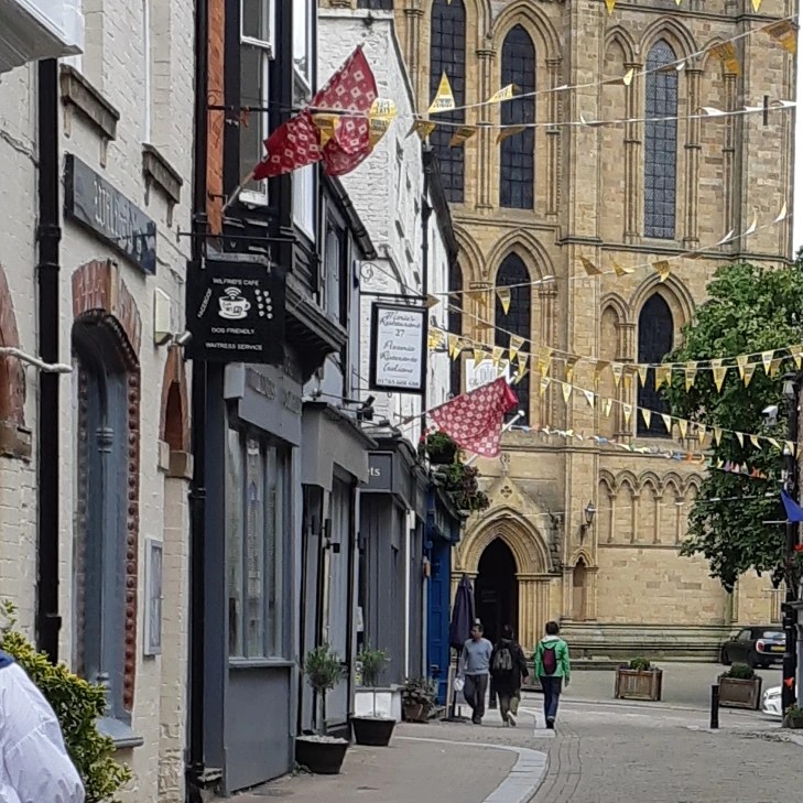
The back streets are home to several independent craft and tourist shops with quality goods for sale. A wide range of eateries provide quality experiences for the visitor. The Cathedral and the nearby Fountains Abbey are high spots for the visitor.
Numerous museums & buildings add extra interest – the Poor Law Museum, The Leper Museum, the courthouse to name a few.
Thirsk has a similar feel, although being smaller, it lacks the range of services & goods on offer. The market square is spread around, overlooked by high-storied buildings, rooted in those important days of coach travel.
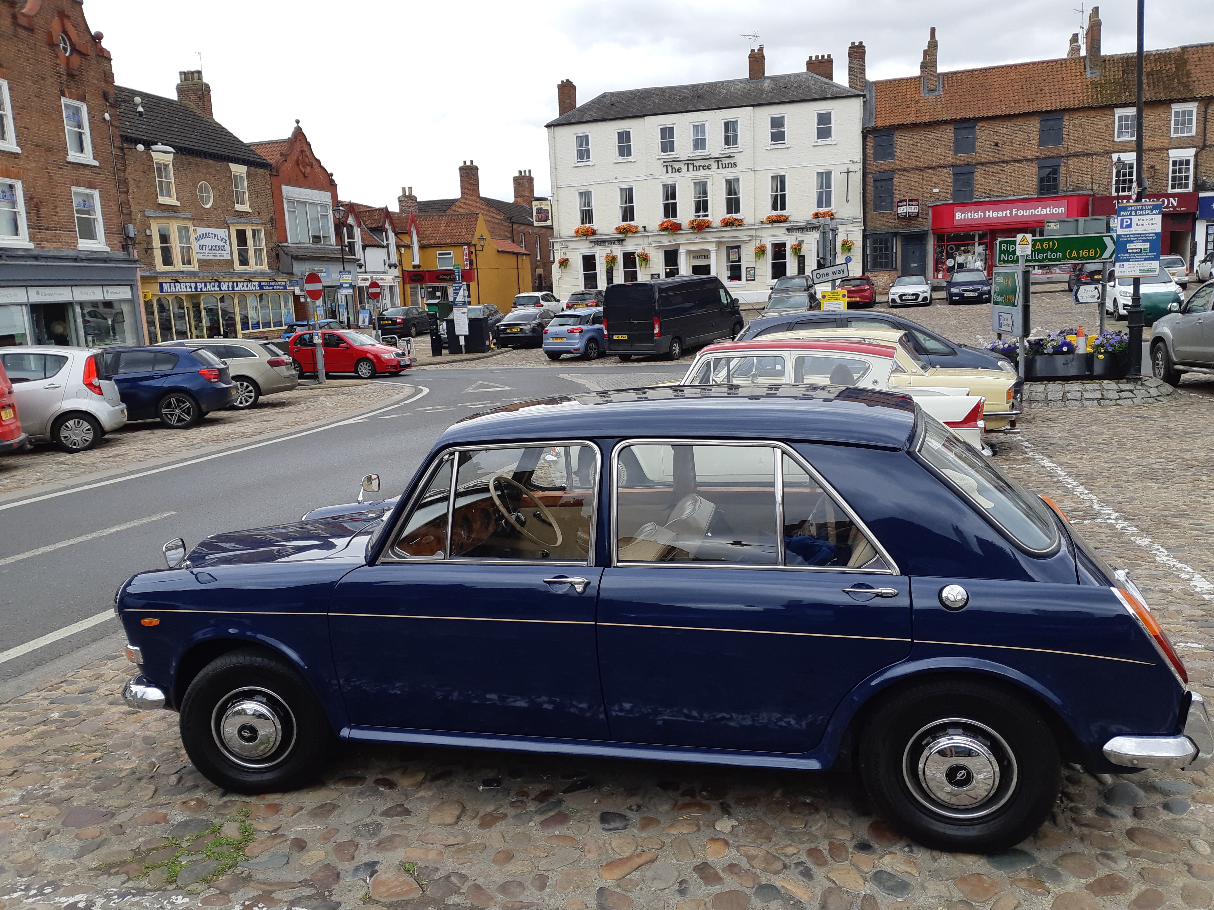
I should explain that the presence of Triumph Heralds, 1100s & Anglias, parked in the square is down to a classic car rally in the town and not an indication of the age or hobbies of the local population.
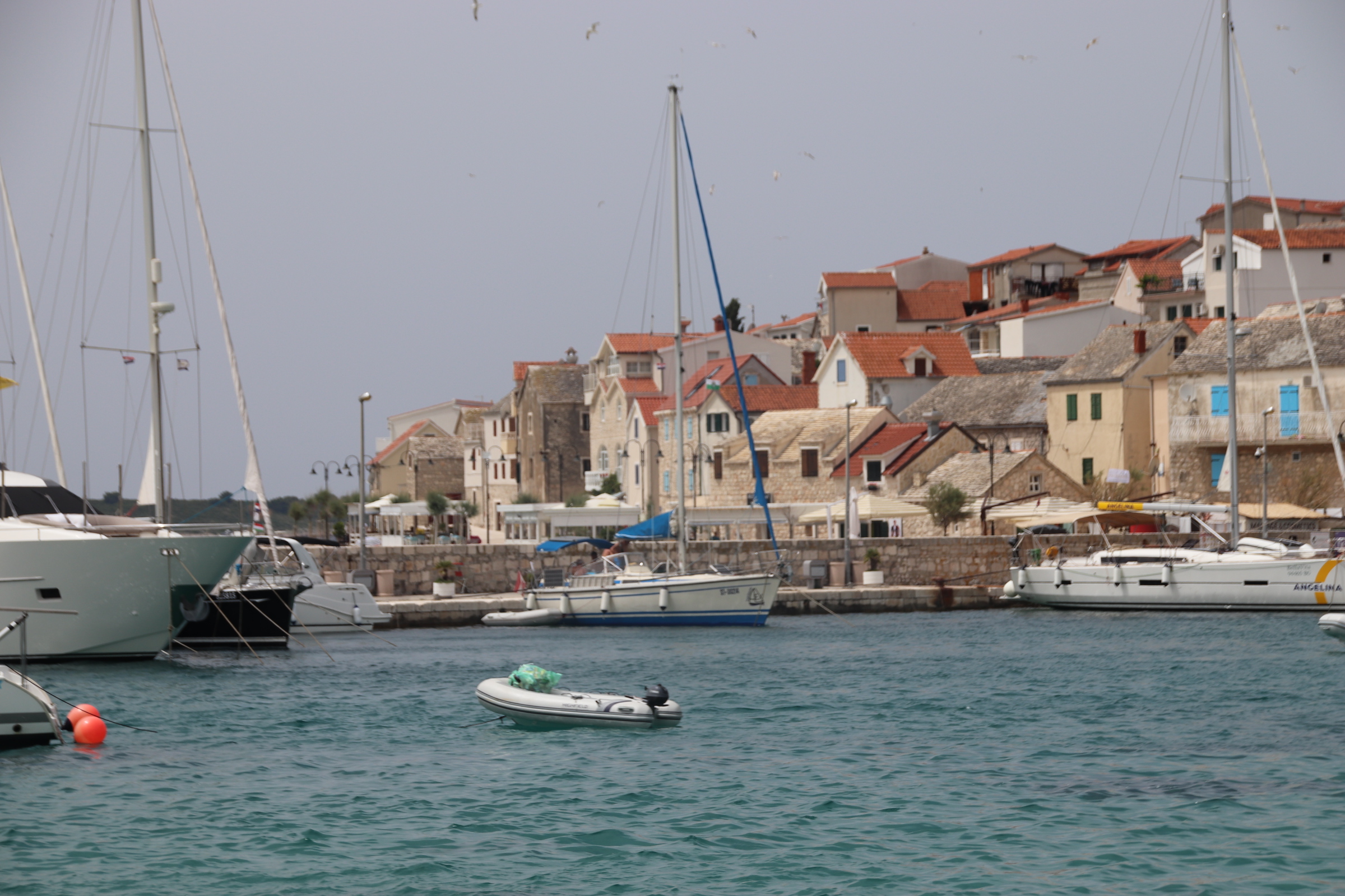
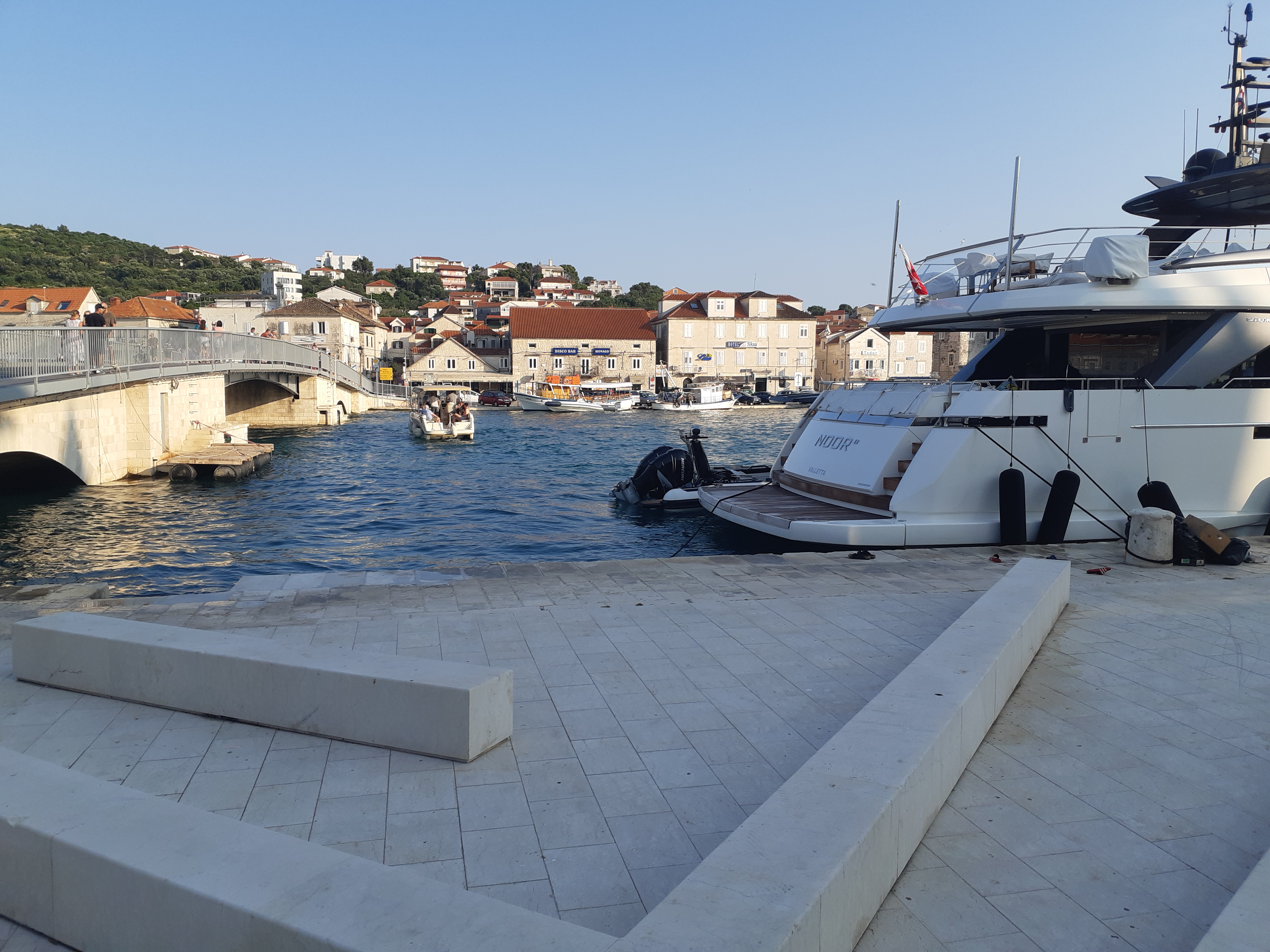
The last day exploring Croatia’s Adriatic coast above Trogir proved rather disappointing. Trogir itself was lovely during the week – atmospheric, great ambiance, history and tourism coming together in harmony and complementing each other. As the weekend approached this seemed to become swamped. The streets became full, with loud crowds of youthful groups pushing their way through, searching for music, partying and a good time. The mini cruises offloaded their guests and the many sailing flotillas on the other side of the water filled the quay there all the way down, moored 6/7/8 abreast. So, it was time to get out and remind ourselves what the real Croatia felt like. If only …….
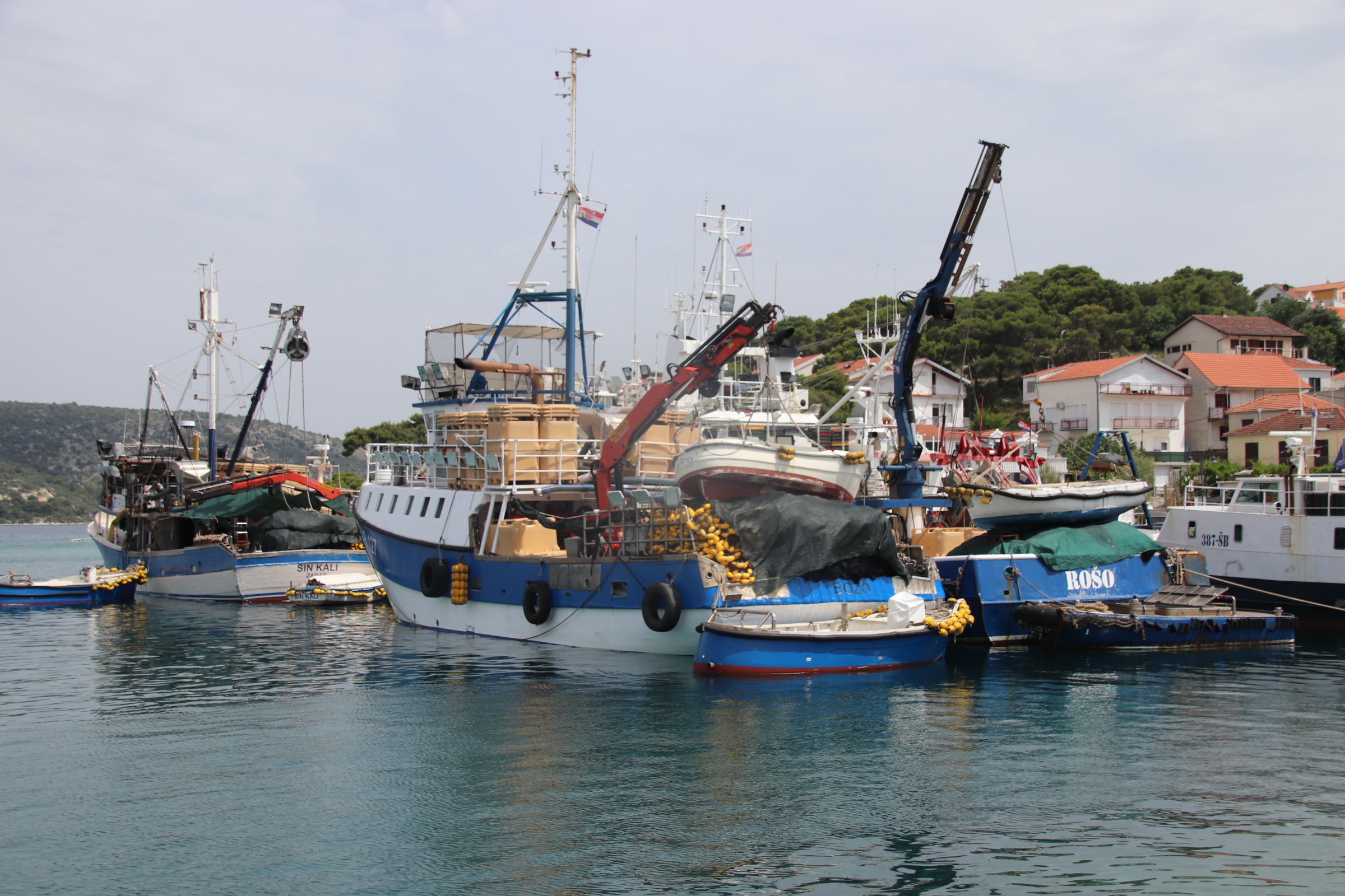
Further up the coast, a number of small fishing villages dot the shore, just off the recently improved coastal road – fresh tarmac and pristine white lines. Rogoznica is one just village which seems to be representative of all the others but at least it still retains a heart in the form of a small fishing fleet and a large yacht marina.
It’s as if developers have identified the original village as an ideal spot for creating a tourist centre. The old cottages have been converted into villas, new holiday apartments have been built within the old centre and the watersde has been given a spanking bright promenade and quay lined by bars and restaurants to bind it all together. The presence of the fishing fleet at least allows the place to retain a small bit of character and an element of charm within the local landscape.
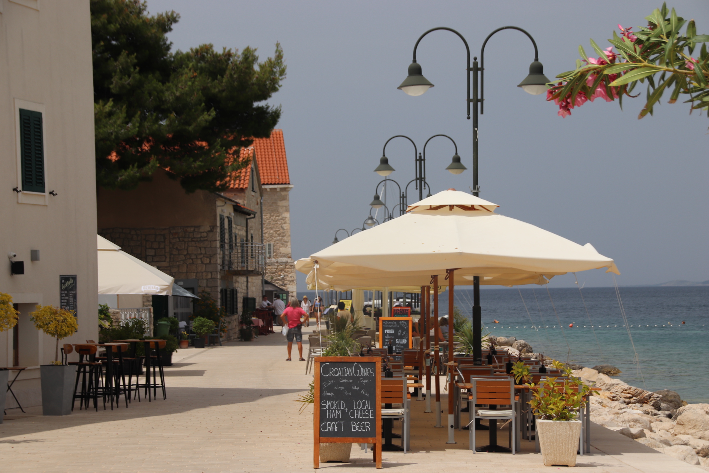
From a distance, Primosten appears to be another wonderful example of an historic fishing village.
Once onto the clean, modern quayside that lines the narrow limestone klinker beach, one gets the feeling of what this island village will be like.
It feels like the streets will be full of character and fishing cottages. But again, the resort has a freshly whitewashed and mortared feel to it. A few old cottages house a few crafty shops and converted holiday dwellings, while sharp rectangular new builds have been constructed in between for tourist apartments & hotels. These spread around the ragged cliffs, where their occupants perch out on the rocks and outcrops to find a place to lie out or access the water.
The opposite beach is a lined arrangement of sunbeds and umbrellas which would put legions of Roman cohorts to shame!
A wide stone/cement walkway meanders, dipping and diving, around the island along the cliffs. Once out of the resort itself the path becomes a bit wilder. An odd cove appears or a classy restaurant, perched high above the surf below. It’s not far before the path flattens out and eateries fill the available space again.
One can only hope that as time passes, such resorts will weather and begin to harmonise with their historical context so such settlements can fulfil their full potential as successful holiday destinations. This may well be possible, if the holiday companies allow it to happen. Good luck, Croatia.
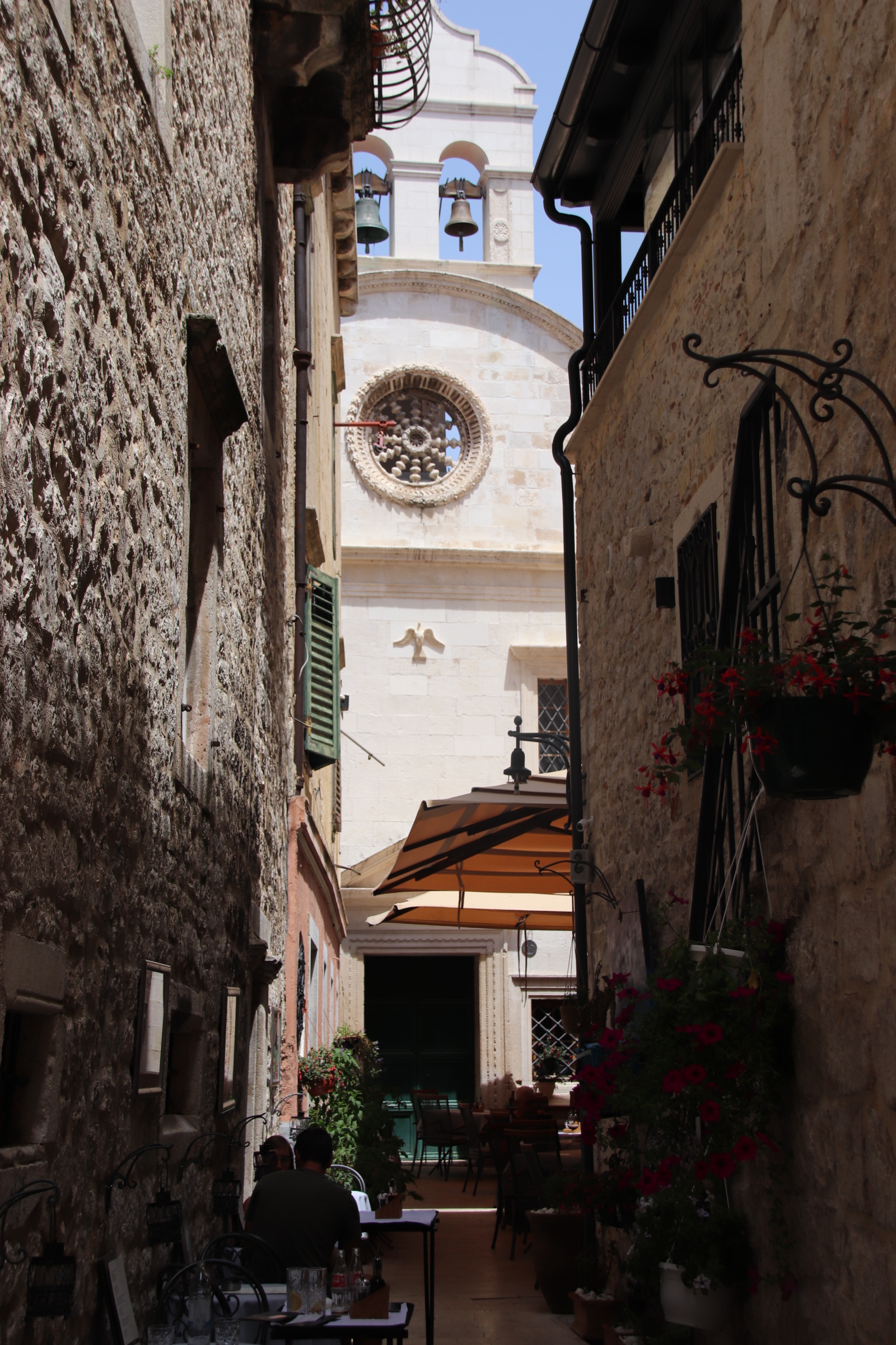
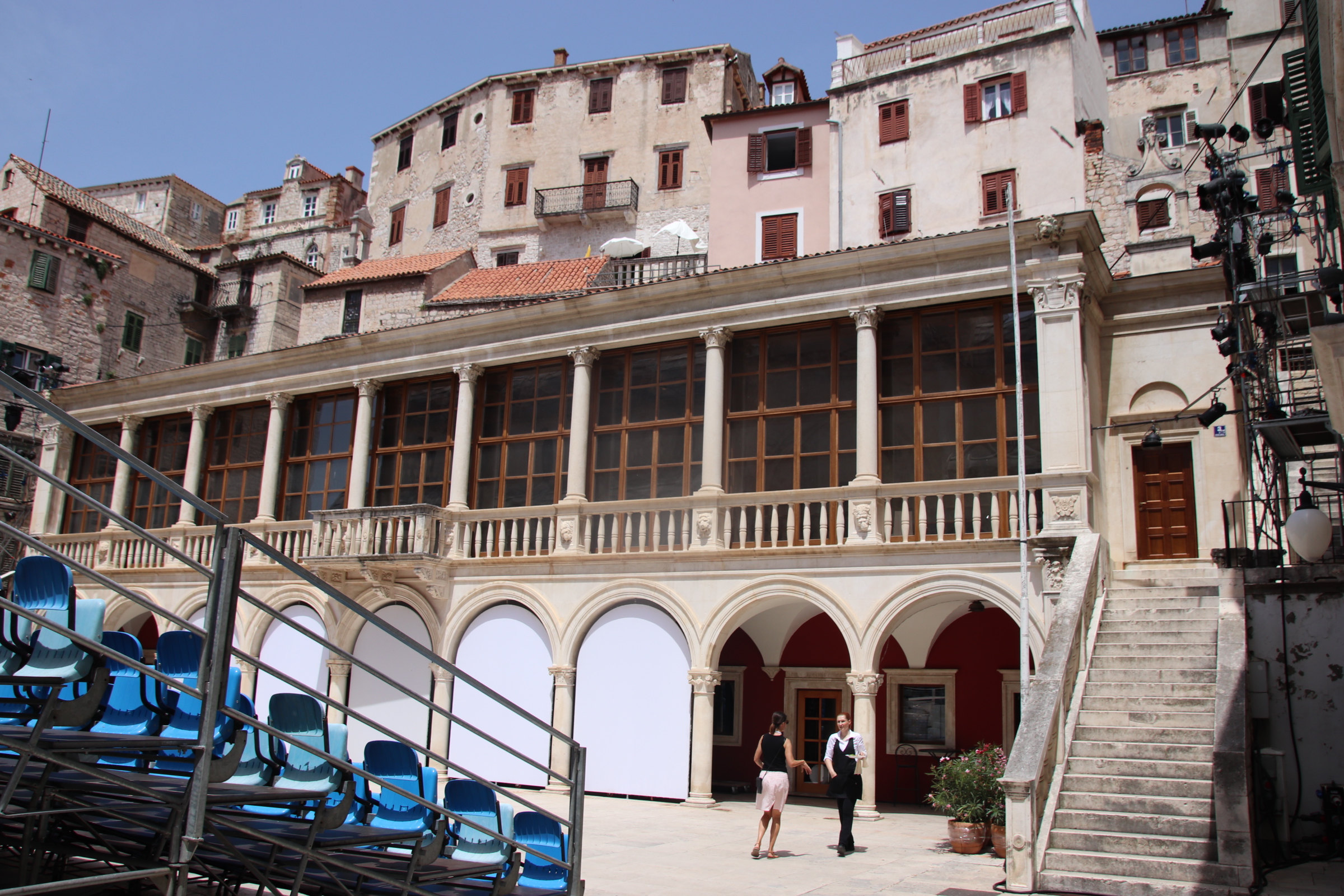
To start with this town seems anything but a special place to visit; on a par with Split & Dubrovnik? Parking down in the port area and looking up behind the few trip boats to the facade of the sea-facing walls, pierced by a few small windows & doorways, it seems nothing special. The dome of the town church pierces the sky line, special enough to be noticed but not enough to be admired. Yet clues to the secrets in these streets can be spied with hints of two of the town’s four large fortresses muddled on high outcrops. Narrow cracks beside seafront cafes tease the visitor and tempt them in.
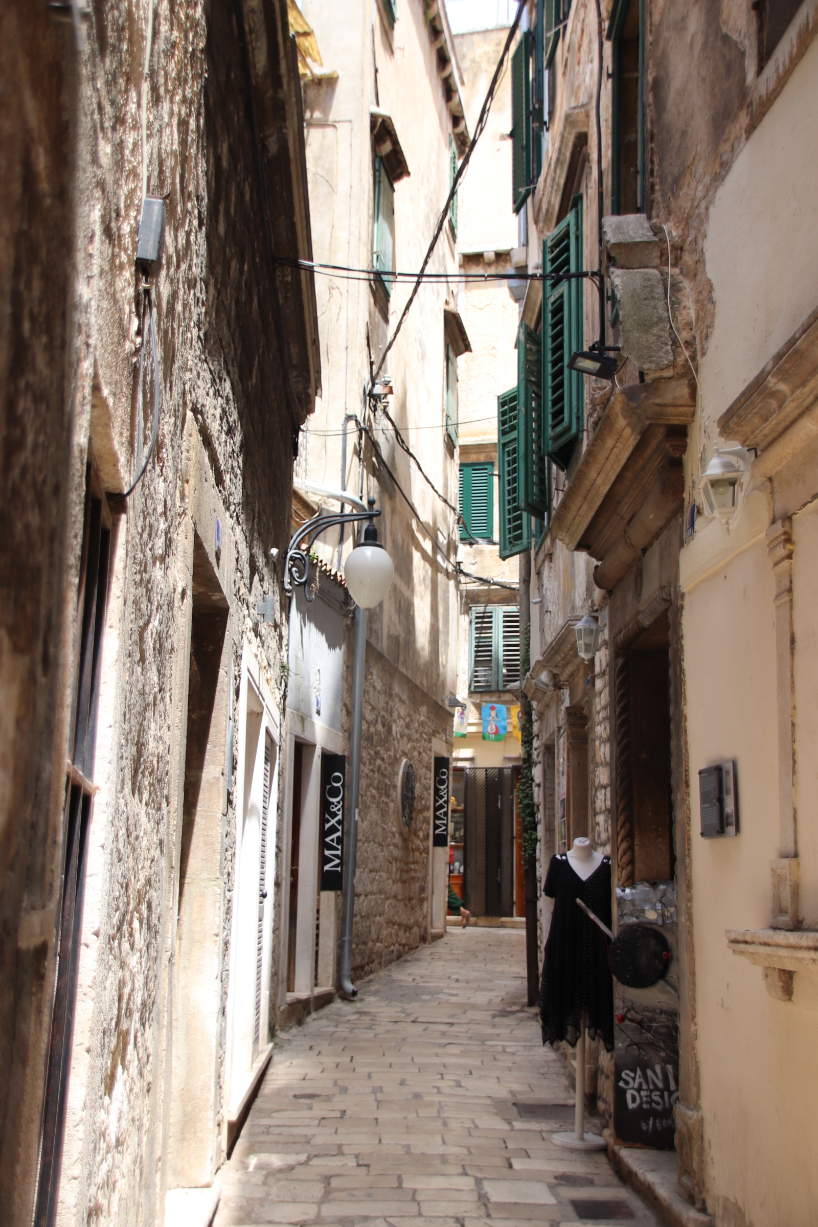
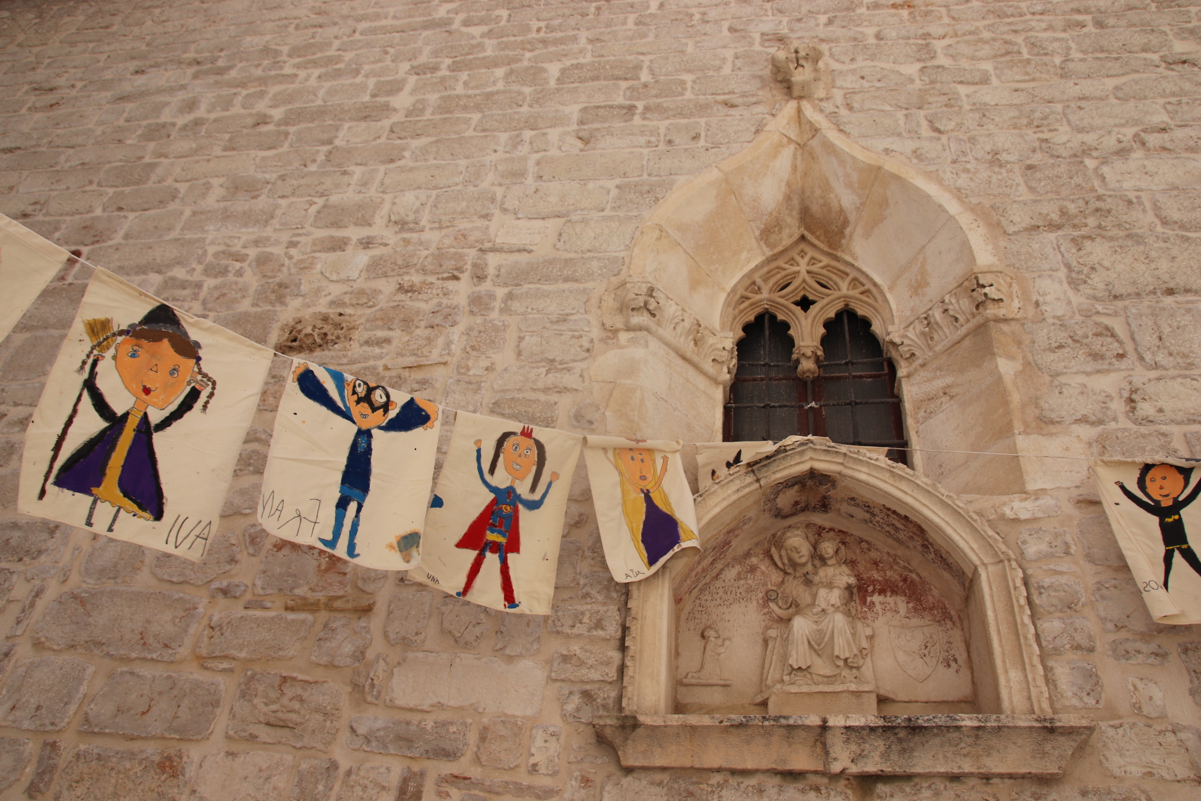
It is only as you take a set of steps into the dark cobbles of the medieval Old Town does Sibenik begin to divulge its treasures and history. A sense of pageantry pervades the labyrinth of the smoothed-cobbled alleys, aided by lines of hanging bunting painted by school children.
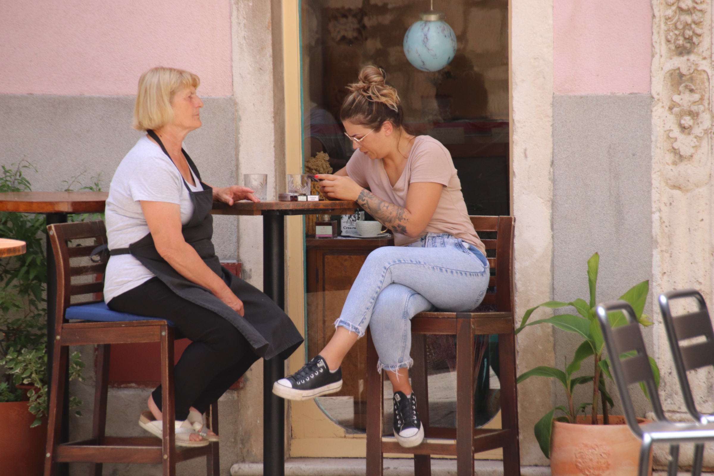
Cool squares & courtyards are squeezed into any tight space and tables arranged as a bar or a restaurant for the few visitors to this shadowed maze.
This passage leads through the tables to what appears to be a grand church but is, in fact, a simple chapel the size of a 10 metre cube.
Divining a way through the streets is a challenge if you try to use your mental compass to reach a set point. Much more exciting & satisfying is to give up any previous guidance system (that the duomo will be at the highest spot of the town – here that is not the case as it is down near the water front) and go with the gut to see what is around the next corner or at the top of a range of stone steps; things like the main drag of shopping outlets, unique independent crafty shops and interesting eateries that create a hotspot of culture and arts, a talented busker.
Umbrellered cafes, shaded by canvas or potted trees offer a respite from the tourist path. Deeper into the myriad of passages, the real gems start to appear. The church of Sveti Barbara date’s back to the 15th century.
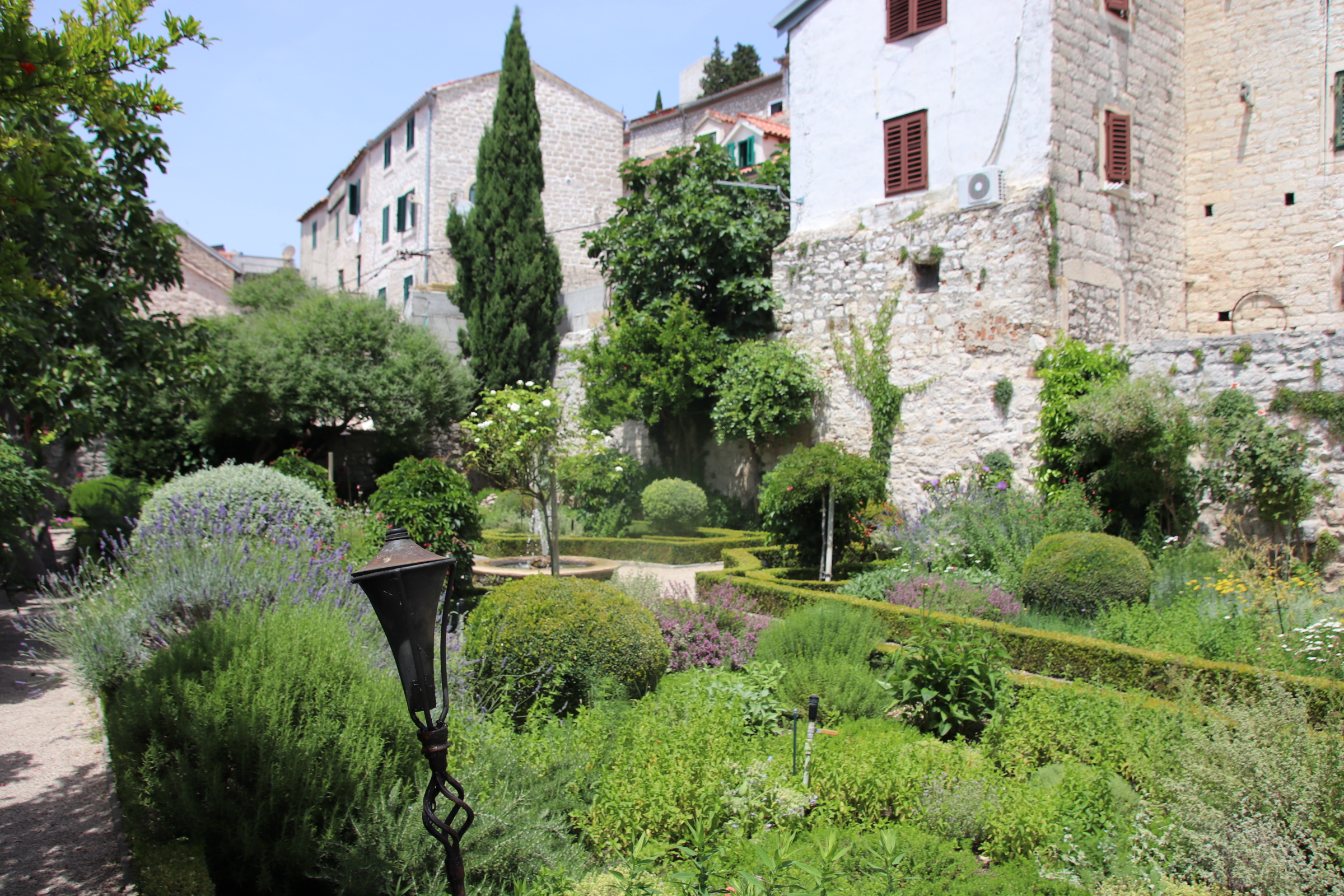
It is no longer used a a church but is being converted to be used as part of the City Museum. Then the heavy stuff comes out – up wide, winding steps is the monastery of St. Lawrence and its small, preciously green garden, a tranquil oasis in a desert of quarried stone. It is free to enter and spend time here. There’s also a small cafe serving healthy drinks & snacks in tune with the ambience; lots of water & no burgers!
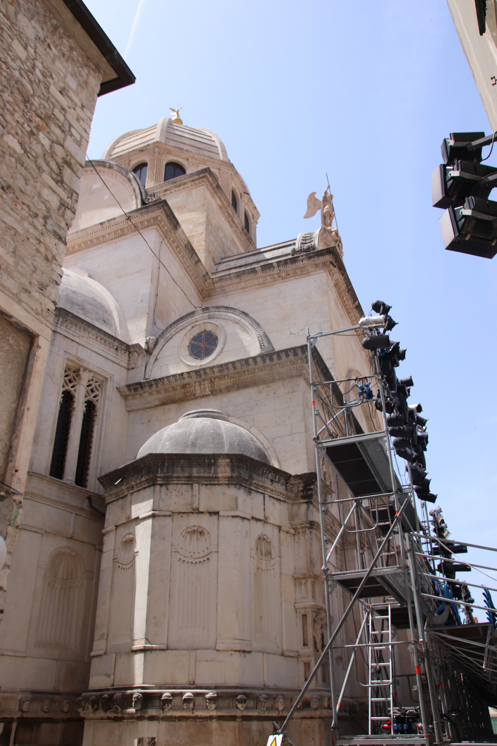
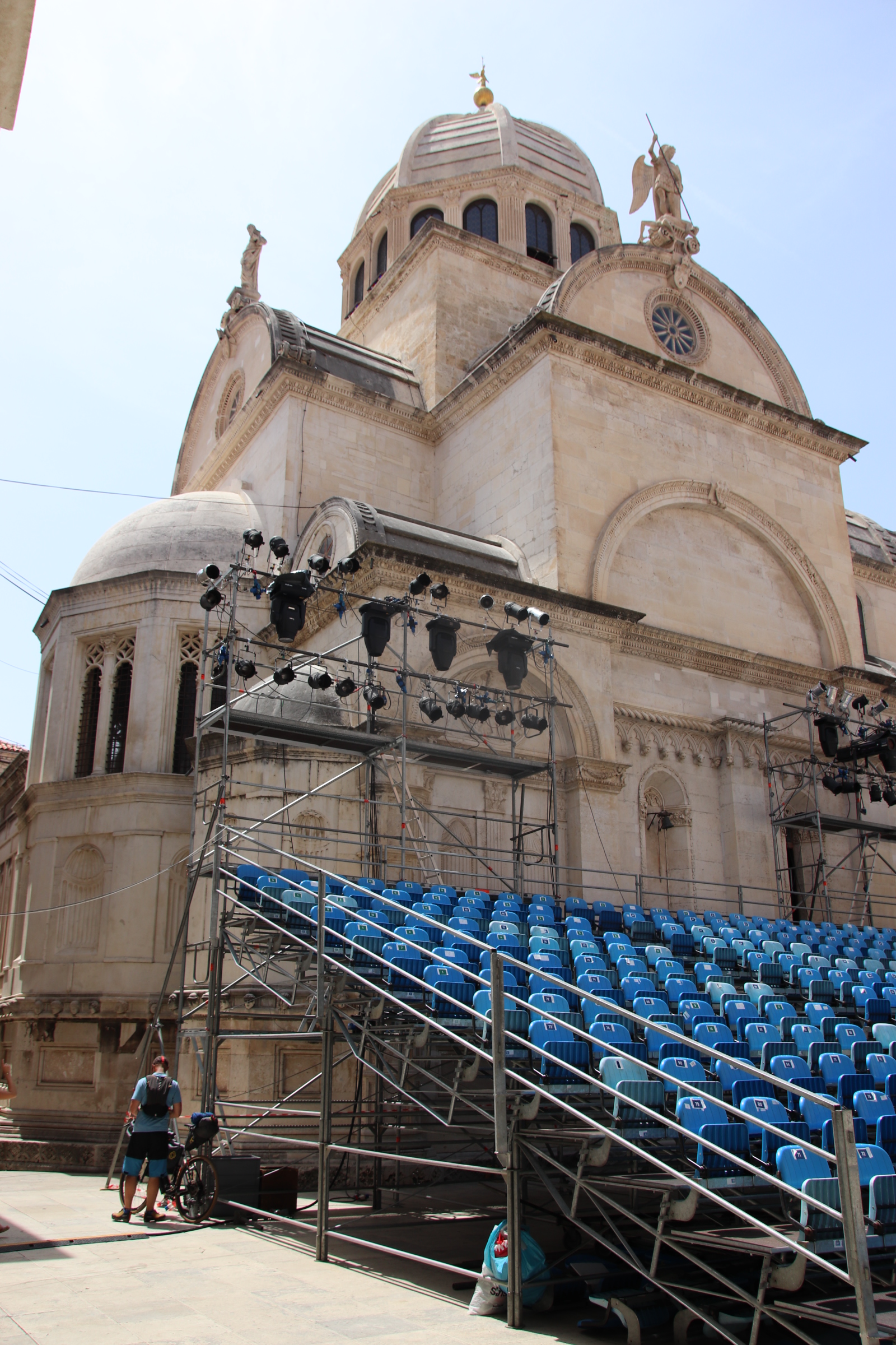
Sibenik Cathedral of St. James is situated in the Republic Square and City Loggia which normally houses a number of small cafes. Today it has been decked out for performances but one can still feel the ambience of the place. The cathedral was built over 100 years between 1431 & 1535.
The Loggia was built over the same period of time but a century later.
The cathedral is equally impressive from many different aspects.
The wide balustrade of steps at the rear lead down through a tidy square & past the pillered man to a wide shaded Promenade where another round of refreshments can be bought from a lovely quirky bar before a gentle stroll along the water back into town.
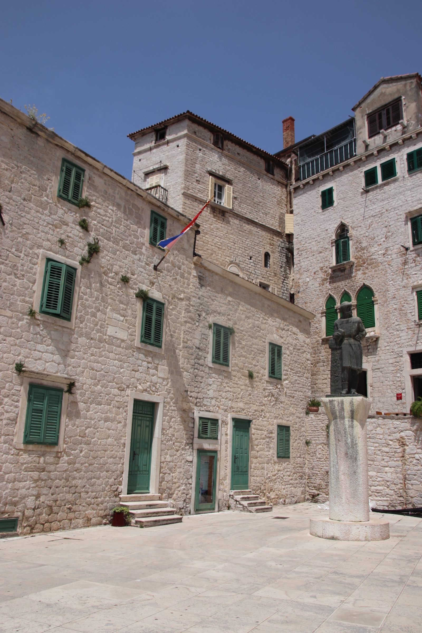
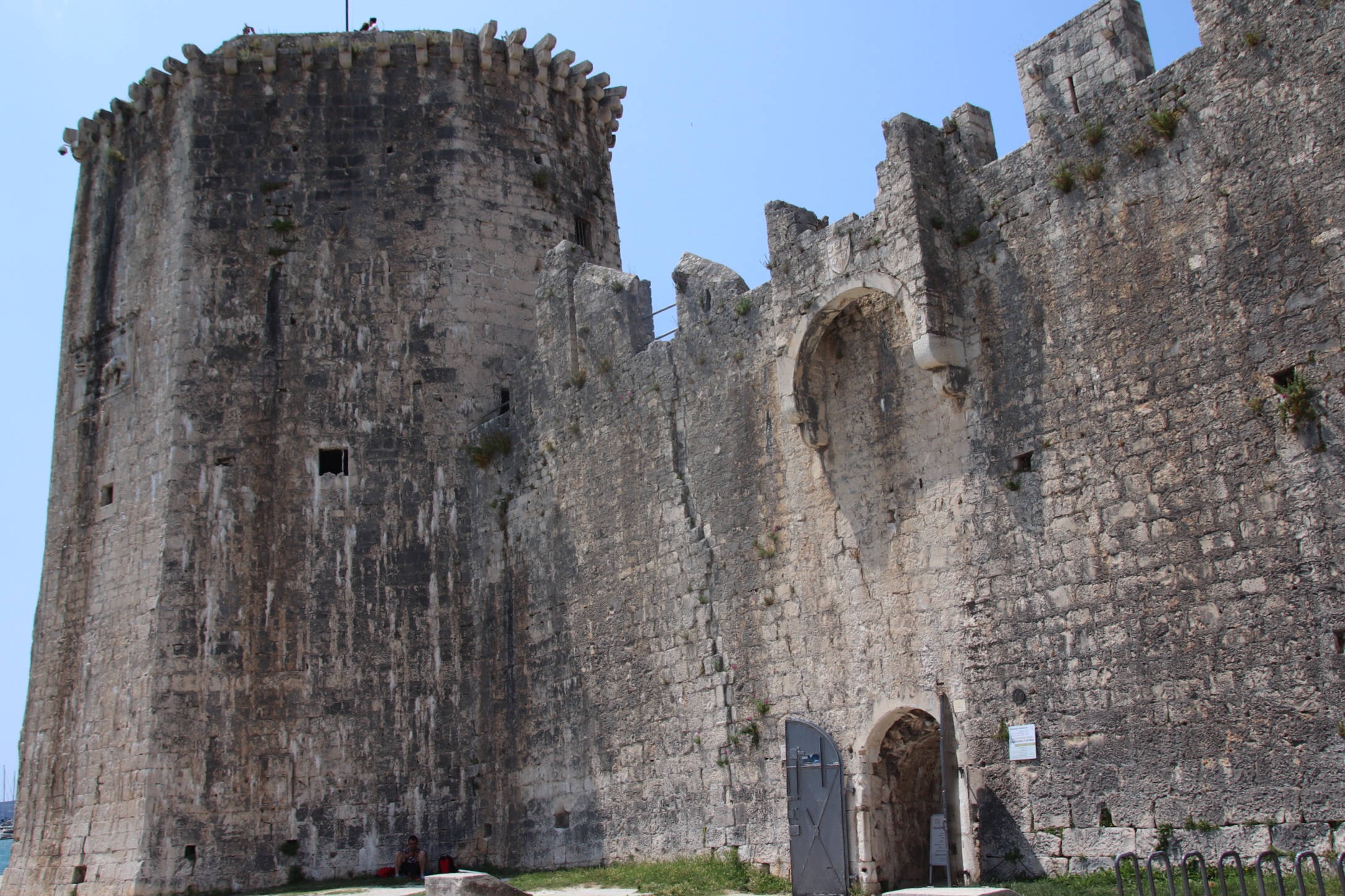
Trogir’s wealth and history is based on its unique island position. Outside the walls, the luxury yachts are moored up along the quay under the protection provided by the giant Fotress Kamerlengo.
From the other end of the quayside another bridge links Trigor’s island with the island of Ciovo. That quay lacks the imposing walls and glitzy yachts of the town, but it is the gateway to other sides of this historic hotspot.
A 20 minute drive along the north coast runs through low apartment buildings across the road from narrow roadside parking above a strip of beach. I say a strip. It’s more concrete constructions mixed with rocky foreshore with the occasional hard place for sitting about on where metal ladders lead down into the water. About a mile further on a slightly more beach-like sections separate the hard, crunchy rocks. Crystal clear water laps up onto white limestone, sharp and very testing for both untamed feet and lying out on unless you’re a contortionist or you have invested in a beach bed/chair or these beauties…..jelly shoes for 10€.
From the row of apartments, families spread out onto the clinker-like beach, nearly all speaking Croatian, Polish, Czech. English is rarely heard.
A few cars make it up here. The road eventually gives way to a dusty track leading to a wonderfully wild area at the top tip of the island.
Turning right over the bridge takes us to another side of Trogir’s attractions for visitors. Okrug Gornji is a resort with a main strip of a kilometre or so. Music blasts out from a line of beach bars that face the sea over what can only be described as a strip of exposed concrete – a sunbed carpark, blazed by the sun, with more short metal rungs or steep clinker slopes providing access to the water. Over the road groups of lads & lasses leave small supermarkets with cases of cannies to consume on their patch of cement. I took no images, here.
Away from this hot, pink, temple to summer drum & base, cheap apartments and painful sunworshipping, the road runs through attractive hillside shrubs, trees and gorse until the far end where Okrug Donji is growing at the other extreme of the social spectrum. Large homes and villas have been built here on the cliffs looking back to the mainland. These are grand, detached second homes or holiday dwellings and generate a feeling of wealth and class. Homes & a restaurant hide in the shade of the cedars, a respectful distance from the noise and action from down the road.


You must be logged in to post a comment.