Clovelly, My Precious

The weather takes a downturn, today, with layers of grey gloom hiding the sun. The surfers are out in force across the vast expanse that is Saunton Sands. It has a special atmosphere in the dull drizzle but our wet-suited heroes don’t give a fan – they’re going to get wet anyway. They only come out when noses, feet & hands have turned the colour of unripened blueberries.

Westward Ho! (The exclamation mark is an official part of the town’s name) mixes up together the elements of this north Devon coast. So surfers attack the waves in front of the static caravans and apartments blocks and beach huts that look out from their cliff locations.

Families and school groups explore the craggy rocks pools and wait for the sands to dry out before cavorting around in disorganised games. I love it. Nothing is too precious. Everything just mixes in together and the empty beach shows it has the space for every background and class to do their own thing when the sun comes out to play.

Now Clovelly is precious. First of all you have to pay £7.50 per person entrance fee. The village has been owned by one family for hundreds of years and none of the 250 inhabitants own their own home. In the blurb they call themselves ‘one of the world’s most beautiful villages’.

It is amazing. The steep descent down cobbled streets between old cottages is half a mile or so in length. The old harbour beside the old pub opens up at the bottom. Thankfully there is a Landrover services from the bottom to take you back up to the top for £2.50 – cheap at 10 times the price.

Hartland Quay, like Clovelly, is a port used to take agricultural produce and to bring in heavy goods like lime and coal and manufactured goods. Just one bar and a few fishermans’s homes line the approach to the beach and the quay itself. The coastline is very stark here. Dragons’ tails mingle with crocodiles’ scales to create a coast line doing impressions of sharp, sharks’ teeth cutting out to sea. It really is an angry place on a drizzly day like today.


Surfer-dudes in North Devon

I cross over into England and start today from Weston-super-Mare. Now this resort town has three things, in particular, going for it. The first is the vast stretch of beautiful, soft sand that cries out for sand castles or jogging or picnics. The second is the pier which looks great whatever the light although it is closed between 4 and 10 so can only stand to be admired from a distance. The third are the beach donkeys – sadly they were not there although there was evidence of their presence in the hitching posts, the blowing hay and the neat baskets of poo.

Burnham-on-Sea is a few miles down the coast. Now here must be the UK’s smallest pier, if it even conforms to the definition of a pier. I call it the Thomas the Tank Engine of piers. Compared with its piers around the coast (you see what I did there?) its name pulls well above its weight.

There is not much else in the town, not even a place for a decent espresso. However at the top end of the beach a white-washed watch tower poses historical questions.

Now isn’t this the saddest of images. Some poor child’s bicycle abandoned in the sinking sands of the beach.

So many questions – did they forget it? Did the tide snatch it and return it in some guilty moment? Did they stomp off after a tantrum abandoning it to the elements? We’ll never know.

Hele is one side of a headland.

Ilfracombe is the other side. The harbour is framed by terraces of elegant houses along with working buildings and overlooked by Damian Hirst’s overwhelming statue of Verity.

Lee is my new favourite. A small cove hides a few well maintained houses with names like Shell Cottage, that cluster around a large abandoned hotel which awaits the developer to spoil the character of the place which, at least at the moment, remains isolated, peaceful, harmonious.

Woolacombe and Putsborough are the anchors that tie each end of the world-famous surfing beach to the land. A host of those black leeches wait in the water, horizontal & patient, until thrown into a frenzy by the build up of waves. The call is out that the surf is up and the surfer-dudes are out in full searching as a pack to find the right wave. It is quite a spectacle. Shame about the modern beach huts.

Dunraven Beach and Penarth Pier are highlights of the day

The wonderful thing about this project is that every single day that I have been away, whether it’s Wales or Whitby or Worthing, every day throws up at least one supremely amazing discovery. Today is no exception. I travel eastwards from Porthcawl. The beaches and headlands continue to be awesome and I wonder at their magnificence and beauty. Ogmore-by-Sea provides views over the sands back to Porthcawl itself as well as providing a lowtide backdrop of rolling cliffs, exposed sands and craggy outcrops of rocks.

From the cliffs of Southerndown, the headlands and bays of the coast can be seen rolling away into the distance.

One of the most striking out beaches is just outside the village at Dunraven. Down a long descent on a narrow road the beach opens up before the visitor. It is a rough, stoney beach with the occasional patch of smooth sand, that looks like it as been scraped of all loose material by huge earth-movers, leaving lines of jagged bedrock heading towards the surf. Humanity gets lost amongst its scratchy surfaces. Can you spot the group of 30 or so infants?

Any patches of sand are lost by Llantwit Major where smoothed stones and large pebbles and even rounded boulders fight for position on the beach. Here is an excellent tea room and toilet and a free car park.

At Barry there is a change. The town is on an island which is separated by a headland. On the east side the low tide exposes a classy expanse off smooth, drying sand which has captured the skeletons of old boats but which still remains excellent terrain for walking designer dogs.

On the other side of the headland is the main resort. Here the bay is still soft sand but it receives a daily seeing to. The tracks of raking tractors show where the litter has been picked and gathered. It looks like Ben Hur has run half a chariot race around the beach. The shops on the front are rather tatty and require a bit of a facelift to match the modern redevelopment of paths and promenades that run along and around the low cliffs. If you venture into town a lot of building is going on – both residential and commercial.

My favourite sight of the day can be found amongst the cobbles of Penarth beach. Here stands the rather stubby but so elegant Penarth Pier Pavilion. The light and the colour of the stones provides a wonderful contrast to the fresh, bright paintwork. I love its size and compactness reaching out from the classy town of Penarth that lines the cliffs behind it.

Mumbling about the Gower and Mumbles

Llanelli is today’s first settlement of any real size. Modern development, in the shape of commercial centres and residential housing hues taken place along the waterline. This is a bit confusing when the tide is out as these modern, freshly painted estates line a huge, disappearing expanse of mud & silt. A dim marker out in the far distance shows where a vague line of surf must flop onto the flatland of the shore. A row of vans are parked out there too….why? Shell gatherers?

Once over the bridge, it is a glorious drive through the rolling hills and open moorland of the Gower. Roof down, music on, blue sky above, wild ponies grazing beside the road…life is good. This wonderful landscape is punctuated by the most breath-taking views of lines of estuaries and crescent-staped bays, some of which I go down to and find family-friendly, soft sanded playgrounds backed by the very necessary tea rooms.

The king, or maybe the queen, is the headland at Rhosseli. Wow. It takes your breath away. And half way along a white-washed farmhouse overlooks the whole scene. Someone lives there and wakes every morning to take in this scene. Heaven.

Some of the larger bays along the coast are Port Eynon,

Oxwich


and Caswell

And then we reach the Mumbles at the top end of Langland Bay which stretches around, past Swansea to Port Talbot. Miles of soft, light sand to entice families away from Benidorm & Corfu.

Mumbles is a small resort town with a lot of charm. The pier is its gem. The pier itself, along with its entertainments and cafe, is constructed on a gantry of ironwork attached to the shore. The rest of the structure heads out to sea beside the old lifeboat station, heading towards two newer stations. It all seems the wrong way around but it is very pleasing on the eye.

Around the bay the new buildings of Swansea line the sandy crescent of sand.


Port Talbot is one of those places where the beach is lined with industry and terraced housing. The sand is the same and just as big a draw for families and neighbours.

A surfers beach has been constructed alongside the industrial terminal and I spent time watching the leech-like forms lying stationary in the water waiting for THE right wave to bring them into squiggling action.

Within Tenby’s 13th century walls an artist’s palette waits to be discovered

With a few good days ahead it’s down to South Wales to compete a leg, maybe two, of my coastline project. I head for Manorbier, an ordinary coastal village with a small beach that holds a surprise. Just outside, standing guard above the beach on the low cliffs outside the houses are the amazingly well-preserved ruins of a Norman castle.

Tenby is a walled, fortified, harbour town. It is a real delight with narrow, quirky streets cross-crossing and overlapping an ancient old town centre.

Steps and alleys cut through between brightly painted terraces hiding their old past behind small windows and narrow doors. B&B accommodation, pubs, sandwich bars, fish & chip shops, tourist shops and independent traders share their space yet in May it is calm, peaceful, civilised. Well worth a visit.

Further along the coast, small settlements are home to tourists to varying degrees. Saundersfoot provides proper tourist facilities in terms of tea, beer, ice cream & fish & chips.


At Wisemans Bridge only a pub and garden serves the line of parking along this beach of hard stones.

Amroth has a few refreshment stops.

Pendine, home of the famous Sands, has a collection of places for the speed king & queen to quench their thirst before venturing out on the sandy flats at low tide to try their luck against their clock. This is one of the places Campbell tried to beat the world land-speed record.

I spend the night at Burry Port, once famous for its metal works, copies in particular. Dusk gives the harbour and marina, and the new lifeboat shed, a lovely golden flow which plays havoc with the shadows that stretch out along the flat, sandy beach.

Tenerife – an island of mixed contrasts

Dawn on the last day dawns. The weather forecast predicted solid sun all day. It’s more like solid cloud all day. Now we know the island we know what to do. Go seek the sun….and within a 10 minute drive the cloud cover breaks and clears and a blue sky stretches from horizon to horizon. That is how it remains on the south coast until we drive back and hit the clouds in the north and temperatures drop a good 15°. This island is so fickle. When its cloudy and cool in the south it’s clear and hot in the north and visa-versa. It seems the sun can always be found somewhere.

So we find a bit of scruffy, rocky beach and while away the day with no-one & nothing to disturb us except the roaring surf rushing to break itself open onto the land and some manic wind turbines exhausting themselves in the high winds.

So another trip comes to an end. This is a island of contrasts – historic centres surrounded by sun-seeking resorts, lounging sunbedders and striding, booted walkers, the scruffy east coast and the exotic west, passionate locals & resorted tourists. There is one motorway that runs most of the way around the edge of the island and loads of squiggly roads that take you inland to the mountainous centre and nature park. A local bus service takes walkers out along the coast road to drop them off so they can walk break our their other way around. Really good for those intrepid hikers.


Tenerife is full of contrasts, yet a great place to explore.

A misjustice to Puerto de la Cruz

OLYMPUS DIGITAL CAMERA

Yesterday I wrote that there wasn’t much in Puerto de la Cruz. Last night I got to thinking that if all these other, smaller towns have an historic district them so must Puerto de la Cruz. Set I did some sleuthing online and found it….a collection of old white washed buildings around the old church. It was particularly will hidden amongst the resort pleasure domes that had repelled me in the first place. So apologies to Puerto de la Cruz.

History shines through Tenerife’s west coast resorts

Having spent the first days of the trip exploring the east coast, it was time to move over to the west coast. The island is absolutely amazing in terms of weather. It can be cool and windy in one place and full sun 10 km down the road. The west side is so very different to the east. Tall cliffs face the ocean with luxuriant vegetation sprouting from every crag & crack – cacti, palms, bougainvillia in full, intense blooming bloom. The ocean beats itself up against the base of the cliffs, its soft, perpetual, roar providing a calming influence to all that goes on. The view from the balcony is serene.

The sun comes up. The sun goes down. The sun sets in glorious technicolour to set expectation high for the next day.

For a change the next day brings some cloud so it is off in the car to explore the west coast of Tenerife. Every hillside seems to grow terraces of Angel Delight-coloured villas and apartments. Butterscotch and Caramel seem to be the favourite with chocolate and vanilla thrown in. Blocks of Neapolitan ice cream also provide variety.

Every bay is home to the resort hugged around every sandy patch of black sand. But look hard, really hard, and that bit of Tenerife history can be found. Although there’s nothing much that can be found in Puerto de la Cruz but I took a picture to share anyway.

Lunch is at a restaurant overlooking Rambla de Castro which is a route through a vast banana plantation. A derelict building marks Tenerife’s first steam engine which was used to draw water to irrigate the land. It also home to St Peter’s heritage and the fort of San Fernando, built in 1808 to protect the area from harassing pirates.

San Juan de la Rambla is situated at the end of an excellent beach. Founded in the early 16th century, many of the buildings, and the church of San Juan Bautiste, date from this time, built by the first European settlers. They were drawn here by the good agricultural land which is still seen in the plantations of bananas that are found on the outskirts of town.

Garachino was the island’s largest port handling local produce and wine in particular. In 1706 the port was filled with larva following a huge volcanic eruption and trade moved elsewhere, leaving it to develop as a day-tripping destination. Convents, monasteries and colonial buildings still share the space with squares and churches and houses of the previously rich and wealthy.

Dig deep and the history on the west coast can be found. All good stuff.

The ghosts of conquistadors haunt Candelaria

Candelaria is a small city where the past oozes from its volcanic pores. Situated a few miles down the east coast from Santa Cruz, it is a small settlement where the first Spanish ships would have made landfall. Back in 1390 it was an empty, deserted area inhabited by island shepherds. The story goes that two natives found the image of one of their gods on a rock on the seashore. They moved her to local caves. They identified her with the appearance of their mother of all gods. The early Christian conquerors insisted she was the image of the Virgin Mary and constructed a hermitage in which to house her and then a basilica. The Basilica de Candelaria has been a place of pilgrimage ever since. The current one dates from 1959 and has space for 5,000 pilgrims.

The large square outside, the Plaza de la Patronas de Canarias, is the meeting place for pilgrims and the space where festivities and celebrations take place.

Around the sea edge are statues of the Aboriginal kings who ruled the nine guanches, the native kingdoms of Tenerife, that existed before the Spanish arrived. They look remarkably European to me.

Behind the basilica its the Cave of Blas. This is the first temple of Christian worship in the Canary Islands and was built over the spot where local guanches undertook their ceremonies. It is a remarkable place. A chapel has been constructed around the entrance to the cave, giving in a spiritual atmosphere whether you’re a Catholic settler/pilgrim or a native inhabitant.

I can feel these early Hispanic conquerors landing here and setting up churches and abbeys to gain God’s protection on their next huge leg across to the new kingdoms in the Americas. The streets and the local population seem to merge seamlessly with their history.

Men & women sit around chattering, leathered and charred by sun and salt spray while a few plaster-torn buildings give impressions of past times.

Classy, cultured Santa Cruz

La Laguna, the old historic centre, is linked to Tenerife’s new capital of Santa Cruz by a tram line. The journey from one terminus to the other takes 20 minutes. I really don’t know why UK cities don’t all ban buses and build a tram system to cut down on pollution and improve the transport system. This one is modern, fast, efficient…a tram runs every 5 mins for 1.35€ a journey. A snip. The impact can be faif on every street corner-the town is quiet, clean, calm. Seems to be a no-brainer especially as places like Oxford have councils who are trying to clear up their centres.

You cannot tell that you are on a volcanic island off the coast of Africa. Santa Cruz is like any other Spanish town in Spain with wide streets and open squares and numerous green parks with cooling fountains and shady trees.

Tall apartment blocks with balconies and shuttered windows stare down from a high number of storeys. It is a very picturesque, rather modern Spanish city with new paint, new buildings, new roads, new port facilities. There’s lots of greenery planted around the place to break up the streets and create a shady ambiance.

Feels like money has been used wisely to calm the place down but, at the same time, keep a classy, cultured feel to its streets and promenades. So no clever images. Just a few pics to give you a flavour of the place.

The harbour was really bustling with a cruise liner in port and four different ferries mooring up and packing or unpacking their vehicular cargoes of lorries and vans and cars, avoiding little columns of anti passengers bouncing and clanging down walkways and ladders to get on or get off.

Tenerife’s southern flank

Having spent a few days exploring the old streets of La Laguna, which definitely displays the city’s historical past and local Spanish culture, it is time to get out of town and follow the only motorway down to the south of the island. One reason was to find the real Tenerife. The other was to find the sun. The weather is completely different depending on which part of the island you are exploring. Clouds, dense clouds hang over the central spine of hills and mountain like an approaching wildfire, hiding everything of any beauty.

This had been the morning greet from the balcony. The colours and flat roofed buildings remind me of Africa but certainly not the cloud cover. I think all Tenerifians (!!) have to use one of four colours to paint their homes.

Driving 10 minutes south east and the sun puts his hat on and celebrates the day with everyone. Los Christianos is a large resort which seems to have got its time zones muddled up. Crescents of plastic sunbeds each accompanied by a sentinel of a similar coloured parasol map the line of the wide crescent of a beach of dark brown-grey sand. The vessel giving cruises around the bay is a Viking longboat, complete with shields and dragon heads. Apartments and bars and tat shops and burger joints creep down from the klinkered cliffs to the harbour. Not inch of anything old remains to admire.

On another 20 kilometres brings Los Gigantes. It is made up of newly built apartment blocks, an old harbour protecting a marina of glitzy motor boats, a few bars, mostly occupied by Brits watching the Livepool game and the smallest black beach you have ever seen.

It does give a wonderful view of the cliffs down the coast.

Cool using failed to find the real Tenerife today it is back up the motorway. A simple swing off into a small coastal hamlet brings quiet relief from crowds & traffic with glorious views up and down the coast and peaceful solitude beside the volcanic rocks.

This is more like it.

Good Friday in La Laguna, Tenerife

I’ve always imagined Spanish Tenerife to be the party island in parts and old winter sun-seekers in parts. But there is more, surely. It must have a heart and a culture. I am determined to seek out the real local character of this volcanic blip in the Atlantic Ocean off the coast of Africa.

So first impressions…..wind in general and wind-turbines in particular. Hundreds of them line the cliffs and highlands on the journey north from the south airport. I suppose if you have a lot of something and you’re stuck out in the middle of the Atlantic then you harness it to your advantage. Boy, do they have a lot of wind and consequently these farms must generate kilowatts upon kilowatts of home-produced energy.

So first stop is La Laguna, the old capital of Tenerife.


….and it’s Easter weekend. The islands were first inhabited by Berbers, Arabs. The Spanish went about colonising the Canary Islands (named after some nasty dog-like animals that lived here…..not quaint, colourful, little flying things) in the latter part of the 15th century, Tenerife being the last one. They established la Laguna as their capital in 1497 in their typical colonial grid pattern with open spaces and wide streets. The town was based on Leonardo da Vinci’s plan of Imalo and was the blueprint for many of the towns in Spain’s new territories in the Americas.

So Thursday evening brings the surprise of Catholic processions through the streets to remind believers of the story of Christ’s crucifixion.

Sombre bands of drums & brass lead slow moving penitents, ankle chains dragging bare feet through the streets of the town and past heaven-dominating churches & derelict ecclesial monuments. Hoods and cloaks disguise men & women who can seek forgiveness for their sins whilst remaining anonymous to friends & neighbours. The ironic thing is that the Klu Klux Klan based their robes on these guys but, in their turn, they were a strictly anti-Catholic organisation.

Good Friday sees the streets full of processions throughout the day. Small ones move out from their churches during their day.

At 5pm they all meet up together, leaving from their mother churches, joining up as one huge, long line of hobbling, hooded, rather eerie individuals led by a swaying marching band in front of a mechanized fibre glass montage of the crucifixion. In the old days a team of men would have sweated the same journey underneath the palette. The day ends with the silent procession at 10.00. Ankles & feet must be sore, but souls must be cleansed, for spectators abingdon participants alike.

The class of Swanage Pier takes a lot of beating

I leave Weymouth and its soft sands and head to Lulworth Cove where the pebbles reappear. If you ever pictured a typical cove on our long & varied coastline then Lulworth Cove fits the bill in every way. You can see where the waves have forced their way through the hard rim of the coastline and eroded the softer rock behind to create a crystal clear bay, fred by a trickling stream.

Swanage is my next stop. I wasn’t really looking forward to my visit, remembering from past experiences nothing of particular interest. I must never have passed the bend because when I did,  there, in front of me, is the prettiest pier I’ve seen on the UK coastline so far. It is built in wrought iron, painted white and blue. It is quite small with good lines and a kink in the middle. The white limestone cliffs give it a wonderful backdrop. A small, well maintained, classic pier that just oozes class.

I take the longer route via Studland and its wonderful, long, duned sands.

and catch the ferry across to Sandbanks.

Did you know that Sandbanks has by area the fourth highest land value in the world? I know Harry Rednap lives there but we don’t all want him as a neighbour. Hey, they may some posh, two-tiered, 60s beach huts but they don’t have a pier of any description.

Now home. A great trip in with blue skies and brilliant weather.

From West Bay to Portland along Chesil Beach

Lyme Regis at dawn is magnificent. I got up early to capture the bay in its best light.

I caught a couple of smaller coastal villages – Charmouth and then Seatown (well hardly a town; more Seavillage although that doesn’t sound so good).

Then I came to West Bay. I did the Broadchurch shot first, much to the anxious consternation of a couple of householders or rather bungalowholders.

Then I went to the centre to appreciate the size of the pebbly breach and the iconic cliffs in the distance.

West Bay is one official end of Chesil Beach. It is 18 miles of pebbles named after cisel, the old English name for shingle or gravel. It’s not single or gravel. The beach off pebbles graded from small to large art watch and banks to very high 12 metres in places, creating a sort of lagoon between the shore and the beach itself.

West Bexington is a hamlet on the beach, occupied by anglers.

Climbing the pebble dunes is like entering a dry world of hollow sounds & crunching and death rattles of rolling pebble-dash. It’s harder to walk on than deep snow.

The far end is anchored by Portland where cliffs stand proudly on its Bill, protruding into the English Channel, a feature to be avoided by any vessel. Not sure how much Bill’s got to offer the visitor either.

The resort of Weymouth is around the coast. Another typical seaside resort with lovely soft sand…and look what I found – a Rossi’s Ice Cream Parlour.

The rhythm of the Jurassic Coast

This part of the coast has a gentle rhythm to it, a curving monotony that extends along the crescent of the shore into the distance. With amazing regulatory it rolls up to a truncated headland before dropping down to a bay where a settlement of some kind nestles in against the beach.

Sidmouth is the first of the day. The resorts seem to merge together along this part of the coast. Each has a rather grand facade lining the promenade, consisting of tall whitewashed buildings housing apartments, hotels, cafes, tea rooms & beach ware ( balls & buckets). Like a fading actress a lot of work has gone into making this as glam as possible. The heart of the resort lies behind this glitter where it lives a normal existence with all the warts of an ordinary town.

Seaton is very similar. The only difference being the increase in the range and number of mobility scooters that race up and down the promenade. I found it really hard to capture an interesting image of the place. I can show you where the beach huts will go…when they get them out of winter storage.

Excited? This sculpture around the sea defences says ‘shore shapes the wave’….hmmmm.

The small fishing settlement of Axmouth at the far end of the beach by the sailing club, has a bit of character.

The place I really liked was the small historic fishing village of Beer. What a great name. A working fishing village with boats & ropes & tackle & nets. Real fishing stuff. Oh, and some very well kept beach huts.

Of course, Lyme Regis is the jewel in the crown of the Jurassic Coast. It has the history and the culture and the industry. The place glows with the afternoon sun and memories come flooding back – the French Lieutenant’s Woman seeing her man off from the Cobb; numerous nights of alcoholic abandonment whilst on cricket tour including marathon games of beach cricket and moonies under the full moon. It was very civilised today, with a lack of rowdy cricketers and racing mobile scooters.

The mouth of the Teign, not the Tyne

Moving eastwards along the south coast, my next stop is Teignmouth. I like Teignmouth. It’s what it says on the town map…..the mouth of the River Teign. One side faces the river with Shaldon on the other side.

The gem on the Teignmouth side is a row of quirky fishing shacks which stare at passers-by, a bit like the cast of Toy Story,

The church anchors Teignmouth Pier to the sea side (!). I like this pier. It is plain & rather subtle. Sadly access through the arcade machines is blocked. I don’t know if its for safety reasons, maintenance or simply a seasonal closure. However, from a distance, I think it comes across really well – understated and underdone…..bit like me really!

Dawlish is the place where the main railway line hugs the coast. You may have seen it when winter storms have battered it and waves attacked it in baths, no pools, no lakes… full of water. It’s hard to believe on a day like this as picnics are taken and the warm spring sun enjoyed.

Further up, Exmouth Beach boasts a very impressive lifeboat and some even more impressive beach huts that share the car park. So impressive are they, that locals try to emulate their style and colour scheme.

Budleigh Salterton glows contentedly as the beach catches the evening rays.

Torbay or not Torbay – that is the question

The weather is set fine for a few days so am off down the coast. First of all I’m heading to the old fishing port of Brixham. It’s nice and civilised. There are a few visitors wandering around the dockside on this shining March day but the crowds are in the imagination rather than on the ground. The Park & Ride is closed even and there are spaces in the central car park.

It’s low tide. In the mud of the harbour a menagerie of boats balance precariously on their keels. It looks like a gentle puff of wind would push them onto their sides leaving them marooned like struggling beetles. I like the fact that Brixham is a working port. Yes, the white fibre-glassed hulls of yachts & cruises are lined up at their moorings in the marina. But the fishing fleet is still there, made up of traditional sailing trawlers, crabbers & modern offshore boats, rusty & stinking of years of holding their catch of fish & crustaceans. The history of the place oozes out of the small houses and the dockside.

Travelling eastwards Broadsands Beach is the recreation area for the town.

Goodrington Sands is also part of the crescent of rich dark sands which curves around from Brixham to Torquay known as Torbay. These beaches attract families and visitors to traditional, bucket & spade seaside holidays.

Paignton stretches eastwards from its old harbour. Beach huts line the promenade in irregular clumps. The pier, in all its tacky glory, reminds everyone that traditional seaside holidays consist of a lot of sand and even more cups of tea, candy floss, fish & chips and endless arcades to battle the children away from.

Torquay is supposed to be the elegant resort. Hmmm. There are many grand, white-washed buildings that remind the visitor of its Victorian past. But the pier…such a disappointment. If the pier reflects the grandeur of the resort then the stubby harbour wall with a few iron seats and stunted lamps along the top is a very poor reflection of Torquay’s past glory & present attraction.

The unique character of Totnes and Salcombe

Totnes is a market town that sits at the head of the Dart estuary. It has prospered since medieval times and has grown a reputation for alternative therapies. Totnes is its main street, lined with a huge range of independent traders including butchers, bakers, fudge-makers, cheese producers, cafes, bistros, ethnic bags and bangles and banjolelesl. The iconic clock tower spans the street around the half-way mark.

This plaque is particularly interesting, coming from Oxford as I do.

Salcombe is a bit further west on the Kingsbridge Estuary. It has a long and rich history as a centre for fishing and as a trade port importing particularly fruit from Spain , the Mediterranean and the Caribbean.

Ship building took place in the town and many small workshops still remain. In the past the town could boast sail makers, blockers, blacksmiths and sawyers.

The first holiday home was built here in the 1700s.

As ship building and trade declined so the town developed its recreational side and it became a bustling resort town with many holiday lets and a busy ferry to take holiday makers over the estuary to the beaches opposite.

All these Devon towns are worth a visit but I have learned a couple of things about them. Firstly parking is a nightmare and it usually takes several circuits of the car parks and streets before a space is spotted. Warning: 9 times out of 10, in order to park will require you to carry out parallel parking  maneuvers (when’s the last time you did that?). Secondly, any space is usually at the top of a hill, requiring a quick descent to places of interest but a laboured accent at the end of the day to rejoin your vehicle. Park & Ride schemes are sign-posted but all seem to be seasonal and none ran after October.

My one tip to you: park on the other side of the estuary to these tourist towns. In most cases at least one passenger ferry dashes about from A to B to C. Although a bit chilly on the water, it beats being stuck in queues in town. Check on-line before you travel.


And then there is Dittisham

And then there is Dittisham. This picturesque village lies on the estuary of the River Dart. It has a population off around 420 and is a couple of kilometres upstream from Dartmouth. It has two pubs, one of which trebles up as a shop and a post office and the seasonal Anchorstone Cafe which serves excellent local seafood lunches. Other than that, it is a sleepy place with lots of holiday lets and a rather affluent feel. But don’t get me wrong. It has a charm and an attraction which makes it a relaxing place to chill out on holiday, although I expect the character might well change in the high season as boats and visitors are drawn to the estuary.

The narrow main street, called The Levels, is the only level surface in the village. It is cut into the scarp of the hills that line the estuary providing wonderful views of the estuary from houses on both sides, above and below the road. Sight of the water can also be grasped though gaps in hedges and over walls.

The approach to the estuary is always steeply downhill. A fact that fills the heart with dread as the minute the gradient starts to increase, you know that the return journey will require a massive effort for muscles and lungs alike.

Two passenger ferries serve the village from the small beach by The Ferry Boat Inn, a small cosy pub right beside the water, and the new pontoon which also acts as a crabbing hotspot.

One runs to and fro between here and Dartmouth, bringing visitors upstream to frequent the pub itself or wander the quiet lanes or as part of a circular amble along the estuary.The other plies across the narrow stretch of water to Greenway House. This is now owned by the National Trust and was once the home of Agatha Christie. Greenway Quay mirrors the pontoon on the west bank. A bell can be rung to summon the boat.

Trains and boats and planes (or three sailing ships) in Dartmouth

Dartmouth is just that…a bustly town at the mouth of the River Dart where narrow streets abound with history and drivers find it impossible to park. Having driven around the town three times and the only car park a similar number, I decide to do the sensible thing and follow the signs out from the centre to the Park & Ride. Here a scruffy piece of A4 over the ticket machine announces that the P&R buses (the whole point of P&R) ceased to run on October 29th. I ask you…what is the point of having the signs from the middle of town. Two more circuits and a bit of hovering and I time it bang on as car leaves from the street and I carry out a pretty impressive piece of parallel parking.

So, in the words of the title of that well known song by Peter, Paul & Mary, I had first hand experience of the train element. From over the estuary the sound of a real steam train stirs boyhood memories with the sound of the whistle and the sight of the ribbon of steam billowing behind above the carriages.

Planes must have passed overhead during my visit. However it was boats that took the biscuit. I saw countless boats of every description. I also saw three ships, well ferries, two of which carried vehicles, pass me by, plying across the water at different locations, even though it was not Christmas Day, nor the morning, just as they have done since the 13th century.

Bayard’s Cove is the oldest part of the town. It is a quay whose cobbles ooze history. Read this bit about the coal gangs that operated from here.

I love the Tudor houses amid the narrow steep alleys and the small fort at the end.

Further along the estuary, where the river meets the sea, yes….the mouth of the Dart (!), is a church, it’s graveyard and, on each bank, two parts of a larger fort. Both would have had cannon and a huge chain would have been stretched across between them to prevent pirates and enemy forces entering the river and threatening the town.

Family-friendly beaches from Dartmouth to Salcombe

Hi Everyone. For me, it’s down to south Devon for a few days over New Year. I have rented a small cottage in Dittisham, overlooking the calm waters of the Dart estuary, between Totnes and Dartmouth (more about that on another occasion). Today I went exploring. I decided to complete the short stretch between Dartmouth and Salcombe as part of my journey around the UK coastline. This section has tall cliffs interrupted by crescent bites of beaches gnawing into the landscape.

Unable to access the coast through the sizable settlement of Stoke Fleming due to its location high up on the cliffs, I drive south of the Dart to find Blackpool. Yep, absolutely true. Blackpool Sands has a similar wide beach but only a few rather classy buildings and an extensive tea shop and eatery. Three rather forlorn beach huts separate the car park from the refreshments.

Streete is also high up on the cliffs. A mile or so out of town the road drops down to the wide crescent of Slapton Sands with the unusual sight of the fresh water nature reserve on the land side separated from the sea by a long, thin spit of land which holds the road.

Torcross at the southern end of the beach is a village of tea rooms and holiday lets hiding behind the sea defences with larger properties holding more impressive positions overlooking the sea from the surrounding cliffs. It’s only claim to fame is that it was a practice beach for unloading troops before the D-day landings. Indeed a tank was found in the sea just off the village around shuts in the car park to be admired by visitors.

Across the cliffs, Beesands is an old fishing village from where crab and lobster fishing took place. This single street settlement hides behind an impressive sea wall, fronted by huge giant rocks, with a small beach at one end, a pub in the middle and a tall closed up house at the other end.

Hallsands is even smaller. It too has a beach. But the sea defences here failed to stop the cliff erosion and now the cliff road has been cut and the terrace of houses at the far end leans close to the precipice, in danger of collapsing onto the rocks below.

Start Point Lighthouse can be seen in the distance.

Thames Crossings for Christmas

Do you remember this? It describes my journey down the River Thames from source to estuary, capturing every crossing as an image and in writing, with some history on each one. Many of you kindly bought a copy last year.

This is a small reminder that if you want to buy friend or family a copy for Christmas this year, than simply get in touch. Each copy costs £15.00 and I can pop one in the post for you for an extra £2. Simply drop me a line at markchesterton@hotmail.com or claykettlebooks@gmail.com and I will confirm the order, the address and provide you with my bank details.

Many thanks.

Mark

24 hours around Chicago

So, I’ve come to my last 24 hours in Chicago. Rather than writing any lengthy commentary I thought I’d just share this collection of images taken with my camera or on my phone to show you what random activities these hours contained.

The 24 hours starts at lunchtime on Saturday with a trip out of town and a double cheeseburger at Superdawgs Drive In. The order is placed at the terminal from the window and delivered to your car. You don’t have to move from your seat.

Then a visit to the five-plus sheds of classic cars, vans, mobile homes, scooters, bicycles, tractors, juke boxes, pinball machines, motorboats & outboard engines in the Volo Auto Museum.

As the sky darkens I arrive in the town of St Charles and its 33rd Scarecrow Fest. No kidding.

Dinner is in the Arcada Theatre. In the Speakeasy on the third floor, the Flapper girls take us through a jumbled history of US popular music.

This morning, breakfast was corned beef hash n eggs, with a side order of crispy bacon, at Louis Mitchell’s place, a traditional diner frequented by presidents and every visitor to Chicago of any worth.

Every item any self-respecting cow-person wishes to purchase can be found at Alcala’s.

The Garfield Conservatory is a connection of huge glass-houses containing collections of flourishingly opulent hot-house plants.

The penultimate stop is at SereniTEA (speak it through slowly to get the real impact of the name), an English tearooms down by the tracks.

I will add on a few hours to the 24 so I can include dinner at the very classy North Pond. No photo. Sorry, that is still a few hours away.

What a fantastic 24 hours. Tomorrow, with great sadness, it is home. Thank you so much, Kate & Tony. A fantastic trip.

Chicago in its best light

Certain aspects of the city are best appreciated in the special light that dusk brings at the end of the day. Cloud Gate, or The Bean, as it is affectionately known by locals, is a sculpture by Indian-born Brit, Sir Anish Kapoor, and situated in Millennium Park. Three quarters of its external surface reflects the sky. In the sculptor’s mind, its intention is to bridge the space between the sky and the viewer.


I never thought of Chicago having a beach. Well it does. A long, long expanse of soft sand running north along each of Lake Michigan. It is not only a summer playground for Chicago locals but a holiday destination for the whole Midwest. At dusk the joggers, the roller skaters, the skateboarders, come out and run their circuits up and down the flat promenade. Lines off empty, netless volleyball courts stand idle, with only a few fortunate enough to feel useful and be in use. But what a backdrop, with the city behind.

The toilet, changing and refreshment block is closed. It feels like a set from Grease in the fading day which colours it with a warm, 1950s hue when everything was golden laughter and happy and fun.

Oh Happy Days!

Marooned in Chinatown

Today it is on the river on the water taxi. $9 for a day rover.


So it is out of town on the south branch of the Chicago River. Soon the glitzy high-risers give way to the Amtrack rail yards on the right

and open bank in varying stages of redevelopment on the left.

The water taxi lets me off at Ping Tom Memorial Park. There are a few other clues that Chinatown is close by. Other than the name, the stop is marked with a pagoda in manicured gardens.


These guys carry out their daily Tai Chi routine with foil-covered wooden swords.


These locals are crossing the tracks to catch the next boat.

The centre of Chinatown is a 15 minute walk. It has a similar feel to every other Chinatown in every other city everywhere else in the world.

My eturn to the water taxi stop is hampered by a slow moving goods train. Lonnie Donegon’s Rock Island Line. It was not a good sign that several locals sat in the road as the pig-iron and coal wagons, the open cars and the flat-bed trucks trundled endlessly by. I exaggerate not, it could well have been over a mile in length. They had been here before.

10 minutes later it was still passing.

With relief the last wagon passed. We all cheered and went about our business. The water taxi dropped me back in the centre of town.

Enjoying Chicago’s night life

The best thing about knowing people in Chicago is that they know the hotspots and how to give you a really good time. Here are a few exceptionally warm, and some really hot, spots.

Firstly, Tuesday evening. It’s dinner at a Cuban restaurant with some work mates. Dark, low ceiling, nets, images of Cadillacs and bowls of fruit on the walls. Pulled pork with rice for me, washed down with copious amounts of BYO red from Aldi. The band started to set up – flamenco; a wonderful guy on Spanish guitar, a youthful singer and husband and wife dancers. It was all very intense with lots of clapping and stamping and pouting and yelling and posturing and waving, but so passionate.

From there it’s an Uber to The Green Mill Cocktail Lounge to listen to The Fat Babies performing classic Chicago jazz of the 1920/30s.


The room warmed up and so did I, helped by numerous rather large rums until my jiving feet got the better off me and I swung the night away. This is me outside the club at the end of the evening about 1am. I think I look fully in control and quite stable. That is Kate, my daughter, looking after me.

Thursday saw us at Buddy Guy’s Club watching a wonderful blues band called The Cash Box Kings with Joel Pattison. Fantastic.

I fully engaged in traditional US bar games which I’d never heard of before. Shuffleboard can be played on a lovely wooden table or on a ship’s deck. I chose the former in the very superior surroundings of the Chicago Athletic Association. It’s a bit like the English game of Shove Ha’ppeny.

Skeeball is played in bars and involves rolling balls up a ramp into holes with different values. A bit like a cross between bar billiards and crazy golf without the cues or the clubs. It also involves lots of yelling and screaming from other team members.

Oh. On my first night I went to see the ice hockey – Chicago Blackhawks against the Columbus Blue Jackets. Chicago won.

So, there is no shortage of night life in this buzzing city. I’m exhausted!!

The subterranean world of Chicago’s bridges

So. These bridges. Chicago is not just home to some of the world’s earliest skyscrapers, it is also a city of bridges. There are five different types of movable bridges and 43 are still operable. The first was timber-built in 1834, similar in design to a medieval drawbridge. The first swing bridge was built in 1856. It was too narrow and eventually collapsed under the weight of a herd of cattle being driven over it. In the mid-1890s vertical lift bridges were developed, pulled up and down from huge counter weights held in towers on one or both sides of it.

Down the main drag of the Chicago River, through the middle of the city, there are 10 bridges, mostly trunnion bascule bridges, the first of which opened in 1907. The leaves of the bridge which span the river are suspended on axles, trunnions, with massive concrete counterweights located below in the river bed. Single leaf bascule bridges were built when the river was narrower and mostly carry subway tracks. Double-leaf bridges stretch from each bank where the river was wider and meet in the middle. All these bridges are opened together at specific times in the spring and autumn to allow high-masted vessels to move up and down the river, to and from winter moorings.

Bridge-tender houses stand sentinel alongside each and reflect different architectural styles.

Some of the bridges in downtown Chicago are double-decker with vehicular traffic using the bottom level and subway trains using the upper level to link up with the overhead gantries at either end. Life down here is pretty medieval. Dark, dimly-lit corridors bore out over the water, protected by huge, riveted balustrades, all covered in anti-rust paint, like an earthy sunset. As the lights change a snarling collection of fiery vehicles charge across, headlights blazing in anger and engines roaring in the echoing darkness.

On the upper layer, silver silk-worms creep out from their holes in the concrete and glassy jungle and over, always exposed to the elements and reflecting the weather on their matted surfaces.

From the bridges raised pillars support the subway gantry above, creating more corridors of flickering sunlight and shadow on the streets below.

The noise is tremendous. There is nothing peaceful about Chicago’s streets. Not only do you get the normal city noise of vehicles – horns, engines, tyres. But as trains approach above, the tracks vibrate, metal hums, the timbers shudder on the metal framework. The clatter and clack of wheels, the squeal of brakes, the complaining of carriage metal on bumpers, the whirl of engines, all intensify as the train passes overhea. It recedes as it disappears into the distance, leaving the pedestrian with more normal street noises until another approaches.

The old Union Stock Yards and the meatpacking district

Something that has always intrigued me about the US is the ‘meatpackers’ and Chicago is the capital of their industry. So today it is a visit to the old Union Stock Yards and the meatpacking district. On the way is a coffee in Johny’s Diner.

The railway companies bought this swampland in 1865 and turned it into a central processing area for cattle and pigs, making Chicago ‘the hog capital of the world’. At its peak in 1924 more meat was processed here than anywhere else in the world. Before the stockyards were built, cattle was driven up here and pastured on land owned by numerous taverns before they were sold. The railroads transformed the industry with properly built pens constructed along the converging tracks. The Civil War created a huge demand, with the US Government requiring 1.5 million hogs and 140,000 head of cattle to feed the troups over the butchering season of 1864/5. Eventually the stockyards had 2,300 separate pens with enough room to hold 75,000 hogs, 21,000 cattle and 22,000 sheep at any one time. Saloons, offices, restaurants and hotels grew up around them. In 1921, the area employed 40,000 workers including meatpackers who had yards in amongst the tracks and the holdings.

At one time 500,000 US gallons of water from the Chicago River was pumped into the stockyards each day, to clear out the waste from the animals. This drained back into a creek of the river, named Bubbly Creek due to the gaseous products of decomposition. The river was so badly polluted that the city authorities undertook a major engineering project to change the flow of the river away from the centre of town and the lake and through a man-made channel that led to the Mississippi. The Yards eventually closed in 1971 after years of decline.

Today the area is changing. It still feels seedy and run down with its boarded warehouses and crusty, chains strangling bored doors, its broken windows and faded, painted brickwork advertising forgotten products and innovations.

Continue reading

An English Sunday in Chicago

I know it’s midweek but let me tell you about our Sunday. We decided, as Kate had been away for over 6 months, that we would do a typical English Sunday. So first of all it was a full fry up with waffles instead of fried bread (neither are very good for you). This was followed by a visit to the supermarket to get all the ingredients for a Sunday roast. Had a bit of a problem with the chicken as they don’t sell whole birds – packs of quarters or rotisseried birds. We decided on the latter.

It was then time to get out. A walk in the park was what we had in mind. However an Oktoberfest street party intrigued us. 5 bucks (do you like the Americanisation I used there?) to get in. Two streets, a community centre car park and a small play area were cordoned off with a stage in a huge marquee and a smaller one out in the street. It was a bit like a village fete with beer – lots of food stalls, two beer stalls and fun activities like Hit the Bell and Design a T-shirt. It was slightly confusing as there were many folk dressed in traditional German lederhosen. It was a district with many descendants of German immigrants.


Beer was the order of the day, just like being down the pub at lunchtime without the bowels of peanuts. We didn’t want to spoil our appetites so we limited our food consumption to a large plate of Funnel Cake consisting of light, doughy, chocccos-type swirls covered in chocolate sauce and a few strawberries and a blizzard of icing sugar. We managed half.

The afternoon took a turn when the first band finished and another started to set up. The first chord heralded these guys:

There followed two sets of Beatles’ classics and two sets of Singalong with John, Paul, George and Ringo. America’s best cover band, we were told, and all for 5 bucks. Value!!! They even spoke English with an Liverpool accent. I was very croaky the next day.

So back home to put on the dinner. The chicken was already cooked, so it was just the roast pots and the veg. US pals were roast virgins, if you see what I mean, parsnips were unknown as was gravy. It all went down very well. The day ended slobbed in front of the TV with an episode of Peaky Blinders on   i-player. A perfect English Sunday in Chicago.

Chicago’s masterclass in the construction of skyscrapers

Chicago is the birthplace of the skyscraper. 1,315 high rise buildings crowd into downtown Chicago, 44 standing higher than 183 metres. You’ll get neck ache looking up at the sheer number straining to be the first up to the heavens. Different materials are used in their construction and this in turn has implications for the construction methods used. Carved limestone swirls neighbours steel-frame functionality neighbours concrete stability.

I particularly love the older, Art Deco buildings. The Wrigley Building is my favourite (the one in the middle next to Trump’s modernist, Dr Who’s screwdriver)


The first skyscraper was built in Chicago in 1885 using the steel-frame method. Originally 10 stories high, it stood 44 metres tall and was the tallest building in the world at the time. It was demolished in 1931In the 1920s eleven of the city’s tallest buildings were built. Another boom has lasted from the 1960s and continues today.

The tallest are in downtown districts on either side of the Chicago River and stretching along the waterfront into North Side towards Lake Michigan and into South Side. As they build up architect’s have to take into account the strength of the wind with higher stories actually swaying in certain conditions.

The fascinating thing about Chicago is that criss-crossing this glitzy, flashy, overpowering menagerie of high-risers is an infrastructure of century-old, flaking, steel bridges which carry vehicles over the river and around the city. If it’s not bridges, it’s the paint-pealed framework of pillars and girders that carries the overhead sections of the subway, its silver sardine cans trundling tight against the buildings that have been constructed so close to the track that one could almost drop in coffee to the passing carriages.


So some facts:
The tallest building, at 442 metres is the 110-storey Willis Tower, formerly the Sears Tower, built in 1974. Trump International Hotel and Tower is the second tallest at 423 metres when it was built in 2009. The view from the bar at the top of the fourth highest, the John Hancock Centre, is really impressive, particularly at night.

The entire city has over 100 buildings over 500 foot, 152 metres.

Chicago – the Windy City

Hello, everyone. I am here in Chicago visiting my daughter, Kate. She lives on the edge of downtown Chicago, high up on floor 26 which is an ideal place from which to get my bearings.

Stretching away from me to the far horizon, I can see through the gaps in neighbouring apartment towers, a toy town of miniature streets separating blocks of flat roofed commercial units, renovated warehouses, offices, multi-floors of dwellings and apartments. From up here there is nothing private, everything is out there and on show – the turquoise waters and lined-up sun beds of swimming pools, the balconies of apartments with their dolls house furniture all still praying to the sun and ignoring the fact that winter snows are around the corner. I can follow trucks and cars and Little People, fidgeting about the streets with purposeful intent going…..goodness knows where – work?

From up here I can watch the endless traffic on the tracks of the marshalling yards, six in one direction, three in another, bending and wriggling over and under each other. Two-storied, silver wagons are pushed and pulled about into convoys of shining transport worms before disappointing around the bend, sometimes four at a time are ringing the curves. This is all accompanied by the clanging of bells, the roar of diesel engines and the horn. Oh, the train horn. The sound of so many American movies. I can only be in the US.


Down at street level the neighbourhood becomes real, the tracks curving around the streets, embedded in the tarmac with only the flimsiest of barriers cutting the progress of pedestrians and cars at the approach of a locomotive. Evidence of the railways is everywhere.

Let’s get out there. First of all a doughnut and coffee at the Doughnut Vault, open until they run out of doughnuts. Here’s Josai with his wares.

The Blommer Chocolate Factory is just that. Boy, does it smell good as you walk past. Pictures of Mr Wonka’s factory come right to the front of the mind. Imagine deliveries of liquid chocolate in wagons like this.


The Loop is Chicago’s subway system. Some of it runs underground, some of it runs on the ground and some of it runs above the ground, supported on a gantry of steel girders. It can be seen throughout the city. These images are within a few metres of the apartment.

So that gives you a flavour of the local community. I am off now to go further afield. Will catch up soon.

It rains in Bergen

Statistically Bergen is one of the wettest cities in Europe. So I should be happy that those greys never really built up to proper downpours. it is Norway’s second city set on the coast where several fjords cconverg, backed by steep, forested slopes. The town’s history is based on trade and the sea and the old streets reflect the wealth of companies and individuals who grew rich here.

Ancient sailors and merchants can almost be heard on the timber wharf, Bryggen. The wharf dates from the 12th century although the buildings there today are around 300 years old, replacing those burnt down in a devastating fire in 1702.

Behind this facade is the old town of narrow, cobbled alleys and white-painted clapboard houses. This is where the real business was done as indicated by the winches hanging from gables. German merchants from the Hanseatic League held sway here trading in dried fish and grain. Homeowners showed off their wealth by painting their homes and warehouses white. White paint was really expensive to produce and so it was an indication of being up there with the rich and famous.


The position of the town can best be seen from the top of the Floibanen funicular on one of the seven mountains that surround Bergen.


Bergen’s fish market is a wonder. Open every day, you can eat every type of fish, shellfish, smoked fish, even whale meat (if that is PC). Plukkfisk is a traditional local dish of white fish, mash and bacon.


It is true, Norway is slightly pricey compared with…..practically everywhere else. I have to share: when asked about the location of the nearest public toilets the bus driver explained where it was and when pressed about the need for coins, advised that a credit card was required to gain entry. The cost of a pee is 10 krone – £1! Goodness knows what you do if you do not have a credit card. It will be good to get home to where I can ‘spend a penny’ or is it ‘a 50p’?


Norway in a Nutshell

It’s up very early today and down to the station to catch the train to Myrdal on the first leg of the journey to Bergen. This journey is rather special. It is called Norway in a Nutshell and takes 13 odd hours involving trains, a bus and a fjord cruise and some time on the famous (!!) Flam railway down to Bergen.


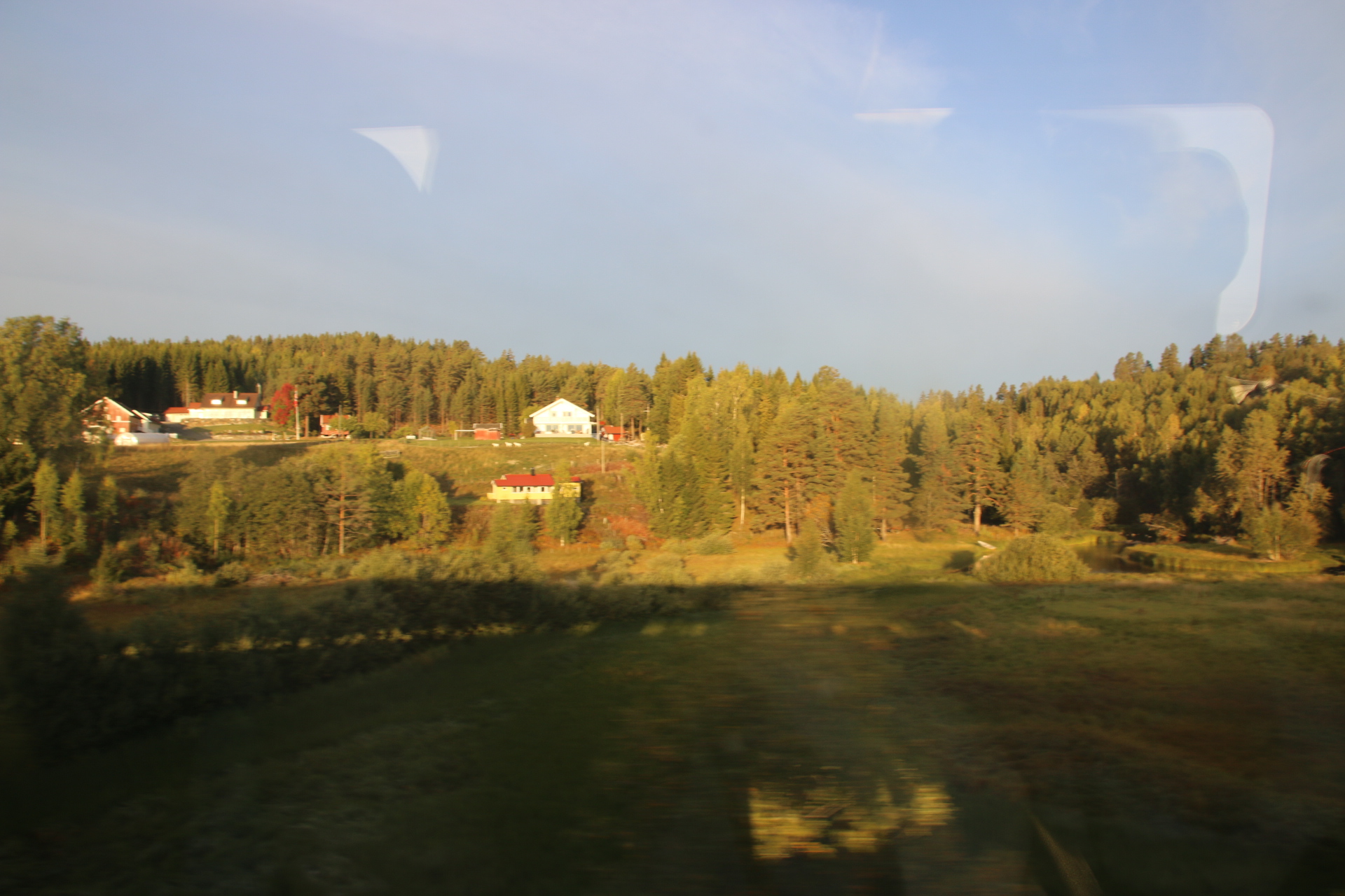
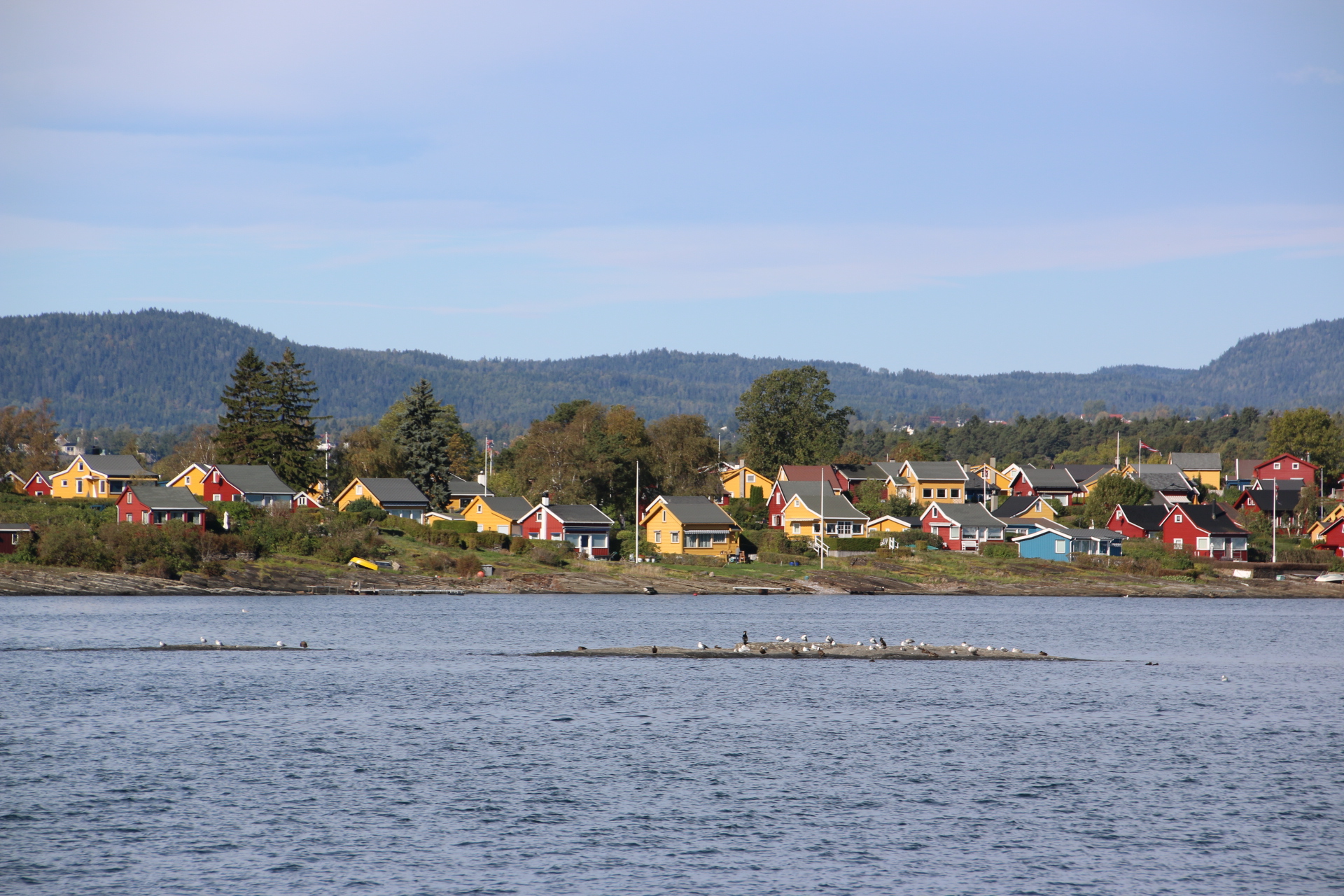
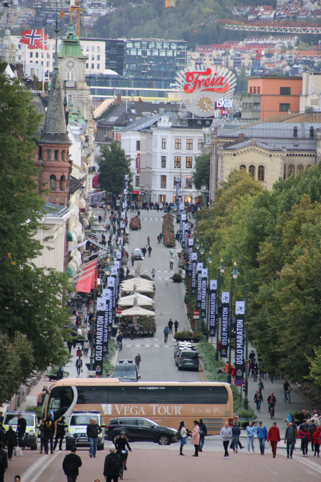
So the first leg is the service out of Oslo, leaving punctually in the darkness at 0625. As dawn comes up the tall suburbs of Oslo fly pass, occasionally interrupted by scenic fingers of water, a river, a lake, its banks dotted with the yellows and reds of painted houses amongst almost-turning trees. Tunnels certainly help. The train disappears leaving an urban landscape outside, only to emerge after 5 minutes or so into another scene of open countryside and wooded valleys. Small towns appear and disappear, giving way to increasingly larger tracts of farmlands with forested ridges and scarps behind.


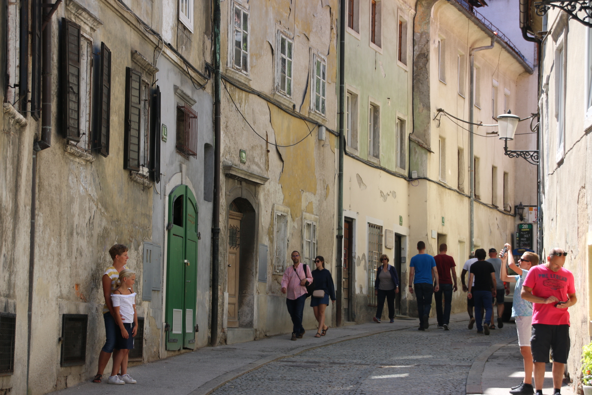
About a dozen towns of reasonable size come up, one at a time, on the flat valley floor every 10 minutes or so as a reminder that man has tamed this landscape and uses its resources, mostly timber from the higher ground, in a responsible way. This leaves the flatter areas free for building and agriculture, linked by the tracks of the railway and the tarmac of the road beside it; two buddies, side by side, linking human communities, sometimes together, sometimes splitting to opposite sides of the river.


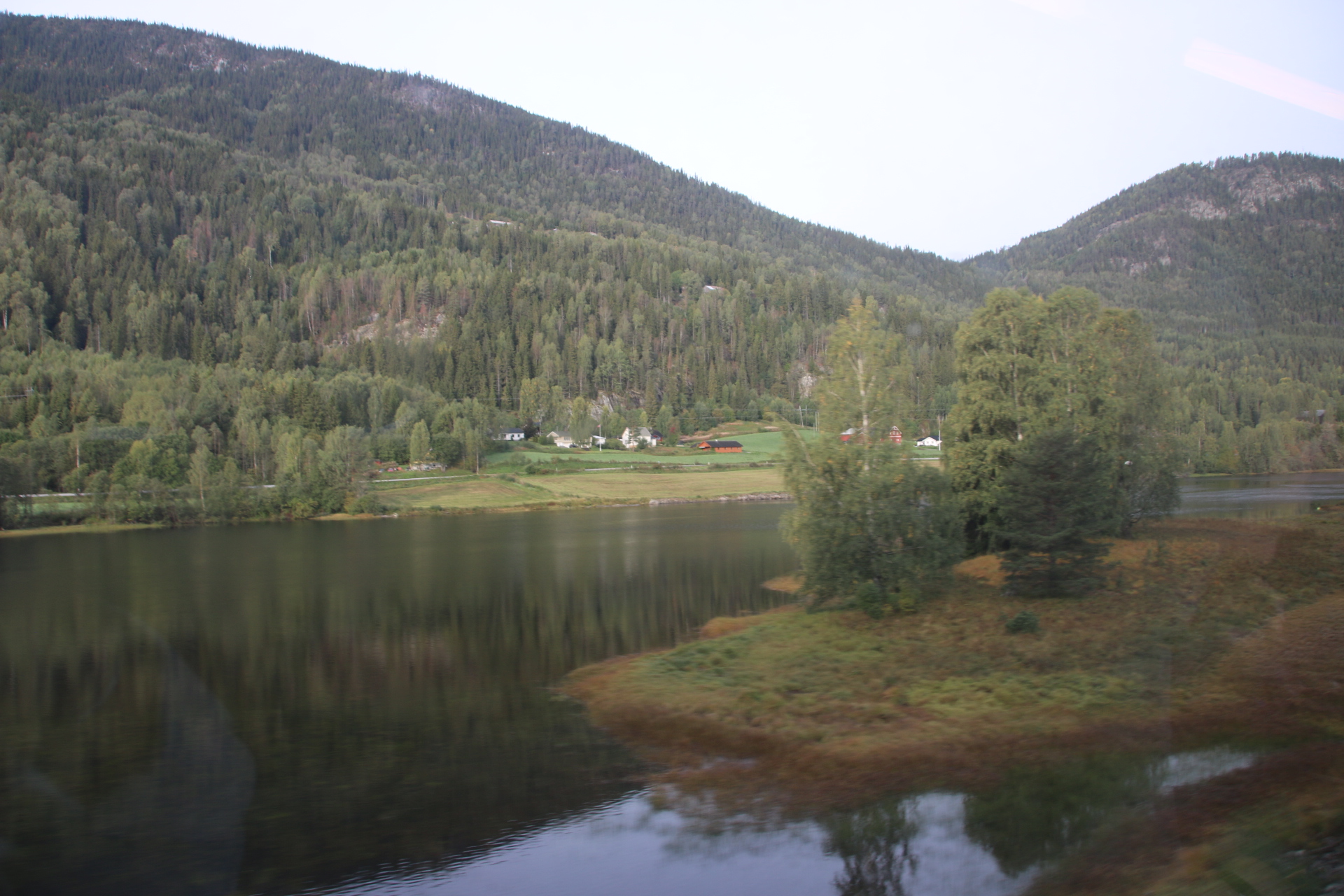
Increasingly wilder mountain scenery squeezes in on either side. Bare rock and clumps of pine hug the tracks to the left, an islanded string of a lake hugs the right. The water cuts the easiest route for the railway and the road to follow through the heights, its presence given away by clinging tendrils of wispy clouds.


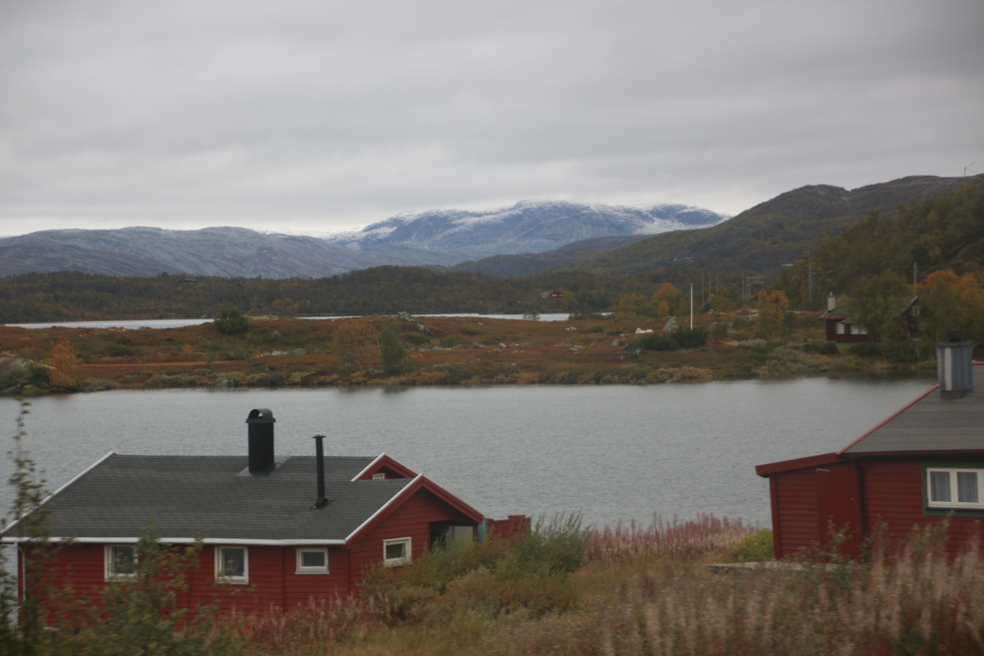
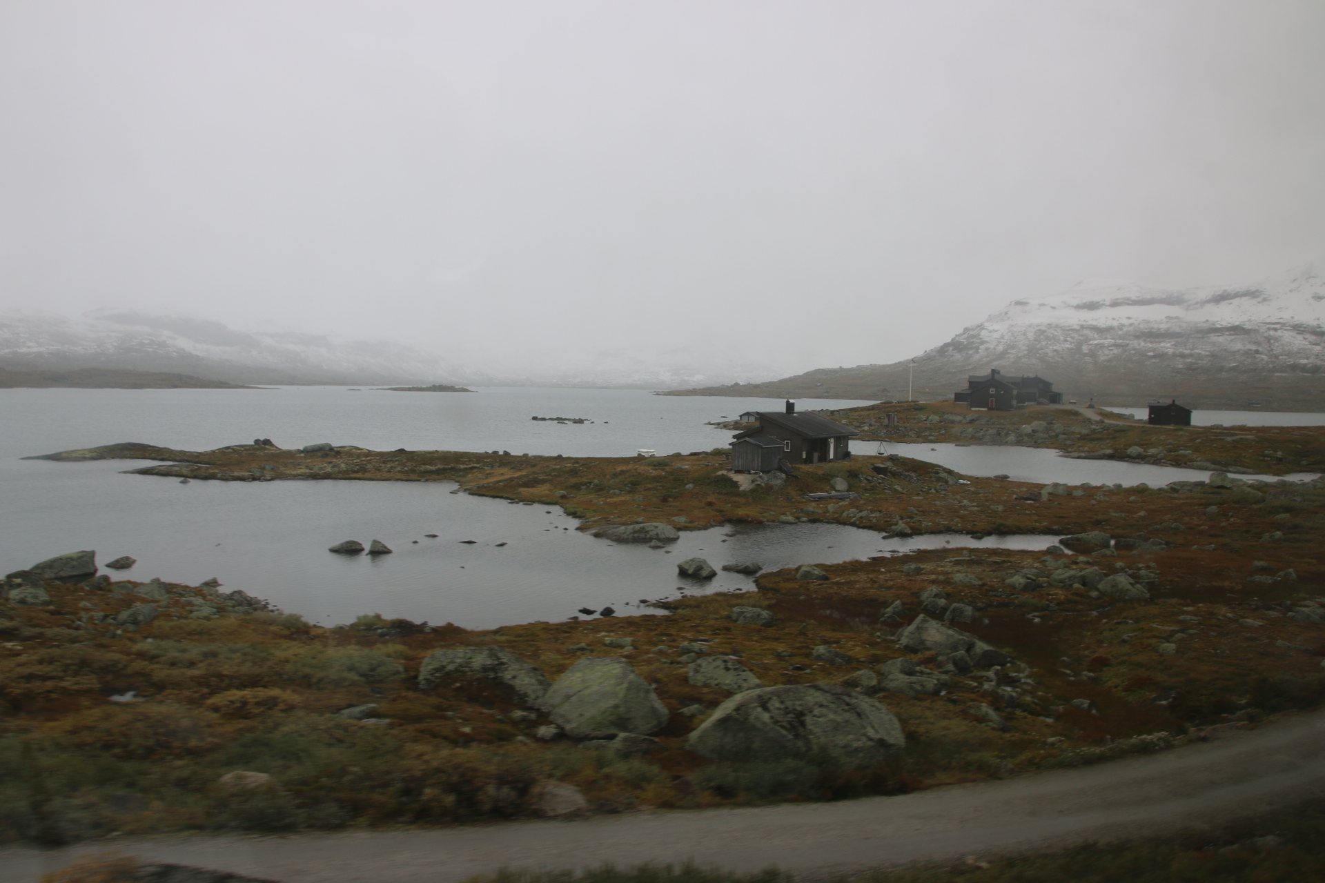
As we climb, one station to another, the temperature drops, unravelling on the landscape. At 7° the leaves have turned and the landscape is transformed from green to yellow. A further drop of 2° sees us at 1,200 metres and another change. Trees have given up entirely and left the mountains naked, their crags and rocks openly on display.


I am trying to take pictures to give you an impression of this journey. This is rather hard as not only are the windows filthy, but the perpetual curtain of pine or scrubby bush or tunnel only occasionally and suddenly draws back to provide fleeting and urgent views of the landscape.

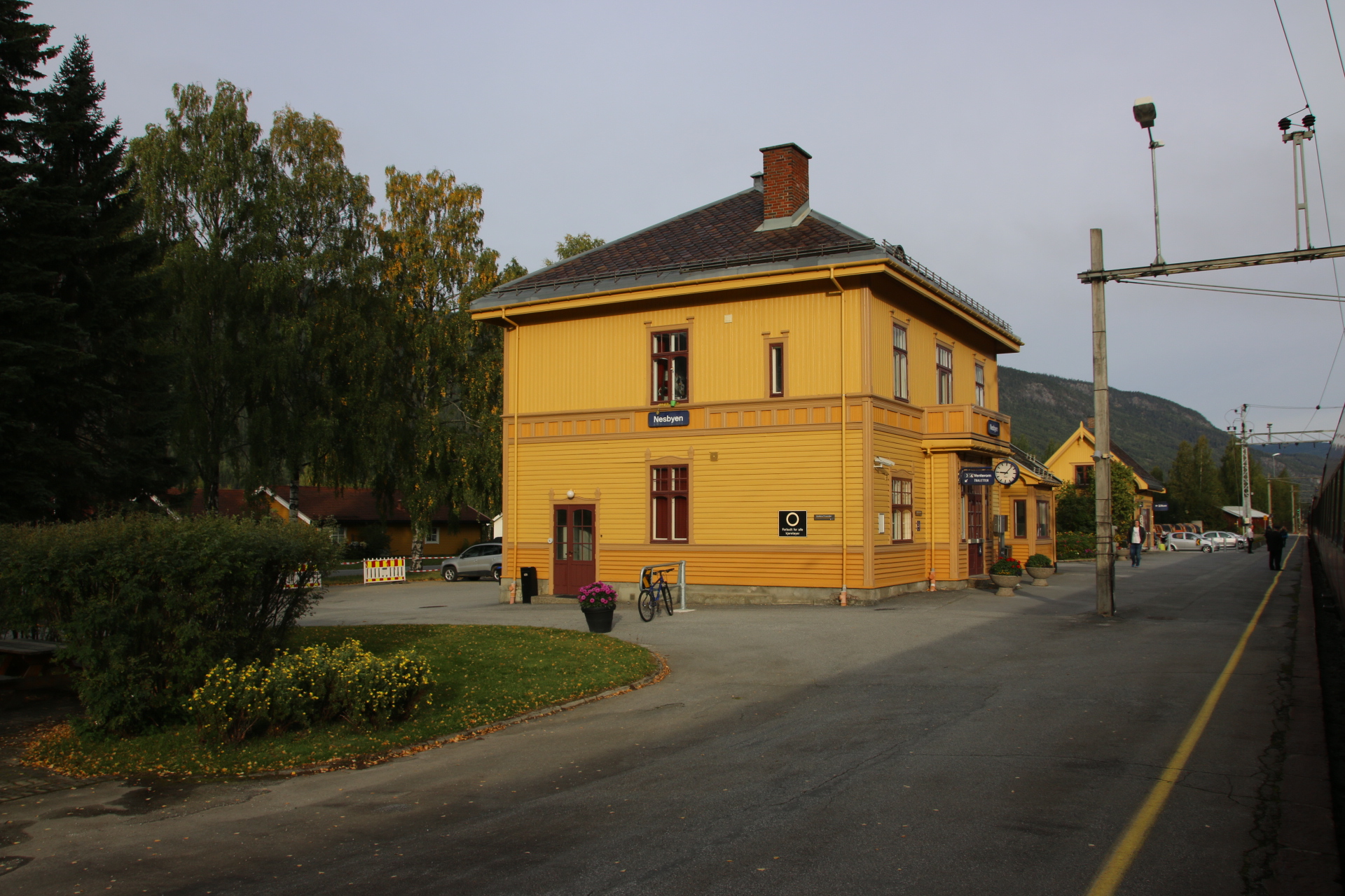
So we arrive at Myrdal, high up on the high mountain plateau where many off us change trains for the journey down.

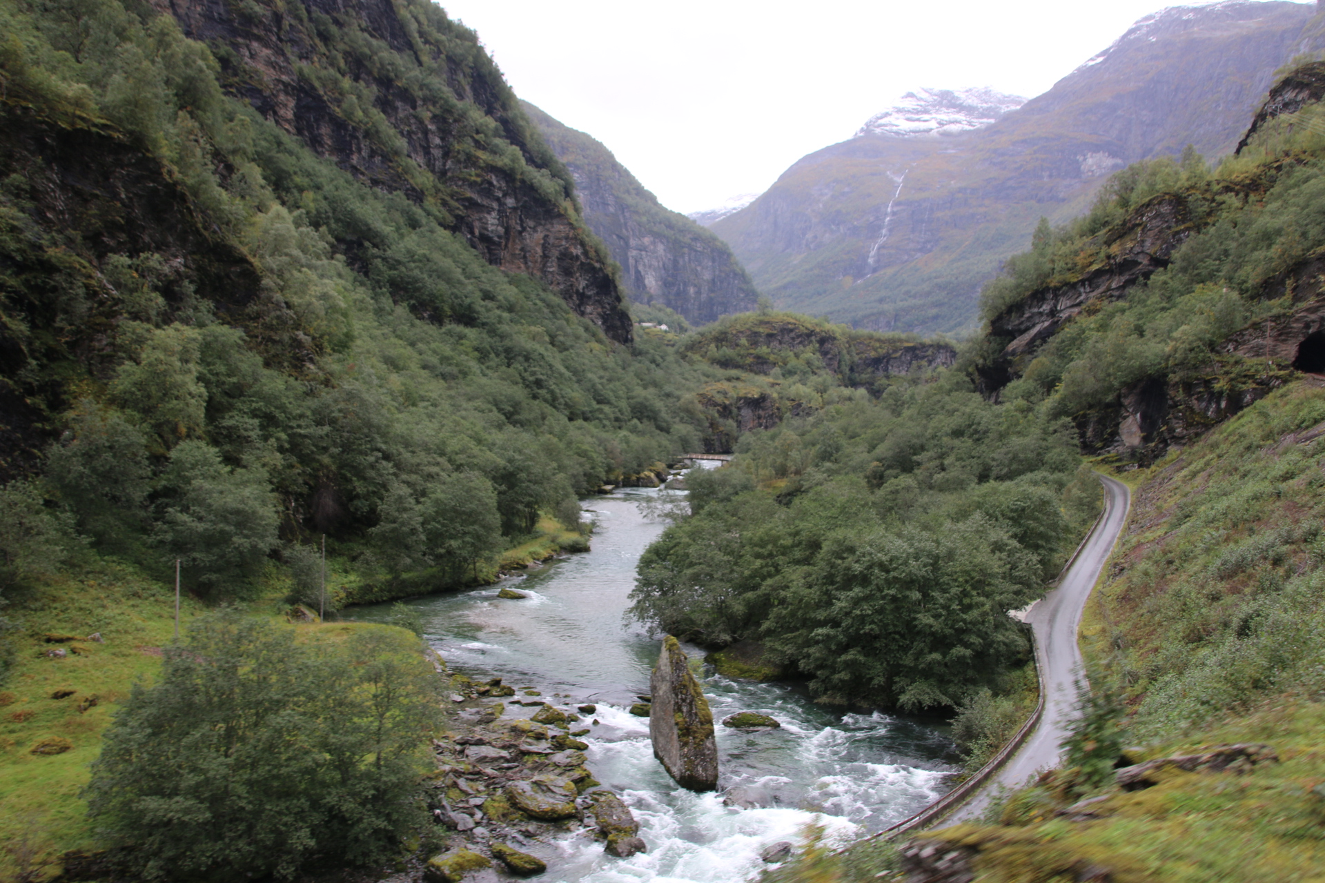
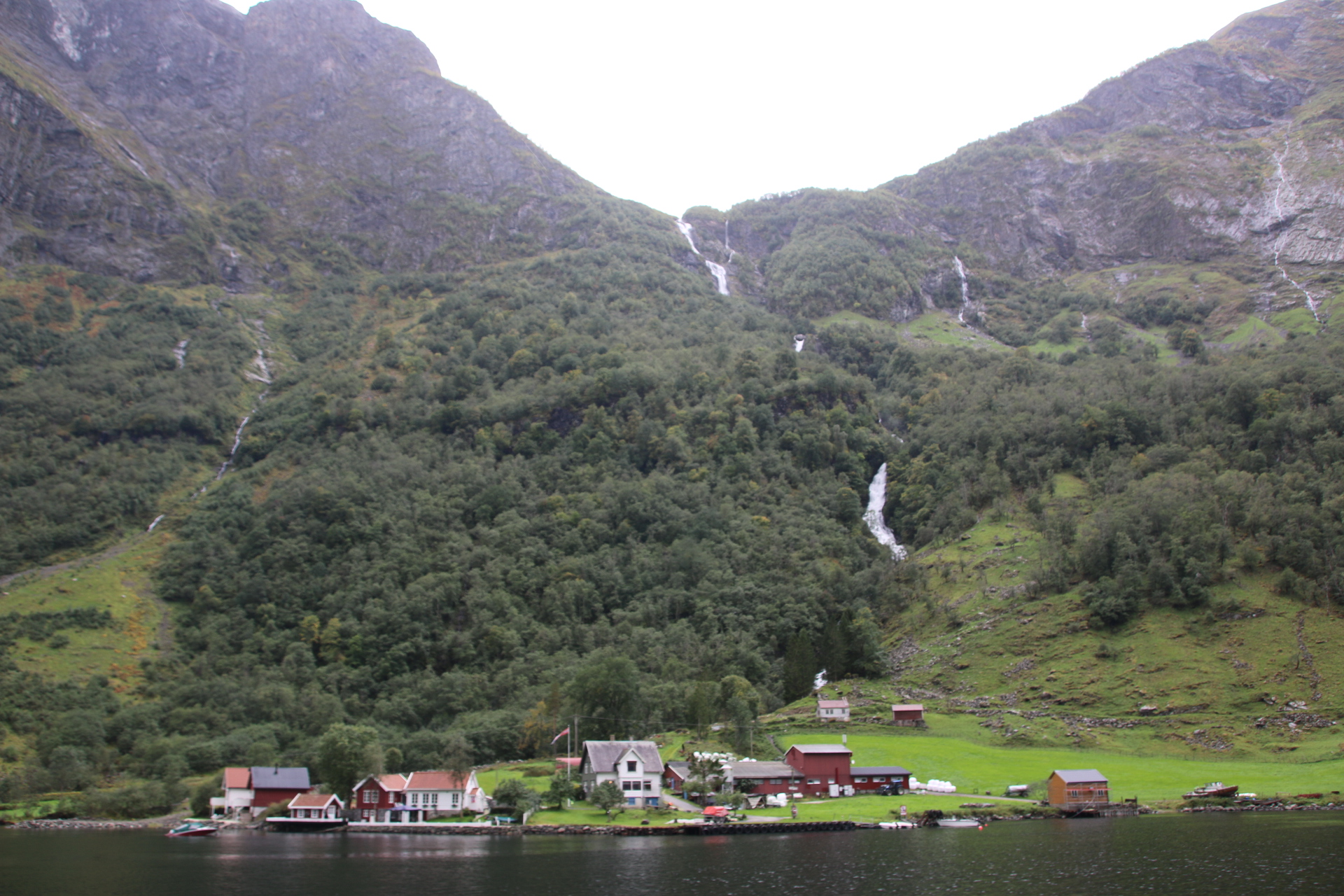
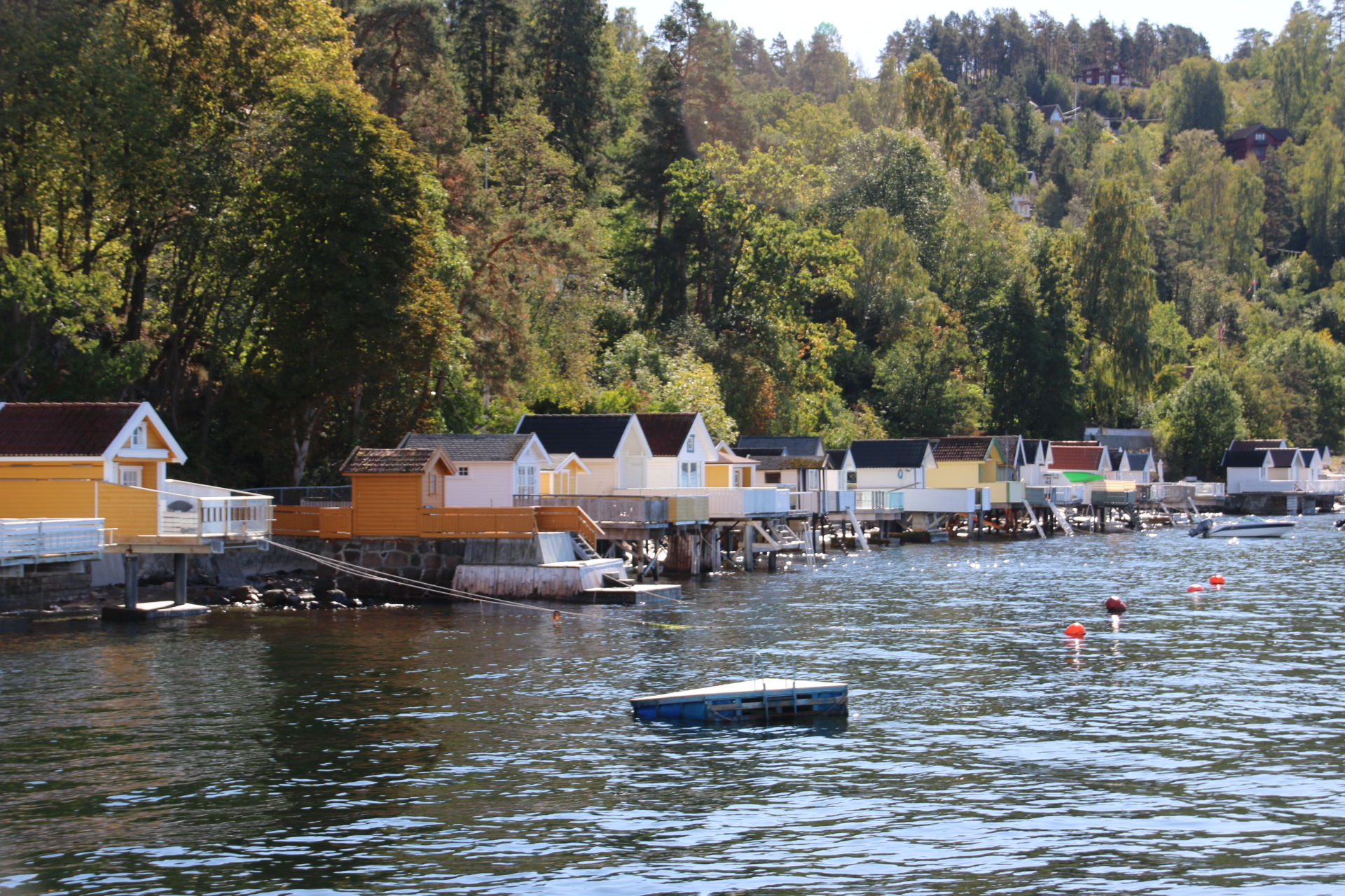
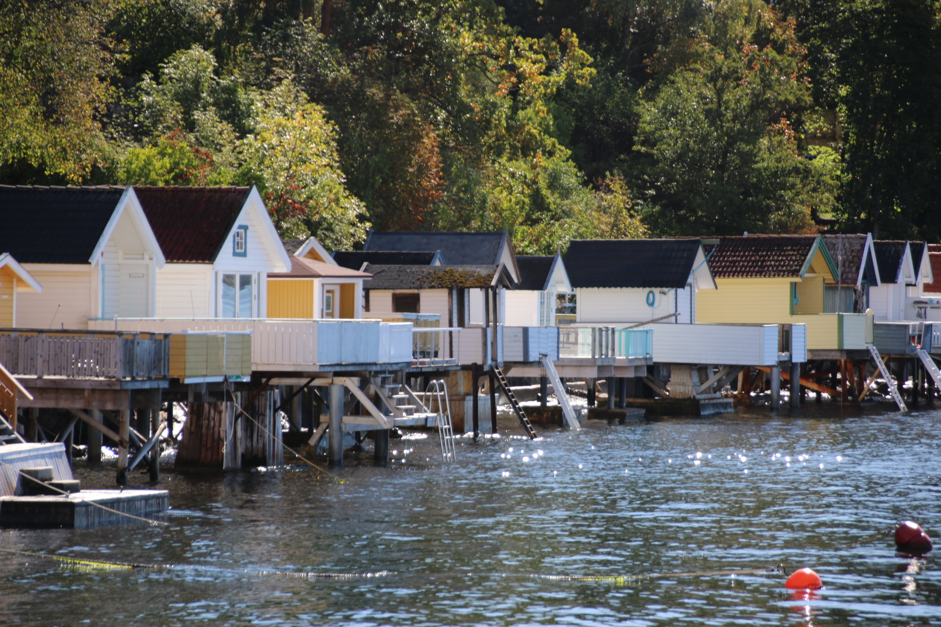
It is then a 1 in 18 gradient descent through the wild Flam valley to the village of Flam itself, on the Aurlandsfjord. This branch line has 20 tunnels, 18 of which were built by hand. On the way down, fantastic views of the valley can be had and its wonderful walking/skiing terrain complete with many waterfalls, rushing torrents of rivers, goat farms and a range of colourful settlements of different shapes and sizes.


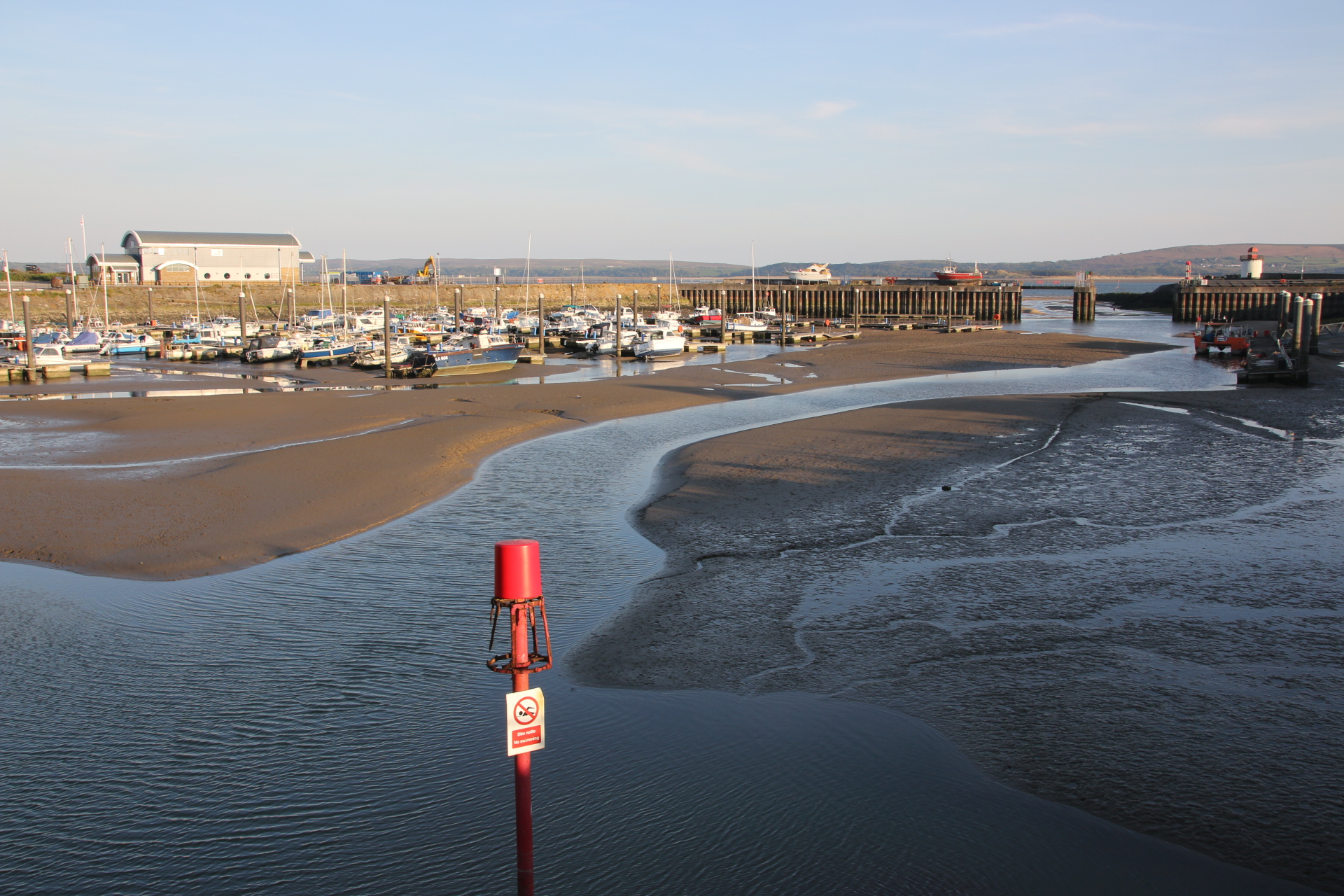
At the bottom the clouds have come down and it all feels very damp and grey. This joins up and the drizzle gets heavier, turning to a perpetual wet rain. The boat is waiting for us.

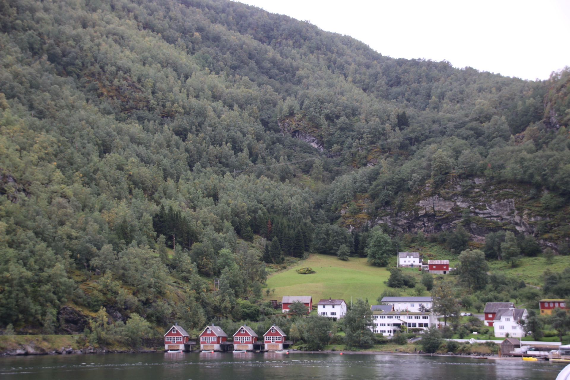
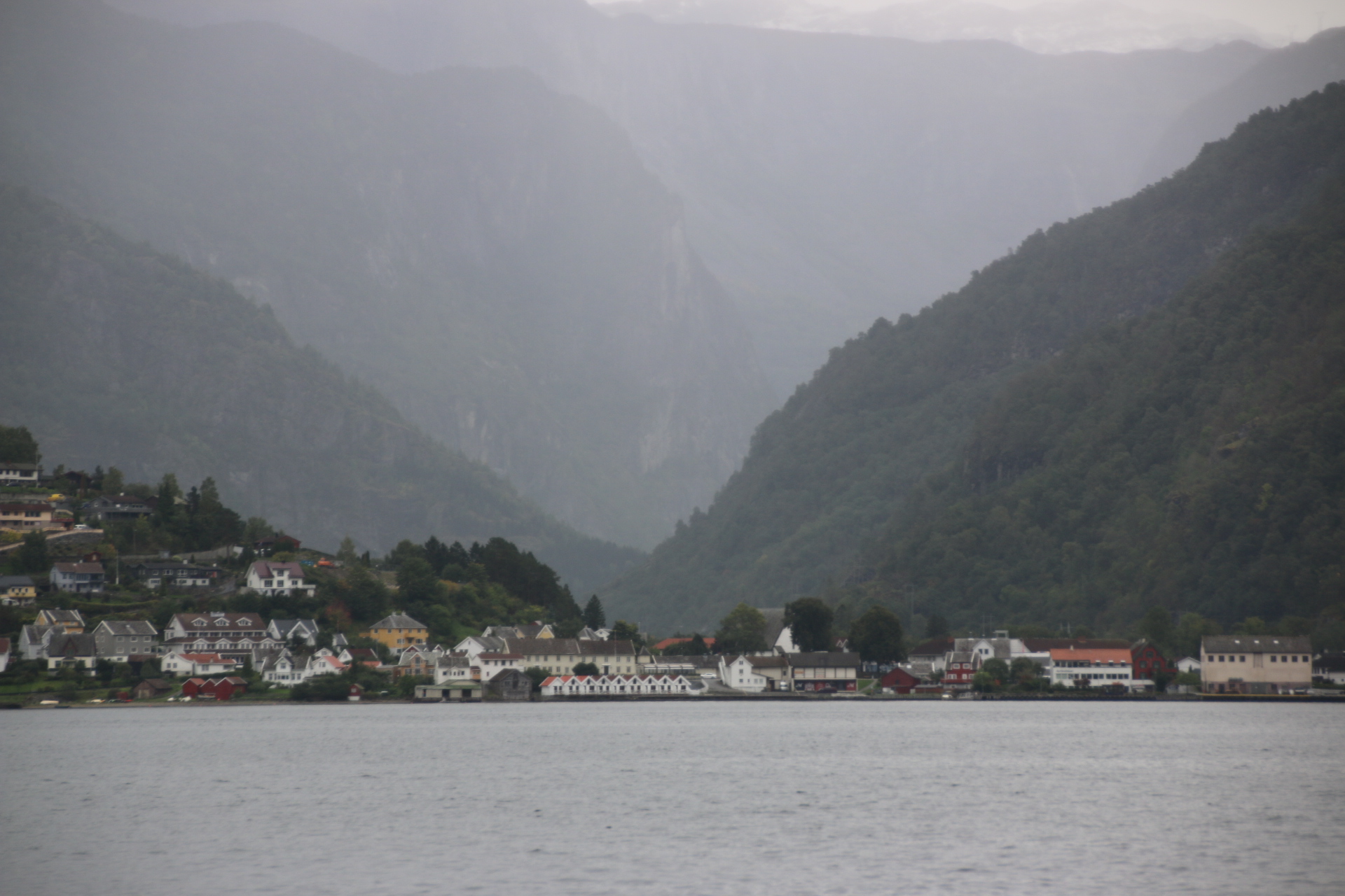
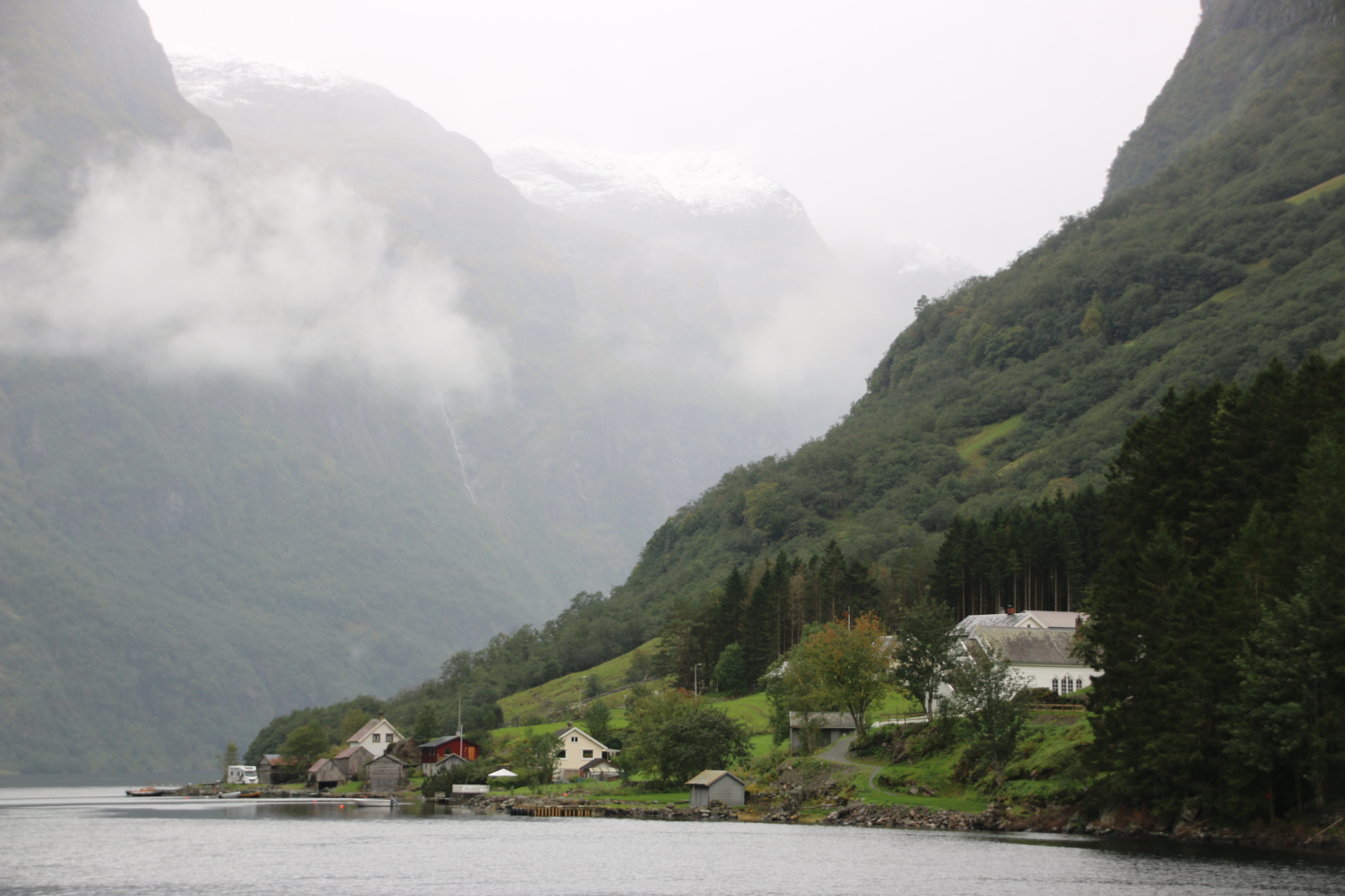
The elements give the chug up the fjord a mysterious, rather heavy feel. A few isolated settlements huddle on their patch of emerald green at the fjord’s edge, dwarfed by mountains and glaciers that blow down their covering of mist and cloud to squash the houses in an eerie gloom.

All of this is a preamble to the next leg. Having seen all this from a distance the bus now takes us up close and familiar on the road to Voss train station – up close to roaring waterfalls, shooting rapids, rushing rivers and familiar with homely farmsteads, brightly painted homesteads and shaved, stubbled fields. Sadly the rain is now proper rain and the windows are so covered with spray that they shield the views from my camera so you’ll have to take my word for it.

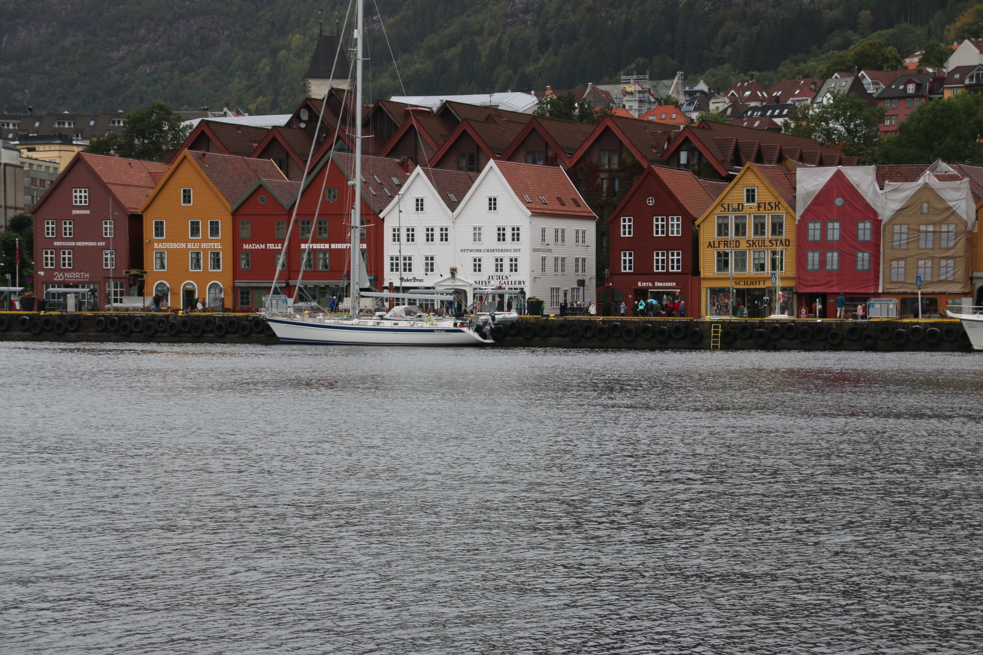
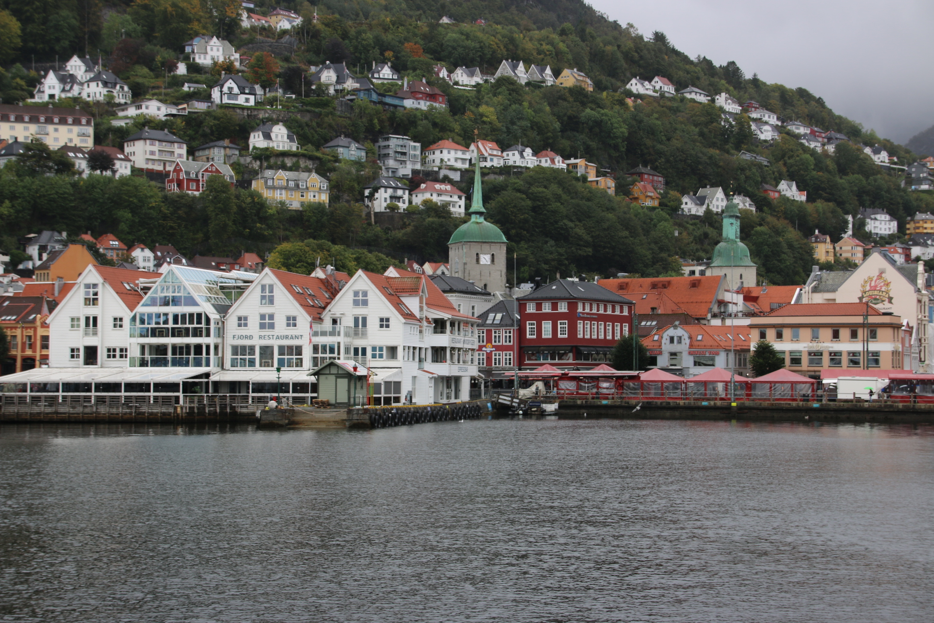
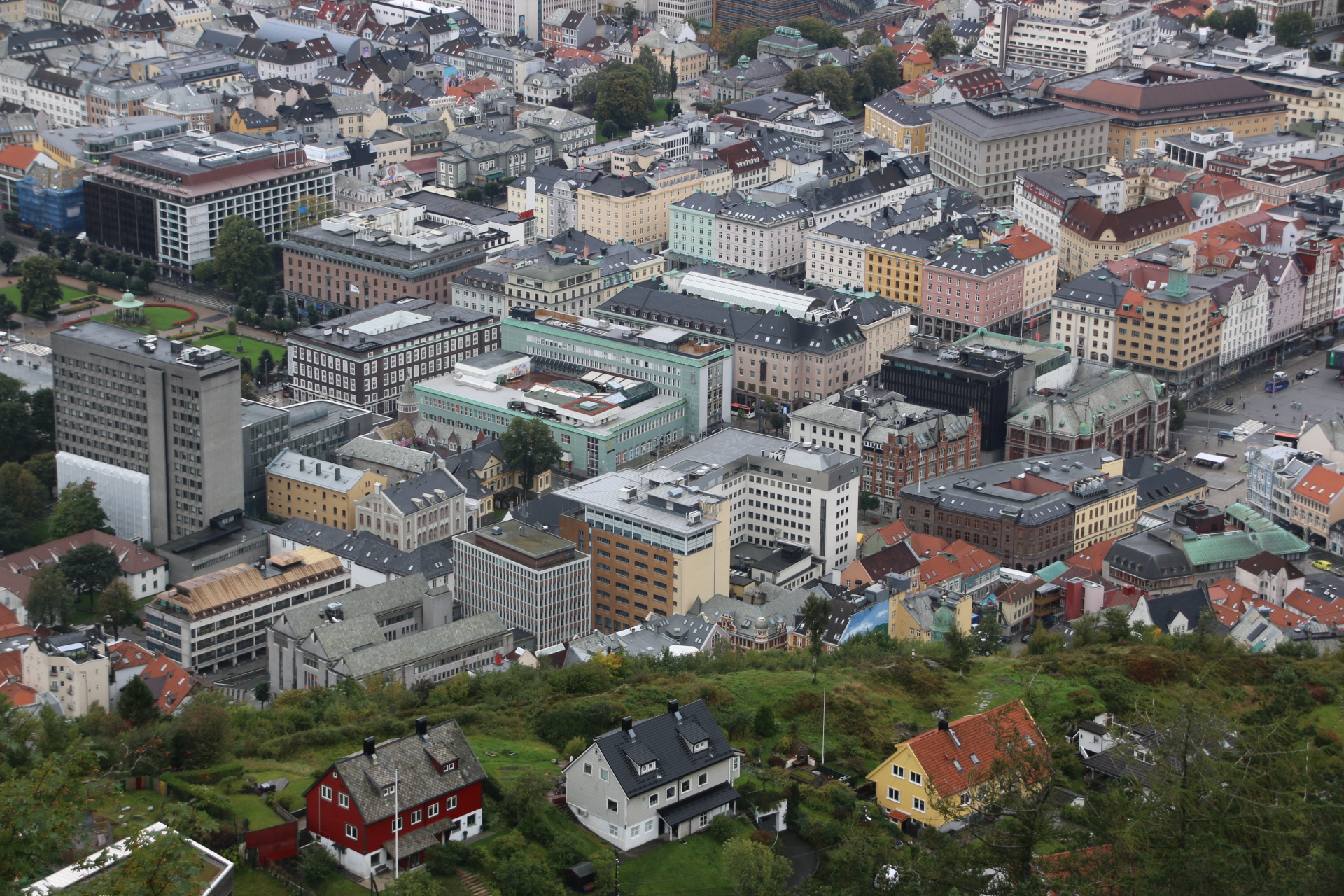
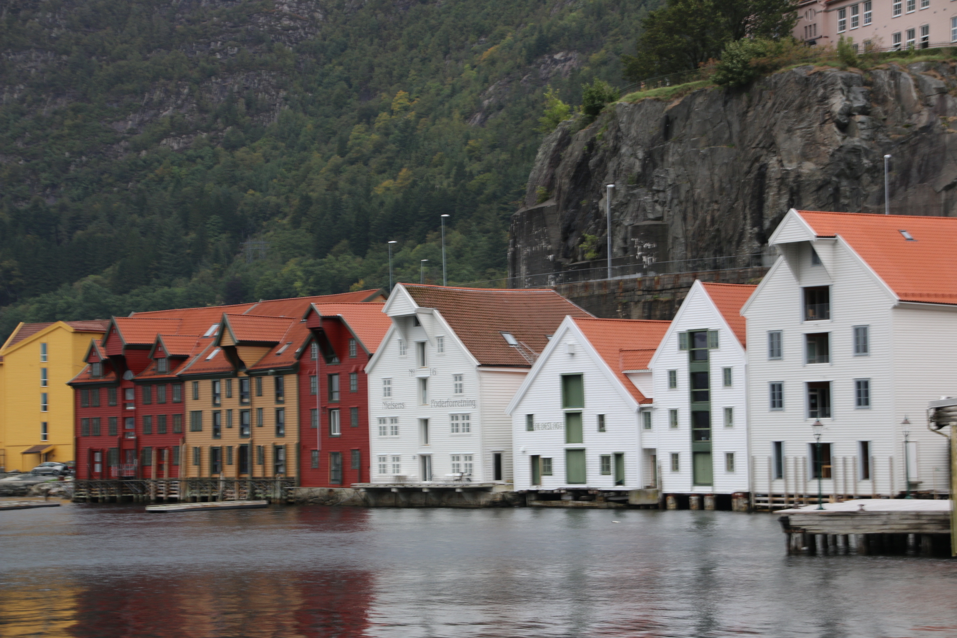
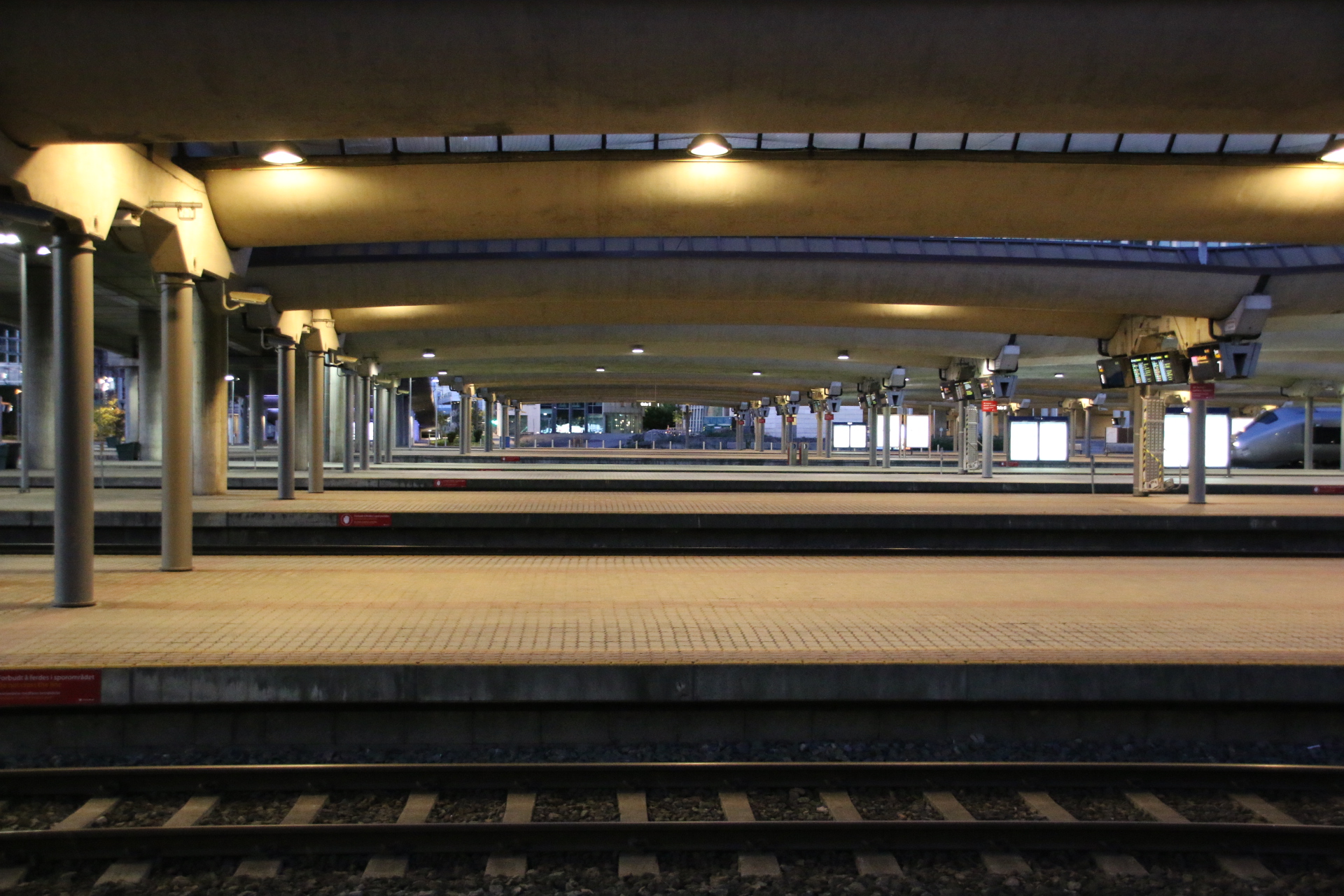
The 1741 train to Bergen is the final leg. It arrives and leaves on time as every mode of transport has done during the day. The trip has been true to its title – it really has been Norway in a Nutshell and well worth it. I hope you enjoyed the journey.

The sunny side of the Oslo marathon

Woke up to a glorious day. Had lots of plans about grabbing the ‘hop on’ bus to museums only to be disappointed as it wasn’t running from the centre because all the buses and trams had been diverted due to the running of the Oslo marathon. Curses!

But a blessing in disguise. Walked down to the docks area and, over coffee at the Nobel Peace Museum, reassessed the day amongst the starters and finishers.

A two hour trip around Oslo fjord in a rigged schooner is advertised. Yep, that’ll do fine. Didn’t want to be indoors in a dusty museum anyway.

Around the harbour to take in the fort, the dockside developments and the wedge of the new Opera House.


Then out around the islands with their colourful houses amongst ready-to-turn foliage.


Further out, the shore is lined with fragile looking summer-houses. Like Victorian swimming huts these date back to the day when folk wanted privacy and changed in the huts before descending a ladder to get in and out of the water, unseen by neighbours or passing sailors.


Then across the bay mixing it with boats and lighthouse islands.


Loved every moment of it – even the English guide over the PA interspersed with melodious, mindfulness music. A real pinch yourself journey.

Hop on, hop off, all across Oslo.

So it’s straight into the city centre and, as is often the case when one only has a couple of days to do somewhere, head for the ‘hop on, hop off’ ‘bus. There is a similar ‘hop on, hop off’ fjord cruise but, sadly, we are officially ‘out of season’.

Oslo is a modern, cosmopolitan city with an old centre of elegant, tall buildings with parks and fountains and countless statues and sculptures positioned around the place. I always think that trams give a city a feeling of quiet sophistication and Oslo is no exception. Building is going on all over the place and cranes scatter the skyline in every direction like a new skeleton is being created within the tatty, dusty fabric of the old framework.

So firstly the city centre.

Then images of the Norwegian Parliament building


and then the National Theatre – showing a cheerful Ibsen offering at the moment.

The sea is never far away, reminding us of Norway’s Viking history and all that raping and pillaging, art home and away. The clever thing they have done here is to place all the museum in one area across the bay and just out of town. So if you want to know about social history and culture, Vikings, the Kon Tiki voyage (always big when I was younger), all things boating, head here.


Vigeland was a local sculptor who was fascinated by the human form. His work is displayed in this park.


The centre piece is this huge monolith which was carved from a single piece of granite. Around it 101 figures are entangled in a fight to reach the top.

Back in the centre, it’s time to head brink surrounded by a diverse local population of all kinds of colour and faiths. It’s 1630 on a Friday and the streets are humming and buzzing with workers and shoppers and buskers and then with tourists adding their own spicy flavours to humanity’s mix.

Dinner is booked in a typical Norwegian restaurant near to the hotel.

A quick trip to Norway

Hi all. I have just come away for a few days to visit Norway. I landed in Oslo late afternoon and as the day seemed to run away from me I am going to let the images tell the story of my impressions of this Nordic country. The plan is to do 3 days in Oslo, take the spectacular seven hour railway trip over the’roof of the world’ and spend two days in Bergen before flying home. So first impressions of Oslo:

The Royal Palace and parade groundvs

A bit further into town before heading out for dinner.

Will really get to it tomorrow.

Quirky sights in Ljubljana

The sun really shone on my last day in this incredible country and in the capital in particular. I tried to capture some quirky images of Ljubljana and am simply going to put them up here as a sort of gallery. See what you think. Love to have some comments.

Always a good day in Slovenia

The weather has broken at long last and low temperatures and persistent rain has driven us from the damp streets of Ljubljana back to the hotel and an opportunity to share with you some reflections about this beautiful country.

As the plane lands the first impression of the land laid out below is one of neatness and order. The landscape is a palette of greens and a patchwork of fields and forests interspersed with collections of painted ginger-bread houses. 68% of the country is forested.

Slovenia is made by its people. Just over two million people live in this small country. The vast majority speak English with a pleasant, warm disposition that is immediately welcoming. There is a colossal link between Slovenes and nature. At weekends most will head for the hills, literally, and ski or bike or canoe. Most families have an allotment and gardening is the number one participation activity. Whatever it is down to, it works. Slovenes are friendly, warm, softly-spoken. They seem grounded and content. Their quality of life and their attitude to living is worth emulating.

Food is very much meat based. Most menus contain locally sourced beef, veal, pork, chicken, venison, even boar. In some more remote parts bear is still found, but not on menus of local restaurants. Dishes are accompanied by locally grown fruit and vegetables. Beer is good and wine, particularly the whites, is exceptional, even for a red lover like me.

Every settlement of any size boasts a church, usually Catholic, and a protecting castle in various states of repair. These places all have a medieval core that transports one back to the old days of ancient monasteries and narrow, cobbled streets and timber bridges. On the small strip of coast Venetian ports remind us that these links are as relevant to the history of Slovenia as the mountain passes and the river valleys. This country has been moulded by its stunning and wonderfully diverse scenery – mountains, rolling hills, rivers, streams, lakes, evergreen pine forests, mixed deciduous woodland, meadows and farmland, allotments and orchards, fields of hops and vines.

So, all in all, a beautiful place with stunning scenery inhabited by friendly people who value their culture and history. What else do you want?

Some delights in southeast Slovenia

As always there is a delight or two to find on any journey in this country around the one back to the capital is no exception. Following a slightly longer route than necessary, the first is Slovenia’s smallest town, but nothing like any town you may have visited. Firstly, Kostanjevica na krki, occupies an island 200m wide & 500m long in the middle of the River Krka. This sleepy place dates back to 1252. Two old timber bridges connect it to either bank so it is possible to drive straight through without stopping. Not that you would want to. The place has an old charm to it that is almost timeless.

Just a few kilometres out of town is the Pleterje Monastery, belonging to the Cathusians, the strictest of all the monastic orders. Only the Gothic church is open to the public. This, in itself, is worth a visit as its empty space arouses the inner spirit, settling anxieties and inspiring awe and wonder. There is no sign of white-hooded monks quietly going about their chores; they have taken a strict vote of silence. The main building, dating from 1407, can be seen from the outside and signs are everywhere reminding visitors of where you are and to respect the tranquillity of the place.

Finally, Otocec Castle, also on a tiny island in the middle of the Krka River but further up stream, is reached by similar timber bridges from opposite banks. The castle is completely restored now and has been converted into a very smart hotel. But hey, not one to miss an opportunity to rub shoulders with the posh & glamorous, it is in through the main door to use the toilets and then order some refreshments. They were very happy to serve some excellent coffee, along with a very tasty choccie with the hotel’s emblem on it rather than, as is normal elsewhere, a simple marciponi biscuit, and not charge the tourists in the scruffy shorts and faded T shirts too much for the presumption.

Saying goodbye to the mountains

Last day up here in the mountains in the eastern part of Slovenia, where mountains and agriculture meet and hops and vines stand gloriously side by side, proudly extolling the quality of the other. So, if its beer or wine that floats your boat you will find excellent products of each for your delectation.

Tomorrow it is back to Ljubljana for a few days before its back home on Tuesday. I am going to miss this place. I will miss the view every morning, now covered in distant haze as a storm builds. I am so familiar with it that I can lean out and reach through the murky horizon and caress those far, glorious lines in my mind. I will miss the cows , just a handful in each of two fields, and their relentless routine from pasture to shed and back again. I will miss the hoarse, screaming call off the two big boys (eagles, buzzards, kites, am not sure which) who appear every morning and rise the thermals and float off to a neighbouring valley to carry out their business out of sight but within sound. I will miss the handful of cars & clanking tractors who periodically negotiate the narrow lane around and down the head of the valley, disappearing into forest and reappearing at the same spot each time, a few hundred metres further on. Such repetition has set these sights in my mind so I can take them out and enjoy them whenever I please.

But one last pleasure is required before we got the bustle of the capital again – a special lunch at the Gric Restaurant I told you about a few days ago, in amongst the patterns of vines on the gentle slopes of Slovenske Konjice.

Beef Tartare and Sea Bream Tartare to start with a sparkling white for company


Veal, medium rare, with roasted veg, polenta cakes & cheese rolls, accompanied by a local Riesling.


Chocolate souffle and coffee to finish. There is always one really special place to eat and remember.