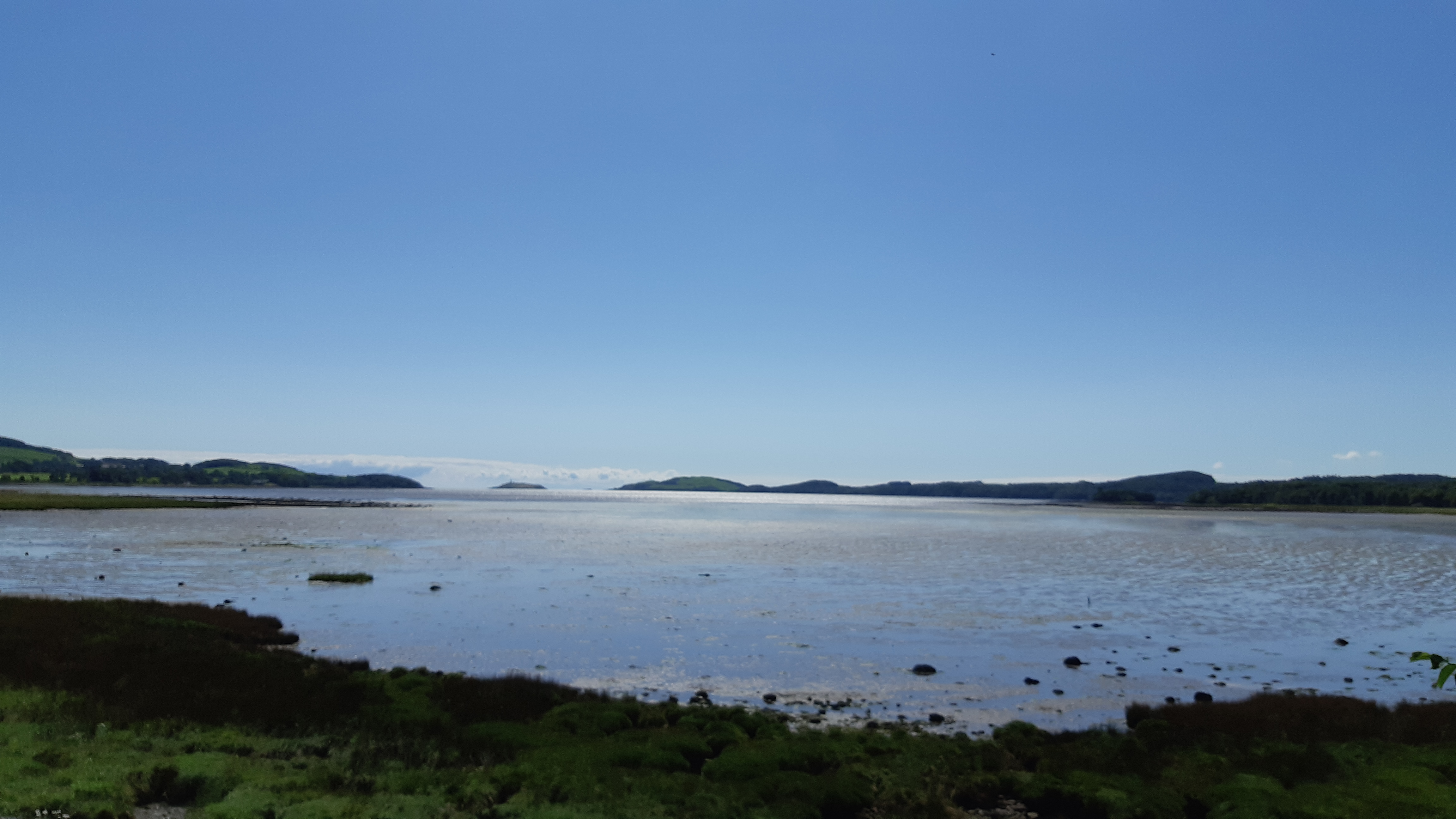
From St Fillans, at the head of Loch Earn, it is south now, past Stirling and Glasgow, to Dunfries & Galloway and the Irish Sea coast. The least said about Castle Douglas the better. Further on is the town of Kirkcudbright, on the banks of the River Dee, about 4 miles from the sea.
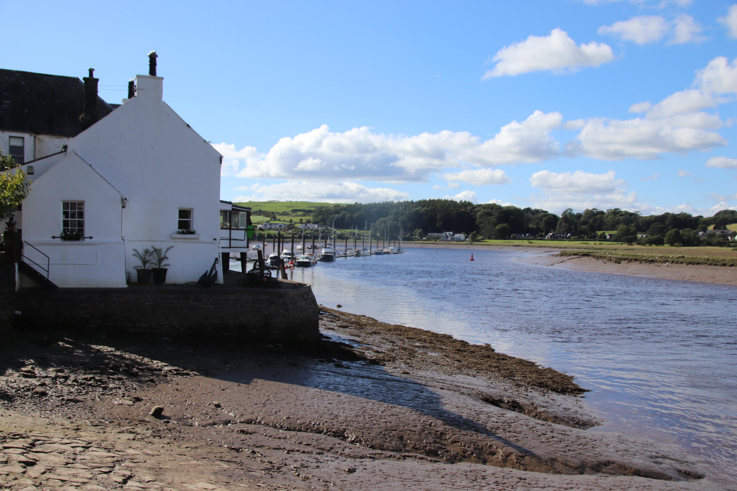
From a spot on the estuary, there is a wonderful view down to the open sea, with the dim silhouette of the Isle of Man in the far distance. The Dee is instrumental in creating wealth for the town as it is the only settlement on the Solway Coast with a working harbour.
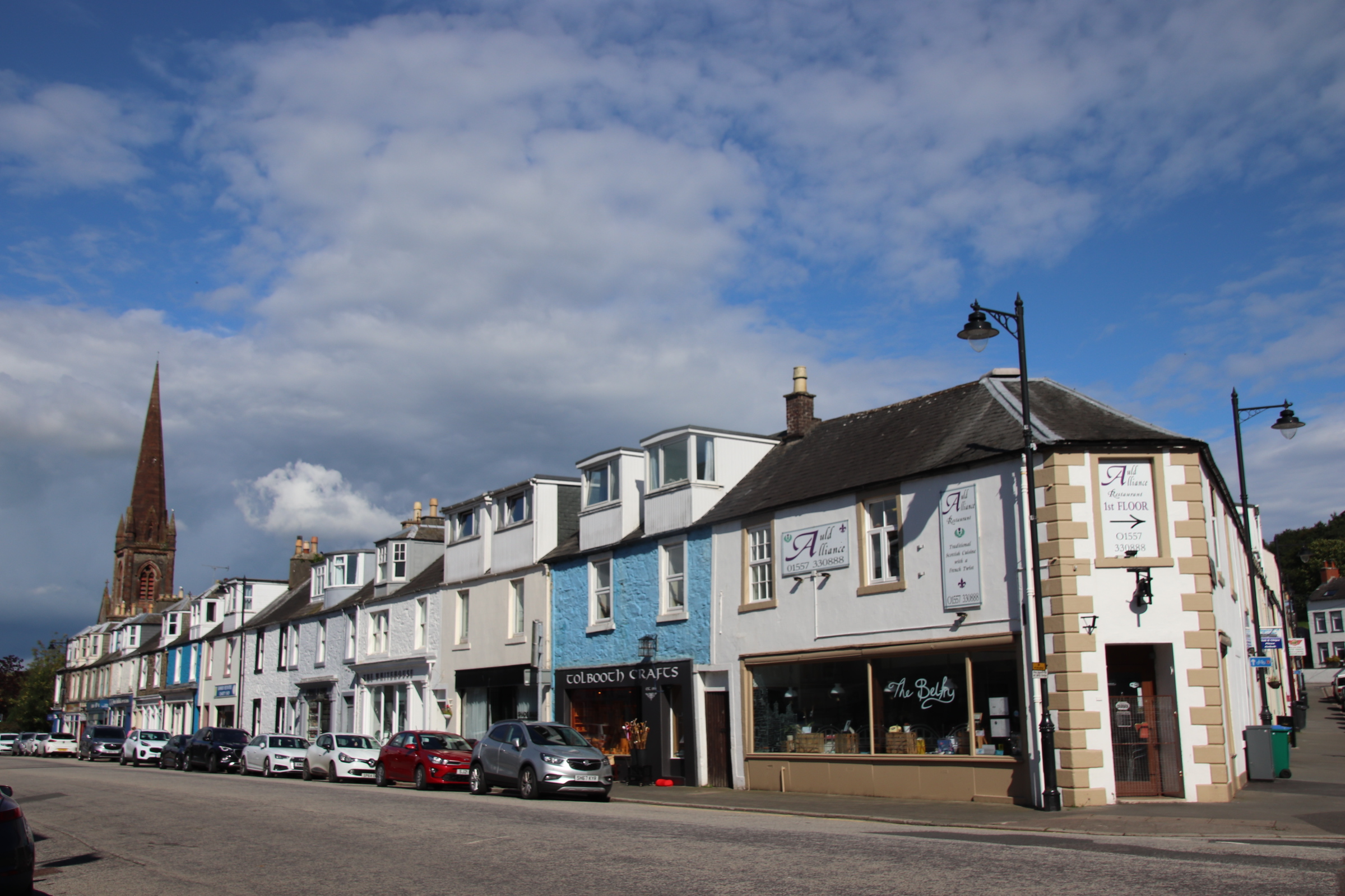
Kirkcudbright (pronounced by the Scotts: kir-KOO-bree!!!) is renowned for the number of galleries and arty/craftyshops. It is an attractive place with a blend of medieval, Georgian & Victorian buildings. It became a magnet for Scottish artists in the late 19th century and is now known as The Artist’s Town attracting both practitioners and promoters.
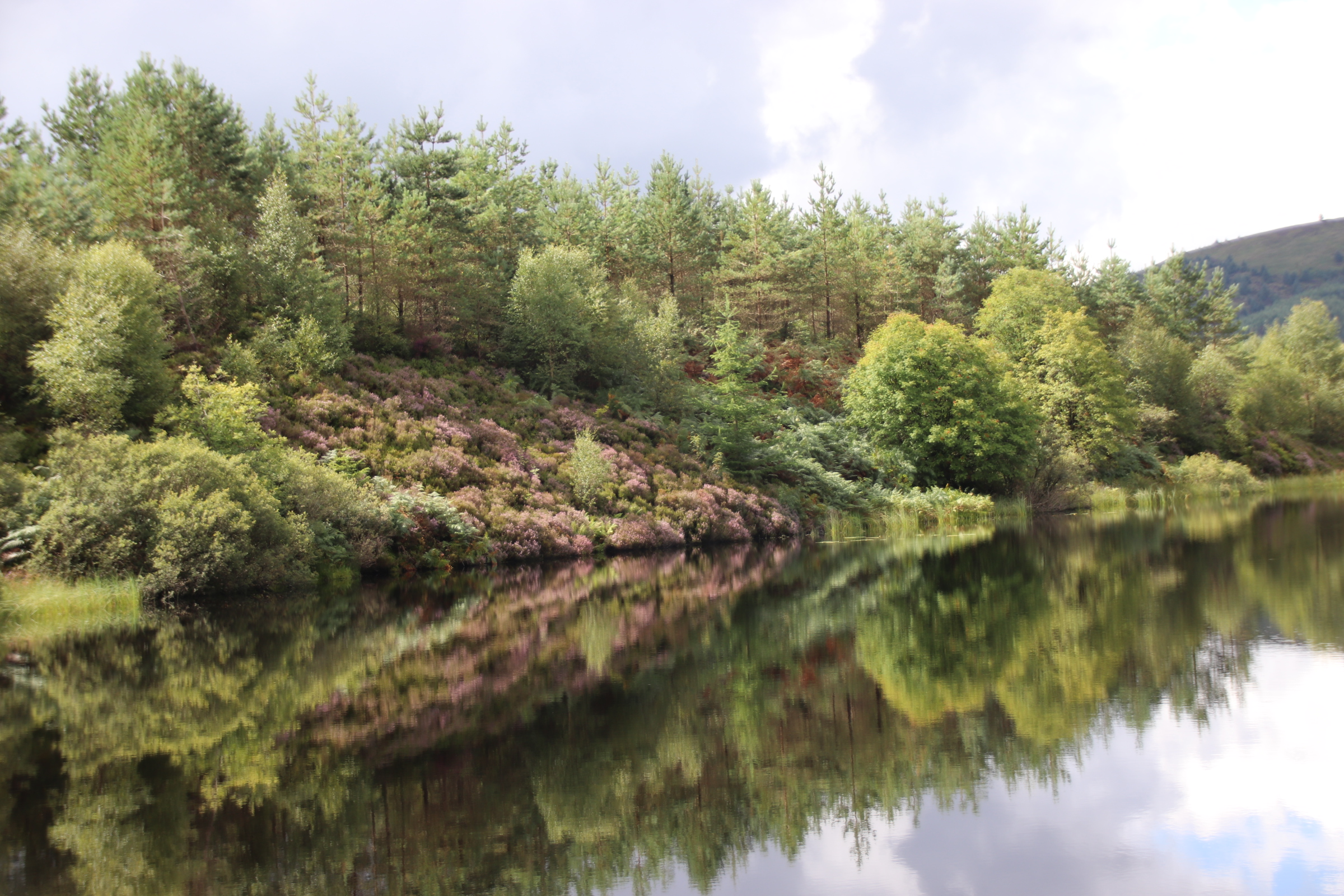
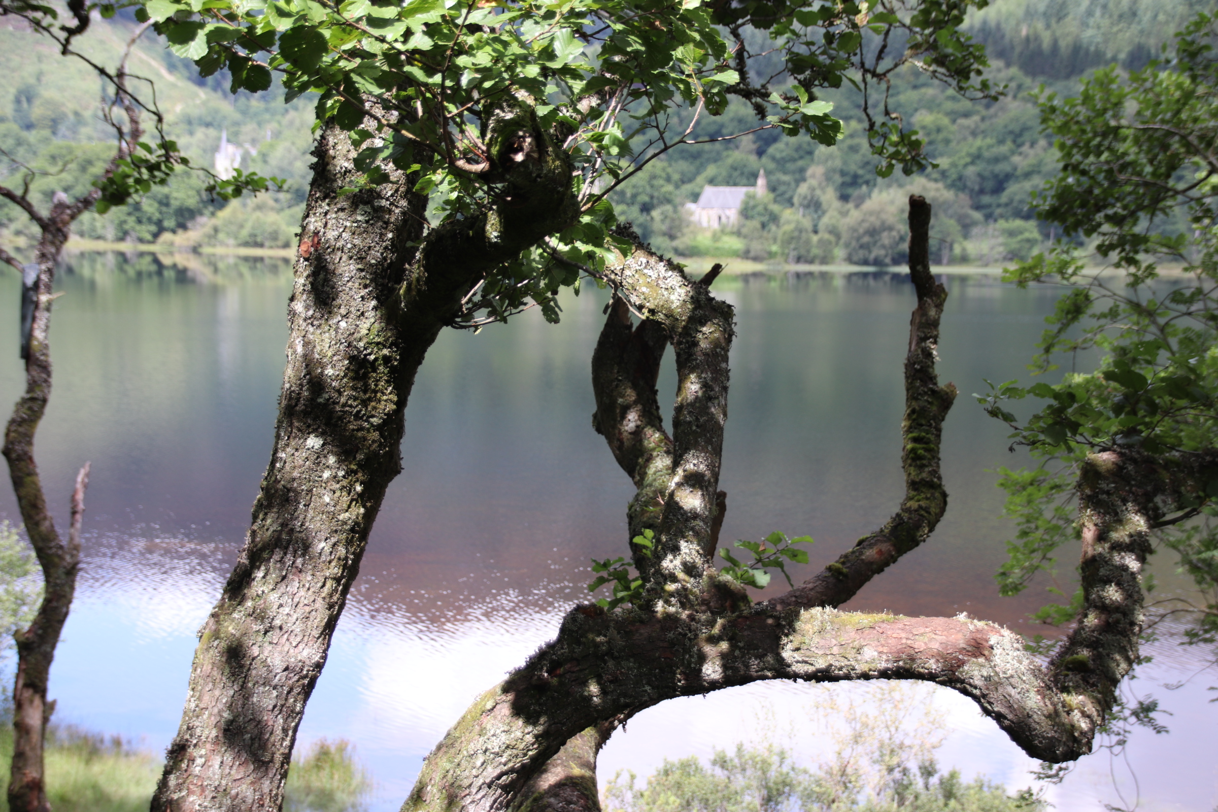
Aberfoyle is the gateway to the Trossacks. The drive from here to St Fillans, (tonight’s accommodation) through mountains & hills, along streams & lochs, past farms & hamlets is gobsmackingly beautiful, with best left till last! Three Lochs Drive starts just outside Aberfoyle and follows an unmade track down, around….you guessed it – 3 lochs! First is Lochan (a baby Loch!) Reoidhte.
Then Loch Drunkie!!!!
Then Loch Achray
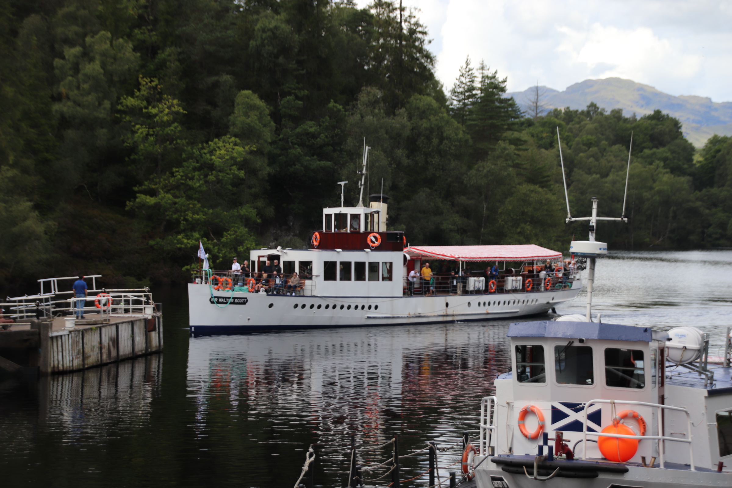
Add in the Victorian hotspot of Loch Katrine
Along to Brig O’Turk along the shores of Lock Venachar to Callander.
Loch Lubnaig
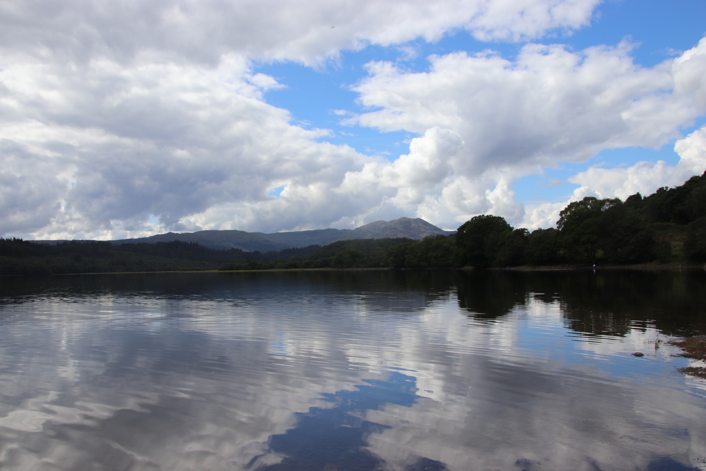
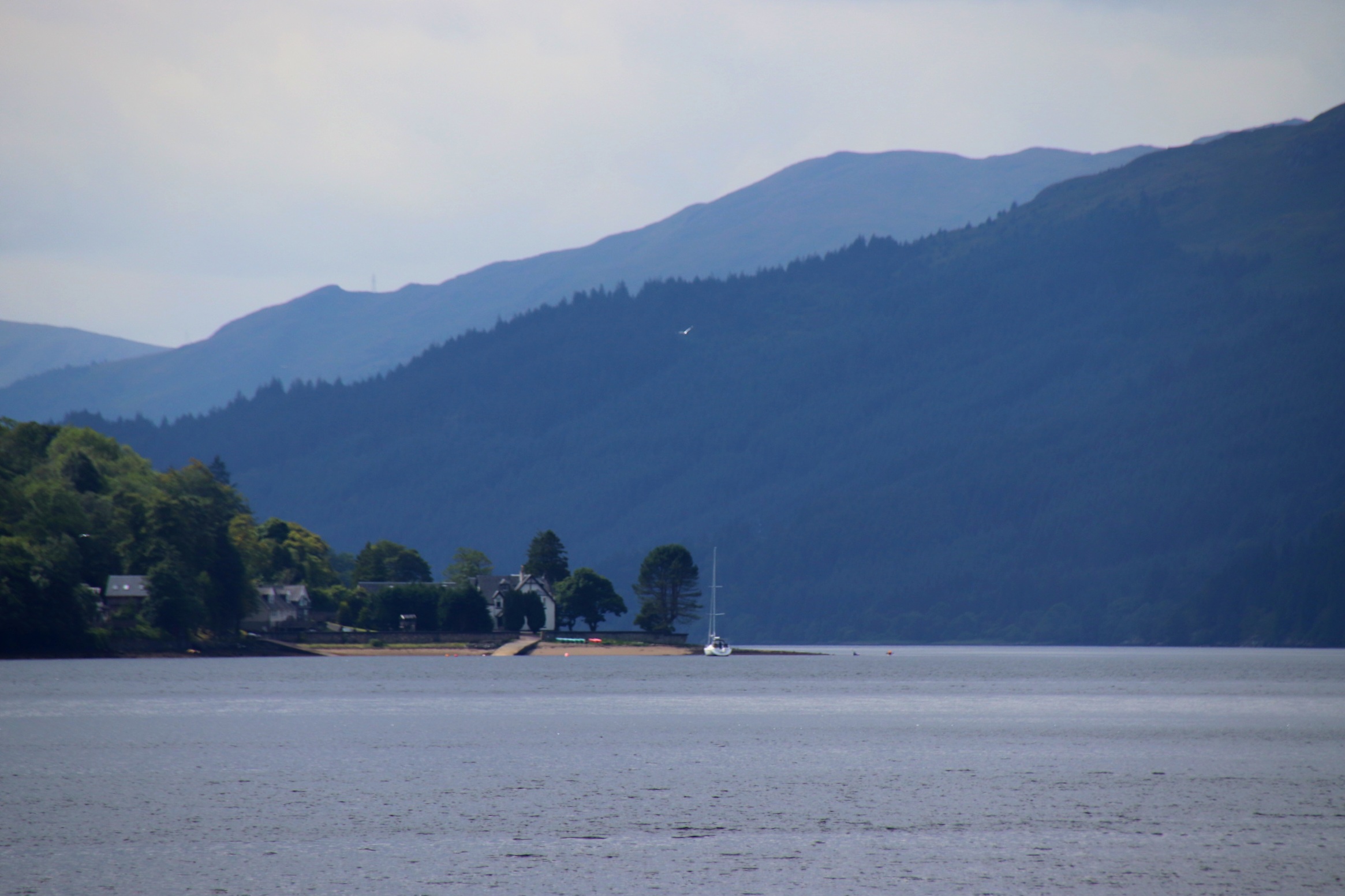
And finally the magnificently, splendidly peaceful Lock Earn from St Fillan.
Farewell Bute with your wild water swimming, your kite flying and your cliff hiking.
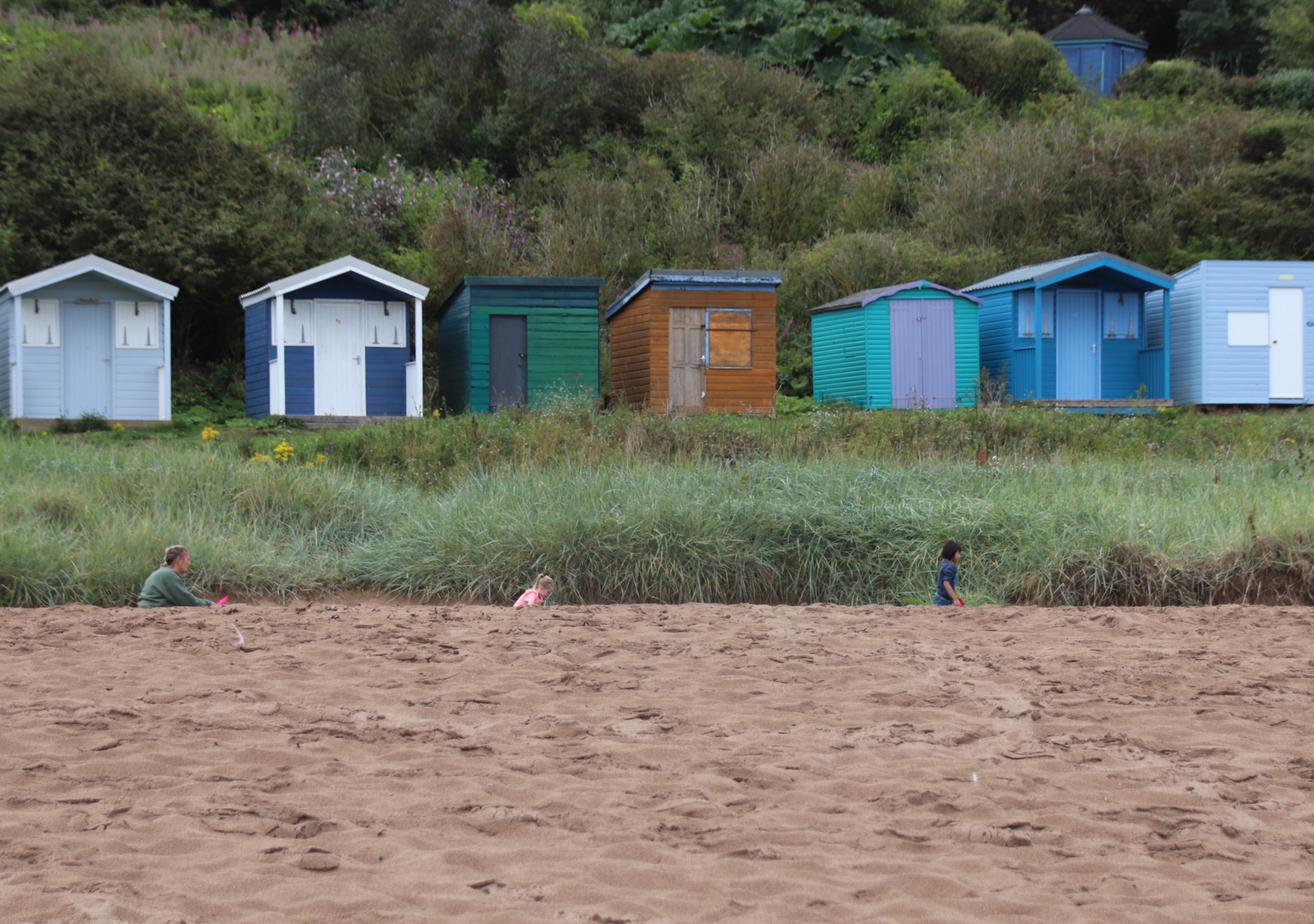
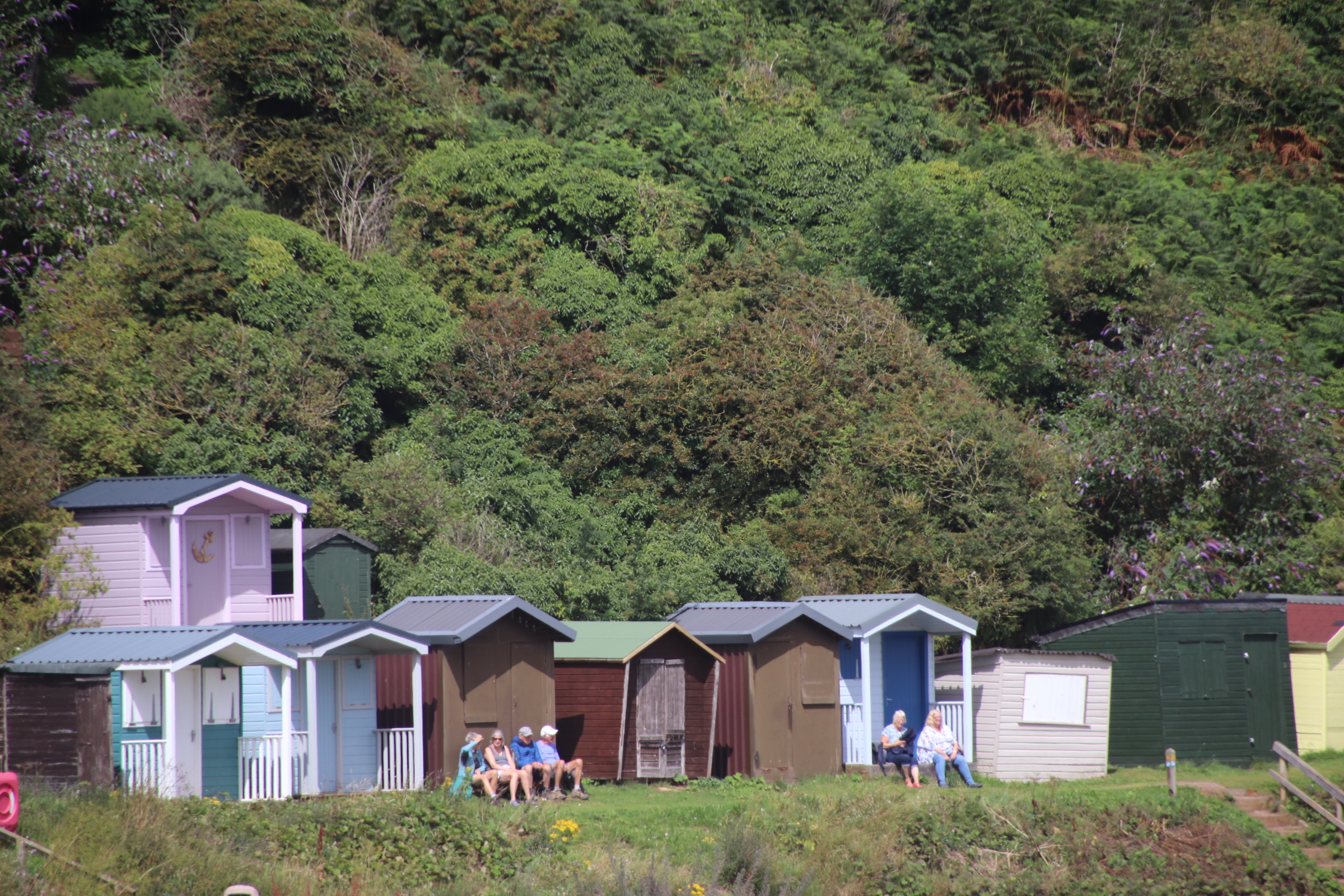
There is a clear difference between your glorious deserted beaches and the seaside attractions of Largs on the mainland. Separated by a few miles of sea and a short drive down the coast road they are like chalk & cheese. The only thing they seem to share appears to be the weather – grey, wet & windy.
Largs has a few things going for it – a range of accommodation, numerous ice-cream parlours including Nardini’s, established by Italian emigres in 1935 , a regular ferry service to outlying islands, a long promenade with crazy golf, a pebbly beach (with a line of light brown kelp & dead jellyfish!) and several play/fitness areas for children or adults.
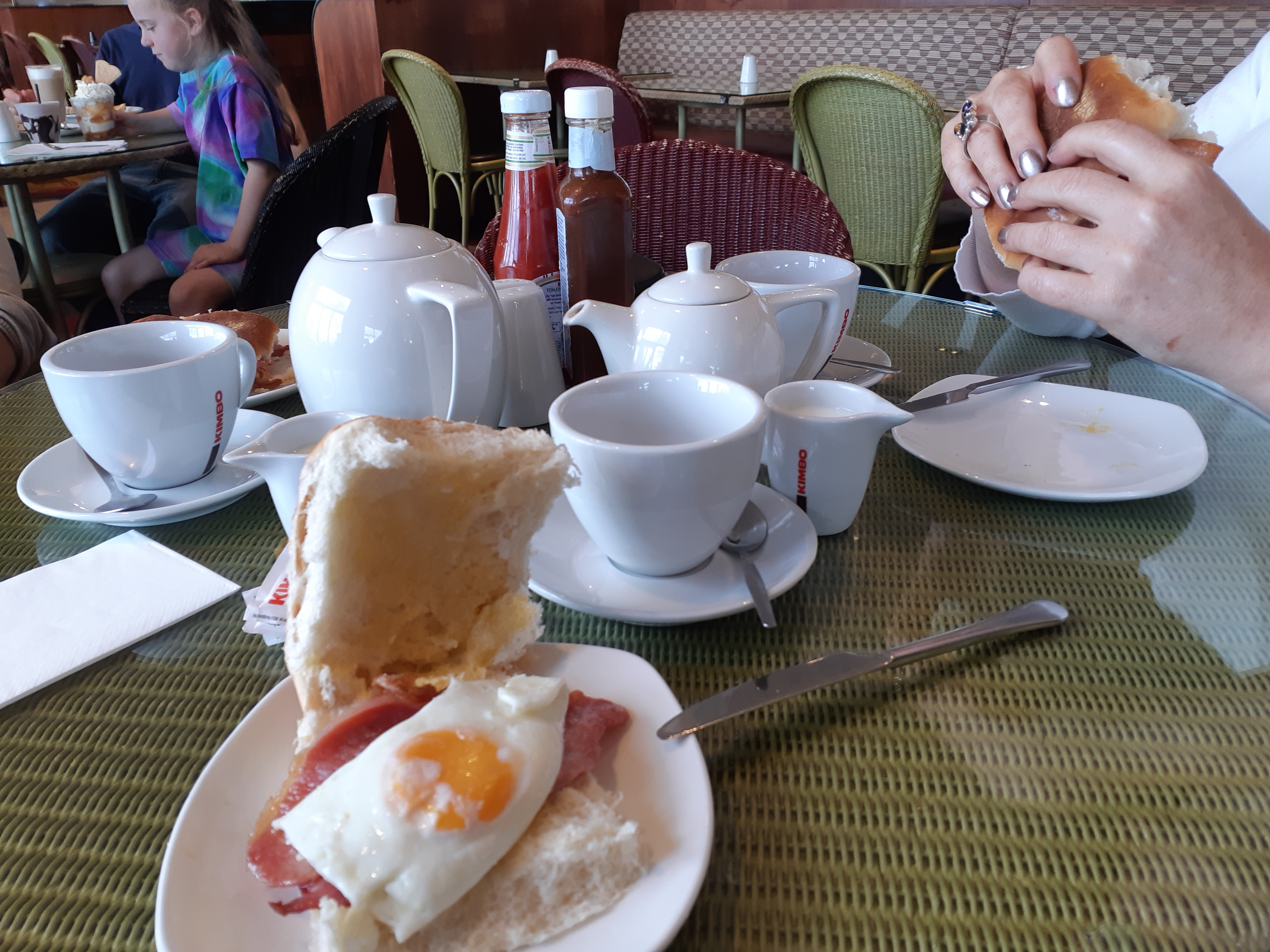
Arriving in Largs, the carpark is shaking off the latest heavy downpour, so it is into the iconic art deco Nardini’s Ice-cream Parlour for the go-to start to any wet day at the seaside – bacon & egg roll & a cuppa tea.
The interior of this magnificent building holds 200 odd punters and is gradually filling up with those partaking in morning refreshments. It will receive two further visits from us as the day progresses.
Outside, the clouds open up and family groups of all shapes & sizes start to appear, wandering rather aimlessly along the promenade seeking some kind of activity to occupy their time. No swimming here – the windy conditions put most people off putting even one foot on the rocky shore.
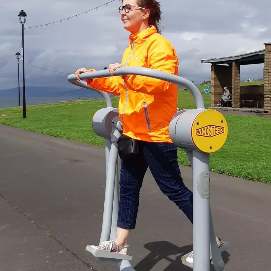
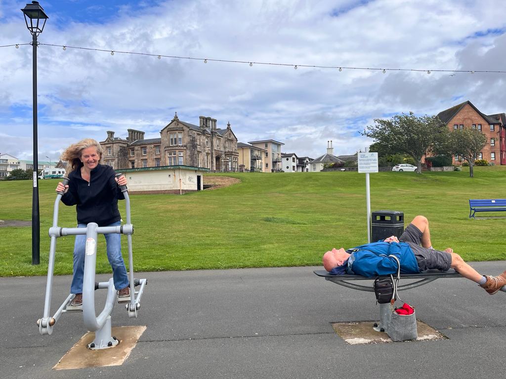
Along the promenade, past the putting green and the children’s playground, the adult gymn tempts passers-by to have a rather inept go. We are no exception and we all put our best feet forward.
So much activity requires a sugar rush, so it’s back to Hardini’s for an ice-cream, one of the 36 flavours made there – strawberry, pistachio, double cream vanilla. We take them outside to sit on a bench in whatever the weather throws at us, in this case wind and showers of chilly rain.
It must be time for a warming coffee and a sample of some very classy mini-pastries.
By this time, like any typical British day at the seaside, the weather takes a turn for the better, the skies part for a bow from the sun, the carpark is full and the funfair is in full swing with all 3 elements in operation.Still no-one is tempted to enter the water.
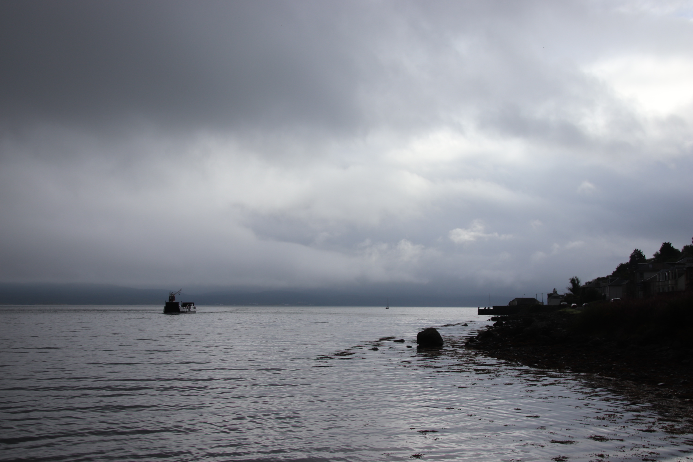
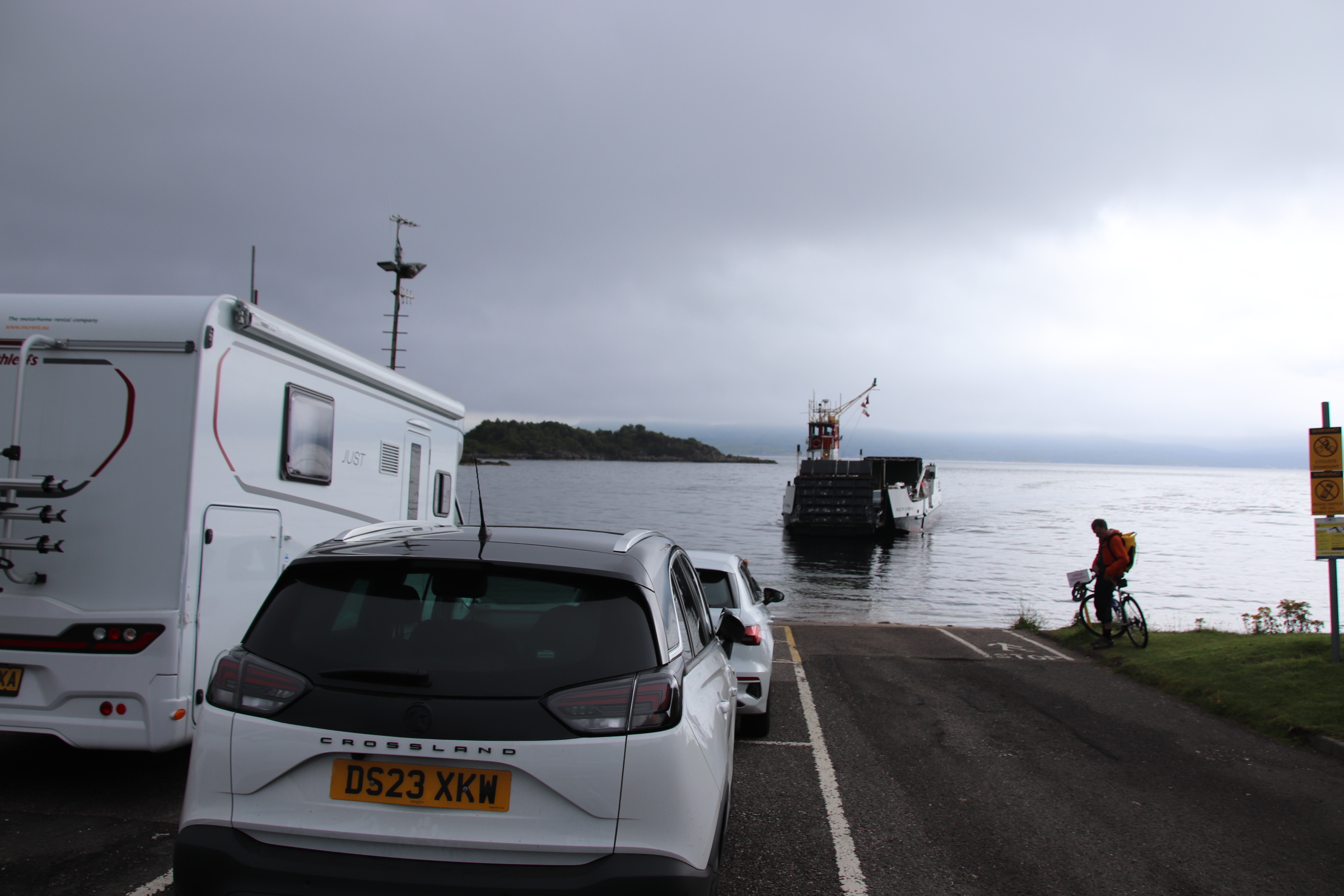
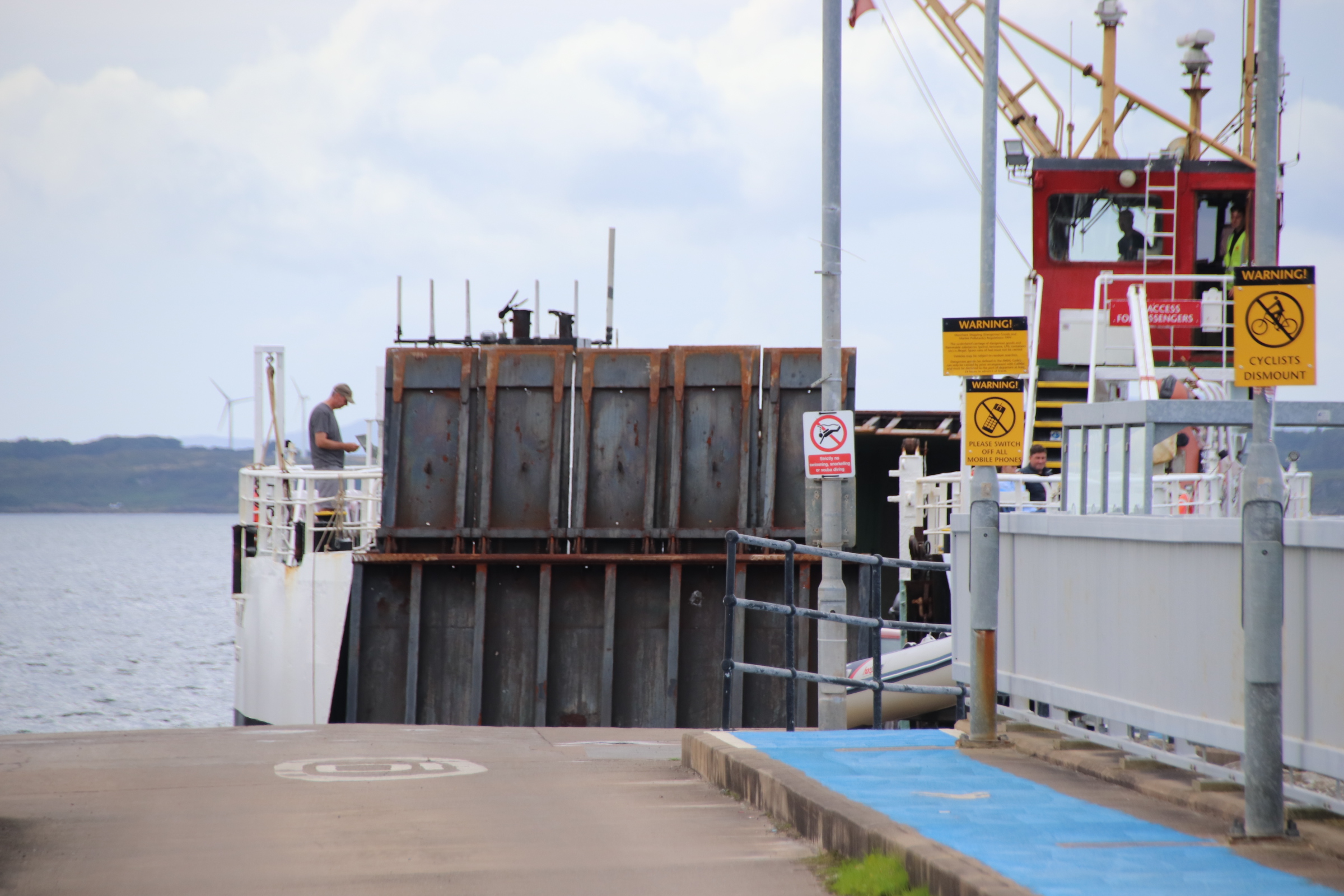
Crossing from the mainland to Rhubodach sets us down on the 23 mile loop around the isle of bute, some distance from the main settlement of Rothesay.
The island is hilly rather than mountainous, with a landscape of woods mixed with harvested cereals and fields of sheep & cattle. It is a few miles around the loch to the main town.
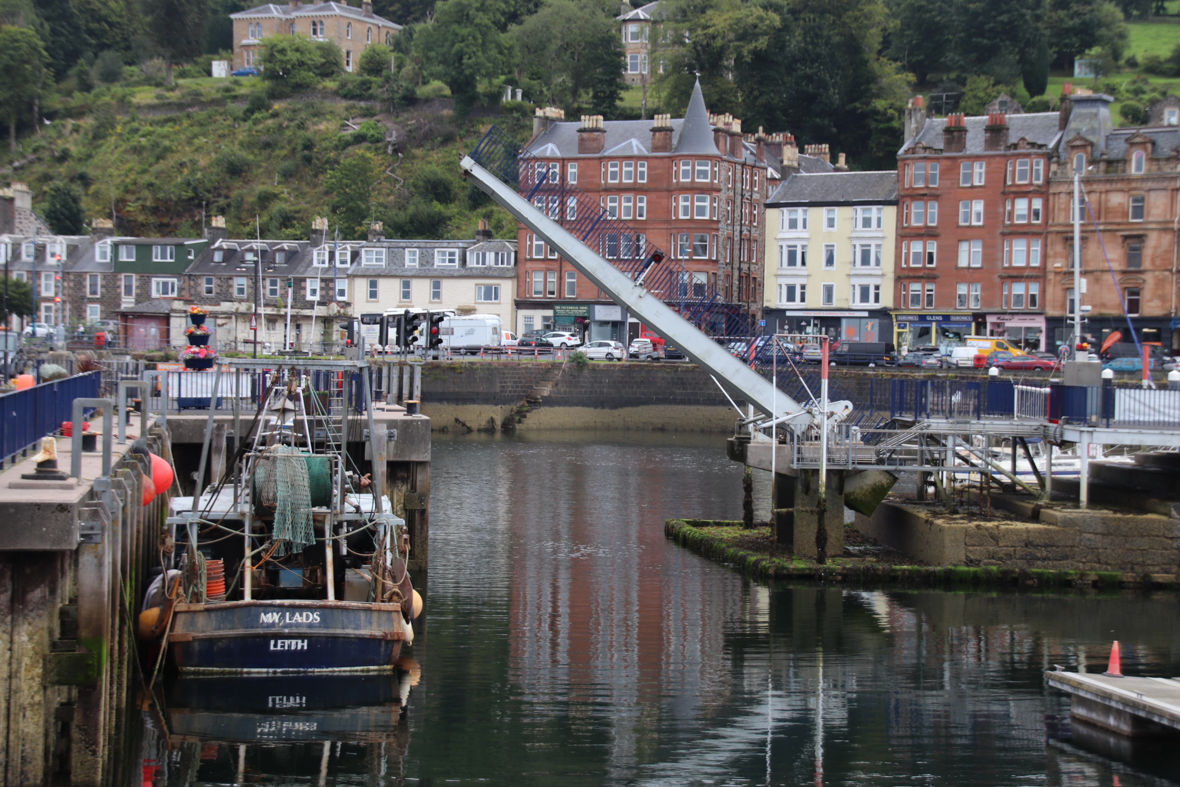
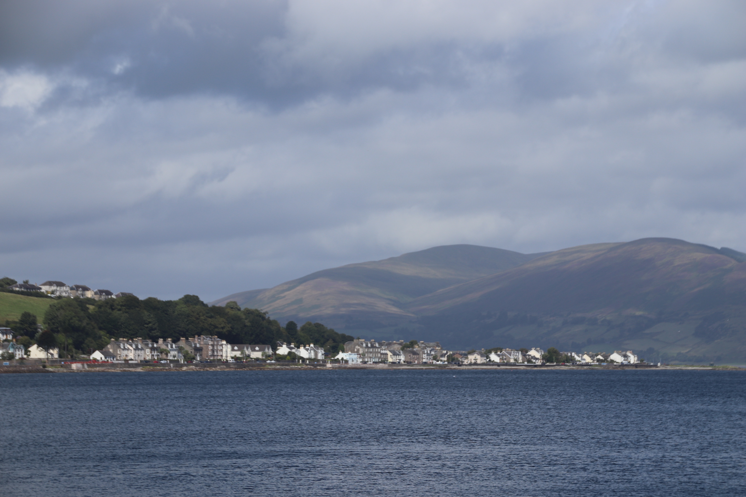
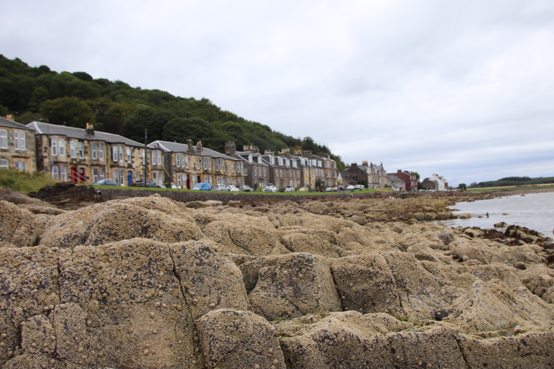
It takes a while to get beyond first impressions of Rothesay. Shop fronts are tired and tatty, with scaffolding and peeling paintwork out front. But look up to the rooftops and a grander side peers across the harbour and the busy ferry terminal.
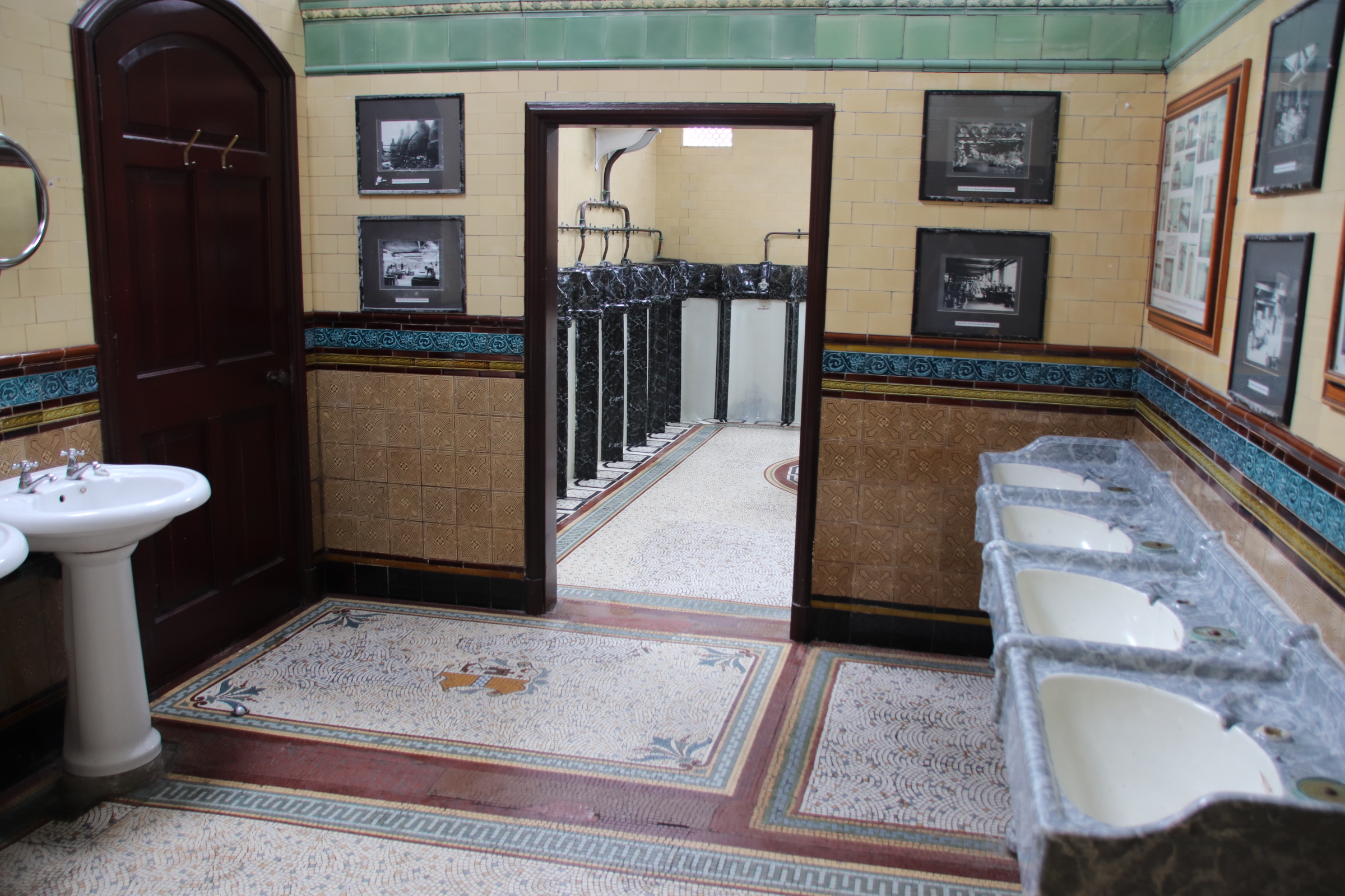
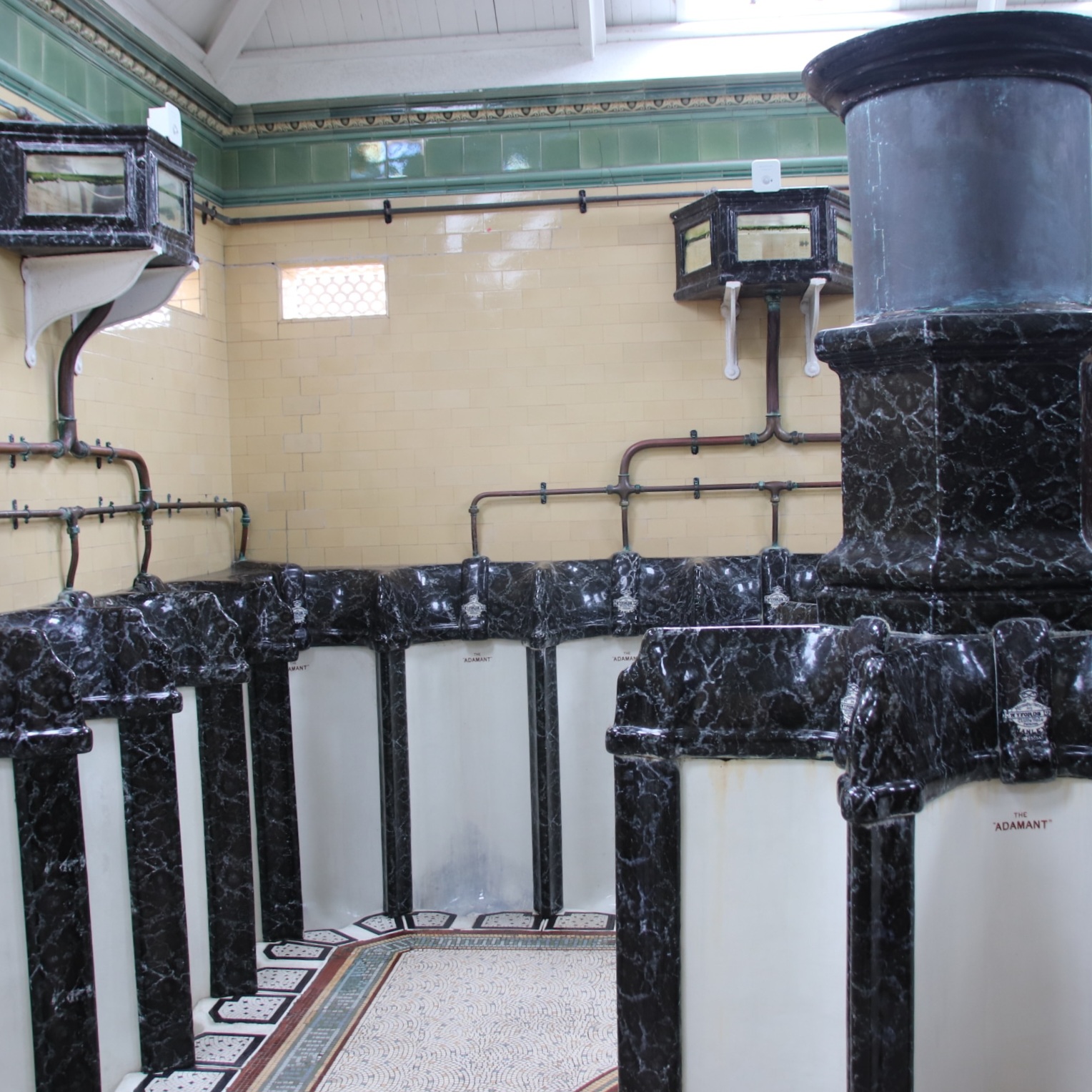
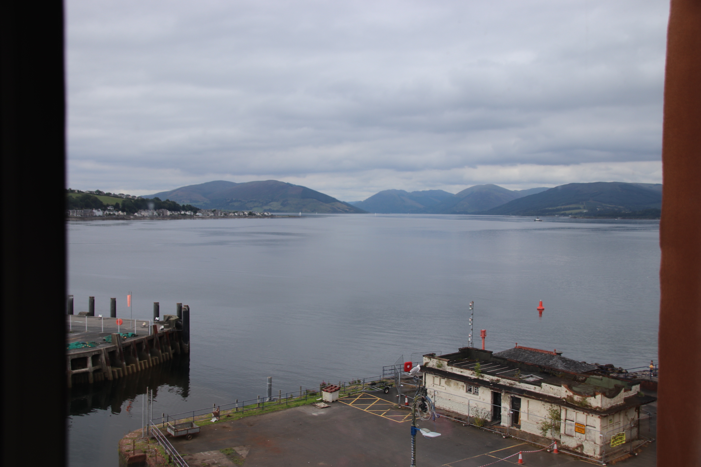
Indeed, looking out from our top floor window one can appreciate the once-grand days of the Victorian wealthy, arriving on steamers to walk the promenade and enjoy the sea air. The renovated Victorian Toilets take bragging rights as the top sight in the town for visitors. Indeed, they are a splendid place in which to spend a penny or, even, take a shower!
Away from the harbour and the centre, the buildings become grander, built by the wealthy as summer residences overlooking the water.
Going out on a tour of the island, the road follows the coastline with small lanes disappearing down to beautiful, sandy bays. Past the big estate (Stuart House, open to the public) Kilchatten Bay is the only other place of any size, a single strip settlement of Victorian houses on the end of the local bus route with a small harbour at the end, once used for bringing in lime for the farms, then for exporting clay tiles for field-drainage and then for bringing in on steamers the wealthy who built holiday homes here.
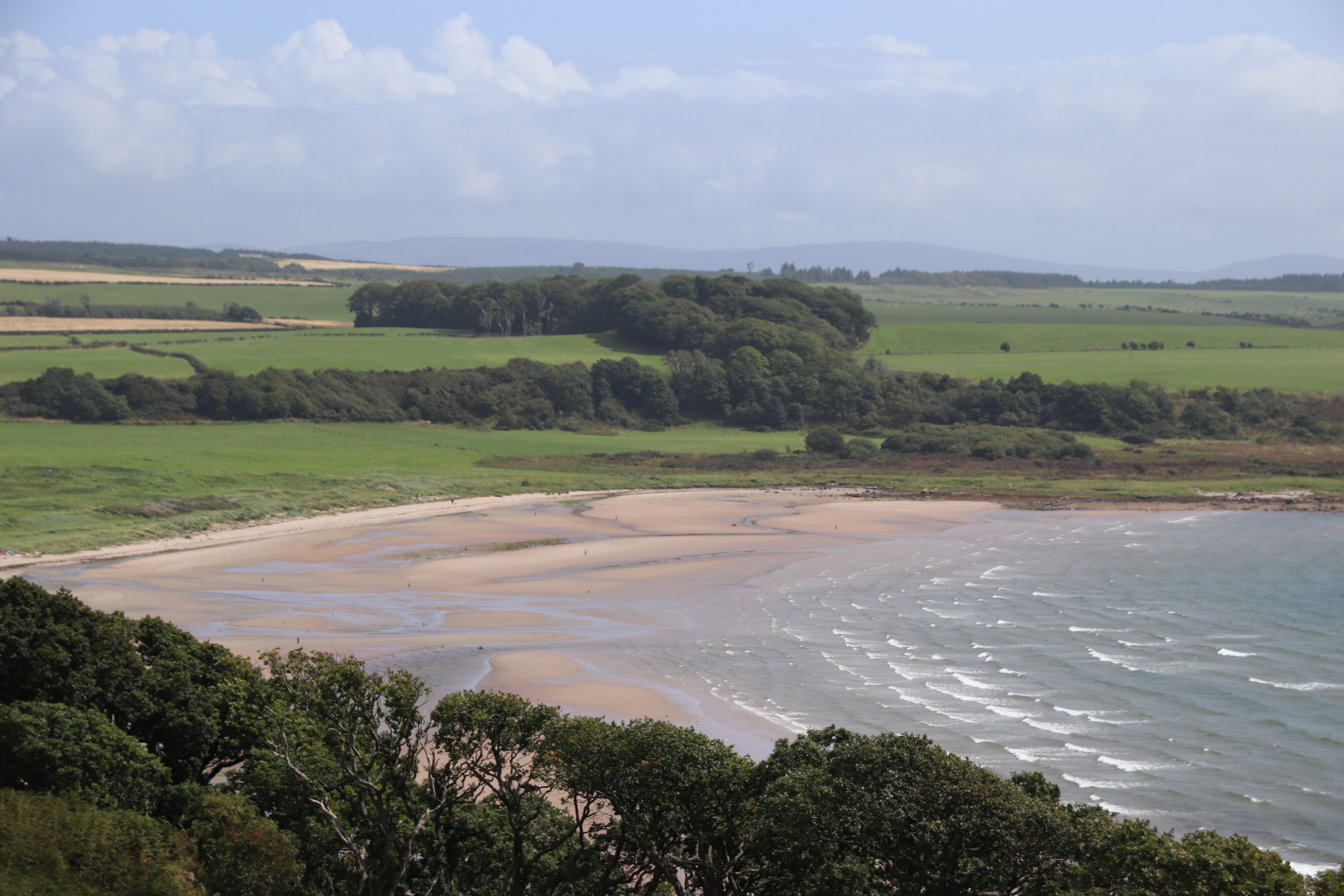
Scalpsie Bay is a popular beach, a short walk from the road, best seen from the clifftop.
The coastline is dramatic, with farms merging down to wide beaches and, in the far distance across the Kyle of Bute, the sharp, molars of the peaks of Arran dominate the horizon.
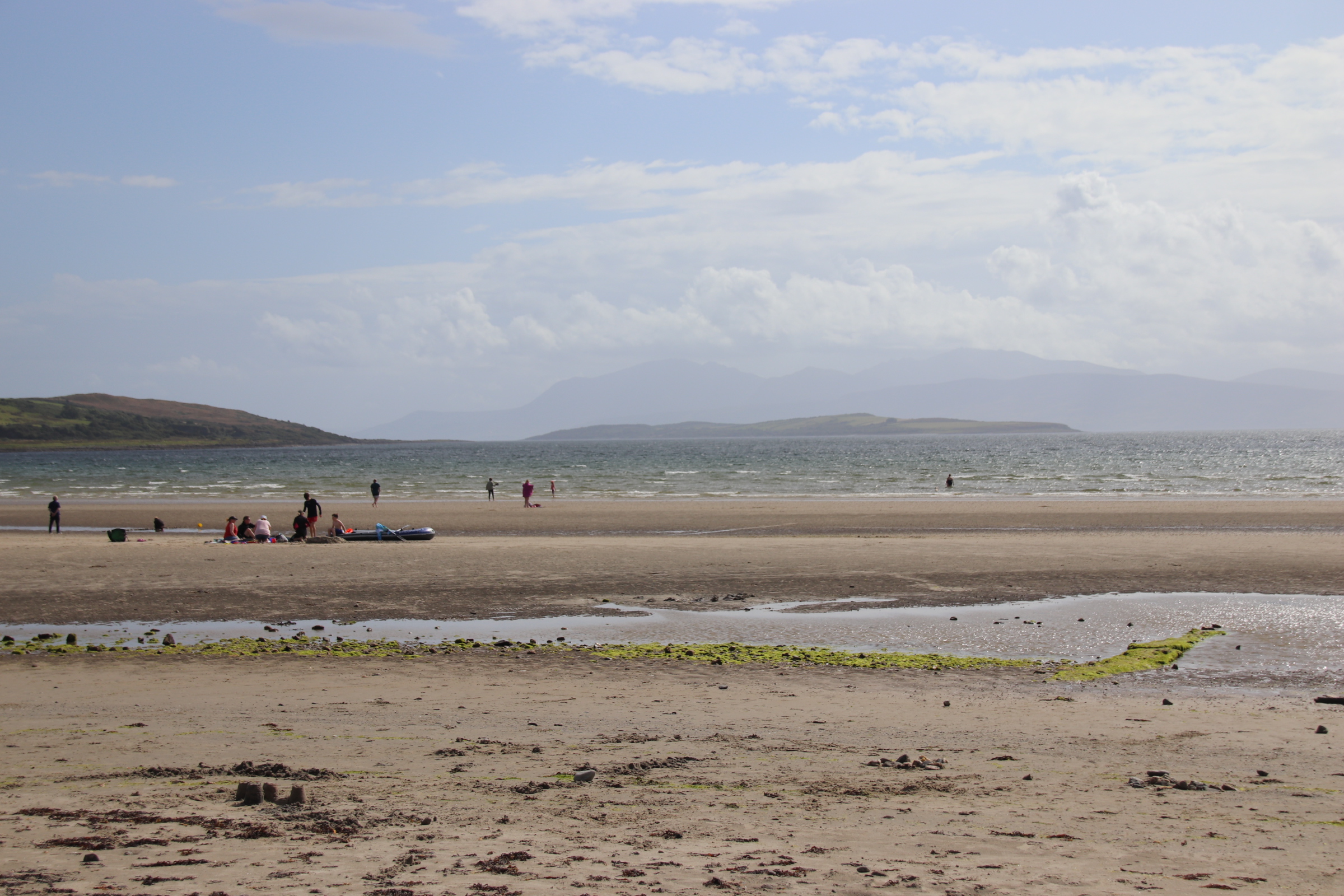
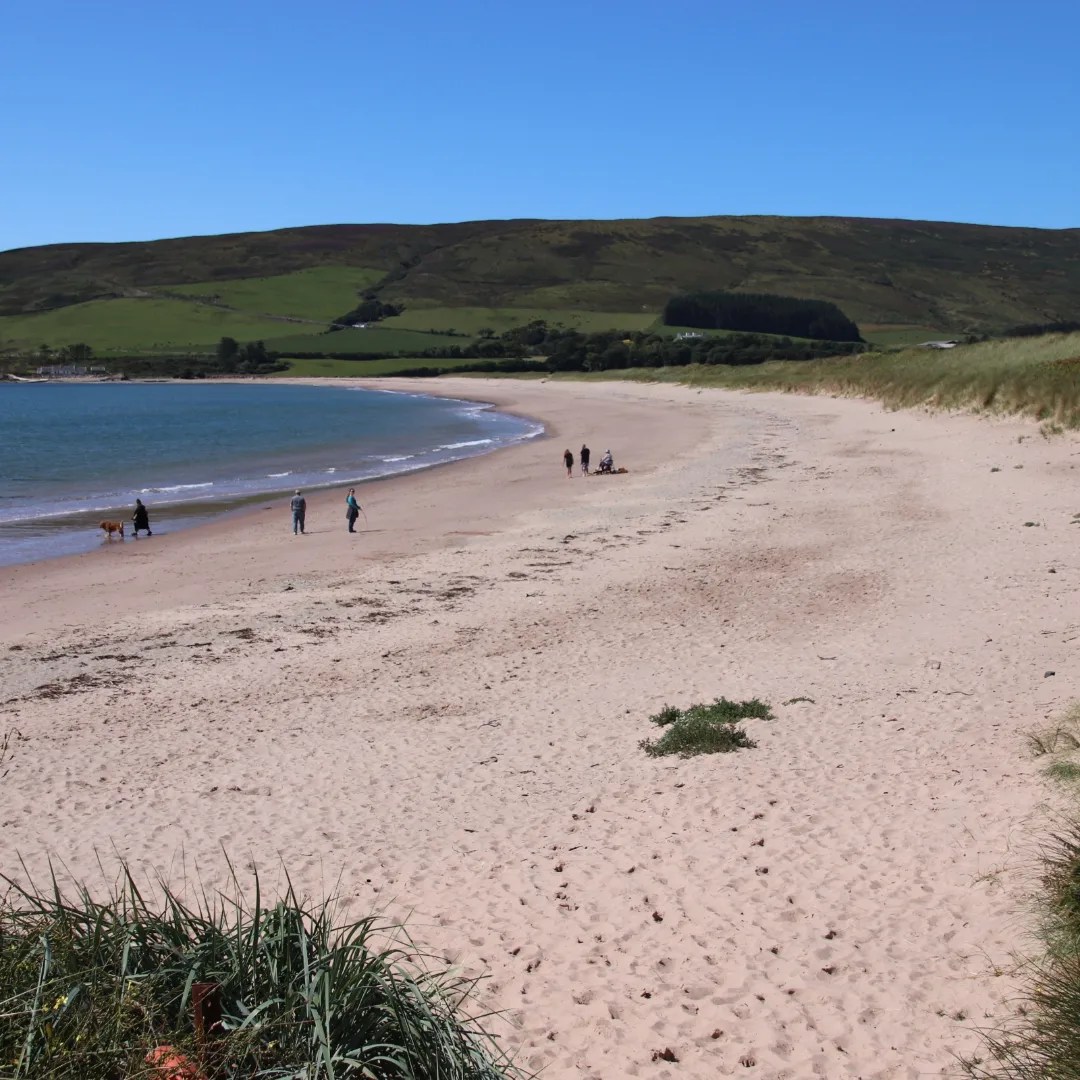
Attrick Bay has two personalities. Firstly empty sands attract wild campers, excited dogs and their owners and folk chewing on their cud at one with the elements.
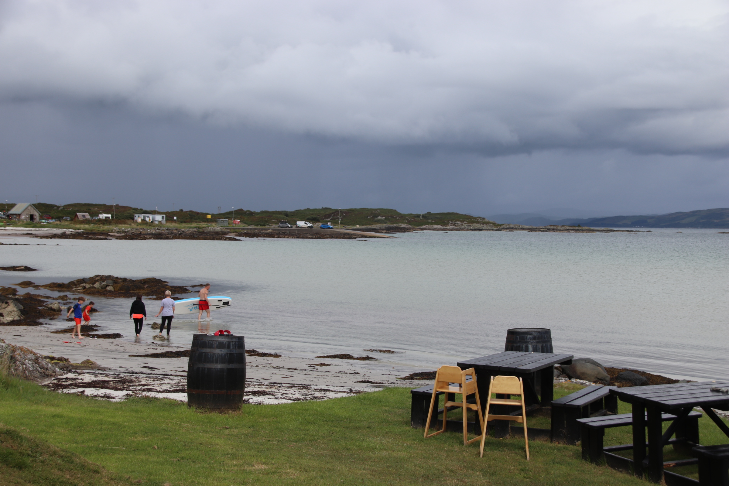
At the other end of the beach, sand-castle-building families, kite flyers, swimmers, leaded pooche owners, lycra-tight cyclists are attracted to the cafe where tea & bacon sandwiches bulk up intrepid wild swimmers as they take on the water…..but hey, it is suprisingly warm, just like old days at the seaside!
So moving on and, very sadly, leaving Gigha takes three ferries if you want the most effective way to reach the island of Bute. Yes, the first is the island ferry from Gigha to the mainland. Then a 30 minute drive to Tarbert – a working fishing village for generations.
First thing in the morning, it’s the ferry across Loch Fynne.
And a drive around the top of the mainland to a 10 minute ferry crossing to Bute.
In 1944, Sir James Horlicks of the nighttime malt drink fame, bought the island and Achamore House and went about planting a rhododendron garden that still exists today. Around it, he gathered a forest of trees and plants from around the world. What better way to spend the last day on this wonderful island than by exploring the colourful gardens and exotic woodlands?
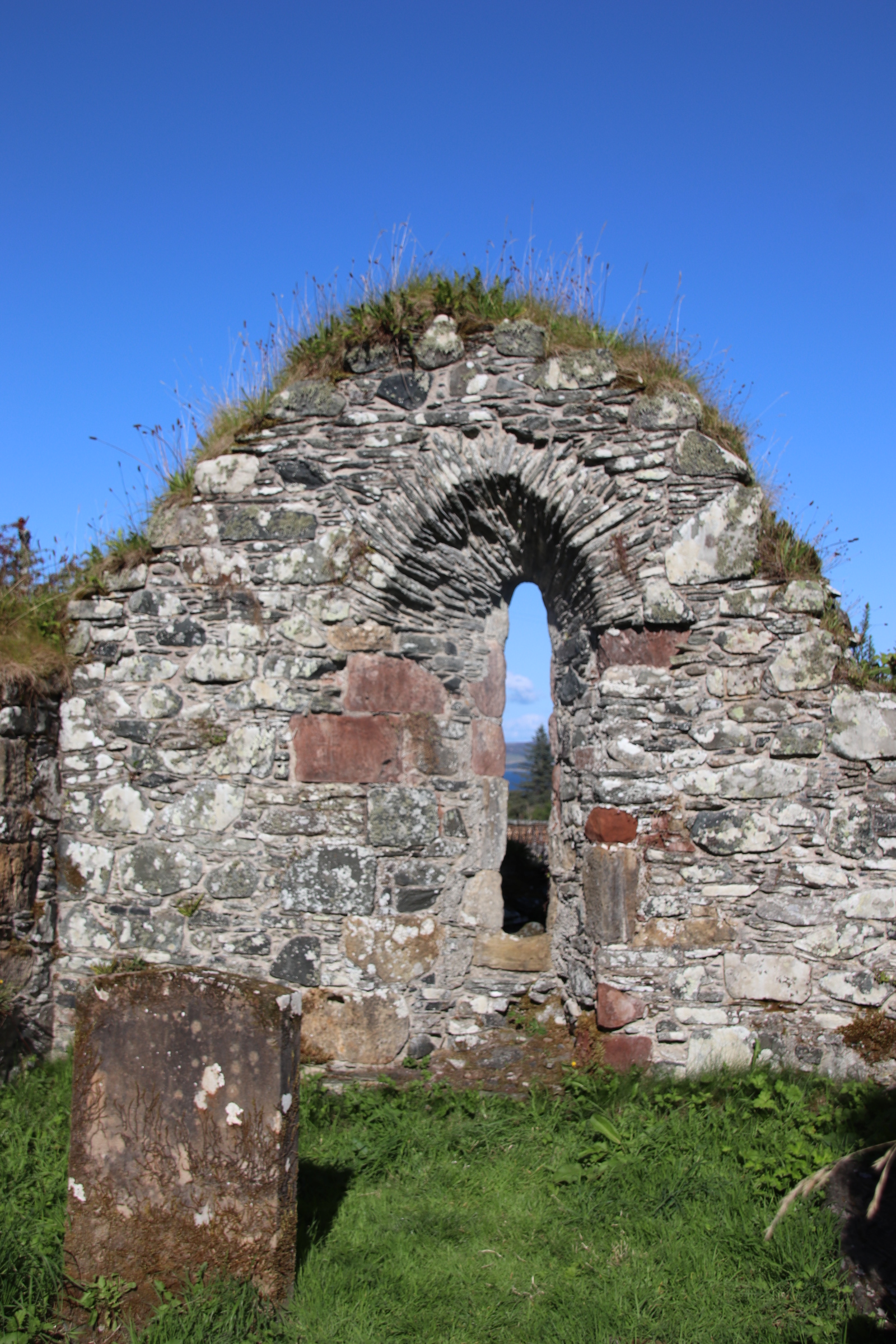
At the far end of Achamore Gardens are the ruins of the island’s first church at Kilchatten.
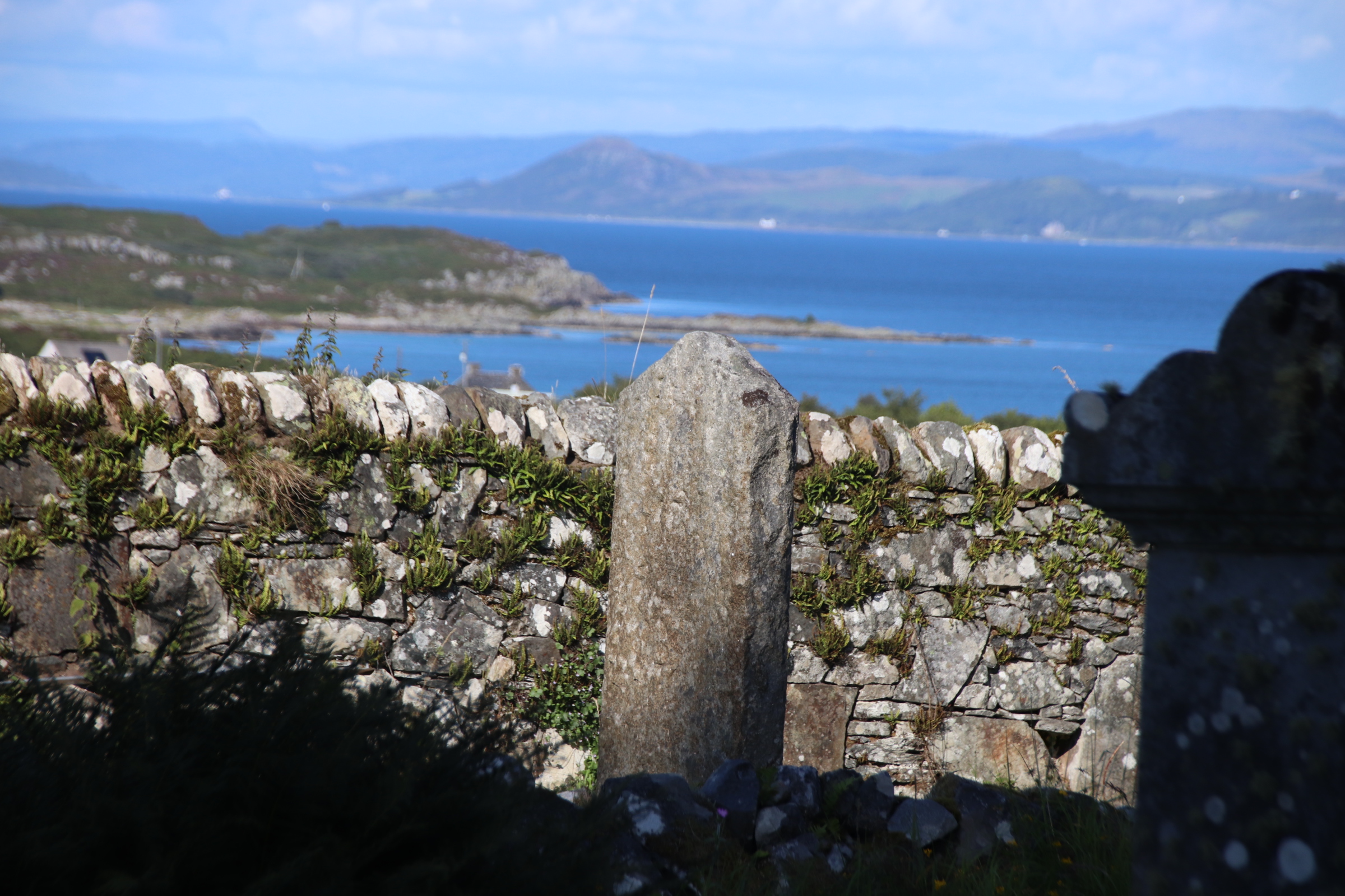
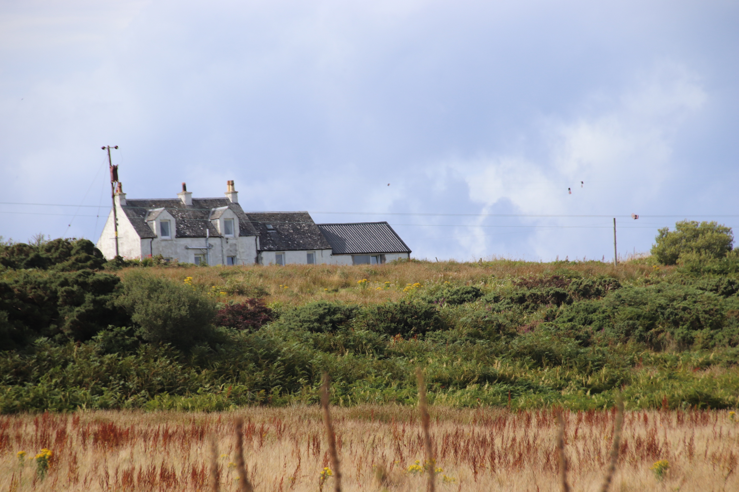
This the view from the bedroom window, every morning must be one of the best. Well, it does change, as the weather changes, but it is still very special and it is what greets you when you emerge from the land of nod. This is the story behind it.
You know you are going somewhere special as you approach the ferry terminal at Tayinloan on the Kintyre peninsula. Across the fields the clutter of bungalows & parked-up vehicles glitter in the afternoon sun, the foreground to the low shadow that is the Isle of Gigha, with the Paps of Jura behind, like a favourite old roller-coaster.
The journey takes just 20 minutes with the vessel zigzagging its way across – with ramps at each end to enable vehicles to drive on & off at each end, propellors are positioned in the middle and prevent it from moving in a straight line. On the Gigha side, vehicles wait patiently in a queue awaiting their turn for the return leg.
Once off, the centre of the island is a short distance. Here are collected most of the homes and most of the services & amenities – the village school, the church, the village store which trebles up as the post office & a takeaway fish bar, a restaurant, a hotel (closed at present), a new cafe, a gift shop with smellies & local crafts and the Trust offices. The weather changes by the hour – the following images were taken within 30 minutes of each other!
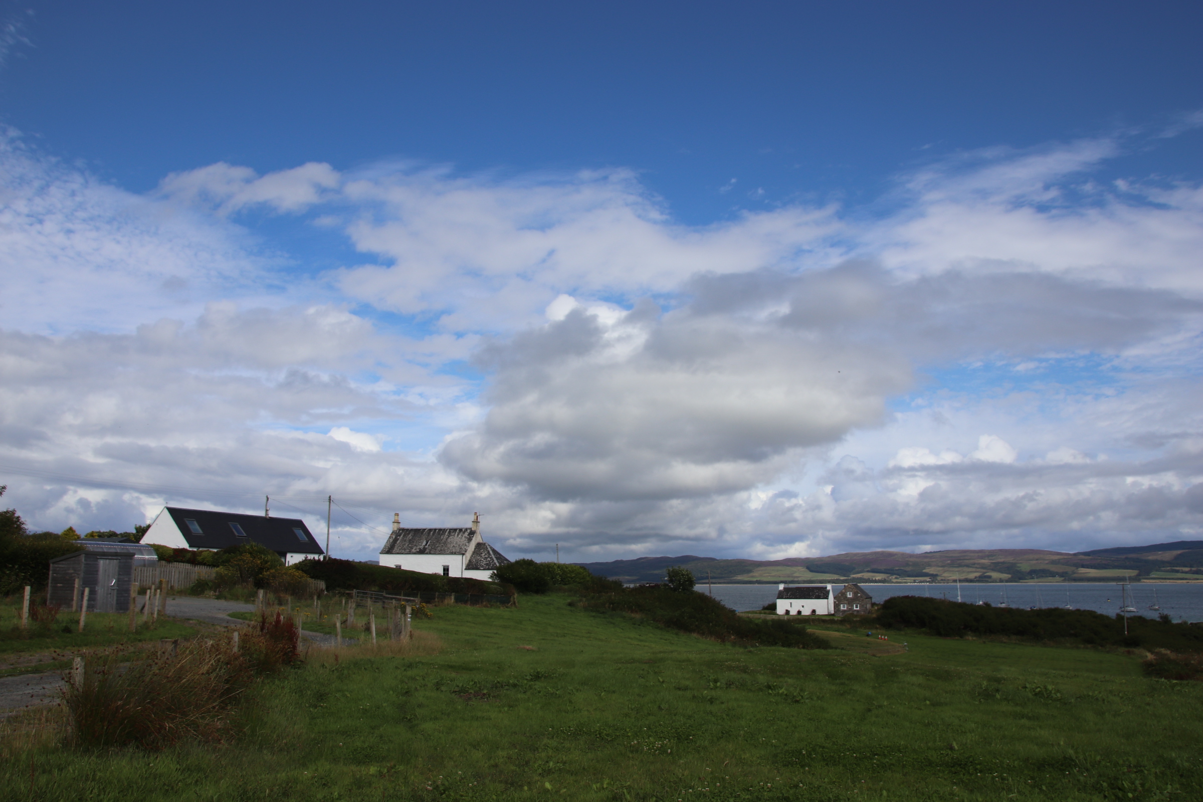
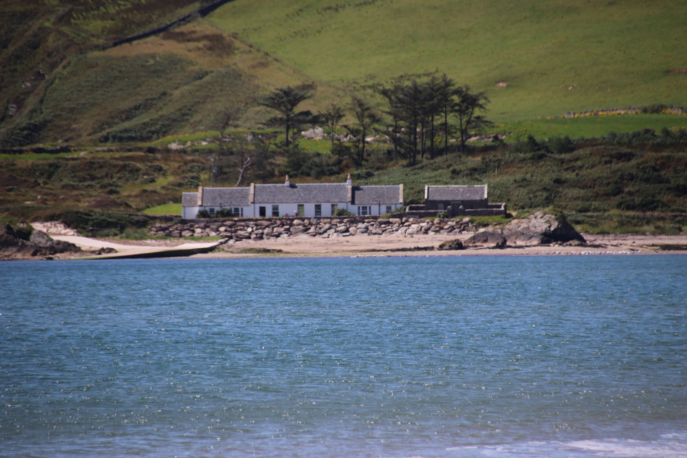
Our destination is this cottage, home for five days and a 15 minute walk from the ferry, up on a small hill.
From this location one can really appreciate both its position and the elements. One can smugly watch the clouded sky grow & darken and plough by on either side or pass along the Kintyre peninsula over the water, dumping its wet stairrods on the hills opposite while overhead a warm sun warms the island through light cloud, its rays picking out houses and vessels down by the ‘marina’.
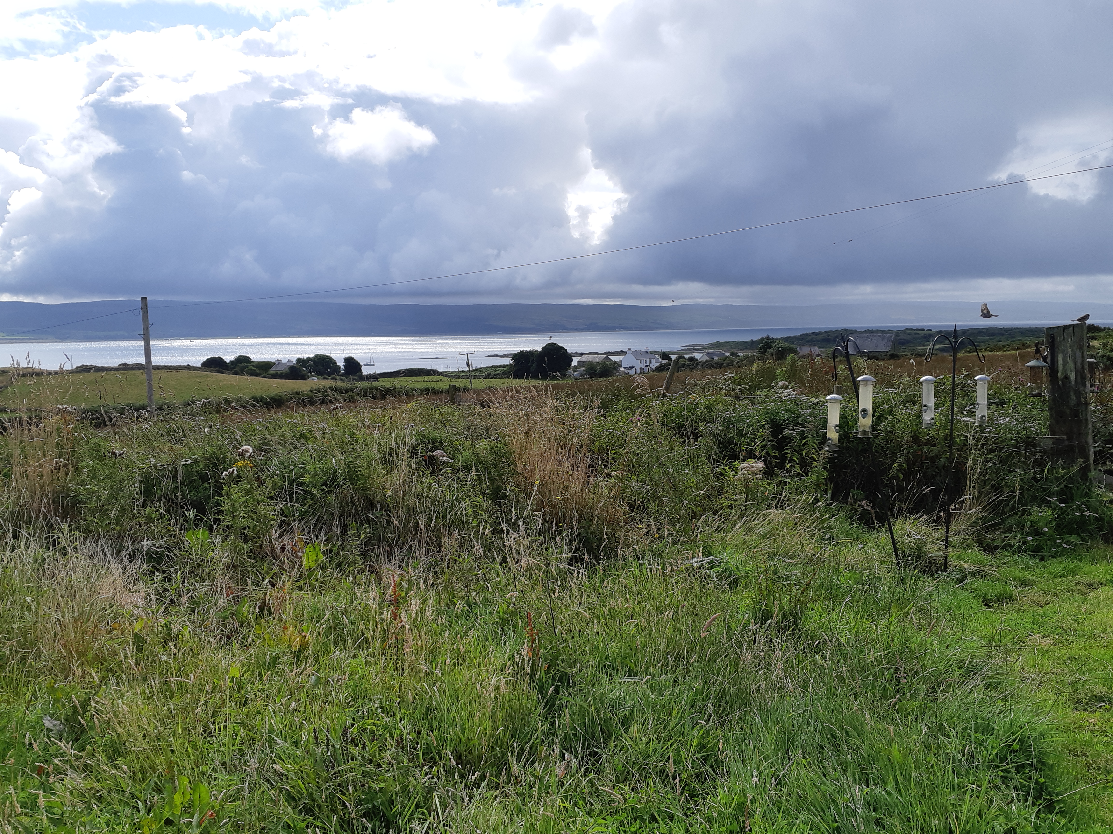
Around the house a host of wild plants & grasses spread down the slope. Bird feeders enhance this seed-based paradise for numerous species of birds. In the space between the outhouses raised beds with an abundance of of veg & edibles show themselves off in full glory before trapsing off indoors to feed family & friends.
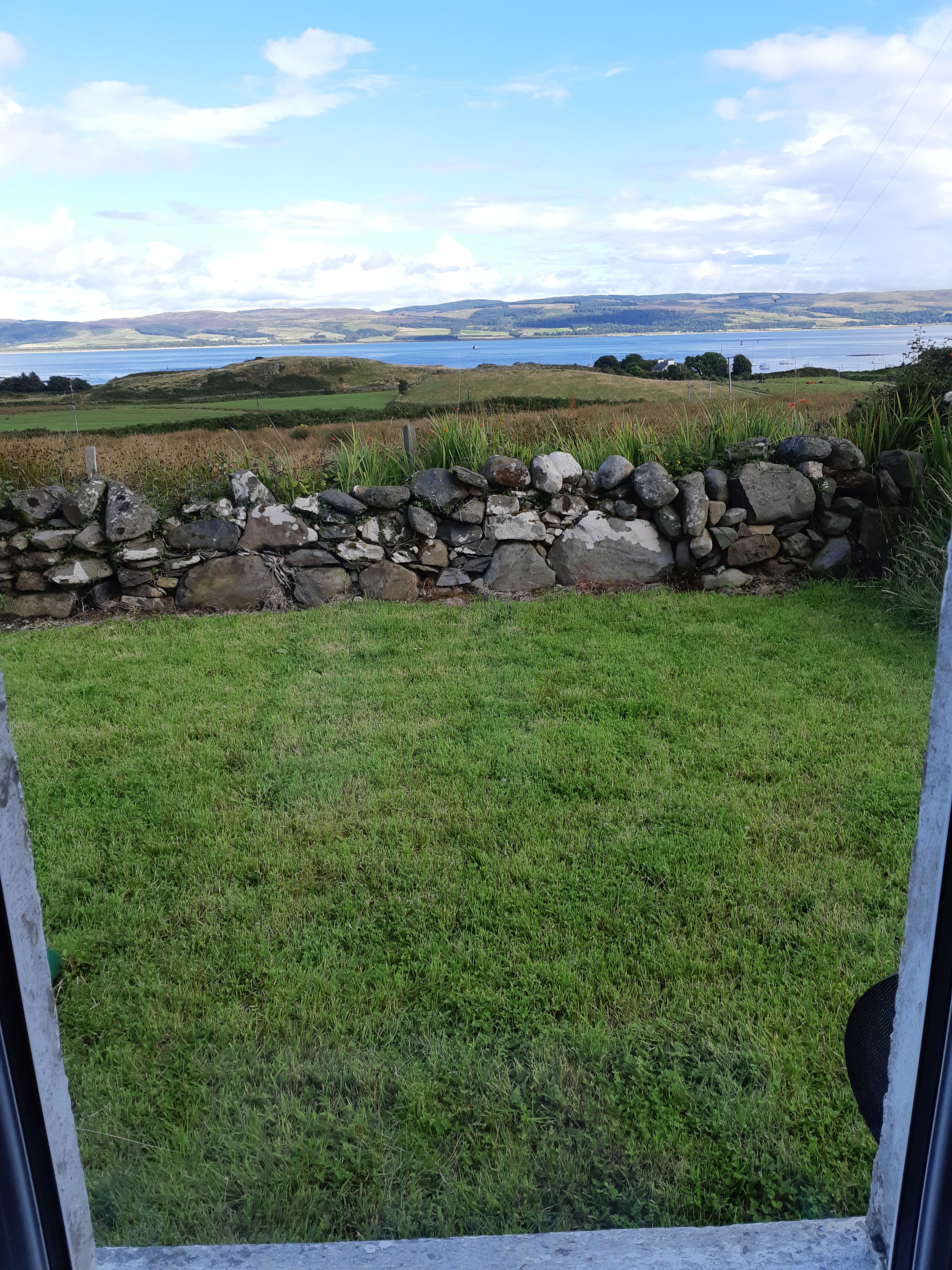
I leave you with the view from the kitchen window which is just as amazing.
To get anywhere from Gigha, it has to start with the ferry. It is, however, a more pleasurable journey when the sun is shining rather than catching that occasional squall:
On the mainland, turn left and the road flows down the coast with breathtaking views of manicured farmland & neat fields to the left and ribs of land, nibbled by Atlantic surf to create sandy bays separated by racks of rock & stone on the right. The occasional bungalow or cluster of mobile homes nab good positions overlooking a patch of sand or easy access to the ocean.
26 miles, on the other side of Cambletown, is the Mull of Kintyre. This is the southwesternmost tip of the Kintyre peninsula, marked by the village of Southend. The local store is a quirky place selling a traditional menu of popular dishes like sausage, beans & chips, alongside a selection of fairground toys and a range of household basics- toilet rolls, butter, cans of soup, surrounded by shelves of 1940s household artefacts. It is also a bakery on a Weds & Fridays selling huge great slabs of delicious cakes & meringues. Just past the line of houses a cluster of mobile homes marks the curve of Dunerverty Bay.
St Columba’s Footsteps mark the spot where said saint first landed on mainland Britain to begin the conversion process. Kiel Cemetary is alongside.
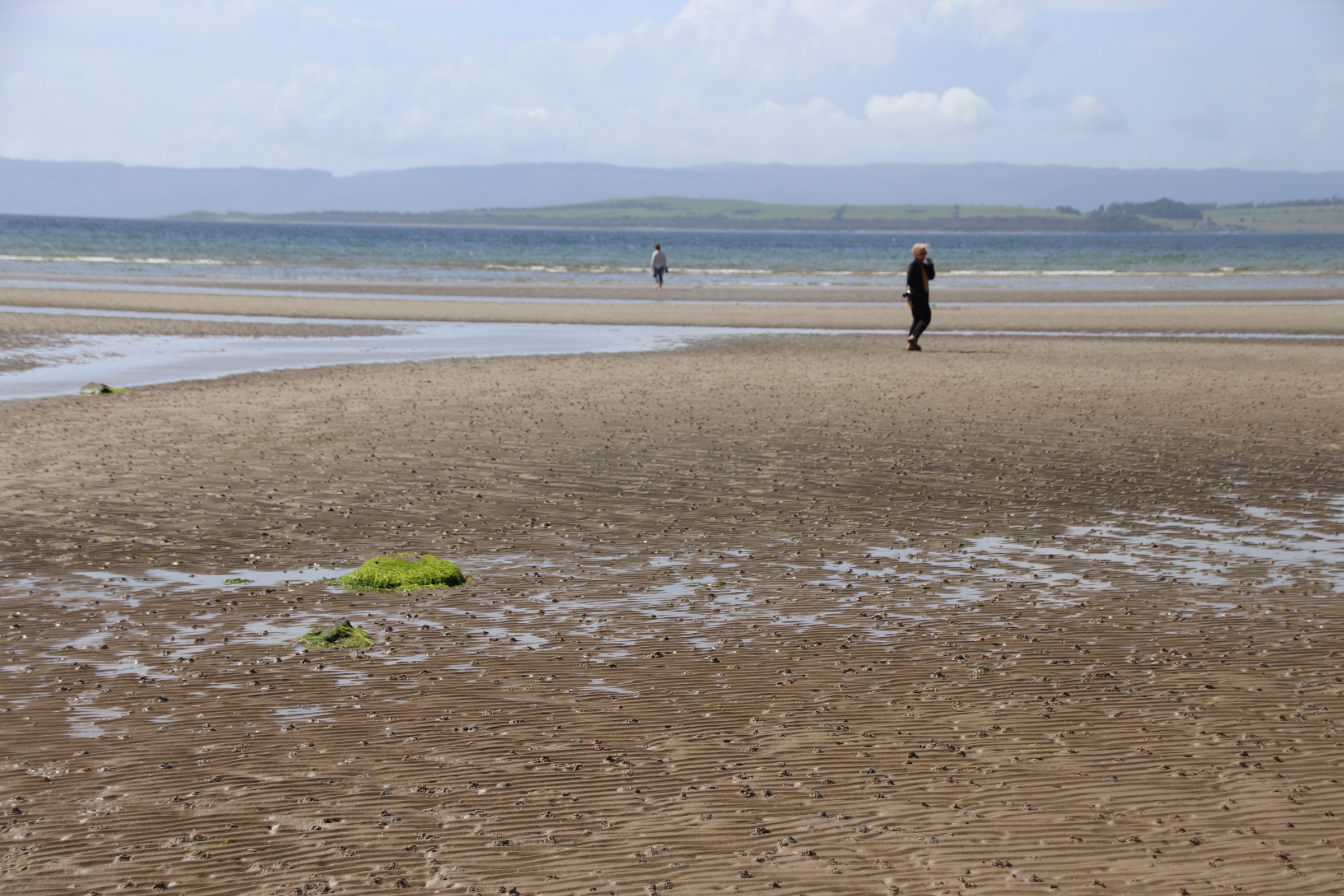
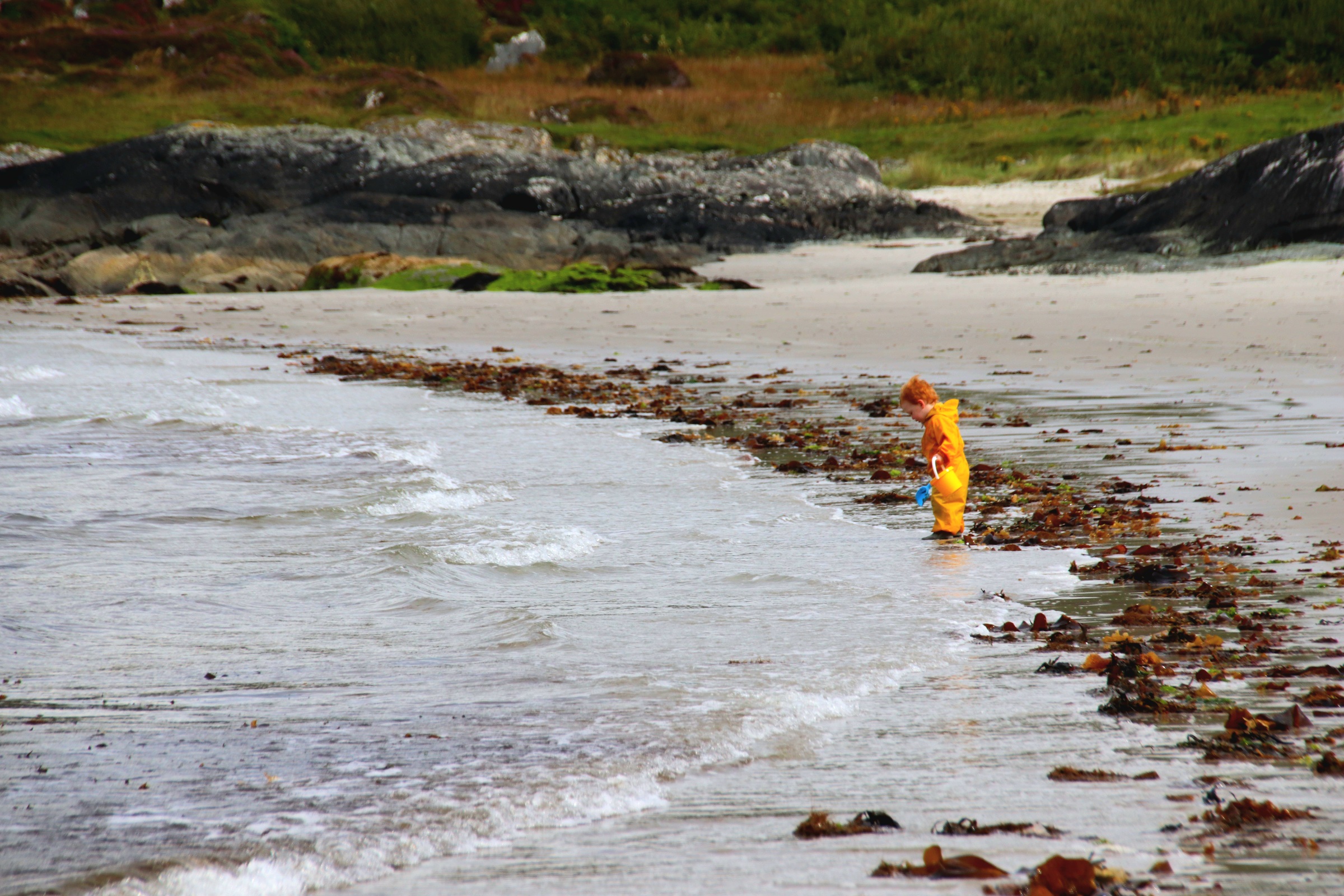
And then on to the beach itself – flat, golden sand stretched out like dough around the bay. A few visitors scatter themselves around the empty surface, marked only with their footprints and a line of tangled flotsam.
Two houses mark the merging of rocks into beach-perfect sand at the top end.
At the far end nearest the faded silhouette of the nearby island of Ireland, a collection of whitewashed houses hides behind the arriving stream and the grass-sprung dunes and a small, renovated ex-terrace, now a single home, stands proud, only disturbed by a chaotic flourish of a flock of party gulls, disturbed by our approach.
Clumps of whispy-cotton cloud, layer upon layer, line up to approach and pass overhead sucked along by a refreshing, wild breeze. The sun shines raising spirits, lifting the mood, bringing joy and light to soul & heart.
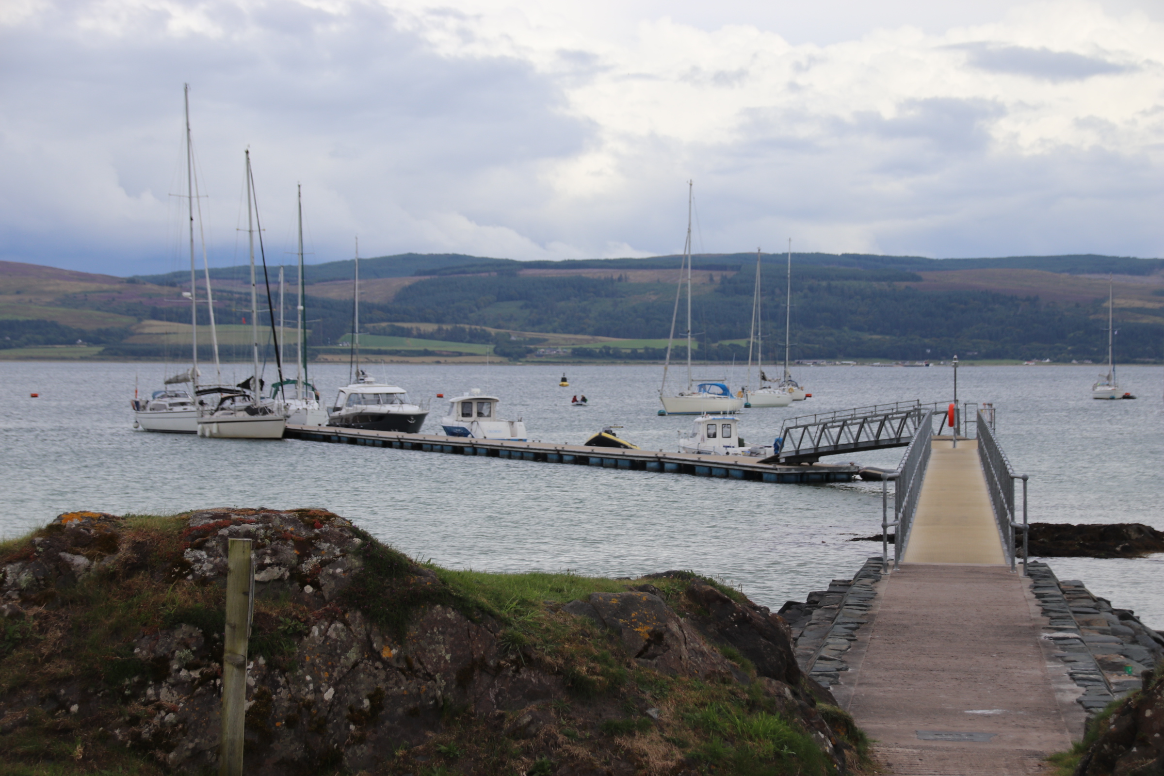
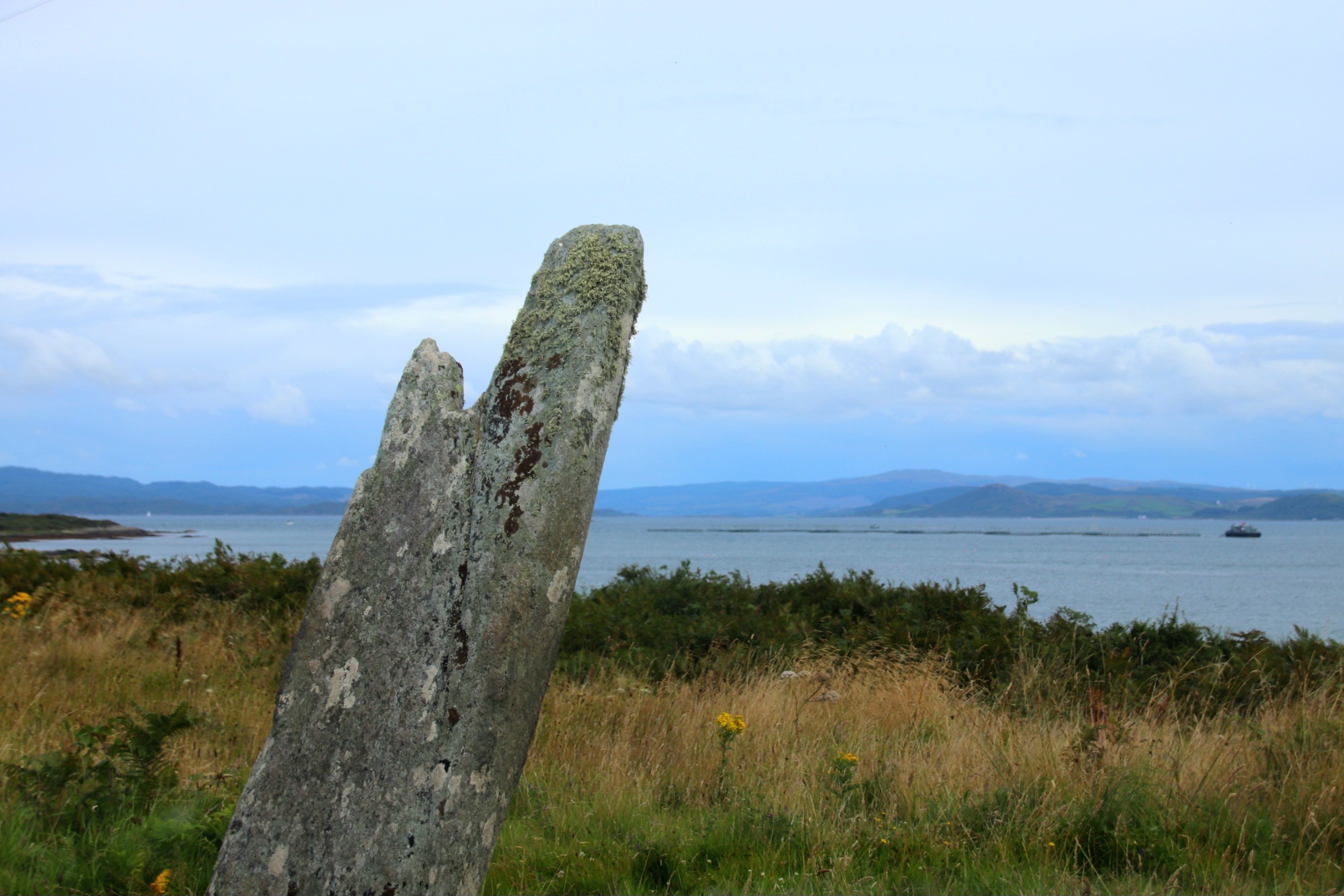
The community-owned Isle of Gigha is a short ferry ride across the sea from Taryloan on the west coast of Scotland. The ferry lands up to 12 or so vehicles and up to 30 odd walk-ons at the terminal which is about half way along the coast, next to the ‘marina’.
There is a small cluster of homes and businesses around this landfall. A store selling the basics, a hotel, (closed at present), a new cafe, canoe and bike hire shop, a fish restaurant. All that is needed if the weather gets so bad the ferry can’t run.
A single, single-track road runs the entire length of seven miles from North End, where the old wooden pier was used to unload passengers.
And South End, where the ferries dock overnight.
At its widest part it is under two miles wide with tracks & paths leading off on both sides to farms & sandy coves.
There is an excellent ice cream business on the island and milk is sent to the mainland. Salmon is farmed in convoys of pens and oysters cultivated in metal cubes.
The island has its own micro-climate, mild with higher than average sunshine hours. On the island we can feel smug as over the mainland to the east, dark menacing storms gather, build and dump their contents in grey curtains of wet stairrods. To the west a brilliant lampstand of sunlight drops glorious rays over gorse and heather, blanketing the landscape in a glaze of shining gold.
163 people now live on Gigha, following the community buy out of the island in 2002. This wonderful place is home for 4 days. More to follow.
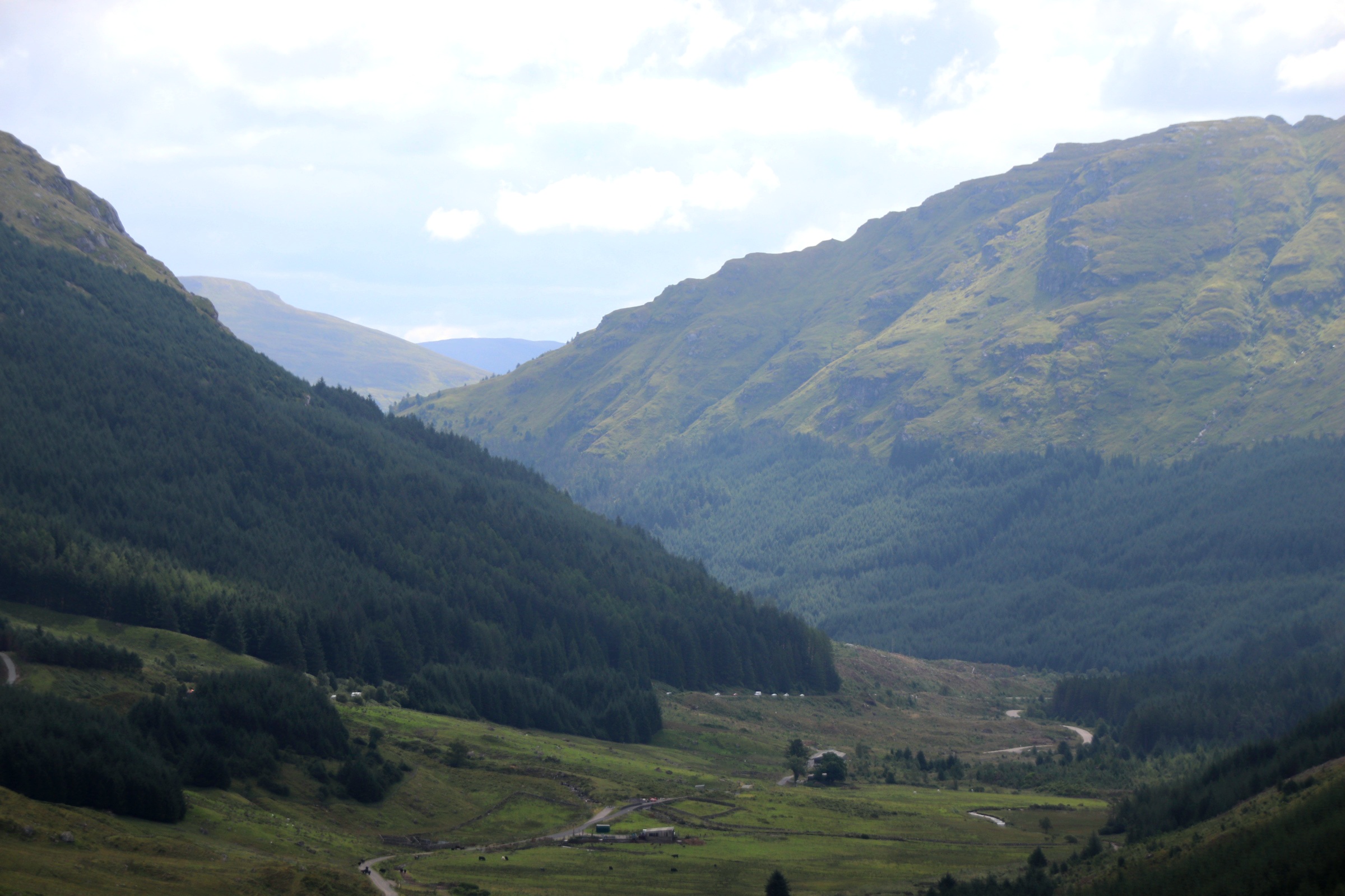
It’s time to change coasts. Having spent 4 days in the rolling, harvested landscape to the east of Edinburgh visiting the many fishing villages & towns by the North Sea, the first part of the journey follows the A1 around the capital. There, the landscape changes and the road climbs, peaks & lochs and high lands closing up around the car.
Gone are the tidy, wide-spreading, fields of golden, swaying wheat & barley & rape seed, edged with Old Man’s Beard and mixed bracken & brambles & grasses. Mountain landscapes appear with disappearing peaks lined up behind each other. Tall mixed woodland of pine & ash, oak & cedars stand imperious, dwarfing the passing traffic. Like a monks’ tonsure, they ring the heights. Breaking through to the light reveals a balding, grazed, rock-pitted landscape, contrasting light-grey, bouldered outcrops with flimsy greens of rough, pasture, yellow-studded gorse and a few stunted trees.
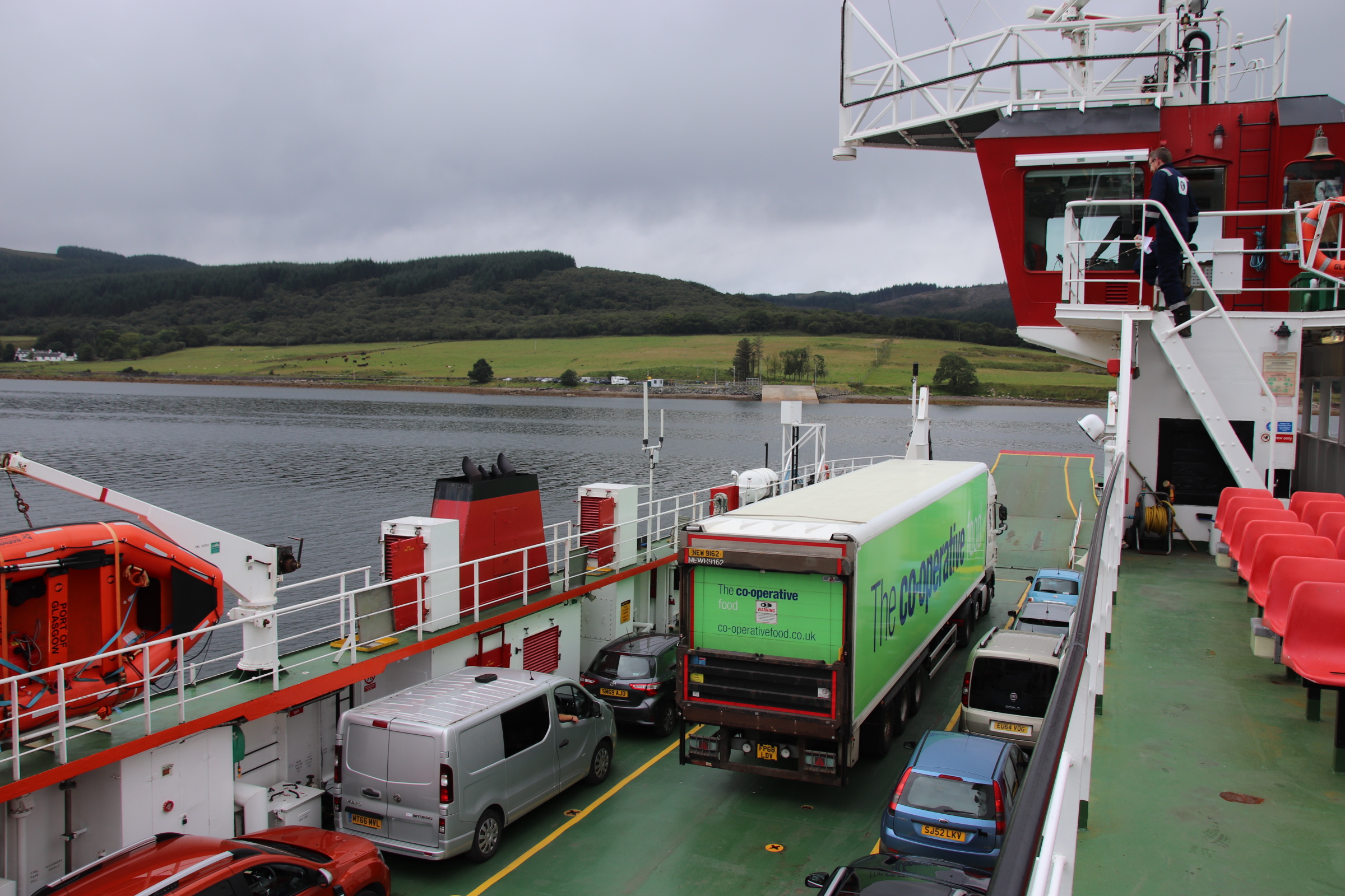
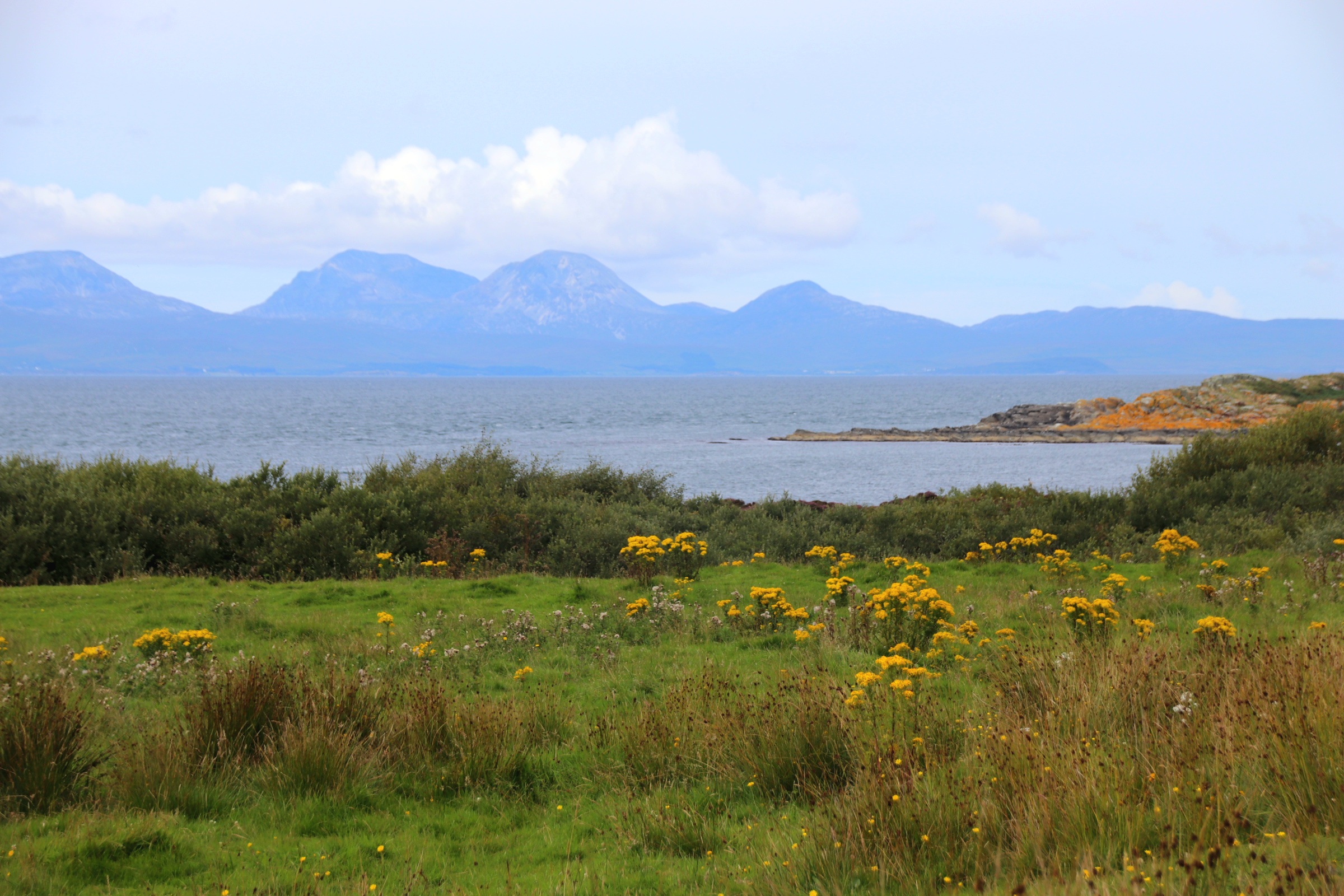
The road passes the sky-reflected mirrors of lochs & streams stretching for miles around the route. Loch Lomond, Loch Long, Loch Fyne break up the scenery, gleaming jewelry draped around the necks of preening peaks.
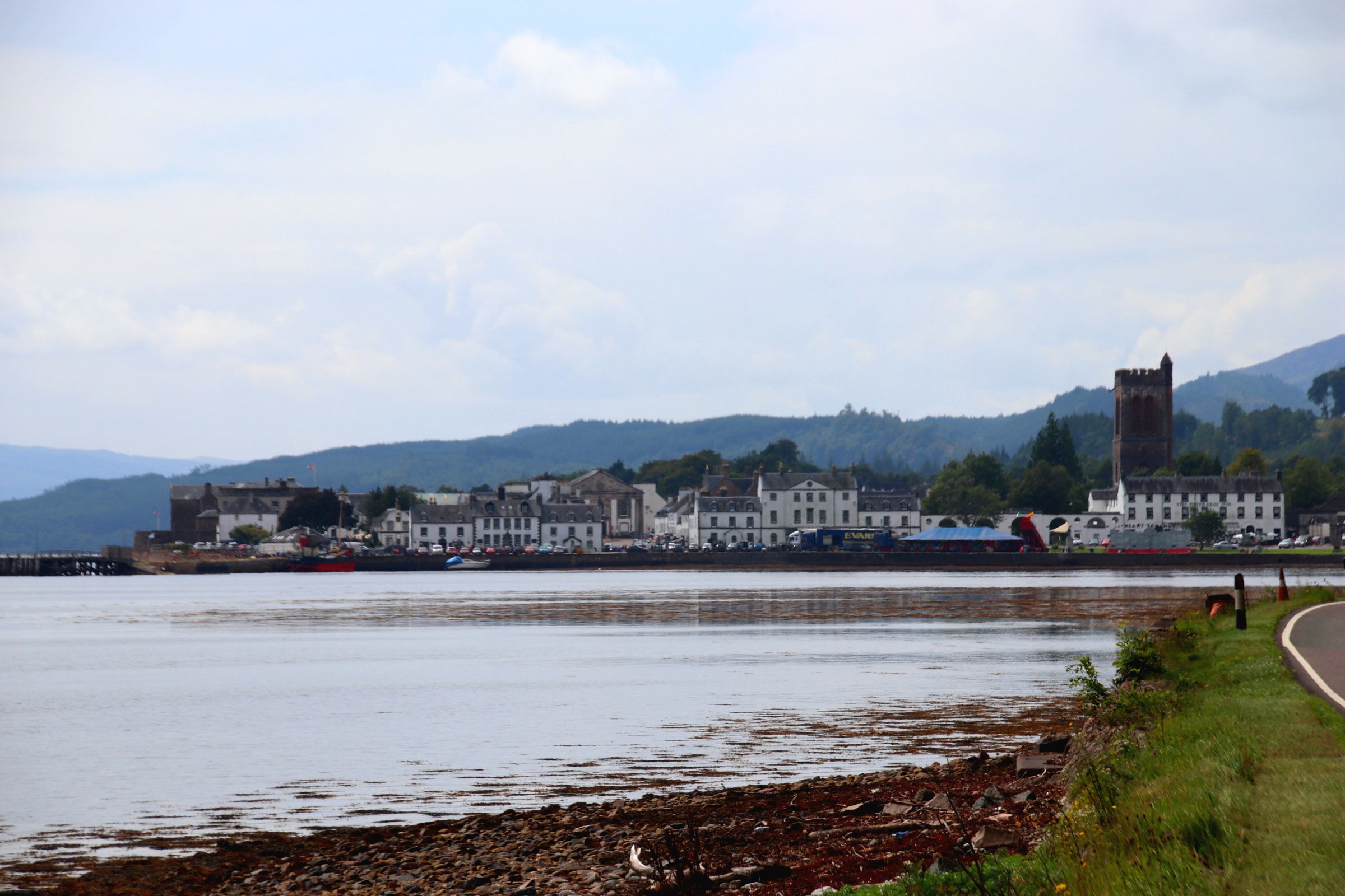
The lochs provided essential means of passage through the mountains for trade & communication and several small towns & villages are dotted around the edges. One of the most picturesque is Inverary on Loch Fyne.
Fishing may well be the source of wealth in small towns like this, as can be appreciated by the size and layout of the buildings.
After a beautiful drive of 5 hours or so, we reach the west coast and the island ferry that runs from Tayinloan to the Isle of Gigha, our final destination.
Dunbar prospered as a market town positioned on the east coast of Scotland, with a strong fishing & farming community, then as a military base before, in the late 19th century with the arrival of the railway in 1844, it became a seaside resort. The historic town centre became one of the oldest Royal burghs in Scotland in 1370. This gave it the right to trade in goods along the long & broad High Street.
In those days town centres featured a standard design with a castle at one end and a church at the other with a very wide street between with enough room to position market stalls on both sides. Over time these ‘shops’ moved into the buildings and the shopkeepers lived with their families upstairs.
The High Street buildings vary in style and grand essentials. Outside the Town House is a statue of John Muir, the founder of the modern conservation movement who was born in Dunbar. He moved to the US and was instrumental in founding their national parks.
To the east of the town, high cliffs peer out across the North Sea and the far-off islands colonised by cormorants.
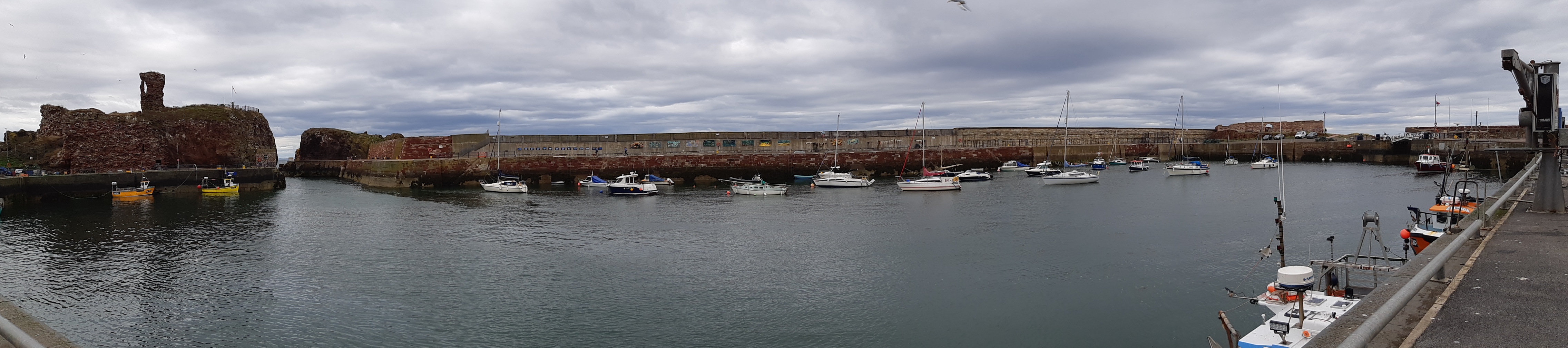
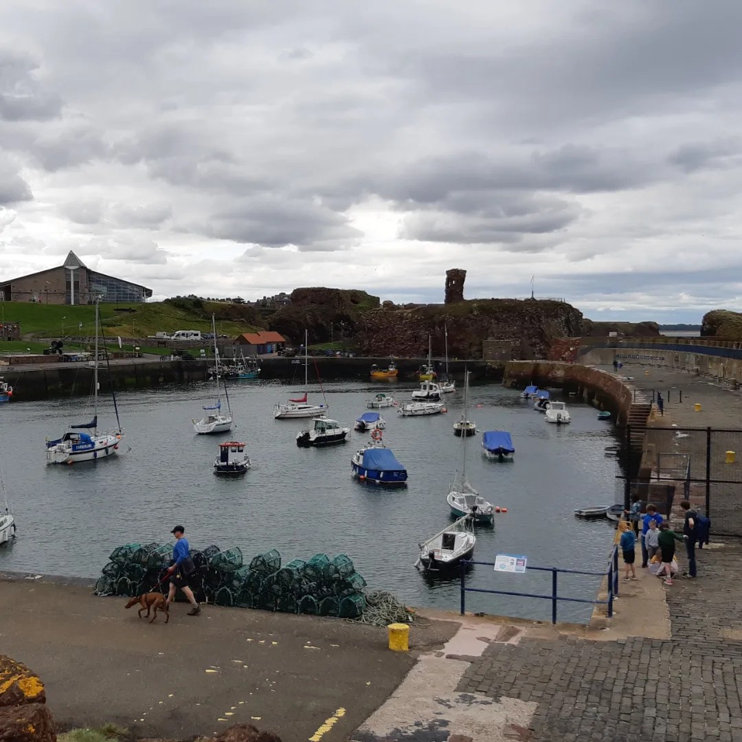
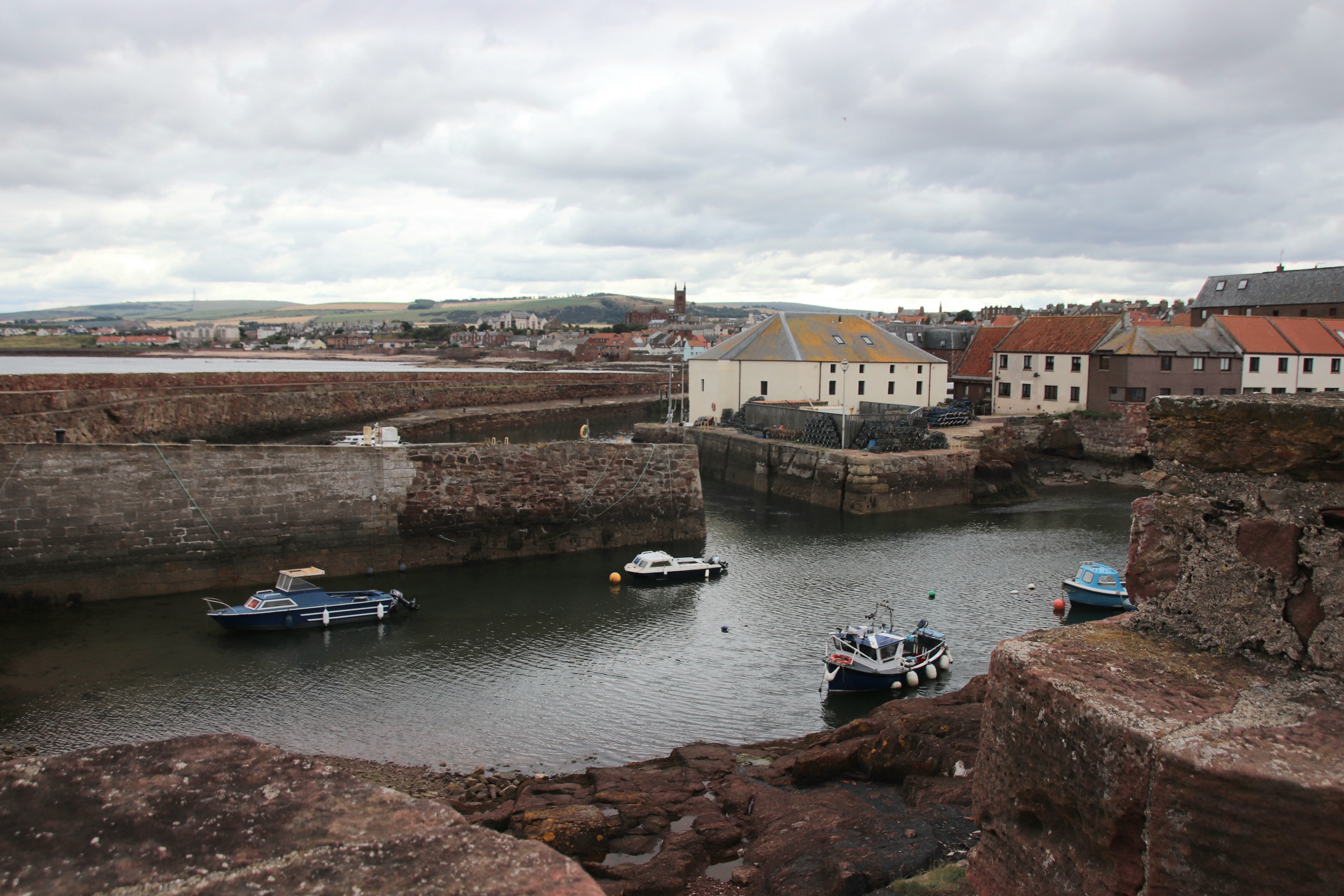
The harbour area below the high cliffs consists of three harbours, a ruined castle and a battery. The town has a long history going back to the 7th century with its strategic importance at the entrance to the Firth of Forth. Above the harbour are the ruins of Dunbar Castle, stone from which was used to create Victoria Harbour in 1842. Dunbar was also home to a major herring & whaling fleet and to this day, retains a commercial fleet mainly landing shellfish.
A bascule bridge (opening upwards) separates the battery from the wharfs & sea walls.
Around the corner, Cromwell Harbour dates from 1574 and provides better shelter during winter storms.
Possession of Berwick-upon-Tweed has passed between England and Scotland on at least a dozen occasions over the centuries, the last being in 1482. Its medieval walls, Elizabethan ramparts and 18th century barracks reflect its strategic importance during frequent border wars between the two countries. However, do not seek refuge in the town on a wet, cold autumn-feeling day, for there is little to raise your spirits beyond these ancient, military walls & defences. Indeed the high Street seems to have given up the fight to bring a bit of colour to families of damp, weary holidaymakers trying to find some shelter from the elements.
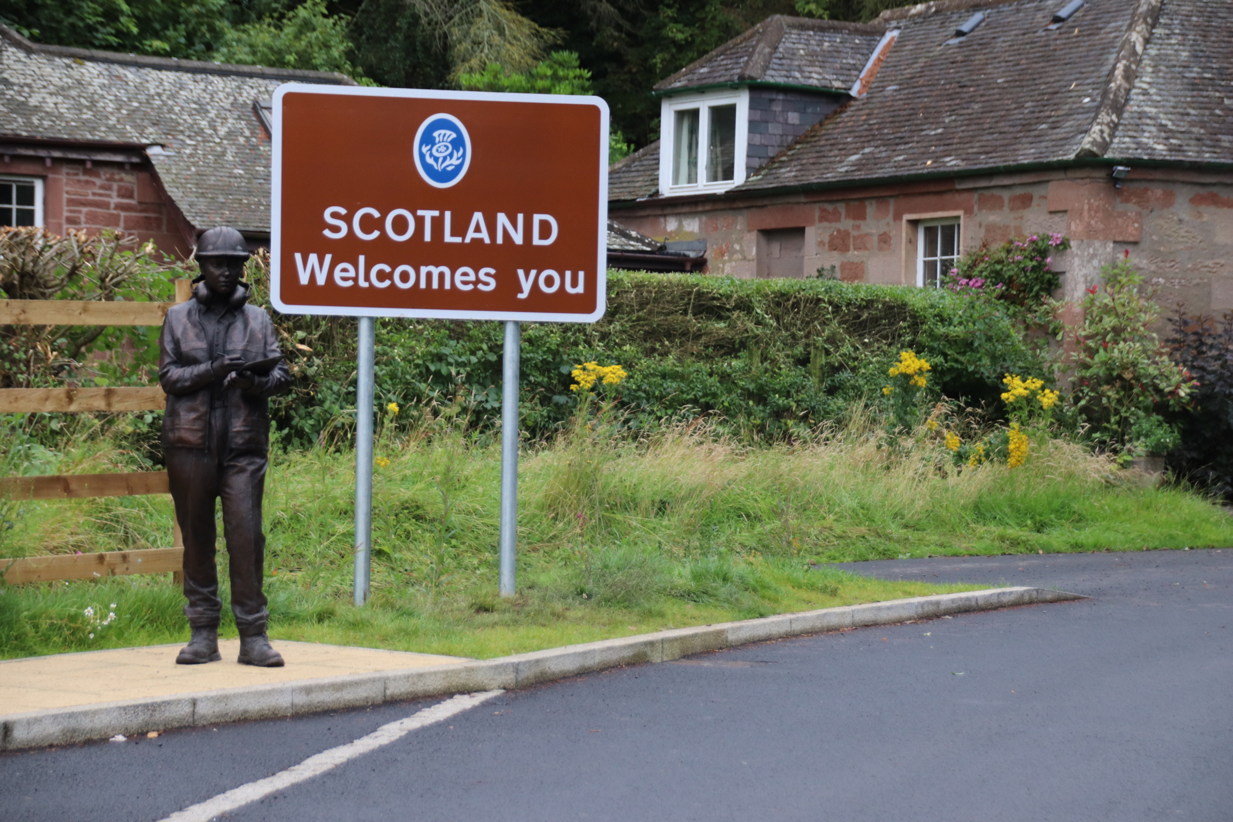
The border between the two countries runs from the North Sea coast just above Berwick-upon-Tweed, south west across the River Tweed near Paxton House, a grand Georgian mansion that is open to the public. This is the first chain link suspension bridge in Europe, built in 1820, for horse & carts and later modified for motorised vehicles.
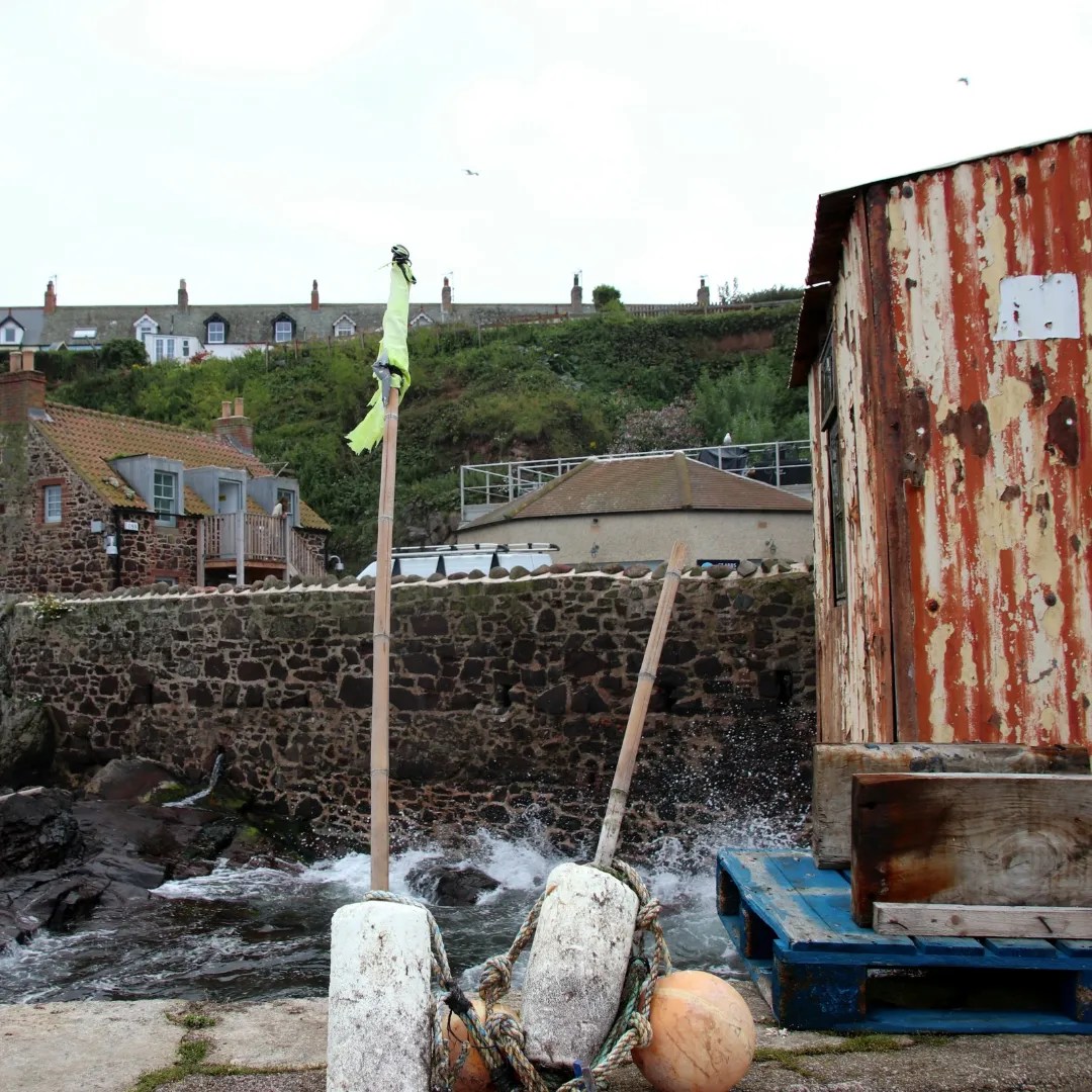
Once in Scotland, the coast road meanders along the clifftop through open, golden, shave-harvested fields and lush, purple-speckled hedgerows, with ocean blue to the distant right flushing up to join the assorted greys above. In places, the road drops down from caravanned headands to busy harbours or sandy beaches. The first is Eyemouth where the harbour has been redeveloped along the estuary to include a wharf for working boats but also bars, cafes & eateries catering for visitors and holidaymakers.
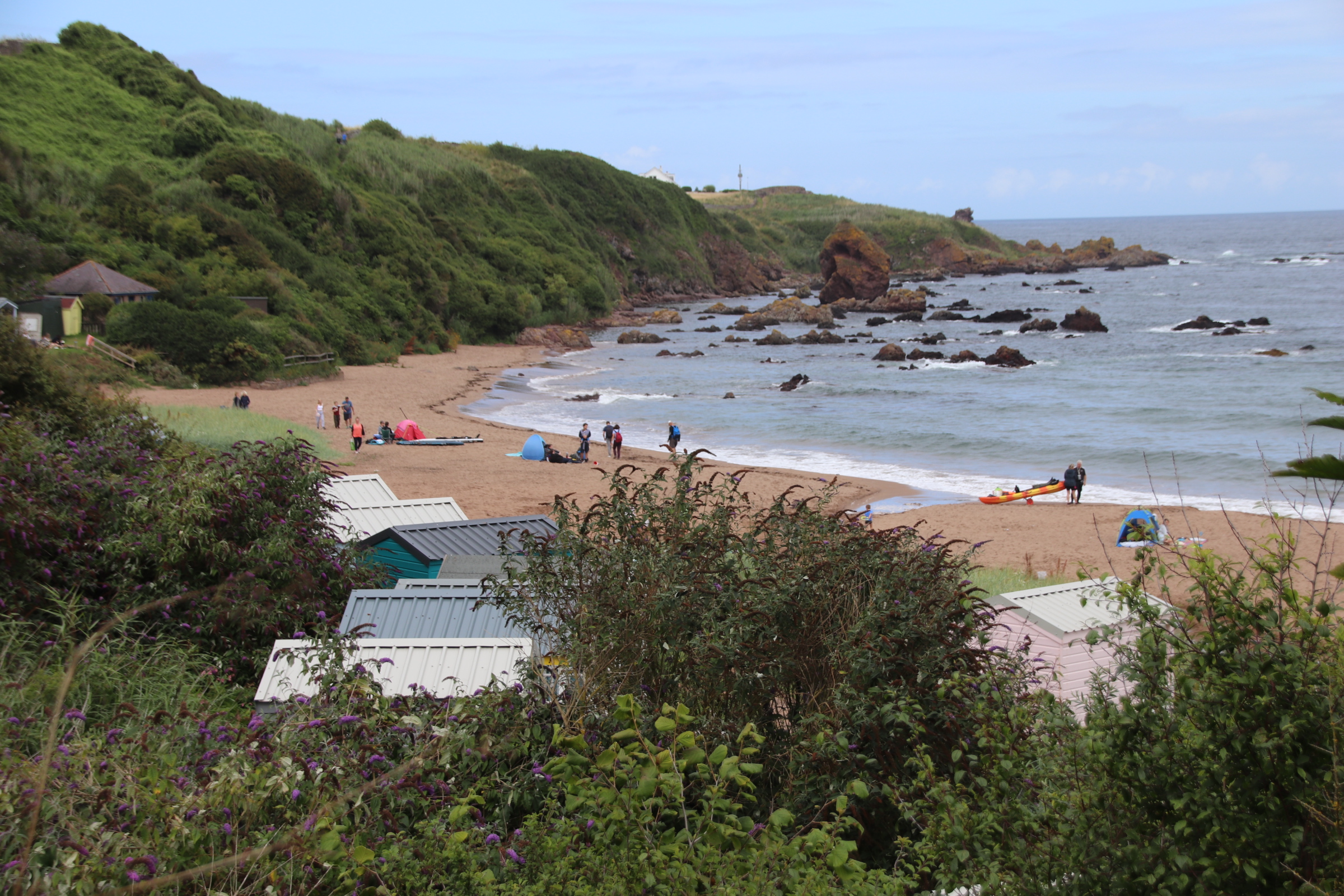
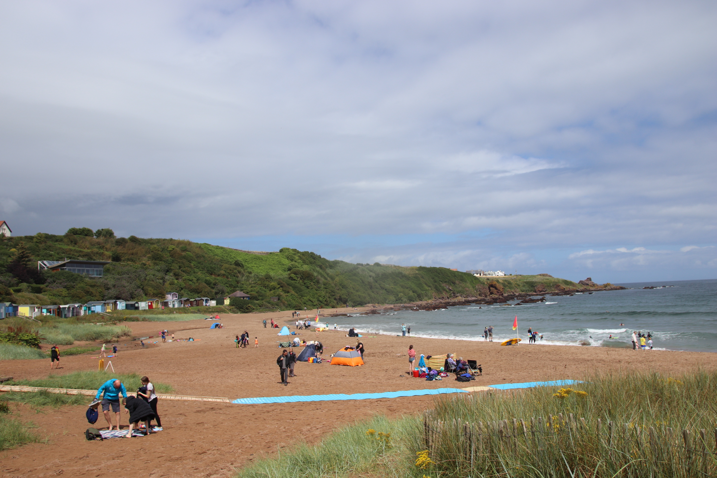
Coldingham village is a mile or so away from its cove where multi-generational families enjoy the sands and the Beach Cafe (called, unsurpringly, the ‘Beach Cafe’!). Children splash the waves, dads score centuries in games of beach cricket, grandads show off keepy-uppies and their dribbling skills against giggling children. A few trepid surfers ride the waves and clusters of children scrape the beach with their body boards.
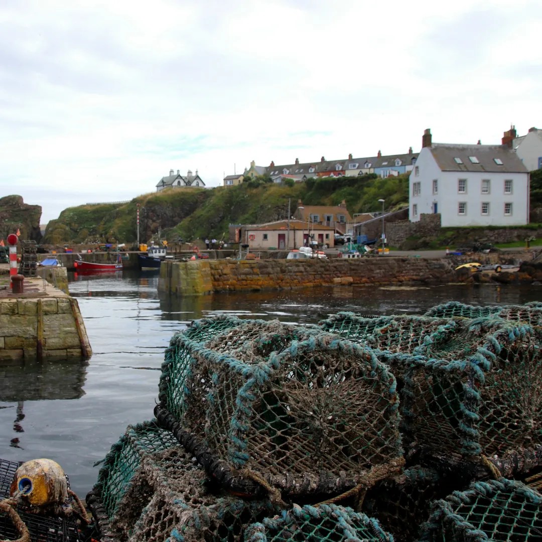
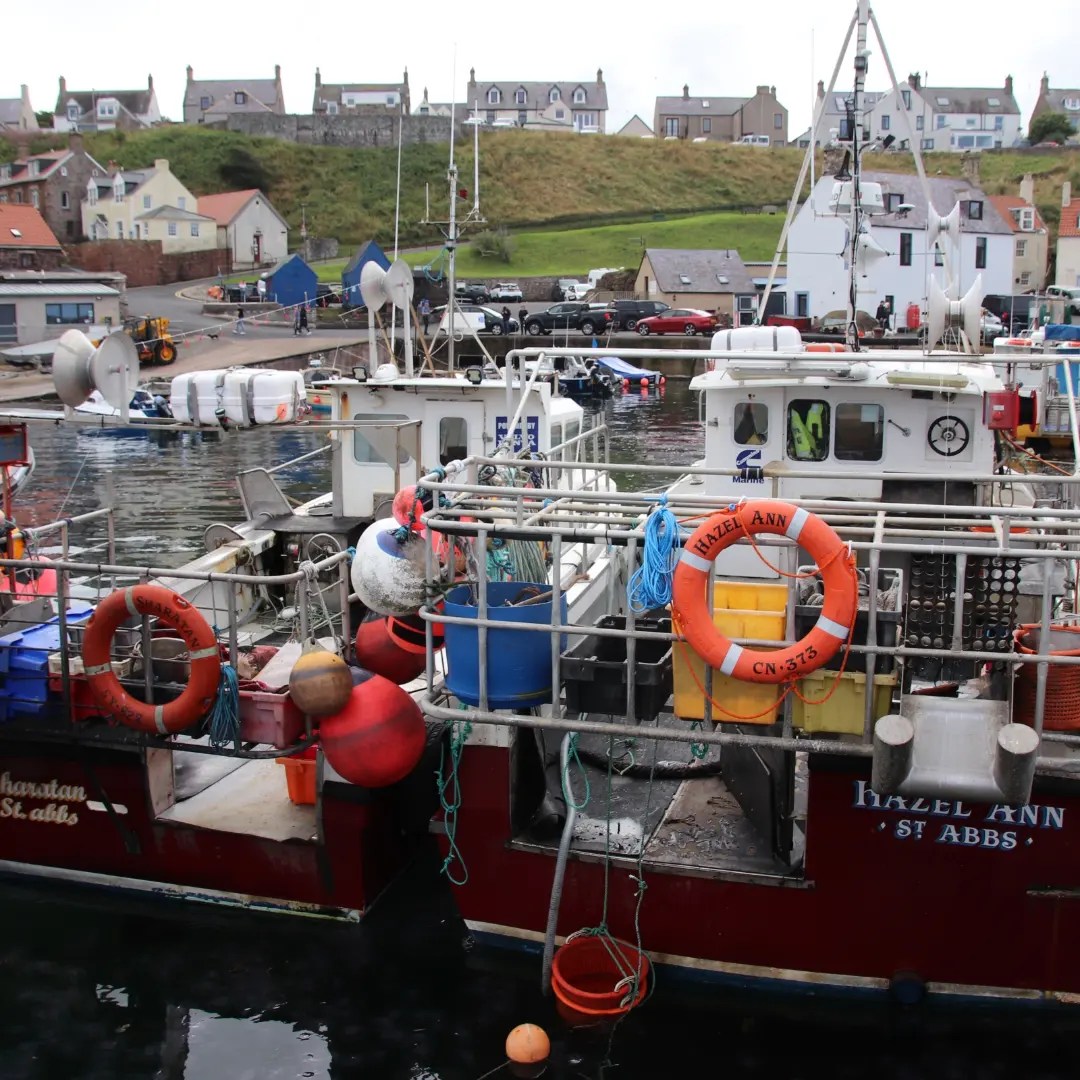
The road struggles up the hill to peak at the brow. Below, picturesque St Abbs collects around a number of quays & wharves, divided by stone walls & jetties. Klinkered rocks jaw around the numerous harbours, ready to snap up fishing vessels and paraphernalia.
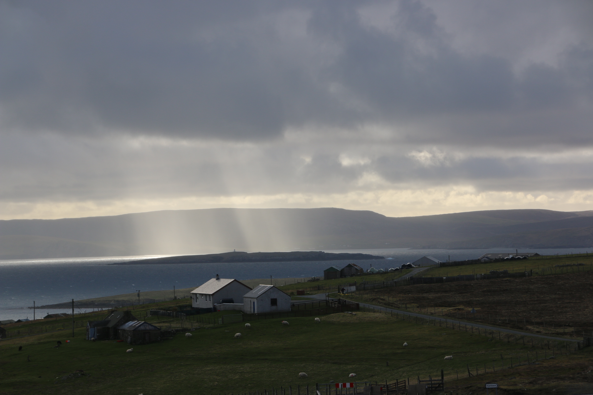
Having filled your lives with wonderful images of Shetland with blue skies and piercing rays of sunlight through streaks and spreads of high clouds and intensifying greys of weather, I can now share with you the fact that this picture is not typical even though the temperatures outside are pretty minimal, hovering around zero in a cutting breeze.
I woke up this morning to grey skies. Within minutes there were flurries of snow in a bitter north westerly wind. 10 minutes later it was proper snow settling on the immediate landscape and hiding the village and the hills with a thick curtain of white gauze. A further 15 minutes down the line and the band of weather passes revealing a huge expanse of brilliant blue sky and we are back to the weather of yesterday, waiting for more bands to send folk scurrying indoors.
I want to show a different side to Shetland, now. This is where the oil and gas are pumped ashore, stored and await the arrival of huge vessels to carry it away to some refinery somewhere in the UK or northern Europe. At the same time the workers on the rigs have pumped money into the island economy and generated considerable wealth for the local councils & businesses.
Most drinking is done within the privacy of one’s own home. However there are a few pubs on the main islands. Here is the one at Voe.
Inside, the place is heaving with one guy behind the bar and one guy on his stool, nursing a point of local brew. Half a dozen wooden tables, slightly sticky with years of slops, are waiting for an influx of locals who never come. Maybe the weekend will transform this place. Let’s hope so.
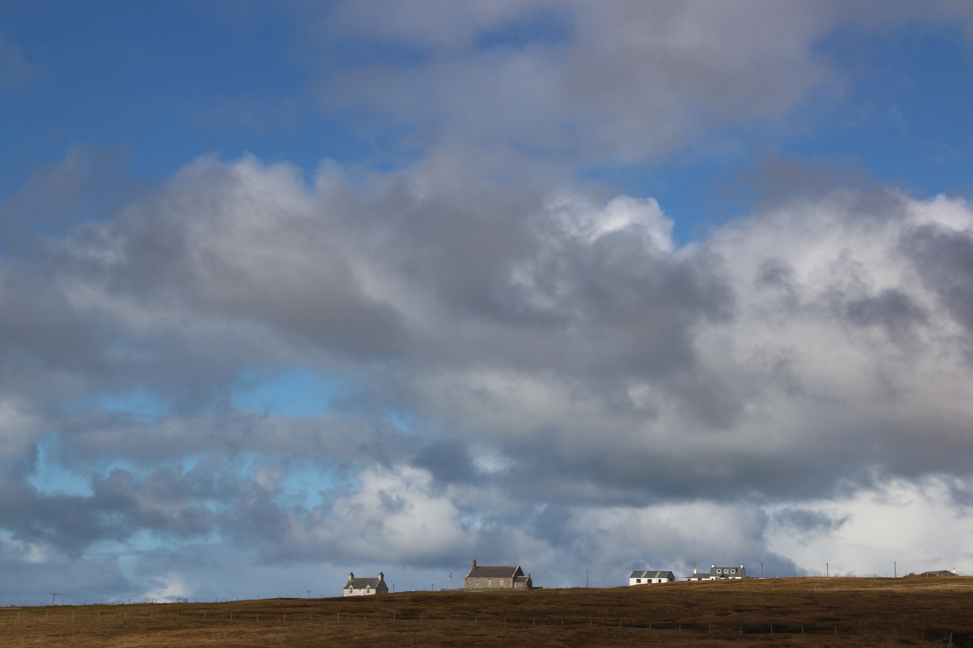
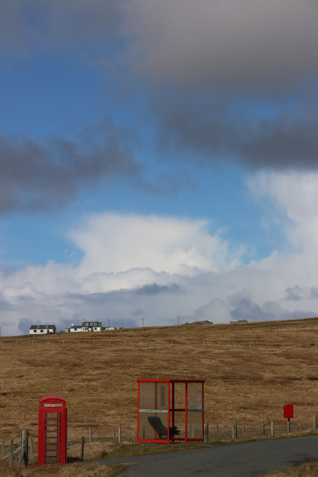
Today is the road trip up the spine of the islands. Shetland consists of 100+ islands. Most are small mounds & humps of rock around the largest island calked Mainland, where most of the 22,000 population live. This is stretched out northwards in a thin line equidistant between Norway and the UK.. It takes about an hour to drive up the island from one end to the other through the brown & grey moors, dropping down to a settlement on the east coast before rising up and over the claggy peat landscape to descend to another on the western side. The North Sea breaks on the east coast and on the west is the Atlantic Ocean, both as wild as the other. Ruined walls of toppling stones and unroofed outlines of past homes and farms are evidence of the travesty that was the clearances when humanity was forcibly moved to make room for sheep.
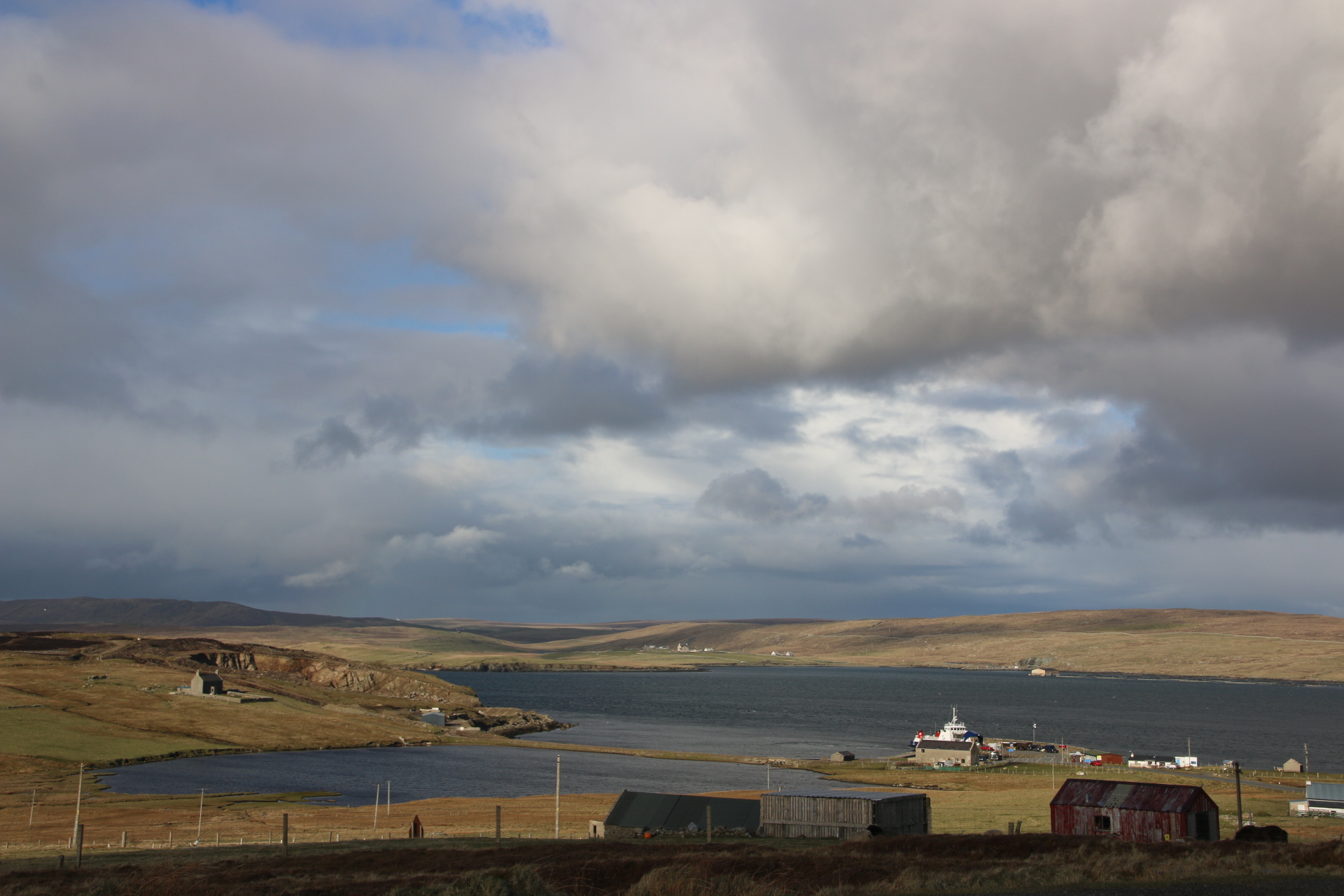
Around every rolling, peat-covered mound or low hill water appears. This is either one of the numerous puddles, lochans or larger lochs of fresh water which dot the landscape or one of the straggling fingers of sea, called voes, which poke and point their way into the interior of the main island and almost touch the ocean on the far side before they are halted by a low rock barrier.
Lines of buoys are arranged along the voes. If they are arranged in rows then it is a mussel farm with the molluscs clinging onto dangling chains until they are ready for harvesting. Whereas the salmon swim around and grow in circular or rectangular cages.
The ferry terminal at Toft is my first destination.
This takes me across to the island of Yell. Yell is another boggy, undulating island full of gobsmacking views & vistas of sweeping, browny-grey heathered covered moorland, cloud-skidding skies and wide spreading seas, all highlighted by an artist’s palette of golden glows and rays and piercings.
The first stop is Global Yell where Andy welcomes us to his textile and music education centre. Glorious textiles hang from the walls and peep out off drawers as he knots up his state of the art loom. This place must be visited. There is also a craft gallery within the complex.
The clouds and sun play chasing games over the surrounding landscape to produce different moors and colours to inspire weavers and artist’s alike. I rather like the office chair in the bus shelter to allow the locals to rest their bums as the next bus might be a while.
Then it is a quick dash to Gutcher to take us over to the island of Unst and the glories of Victoria’s Vintage Tea Rooms.
This bus shelter really takes the prize. The locals give it a theme each month and then decorate it accordingly. Well what else does one do during those long winter nights? From here it is a short drive up to Burrahfirth and the most northern beach in the British Isles.
The sun starts to drop down to meet the horizon and the clouds thicken making for a dramatic return journey to Mainland. Mrs Seal acknowledges my passing as we drop down to the local store which stocks everything from bicycle oil to cornflakes where I make my own self-serviced tea before boarding the 5.15 ferry.
Wow. What a day, full of sky and sun and and coast and sweeping blankets of moorland.
Well peat and heather, together, cover every contour of the rolling landscape of these windswept islands. Human settlements huddle together dotted across the moorland or along estuaries or clinging to the sides of headlands, trying to shelter from the constant winds.
This is the village of Hoswick. It boasts a visitors’ centre with a cafe, two small knitwear outlets that cater, in particular, for coaches of tourists from the cruise ships that visit Lerwick, a general store and its own Carnegie Hall – their community hall.
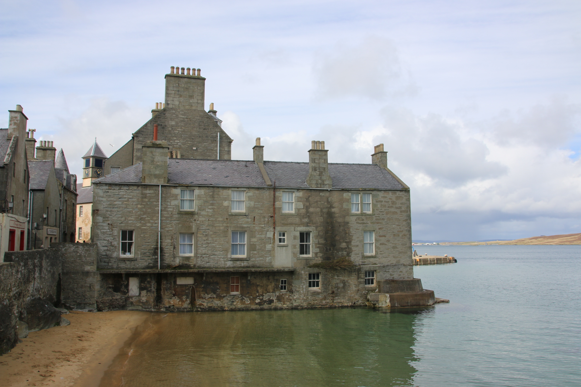
Here is Lerwick.
Lerwick is the capital of Shetland. 9,000 people live here around the moorland cliffs that line either side of the peninsula on which it is built. The historic centre faces the island of Bressay across the bay connected to the capital by a regular, plodding ferry. Around the old harbour the rather austere, grey, granite buildings stand tall against the weather with their strong facades immovably protective to the shops & businesses & cafes & fish and chip fryers that are housed within the safety of their walls. Narrow stepped streets fan out and away from the main shopping drag to the buildings that stand in lines in their uniform of grey pebble-dash.
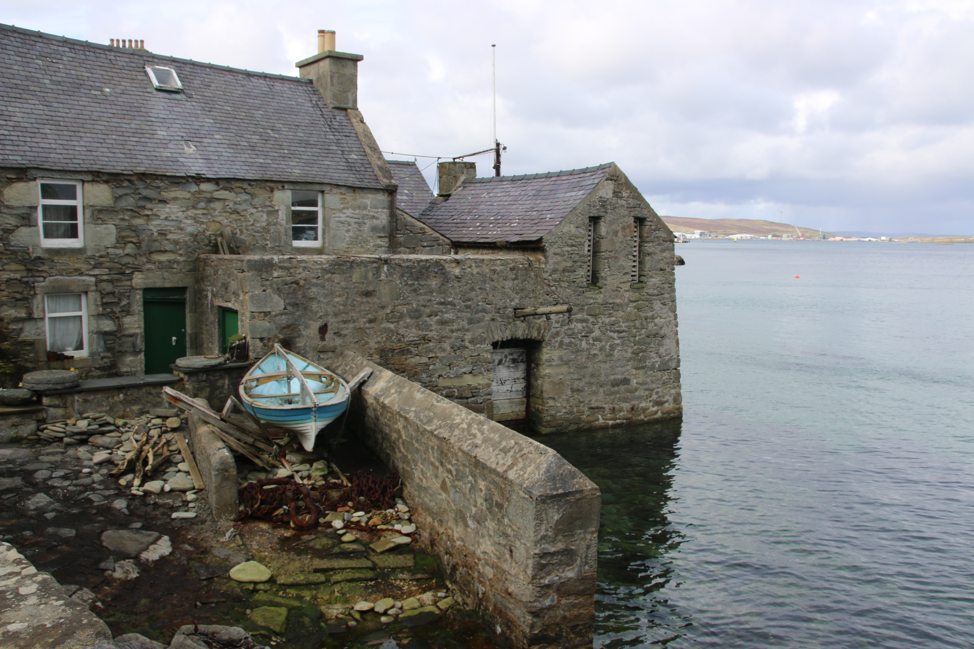
Down from the centre the old fishing houses line the bay. It is here that the Dutch herring fleets would unload their catch straight into the buildings. The locals would give woven goods in payment.
In the other direction the wharves have been modernised to provide warehouses, ferry terminals, anchorages for huge fishing vessels and tie up spots for cruise ships who unload their cargo of multilingual tourists on the local shops and neighbouring countryside.
Here the excellent Lerwick Museum is open most days between 10 & 4. The Mareel building, faced with sheets of metal, provides a venue for a cinema, music, drama & exhibitions as well as a very pleasant cafe. After a cream tea it is back home.
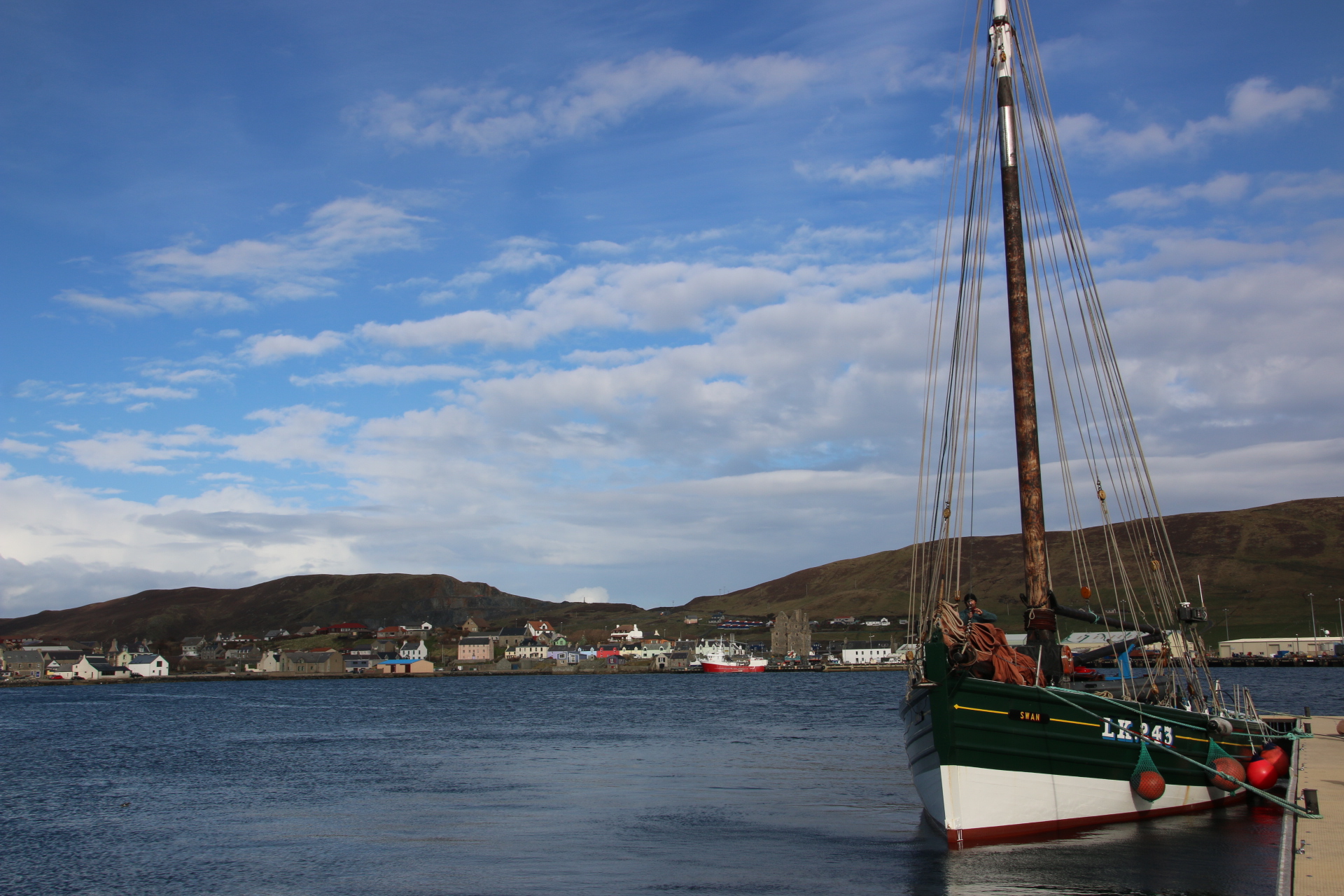
On the way back I drop down into Scalloway. This is the ancient capital of Shetland and was first settled by the Picts. Hiding behind an old herring drift trawler, built in 1900 in Grimsby, the remains of the old castle is all that remains of the original settlement. Now lines of brightly painted fisherman’s cottages & holiday lets, fishing boats & marina yachts surround the deserted building. The blades of wind turbines peer over the tops of turfed hills to provide a modern backdrop to this ancient scene.
A short flight in a short plane takes me from the mainland to Sumburgh on Shetland. I mean a short plane with room for just 12 rows of seats. It is the layout inside that must be a challenge for any pilot. On one side of the aircraft pairs of seats face the hunched figure of the sole stewardess who gives her safety briefing hunched in the narrow space between the single row of overhead lockers. The other side has rows of single seats. So one side has double the weight of the other side. Surely, this makes it hard to fly in a straight line.
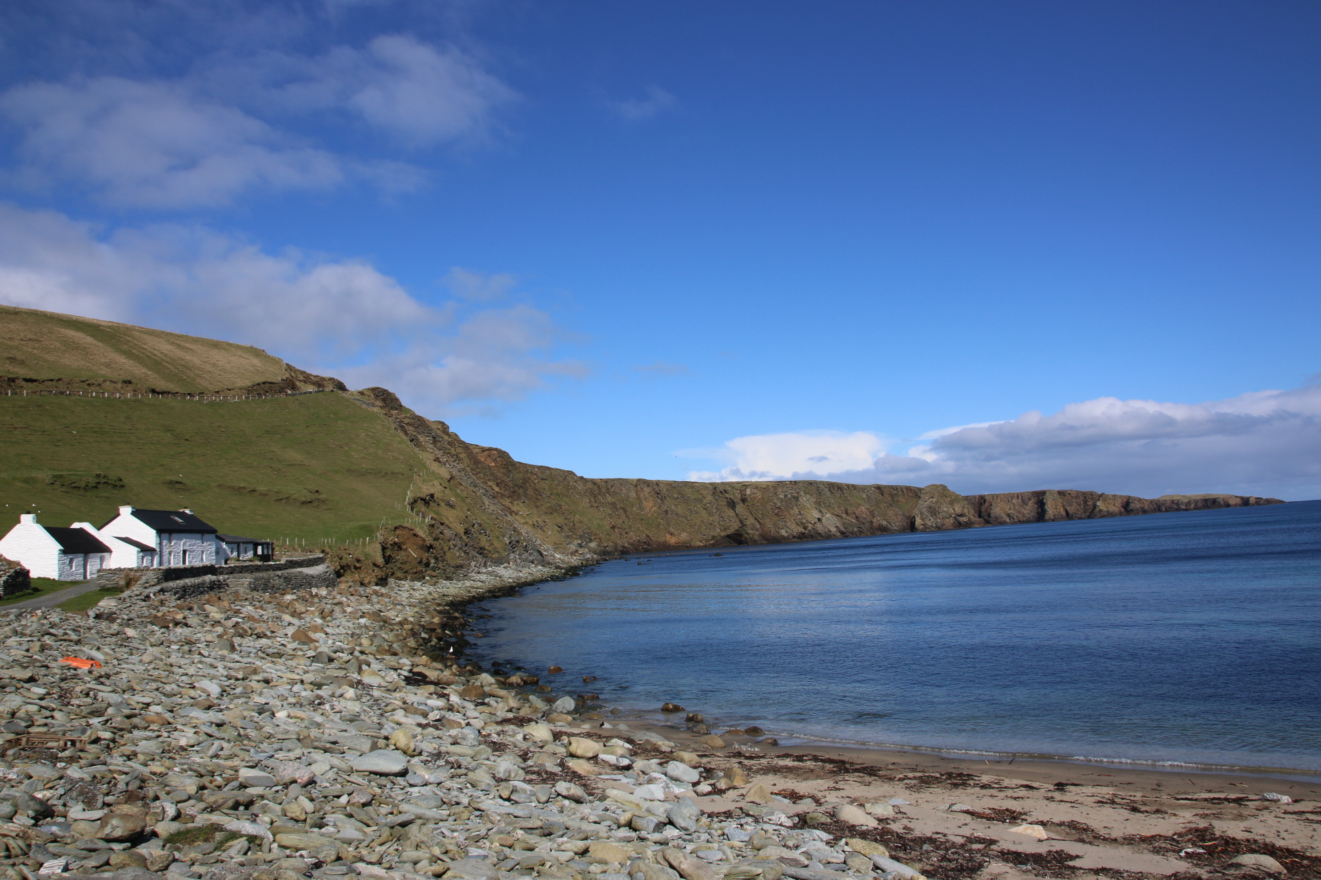
Well, in a straight line it goes. The first sight of Shetland is through holes in the cloud cover. Smooth, felt-covered hills slope away from the coast where nautical mice have nibbled away at the land to leave teeth-marked cliffs standing tall, facing the rolling sea. The sun shines through to give this land a bright, openess as it catches the highlight of isolated farms and huddled villages painted in contrasts of white & maroon & grey.
To the west lies Canada and to the north lies Iceland and to the east, Norway. This place is equidistant between the UK mainland and Norway, 200 miles in each direction. 22,000 people live on the 16 inhabited islands out 100 that make up this Scottish district.
Driving along the single track roads from the airport, small sandy bays & crescents of smooth sands can be seen peeping around headland and every corner. Not a tree in sight; just a flat, green landscape with grazing sheep the only disturbance around low settlements that scream to hug the tugged coastline. The two-storey house is the exception amongst the scattered villages of traditional, low bungalows and barns of these wind-swept islands. No place on the island is further than 3 miles from the sea and this is so obvious as one travels about. The sea is always there. Why are the dwellings in these remote locations, clamped to a bay or holding on to a wedge of sand? Weaving or whaling or fishing maybe.
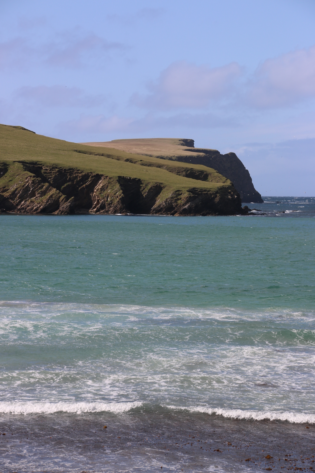
On one beach surfers surf; on another beach walkers walk; on a third beach seals laze in the sun. The one constant is the aquamarine ocean that crashes in rows and lines of waves and ripples on the waiting shore.


You must be logged in to post a comment.